How Much Habitat is Enough?
|
|
|
- Branden Patrick
- 5 years ago
- Views:
Transcription


1 How Much Habitat is Enough? Canadian Wildlife Service 2017 Third Edition
2 Page 2 April 19, 2017
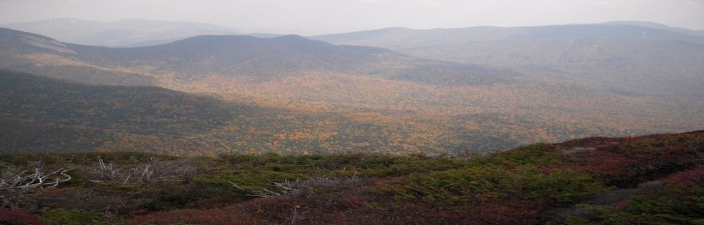
3 Grasslands Forest Wetlands Riparian & Watershed Page 3 April 19, 2017
4 Significant impairment in stream At a minimum, the greater of (a) 10% water quality and quantity is highly of each major watershed and 6% of likely above 10% impervious land each subwatershed, cover and can often begin before or (b) 40% of the historic watershed this threshold is reached. In urban wetland coverage, should be systems a second threshold is protected and restored. likely reached at the 25 to 30% Wetlands that are in close proximity to each other, based on their functions, level. or that are in close proximity to other natural features, should be given high priority in terms of landscape planning. 30 m wide naturally vegetation adjacent to streams, greater depending on conditions 75% of stream length should be naturally vegetated forest patches should be within 2 km of each other or other supporting habitat feature 30% watershed forest cover is a high risk minimum, 50% cover is a low risk cover. Focus on restoring and creating grassland habitat in existing and potential grassland landscapes.


5 HMHE Use Used in Natural Heritage Strategies and Official Plans, watershed plans, land acquisition strategies, environmental assessment, postsecondary classrooms, etc. Now used across Mixedwood Plains and well beyond. The Framework has evolved into a wider framework for protection, conservation and restoration. Page 5 April 19, 2017
6 The advice matches the planning unit They are simple, concise and easy to understand. They are not exclusive. Can use these with other The products guidelines such as conservation blueprints. Page 6 April 19, 2017
7 The forest interior and shape guidelines A watershed or other land unit should have at least one, and preferably several, 200-hectare forest patches (measured as forest area that is more than 100 metres from an edge). To be of maximum use to species such as forest breeding birds that are intolerant of edge habitat, forest patches should be circular or square in shape. The proportion of the watershed that is forest cover and 100 metres or further from the forest edge should be greater than 10%.
8 Interior forest forest
9 Percent Forest Cover At the watershed scale: 30% minimum forest cover equates to a high-risk approach that may only support less than one half of the potential species richness, and marginally healthy aquatic systems; 40% forest cover equates to a medium-risk approach that is likely to support more than one half of the potential species richness, and moderately healthy aquatic systems; 50% forest cover or more equates to a low-risk approach that is likely to support most of the potential species, and healthy aquatic systems.
10 Big Woods Big Woods areas, representing concentrations of smaller forest patches as well as larger forest patches, should be a cornerstone of protection and enhancement within each watershed or land unit.
 focus, applicable to temperate forest biome of E.")
11 Focus and Scope: How Much Habitat is Enough for What? Where? The suite of species and habitats representing the federal terrestrial biodiversity portfolio. Still contributes to ecosystem integrity/health at the local to international scale. Geographic scope: Mixedwood Plains (i.e. S. Ont.) focus, applicable to temperate forest biome of E. North America, south of the Boreal Shield. HMHE context is the current landscape and the target is species based: species persistence and provision of basic unimpaired wildlife habitat functions. Page 11 April 19, 2017


12 Forest Quality: Species Composition and Age Structure Watershed forest cover should be representative of the full diversity of naturally occurring forest communities found within the ecoregion. This should include components of mature and old growth forest.
13 Percent of an Urbanizing Watershed that is Impervious Urbanizing watersheds should maintain less than 10% impervious land cover to preserve the abundance and biodiversity of aquatic species. Significant impairment in stream water quality and quantity is highly likely above 10% impervious land cover and can often begin before this threshold is reached. In urban systems that are already degraded, a second threshold is likely reached at the 25 to 30% level.

14 Percent of stream length naturally vegetated 75% of stream length should be naturally vegetated Width of natural vegetation adjacent to stream Both sides of streams should have a minimum 30 m wide naturally vegetated riparian area to provide and protect aquatic habitat. The provision of highly functional wildlife habitat may require total vegetated riparian widths greater than 30 m.
15 Percent Wetlands in Watersheds and Subwatersheds No net loss of wetland area, maintain and restore wetland functions at a watershed and subwatershed scale based on historic reference conditions. At a minimum, the greater of (a) 10% of each major watershed and 6% of each subwatershed, or (b) 40% of the historic watershed wetland coverage, should be protected and restored. Page 15 April 19, 2017
16 Amount of Natural Vegetation Adjacent to the Wetland Critical Function Zones should be established around wetlands based on knowledge of species present and their use of habitat types. Protection zones should protect the wetland attributes from stressors. Recommended widths should consider sensitivities of the wetland and the species that depend upon it, as well as local environmental conditions (e.g. Slopes, soils and drainage), vegetative structure of the Protection Zone, and the nature of changes in adjacent land uses. Stressors need to be identified through Protection Zone design. Page 16 April 19, 2017

17 Wetland Shape, Area and Diversity Capture the full range of wetland types, areas and hydroperiods that occurred historically within the watershed. Swamps and Marshes of sufficient size to support habitat heterogeneity are particularly important, as are extensive swamps with minimum edge and maximum interior habitat to support area-sensitive species. Page 17 April 19, 2017
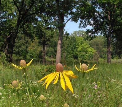
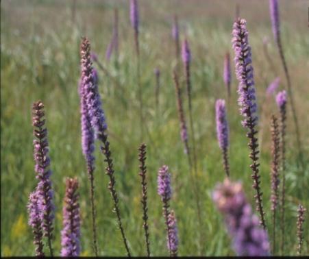
18 Grasslands Page 18 April 19, 2017
19 Grassland Habitat Guidelines Grassland is different... A minority natural habitat in a wetland and forest dominated biome/matrix that became the dominant matrix as a surrogate (agricultural) habitat That enabled new species to settle And increased populations of taxa such as grassland birds And then the habitat started declining But the new species stayed but started to also decrease in number And we have to conserve them And the surrogate habitat relies on humans to persist And leaves us asking what is natural? And does it matter what s natural? Page 19 April 19, 2017
20 Grassland Habitat Guidelines What to do? Should it be grassland? What should that grassland look like? What functions should it perform? What is realistic? How do we move forward? Should I plant trees or not? Page 20 April 19, 2017
21 Where to Protect and Restore Focus on restoring and creating grassland habitat in existing and potential grassland landscapes. Habitat Type and Area Maintain, restore and create native grassland patches to their historic extent and type at a county, municipal and/or watershed scale considering past presence and current conditions. Any increase in native grassland is positive given 97% loss of what was never an extensive habitat (e.g. 100,000 ha prairie in S. Ont. estimate) If there is an extent threshold for native grassland species we are likely below it More is better for overall grassland but no known threshold currently At least use past conditions as a guide Page 21 April 19, 2017
22 Patch size Maintain and create small and large grassland patches in existing and potential local grassland landscapes, with an average grassland patch area of greater than or equal to 50 hectares and at least one 100-hectare patch. Landscape heterogeneity Some grassland habitat should be located adjacent to hedgerows, riparian and wetland habitats for species that require different habitat types in close proximity. Page 22 April 19, 2017


23 Mapping Existing and Potential Grassland Landscapes: Results Page 23 April 19, 2017

24 Corridors and Proximity Proximity to other forested patches To be of maximum use to species such as forest birds and other wildlife that require large areas of forest habitat, forest patches should be within two kilometres of one another or other supporting habitat features. Big Woods areas, representing concentrations of smaller forest patches as well as larger forest patches, should be a cornerstone of protection and enhancement within each watershed or land unit. Landscape configuration, heterogeneity and connectivity Forest corridors will vary with function, m to facilitate species movement, potentially larger and more specialized for breeding. Grassland habitat patches should be clustered or aggregated, and any intervening land cover should be open or semi-open in order to be permeable to species movement. Page 24 April 19, 2017
25 The advice matches the planning unit They are simple, concise and easy to understand. They are not exclusive. Can use these with other Going products North such as conservation blueprints. Page 25 April 19, 2017

26 Habitat guidance for the Southern Boreal Shield (aka HMDITM) How Much Disturbance is Too Much? Habitat Conservation Guidance for the Southern Canadian Shield REVISED FINAL REPORT MARCH Page 26 April 19, 2017
27 Southern Shield guidance Response to request for guidelines specifically for Shield environment Different from HMHE: Relatively intact vs. fragmented landscape Opportunity to protect and conserve, not just restore Less available science relevant to southern shield How to deal with dominant natural matrix with an embedded, but growing, human footprint. Still draft focus has been on mapping a couple of the key overarching guidelines Page 27 April 19, 2017
28 Southern Shield: key guidance Identify and conserve, respectively, Regional Habitat Mosaics and Local Habitat Mosaics that capture relatively high levels and/or concentrations of habitat diversity and are predominantly natural areas subject to low levels of disturbance by human activities. Regional Habitat Mosaics and Local Habitat Mosaics should cover at least 50 to 60 percent of their respective jurisdiction. These mosaics should include habitats that are uncommon in the landscape as well as good representations of more common habitat types, a diversity of age classes for forested habitats and promotion of landscape connectivity. Page 28 April 19, 2017
29 Other HMDITM guidance Ensure habitat mosaics provide for full range of species, especially those sensitive to lakeshore development Maintain buffers between important wetlands and roads Consider the positive ecological influence of natural lakeshores and potential negative influence when disturbed or developed No development zones around portions of lakes and rivers Avoid roads in regional and local habitat mosaics Avoid locating roads between wetlands Lakeshore connectivity cannot necessarily be compensated by habitat corridors away from the lakeshore Maintain large contiguous habitat patches Consider the connectivity needs of species at risk as a model for establishing landscape connectivity Focus on conserving diversity of wetlands Maintain Critical Function Zones and Protection Zones for wetlands Page 29 April 19, 2017
30 Overarching guidance Take a habitat mosaic approach In brief Conserve 50-60% of the landscape at low levels of human disturbance Predominantly natural High habitat diversity Uncommon and representative habitats Large patches Range of forest age classes Connected, un-fragmented Page 30 April 19, 2017
31 The advice matches the planning unit They are simple, concise and easy to understand. They are not exclusive. Can use these with other uses, products lessons such as & conservation considerations blueprints. Page 31 April 19, 2017
32 HMHE3 just guidance Guide, not dictate local decisions. Providing planners, rehabilitation teams, and other decision makers with the best available information to enable them to make their own decisions on how much habitat is required to rehabilitate local watersheds and landscapes. The framework does not represent policy or legislation. The guidelines provided are not intended as mandatory limits or targets, and it is not intended that every area meet the guidelines expressed here. If the guidelines are adapted into policy, care must be taken to consider the limitations and context found in the guideline supporting text. The best practice is to study and refer directly to the literature cited within the supporting text. Page 32 April 19, 2017

33 Using the Guidelines: Considerations Conserve it first Guidelines are minimums! * Do not manage down any loss in habitat will result in impaired habitat and ecological function Adapt first, adopt second Look beyond local boundaries Consider landscape context Acknowledge stressors beyond habitat Acknowledge the limits of land use planning, restoration and protection Species at risk follow recovery documents first Urban areas may require different guidance and approach Page 33 April 19, 2017
34 Limitations, caveats, cautions habitat is closer than it appears, do not take with alcohol, may cause headaches, may cause drowsiness,. Go back to the science, local conditions rule, these are general guidelines. There are also clear limits to prescriptive advice and planning. Respond to questions Page 34 April 19, 2017

35 Page 35 April 19, 2017


36
How Much Habitat Is Enough? How Much Disturbance is Too Much?
 How Much Habitat Is Enough? How Much Disturbance is Too Much? Jocelyn Sherwood Canadian Wildlife Service - Ontario January 27 th, 2017 Page 2 April 19, 2017 Page 3 April 19, 2017 Grasslands Forest Wetlands
CWS Landscape Conservation Guidance and Planning. Graham Bryan CWS-ON September 16 th, 2016 Bracebridge
 CWS Landscape Conservation Guidance and Planning Graham Bryan CWS-ON September 16 th, 2016 Bracebridge Canadian Wildlife Service Part of Environment & Climate Change Canada CWS is responsible for wildlife
A Bird s Eye View of Habitat. Putting the pieces together
 A Bird s Eye View of Habitat Putting the pieces together Restoration Ecology Using what science has learned about living things and their interactions with their environment to re-create habitats that
Oshawa Creek Watershed Management Plan EXECUTIVE SUMMARY
 Oshawa Creek Watershed Management Plan EXECUTIVE SUMMARY The Central Lake Ontario Conservation Authority (CLOCA) has recognized the need to prepare comprehensive management strategies for all of its watersheds.
8/5/2011. Lesson Overview. Disturbance/Fragmentation. Shifting Mosaic. Number one cause of biodiversity loss. Types of disturbance. - Scale, frequency
 Lesson Overview Disturbances Fragmentation Types Measuring Corridors Effects Texas Example 1 Shifting Mosaic Landscape a shifting mosaic. - Made up of patches in different phases of successional development.
Beverly. Produced in This report and associated map provide information about important sites for biodiversity conservation in your area.
 CONSERVING THE BIODIVERSITY OF MASSACHUSETTS IN A CHANGING WORLD Beverly Produced in 2012 This report and associated map provide information about important sites for biodiversity conservation in your
MURPHY DRAIN CATCHMENT
 The RVCA produces individual reports for 16 catchments in the Lower Rideau subwatershed. Using data collected and analysed by the RVCA through its watershed monitoring and land cover classification programs,
Integration of climate change adaptation : site and landscape responses. Simon Duffield Natural England
 Integration of climate change adaptation : site and landscape responses Simon Duffield Natural England Present more in detail the topics on which the Convention should work, explaining why it would be
Appendix 1. Vancouver s Ecological Network
 Appendix 1. Vancouver s Ecological Network Introduction Biodiversity in urban landscapes depends on maintaining a network of connected natural areas anchoured by larger patches such as Stanley Park and
H ollow R iver. Stewardship Works! S ubwatershed. Grades. Land Water Wetlands Biodiversity. Not Stressed Not Stressed Not Stressed Vulnerable
 s H ollow R iver Land Water Wetlands Biodiversity S ubwatershed T he Hollow River Subwatershed is 40,863 hectares in size and lies predominantly in the Township of Algonquin Highlands in Haliburton County.
Jan Moryk, Project Manager, Environmental Monitoring and Data Management Section, TRCA
 Distribution of Brook Trout in the TRCA Jurisdiction and what Legislation, Policies, and Guidelines do Conservation Authorities have at their disposal to Protect Brook Trout Habitat Jan Moryk, Project
Jan Moryk, Project Manager, Environmental Monitoring and Data Management Section, TRCA
 Distribution of Brook Trout in the TRCA Jurisdiction and what Legislation, Policies, and Guidelines do Conservation Authorities have at their disposal to Protect Brook Trout Habitat Jan Moryk, Project
DRAFT FOR CONSIDERATION AT THE APRIL 27, 2006 MEETING OF NATURAL RESOURCES COMMITTEE OF THE HIGHLANDS COUNCIL
 RMP Component: Resource Assessment / Ecosystem Assessment Technical Report: Forest Integrity Council Committee: Natural Resource Committee Memorandum Title: Technical Approach to Define Highlands Forest
California Rapid Assessment Method for Wetlands (CRAM) Buffer and Landscape Context Attribute
 Buffer and Landscape Context Attribute") California Rapid Assessment Method for Wetlands (CRAM) Buffer and Landscape Context Attribute Buffer and Landscape Context Attribute Presence and/or continuity of wetlands and riparian areas adjacent to
California Rapid Assessment Method for Wetlands (CRAM) Buffer and Landscape Context Attribute Buffer and Landscape Context Attribute Presence and/or continuity of wetlands and riparian areas adjacent to
1/16/2016. California Rapid Assessment Method for Wetlands (CRAM) Buffer and Landscape Context Attribute. Buffer and Landscape Context Attribute
 Buffer and Landscape Context Attribute. Buffer and Landscape Context Attribute") California Rapid Assessment Method for Wetlands (CRAM) Buffer and Landscape Context Attribute Buffer and Landscape Context Attribute Presence and/or continuity of wetlands and riparian areas adjacent to
California Rapid Assessment Method for Wetlands (CRAM) Buffer and Landscape Context Attribute Buffer and Landscape Context Attribute Presence and/or continuity of wetlands and riparian areas adjacent to
awetlands aprairie aforests ahabitat for Fish, Game & Wildlife
 Rec. H1 priority land habitats pp. 63-67 Priority areas identified in integrated mapping assessing critical land habitat and threats to habitat pp.33-63 o Mapping is scalable for use in localized areas
24. Wildlife Habitat on Farmland
 24. Wildlife Habitat on Farmland AUTHORS: S.K. Javorek, R. Antonowitsch, C. Callaghan, M. Grant and T. Weins INDICATOR NAME: Wildlife Habitat on Farmland Indicator STATUS: National coverage, 1981 to 2001
CATEGORY a protection of the natural environment, its ecosystems and biodiversity.
 29. ENVIRONMENTAL DEVELOPMENT PERMIT AREA CATEGORY a protection of the natural environment, its ecosystems and biodiversity. The requirement to obtain an environmental development permit is cited in Section
PRINCE GEORGE NATURAL AREAS AND THE EFFECTS OF CLIMATE CHANGE: CASE STUDY
 PRINCE GEORGE NATURAL AREAS AND THE EFFECTS OF CLIMATE CHANGE: CASE STUDY Natural Areas in Prince George The City of Prince George is dominated by natural, undeveloped areas within city limits and in adjacent
B ig E ast R iver. Stewardship Works! S ubwatershed. Grades. Land Water Wetlands Biodiversity. Not Stressed Not Stressed Not Stressed Vulnerable
 s B ig E ast R iver Land Water Wetlands Biodiversity S ubwatershed T he Big East River Subwatershed is 64,699 hectares in area. Major lakes in the subwatershed include Bella Lake (3.45 km2) and Rebecca
Natural Systems Planning Primer
 Natural Systems Planning Primer Lise.Guevremont@ottawa.ca Amy.Macpherson@ottawa.ca Land Use and Natural Systems Unit Planning and Growth Management November 2015 1 Welcome Policy Framework Development
TAC CHARRETTE WORKBOOK Ecosystem Management and Sustainable Forestry Practices
 For Discussion Purposes TAC CHARRETTE WORKBOOK Ecosystem Management and Sustainable Forestry Practices NEW JERSEY HIGHLANDS COUNCIL March 28, 2006 1 Overview of RMP Goals and Structure NEW JERSEY HIGHLANDS
Riparian Vegetation Protections. Heritage Tree Protection
 PLACER Protections in place: Oak Tree Retention/ Replacement Requirements General Plan Language Specific Voluntary Rural Design require preservation of native trees and groves through replacement and dedication
TABLE OF CONTENTS 5.0 FOREST MANAGEMENT PLANNING...
 TABLE OF CONTENTS 5.0 FOREST MANAGEMENT PLANNING... 1 5.1 Planning Framework... 1 5.1.1 Sustainable Forest Management Planning... 1 5.1.2 Five-Year Operating Plan... 1 5.1.3 Annual Operating Plans... 3
City of Mississauga Environmental Impact Studies Terms of Reference 2002
 City of Mississauga Environmental Impact Studies Terms of Reference 2002 1.0 INTRODUCTION To ensure in so far as possible, both private and public developments are consistent with Natural Heritage and
Great Lakes Riparian Opportunity Assessment Methodology New York Natural Heritage Program September 25, 2015
 Great Lakes Riparian Opportunity Assessment Methodology New York Natural Heritage Program September 25, 2015 OBJECTIVES The goal of this analysis is to assemble a suite of riparian habitat quality indicators
Water and Watersheds. Data Maps Action
 Water and Watersheds Data Maps Action What is the Wildlife Action Plan? Restore rare wildlife and habitats. Keep common species common. 2015 Revision: Partners in Conservation Science 2015 Revision Data
EXECUTIVE SUMMARY DES PLAINES RIVER WATERSHED-BASED PLAN WHY A WATERSHED-BASED PLAN? WHAT IS A WATERSHED?
 Des Plaines River Watershed-Based Plan EXECUTIVE SUMMARY June 2018 EXECUTIVE SUMMARY DES PLAINES RIVER WATERSHED-BASED PLAN WHY A WATERSHED-BASED PLAN? Water is elemental to our lives. Plants and animals,
Gray s Creek. Gray s Creek
 Gray s Creek 1 Grades F + Forest Conditions B Wetland Conditions C - Surface Water Quality This Watershed Report Card outlines the environmental information for the Gray s Creek watershed as of 2017. The
The Rouge River Fisheries Management Plan
 The Rouge River Fisheries Management Plan Draft 2010 Measuring Success Are We There Yet, Mom? Watershed Based FMP Development Partnership Toronto and Region Conservation (TRCA) and Ministry of Natural
DRAFT Natural Heritage & Urban Forest Strategy (NH&UFS) OVERVIEW June 2013
 OVERVIEW June 2013") DRAFT Natural Heritage & Urban Forest Strategy (NH&UFS) Introduction Mississauga s natural areas and urban forest are found within the City s parks and open spaces, along its valley and stream corridors,
DRAFT Natural Heritage & Urban Forest Strategy (NH&UFS) Introduction Mississauga s natural areas and urban forest are found within the City s parks and open spaces, along its valley and stream corridors,
CITY POLICY POLICY NUMBER: C531 REFERENCE: ADOPTED BY: City Council Council July 2007 SUPERSEDES: Policy C467
 CITY POLICY REFERENCE: ADOPTED BY: City Council Council 1995 07 25 17 July 2007 SUPERSEDES: Policy C467 PREPARED BY: Office of Natural Areas DATE: 5 June 2007 Policy Statement: Since Edmonton was settled
BMP 5.4.2: Protect /Conserve/Enhance Riparian Areas
 BMP 5.4.2: Protect /Conserve/Enhance Riparian Areas The Executive Council of the Chesapeake Bay Program defines a Riparian Forest Buffer as "an area of trees, usually accompanied by shrubs and other vegetation,
B.C. Protected Areas Research Forum. Taking Nature s Pulse The Status of Biodiversity in British Columbia Putting Science into Action
 B.C. Protected Areas Research Forum Taking Nature s Pulse The Status of Biodiversity in British Columbia Putting Science into Action December 2, 2008 Who is Biodiversity BC? Ducks Unlimited Canada Environment
ROUNDTABLE MEETING ON SUSTAINABLE PALM OIL. RSPO Guidance for the Management and rehabilitation of Riparian Reserves Holly Barclay
 ROUNDTABLE MEETING ON SUSTAINABLE PALM OIL RSPO Guidance for the Management and rehabilitation of Riparian Reserves Holly Barclay Riparian reserves (also called riparian buffer zones ) = strips of natural
Support legislation that will protect the quantity of water in Lake Erie
 Specific Regional Priorities Each of Pennsylvania s major drainage basins has an array of individual characteristics that distinguish it from other regions of the state. These include diverse geographic
Humber River Watershed Scenario Modelling and Analysis Report. Section 4.5 Terrestrial System
 Humber River Watershed Scenario Modelling and Analysis Report Section 4.5 Terrestrial System TABLE OF CONTENTS 4.5 TERRESTRIAL SYSTEM... 4.5-1 4.5.1 Key Indicators... 4.5-1 4.5.2 Terrestrial Natural Heritage
Modeling Cottonwood Habitat and Forecasting Landscape Changes along the Missouri River
 Modeling Cottonwood Habitat and Forecasting Landscape Changes along the Missouri River Lisa Rabbe USACE, Alaska District Kelly A. Burks-Copes US Army Engineer Research and Development Center (ERDC-EL)
WQMP AMENDMENT REVIEW CHECKLIST
 State of New Jersey Highlands Water Protection and Planning Council 100 North Road (Route 513) Chester, New Jersey 07930-2322 (908) 879-6737 (908) 879-4205 (fax) www.highlands.state.nj.us WQMP AMENDMENT
Landscape Analysis for Forest Conservation Planning. June 2005, Toronto FPAC/ WWF Technology Transfer Workshop
 Landscape Analysis for Forest Conservation Planning June 2005, Toronto FPAC/ WWF Technology Transfer Workshop Presentation Overview WWF overview Forest statistics the case for forest conservation Market
Ecologically Beneficial Native Afforestation Site Prioritisation. for carbon sinks and other purposes. Kāpiti Coast District
 Ecologically Beneficial Native Afforestation Site Prioritisation for carbon sinks and other purposes Kāpiti Coast District 14 November 2017 Paul Hughes OpenGeo Contents Introduction...3 Native afforestation
Wetlands in Alberta: Challenges and Opportunities. David Locky, PhD, PWS, PBiol Grant MacEwan University
 Wetlands in Alberta: Challenges and Opportunities David Locky, PhD, PWS, PBiol Grant MacEwan University Overview What & Where Function & Value Alberta s Keystone Ecosystem Losses & Impacts Restoration
Climate Change Adaptation for Natural Resources in the North Atlantic Region
 Climate Change Adaptation for Natural Resources in the North Atlantic Region Andrew Milliken North Atlantic Landscape Conservation Coordinator U.S. Fish and Wildlife Service Preparing New Jersey for Climate
CHAPTER 5 MANAGEMENT ZONES
 CHAPTER 5 MANAGEMENT ZONES The inventory and analysis that is outlined in Chapter 4 formed the basis for determining the management zones. The TRCA used this information to refine the definitions of the
Forest Cover and Trends Analysis
 Forest Cover and Trends Analysis February 2014 ] TABLE OF CONTENTS 1. INTRODUCTION 1 2. OBJECTIVES 1 3. CONSTRAINTS 1 4. METHODOLOGY 2 5. RESULTS 2 5.1. FOREST COVER 3 5.2. FOREST FRAGMENTATION 5 6. COMPARISON
Riparian Forest Ecology & Management. Derek Churchill, Nov 8, 2014
 Riparian Forest Ecology & Management Derek Churchill, Nov 8, 2014 Outline 1. Importance of Riparian Zones 2. Watersheds & Stream Type 3. Forest Stream Interactions 4. Riparian forest types & development
Executive Summary: Report on Ecosystems Executive Summary: Report on Gatineau Park Ecosystems
 Executive Summary: Report on Ecosystems i ii Background, the Capital s conservation park, is beloved to the over 700,000 people who make more than 2.7 million visits to the Park each year (NCC internal
Natural Resources of Chatham
 Natural Resources of Chatham Andrew Meyer, Beth Roessler, Karen Strong, and Emily Vail NYSDEC Hudson River Estuary Program and Cornell University Presentation to Town of Chatham, December 6, 2012 The Hudson
Appendix C: Wetland Functional Values Assessment Methodology
 Appendix C: Wetland Functional Values Assessment Methodology Carver County Water Plan September 2010 Appendix C: Wetland Functional Values Assessment Methodology C1 Carver County Wetland Assessment Contents
Biodiversity Conservation
 SITE PLAN REVIEW & BIODIVERSITY CONSERVATION Hudsonia Ltd. Session 3 of a workshop series sponsored by the Teatown Lake Reservation Site Plan Review & Biodiversity Conservation Biodiversity and Ecosystem
Regional Master Plan Consistency Report 1/8/2010
 of 47 11:31 AM Regional Master Plan Consistency Report Prepared by State of New Jersey Highlands Water Protection and Planning Council 100 North Road (Route 513), Chester, NJ 07930 Telephone: (908) 879-6737
Forest Cover on PEI Opportunities and Challenges. Kate MacQuarrie Director of Forests, Fish and Wildlife
 Forest Cover on PEI Opportunities and Challenges Kate MacQuarrie Director of Forests, Fish and Wildlife Boreal Ecosystem Accounts - Forests Forestry-related GDP Carbon Storage Pest Control by Birds Nature-related
September 2016 ID Competency Statement Type
 September 06 Ensures that the impact assessment scope, criteria and conditions (geographic, environmental, economic, social, and cultural) are defined adequately. Develops a project management plan for
COMPREHENSIVE ENVIRONMENTAL IMPACT STUDY & MANAGEMENT PLAN South Albion Bolton Community Plan Employment Needs & North Hill Commercial Lands Study
 COMPREHENSIVE ENVIRONMENTAL IMPACT STUDY & MANAGEMENT PLAN South Albion Bolton Community Plan Employment Needs & North Hill Commercial Lands Study Part A Study Components Background Information Review
Amazon conservation biology:
 Amazon conservation biology: the challenge of representing biodiversity in a changing environment JC Riveros, G. Powell, C. Scaramuzza, A. Soto, S. Rodrigues, C. Suarez WWF March 22th 2007 Outline Purpose
Suggested Citation: Report Prepared by: Shari Clare and Shantel Koenig
 Front Cover Photo: Aerial view of a riparian area in the North Saskatchewan River basin, captured from a unmanned aerial vehicle. Credit: Fiera Biological Consulting Ltd. Suggested Citation: Fiera Biological
Enclosed farmland: Arable and Horticultural, Improved and Neutral Grasslands
 executive summary Executive summary 1 Countryside Survey 2000 (CS2000) and the Northern Ireland Countryside Survey 2000 (NICS2000) have been designed to provide detailed information about the habitats
Appendix E : Guidelines for Riparian Buffer Areas
 Appendix E : Guidelines for Riparian Buffer Areas This document should be read in conjunction with the CRCA Planning Policy. 1.0 PURPOSE The purpose of this document is to summarize the recommendations
Credit River Watershed Natural Heritage System Phase 3: Natural Heritage System methodology Draft summary report, May 2014
 Citation: CVC (Credit Valley Conservation) 2014. Credit Valley Conservation Natural Heritage System Strategy. Phase 3: Credit River Watershed Natural Heritage System.. 79p. For further inquiries regarding
Chapter 13: Wildlife and Vegetation
 Chapter 13: Wildlife and Vegetation Introduction and Setting Nevada County contains an extremely wide range of plants, animals and habitat types. With topographic elevations ranging from 300 feet in the
Development of a Statewide Wetland Reference Network for Montana. Karen Newlon and Linda Vance Montana Natural Heritage Program Helena, MT
 Development of a Statewide Wetland Reference Network for Montana Karen Newlon and Linda Vance Montana Natural Heritage Program Helena, MT Montana s s source for information on native species and habitats,
CLEARWATER TOWNSHIP WATER QUALITY ACTION PLAN
 CLEARWATER TOWNSHIP WATER QUALITY ACTION PLAN Elk-River-Chain-of-Lakes Gaps Analysis Project The Watershed Center Grand Traverse Bay Michigan Department of Environmental Quality July 2011 Purpose The Grand
S e c t i o n B i o d i ve r s i t y
 S e c t i o n 2. 2 - B i o d i ve r s i t y The District has a wealth of ecosystems which support indigenous vegetation and habitats of indigenous fauna. Many of these ecosystems are the remnants of the
Joyce Chau Debbe Crandall Anne Bell Amber Ellis Executive Director Director, Policy STORM Coalition
 Ala Boyd Manager Natural Heritage Section Ministry of Natural Resources and Forestry, Policy Division Natural Resources Conservation Policy Branch 300 Water Street Peterborough ON K9J 8M5 October 4, 2017
City of Tacoma Planning and Development Services
 City of Tacoma Planning and Development Services Agenda Item D-2 To: Planning Commission From: Elliott Barnett, Associate Planner Subject: Open Space Corridors Project Phase 1 Meeting Date: January 17,
Natural Ecosystem Connectivity across the Chignecto Isthmus - Opportunities and Challenges
 Natural Ecosystem Connectivity across the Chignecto Isthmus - Opportunities and Challenges Executive Summary and Table of Contents May 2005 By: Alexander MacDonald CPAWS Nova Scotia Chapter Roberta Clowater
CHAPTER 4 WATERSHED PLAN GOALS & OBJECTIVES
 4.0 Introduction CHAPTER 4 WATERSHED PLAN GOALS & OBJECTIVES After the watershed analysis had been completed, the next step in the planning process followed by the group was to come up with goals and objectives
WV WATERSHED ASSESSMENT PILOT PROJECT. Gauley River Kent Mason
 WV WATERSHED ASSESSMENT PILOT PROJECT Gauley River Kent Mason Expert Workshop #2, Round 2 Capitol Conference Center, Charleston. January 8 & 9, 2013 Workshop Outline Day 1 Project Background & Methodology
Stormwater Management Tools: Real-Life Solutions for a Resilient Community Riparian Corridor Protection
 Stormwater Management Tools: Real-Life Solutions for a Resilient Community Riparian Corridor Protection Montgomery County Planning Commission October 24, 2013 Eric Jarrell, Assistant Section Chief, Community
Beyond the fragments: from sites to ecological networks. Nicholas Macgregor Natural England
 Beyond the fragments: from sites to ecological networks Nicholas Macgregor Natural England Steve Pullan, Natural England 77% of SSSIs are smaller than 100 ha SSSIs cover only about 7% of the country Nature
Watershed. Rigaud River Report Card. Grades: Forest Conditions Wetland Conditions Surface Water Quality
 Watershed Report ard Grades: + onditions Wetland onditions Surface Water Quality This Watershed Report ard outlines the environmental information for the watershed as of 2006. The information provides
About the Canadian Wildlife Service
 About the Canadian Wildlife Service Environment Canada s Canadian Wildlife Service is responsible for wildlife matters that are related to species of federal concern. This includes protection and management
Land Use, Water Quality, and Biotic Community Attributes
 Land Use, Water Quality, and Biotic Community Attributes Exploring Linkages in Lake Ontario Coastal A.D. Latornell Conservation Symposium Greg Grabas and Krista Holmes Canadian Wildlife Service November
AUMA Policy Paper 2013.A1
 AUMA Paper 2013.A1 AUMA Board of Directors Municipal Water on Wetlands WHEREAS in 2012 the AUMA Board of Directors issued the mandate of developing Municipal Water Policies and approved advancing polices
Revisions to the RI Freshwater Wetlands Act
 Revisions to the RI Freshwater Wetlands Act 2016 Land & Water Summit Chuck Horbert, Supervising Environmental Scientist RI DEM March 19, 2016 1 A Short History 1971: RI Freshwater Wetlands Act passed (second
The Social and Economic Importance of Canada s Privately Owned Forest Lands
 The Social and Economic Importance of Canada s Privately Owned Forest Lands Key Points n Private forests make up 6% of Canada s 402 million ha of forested land and 13% of the managed forest. n Private
Cannon River One Watershed, One Plan. POLICY COMMITTEE MEETING January 10, 2018 Rice County Government Center Faribault, MN
 Cannon River One, One Plan POLICY COMMITTEE MEETING January 10, 2018 Rice County Government Center Faribault, MN TASK Task 1. Aggregate Existing Physical & Spatial Data 1A. Create project maps 1B. Meeting
CITY OF NEW WESTMINSTER. Bylaw No. 7033, 2005 RIPARIAN AREAS PROTECTION BYLAW
 CITY OF NEW WESTMINSTER Bylaw No. 7033, 2005 RIPARIAN AREAS PROTECTION BYLAW WHEREAS the City may preserve, protect, restore and enhance the natural environment near streams that support fish habitat from
ANCR INDIVIDUAL RESPONSES SUMMARY: 2/11/04 WATER RESOURCES GOALS AND OBJECTIVES
 ANCR INDIVIDUAL RESPONSES SUMMARY: 2/11/04 WATER RESOURCES GOALS AND OBJECTIVES Goal 1: Protect the health and safety of the Dane County population. a. Prevent development that may have an adverse effect
60 Sunshine Coast Biodiversity Strategy
 60 Sunshine Coast Biodiversity Strategy 2010-2020 Section 7 Maps Sunshine Coast Biodiversity Strategy 2010-2020 61 Map 7.1: Core and connecting habitat areas Landscape Element Definition Core Habitat Area
Sustainable Natural Environment Fish Habitat
 Town of Huntsville Official Plan Review - POLICY BACKGROUND PAPER Sustainable Natural Environment Fish Habitat BACKGROUND: Lakes, rivers, streams, ponds and many wetlands provide fish habitat. Intermittent
General Plan Update Workshop 6 Agriculture, Conservation, & Open Space February 23, 2005
 General Plan Update Workshop 6 Agriculture, Conservation, & Open Space February 23, 2005 Municipal Services Agency Planning and Community Development Department Workshop Outline GPU Update Background &
ALTONA FOREST. ENVIRONMENTAL MANAGEMENT PLAN THE METROPOLITAN TORONTO AND REGION CONSERVATION AUTHORITY
 ALTONA FOREST ENVIRONMENTAL MANAGEMENT PLAN THE METROPOLITAN TORONTO AND REGION CONSERVATION AUTHORITY MARCH 29, 1996 TABLE OF CONTENTS PAGE List of Figures, Table and Appendix jj PREAMBLE jjj 10 INTRODUCTION
Vegetative Buffer Regulations to Protect Water quality
 Vegetative Buffer Regulations to Protect Water quality Robert Jontos, PWS, CPESC Land-Tech Consultants, Inc. Environmental Scientists and Engineers Connecticut Association of Conservation and Inland Wetland
natural landscape, in particular throughout the boreal forest. In an effort to better understand
 Boreal Chickadee [Poecile hudsonicus] Distribution & Habitat Associations in Alberta The Boreal Chickadee is a common, iconic and well-loved feature of Canada s natural landscape, in particular throughout
Hydroecological tool: enhancements and results. enhancements and results. Marci Meixler. Project partners: Sponsored by:
 Hydroecological tool: Marci Meixler Sponsored by: Project partners: Motivation Great Lakes Charter Annex establish uniform, regional protections for Great Lakes waters ensure that authority over the Lake
Private Woodland Owners - Meeting the Stewardship Challenge
 Private Woodland Owners - Meeting the Stewardship Challenge Authors: Erin Neave (conference presenter), Neave Resource Management, Nepean, Ontario, Canada (neavee@igs.net) Doug Wolthausen (co-author),
Rating: Good news: Area of Humber River Watershed (hectares) Municipality
 Municipality") INDICATOR 3: Forest Cover How well are watershed forests being protected and regenerated? Rating: C Measure: Total watershed forest cover, excluding urban street trees, based on interpretation of aerial
INDICATOR 3: Forest Cover How well are watershed forests being protected and regenerated? Rating: C Measure: Total watershed forest cover, excluding urban street trees, based on interpretation of aerial
LIVING LANDS Helping Land Trusts Conserve Biodiversity
 LIVING LANDS Helping Land Trusts Conserve Biodiversity Habitat Restoration: Information for Land Trusts What is Habitat Restoration? Habitat restoration is defined as the process of assisting the recovery
Rogue Basin Ecological Integrity Assessment and Climate Change Management Interactions
 Rogue Basin Ecological Integrity Assessment and Climate Change Management Interactions Jimmy Kagan OSU PSU UO Ecological Integrity Measures (by area) Land management status Landscape features Habitat characteristics
Habitat Evaluation Scoring Method to Estimate Ecosystem Service Improvements from Restoration. Timothy Barber, Jennifer Lyndall, and Wendy Mahaney
 Habitat Evaluation Scoring Method to Estimate Ecosystem Service Improvements from Restoration Timothy Barber, Jennifer Lyndall, and Wendy Mahaney The Challenge Valuation of Ecosystem Services from Restoration
Don t Mow. Let it Grow!
 Don t Mow. Let it Grow! The Science Behind the Need for Riparian Buffer Protection. Chelsea Walker, WCD Watershed Specialist chelsea@wcdpa.com 724-837-5271 What is a Riparian Buffer? A riparian buffer
STAFF REPORT FOR POLICY PLAN AMENDMENT S10-CW-1CP
 STAFF REPORT FOR POLICY PLAN AMENDMENT S10-CW-1CP EXECUTIVE SUMMARY This Plan Amendment would serve to clarify policy guidance regarding circumstances under which proposals for disturbances to Environmental
Maintaining Riparian Areas and Wetlands
 Maintaining Riparian Areas and Wetlands Riparian areas are the lands along the banks of our rivers, lakes, and tidal waters. Many riparian areas not only border surface waters, but they are often adjacent
Environmental Concerns in Midwest Agricultural Landscapes. Roberta Parry US EPA Office of Water June 25, 2014
 Environmental Concerns in Midwest Agricultural Landscapes Roberta Parry US EPA Office of Water June 25, 2014 Water Quality Nutrients Local Regional Key Concerns Agricultural Drainage Human Health Wildlife
RIPARIAN AREAS REGULATION
 Definitions and interpretation RIPARIAN AREAS REGULATION 1 (1) In this regulation: Act means the Fish Protection Act; active floodplain means an area of land that supports floodplain plant species and
New Hampshire s Wildlife Habitat Conditions
 CHAPTER THREE New Hampshire s Wildlife Habitat Conditions Abstract Wildlife habitat condition was assessed for all 27 habitat types. NHFG developed a methodology to assess the relative ecological condition
New Jersey Forest Stewardship Program Spatial Analysis Project Map Products And Data Layers Descriptions
 New Jersey Forest Stewardship Program Spatial Analysis Project 2007 Map Products And Data Layers Descriptions 01/07 NJ Forest Stewardship Program (FSP) Spatial Analysis Project (SAP) Methodology Project
Landscape Conservation Design in the Connecticut River Watershed: A Pilot Project
 Landscape Conservation Design in the Connecticut River Watershed: A Pilot Project Nancy McGarigal, Natural Resource Planner National Wildlife Refuge System Scott Schwenk, Science Coordinator North Atlantic
MILTON TOWNSHIP WATER QUALITY ACTION PLAN
 MILTON TOWNSHIP WATER QUALITY ACTION PLAN Elk-River-Chain-of-Lakes Gaps Analysis Project The Watershed Center Grand Traverse Bay Tip of the Mitt Watershed Council Michigan Department of Natural Resources