GEO FCT activities in INDONESIA Progress and Plans
|
|
|
- Christine Shepherd
- 5 years ago
- Views:
Transcription
1 GEO FCT activities in INDONESIA Progress and Plans KUSTIYO Indonesian National Institute of Aeronautics and Space (LAPAN) MRV Joint Workshop June 2010, Guadalajara, Jalisco Mexico
2 Table of contents Indonesia s National Carbon Accounting System LAPAN s Roles in INCAS Land Cover Change Monitoring LCC Processing Stream Current Status of Carbon Emissions Estimation (INCAS) Available Data The Verification Sites (VS) Future Activities
3 INCAS Indonesia s National Carbon Accounting System (INCAS) is the IAFCP program to support Indonesia to provide significant and cost effective reduction in greenhouse gas emission in Indonesia by reducing deforestation, encouraging reforestation and promoting sustainable forest management. INCAS will be modeled off Australia s NCAS but tailored to Indonesia s unique circumstances. INCAS will be a highly integrated system that will compile information from Indonesia s forestry and agricultural to provide a robust emissions profile from: Remotely sensed land cover change (Activity factors) Climate and soil data Growth and biomass data (Emission factors) 3
4 Collaborative efforts involved in INCAS: National Institute of Aeronautics and Space (LAPAN) Min. of Forestry (MENHUT) National Coordinating Agency for Survey and Mapping (BAKOSURTANAL) Indonesia Australia Forest Carbon Partnership (IAFCP) Australian Department of Climate Change (DCC) Geosciences Australia (GA) Australian Commonwealth Scientific and Research Organization (CSIRO) South Dakota State University (SDSU) - USA 4
5 INCAS Land Cover Change Monitoring Objectives: To provide long-term monitoring of land cover change commencing from 1990s. To provide a multi-temporal, fine-resolution data series identifying through time, for any land unit, land cover change (removal of forest cover and forest regrowth) that is attributable to direct human actions. Period: Feb 2009: Kick-off meeting in Bali Mar Jun 2009: LCC Preparation phase Jul 2009 Dec 2010: LCC Processing phase

")
6 LCC Monitoring - Preparation Phase Schedule: Mar 2009: Scene selection training (at LAPAN) Jun 2009: Software and documentation preparation Infrastructure, Hardware, and Software: Dedicated processing room Servers and 10TB NAS Networking Software licenses CSIRO soft. for INCAS processing 10 workstations networked to Server Data: Primary data: Landsat ( ) obtained from GA, GITSDA, USGS, and LAPAN s archive
7 LCC Monitoring Processing Phase Objective: To process a time series of Landsat data ( ) to produce accurate change products at 25m for Indonesia (national scale) Expected Outputs: Processed data: Standards Archiving Capacity Building: Image Processing skills Quality Assurance (QA) skills Documentation
8 LCC Monitoring Processing Phase Training : Jun -Jul 2009: Image rectification and correction training and processing (by CSIRO, at LAPAN) Aug 2009: Multitemporal Landsat data processing for forest cover change analysis in Indonesia training (by SDSU, at LAPAN) Sept 2009: QA training (at CSIRO) Dec 2009 Jan 2010: Tests with INCAS images in SDSU (CSIRO-SDSU) Dec 2009: Cloud masking training (by SDSU, at LAPAN) Feb 2010: Orthorectification refresher and illumination terrain correction training (by CSIRO, at LAPAN)


 : Australian Commonwealth Scientific and")
9 LCC Processing Stream Current Status Scene Selection Quality Assurance Registration and Calibration; Terrain Correction Cloud Masking and Mosaicing Quality Assurance Thresholding to map forest extent Multi-temporal processing to monitor change Attribution for Purpose Processing of Other Products : LAPAN : Australian Dep. of Climate Change (DCC) : Australian Commonwealth Scientific and Research Organization (CSIRO)


10 Examples of Processed Data
 GISTDA (Thailand) USGS LAPAN Stage 1: Year 1998-2008 400")
11 Landsat Coverage and Sources Landsat path-row coverage over Indonesia Landsat data sources: Geosciences Australia (GA) GISTDA (Thailand) USGS LAPAN Stage 1: Year scenes/year
12 No. of Landsat Scenes No. of Landsat scenes delivered to INCAS from: Level 1G (Path oriented): USGS : 447 scenes GISTDA (Thailand) : 489 scenes Geosciences Australia : 358 scenes Ortho-rectified (Level 1T): USGS : 1367 scenes Year Lapan Non-Lapan Total
 GA GITSDA")
13 Landsat Coverage (from GA, GITSDA, USGS) GA GITSDA USGS


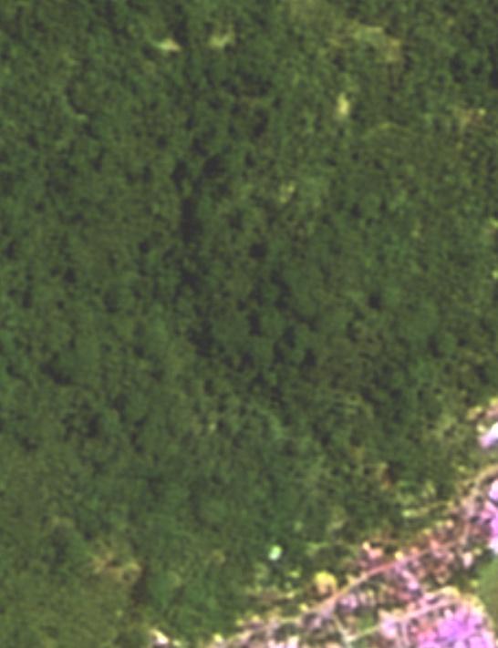
14 The Verification Sites (VS) Example Quickbird Data in West Sumatera


15 The Verification Sites (VS) Example of SPOT-5 Data (2.5 m)

16 IKONOS/QUICKBIRD Data in LAPAN
17 Future Activities Juli 2010: Training on Cloud masking and Mosaiking (Jkt) Priority for Kalimantan and Sumatera New Algorithm for Cloud masking 27 Juli 2 Augt 2010: Training on Forest Classification (Perth) Multi-temporal classification Production system and capacity Forest change maps Ground data: MoF experts and participation Producing the Forest Classification map and verification (priority for Kalimantan) We hope, we can get more data likes RADAR Data

18