Ecosystem Carbon Stocks of Tropical Wetland Forests of the Asia Pacific and Their Fates Following Land Use/Land Cover Change.
|
|
|
- Scarlett Waters
- 5 years ago
- Views:
Transcription


1 Ecosystem Carbon Stocks of Tropical Wetland Forests of the Asia Pacific and Their Fates Following Land Use/Land Cover Change. Boone Kauffman, D. Murdiyarso, S Kurnianto, Daniel Donato, and Matthew Warren Northern Research Station USDA Forest Service Durham, New Hampshire


2 Tropical wetlands are ecosystems that are inundated or saturated by surface or ground water at a frequency and duration sufficient to support a prevalence of vegetation typically adapted for life in saturated soil conditions.


3 Ecosystem services of tropical wetlands freshwater peat and mangroves Biological diversity Water quality and timing Flood and storm damage Forest and non-timber forest products Aesthetic and ecotourism values Fish and Shellfish Carbon Sinks


4 Ecosystem Services Fisheries 75% of all tropical commercial fish species pass part of their lives in the mangroves, where they encounter: nursery grounds shelter food 75% de todas las especies comerciales de peces tropicales pasan parte de su vida en los manglares, donde se encuentran: zonas de cría abrigo comida
. There are about 441,000 km2 of tropical peatlands ~11% of the total peatland area; volume is ~18 25% (Page et al. 2010).")

5 Tropical Peat forests (freshwater wetlands) Peat swamp forests have high root/shoot ratios and occur on organic rich soils that can be up to several meters deep (Komiyama et al. 2008, Fujimoto et al. 1999, Page et al. 2002). There are about 441,000 km2 of tropical peatlands ~11% of the total peatland area; volume is ~18 25% (Page et al. 2010). Southeast Asia is home to 25 million hectares of peatlands, or 56% of all tropical peatlands. Total C storage in these ecosystems may be among the largest forest C pools on Earth. Yet data are lacking quantifying these globally significant carbon stores. Tropical peat forests are excellent candidates for inclusion in REDD+ strategies, but critical information on carbon pools and land use is needed in order to be effective.


6 Mangroves Tidal wetland forests 140, ,000 km countries Indonesia alone contains almost 23% of the world s mangroves or about 3 million ha. There are more mangroves in Indonesia that any of the Earth s continents.
 Carbon stocks of degraded peatlands/wetlands other land uses/cover types Emissions from fires in")
7 Significant uncertainties and information needs relating to tropical wetlands, REDD+, and MRV C stocks of intact tropical wetland forests Peat thickness potential aboveground indicators of peat soil properties Carbon content of organic soils (bulk density, C concentrations of peat and soil layers) Carbon stocks of degraded peatlands/wetlands other land uses/cover types Emissions from fires in peatlands C dynamics during land use and abandonment sequestration and emissions


 D Wood debris")
 A Trees <5 cm dbh")
 R= 2m C B")
 3 soil")
")
8 Quantifying C-stocks General Plot layout to quantify ecosystem C pools in Tropical Peat Forests Trees >5 cm dbh measured in 10m radius (all plots) D Wood debris transects (4 per plot, all plots) A Trees <5 cm dbh measured in 2m radius (all plots) R= 2m C B Understory/litter sample (2 per plot, all plots) 3 soil depth measurements and 1 nutrient core (all plots) Peat Forest ecotone Plot: m 50 m

9 ECOSYSTEM CARBON POOLS TANJUNG PUTING NP, KALIMANTAN INDONEISA. All sampled forests had peat depths of only 28 to 69 cm yet; ecosystem C pools are very high.
10 2500 Ecosystem C pools Tropical freshwater wetland forests, Kosrae FSM Ecosystem C pool Mg/ha FWD C CWD C Tree C (AG) Tree C (BG) Yewal Yewak Melo Yela Menke


11 Coastal Ecosystems The ocean s vegetated habitats, especially mangroves, salt marshes, and seagrasses cover <0.05% of the sea bed but account for >50% and as much as 71% of all C storage in ocean sediments. They comprise only 0.05% of the plant biomass on land but fix a comparable amount of C per year to tropical forests, thus rank among the most intense carbon sinks on the planet. Nellemann et al. (2009)

12 Mangroves Greater carbon storage = Greater REDD potential but how much is in mangroves and other coastal ecosystems? Sundarbans, Ganges River Bangladesh
 0 10 20 0 10 20 0 10 20 0 10 20 0 10 20")
 Oceanic Soil depth (m) 0 10 35 60 85 110 135 Distance from seaward")
13 Soil properties 0 Distance from seaward edge (m) Organic C content (%) Depth (m) 1 2 Estuarine Oceanic Soil depth (m) Estuarine (88% >3 m) Oceanic Soil depth (m) Distance from seaward edge (m)

14 Distance from edge
15 Ecosystem C pools of selected tropical forests C pool g/m m Aboveground Belowground Tropical Forest Temperate Forest Boreal Forest Tropical Savannas Mangroves Peat Forest Kalimantan Peat Forests Kosrae Data are from:ipcc, 2001: Climate Change 2001: The Scientific Basis. Contribution of Working Group I to the Third Assessment Report of the Intergovernmental Panel on Climate Change ; Donato et al. (2011., and this presentation.


16 Observations Ecosystem C pools of tropical peat forests and mangroves are among the largest terrestrial C pools on Earth; some sites exceed 2000 Mg/ha. The vast majority of this pool is belowground; yet great uncertainties still exist with methodologies Not all swamp forests are true peats there is great variation in below ground properties between stands within the regions


17 Emissions


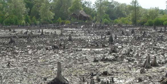
18 Tropical Wetlands: Issues of global concern Deforestation rates in Southeast Asia tropical forests are among the highest in the world. Annual deforestation rates as high as 8% are occurring in mangroves and as high as 2.2% in peat forests. Shifts in climate or land uses that result in the shift of peat forests from sources to sinks is a significant global climate concern. Sea level rise, changes in ENSO, ppt patterns, and other effects of climate change may disproportionately affect peatlands


19 Currently, on average, between 2-7% of blue carbon sinks are being lost annually: Rice/Agriculture Aquaculture Road development /hydrological disruptions Coastal development

20 Estimating per hectare emissions Assumptions: 95% CI of mangrove ecosystem C stocks Low end low mean standing biomass 50% biomass loss 25% soil C loss from top 30 cm, no loss from deeper layers High end high mean standing biomass 100% biomass loss 75% soil C loss from top 30 cm, 25% loss from deeper layers This equates to Mg C released per hectare cleared ( Mg CO2 equiv.) Donato et al. (2011)
21 Estimating global C storage and emissions Global scaling made difficult from uncertainties in mangrove area by structural type The global C storage in mangroves: ~ Pg C (13 70 Pg CO2 equiv.) ~ 4 23% increase over peat swamps alone (Donato et al., 2011) Global emissions from mangrove conversion: Pg yr 1 ( Pg CO2 equiv.) Or as much as: 40% of peat swamp emissions 10% of current emission estimates from deforestation (despite only 0.7% of tropical forest area) Donato et al. (2011)
22 Uncertainties in quantifying emissions from tropical wetlands Carbon stocks Emissions arising from land conversion Wood export Fire Decomposition Erosion and Dissolved C losses Carbon stocks, emissions and sequestration from various land uses.
23 Table 1. Emission factors for flaming and smoldering combustion in primary forest slash and pasture burning. Values are mean emission factors and standard errors from unpublished data collected during the 1995 Smoke, Clouds, and Radiation Brazil (SCAR-B) Experiment (D. Ward, personal communication, USFS Missoula, MT). Flaming phase combustion emission factors are based on tower measurements recorded in the early stages of the fire and smoldering emission factors of fuel consumed were recorded in the later stages of the fire. Primary Forest Pasture Flaming Smoldering Flaming Smoldering Emission g kg -1 g kg -1 g kg -1 g kg ± ± ± ±2.87 CO (carbon monoxide) CO 2 (carbon dioxide) CH 4 (methane) ± ± ± ± ± ± ± ±0.18 C 2 H 2 (ethyne) 0.27± ± ± ±0.01 C 2 H 4 (ethene) 1.20± ± ± ±0.03 C 2 H 6 (ethane) 0.66± ± ± ±0.04 C 3 H 4 (propyne) C 3 H 6 (propene) C 3 H 8 (propane) 0.06± ± ± ± ± ± ± ± ± ± ± ±0.02
24 The mass of C for trace gas emissions from biomass burning is calculated as follows: lmax, kmax E i = (η il flame f lk flame + η il smolder f lk smolder ) m i c l b lk TAGB f lk burned a l burned l,k=1 Where: E i : Mass of C in gas species i emitted, emissions flux (Mg); η flame il, η smolder il : flaming and smoldering emission factors for gas species i by land cover type l (g emission/g i fuel); f flame lk, f smolder lk : fraction of biomass of land cover type l burned during flaming and smoldering combustion of fuel class k; m i : mass of carbon in gas species i (g C/g emission) c l : carbon concentration (%) of biomass for each land cover type; b TAGB lk : total aboveground biomass (g/ha) of fuel classes for land cover types; f burned lk : fraction of biomass or fuel burned by land cover type and fuel class; and a burned l : area of burn (ha) by land cover type. The proportion of biomass that is actually burned, f lk burned (or the combustion facto CF_ =48±3.
25 Modeled fire emissions peatlands forest conversion - fire 1200 C Emissions CO O2e (Mg/ha ) Abovegd CH4 Abovegd CO2 Peat CH4 Peat CO2 0 Kosrae Kalimantan Amazon RF Data are from Murdiyarso et al. (2010) and this study for peat forest biomass and carbon pools. Data from rainforest and methods to predict emissions from fires are from Guild et al. (2004) Ecol Apps 14: Combustion factors were set at 48% for all sites following Guild et al. Peat emissions are based on the assumptions of 15 cm of peat consumption by fire with 90% through smoldering combustion.
26 C pools most susceptible to LULUCF Aboveground + belowground to 30 cm (Mg/ha) C pool TAGC Soil Kosrae Kalimantan dry moist wet PM rain LM rain Data are intact Costa Rican forests from Hughes et al. (in review) and this study.
27 Consequences of Conversion potential CO2 emissions Emissions CO O2e (Mg/ha) Assumptions 75% loss/replacement of TAGB 90% loss of C 0 30 cm peat soils 10% loss of C mineral soils Aboveground Soil Kosrae Kalimantan dry moist wet PM rain LM rain Data are intact Costa Rican forests from Hughes et al. (in review) and this study.

")
28 Conclusions Tropical wetlands, C Stocks, and land use Tropical wetlands have among the largest terrestrial carbon stocks on Earth. This is largely due to carbon rich soils. Rates of deforestation of tropical wetlands are among the highest on Earth. Emissions arising from land use/land cover change far exceed that from similar conversions onupland forests. Because of these factors, their numerous other ecosystem services, and vulnerability to climate change, tropical wetlands could be focal points for adaptation/mitigation (REDD+) activities. Ironically tropical wetlands have received little study relative to temperate forests, boreal peatlands, or other tropical forests. Thus the purpose of this workshop.


29 Terima Kasih f