GREEN INFRASTRUCTURE. An Introduction to. CITYgreen. Prepared by the Green Infrastructure Center Inc.
|
|
|
- Collin Conley
- 5 years ago
- Views:
Transcription


1 An Introduction to CITYgreen Prepared by the Green Infrastructure Center Inc. August 20, 2010


2 Thanks to our funders! This project is funded in part by the Virginia Coastal Zone Management Program at the Department of Environmental Quality through Grant #NAO9NOS of the U.S. Department of Commerce, National Oceanic and Atmospheric Administration, under the Coastal Zone Management Act of 1972, as amended.

3 If Virginia will develop more land in the next 40 years than the last 400 what will happen to our forests?
 and improving air")
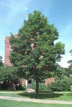
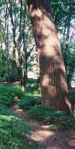
4 Benefits of the forest Combats global warming (carbon sequestration) and improving air quality.

5 Benefits of the forest Combats global warming (carbon sequestration) and improving air quality. Protects and preserves water quality and supply.

6 Benefits of the forest Combating global warming (carbon sequestration) and improving air quality. Protects and preserves water quality and supply. Provides stormwater management, hazard mitigation.

7 Benefits of the forest Combats global warming (carbon sequestration) and improving air quality. Protects and preserves water quality and supply. Provides cost-effective stormwater management and hazard mitigation. Preserves biodiversity and wildlife habitat.
8 Benefits of the forest Combating global warming (carbon sequestration) and improving air quality. Protects and preserves water quality and supply. Provides stormwater management, hazard mitigation. Preserves biodiversity and wildlife habitat. Improves quality of life and fitness by access to recreation.


9 s/citygreen/ GREEN INFRASTRUCTURE
10 CITYgreen Background Software developed by American Forests Planning tool for mapping urban ecosystems and calculating their value Software initially released in 1996 Current version is an extension for ArcGIS
11 CITYgreen Capabilities CITYgreen areas of analysis: Land cover distribution Air pollution removal Carbon storage and sequestration Stormwater management savings Water quantity (runoff) Water quality (contaminant loading) Alternate scenarios
12 CITYgreen Capabilities ArcGIS Extension Land cover classification (trees, lawn, impervious) Utilizes extensive database USFS UFORE data collection NRCS soil database Values assigned based on specific preferences and data for reference city (with similar climate)
13 CITYgreen Capabilities Large Area (>20 acres) Classified satellite or infrared aerial imagery Small Area (<20 acres) Vector data (polygons) created by handdigitizing features from aerial photograph
14 CITYgreen Considerations CITYgreen focuses on quantifying the cost benefits of trees Other tools are available for: Analyzing ecosystem health, Identifying sensitive areas or rare species Surveying and sampling tree species, size, and health Quantifying other benefits such as energy saving benefits of trees
15 CITYgreen Applications Model development scenarios and evaluate ordinances Estimate the impact of tree loss on stormwater management costs Justify increases in urban forestry maintenance, planting, and preservation Measure air quality benefits provided by green space
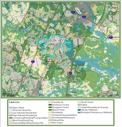
16 Example: Charlottesville, VA Urban Tree Canopy (UTC) Analysis Determine existing tree canopy cover Charlottesville s urban tree canopy covers approx. 2,096 acres (31.6%) of the city s total land area (6,656 acres) American Forests recommends 40% tree cover Calculate benefits provided by urban forest Absorbs and filters more than 203,665 lbs. of air pollutants each year Stores up to 90,194 tons of carbon in biomass


17 Tree Canopy Mapped forest canopy in GIS by digitizing aerial photos. Set goals for future canopy Today = 31.6 % Future = 40 %

18 Next: Where can we put new trees to get to 40%?


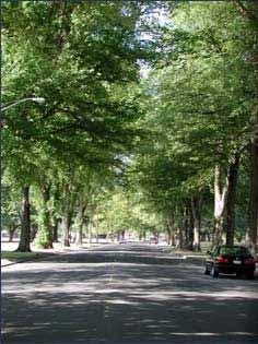
19 Street Trees: Simple Method Street tree inventory and gap list for 5 neighborhoods. 484 new locations for trees found.

20 CITYgreen for Site Level Plans We can calculate the benefits of particular parcels by drawing a polygon around a particular area of interest. In this example, we selected the boundary of a heavily wooded park.

21 Pollution Removal Values for Park 84.9% of 13.5-acre park is covered by trees Pollution removal value: $2,694/year Stormwater control value: $15,000/year


22 Modeling Example: Existing Conditions modeled in CITYGreen Quarry Park, Charlottesville, VA Doubles carbon sequestration from 63 to 104 tons! Alternative conditions modeled in CITYGreen to add more trees. Modeler Jonah Chirenza Helps meet Mayor s Climate Change Agreement


23 PUD example William Taylor Plaza (Ridge and Cherry, Cville, VA) 60,000 square feet requested for 50 apartments 40,000 square feet commercial = 100,000 square feet on 2.9 acres Proffer examples: 22% of space arboretum LEED building Possible use of LID strategy Rezoning to PUD from Residential, Commercial
24 Mayor s Climate Change Agreement = Impetus for GI since trees sequester carbon and cool urban areas We urge the federal government and state governments to enact policies and programs to meet or beat the target of reducing global warming pollution levels to 7 percent below 1990 levels by 2012, including efforts to: reduce the United States dependence on fossil fuels and accelerate the development of clean, economical energy resources and fuel-efficient technologies such as conservation, methane recovery for energy generation, waste to energy, wind and solar energy, fuel cells, efficient motor vehicles, and biofuels mayors signed on to date and 10 Virginia localities: Alexandria, Blacksburg, Charlottesville, Newport News, Norfolk, Portsmouth, Richmond, Salem, Virginia Beach and Williamsburg are signatories
 = livable cities.")

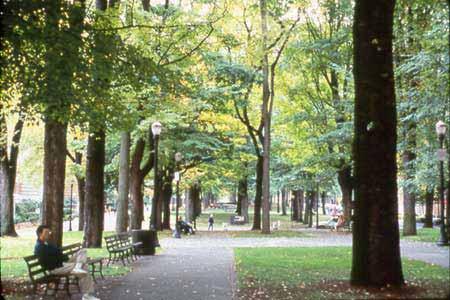
25 Tree Canopy Values Important for reducing heat, sequestering pollutants and carbon (Cool Counties and Mayors Climate Change Initiatives) = livable cities. Provide more attractive areas for development, historic districts, commercial areas opportunities for people to interact with nature. A study by the University of Washington found that people shopped longer and more often in tree-lined retail areas and spent about 12 percent more money.
 Well being and mental health - -people heal faster when they can see or access green. (hospitals need this for patients, reduces absenteeism of workers) Less crime occurs near trees.")
26 Trees: for Health Access to fitness opportunities. (addresses obesity, nature deficit disorders) Clean air trees absorb pollutants, VOCs, filter runoff, cool the city. (combat asthma) Well being and mental health - -people heal faster when they can see or access green. (hospitals need this for patients, reduces absenteeism of workers) Less crime occurs near trees. (issue especially for downtowns and public housing areas) Employees will exercise if they can access green where they work and on the way to work. (addresses employee health)
 roofs Light colored surfaces and Open space")
27 Aug. 14, 2002, a very hot NY City Day GREEN INFRASTRUCTURE Urban Heat Islands Thermal (top) and vegetation (bottom) infrared satellite data measured by NASA s Landsat7 Enhanced Thematic Mapper Plus shows where vegetation is dense, temperatures are cooler NY City determined that highest cooling potential per area = Street Trees Living (green) roofs Light colored surfaces and Open space planting

28 Trees: for job development GREEN INFRASTRUCTURE Small companies, especially those that are have well paid and skilled workforce place a strong importance on the green of the local environment. Crompton Love and Moore, 1997 The creative class: artists, media, lawyers, analysts, make up 30 percent of the U.S. workforce and they place a premium on outdoor recreation and access to nature. Florida, 2002


29 Simulations. GREEN INFRASTRUCTURE Simulations are a great way to make the case for urban trees. This is Oakland, CA would you live here?

30 End