INTEGRATED PLANNING FOR FOREST AREAS USING A SPATIAL DECISION SUPPORT SYSTEM
|
|
|
- Roger Smith
- 5 years ago
- Views:
Transcription


1 INTEGRATED PLANNING FOR FOREST AREAS USING A SPATIAL DECISION SUPPORT SYSTEM Navalho, I.; Alegria, C.; Quinta-Nova, L. Polytechnic Institute of Castelo Branco 11.september.2017
2 Objectives Development of a spatial analysis methodology using Spatial Multicriteria Analysis (Analytic Hierarchy Process - AHP), based in biophysical data and legal constraints that could be useful to land use planning, in a perspective of forest areas multifunctionality: production function; protection function; conservation function; silvopastoral, hunting and fishing functions; recreation function; landscape and aesthetic function.

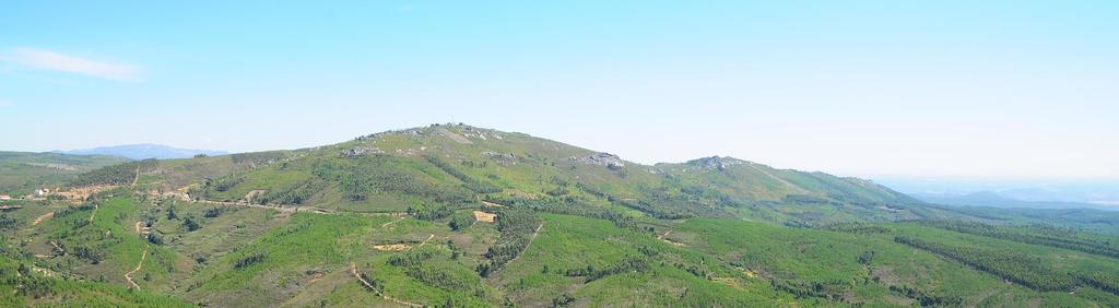
3 Study area Territorial unit: NUT III District: Castelo Branco Municipality: Oleiros Parish: Sarnadas de São Simão Area: ha
4 SDSS - Spatial Decision Support System The Spatial Decision Support System (SDSS) are interactive systems conceived to help users in decision making about structured problems of spatial nature (Malczewski 1997). Characteristics: Existence of alternative scenarios. Each alternative is evaluated based in different scenarios (qualitative and quantitative). Participation of decision makers and stakeholders. The participants have different views about the problem.
 Design - to structure de decision alternatives.")
5 Decision Making Process The model have 3 interactive steps: Assess Design Select (1) Assessment to identify the problem or the opportunity to change. (2) Design - to structure de decision alternatives. (3) Selection - to evaluate and select the better alternative.
6 Geographic Information Systems (GIS) GIS are useful tools to support the decision making process: generating maps that allow the visualization of the problem. doing operations of spatial analysis (geoprocessing). modeling events that could happen in the future. But a GIS is not by itself a Spatial Decision Support System
7 SDSS STRUCTURE Models GIS Data base Interface User
8 Land use and Forestry management plans Regional Plan for Forest Management of Pinhal Interior Sul PROF region Sub-region 1.st Function 2.nd Function 3.rd Function Silvopastoral, Pinhal Interior Pampilhosa hunting and Protection Production Sul e Alvéolos fishing Municipal Plan for Forest Fires Protection of Oleiros Municipality Master Plan of Oleiros Land use management map National Ecological Reserve (REN) map National Agricultural Reserve (RAN) map Legal constraints Map
9 Production function Evaluation of the forest species suitability Protection function Evaluation of the sensitive areas in terms of soil and water resources GIS-based forest land use models Conservation function: habitats, fauna and flora Habitat, flora and fauna conservation (Natura 2000 network and protected areas) Silvopastoral, hunting and fishing functions Recreation and landscape aesthetic function
10 Evaluating the suitability of forest species 21 forest tree species were selected following the indications of PROF PIS Reclassification of maps based in literature and experts Soil analysis Classification: higher than reference (3) Without limitations to the species development. Reference (2) Without severe limitations to the species development. Lower than reference (1) Severe limitations to the species development. Ecological zonation Land use suitability (Intersection) Suitability maps by species Phytoclimatic classification Reclassification Phytoclimatic classification Land use suitability
 and 3 (higher than")
11 Classification of the soil constraints to forestry use by species in 3 suitability levels Production function Classification of ecological zones by species in 3 suitability levels The potential forest use map was elaborated using the Combine function, considering the áreas with suitability 2 (reference) and 3 (higher than reference).
12 Production function National Ecological Reserve (REN) National Agricultural Reserve (RAN) Water resources National Ecological Reserve Map REN areas by type: Type % Cliffs and instable slopes 5,0 Erosion risk 54,8 Aquifer recharge sensitive areas 13,7 Water courses and margins 1,4 Flooding risk 0,3
13 Protection function Legal constraints for water courses and water bodies Carta das Servidões Administrativas
14 Conservation function: habitats, fauna and flora Water courses corridors It was defined a 30 m buffer to each margin in the protected habitat 91E0* (Aluvial forests of Alnus glutinosa and Fraxinus excelsior (Alno-Padion, Alnion incanae, Salicion albae). Recreation and landscape aesthetic function Recreation map based in field work and other assessment studies with identification of important sites.
15 Spatial Multicriteria Analysis Method
16 Conceptual model to evaluate the forest spaces potential Multicriteria analysis to evaluate the suitability of an area Analytic Hierarchic Process (AHP) (Saaty, 1970) Pairwise comparison between criteria to define the weight of each criteria. The AHP was made only for production and protection functions.
17 Conceptual model to evaluate the forest spaces potential Analytic Hierarchic Process (AHP) Criteria reclassification Production function 1 Low or without suitability 2 Medium suitability 3 High suitability Production function Criteria Description Weight higher than reference 3 Reference 2 Lower than reference 1 0 < d < 8% 3 8 < d < 15% 2 Slope 15 < d < 30% 2 d > 30% 1 0º < e < 147º 3 Aspect 147º < e < 188º 2 188º < e < 242º 1 Forest species suitability
18 Conceptual model to evaluate the forest spaces potential Analytic Hierarchic Process (AHP) Protection function Criteria reclassification The criteria corresponding to the constraints were reclassified in 0 and 1 (Boolean). Critérios Descrição Ponderação Protection function National Ecological Reserve (REN) National Agricultural Reserve (RAN) Hydric resources (RH) National Ecological Reserve 0 Areas without restrictions 1 National Agricultural Reserve 0 Areas without restrictions 1 Legal restriction 0 No restriction 1 0 Areas with legal restrictions; 1 Area without legal restrictions.
19 GIS model

20 Land use management model Production function Some examples of maps for each forest species. The higher suitability values are the red ones and the lower values are represented in blue.


21 Land use management model Production function 21 suitability maps were generated (one for each species) Based on the aggregation of the 21 suitability maps a Potential Forest Use map was produced.


22 Land use management model Protection function From the overlay of the different legal restrictions we obtain the protected areas. REN RAN Water resources

23 Protection function Map
24 Land use management model Conservation function: habitats, fauna and flora Habitat 91E0* Aluvial forests of Alnus glutinosa and Fraxinus excelsior (Alno-Padion, Alnion incanae, Salicion albae).
25 Land use management model Recreation and landscape aesthetic function Areas of landscape value: Appalachian relief of Serra do Muradal (quarzitic mountains); Religious monuments; Pedestrian routes; Water bodies with fishing interest.

26 Suitability map - Quercus pyrenaica Resulting from the combination of Production, Protection and Conservation functions 1ª Função de Produção 2ª Função de Proteção 3ª Função de Conservação

27 Final Forest Suitability Map
28 Final remarks The methodology AHP is valid to support Forest Management Plans (PGF) allowing to make the zonation based in a dominant function. This type of analytic models gives information about biophysical suitability of the territory to forest tree species, being a important tool for forest management. From the analysis of the Potential Forest Use map we verify that 6 species (maritime pine, eucalyptus, Pyrenean oak, cork oak, holm oak and strawberry tree) present a medium to high suitability.
29 Blagodarya!