¼ Century GIS and RS in Fiji Forestry
|
|
|
- Todd Webb
- 5 years ago
- Views:
Transcription
1 ¼ Century GIS and RS in Fiji Forestry NOA VAKACEGU, MSD-FORESTRY 1991 Establishment of GIS&RS in MSD Forestry PC with 400 MB hard disk, the biggest computer in Government! Digitising table Tape drive GPS (did not work under canopy) ERDAS software ArcInfo software (not utilised at this time) One laptop with 40 MB hard disk 1


 Supervised image classification with DTM")

2 Forest Inventory Fiji Tracking and Data Relay Satellite System TDRSS High amount of scenes recorded and stitched within 2 years to cover Fiji, EOSAT provider (not all recovered!) Supervised image classification with DTM involvement Image classification carried out in Europe not in Fiji Forest Function Map 1991/92 Raster data GIS application 2

3 Lessons Learned: Supervised classification difficult in Pacific volcanic islands due to atmospheric conditions Supervised classification must be performed with field knowledge in the country DTM 1:10,000 3


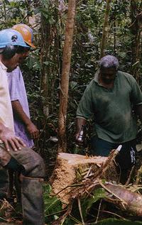
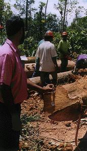
4 Logging Maps scale 1:10,000 road network creeks contour lines ridges areas of slope > 32 degree Field Data Capture 1996 Hardwood Plantation Mapping MSD Forestry


5 Lessons learned DTM creation went very well, more DTMs at 1:10,000 scale than ever before in Fiji Hardwood plantation survey was not accepted as the legal system did not recognise GPS System could not be maintained as no funds available for hardware maintenance No funds available to train the second photogrammetric specialist No more DTM establishment at MSD Chain of Custody ITTO Project 1999 Define origin of timber when exporting to other countries 5


6 Spatial Display Timber available in sawmills Log Tagging for Identification 6


7 Chain of custody Scaling Felling Transport Arrival at Sawmill SQL Server MSD Into Saw Gate Exported Sawn timber Application for Export License One Central Database at MSD Forestry 7
8 Update of Database Tables at MSD-Forestry DFO-South DFO-West SQL-Server 7.0 DFO-North MSD-Forestry Lessons learned ITTO used Fiji as an example in newsletter and poster world wide Project died No acceptance by most sawmills No funds for phone bills No funds for tags 8


9 National Forest Inventory 2006, GIZ funded Automatic classification pre-condition Landsat data from 2001 as Landsat 7 died Reduction from 3 forest densities to 2 Best Fit of Classes, Unsupervised Classification 9


10 Haze Different thresholds Only Natural Forest None forest Plantation Mangroves 10
11 Lessons learned Unsupervised classification has more possibilities for interaction than supervised Mask building helped Atmospheric problems required visual interpretation to create reasonable results Rate of Deforestation GIZ funded 2009 Overlay of forest map created 1991, forest map created 2006 with image data 2001 Forest map created with data recorded
 normal colour, (ii) false colour IR, (iii) vegetation index Lessons learned 1991")

12 Visual Interpretation Forest layers created in 1991 and in 2006 had to be revised Multi layer interpretation (i) normal colour, (ii) false colour IR, (iii) vegetation index Lessons learned 1991 forest layer and 2001 forest layer had to be re-established Geometric accuracy problems between image data from different periods and Fiji map basis Unclear definition of plantations Deforestation is low in Fiji most timber 12
13 Forest Mapping 1:10,000 Start as visual interpretation with atmospherically corrected image data Visual interpretation at 1:10,000 too slow, move back to semi automatic classification Separation of semi dense and dense forest possible by applying object based classification software (ecognition) Cooperation between Forestry and Agriculture Outlook: Mapping Degradation of Forest Investigation mapping secondary vegetation as indicator for forest degradation Investigation mapping logging tracks with multiple free data sources (Landsat, Sentinel) Investigation mapping logging tracks with high resolution radar data 13

14 Thanks 14