K&C Phase 3 Brief project essentials
|
|
|
- Brooke Mitchell
- 5 years ago
- Views:
Transcription
1 K&C Phase 3 Brief project essentials Aboveground Biomass and Carbon Stock Mapping and Changes Monitoring in the Forest of Peninsular Malaysia Using L-Band ALOS Palsar and JERS-1 Hamdan Omar & Khali Aziz Hamzah Forest Research Institute Malaysia (FRIM) Science Team meeting #17 Phase 3 JAXA TKSC/RESTEC HQ, March 27-29, 2012

2 Non-Forest Forest in Malaysia ( 000,000 ha) Pen. Malaysia 3.62 Sabah Sarawak
3 Distribution and extent of major forest types in Malaysia, 2010 ( 000,000 ha) Region Land Area Natural Forests Total Dry Inland Forest Swamp Forest Mangrove Forest Forested Land % of Total Land Area Pen. M sia Sabah Sarawak Malaysia Sources: Forestry Department Peninsular Malaysia (2011) Sabah Forestry Department (2011) Forest Department Sarawak (2011)
4 Permanent Reserved Forest in Malaysia, 2010 ( 000,000 ha) Region Protection Forest Production Forest Total PRFs Pen. M sia Sabah Sarawak Malaysia Sources: Forestry Department Peninsular Malaysia (2011) Sabah Forestry Department (2011) Forest Department Sarawak (2011)
5 Forest in Peninsular Malaysia Malaysia is one of the countries with high percentage of forested land among developing countries. Estimated forested land in Peninsular Malaysia (2010) million ha or 44.4% of the total land area. Of the total forested land, 4.80 million ha - Permanent Reserved Forests (PRFs) - National Forestry Act PRFs is being managed based on Sustainable Forest Management (SFM) principles and practices.


6 Major types of forest in Peninsular Malaysia Inland forest Peat swamp forest Mangrove forest

7 Major forest types in P. Malaysia Upper Montane 1500 m Mangrove Peat Swamp Dry Inland Lower Montane 1300 m Upper Dipterocarp 750 m Hill Dipterocarp Peat Swamp Lowland Dipterocarp 300 m Mangroves
8 Project Summary TITLE: Aboveground Biomass and Carbon Stock Mapping and Changes Monitoring in the Forest of Peninsular Malaysia Using L-Band ALOS Palsar and JERS-1 DURATION: Two years (April 2012 March 2014) EXEC. AGENCY: LOCATION: Malaysian Forestry Research and Development Board, Forest Research Institute Malaysia (FRIM) Peninsular Malaysia
9 Objectives: Project objectives and schedule (i) to establish empirical relationship between aboveground biomass and L- Band signals for tropical forest ecosystem, (ii) to determine aboveground biomass by using L-band SAR data, and (iii) to map the current status and identify changes of aboveground biomass and carbon stocks in the forest in Peninsular Malaysia. Deliverables: (i) Forest cover in the study area (1995 & 2010) (ii) Pattern of spatial distribution of above ground biomass & carbon stocks in the forest (1995 & 2010) (iii) Changes of biomass and carbon stocks from 1995 to 2010.


10 Project area Forest Cover in Peninsular Malaysia Location of Peninsular Malaysia: Upper left Latitude/Longitude 6 o / 100 o Lower right Latitude/Longitude 1 o / 105 o Region Land Area Dry Inland Forest Natural Forests Swamp Forest Mangrove Forest Total Forested Land % of Total Land Area Pen. M sia
11 Methodology JERS-1 (1995) ALOS PALSAR (2010) Corrections: -NRCS conversion - Noise filtering - Topographic norm. Forest Cover Classification Landuse Maps Biomass & Carbon Stock modeling - Inland Forest - Peat Swamp Forest - Mangrove Forest Carbon Stocks Changes Assessment Validation Forest Inventory National Forest Inventory
12 Project milestones No. Key-milestone Date of completion i Forest inventory data Jun 2012 ii Maps of forest cover in the study area (1995 & 2010) September 2012 iii Spatial distribution map of biomass and carbon stock March 2013 (2010) iv Spatial distribution map of biomass and carbon stock Jun 2013 (1995) v Spatial distribution map of biomass and carbon stock Dec 2013 changes over 15 years ( ) vi Project report March 2014
13 X : Activities : Planned milestone Project Schedule Japanese Fiscal Year 2012 (April) 2015 (March) Project Activities 2012/ /14 A M J J A S O N D J F M A M J J A S O N D J F M Agreement signing & ALOS Palsar + JERS-1 Data collection X Secondary data collection X X Ground data collection/plot Sampling X X Ground data analysis X X ALOS Palsar Image pre-processing: - Image Mosaic - Topographic normalization X X - DN to NRCS (db) Conversion ALOS Palsar Image processing: - Forest classification - Biomass modeling X X Mapping of Current AGB & Carbon Stocks (2010 ) X X X X X JERS-1 Image pre-processing: - Image Mosaic X X - Topographic normalization - DN to NRCS (db) Conversion JERS-1Image processing: - Forest classification X X Mapping of AGB & Carbon Stocks in 1995 X X X X X Mapping of AGB & Carbon Stocks Changes ( ) X X X X X Validation and verification X X Project completion report X X
14 Support to JAXA s global forest mapping effort Tropical rainforest of Malaysia is one of the oldest and most complex ecosystems in the world. Although generally taken to mean the species rich lowland forests, other forest types include mangroves, peat swamps and montane forests are also rich with diverse species. Forest Research Institute Malaysia (FRIM) will be responsible to verify and validate these forest cover in Peninsular Malaysia, and assess the response of SAR data on these forests. By using ground truth samples and experts knowledge, the algorithm that will be developed for forest cover mapping by using both ALOS Palsar and JERS-1 SAR products will be validated, specifically for the corresponding region in the study area.
15 Growth levels, health status, density and quality of each type of the forest will be taken into considerations in sampling processes. Data will be inventoried on the ground and will be stored in digital shapefile (.shp) for analysis and image pixel sampling. This ground data will be shared together with JAXA scientist on conditions as specified in the project agreement. Number of sampling plots according to the forest types Types of forest No. of Sampling Points Natural Forest Dry inland Swamp forest Mangrove forest 150 (4.5 mil. ha) 35 (0.2 mil. ha) 20 (0.1 mil. ha) Plantation forest (mil. ha) Total samples 220


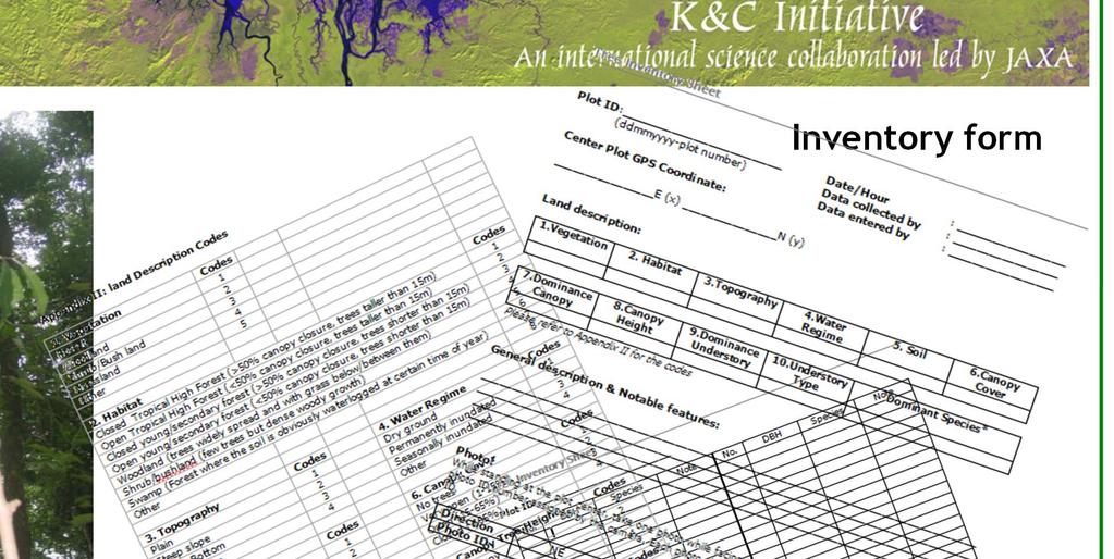

16 GPS to record plot center coordinate Inventory form


17 Inland Forest Hutan Simpan Jengai


18 Mangrove Forest

19 Peat Swamp Forest
20 Biomass Allometric Functions No. Source Allometric functions Application to type of forest 1 Kato et al. (1978) 1/H = 1/(2.0*D) + 1/61 from the values of D and H, the dry mass of stem, branches, and leaves of the tree is estimated Ms=0.0313*(D 2 H) Mb=0.136*Ms /Ml=1/(0.124Ms )+1/125 Inland forest including both lowland and hill forest type at Bukit Lagong FR, Sungei Menyala FR, Pasoh FR and Semangkok FR, FRIM s planted forest 2 Niiyama et al. (2010) 3 Chave et al. (2005) 4 Istomo (2006) 5 Komiyama et al. (2007) 6 Ong et al. (2004) Wr = *D Wt=0.0509*ρD 2 H Wt=ρ*exp( *ln(D)+0.207*(ln(D)) *(ln(D)) 2) Wt = (D 3 ) * (D 2 ) *(D) Wr = 20.1% of Wt Wt= 0.251ρD 2.46 Wr=0.199ρ D 2.22 Log10(Wt)= *log10(gbh) Log10(Wr)= *log10(gbh) 3.454) As above Pasoh 50 ha plots and other CTFS plots Peat swamp forest Common equation applied to all trees in mangrove forest Specific equation Rhizophora apiculata
21 Case Study 1 O Hamdan, H Khali Aziz & K Abd Rahman (2011). Remotely Sensed L-Band SAR Data for Tropical Forest Biomass Estimation. Journal of Tropical Forest Science 23(3):

22
23 Field Inventory Data Field survey was carried out and more than 30 plots of 50 x 50 m size were established within the study area. The plots covered all forest types and various ages. All the trees with the size of dbh of more than five centimetre ( 5 cm) were inventoried.
24 Design of the plots that were distributed and laid on the ground in the study area.


25 NE SE PLOT CENTER NW SW Ground data collection: Plots were laid on the ground and the centre coordinate was recorded.


26 Dominant types of standing trees that are found in the study area. Most of the trees are above 25 m height and reach up to 45 m. High biomass & carbon concentration Medium biomass & carbon concentration Low biomass & carbon concentration
27 Biomass Allometry Biomass equations to calculate AGB were based on Kato et al. (1978). The allometric function of trees applied in the calculation of standing biomass can be expressed as 1/H = 1/(2.0*D)+1/61 From the values of D and H, the dry mass values of stem, branches and leaves of the tree are estimated. Ms Mb 1/Ml = *(D2H) = 0.136*Ms1.070 = 1/(0.124Ms0.794)+1/125 where; H = total tree height D = stem diameter at breast height (dbh) Ms, Mb and Ml denote the dry mass of stem, branches and leaves respectively.
28 Relationship between biomass and L-Band ALOS PALSAR signal Strong signal Dense stands High Biomass Weak signal Small stands
 Carbon Stocks (t ha -1 ) Coverage (%) Small, growing stands 26-116 13-58 28.")
29 Range: t C Total C stocks: 56,874.9 t C Category Biomass (t ha -1 ) Carbon Stocks (t ha -1 ) Coverage (%) Small, growing stands Mixed small & mature stands Mature, dense stands Mature & very dense stands

30
31 Case Study 2 Hamdan O, Ismail P & Azian M. (2012). Assessment of carbon stock changes in demonstration site of Asean Peatland Forest Project (APFP) at Raja Musa Forest Reserve. Project Report, Forestry Department Peninsular Malaysia. 39pp.


32 Satellite images over the years 1989 and 2010


33 Spatial distribution maps of C stock over the years 1989 and 2010 Source: Assessment of carbon stock changes in demonstration site of Asean Peatland Forest Project (APFP) at Raja Musa Forest Reserve. Submitted to Forestry Department Peninsular Malaysia. 39pp.
34

35
36 Carbon Stocks Inland forest Forest P. Malaysia Lowland dipterocarp Pasoh FR Inland Air Hitam FR Carbon stocks (t/ha) 155 (Primary forest) 138 (Secondary forest) Reference Okuda, et al (2003) Ismriah & Ahmad Fadli (2007) Sarawak Mixed dipterocarp Brown (1997) Secondary forest Chai (1997) yrs Lambir, FR Feeley et al (2007) Sabah Lowland dipterocarp Foody et al (2001)
37 Changes in Carbon Stocks - PSF PSF *Logged PSF Degraded PSF *Johor and Selangor PSF Unit: t/ha
38 Carbon Stocks Mangrove, Matang FR C Stock (t ha -1 ) yrs yrs yrs VJR Growth ages
39 Thank you Terima kasih ありがとうございます Obrigado Salamat sa iyo Merci beaucoup Danke schön Su-bhaay