Urban Forest Perth & Peel
|
|
|
- Cody Dawson
- 5 years ago
- Views:
Transcription
1 Urban Forest Perth & Peel CSIRO Urban Monitor 2009 & 2014


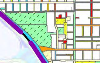
2 A compilation of maps illustrating the location and proportion of tree canopy cover above 3 metres across Perth and Peel in Suburbs Private property and parks by street block Roads and parks

3


4 Data Source: CSIRO s Urban Monitor 2009 demonstrates the capabilities of high resolution digital photography Terrestrial Mapping And Monitoring CSIRO Computational Informatics Stream Leader Research Scientist Dr Peter Caccetta (BEng (Hons) PhD)
5 Data Source: CSIRO s Urban Monitor 2009 demonstrates the capabilities of high resolution digital photography 2014 Urban Forest data has arrived Terrestrial Mapping And Monitoring CSIRO Computational Informatics Stream Leader Research Scientist Dr Peter Caccetta (BEng (Hons) PhD)

6

7


8 2014 aerial 2009 aerial 2009 Urban Forest report tree canopy change
9 URBAN MONITOR APPLICATIONS IN ENVIRONMENTAL MONITORING FOR THE STRATEGIC ASSESSMENT OF THE PERTH AND PEEL REGIONS Katherine Zdunic and Ricky van Dongen Ph: Remote Sensing and Spatial Analysis Section GIS Branch Department of Parks and Wildlife
")
10 Rule set steps: Identify all veg above 8 m Grow out from this a number of loops To a maximum height Optimised to 6 loops to 2 m Mean accuracy of 1.47 m (std dev = 1.3 m)


11 Applications at revegetation and rehabilitation works to measure success an indicator of ecological function for TEC, PEC, DRF, riparian veg etc


12 Connectivity and fragmentation Applicable at a range of scales :

13
14 Sub regional scale application


15


16


17 Environmental objectives and commitments for State values 48. Better understand and manage urban heat island vulnerabilities by undertaking studies and monitoring. This would include investigation of barriers to minimising heat island effect through design and where they exist how they might be remedied. 49. Support human health and amenity values in existing and proposed urban areas by developing a framework for maintaining or enhancing a network of green space and tree canopy cover which will include: Guidance and support for local government strategies in setting and achieving minimum standards for canopy cover and on ground actions for achieving a net increase in tree canopy cover; Communication and knowledge sharing concerning the benefits of urban tree canopy retention and expansion; and Response to the outputs of the preceding commitment. 50. Conduct monitoring of urban tree canopy and publishing of data to support local governments track trends in canopy coverage, and evaluate the effectiveness of their heat island effect reduction strategies.
18 Suburb structure


19 Private Property Roads Parks High risk Medium risk Low risk


20 City of Armadale Urban Forest Strategy Armadale Bedfordale Urban Forest of Perth and Peel: Statistics for City of Armadale Kelmscott Seville Grove


21 City of Vincent Greening Plan 11% Tree canopy cover (baseline year 2009) 2050 Target 20-25% Tree canopy cover Mt Hawthorn Leederville Highgate
22 Urban typologies


23


24


25

26 Thank you