WHITE OAK PLACE. Brownfield Plan No East Grand River, Tax ID Spartan Ave, Tax ID
|
|
|
- Merryl Nancy Fletcher
- 5 years ago
- Views:
Transcription

 648-2434 East Lansing Brownfield Redevelopment Authority 410 Abbott Road East Lansing, Michigan 48823 Contact: Tim Dempsey Phone: (517)")
1 WHITE OAK PLACE 1301 East Grand River, Tax ID East Grand River, Tax ID Spartan Ave, Tax ID East Lansing, Michigan Brownfield Plan No.21 Revised February 25, 2016 Prepared with assistance from: ADVANCED REDEVELOPMENT SOLUTIONS PO Box 204 Eagle, Michigan Contact: Eric P. Helzer, EDFP Phone: (517) East Lansing Brownfield Redevelopment Authority 410 Abbott Road East Lansing, Michigan Contact: Tim Dempsey Phone: (517) Approved by the East Lansing Brownfield Redevelopment Authority 02/25/2016 Approved by the East Lansing City Council 06/07/2016
2 Table of Contents Project Summary Sheet: Brownfield Plan No. 21 White Oak Place... 2 Introduction Description of the Eligible Property (Section 13(1)(h)) Basis of Eligibility (Section 13 (1)(h), Section 2 (m)), Section 2(r) Summary of Eligible Activities and Description of Costs (Section 13 (1)(a),(b)) Captured Taxable Value and Tax Increment Revenues (Section 13(1)(c)) Method of Brownfield Plan Financing (Section 13(1)(d)) Amount of Note or Bonded Indebtedness Incurred (Section 13(1)(e)) Duration of the Brownfield Plan and Effective Date (Section 13(1)(f)) Estimated Impact on Taxing Jurisdictions (Section 13(1)(g), Section 2(ee)) Displacement of Persons (Section 13(1)(i-l)) Authority Revolving Fund (Section 8; Section 13(1)(m)) Other Information (Section 8; Section 13(1)(n)) Tables Exhibits Table 1 Eligible Activities and 15 Table 1a Itemized Eligible Activities Table 1b Summary of Eligible Activities Table 2 Captured Incremental Taxable Values & Tax Increment Revenues Captured Table 3 Impact to Taxing Jurisdictions Table 4 Tax Increment Financing Estimates... Exhibit C Table 4a1 Base Year/Initial Taxable Value (ITV) Table 4a2 Taxes Paid to All Taxing Jurisdictions on the Base Year Taxable Value/Initial Taxable Value (ITV) Table 4b Estimated Future Taxable Value (FTV) Table 4c Impact of Tax Capture on Taxing Jurisdictions Table 4d Reimbursement of Eligible Activities & Disbursements A. Legal Descriptions (per Ingham County Assessing Records) and Eligible Property Boundary Maps B. Basis of Eligibility Supportive Environmental and Non-Environmental Brownfield Information C. Table 4 Tax Increment Financing Estimates Brownfield Plan No.21 White Oak Place, East Lansing Page 1 Revised February 25, 2016
3 PROJECT SUMMARY SHEET: BROWNFIELD PLAN NO.21 WHITE OAK PLACE Project Name: White Oak Place Applicant/Developer: Entity Name: Next Generation Investment Properties, LLC Contact: Joe Goodsir Mailing Address: 251 W. Grand River Ave., East Lansing, MI Phone: (517) Eligible Property Location: The eligible property ( Property ) consists of three (3) parcels located at: 1301 East Grand River, Tax ID ; 1307 East Grand River, Tax ID ; Spartan Ave, Tax ID East Lansing, Michigan Property Size: Type of Eligible Property: Project Description: Approximately 1.08 acres (0.26 acres {-009} acres {-010} acres {-008}) Facility (Contaminated) White Oak Place Project This Brownfield Plan (the Plan ) anticipates $22.1 million in future investments by Next Generation Investment Properties, LLC, an East Lansing-based developer that primarily manages and builds residential and rental housing. This Plan contemplates redevelopment upon all three (3) Eligible Properties East Grand River (Tax ID ) and 1307 East Grand River (Tax ID ) have been vacant for nearly 3 years and are blighted, underutilized and contaminated property. White Oak Place is a mixed-use redevelopment project with apartments and retail space which will create a dense urban redevelopment while preserving the approximate 265 year-old White Oak tree and creating a substantial green courtyard. The project will occur on a 1.08 acre site east of Spartan Avenue and north of East Grand River Avenue. The applicant proposes to raze the existing buildings on all three eligible properties and construct a mixed-use 6- story building which includes one level of underground parking, parking and commercial use on the first floor, five-floors of residential use above. Project building area consists of 140,175 gross square feet (GSF) containing 29,634 GSF of underground parking, 1,726 GSF usable retail/commercial space, 1,731 GSF common space, and 107,084 GSF multifamily residential. Total of 69 apartment units ranging between one and four bedrooms (213 total beds) all housed in a very prominent location on East Grand River Avenue across from Michigan State University ( MSU ). The project is being built with the intention of serving a mixed market of people, including graduate students and young professionals, who desire to live in the downtown and near the MSU campus. It is expected this new facility will attract more people to the area, some of which will Brownfield Plan No.21 White Oak Place, East Lansing Page 2 Revised February 25, 2016
4 have a desire to live in a building such as that proposed in this project. Added project features include art work display, extensive covered bike and moped parking, urban setting on Grand River Avenue containing a unique landscaped courtyard preserving the large approximate 265 year-old White Oak on the Property. Construction is scheduled to begin in the early spring 2016, with occupancy available by August However, environmental contamination and increased costs threaten the redevelopment planned. The completion of this project represents a unique opportunity to accomplish long term environmental benefits and protect the water resources of the Red Cedar River within the City. The project is seeking tax increment financing through the Brownfield Redevelopment Financing Act (Public Act 381 of 1996), which is the subject of this Plan, to allow for a successful redevelopment and environmental cleanup at this site. Estimated Job Creation: Once complete, up to 10 immediate new full time jobs will be created. Estimated Gain in Taxes: (after Project completion) Current Taxable Value Future Taxable Value Increased/ Taxable Value (Increment) (2015) (2018) (2018) $428,880 $5,821,028 $5,392,148 Annual Taxes Paid $33,669 $456,972 $423,303 Duration of Plan: 17 years (2033) Total estimated Plan duration with tax capture for reimbursement of Eligible Activities, Brownfield Plan & Work Plan Preparation, Contingency, ELBRA Administrative Fees, and State Brownfield Revolving Fund. Brownfield Plan No.21 White Oak Place, East Lansing Page 3 Revised February 25, 2016
5 Gain in Taxes Breakdown: (Total Plan Duration) Notes Total/ Annual Cumulative Average Total Taxes Paid During Brownfield Plan Tax Capture Period Capture Period in Years $ 8,131,075 $ 478,299 Total New Tax Revenue Received by each Taxing Unit/ Entity CITY OF EAST LANSING Percentage of Pass-Through/ Sharing Total/ Cumulative Annual Average Operating 10% $ 182,181 $ 10,717 Solid Waste/Recycling 10% $ 18,903 $ 1,112 Library 10% $ 20,715 $ 1,219 Downtown Development Authority - DDA 100% $ 179,383 $ 10,552 City Debt 100% $ 133,302 $ 7,841 Subtotal to Above - $ 534,483 $ 31,440 INGHAM COUNTY 10.00% $ 101,787 $ 5,987 Capital Region Airport Authority - CRAA 10.00% $ 7,240 $ 426 Capital Area Transportation Authority - CATA 10.00% $ 31,145 $ 1,832 INTERMEDIATE SCHOOL DISTRICTS (ISD) 10.00% $ 62,022 $ 3,648 Lansing Community College - LCC 10.00% $ 39,433 $ 2,320 Subtotal to Above - $ 241,628 $ 13,788 LOCAL SCHOOL MILLAGES: excludes State School millages East Lansing School Debt % $ 565,110 $ 33,242 East Lansing School Building and Site ("Sinking Fund" millage available for tax capture) 10.00% $ 13,320 $ 784 Subtotal to Above - $ 578,430 $ 34,025 Added taxes not captured but redistributed from the final year(s) of capture* - $ 385,013 $ - STATE SCHOOL MILLAGES: excludes Local School millages Gain In Taxes Breakdown Subtotal of All of the Above - $ 1,739,554 $ - State Education Tax - SET 10.00% $ 62,145 $ 3,656 Local School Operating - LSO: 18 mills for Real Property; only 6 mills for Personal Property 10.00% $ 186,436 $ 10,967 Subtotal to Above - $ 248,582 $ 14,622 Added taxes not captured but redistributed from the final year(s) of capture - $ 60,575 $ - GRAND TOTAL OF NEW TAX REVENUE TO ALL OF THE ABOVE - $ 2,048,711 - *Excluding any Taxing Unit levying a millage not allowed for tax capture (e.g. debt millages) Brownfield Plan No.21 White Oak Place, East Lansing Page 4 Revised February 25, 2016
6 Total Taxes Captured: (Total Plan Duration) Total Taxes Captured During Brownfield Plan Tax Capture Period Total/ Cumulative Annual Average Brownfield Redevelopment Authority (BRA) Administration BRA Local Site Remediation Revolving Fund (LSRRF) State of Michigan Brownfield Redevelopment Fund (MBRF) Local Taxes To Developer (Reimburse Eligible Activities) State School Taxes To Developer (Reimburse Eligible Activities) $ 255,000 $ 15,000 $ - $ - $ 279,655 $ 16,450 $ 3,650,701 $ 214,747 $ 1,897,008 $ 111,589 Total New Tax Capture (See Table 1a) $ 6,082,364 $ 357,786 Distribution of Total New Taxes Paid: (Total Plan Duration) Total New Taxes Received by Taxing Units $ 2,048,711 Total New Taxes Captured $ 6,082,364 Total New Taxes $ 8,131,075 Eligible Activities and Eligible Costs: Eligible Activities Eligible Costs Baseline Environmental Assessment (BEA) Activities $ 66,700 Due Care Activities $ 787,781 Additional Response Activities $ 2,364,214 Demolition Activities $ 126,900 Lead and Asbestos Abatement Activities $ 25,300 Infrastructure Improvements Activities (Private) $ 208,185 Infrastructure Improvements Activities (Public) - In Public ROW/Easements $ 170,163 Site Preparation Activities $ 228,725 Subtotal $ 3,977,968 Contingency (0%) $ - Interest (5%) $ 1,527,241 Subtotal with Contingency & Interest $ 5,505,209 Brownfield Plan & Work Plan Preparation $ 42,500 Subtotal (to Developer) $ 5,547,709 ELBRA Administration $ 255,000 State of Michigan Brownfield Redevelopment Fund $ 279,655 Grand Total* $ 6,082,364 *No Local Site Remediation Revolving Fund ( LSRRF ) deposits will be made with this Plan. Brownfield Plan No.21 White Oak Place, East Lansing Page 5 Revised February 25, 2016
7 INTRODUCTION The City of East Lansing, Michigan (the City ), established the East Lansing Brownfield Redevelopment Authority (the Authority ) on August 28, 2000, pursuant to the Brownfield Redevelopment Financing Act, Michigan Public Act 381 of 1996, MCLA et. seq., as amended ( Act 381 ), is authorized to exercise its powers within the City of East Lansing, Michigan. The purpose of this Brownfield Plan (the Plan ) to be implemented by the Authority, is to satisfy the requirements of Act 381 for including the eligible property described below in a Plan. This Plan promotes the redevelopment of and investment in the eligible Brownfield Property within the City, to facilitate financing of eligible activities at the Property. Inclusion of Property within any Plan in the City will facilitate financing of eligible activities at eligible properties, and will also provide tax incentives to eligible taxpayers willing to invest in revitalization of eligible sites, commonly referred to as Brownfields that are either environmentally contaminated (a facility ), blighted property, historic resource or deemed functionally obsolete property. By facilitating redevelopment of the Property, this Plan is intended to promote economic growth for the benefit of the residents of the City and all taxing units located within and benefited by the Authority. This Plan is intended to apply to the Eligible Property identified in this Plan and, if tax increment revenues are proposed to be captured from that Eligible Property, to identify and authorize the eligible activities to be funded by such tax increment revenues. This Plan is intended to be a living document, which may be modified or amended in accordance with the requirements of Act 381, as necessary to achieve the purposes of Act 381. The applicable sections of Act 381 are noted throughout the Plan for reference purposes. This Plan contains information required by Section 13(1) of Act 381. Brownfield Plan No.21 White Oak Place, East Lansing Page 6 Revised February 25, 2016
(H))")

8 1. DESCRIPTION OF THE ELIGIBLE PROPERTY (SECTION 13(1)(H)) Brownfield Plan No.21 White Oak Place, East Lansing Page 7 Revised February 25, 2016
 and 116-132 Spartan Ave (ID No. 33 20 02 18 415 008), East Lansing, Ingham County, Michigan.")
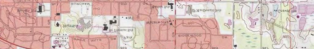
9 The Eligible Property ( Property ) consists of three parcels and is located at 1301 East Grand River (ID No ), 1307 East Grand River (ID No ) and Spartan Ave (ID No ), East Lansing, Ingham County, Michigan. The Property is situated to the north of East Grand River Avenue and east of Spartan Avenue. The Property contains approximately 1.08 acres in the City of East Lansing ( City ). The Property is surrounded by B-2, Retail Sales Business District to the west and east, and to the south across East Grand River Avenue are apartments zoned EV, East Village. To the northwest and northeast the properties are zoned RM-32, City Center Multiple-Family District. Brookfield Plaza is located just to the east where there are several restaurants, a financial institution, office space, personal service businesses and retail businesses. Directly to the west is a restaurant and to the north are single-family dwellings licensed for occupancies of four (4) persons. To the northeast is a multiple-family dwelling with occupancy for 22 persons. Red Cedar River is less than 300 feet to the south, and the Property is abutted by surface roadways, municipal water, sanitary and storm sewer services, and electrical and gas utilities. The existing property at Spartan Avenue consists of a 4,200 square foot one story building built in 1959, which is currently being used as a fraternity house. The parcel is approximately 0.65 acres in size. Brownfield Plan No.21 White Oak Place, East Lansing Page 8 Revised February 25, 2016


10 The existing property at 1301 East Grand River Avenue recently operated as a gas station/convenience store. The building is approximately 1,300 square feet in size and built in The parcel is approximately acres in size. The existing property at 1307 East Grand River Avenue recently operated as an ice cream shop (Tasty Twist). The building is approximately 500 square feet in size and built in The parcel is approximately acres in size. Brownfield Plan No.21 White Oak Place, East Lansing Page 9 Revised February 25, 2016
11 See Exhibit A, Legal Descriptions (per Ingham County Assessing Records) and Eligible Property Boundary Map. Eligible Property Address Tax ID Basis of Eligibility Approximate Acreage Current Zoning 1301 East Grand River Facility B East Grand River Facility B Spartan Ave Adjacent or Contiguous to Facility Property 0.65 B-2 The Property consists of three parcels of land. Two of the three parcels is a "facility" as defined by Part 201 of Michigan's Natural Resources and Environmental Protection Act (P.A. 451, as amended). In accordance with Act 381, the remaining parcel included in this Plan is adjacent or contiguous to the facility-designated properties and is estimated to increase the captured taxable value of the facility-designated parcels. The parcels are located within the boundaries of the City of East Lansing, Michigan. The Property is zoned Retail Sales Business District (B-2). The B-2, Retail Sales Business District permits a variety of retail stores, personal service shops, restaurants, offices, mixed use structures containing residential dwellings and other businesses necessary to provide for the wide range of shopping and service needs of the community. B-2 zoning allows for a zero setback. Although zoned B-2, the building has been set back a minimum of 3 feet at grade along East Grand River Avenue and Spartan Avenue, with greater setbacks at the rear and side lot lines to allow for a greater separation from the public right-of-ways and adjacent developments. A portion of the building has a much greater setback from the west property line to retain a large tree that currently exists on site. Mixture of uses proposed on Property is consistent with the City s Comprehensive Plan. Several of the goals and objectives of the Comprehensive Plan are being met by the applicant through its streetscape enhancements to this section of East Grand River Avenue and by creating mixed-use neighborhoods. This Property is located in the Downtown Development Authority District and will be required to meet the requirements of the DDA Design Guidelines for the public space located along Grand River Avenue and Spartan Street. The Project proposes to redevelop underutilized and vacant properties into a multi-use development. The redevelopment integrates design elements, environmental response activities, and economic development to further goals of the City, the Michigan Department of Environmental Quality ( MDEQ ) and the Michigan Economic Development Corporation ( MEDC ). It will result in: (1) the community and municipal benefits of increased property taxes on the Property; (2) due care and additional response activities that will address the contamination on the Property, reducing the threat to human health and the environment; and (3) a substantial improvement to the appearance and aesthetics of the Property which will assist in increasing the property values of the neighboring community. The overall redevelopment of this site will include demolition and removal of environmentally contaminated soil and ground water of the parcels located at 1301 and 1307 East Grand River, environmental due care and additional response activities, and redevelopment into a mixed- Brownfield Plan No.21 White Oak Place, East Lansing Page 10 Revised February 25, 2016


12 use development project. The applicant has a strong desire to put this vacant property back to productive use and drastically improve the aesthetics of the area. The parcel and all tangible real property located thereon will comprise the Eligible Property and is referred to herein as the Property. Any such funds will be used to reimburse the Authority and Developer for eligible activities, to the extent authorized by this Plan, and an executed development reimbursement agreement between the Developer and the Authority. Brownfield Plan No.21 White Oak Place, East Lansing Page 11 Revised February 25, 2016
13 2. BASIS OF ELIGIBILITY (SECTION 13 (1)(H), SECTION 2 (M)), SECTION 2(R) The Property is considered eligible property as defined by Act 381, Section 2 because (a) the Property was previously utilized or is currently utilized for a commercial or residential purpose; (b) two of the three parcels comprised by the Property has been determined to be a facility ; (c) includes parcels that are adjacent or contiguous to that Property because the development of the adjacent and contiguous parcels is estimated to increase the captured taxable value of that property; and, (d) the Property is located within the City of East Lansing, a qualified local governmental unit, or Core Community under Act 381. Eligible Property Address Tax ID Basis of Eligibility Approximate Acreage 1301 East Grand River Facility East Grand River Facility Spartan Ave Adjacent or Contiguous to Facility Property 0.65 Exhibit B includes an overview of the environmental conditions on the Property as it is related to its basis of eligibility and inclusion in the Plan. As Eligible Property, the Property is eligible for Brownfield redevelopment incentives from the Authority. 3. SUMMARY OF ELIGIBLE ACTIVITIES AND DESCRIPTION OF COSTS (SECTION 13 (1)(A),(B)) The eligible activities that are intended to be carried out at the Property are considered eligible activities as defined by Sec 2 of Act 381, because they include Baseline Environmental Activities (BEA) {Phase I ESA, Phase II ESA, and BEA}, due care activities, additional response activities, lead & asbestos survey and abatement, demolition, site preparation, infrastructure improvements, and preparation of a Brownfield Plan & Act 381 Work Plan. Exhibit B includes an overview of the Brownfield eligible activities that are contemplated for the Property. A summary of the eligible activities and the estimated cost of each eligible activity intended to be paid for with Tax Increment Revenues from the Property are shown in the following tables (Tables 1a and 1b). Response activities will include a focus on the cleanup of a source area of hydrocarbon contamination beneath the vacant gas station site 1301 East Grand River and groundwater that has migrated under the 1307 East Grand River site. Contaminated groundwater has been detected migrating from this area to the south toward the Red Cedar River. Although impacted groundwater migrating from this source area does not appear to be currently reaching the river, the ability to access the contamination in the future would be significantly adversely affected by the development should plume migration conditions change in the future. Accordingly, the completion of this project represents a unique opportunity to accomplish long term environmental benefits and protect the water resources of the Red Cedar River within the City. Brownfield Plan No.21 White Oak Place, East Lansing Page 12 Revised February 25, 2016
14 For Environmental Activities, the line item costs for any eligible activity may be adjusted after the date the Plan is approved by the Brownfield Redevelopment Authority and/or Governing Body, so long as the costs do not exceed the total combined costs of said activities plus a prorata contingency amount, to the extent that the adjustments do not violate the terms of any approved documents, such as a Development Reimbursement Agreement or Work Plan (if applicable). For Non-Environmental Activities, the line item costs for any eligible activity may be adjusted after the date the Plan is approved by the Brownfield Redevelopment Authority and/or Governing Body, so long as the costs do not exceed the total Non-Environmental costs plus a pro-rata contingency amount, to the extent that the adjustments do not violate the terms of any approved documents, such as a Development Reimbursement Agreement or Work Plan (if applicable). The Developer desires to be reimbursed for the costs of eligible activities. Tax increment revenue generated by the Property will be captured by the Authority and used to reimburse the cost of the eligible activities completed on the Property. Amendments to Act 381 that were signed in to law on December 28, 2012 allow local units of government to approve reimbursement of eligible activities with tax increment revenues attributable to local taxes on any eligible activities conducted on eligible property or prospective eligible properties prior to approval of the Plan, if those costs and the eligible property are subsequently included in an approved Plan. In the event that eligible activities are performed prior to Plan approval, approved eligible activity costs will be reimbursable in accordance with Act 381. Furthermore, costs in this Plan are subject to approval by the MDEQ and MSF (through the MEDC) for the use of state tax increment revenues. The MDEQ and MSF/MEDC may adjust specific eligible activities amongst environmental and non-environmental eligible activities in accordance with state policy and guidance. Changes made between environmental and non-environmental eligible activities will be reflected in the Act 381 Work Plan. These adjustments made by the state agencies are allowed and do not change the validity of this Plan, so long as the Grand Total of eligible activity costs identified ($6,082,364) are not exceed. Any costs not authorized by the MDEQ or MSF/MEDC will become reimbursable costs with captured local-only tax increment revenues from locally levied millages, if available. In accordance with this Plan and the associated Development Reimbursement Agreement (the Agreement ) with the Authority, the amount advanced by the Developer will be repaid by the Authority solely from the tax increment revenues realized from the eligible property. Tax increment revenues will first be used to pay or reimburse State Brownfield Revolving Fund costs and Administrative expenses described in the tables. Local and state school tax capture was assumed to reimburse eligible activity costs in this Plan. The costs listed in the tables are estimated costs and may increase or decrease depending on the nature and extent of the actual conditions encountered on the Property. The actual cost of those eligible activities encompassed by this Plan that will qualify for reimbursement from tax increment revenues of the Authority from the Property shall be governed by the terms of the Agreement. No costs of eligible activities will be qualified for reimbursement except to the extent permitted in accordance with the terms and conditions of the Agreement. Brownfield Plan No.21 White Oak Place, East Lansing Page 13 Revised February 25, 2016
15 Table 1a - Itemized Eligible Activities Baseline Environmental Assessment (BEA) Activities Local Tax Capture State School Tax Capture $ 66,700 $ 43,841 $ 22,859 Due Care Activities $ 787,781 $ 517,796 $ 269,986 Additional Response Activities $ 2,364,214 $ 1,553,959 $ 810,256 Local Tax Capture Only State Tax Capture Only 65.73% 34.27% % % Total Environmental $ 3,218,696 $ 2,115,595 $ 1,103,100 $ - $ - Demolition Activities $ 126,900 $ 83,409 $ 43,491 Lead and Asbestos Abatement Activities $ 25,300 $ 16,629 $ 8,671 Infrastructure Improvements Activities (Private) $ 208,185 $ 136,837 $ 71,348 Infrastructure Improvements Activities (Public) - In Public ROW/Easements Eligible Activity Amount Supported in Brownfield Plan $ 170,163 $ 111,845 $ 58,318 Site Preparation Activities $ 228,725 $ 150,337 $ 78,388 Total Non Environmental $ 759,273 $ 499,057 $ 260,215 $ - $ - Contingency Environmental (0%) $ - $ - $ - Contingency Non-Environmental (0%) $ - $ - $ - Interest (5%) $ 1,527,241 $ 1,003,830 $ 523,411 Sub Total: EAs + Contingencies + Interest $ 5,505,209 $ 3,618,482 $ 1,886,727 $ - $ - Brownfield Plan & Work Plan Preparation $ 42,500 $ 19,719 $ 10,281 $ 12,500 Total Administrative: Brownfield Plan + Work Plan + Application Fees Sub Total: EAs + Contingencies + Interest + Administrative Brownfield Redevelopment Authority (BRA) Administration BRA Local Site Remediation Revolving Fund (LSRRF) $ 42,500 $ 19,719 $ 10,281 $ 12,500 $ - $ 5,547,709 $ 3,638,201 $ 1,897,008 $ 12,500 $ - $ 255,000 $ 255,000 $ - $ - Total BRA: BRA Administration + LSRRF $ 255,000 $ - $ - $ 255,000 $ - Sub Total: EAs + Contingencies + Interest + Administrative + BRA $ 5,802,709 $ 3,638,201 $ 1,897,008 $ 267,500 $ - State of Michigan Brownfield Redevelopment Fund (MBRF) GRAND TOTAL: EAs + Contingencies + Interest + Administrative + BRA + MBRF $ 279,655 $ - $ - $ - $ 279,655 $ 6,082,364 $ 3,638,201 $ 1,897,008 $ 267,500 $ 279,655 Brownfield Plan No.21 White Oak Place, East Lansing Page 14 Revised February 25, 2016
16 Table 1b - Summary of Eligible Activities Total Local Taxes to Developer Eligible Activities, Contingency and Interest Total Local Taxes to BRA Eligible Activities, Contingency and Interest Total Local Tax Capture Eligible Activities, Contingency and Interest Eligible Activity Amount Supported in Brownfield Plan $ 3,650,701 $ - $ 3,650,701 Total Local Taxes to BRA Administration $ 255,000 Total Local Taxes to Local Site Remediation Revolving Fund (LSRRF) $ - Total Local Taxes to BRA $ 255,000 Total School Taxes to Developer Eligible Activities, Contingency and Interest Total School Taxes to BRA Eligible Activities, Contingency and Interest Total School Taxes to State of Michigan Brownfield Redevelopment Fund (MBRF) Total School Tax Capture Eligible Activities Total Capture by Brownfield Redevelopment Authority (BRA) Total Capture by State of Michigan Brownfield Redevelopment Fund (MBRF) $ 1,897,008 $ - $ 279,655 $ 2,176,663 $ 255,000 $ 279,655 Total Capture by Developer $ 5,547,709 GRAND TOTAL $ 6,082,364 Brownfield Plan No.21 White Oak Place, East Lansing Page 15 Revised February 25, 2016
17 4. CAPTURED TAXABLE VALUE AND TAX INCREMENT REVENUES (SECTION 13(1)(C)) This Plan anticipates the capture of tax increment revenues to reimburse the Developer for the costs of eligible activities under this Plan in accordance with the Agreement. The initial taxable value of the Property shall be determined by the use of tax year 2016 tax values. Tax increment revenue capture will begin when tax increment is generated by redevelopment on the Property; this is expected to begin in Estimates project that the Authority is expected to capture the tax increment revenues from 2017 through 2033 which will be generated by the increase in taxable value. The following table provides a summary of the captured incremental taxable values and tax increment revenues captured which it will provide after completion of the redevelopment projects. In addition, detailed tables of estimated tax increment revenues to be captured is attached to this Plan as Exhibit C, Table 4 - Tax Increment Financing Estimates. Prior to commencement of reimbursement to the Developer, payment of State Brownfield Revolving Fund and Authority Administrative fees will occur. The captured incremental taxable value and associated tax increment revenue will be based on the actual increased taxable value from all taxable improvements (real property) on the Property set through the property assessment process by the local unit of government and equalized by the County. The actual increased taxable value of the land and all future taxable improvements on the Property may vary. Furthermore, the amount of tax increment revenue available under this Plan will be based on the actual millage levied annually by each taxing jurisdiction on the increase in tax value resulting from the redevelopment project that is eligible and approved for capture. Brownfield Plan No.21 White Oak Place, East Lansing Page 16 Revised February 25, 2016
18 Table 2 - Captured Incremental Taxable Values & Tax Increment Revenues Captured Tax Year Captured Incremental Taxable Values Tax Increment Revenues Captured Base Year $ - $ Start of Tax Capture $ 2,608,670 $ 164, $ 5,392,148 $ 339, $ 5,503,487 $ 346, $ 5,617,053 $ 354, $ 5,732,890 $ 361, $ 5,851,044 $ 368, $ 5,971,561 $ 376, $ 6,094,489 $ 384, $ 6,219,875 $ 392, $ 6,347,768 $ 400, $ 6,478,220 $ 408, $ 6,611,280 $ 416, $ 6,747,002 $ 425, $ 6,885,438 $ 433, $ 7,026,643 $ 442, $ 7,170,672 $ 451, $ 7,317,582 $ 461,197 Total - $ 6,527,952 Total of "Surplus Revenue/Surplus Incremental Taxes Paid" be returned to the applicable Taxing Jurisdictions on a pro-rata basis $ 445,588 Total Tax Increment Revenues Captured $ 6,082, METHOD OF BROWNFIELD PLAN FINANCING (SECTION 13(1)(D)) Eligible activities are to be financed by the Developer. The Developer will be reimbursed for eligible costs as listed in Tables 1a and 1b above. The current estimated amount of capture used to reimburse the Developer and Authority for costs in this Plan is $6,082,364 (including State Brownfield Revolving Fund, and Authority Administrative fees). Brownfield Plan No.21 White Oak Place, East Lansing Page 17 Revised February 25, 2016
19 All reimbursements authorized under this Plan shall be governed by the Agreement. The Authority shall not incur any note or bonded indebtedness to finance the purposes of this Plan. The inclusion of eligible activities and estimates of costs to be reimbursed in this Plan is intended to authorize the Authority to fund such reimbursements and does not obligate the Authority or the Township to fund any reimbursement or to enter into the Agreement providing for the reimbursement of any costs for which tax increment revenues may be captured under this Plan, or which are permitted to be reimbursed under this Plan. The amount and source of any tax increment revenues that will be used for purposes authorized by this Plan, and the terms and conditions for such use and upon any reimbursement of the expenses permitted by the Plan, will be provided solely under the Agreement contemplated by this Plan. The Authority anticipates collecting $255,000 in Administrative costs under this Plan. State Brownfield Revolving Fund (State of Michigan Brownfield Redevelopment Fund {MBRF}) anticipates collecting $279,655. State Brownfield Revolving Fund and Administrative costs are reflective of the redevelopment project being completed. 6. AMOUNT OF NOTE OR BONDED INDEBTEDNESS INCURRED (SECTION 13(1)(E)) The Authority will not incur a note or bonded indebtedness for this Brownfield project under this Plan. 7. DURATION OF THE BROWNFIELD PLAN AND EFFECTIVE DATE (SECTION 13(1)(F)) In no event shall the duration of the Plan exceed 35 years following the date of the resolution approving the Plan, nor shall the duration of the tax capture exceed the lesser of the period authorized under subsection (4) and (5) of Section 13 of Act 381 or 30 years. The date of tax capture shall commence during the year construction begins or the immediate following year as increment revenue becomes available, but the beginning date of tax increment revenues capture shall not exceed five years beyond the date of the governing body resolution approving the Plan. 8. ESTIMATED IMPACT ON TAXING JURISDICTIONS (SECTION 13(1)(G), SECTION 2(EE)) The following table presents a summary of the impact to taxing jurisdictions (if the redevelopment project is completed). Brownfield Plan No.21 White Oak Place, East Lansing Page 18 Revised February 25, 2016
20 Taxing Unit Table 3 - Impact to Taxing Jurisdictions Incremental Taxes Paid Taxes Returned to Taxing Unit Impact to Taxing Jurisdiction CITY OF EAST LANSING Operating $ 1,821,805 $ 182,181 $ 1,639,625 Solid Waste/Recycling $ 189,026 $ 18,903 $ 170,123 Library $ 207,152 $ 20,715 $ 186,436 Downtown Development Authority - DDA $ 179,383 $ 179,383 $ - City Debt $ 133,302 $ 133,302 $ - INGHAM COUNTY County Operating $ 661,249 $ 66,125 $ 595,124 Potter Park Zoo $ 42,466 $ 4,247 $ 38,219 Public Transportation $ 12,429 $ 1,243 $ 11,186 Special Transportation $ 49,716 $ 4,972 $ 44, System $ 87,325 $ 8,732 $ 78,592 Juvenile Justice $ 62,145 $ 6,215 $ 55,931 Farmland Preservation $ 14,501 $ 1,450 $ 13,051 Health Services $ 36,252 $ 3,625 $ 32,626 Parks/Trails $ 51,788 $ 5,179 $ 46,609 Capital Region Airport Authority - CRAA $ 72,399 $ 7,240 $ 65,160 Capital Area Transportation Authority - CATA $ 311,452 $ 31,145 $ 280,307 INTERMEDIATE SCHOOL DISTRICTS (ISD) RESA Operating $ 19,617 $ 1,962 $ 17,656 RESA Special Education $ 466,733 $ 46,673 $ 420,060 RESA Vocational Education $ 133,872 $ 13,387 $ 120,485 COMMUNITY COLLEGE Lansing Community College - LCC $ 394,334 $ 39,433 $ 354,900 LOCAL SCHOOL MILLAGES: excludes State School millages $ East Lansing School Debt $ 565,110 $ 565,110 $ - East Lansing School Building and Site ("Sinking Fund" millage available for tax capture) $ 133,199 $ 13,320 $ 119,879 STATE SCHOOL MILLAGES: excludes Local School millages State Education Tax - SET $ 621,455 $ 62,145 $ 559,309 Local School Operating - LSO: 18 mills for Real Property; only 6 mills for Personal Property $ 1,864,365 $ 186,436 $ 1,677,928 Totals $ 8,131,075 $ 1,603,123 $ 6,527,952 "Surplus Revenue/Surplus Incremental Taxes Paid" from Local Millages (all but State School Millages) to be returned to the applicable Taxing Jurisdictions on a pro-rata basis (excluding any millages not allowed for tax capture) "Surplus Revenue/Surplus Incremental Taxes Paid" from State School Millages to be returned to the applicable Taxing Jurisdictions on a pro-rata basis $ $ 385,013 60,575 Total Tax Increment Revenues Captured $ 6,082,364 Brownfield Plan No.21 White Oak Place, East Lansing Page 19 Revised February 25, 2016
21 Additional information related to the impact of tax increment financing on the various taxing jurisdictions is presented Exhibit C, Table DISPLACEMENT OF PERSONS (SECTION 13(1)(I-L)) A fraternity house is currently residing on a portion of the Property and the others buildings are vacant, however prior to construction the Property will become vacant after MSU students leave for summer break and there will be no persons or businesses residing on the Property. Additionally no occupied residences will be acquired or cleared; therefore there will be no displacement or relocation of persons or businesses under this Plan. 10. AUTHORITY REVOLVING FUND (SECTION 8; SECTION 13(1)(M)) The Authority has not established a LSRRF. 11. OTHER INFORMATION (SECTION 8; SECTION 13(1)(N)) The Authority and the East Lansing City Council, in accordance with the Act, may amend this Plan in the future in order to fund additional eligible activities associated with the Project described herein. There are non-homestead mills available for capture, with school millage equaling mills (34.27%) and local millage equaling mills (65.73%). None of the project will include homestead residential property, with those properties including the State Education Tax and local ISD taxes. The requested tax capture for MSF and MDEQ eligible activities breaks down as follows: State to Local Tax Capture Eligible Costs MSF/MDEQ School Tax Capture (34.27%) $ 1,897,008 MSF/MDEQ Local Tax Capture (65.73%) $ 3,638,201 Local-Only Tax Capture* $ 267,500 State-Only Tax Capture** $ 279,655 TOTAL $ 6,082,364 * Includes capture for Administrative costs ** Includes capture for State Brownfield Revolving Fund costs Brownfield Plan No.21 White Oak Place, East Lansing Page 20 Revised February 25, 2016
22 Exhibit A Legal Descriptions And Eligible Property Boundary Maps Redevelopment of parcels located in East Lansing ( Property ) into a Mixed-use Redevelopment project ( Project ). Per Ingham County Assessing Records, the Property is defined as: Legal Descriptions (Eligible Property Boundary Map follow) Parcel: Legal: W 100 FT OF LOT 6 SUPERVISORS PLAT NO 5 OF MERIDIAN TOWNSHIP. Acres: Parcel: Legal: LOT 6 EXC W 100 FT SUPERVISORS PLAT NO 5 OF MERIDIAN TOWNSHIP. Acres: Parcel: Legal: LOT 60, 61 & 62 COLLEGEDALE, A SUBDIVISION OF LOTS 5 AND 7 AND OUTLOT A OF SUPERVISOR S PLAT NO. 5, CITY OF EAST LANSING, INGHAM COUNTY, MI ACCORDING TO THE RECORDED PLAT THEREOF AS RECORDED IN LIBER 13 PAGE(S) 8, INGHAM COUNTY RECORDS. Acres: 0.65
23 Eligible Property Boundary Map
24 EXHIBIT B Basis of Eligibility Supportive Environmental and Non-Environmental Brownfield Information A. HISTORY The location of the subject property (Property) is shown on Figure 1. The Property was historically developed with and/or operated with the following: Large residential building (operated as residential dwelling, church, and fraternity housing) Gasoline service station Commercial building (primarily operated as a walk up ice cream stand) The Property consists of three separate parcels identified as follows: Spartan Avenue (Tax ID ) 1301 East Grand River Avenue (Tax ID ) 1307 East Grand River Avenue (Tax ID ) B. ENVIRONMENTAL FINDINGS Phase I Environmental Site Assessment Findings A mixed-use redevelopment is currently being proposed for the Property. This proposed redevelopment includes underground parking and underground storm water detention, as shown on Figure 2. In preparation for these redevelopment activities, Natural Resource Technology, Inc. (NRT) completed a Draft Phase I Environmental Site Assessment (ESA) for the Property on behalf of Advanced Redevelopment Solutions (ARS) in September This report was finalized on December 23, A brief history of each parcel, including recognized environmental conditions (RECs) identified in NRT s Phase I ESA, is presented in the sections below. RECs associated with adjoining properties are also noted in the sections below Spartan Avenue (Tax ID ) Vacant from 1909 to 1959 Residential dwelling, church, nursing sorority house, and fraternity housing from 1959 to present NRT s Phase I ESA did not identify RECs associated with this parcel East Grand River Avenue (Tax ID ) Vacant from 1909 to approximately 1950 Gasoline service station from approximately 1950 to approximately 2010 Exhibit B - Basis of Eligibility Supportive Environmental and Non-Environmental Brownfield Information Page 1 February 25, 2016
25 Vacant gasoline service station for at least two years, current blighted property NRT s Phase I ESA identified the following RECs associated with this parcel: o Open leaking underground storage tank (LUST) release (gasoline) site from May 17, 1996 o Three existing USTs and associated piping installed in ,000-gallon gasoline UST 6,000-gallon gasoline UST 4,000-gallon diesel UST o General gas station operations until approximately 2010 o Michigan Department of Transportation (MDOT) restricted excavation area marker along East Grand River Avenue right-of-way The site is listed in the Michigan Department of Environmental Quality (MDEQ) UST database. According to MDEQ, five USTs were removed from the ground on May 1, 1996: one 6,000-gallon gasoline UST, two 2,000-gallon gasoline USTs, one 3,000-gallon gasoline UST, and one used oil UST (unknown capacity). Three USTs were reportedly installed at that same time: one 10,000-gallon gasoline UST, one 6,000-gallon gasoline UST, and one 4,000-gallon diesel fuel UST (which are the three existing USTs at the site). A LUST incident was recorded on May 16, 1996 subsequent to the removal of the five previous USTs and installation of the three existing USTs. The leaked substance was reportedly gasoline (Leak Number C ). This LUST incident is listed with an open status per the MDEQ. Various environmental reports regarding the contamination encountered at this site are available through MDEQ. The report titled 4 th Quarter 2013 Groundwater Monitoring Report prepared by Practical Environmental Consultants, Inc. (PEC) and dated March 28, 2014, is the most current report available in the MDEQ file for the site. This report provides details of groundwater sampling conducted with regard to the LUST incident. Additionally, an oxygen delivery system reportedly was in operation on the southern portion of this parcel and the adjacent parcel to the east (1307 East Grand River Avenue) from October 14, 2009 to February 15, This system was not observed during NRT s Phase I site reconnaissance, i.e., no components of the system remained visible at the surface or occupied any footprint at the Property. Results of the October 2013 groundwater sampling indicated unleaded gasoline constituents of concern, as well as lead, were detected at concentrations exceeding the applicable Part 213 Tier I Risk Based Screening Levels (RBSL) and/or Site Specific Target Levels (SSTL) in some samples. Groundwater flow is to the south towards the Red Cedar River. Storm sewer effluent has also been sampled at various times in the area and has been found to be impacted with petroleum volatile organic compounds (PVOCs) up, down, and cross gradient of the site, including at the downgradient discharge to the Red Cedar River. A 1996 Initial Assessment Report contained a Pollution Emergency Alerting System (PEAS) incident report. In that June 1996 PEAS incident report, visual or olfactory evidence of petroleum contamination was observed at the storm sewer outfall to the Red Cedar River and traced back to storm sewer manholes proximal to the site. Exhibit B - Basis of Eligibility Supportive Environmental and Non-Environmental Brownfield Information Page 2 February 25, 2016
26 During the site reconnaissance, NRT observed a marker in the southeastern corner of the site indicating the southern boundary of the site is a Restricted Excavation Area per MDOT Permit Number MDOT Restricted Excavation Areas denote locations of existing contamination within property controlled by MDOT in which no excavation is to occur unless approved by MDOT. MDOT provided a copy of the associated Environmental License Agreement (ELA) between MDOT and Speedway LLC, as well as the Technical Summary Report dated August 21, 2014 prepared by PEC on behalf of Speedway. The report confirms that groundwater contamination remains on the parcel and within the East Grand River Avenue right-of-way at concentrations exceeding the RBSLs and Non-residential Vapor Intrusion Groundwater Screening Levels (VIGSLs). Soil data presented in the Technical Summary Report indicates that unsaturated soil contains significant levels of petroleum constituents at concentrations exceeding MDEQ Part 201Generic Residential Criteria and Screening Levels. No soil summary analytical tables or related laboratory reports were included in the Technical Summary Report, but Figure 3 conveys the soil sample results as depicted by PEC. Additionally, the oxygen delivery system dates of operation provided in the Technical Summary Report (September 2002 through January 2004 and March 2011 through December 2012) conflict with the dates of operation provided in the 4 th Quarter 2013 Groundwater Monitoring Report (October 14, 2009 to February 15, 2013, as mentioned above) East Grand River Avenue (Tax ID ) Vacant from 1909 to 1951 Commercial building (primarily operated as ice cream stand) from 1951 to approximately 2010 Vacant ice cream stand for at least two years, current blighted property NRT s Phase I ESA did not identify RECs associated with this parcel. Adjoining Property RECs Identified in NRT s Phase I ESA An historic gasoline service station with a known and open LUST release located on the Property (1301 East Grand River Avenue) as discussed above An historic dry cleaning facility located east of the Property (1331 East Grand River Avenue) An historic dry cleaning facility located west of the Property (120 Stoddard Avenue) An historic gasoline service station located west of the Property (1219 East Grand River Avenue) Monitoring wells related to the open LUST release site on the adjacent and contiguous parcel, 1301 East Grand River, exist on the 1307 East Grand River parcel. Groundwater analytical results from previous environmental investigations related to this adjacent parcel indicated detections of petroleum hydrocarbons above generic Residential Cleanup Criteria (RCC) as defined in Part 201 (Environmental Remediation) of the Natural Resource and Environmental Protection Act (NREPA), Exhibit B - Basis of Eligibility Supportive Environmental and Non-Environmental Brownfield Information Page 3 February 25, 2016
27 PA 451, 1994, as amended (Part 201). Some of these wells were sampled as part of NRT s Phase II ESA (results discussed below). An historic dry cleaning facility previously operated on a property adjoining the Property to the east (1331 East Grand River Avenue) in a topographically cross-gradient position relative to the Property. This facility is listed in the MDEQ Baseline Environmental Assessment (BEA) database (One Hour Martinizing) and was identified in the historical review of NRT s Phase I ESA as a dry cleaner. According to NRT s Phase I ESA, a 1966 Sanborn Fire Insurance Map depicts an historic dry cleaning facility as constructed in 1954 on a property located west of the Property (120 Stoddard Avenue), in a topographically cross-gradient position relative to the Property. According to NRT s Phase I ESA historical review information, an historic gasoline service station previously operated on a property located west of the Property (1219 East Grand River Avenue) in a topographically cross-gradient position relative to the Property. According to the Environmental Data Resources (EDR) Report, one 4,000-gallon UST was removed from the property on December 18, 1990 (unknown substance). During this removal, a LUST incident was opened for the property (One Stop Auto Parts, Inc. - Leak Number C ). This LUST incident was reportedly closed on December 18, Exhibit B - Basis of Eligibility Supportive Environmental and Non-Environmental Brownfield Information Page 4 February 25, 2016
28 Phase II ESA Findings To further investigate the aforementioned RECs, NRT completed a Phase II ESA for the Property on behalf of ARS in October 2015 and prepared an associated Phase II ESA Report, dated January 8, Prior subsurface investigations were completed on the Property between January 1996 and October 2013, in association with the UST releases at the 1301 East Grand River Avenue parcel. Based on the analytical results from NRT s Phase II ESA, occurring more than two years after the shut-down of the oxygen injection system that previously operated at the 1301 and 1307 East Grand River Avenue parcels, petroleum constituents (e.g., benzene, toluene, ethylbenzene, xylenes [BTEX], trimethylbenzene isomers [TMBs], etc.) were detected on the Property at concentrations exceeding MDEQ RCC. Key results are highlighted at locations on Figure 4, including exceedances of MDEQ RCC. Based upon the investigations completed to date, the Property is considered eligible property as defined by Act 381, Section 2 because (a) the Property was previously utilized or is currently utilized for a commercial or residential purpose; (b) two of the three parcels comprised by the Property have been determined to be a facility; (c) includes parcels that are adjacent or contiguous to that Property because the development of the adjacent and contiguous parcels is estimated to increase the captured taxable value of that property; and, (d) the Property is located within the City of East Lansing, a qualified local governmental unit, or Core Community under Act 381. The attached tables and figures to this Exhibit summarize the current environmental conditions of the Property. Table 1 provides a comparison of NRT soil sample analytical results to the most restrictive MDEQ RCC and Figure 3 conveys the soil sample results as depicted by PEC, which aids in the facility determination, as defined by Part 201 of the NREPA. Table 2 provides a comparison of NRT soil sample analytical results versus a number of potentially relevant MDEQ RCC. Table 3 is a groundwater results table analogous to Table 1, i.e., it presents the NRT groundwater analytical results summary in comparison to the most restrictive MDEQ RCC. Table 4 presents the NRT groundwater analytical results in comparison to a number of potentially relevant RCC and screening levels. A summary of Phase II ESA findings by parcel follows. Figure 4 also highlights locations with key analytical results in groundwater Spartan Avenue (Tax ID ) Phase II ESA investigation activities consisted of soil borings, soil sampling and analysis, and groundwater sampling and analysis. No regulated compounds were detected in either soil or groundwater (as shown in Tables 1-4) above generic RCC for this parcel East Grand River Avenue (Tax ID ) Phase II ESA investigation activities consisted of soil borings, soil sampling, groundwater sampling, and slug testing to determine hydraulic conductivity. As shown in Tables 1 4, regulated compounds were detected above generic RCC in groundwater, including BTEX, TMBs and/or naphthalene at locations GP-13, MW-11 and MW-12D. In addition, benzene, TMBs, and several Exhibit B - Basis of Eligibility Supportive Environmental and Non-Environmental Brownfield Information Page 5 February 25, 2016
29 PNAs have been detected in groundwater at multiple locations in exceedance of their respective MDEQ draft residential screening levels for Groundwater Sump Concentration for Vapor Intrusion East Grand River Avenue (Tax ID ) Phase II ESA investigation activities consisted of soil borings, soil sampling, groundwater sampling, and slug testing to determine hydraulic conductivity. As shown in Tables 1 4, regulated compounds were detected in at GP-14 above generic RCC in groundwater, including, ethylbenzene and xylenes. In addition, benzene, TMBs, and several PNAs have been detected in groundwater at least one location, GP-14, in exceedance of their respective MDEQ draft residential screening levels for Groundwater Sump Concentration for Vapor Intrusion. Slug testing at temporary well GP-14 indicated a hydraulic conductivity ranging from approximately 5.8 to 8.0 feet/day, which has been used to preliminarily predict dewatering efforts required to facilitate the proposed project. Environmental Brownfield Eligible Activities NRT completed a Draft Phase I ESA for the Property on behalf of ARS in September This report was finalized on December 23, To further investigate the RECs identified in the Phase I ESA, NRT completed a Phase II ESA for the Property on behalf of ARS in October 2015 and prepared an associated Phase II ESA Report, dated January 8, Prior subsurface investigations were completed on the Property between January 1996 and October 2013, in association with the UST releases at the 1301 East Grand River Avenue parcel. Based on analytical results obtained during the subsurface investigations conducted in October 2015, occurring more than two years after the shut-down of the oxygen injections system previously operated at the 1301 and 1307 East Grand River Avenue parcels, petroleum constituents BTEX, TMBs, and naphthalene were detected on the Property at concentrations exceeding MDEQ RCC. Concentrations in soil were historically detected above the Groundwater Surface Water Interface Protection (GSIP) criteria, Drinking Water Protection (DWP) criteria and Volatilization to Indoor Air (VIA) criteria. Concentrations in groundwater have historically been detected above the Groundwater Surface Water Interface (GSI) criteria, Drinking Water (DW) criteria, and VIA criteria. In addition, concentrations in groundwater have historically been detected above and continue to exceed the screening levels for Groundwater Sump Concentration for Vapor Intrusion. This is a general summary of environmental conditions on the Property. Current environmental conditions and environmental eligible activities will be further discussed in future environmental site assessment reports or a MDEQ Act 381 Work Plan. Environmental eligible activities consist of soil removal, dewatering, vapor & water intrusion mitigation, and other assessment, due care, and additional response activities. A large percentage of the area to be excavated is in the vicinity of the underground parking structure, as well as underground storm water detention system, is in the contaminated soil and ground water zone. By removing contaminated soils and dewatering the Property during construction and treating the purged contaminated water, it is anticipated that a majority of the Property s contamination will be cleaned-up. If a slab-on-grade development, requiring minimal excavation and dewatering for construction, were to be constructed instead of the proposed development with underground parking and underground storm water detention, the ability to access the Property s contamination in the future would be significantly adversely affected by the development. Accordingly, the completion of this project and its underground Exhibit B - Basis of Eligibility Supportive Environmental and Non-Environmental Brownfield Information Page 6 February 25, 2016
30 parking structure and underground storm water detention represents a unique opportunity to accomplish long-term environmental benefits and protect the water resources of the Red Cedar River within the City. Furthermore, because the proposed development involves underground parking and underground storm water detention, both a waterproof and vapor barrier are required to satisfy due care compliance of the future proposed development. Additionally, in response to the historically high BTEX concentrations at the site in groundwater and the remaining high concentrations of benzene, a passive vapor trench is proposed at the southern exterior of the proposed superstructure for the purposes of allowing volatile petroleum compounds in the aqueous phase the preferential path to volatilize to the passive vapor trench as opposed to breaching the vapor/hydraulic barrier. C. OTHER FINDINGS In addition to the Property being a facility (contaminated), asbestos abatement in the three existing buildings and demolition (site and building) activities are necessary to prepare the site for redevelopment. Two of the three existing buildings are vacant and have been blighted for at least two years. Non-Environmental Brownfield Eligible Activities The principal activities and costs for the non-environmental eligible activities involve asbestos abatement, demolition activities (site demolition including the three UST removals and associated piping, and building demolition), site preparation activities, infrastructure activities, and Brownfield Plan & Work Plan preparation. A detailed summary of non-environmental eligible activities will be further discussed in the MSF Act 381 Work Plan. Exhibit B - Basis of Eligibility Supportive Environmental and Non-Environmental Brownfield Information Page 7 February 25, 2016


31 SITE Y:\Mapping\Projects\23\2308\MXD\Phase 2 Investigation\Figure 1_Site Location Map.mxd Author: dduda; Date/Time: 1/7/2016, 10:34:06 AM Service Layer Credits: Copyright: 2013 National Geographic Society, i-cubed DRAWN BY/DATE: DMD 12/11/15 REVIEWED BY/DATE: MDW 12/11/15 APPROVED BY/DATE: JWP 12/11/15 SITE LOCATION MAP PHASE II INVESTIGATION 116 SPARTAN AVENUE, 1301 GRAND RIVER AVENUE AND 1307 EAST GRAND RIVER AVENUE EAST LANSING, MICHIGAN ³ 0 1,000 2,000 SCALE IN FEET PROJECT NO: 2308 FIGURE NO: 1


32 A EAST 15.00' 11.00' 6.50' COLUMN TYP. FILL UNCLASSIFIED MATERIAL GROUND FLOOR LEVEL PARKING GARAGE LEVEL ELEVATOR SHAFT FILL BOTTOM EXCAVATION COLUMN TYP. COLUMN FOOTING TYP. CROSS-SECTION A-A' SCALE = 1" = 15' FILL 48" RCP STORM SEWER TYP. EDGE OF BUILDING SIDEWALK VAPOR BARRIER (TYP.) WALL FOOTING UNCLASSIFIED MATERIAL PVC PIPE (VENTS TO ROOFTOP) PASSIVE VENTING TRENCH TYP. SPARTAN AVENUE UNCLASSIFIED MATERIAL WEST A' 01/07/16 DATE: DMD DRAWN BY: MDW DATE: 01/08/16 CHECKED BY: DATE: JWP 01/08/16 APPROVED BY: Figure 2_Cross-Section A-A' DRAWING NO: PHASE II INVESTIGATION. REFERENCE: 116 SPARTAN AVENUE, 1301 GRAND RIVER AVENUE AND 1307 GRAND RIVER AVENUE EAST LANSING, MICHIGAN NATURAL RESOURCE TECHNOLOGY PROJECT NO. 2308/6.0 FIGURE NO. 2