Route 20/ Downtown Redevelopment Project Area
|
|
|
- Daniella Holland
- 5 years ago
- Views:
Transcription
1 Village of Stockton, Illinois Route 20/ Downtown Redevelopment Project Area Tax Increment Finance Program REDEVELOPMENT PLAN December 2005 Prepared By: Ehlers and Associates 550 Warrenville Road Lisle, IL
2 Village of Stockton, IL Route 20/ Downtown Redevelopment Project Area Redevelopment Plan Table of Contents I. Introduction Discussion of TIF... 1 The Village of Stockton... 2 Summary of Village s Problems... 4 Tax Increment Financing... 5 The Redevelopment Project Area of the Village of Stockton... 6 Village of Stockton Redevelopment Project and Plan... 7 II. Redevelopment Project Area Eligibility Conditions Surveys and Analyses Conducted III. Redevelopment Plan Redevelopment Plan Goals Redevelopment Plan Objectives Redevelopment Program Redevelopment Policies Redevelopment Implementation Strategies IV. Redevelopment Project Costs VI. Redevelopment Program Certifications VII. Provisions for Amending the Redevelopment Plan Tables Table 1: TIF Base / Five-Year EAV Table 2: Projected EAV and Tax Increment in Redevelopment Project Area Attachments Attachment 1: Legal Description Attachment 2: Map Attachment 3: Eligibility Report
3 I. INTRODUCTION A. Discussion of TIF Under the Tax Increment Allocation Redevelopment Act (65 ILCS 5/ et seq., as supplemented and amended, the Act ), the Village of Stockton, Illinois (the Village ) anticipates designating the Route 20/ Downtown Redevelopment Project Area as a Redevelopment Project Area under the Act (the Redevelopment Project Area ), prior to which the Village shall have adopted and approved this Tax Increment Finance Redevelopment Plan and Redevelopment Project as a Redevelopment Plan (the Redevelopment Plan ) and Redevelopment Project (the Redevelopment Project ) and the use of tax increment finance ( TIF ) in connection with the payment of qualifying Redevelopment Project Costs under the Act and implementation of this Redevelopment Plan and the Redevelopment Project. As part of a strategy to encourage managed redevelopment and stimulate private investment in the Redevelopment Project Area, the Village of Stockton engaged Ehlers and Associates, Inc. (the Consultant ) to investigate whether the Redevelopment Project Area qualifies under the Act as a "conservation area," a "blighted area," or a combination thereof. The generic boundary of the Redevelopment Project Area is as follows: Beginning with parcel , the study area is located on portions of the north and south side of Route 20 East from South Curtiss Road to South Simmons Street, then south down Simmons Street on the east side to East Stockton Road, then west on line with East Stockton Road to South Main Street then north to Railroad Avenue, west on Railroad Avenue to the end, then north on line with Rush Avenue to Front Avenue, east on Front Avenue to Park Street, then north on Park Street to Benton Avenue, then east on Benton Avenue to Hudson Street, and south on Hudson Street to Queen Avenue, then east on Queen Avenue to the beginning at South Simmons Street. Attachment 1 is the Legal Description of the Redevelopment Project Area. Attachment 2 is the Map of the Redevelopment Project Area. 1
4 B. The Village of Stockton The Village of Stockton was originally platted and plotted in In 1886 Stockton was chosen as a site for a depot by the Minnesota and Northwestern Railroad to support the hog and cattle market in the area. This availability of stock lead to the naming of the community that was incorporated in The Village of Stockton covers.9 square miles. It had a year 2000 population of 1,926. Stockton is located in Jo Davies County on Route 20. It lies 135 miles west of Chicago in Northwestern Illinois. The community is mid point between Freeport and Galena. Dubuque, Iowa is the nearest city with a population of over 50,000. Clinton Municipal Airport (43 miles away), Dubuque Regional (49 miles away) Whiteside County Joseph H. Bittford Field (49 miles way) are the closest air carrier airports. Other airports serving the community are Foster Field (14 miles away in Apple River, IL), Tri Township Airport (23 miles away in Savanna, IL) and Albertus (32 miles away in Freeport, IL). Finally, air carrier and international service are available at the Rockford, IL airport as well O Hare and Midway airports in Chicago. A Village President and a Village Board composed of six Trustees govern the Village. The Village provides water, sewer and police services. The Fire Protection District provides fire services. Alliant Energy provides electrical services. Verizon provides local phone services and a variety of companies provide long distance and cellular phone services. NICOR provides gas services. The following are the closest colleges and universities: Highland Community College, Freeport, IL University of Wisconsin-Platteville, Platteville, WI University of Wisconsin Colleges, Madison, WI Saint Ambrose University, Davenport IA Black Hawk College, Moline, IL Eastern Iowa Community College District, Davenport, IA Rock Valley College, Rockford, IL The colleges and universities of the State of Illinois and the Chicago metropolitan region are also available to residents of the Village of Stockton. 2
5 The Stockton Elementary, Middle and High Schools provide primary through secondary education to students in the Village. The Stockton Township Public Library provides library services to the community. For leisure activities Stockton boasts of the Blackhawk Run Golf Course. Stockton historic downtown also offers shopping opportunities. Finally, Stockton Park is available for recreational activities. As with universities, the medical complexes serving the Metropolitan Chicago area and the quad cities area are available to residents of Stockton. Memorial Hospital Lafayette City is 25 miles away, Freeport Memorial Hospital is 27 miles away and Galena-Stauss Hospital is 28 miles away. Village of Stockton 3
6 C. Summary of Village s Problems The Village of Stockton is neither near a large major city nor does it have easy expressway access. Further impact will occur as US 20 by passes the Village. This makes the attraction of jobs, residents and commerce difficult for the community. The Village also has a small residential base further complicating the attraction of commercial activities. These problems contribute to a stagnant tax base for the community. The Village has served the needs of its residents and those farming in the nearby area for a number of years. The Village was named for its agricultural past. A cheese factory exists outside the Village limits. However, agriculture does not provide the needed support for the continuing existence of the Village. The Village does have the advantage of being on the route to the popular tourist destination of the City of Galena. The Village of Stockton along with the Village of Elizabeth provides the opportunity for attraction of tourists in their historic downtowns. This benefit occurs in that travelers must pass through the community to get to other tourism areas. However, tourism, according to Jo Daviess County authorities, is unfortunately a flat industry for this area. Also, as time has passed, the community has witnessed a deterioration of a once vibrant downtown commercial area. Significant deterioration, obsolescence, and vacancies are occurring. These problems leading to blight are described in the Eligibility Report, Attachment 3. This report also documents how the Village is attempting to deal with these problems of blight through the formation of this Redevelopment Project Area in order to use Tax Increment Financing. While some development has occurred along the Route 20 Corridor, additional development in this area is difficult since utilities are not present. This area is the most likely area to develop. It then can be used to spur redevelopment in the downtown area. However, vacant land in the Route 20Corridor is also next to a large number of deteriorated structures. The land also lacks adequate platting. Rights-of- way and roads are not present to support development. Finally, the Equalized Assessed Valuation of this area also has not grown at the rate of the rest of 4
7 the Village. Platting is also a problem with rights of way and the rail right of way. The Village can boast of a major manufacturing facility. However, this facility has lost jobs and will need extensive internal rehabilitation and machining if it is to continue to be competitive. D. Tax Increment Financing In January 1977, the Illinois General Assembly passed the initial version of the present Tax Increment Allocation Redevelopment Act. This legislation was the initial authorization of tax increment financing (TIF) in Illinois. The General Assembly on many occasions since 1977 amended the Act and it is now in 65 ILCS 5/ et seq. (the Act ). The Act provides a means for municipalities, after the approval of a Redevelopment Plan and a Redevelopment Project, designation of the Redevelopment Project Area and adoption of tax increment finance, to redevelop blighted, conservation, or industrial park conservation Redevelopment Project Areas and to pay or finance Redevelopment Project Costs ( Redevelopment Project Costs ) with incremental property tax revenues ( Incremental Property Taxes ). Incremental Property Taxes are derived from the increase in the current equalized assessed valuation ( EAV ) of real property within the Redevelopment Project Area over and above the Initial EAV of the real property. Any increase in EAV is then multiplied by the current tax rate, which results in Incremental Property Taxes. The Act defines a number of eligible items that may be Redevelopment Project Costs under the Act. Incremental Property Taxes may pay for those Redevelopment Project Costs as set forth in this Redevelopment Plan. In addition, a municipality may pledge as payment additional revenues including revenues from the Redevelopment Project, municipal property taxes or other nondesignated revenue sources such as utility taxes or sales taxes, bonds backed by the general obligation of the municipality or payable solely by Incremental Property Taxes. Tax increment finance does not generate tax revenues by increasing tax rates, but rather through the capture for the term of the designated Redevelopment Project Area of new tax revenues generated by the increase in the EAV over the Initial EAV. This increased EAV of properties results from a municipality s redevelopment program, improvements and activities, various development and redevelopment activities, and the reassessment of 5
8 properties. Under the Act, all taxing districts continue to receive property taxes levied on the Initial EAV of properties within the Redevelopment Project Area. Additionally, taxing districts can receive distributions of Incremental Property Taxes designated by the Village as surplus under the Act. This can occur when taxes received exceed principal and interest obligations for that year and expected Redevelopment Project Cost expenditures necessary to implement the Redevelopment Plan or fails to timely earmark Incremental Taxes for certain Redevelopment Project Costs. Taxing districts also benefit from the increased property tax base after Redevelopment Project Costs and obligations payable from property taxes are paid. E. The Redevelopment Project Area of the Village of Stockton At the request of the Village, the Consultant surveyed the area identified by the Village and referred to as the Village of Stockton, Route 20/ Downtown Redevelopment Project Area to document any blighting or conservation area factors that may exist within the Redevelopment Project Area. The Consultant documented these factors in an analysis entitled the Village of Stockton, Route 20/ Downtown Redevelopment Project Area Eligibility Report, December 2005 (the Eligibility Report ), in Attachment 3 to this Redevelopment Plan. The Redevelopment Project Area contains approximately acres. The Redevelopment Project Area is as follows: Beginning with parcel , the study area is located on portions of the north and south side of Route 20 East from South Curtiss Road to South Simmons Street, then south down Simmons Street on the east side to East Stockton Road, then west on line with East Stockton Road to South Main Street then north to Railroad Avenue, west on Railroad Avenue to the end, then north on line with Rush Avenue to Front Avenue, east on Front Avenue to Park Street, then north on Park Street to Benton Avenue, then east on Benton Avenue to Hudson Street, and south on Hudson Street to Queen Avenue, then east on Queen Avenue to the beginning at South Simmons Street. 6

9 Attachment 1 is a legal description of the Redevelopment Project Area. Attachment 2 is a map of the Redevelopment Project Area. Aerial Map of Redevelopment Project Area F. The Village of Stockton Tax Increment Redevelopment Project and Redevelopment Plan The Redevelopment Project Area as a whole has not been subject to growth and development through private investment. Furthermore, it is not reasonable to expect that the Redevelopment Project Area as a whole will be developed or redeveloped on a comprehensive and coordinated basis without the use of TIF. This Redevelopment Plan has been prepared in accordance with the provisions of the Act. This Redevelopment Plan is intended to guide improvements and activities within the Redevelopment Project Area in order to stimulate private investment in the Redevelopment Project Area. The goal of the Village, through the implementation of this Redevelopment Plan, is that the entire Redevelopment Project Area be revitalized to the extent possible on a comprehensive and planned basis. For this to occur, the Village must foster private investment, development and development of the Redevelopment Project Area. 7
10 In order for future development and redevelopment successes to occur, cooperation is necessary between the private sector and the Village. Tax Increment Finance and other Village, State and Federal programs within the Redevelopment Project Area is a means of implementing such cooperation. By means of public investment, the Redevelopment Project Area will become a stable environment that will attract additional private investment. With this as a sound financial base, the Village will be better able to provide adequate services for its citizens and increase the viability of the Village. This Redevelopment Plan specifically describes the Redevelopment Project Area and sets forth the factors that qualify the Redevelopment Project Area for designation as a Redevelopment Project Area as defined in the Act. Attachment 1 is the legal description and Attachment 2 is the map depicting the boundaries of the Redevelopment Project Area. Successful implementation of the Redevelopment Plan requires that the Village utilize Incremental Property Taxes in accordance with the Act and work cooperatively with the private sector and local governmental agencies. The Village will use Incremental Property Taxes to stimulate the comprehensive and coordinated development of the Redevelopment Project Area. Only through the implementation of Redevelopment Project Costs allowed under the Act would the Redevelopment Project Area develop on a comprehensive and coordinated basis, thereby reducing the blighting factors, which have precluded substantial development and redevelopment of the Redevelopment Project Area by the private sector. Left on its own, the Redevelopment Project Area, without costs authorized by the Act, would continue to experience blight conditions and will see that blight expand. The use of Incremental Property Taxes by the Village will permit the Village to direct and coordinate public and private improvements and activities to stimulate public and private investments on a comprehensive basis. These improvements, activities, and investments will benefit the Village, its residents, and all local governments serving the Redevelopment Project Area. The anticipated benefits include: To eradicate blighting conditions in the commercial structures; To retain and create employment opportunities; To add to the inventory of residential, industrial, and 8
11 commercial development; To make public investments that will encourage private investment; To restore and enhance the tax base of taxing districts within the Redevelopment Project Area; To increase sales tax for the Village; To provide private incentives such as interest subsidies; To acquire, construct, (which includes repair, remodeling and rehabilitation) and install public facilities and improvements; To encourage private development of residential, business and commercial improvements and facilities; To develop residential properties where commercial is not feasible or to use residential property to create markets for commercial; To accomplish redevelopment on a comprehensive basis within the Redevelopment Project Area, the following steps should be taken: 1. Coordinate design within the Redevelopment Project Area; 2. Repair, remodel, or replace obsolescent and deteriorating structures; 3. Construct, improve and replace existing public facilities and improvements that are deteriorating or are needed to support the development; 4. Maximize and improve access including the platting of areas to provide for streets and Row s; 5. Relocate affected businesses; 6. Provide for new or rebuilt public infrastructure, facilities and improvements to maximize the development; 7. Undertake a landscaping/ façade/ beautification plan; 8. Acquire real estate and personal property, including for disposition at up to 100% write-down for public and/or private development Activities; 9. Provide financing assistance and interest subsidy for public and private development activities; 10. Develop public improvements (i.e. drainage and flood management control facilities such as, for example, detention basins) to alleviate the flooding problem. 9
12 II. REDEVELOPMENT PROJECT AREA ELIGIBILITY CONDITIONS The Redevelopment Project Area s blight conditions documented in this section are based on surveys and analyses conducted by the Consultant in June, October, and December As set forth in the Act, the Redevelopment Project Area qualifies as a "blighted area" and a conservation area. The Redevelopment Project Area and its existing conditions are briefly described below. For greater detail on these factors, refer to the Eligibility Report, in such Attachment 3. This report concludes that the Village of Stockton Route 20/Downtown Redevelopment Area is eligible for TIF designation as blighted for structures. Seven criteria of thirteen criteria required for land with structures are present. The Redevelopment Project Area meets the requirements for designation as Blighted based on the following seven criteria (five are required) present in areas with structures: Obsolescence Deterioration Excessive vacancies Inadequate utilities Excessive land coverage Lack of community planning EAV increased at a lesser rate than the Village as a whole for three of the last five years. The Redevelopment Project Area is eligible to be designated as a Conservation Area because 50% or more of the structures in the area are 35 years or older. The Redevelopment Project Area qualifies by meeting the above seven criteria (three are required) it also qualifies in that 74% of the structures are 35 years of age or more. The Stockton Route 20/Downtown Redevelopment Project Area meets the requirements for designation as Blighted (vacant) based on the following: For vacant land, the minimum of two criteria is required under one section; three criteria are met as follows: EAV Increase less than Village s Increase, (five of the last five years) 10
13 Obsolete Platting Adjacent Structures and Site Improvements are deteriorated. The following are the vacant parcels: For designation as a blighted area only one of the two sets of criteria need to be met. In this case, the vacant land meets one set of criteria. The factors are distributed throughout the vacant potions of the Redevelopment Project Area and are present to a meaningful extent so that a local governing body may reasonably find that the factor is clearly present within the intent of the Act. Surveys and Analyses Conducted The conditions summarized above are based upon surveys and analysis conducted by the Consultant. The surveys and analysis on improved areas conducted include: 1) An exterior survey of the condition and use of each structure; 2) Field survey of environmental conditions covering streets, sidewalks, lighting, traffic, parking facilities, landscaping, fences and walls, and general property maintenance; 3) Analysis of existing land and building uses and their relationships; 4) Analysis of tax maps to ascertain platting; 5) Analysis of vacant sites; and 6) Review of previously prepared plans, studies and data. 11
14 III. REDEVELOPMENT PLAN A. Redevelopment Plan Goals Listed below are the general goals of this Redevelopment Plan. These goals provide the overall framework for guiding decisions during the implementation of this Redevelopment Plan. 1) An improved quality of life in the Redevelopment Project Area and the Village by the reduction of physical and economic deterioration. 2) An environment within the Redevelopment Project Area which will contribute more positively to the health, safety and general welfare of the Village, and preserve or enhance the value of properties adjacent to Redevelopment Project Area. 3) A diversified and increased tax base for the Village and an increased property tax base for other local governments having jurisdiction overlapping the Redevelopment Project Area. 4) Strengthen and diversify the economy of the Village and the larger community. 5) Encourage sound economic development in the Redevelopment Project Area, thereby creating employment opportunities within the community. B. Redevelopment Plan Objectives Listed below are objectives of this Redevelopment Plan, which guide planning decisions to achieve the goals and objectives contained in this Redevelopment Plan. 1) Reduce or eliminate those conditions that qualify the Redevelopment Project Area as a blighted area. 2) Encourage a high-quality appearance of buildings and rights-of-way and encourage high standards of design. 3) Strengthen the economic well-being of the Redevelopment Project Area and the Village by increasing business activity, tax base, and job opportunities. 12
15 4) Assemble land into parcels of sufficient shape and size for disposition and redevelopment in accordance with this Redevelopment Plan and contemporary development needs and standards. 5) Stimulate private investment in appropriate new construction and rehabilitation. 6) Achieve attractive development with a complementary mix of uses within the Redevelopment Project Area. Mixed commercial and residential uses are allowable. 7) Provide needed public improvements or facilities in proper relationship to the projected demand for such facilities and in accordance with present-day design standards for such facilities. 8) Provide needed incentives to encourage a broad range of improvements. 9) Improve the visual attractiveness of the Village by landscaping, renovation or removal of buildings and other structures, screening of unattractive uses, and façade improvements. 10) Provide a retail focal point and retail services for residents and a tourism attraction for visitors. C. Redevelopment Program The Village proposes to achieve its redevelopment goals and objectives for the Redevelopment Project Area through public payments, subsidy and financing techniques including, but not limited to, tax increment financing and by utilizing such financing techniques to undertake some or all of the following activities and improvements: 1) Analysis, Administration, Studies, Surveys, Legal, etc. The Village may undertake or engage professional consultants, engineers, architects, attorneys, etc. to conduct various analyses, studies, surveys, administration or legal services to establish, implement and manage the Redevelopment Plan. 13
16 2) Property Assembly The Village, or an agent for the Village, may acquire and assemble land for the purpose of redevelopment. Vacant, underutilized or misused property may be acquired by purchase, exchange, up to100% write down, or long-term lease by private developers or the Village for the purpose of new development. 3) Site Preparation The Village may assist businesses in the assembly, acquisition and preparation of land and buildings for the relocation of businesses including IEPA hazardous waste clean up and mitigation of flooding or wet lands. To the extent these conditions are found, funds may be used to assess the conditions and, where applicable, provide for or assist with the clean up. Currently, there are no identified Flood Hazard sites. 4) Displacement In the event that active businesses and residential units are displaced by the public acquisition of property, they may be relocated and may be provided with financial assistance and advisory services. As there are fewer than ten residential displacements or seventy-five occupied residential units, a Housing Impact Study and Relocation Plan will not be necessary. 5) Redevelopment Agreements The Village may enter into redevelopment agreements with private or public entities for the furtherance of this Redevelopment Plan. Such redevelopment agreements may be for the assemblage of land, demolition of buildings, rehabilitation of buildings, construction of improvements or facilities, improvement of access, the provision of services or any other lawful purpose. Redevelopment agreements may contain terms and provisions that are more specific than the controls that are summarized in this Redevelopment Plan. 14
17 6) Provision of Public Works or Improvements The Village may provide public improvements and facilities that are necessary to service the Redevelopment Project Area in accordance with the Redevelopment Plan. Public improvements and facilities may include, but are not limited to, the following: a) Streets, Sidewalks, Utilities and Parking It is anticipated that public infrastructure improvements will be necessary to adequately serve the Redevelopment Project Area and potential new development. Improved access will be necessary to develop portions of the Redevelopment Project Area. Parking lots will need to be constructed, and replaced, improved, or modified to meet the needs of businesses. b) Landscaping Landscape/buffer improvements, street lighting and general beautification improvements may be provided. c) Stormwater Management and Sanitary System Improvements Stormwater and sanitary system improvements will be provided. d) Water System Improvements Additions will be made to the water system. 7) Building Rehabilitation and Facade Improvements The Village will encourage the rehabilitation of buildings, both public and private, which includes upgrading commercial facades that are basically sound. 8) Building Demolition Where possible, buildings will be remodeled, repaired and rehabilitated. Where this is not possible, due to deterioration or with buildings that are not compatible in the market, buildings may be demolished. 9) Coordinate Design within the Redevelopment Project Area 15
18 Where possible, design elements should be planned in such a way as to make the Redevelopment Project Area aesthetically pleasing. Consistent and coordinated design patterns should be promoted. 10) Job Training Improve job skills of those working in the Redevelopment Project Area. 11) Interest Subsidies Funds may be provided to redevelopers or developers for a portion of interest costs incurred by a redeveloper related to the construction, renovation, or rehabilitation of qualifying redevelopment facilities and improvements. 12) Assist in Financing Project Contiguous TIF Districts Should other Redevelopment Project Areas be created that are contiguous, funds are eligible to be used for the support of their redevelopment programs under this Redevelopment Plan. D. Redevelopment Policies The Village of Stockton proposes to undertake this Redevelopment Plan and the related Redevelopment Project, which consists of planned economic development and redevelopment activities, sound fiscal policies, marketable land uses, and other private and public activities. Appropriate policies have been or will be developed as required assuring the completion of this Redevelopment Plan and the activities specified. The Village may also employ other financial incentives for private investment within the Redevelopment Project Area. This includes Tax Increment Financing, which constitutes one of the key financial components for enabling the redevelopment of the Redevelopment Project Area. This portion of the community, the Village as a whole, and all other local taxing bodies, will benefit from the implementation of this Redevelopment Plan. E. Redevelopment Implementation Strategy The implementation and conclusion of a well-devised redevelopment strategy is a key element in the success of this Redevelopment Plan. In order to maximize program efficiency and to take advantage of 16
19 development interest in the Redevelopment Project Area, and with full consideration of available funds, the Village will proceed in an expeditious manner. A combination of private investments and public improvements is an essential element of this Redevelopment Plan. In order to achieve this end, the Village may enter into agreements with private developers proposing that TIF assistance may be provided, where deemed appropriate by the Village, to facilitate private projects and development. The Village may also contract with others to accomplish private and public projects as contained in this Redevelopment Plan. IV. REDEVELOPMENT PROJECT COSTS Redevelopment Project Costs are defined within the Act and all costs to be reimbursed in the Redevelopment Project Area will conform to this definition. Estimated Redevelopment Project Costs A wide range of redevelopment activities and improvements will be required to implement the Redevelopment Plan. The activities and improvements and their estimated costs (2005 dollars) are summarized below. To the extent that obligations are issued to pay for such Redevelopment Project Costs prior to, and in anticipation of, the adoption of the Redevelopment Project Area, the Village shall be reimbursed from Incremental Property Taxes for such Redevelopment Project Costs. Redevelopment Project Costs, described in this Redevelopment Plan, are intended to provide an upper estimate of expenditures. These costs are subject to prevailing market conditions and are in addition to total Redevelopment Project Costs. While all of the costs in the budget are eligible Redevelopment Project Costs under the Act and this Redevelopment Plan, inclusion herein, does not commit the Village to finance all these costs with TIF. 17
20 (1) Costs of studies, surveys, development of plans and specifications, implementation and administration (annual administrative costs shall not include general overhead or administrative costs of the municipality that would still have been incurred by the municipality if the municipality had not designated a Redevelopment Project Area or approved a Redevelopment Plan) of the Redevelopment Plan including, but not limited to, staff and professional service costs for architectural, engineering, legal, financial, planning or other services... $1,000,000 (2) Costs of marketing sites within the Redevelopment Project Area to prospective businesses, developers, and investors... $500,000 (3) Property assembly costs, including, but not limited to, acquisition of land and other property, real or personal, or rights or interests herein, demolition of buildings, site preparation, site improvements that serve as an engineered barrier addressing ground level or below ground environmental contamination, including, but not limited to, parking lots and other concrete or asphalt barriers, and the clearing and grading of land... $10,000,000 (4) Costs of rehabilitation, reconstruction or repair or remodeling of existing public or private buildings, and fixtures, and leasehold improvements; and the cost of replacing an existing public building if pursuant to the implementation of a Redevelopment Project, the existing public building is to be demolished to use the site for private investment or devoted to a different use requiring private investments... $10,000,000 (5) Costs of the construction of public works or improvements... $20,000,000 (6) Costs of job training and retraining projects, including the cost of "welfare to work" programs implemented by businesses located within the Redevelopment Project Area... $ 500,000 (7) Financing costs, including, but not limited to, all necessary and incidental expenses related to the issuance of obligations and which may include payment of interest on any obligations issued hereunder including interest accruing during the estimated period of construction of any Redevelopment Project for which such obligations are issued and for not exceeding 36 months thereafter and including reasonable reserves related thereto... $10,000,000 18
21 (8) To the extent the Village, by written agreement, accepts and approves the same, all or a portion of a taxing district's capital costs resulting from the Redevelopment Project necessarily incurred or to be incurred within a taxing district in furtherance of the objectives of the Redevelopment Plan and project... $5,000,000 (9) Relocation costs to the extent that a municipality determines that relocation costs should be paid or as required to make payment of relocation costs by Federal or State law or in order to satisfy subparagraph (7) of subsection (n) of Section of the Act... $3,000,000 (10) Payment in lieu of taxes... $1,000,000 (11) Costs of job training, retraining, advanced vocational education or career education, including but not limited to courses in occupational, semi-technical or technical fields leading directly to employment, incurred by one or more taxing districts, provided that such costs (i) are related to the establishment and maintenance of additional job training, advanced vocational education or career education programs for persons employed or to be employed by employers located in a Redevelopment Project Area; and (ii) when incurred by a taxing district or taxing districts other than the municipality, are set forth in a written agreement by or among the municipality and the taxing district or taxing districts, which agreement describes the program to be undertaken, including, but not limited to, the number of employees to be trained, a description of the training and services to be provided, the number and type of positions available or to be available, itemized costs of the program and sources of funds to pay for the same, and the term of the agreement. Such costs include, specifically, the payment by community college districts of costs pursuant to Sections 3-37, 3-38, 3-40 and of the Public Community College Act and by school districts of costs pursuant to Sections a and a of The School Code... $500,000 (12) Interest cost incurred by a redeveloper related to the construction, renovation or rehabilitation of a Redevelopment Project... $10,000,000 (13) Contributions to Schools for an increased student population as a result of TIF Projects... $2,000,000 (14) Contributions to Library for an increased library population as the result of TIF projects... $2,000,000 19
22 The above costs may be affected by direct payment of or reimbursing developers who incur Redevelopment Project Costs authorized by a redevelopment agreement. The Village reserves the right to utilize revenues received under the Act from one Redevelopment Project Area for eligible costs in another Redevelopment Project Area that is either contiguous to, or is separated only by a public right of way from, the Redevelopment Project Area from which the revenues are received. It is anticipated that the Village will carefully stage or phase Village expenditures for Redevelopment Project Costs on a reasonable and proportional basis to coincide with Redevelopment Project expenditures by private developers and the receipt of revenues from Redevelopment Project Costs. Notes: 1. All costs shown are in 2005 dollars and do not include additional costs to be incurred in future financing (e.g., bond issuance costs, interest payments on obligations and related expenses) or inflationary costs that may be realized. 2. Private redevelopment costs and investments are in addition to the above. 20
23 VI. REDEVELOPMENT PROGRAM CERTIFICATIONS This section reviews the Redevelopment Plan and provides appropriate responses to certifications required in the Act. According to the Act: Each Redevelopment Plan shall set forth in writing the program to be undertaken to accomplish the objectives and shall include but not be limited to A. An itemized list of estimated Redevelopment Project Costs. See Section IV. Redevelopment Project Costs, which is incorporated by this reference. B. Evidence indicating that the Redevelopment Project Area on the whole has not been subject to growth and development through investment by private enterprise. The Redevelopment Project Area on the whole has not been subject to growth and development through investment by private enterprise and will not be without TIF assistance. Evidence includes the following: The EAV, as noted in Table 1, of the Village has increased at a rate higher than the Redevelopment Project Area for three of the last five years. In addition, it shows that the average growth in EAV since 2000 for the City as a whole was 7.51% and for the Redevelopment Project Area was 4%. In addition, in 2005 the Village had a double-digit increase in EAV while in the same years there was only the average 4% increase in EAV in the Redevelopment Project Area. Discussions with officials of the Village indicate that without incentives, especially to provide water and sewer infrastructure, that little is likely to happen in the development of the community. New development will be necessary to spur redevelopment. Incentives will also be necessary to spur development related to changes in transportation alignments. Table 1 is incorporated by this reference. C. An assessment of any financial impact of the Redevelopment Project Area on or any increased demand for services from any taxing district affected by the plan and any program to address such financial impact or increased demand. 21
24 It is anticipated that the Redevelopment Plan, may cause increased demand for services or capital improvements in other taxing districts. This impact as well as its remediation is addressed in the following analysis by district. No current property taxes are to be diverted from any taxing district. The following is an assessment by taxing district within the Redevelopment Project Area: Highland Community College No additional demand for services is expected as the area is already developed. Training funds are included for the College in the budget. Jo Daviess County No additional demands are expected for services as the area is already developed. Should there be increased demand for services with redevelopment; capital funds are available in the budget. Stockton Township No additional demands for services are expected. Should there be increased demand for services with redevelopment; capital funds are available in the budget. Stockton School District #206 No additional demands for services are expected. Should the TIF result in new students for the District, funds are available for payment according to the Act. Capital funds are available if the TIF results in capital costs for the District. Stockton Fire Protection District No additional demands for services are expected. Should capital costs result from the TIF, funds are included in the budget for these expenses. Stockton Public Library District There may be a small residential area as part of the Redevelopment Project Area. If any additional patrons are generated by virtue of the Redevelopment Plan and Project, the District will be compensated according to the Act. In addition, capital funds are included in the budget should there be appropriate capital expenses. Village of Stockton No additional demands for services are expected. Should capital costs result from the TIF, funds are included in the budget for these expenses. Stockton Park District No additional demands for services are expected. Should capital costs result from the TIF, funds are included in the budget for these expenses. 22
25 D. The sources of funds to pay costs. The real estate property tax increment is the principal source of funds to pay for Redevelopment Project Costs or to pay and/or secure municipal TIF general or revenue obligations. The Village could incur debt for Redevelopment Plan Costs and pledge water and sewer revenues or other unrestricted appropriate revenue sources as security for any municipal debt. In addition, the Village may utilize state and federal grants. Finally, the community may permit the utilization of guarantees, deposits and other forms of security made available by private sector developers E. The nature and term of obligations to be issued. The Village may issue obligations secured by Incremental Property Taxes pursuant to the Act. To enhance the security of a municipal obligation, the Village may pledge its full faith and credit through the issuance of general obligation bonds or other obligations, including alternate bonds. Additionally, the Village may provide other legally permissible credit enhancements to any obligations issued pursuant to the Act. All obligations issued by the Village pursuant to this Redevelopment Plan and the Act shall have a term not to exceed twenty (20) years and shall be retired within twenty-three (23) years from the adoption of the initial ordinances approving this Redevelopment Project Area and approving this Redevelopment Plan, with the Village having the right under the Act and this Redevelopment Plan to have obligations maturing in the 24 th year and to apply Incremental Property Taxes received in such 24 th year. Obligations may be of parity or senior/junior natures. In addition to paying Redevelopment Project Costs, Incremental Property Taxes may be used for the scheduled retirement of obligations, mandatory or optional redemptions, establishment of debt service reserves and bond sinking funds, and any other lawful purpose. To the extent that Incremental Property Taxes are not needed for these purposes, any excess Incremental Property Taxes may then become available for distribution annually to taxing districts within the Redevelopment Project Area in the manner provided by the Act. F. The most recent equalized assessed valuation of the Redevelopment Project Area. 23
26 See Table 1 for the most recent equalized assessed valuation, which is incorporated here by reference. G. An estimate as to the equalized assessed valuation after redevelopment and the general land uses to apply in the Redevelopment Project Area. General Land Uses within the Redevelopment Project Area will remain the same with the exception of the agricultural area. These uses will be modified according to the Land Use Plan. See Table 1, which is incorporated here by reference for estimated EAV. See Table 2, which is incorporated here by reference for projected EAV. H. A commitment to fair employment practices and an affirmative Action plan. The Village is committed to and will affirmatively implement the assurance of equal opportunity in all personnel and employment actions with respect to this Redevelopment Plan. This includes, but is not limited to: hiring, training, transfer, promotion, discipline, fringe benefits, salary, employment working conditions, termination, etc. without regard to race, color, religion, sex, sexual preference, age, handicapped status, national origin, creed, or ancestry. In order to implement this principle for this Redevelopment Plan, the Village shall require and promote equal employment practices and affirmative action on the part of itself and its contractors and vendors. In particular, parties engaged by the Village shall be required to agree to the principles set forth in this section. I. If it concerns an industrial park conservation Redevelopment Project Area, the plan shall also include a general description of any proposed developer, user and tenant of any property, a description of the type, structure and general character of the facilities to be developed, a description of the type, class and number of employees to be employed in the operation of the facilities to be developed. This Redevelopment Plan does not concern industrial park conservation Redevelopment Project Area. 24
27 J. If property is to be annexed to the municipality, the plan shall include the terms of the annexation agreement. All property included in the Redevelopment Project Area will be annexed to the municipality prior to the adoption of the Redevelopment Plan and TIF. The Village of Stockton makes the following findings as described in the Act: 1. According to the Act, the municipality must find that the Redevelopment Project Area on the whole has not been subject to growth and development through investment by private enterprise and would not reasonably be anticipated to be developed without adoption of the Redevelopment Plan. In response to the above compliance requirement in the Act, the Village of Stockton finds that private investment and redevelopment has not occurred to the extent necessary to eliminate the blighting and influences that currently exist. The Redevelopment Project is not reasonably expected to be developed without the efforts and leadership of the Village, including the adoption of this Redevelopment Plan and the application of Incremental Taxes under the Act and this Redevelopment Plan. Table 1 shows the EAV of the community and Redevelopment Project Area. During the last five years the EAV of the community has averaged an increase of 7.51 where the Redevelopment Project Area has exhibited an increase of 4%. In addition, in 2005 the Village had a significant increase in EAV while in the same years there was only the average 4% increase in EAV in the Redevelopment Project Area. Discussions with officials of the Village indicate that without incentives, especially to provide water and sewer infrastructure, little is likely to happen in the development of the community. New development will be necessary to spur redevelopment. Incentives will also be necessary to spur development related to changes in transportation alignments. Without the adoption of this Redevelopment Plan, the Redevelopment Project Area is not reasonably expected to be 25
28 redeveloped by private enterprise. In the absence of Village assisted redevelopment initiatives and activities, there is a prospect that blighting conditions will continue to exist. In the absence of Village-sponsored redevelopment initiatives, erosion of the assessed valuation of property in and outside of the Redevelopment Project Area could lead to a reduction of real estate tax revenue to all taxing districts. 2. According to the Act, the municipality must find that the Redevelopment Plan and Project conform to the comprehensive plan for the development of the municipality as a whole (additional provisions for municipalities with a population of 100,000 or more). This Redevelopment Plan conforms to and is consistent with the comprehensive plan for the development of the municipality. The Village s Comprehensive Plan is entitled Village of Stockton Comprehensive Plan, May The following are goals, objectives, and policies of the current Comprehensive Plan conform to the Redevelopment Plan. Land Use Goal 1 Maintain and enhance property values in the Village of Stockton Goal 2 Develop an industrial park Goal 3 Redevelop Stockton s downtown Objectives 1. Identify historic structures and any incentives that may be available for other rehabilitation 2. Identify blighted parcels and actively pursue their redevelopment Goal 4 Plan appropriately for the relocations of US Highways 20 and State Highway 78 26
29 Community Facilities Goal 5 To maintain and enhance community s appearance Objectives 1. Update Storefronts 2. To enhance downtown businesses Economic Development Goal 1 To provide a range of employment options to residents Objectives 1. Encourage the development of more business variety. Goal 2 To attract and retain quality businesses and employees. Objectives 1. Get traffic to go down 78 South to Downtown 2. Develop business incentives to attract and retain quality businesses 2. Develop and Industrial Park located in close proximity to USH 20 The Redevelopment Project Area should be redeveloped primarily in a planned and cohesive manner providing sites for commercial, industrial and residential, uses. The various land uses are arranged and located to minimize conflicts between neighboring land use activities. Defined commercial corridors should be created. Mixed uses will be allowed. In addition to the land use proposals shown, the general land use plan as described above, all Redevelopment Projects shall be subject to the provisions of the Village s ordinances and other applicable codes as may be in existence and may be amended from time to time. Based on the above comparison the Village finds that the Goals and Objectives of the Redevelopment Plan support the Goals and Objectives of the Village s Comprehensive Plan. 3. According to the Act, the Redevelopment Plan must establish the estimated dates of completion of the Redevelopment Project and retirement of obligations issues to finance the Redevelopment Project Costs. The Act sets the maximum date at not more than 23 years. The Redevelopment Project is to be completed in 2029 on or before the anniversary date of the adoption of the ordinance 27
30 adopting this Redevelopment Plan and Project. The Village reserves the right under the Act and this Redevelopment Plan to receive the 23 rd year of Incremental Property Taxes by December 31 of the 24 th year, December 31, According to the Act, the municipality must find, in the case of an industrial park conservation Redevelopment Project Area, that the municipality is a labor surplus municipality and that the implementation of the Redevelopment Plan will reduce unemployment, create new jobs and by the provision of new facilities, enhance the tax base of the taxing districts that extend into the Redevelopment Project Area. The Redevelopment Project Area is not an Industrial Park Conservation Redevelopment Project Area. 5. According to the Act, the municipality must find that the Project Redevelopment Project Area would not reasonably be developed without the use of incremental revenue. The Village finds that the Redevelopment Project Area would not reasonably be developed without the use of incremental tax revenue. This is also noted previously in this section under redevelopment program Certification B that is incorporated by this reference. 6. According to the Act, the municipality must certify that such incremental revenues will be exclusively utilized for the development of the Redevelopment Project Area. Except in the case of contiguous TIF s should they be created, the Village of Stockton certifies that Incremental Property Taxes will be exclusively utilized for the development of the Redevelopment Project Area. Incremental Property Taxes will be used according to the budget set forth in this plan for the development and redevelopment of the Redevelopment Project Area. 7. According to the Act, the municipality must determine the need for a housing impact study, based on 10 or more inhabited residential units to be displaced, and certify if the above criteria are not met. The Village of Stockton hereby certifies that this Redevelopment Plan will not result in displacement of residents from 10 or more 28
31 inhabited residential units. 8. According to the Act the municipality must determine the number of residences and certify that the area contains fewer than 75 inhabited residential units. The Village of Stockton hereby certifies that there are fewer than 75 inhabited residential units in the Redevelopment Project Area. 9. According to the Act, the municipality must incorporate the housing impact study if required. The Village of Stockton hereby certifies that this Redevelopment Plan will not result in displacement of residents from 10 or more inhabited residential units and there are fewer than 75 inhabited residential units within the Redevelopment Project Area; therefore no housing impact study is required. 10. When a relocation plan is required, and the residents are low and very low-income households, then the plan must adopt an assistance plan that is not less than the Federal Uniform Relocation Assistance and Real Property Acquisition Policies Act of 1970 and the regulations under the Act. As certified above in 7. and 8., the Redevelopment Plan does not require a housing impact study and, therefore no relocation plan is required. As no Relocation Plan is required, no assistance plan is required. 11. According to the Act, the municipality must indicate the effort to be made for relocation to occur near the Redevelopment Project Area. As certified, the Redevelopment Plan does not require a housing impact study and, therefore, requires no relocation plan. 12. According to the Act, the municipality must indicate how a change in the number of inhabited residential units to be affected in a plan causes the housing provisions to be triggered. The Village does not anticipate the relocation of more than nine inhabited residential units. However, the Village will monitor relocations of inhabited residential units. Should the Village relocate more than nine inhabited residential units, it will comply 29
32 with the provisions of the Act. It will undertake a Housing Impact Statement, Relocation Plan and Assistance Plan as required by the Act. It will amend the Redevelopment Plan and Project accordingly. 13. According to the Act, the Redevelopment Project Area includes only those contiguous parcels of real property and improvements that will be substantially benefited by the proposed redevelopment project improvements. The map of the Redevelopment Project Area shows that all parcels are real property and contiguous. The map is Attachment 2 and is incorporated here by reference. All parcels were reviewed and found to be either blighted or in the boundaries of the blighted area and, therefore, at risk of becoming blighted. The Redevelopment Project Area Program (Section III, C of this report incorporated here by reference) and the Redevelopment Project Improvements as identified in the Redevelopment Area Program and Budget are specifically geared to remediation of blight. Therefore, the proposed Redevelopment Project Improvements will substantially benefit all parcels. 14. According to the Act, the plan cannot include the development of vacant land (i) with a golf course or (ii) designated as public land for outdoor recreational activities (camping hunting) or for nature preserves used for those purposes within five years prior to the adoption of the plan. The plan does not include the development of vacant land (i) with a golf course or (ii) designated as public land for outdoor recreational activities (camping hunting) or for nature preserves used for those purposes within five years prior to the adoption of the plan. 30
33 VII. PROVISIONS FOR AMENDING THE REDEVELOPMENT PLAN This Redevelopment Plan may be amended pursuant to the Act. 31
34 TABLE 1 VILLAGE OF STOCKTON ROUTE 20/ DOWNTOWN REDEVELOPMENT PROJECT AREA TIF BASE and FIVE-YEAR EAV PIN 2000 EAV 2001 EAV 2002 EAV 2003 EAV 2004 EAV 2005 EAV ,904 34,524 34,770 33,650 34,227 33, ,406 31,406 35,125 35,125 37,647 37, ,911 13,911 14,962 14,962 14,788 19, ,673 3,673 4,168 4,168 4,467 4, Exempt Exempt Exempt Exempt Exempt Exempt ,714 7,282 6,900 6,558 6, ,607 18,607 18,679 18,679 18,679 18, ,354 28,125 28,125 28,125 28,125 28, ,000 2,000 2,500 2,500 2,500 2, ,563 94,142 91,658 88,074 87,455 84, ,442 18,442 18,595 18,595 18,681 23, ,748 19,748 21,792 21,792 22,107 27, ,794 2,516 2,263 2,037 1,833 1, Exempt Exempt Exempt Exempt Exempt Exempt ,688 45,774 40,855 36,870 33,288 30, ,534 61,194 59,932 57,225 57,046 54, ,020 1,020 1,020 1, ,231 3,232 2,908 2,618 2,356 2, ,455 17,455 17,991 17,991 17,991 17, ,631 40,631 40,631 40,631 40,631 40, ,563 26,563 26,563 26,563 26,563 26, ,010 23,010 17,232 17,232 17,232 17, ,633 17,633 17,883 17,883 17,883 17, ,433 18,433 18,433 18,433 18,433 18, ,504 48,504 48,504 48,504 48,504 48, ,050 1,050 1,050 1,050 1,050 1, ,960 8,630 11,136 11,136 11,936 11, ,657 14,657 14,657 14,657 14,657 14, ,415 43,415 43,415 43,415 43,415 43, Exempt Exempt Exempt Exempt Exempt Exempt ,939 16,939 16,939 16,939 16,939 16, ,460 12,460 12,460 12,460 12,460 12, ,893 21,722 21,722 21,722 21,722 21, ,291 26,291 26,291 26,291 26,291 26, ,889 22,889 28,528 28,528 28,528 28, ,258 17,258 21,462 21,462 21,462 21, ,912 3,912 3,912 3,912 3,912 3, ,421 26,421 26,421 26,421 26,421 26, ,261 25,261 25,261 25,261 25,261 25, ,961 13,961 16,383 16,383 16,383 16, ,880 10,880 10,880 10,880 32,454 32,454

35
36 Exempt Exempt Exempt Exempt Exempt Exempt ,033 95, , , , , , , ,156 16, ,944 35,444 45,379 45,379 51,928 51, ,300 3,300 3,300 3,300 3,537 3, , , , , , , ,429 17,429 21,187 21,187 22,709 22, ,456 11,456 18,503 18,503 19,519 19, ,603 14,603 15,062 14,603 12,103 24, ,937 23,937 23,937 23,937 23,937 23, ,841 34,016 34,016 34,016 34,016 34, ,000 7,000 6,667 6,667 6,667 6, ,504 40,504 40,504 40,504 40,504 40, ,661 28,661 28,661 28,661 28,661 28, , , , , , , ,699 23,699 27,272 27,272 29,230 29, ,817 17,817 17,817 17,817 15,317 25, ,520 41,520 44,859 44,859 44,859 44, ,126 10,126 9,521 9,459 10, * , ,185 9,912 17,622 17,622 18,887 18, ,230 8,749 14,278 14,278 15,303 15, ,344 14,344 15,957 15,957 17,103 17, ,127 15,127 21,069 21,069 22,581 22, ,093 15,093 20,400 20,400 21,864 21, ,778 13,778 19,329 19,329 20,712 20, ,075 13,075 13,075 13,075 13,075 13, ,066 28,066 29,429 29,429 29,429 23, ,667 11,408 11,408 11,408 11,408 11, ,039 8,039 8,641 8,641 8,641 8, , , , , , , * ,164 73,164 73,164 73,164 73,164 73,164 TOTAL EAV $ 3,217,028 $ 3,481,345 $3,620,325 $3,635,998 $3,708,316 $3,787,406 PERCENT CHANGE 8% 4% 0% 2% 2% CITY WIDE EAV $16,935,008 $17,191,561 $18,646,594 $19,065,348 $19,341,991 $23,962,957 PERCENT CHANGE 2% 8% 2% 1% 24% before *subdivided PIN exemptions
37 TABLE 2 VILLAGE OF STOCKTON ROUTE 20/ DOWNTOWN REDEVELOPMENT PLAN AND PROJECT AREA PROJECTED EAV AND TAX INCREMENT Highway 20 Redevelopment Project Area Base Value 3,787,415 Inflation Factor 1.00% Construction Valuation Revenue Inflation Value Valuation Tax Tax Year Year Year Increment Added Increment Rate Increment ,874 37, , , , , , ,135 62,500 1,035, , , ,000 1,343, , , ,000 1,655, , , ,000 2,059, , , ,000 2,468, , ,556 50,000 2,580, , ,682 10,000 2,654, , ,419 10,000 2,728, , ,163 10,000 2,804, , ,914 10,000 2,879, , ,674 2,946, , ,340 3,013, , ,014 3,081, , ,694 3,150, , ,381 3,220, , ,075 3,290, , ,775 3,360, , ,483 3,432, , ,198 3,504, , ,920 3,577, ,070 Totals 2,222,500 4,084,252
38 Attachment 1. Village of Stockton Route 20/Downtown Redevelopment Project Area Legal Description Beginning at the northeast corner of Section 12, Township 27 North Range 4 East of the Fourth Principal Meridian, Jo Daviess County, Illinois; thence west along the north line of the Northeast Quarter of said Section 12 to the northerly extension of the west right of way line of South Curtiss Road; thence south along said right of way to the intersection with the south line of said Northeast Quarter of Section 12; thence west along said south line and the south line of the Northwest Quarter of said Section 12 to the southwest corner of the Southeast Quarter of said Northwest Quarter of said Section 12; thence south along the east line of the west half of the Southwest Quarter of said Section 12 and it s southerly extension to the intersection with the south right of way line of East Stockton Road; thence west along said south right of way line and it s westerly extension to the intersection with the west right of way line of South Simmons Street in the Village of Stockton; thence north along said west right of way line to the intersection with the south line of the Southeast Quarter of Section 11, Township 27 North, Range 4 East of the Fourth Principal Meridian; thence west along said south line of the Southeast Quarter of Section 11 to the southeast corner of a parcel comprising 631 South Main Street, said corner also being 174 feet east of the centerline of Illinois Route 78; thence northeasterly along the east line of said parcel 100 feet to the northeast corner thereof; thence north along the east line of a parcel comprising 611 South Main Street to the northeast corner thereof; thence north along a line parallel with and 140 feet east from the east right of way line of said Illinois Route 78 to the east end of the south right of way of Washington Street in the Village of Stockton; thence north along the east right of way of the alley on the east side of Block 7 of Carpenter s Addition to the Village of Stockton to the south right of way line of King Avenue; thence east along said south right of way line to the east end of said King Avenue, also being the south end of the east right of way line of Hudson Street; thence north along said east right of way of Hudson Street, also being the westerly line of Lot 1 of Pierce and Schamberger s Addition to Stockton Township to the northwest corner of said Lot 1; thence east along the north line of said Lot 1 60 feet; thence north along a line parallel with and 60 feet east from said east right of way of Hudson Street to a point 10 feet east of the southwest corner of Lot 2 in Block 10 of Carpenter s Addition to the Original Town of Stockton; thence east along the south line of said Block 10 approximately 213 feet to the southeast corner of a parcel comprising 228 East Carpenter Avenue; thence north along the east line of said parcel to the south right of way line of Carpenter Avenue; thence west along said south right of way line of Carpenter Avenue to the east right of way line of said Hudson Street; thence north along said east right of way line of Hudson Street to the north right of way line of Railroad Avenue; thence Northwesterly along said northerly right of way line of Railroad Avenue to the westerly end of Railroad Avenue, also being the southwest corner of Parcel 2 of property owned by Stockton Cheese, Inc.; thence north along the west line of said Stockton Cheese parcel, also being the east line of an unnamed public roadway and it s southerly and northerly extensions to the north right of way line of West Front Avenue; thence east along said north right of way of West Front Avenue to the southwest corner TIF Legal Description Page 1 of 5 revised 4/10/06
39 of Lot 9 of Block 3 of Benton s Addition to Stockton; thence north along the west line of Said Lot 9 to the northwest corner of said Lot 9, also being the south line of an east-west alley in said Block 3; thence west along said south alley line to it s intersection with the southerly extension of the west right of way of a north-south alley in said Block 3; thence north along said west alley right of way, also being the east line of Lot 18 in said Block 3 to the south right of way line of Benton Avenue; thence east along said south right of way of Benton Avenue to the northwest corner of Lot 6 in Block 1 in Enoch Hawe s Addition to Stockton; thence south along the west line of said Lot 6 and also the west lines of Lots 1 and 2 in said Block 1 to the north right of way of East Front Avenue; thence west along said north right of way to the southwest corner of Lot 5 in Block 4 of said Benton s Addition; thence southerly across said East Front Avenue to the northeast corner of Lot 1 in Block 3 of Carpenter s Original Town of Stockton; thence south along the east lines of Lots 1 through 10 in said Block 3 to the north right of way line of Queen Avenue in the Village of Stockton; thence east along said north right of way line to the east right of way line of Cherry Street in the Village of Stockton; thence north along said east right of way line of Cherry Street to the north right of way line of Front Avenue said point being 360 feet east from the east right of way line of Simmons Street; thence north parallel with said east right of way line of Simmons Street 270 feet to the northeast corner of the parcel described in a warranty deed filed for record in the Jo Daviess County Recorder s office as document ; thence west along the north line of said parcel 14 feet to the southeast corner of a parcel depicted on a plat of survey in Plat Book 15 at Page 9; thence north parallel with said east right of way line of Simmons Street feet; thence northwesterly feet to a point, as depicted on said plat, that is 185 feet east from said east right of way of Simmons Street and is 410 feet north from said north right of way line of Front Avenue; thence west 25 feet to the southeast corner of Lot 3 of Hill Subdivision in the Village of Stockton; thence north along the east lines of Lots 3, 2 and 1, and the northerly extension thereof to the easterly extension of the south right of way line of East High Avenue in the Village of Stockton; thence west along said easterly extension of the south right of way line of East High Avenue to the east right of way line of said North Simmons Street; thence north along said east right of way of North Simmons Street to the southwest corner of Hill Second Subdivision; thence east along the south line of Hill Second Subdivision to the southeast corner of said Hill Second Subdivision; thence north along the east line of said Hill Second Subdivision to the northeast corner thereof, also being a point on the south line of the Ladies Union Cemetery; thence east along said south line of Ladies Union Cemetery to the southeast corner thereof; thence north along the east line of said Ladies Union Cemetery to the south right of way line of US Highway 20; thence west along said south right of way of US Route feet to the west end of the right of way parcel held in fee by the State of Illinois; thence north feet to the north line of the Northwest Quarter of said Section 12, Township 27 North, Range 4 East; thence west along said north line of the Northwest Quarter of Section 12 to the northwest corner of said Section 12, also being the northeast corner of Section 11; thence west along the north line of said Northeast Quarter of said Section 11 to the intersection with the west right of way line of said North Simmons Street; thence north along said west right of way line of North Simmons Street to it s intersection with the westerly extension of the north right of way line of Phelps Avenue in the Village of Stockton; thence east along said north right of way of Phelps TIF Legal Description Page 2 of 5 revised 4/10/06
40 Avenue to the east end of said Phelps Avenue thence South along said east end of the Phelps Avenue right of way to the east end of the south right of way line of said Phelps Avenue; thence west along said south right of way line of Phelps Avenue to the northeast corner of Lot 8 in Hansen Subdivision in the Village of Stockton; thence south along said east line of Lot feet, more or less, to the northwest corner of Offenheiser s Addition to Stockton Township as originally recorded in Plat Book 14 at Page 70 in the Jo Daviess County Recorder s Office and subsequently moved to Plan Hold B at Number 44A; thence east along the north line of said parcel feet to the northeast corner thereof; thence continuing east along the north line of a parcel as described in a warranty deed recorded as document in said Recorder s Office feet; thence southeasterly along the north line of said parcel feet to a point on the north line of a parcel described in a warranty deed filed for record in Deed Book 213 at page 574 in said Recorder s Office, said point being feet east from the northwest corner thereof; thence east along said north line to the west line of the east half of the Southeast Quarter of Section 1 in Township 27 North, Range 4 East; thence north along said west line to the northwest corner of the south half of the southeast quarter of the Southeast Quarter of said Section 1; thence east along the north line of said south half of the quarter-quarter to the east line of the Southeast Quarter of said Section 1; thence south along said east line to the Point of Beginning. EXCEPTING THEREFROM THE FOLLOWING: Exception 1 ( ) A 0.96 acre parcel situated in the Southeast Quarter of Section 11, Township 27 North, Range 4 East of the Fourth Principal Meridian, Jo Daviess County, Illinois more particularly described as follows; Beginning on the east line of said Section 11 at a point 4, feet south of the northeast corner of said Section 11; thence west feet; thence south feet; thence east feet; thence north feet to the Point of Beginning, all as shown on a plat of survey filed for record in the Jo Daviess County Recorder s office in Plan Hold 2 at 38B. Exception 2 ( ) Lots 6 and 7 in block 2 of the plat of Carpenter s Original Town of Stockton. Exception 3 ( ) Lot 10 in block 3 of the plat of Carpenter s Original Town of Stockton. Exception 4 ( , , , ) Four parcels of land encompassed by the following description: Beginning at the northwest corner of the Northeast Quarter of Section 11, Township 27 North, Range 4 East of the Fourth Principal Meridian, Jo Daviess County, Illinois; thence east along the north line of said Northeast Quarter 1,401 feet; thence south along the east line of Tract 2 of a parcel of land as depicted on a plat of survey filed for record in the Jo Daviess County Recorder s office in Plan Hold A at number 266, 467 feet; thence west along a line parallel with and south from said north line of the Northeast Quarter of Section 11, 1,401 feet to the west line of said Quarter Section; thence north along said west line 467 feet to the Point of Beginning. TIF Legal Description Page 3 of 5 revised 4/10/06
41 Exception 5 Two tracts of land more particularly described as follows: ( ) TRACT 1 Part of the Southeast Quarter of Section Eleven (11) in Township Twenty-seven (27) North, Range Four (4) East of the Fourth Principal Meridian, Jo Daviess County, Illinois, described as follows: Beginning at a point on the East line of said Section Eleven (11) feet South of the Northeast corner of said Section; thence South on the said East line, 300 feet; thence West perpendicular to the said East line, 333 feet; thence North parallel with the said East line, 300 feet; thence East 333 feet to the said point of beginning, containing 2.07 acres more or less, lying West of the right of way of the public road and 2.29 acres more or less in all; TRACT 2 Part of the Southeast Quarter of Section Eleven (11) in Township Twenty-seven (27) North, Range Four East of the Fourth Principal Meridian, described as follows: The point beginning of the tract hereby described is located by beginning at the Northeast Corner of said Section Eleven (11) and continuing South on the East line of said Section a distance of Four Thousand Five Hundred and Seventy-six and Forty-five Hundredths (4,576.45) feet, thence West perpendicular to said East Section Line a distance of Ninetythree (93) feet to the point of beginning of the tract hereby conveyed; from said point of beginning continue West on the same course a distance of Two Hundred and Forty (240) feet, thence North on a line parallel to the East Line of said Section a distance of Four Hundred and Eighty-seven (487) feet more or less, to the Southwesterly Line of a parcel of Real Estate described in a Deed to Albert G. Carroll and Laura Carroll, which Deed is recorded in the Recorder s Office of Jo Daviess County, Illinois, in Book 132 of Deeds on pages 13 and 14, thence Southeasterly along the Southerly boundary of said Real Estate so conveyed to Albert G. Carroll and Laura Carroll and on a Line parallel with Carpenter Avenue in the Village of Stockton, Illinois, to a point that is Ninety-three (93) feet perpendicularly West of the East Line of said Section, thence South a distance of Four Hundred and Ten (410) feet, more or less, to the point of beginning, containing 2.47 acres, more or less, situated in the County of Jo Daviess, in the State of Illinois: Exception 6 ( ) Part of the Southwest Quarter of the Southwest Quarter of Section Twelve (12) in Township Twenty-seven (27) North, Range Four (4) East of the Fourth Principal Meridian, bounded and described as follows: Beginning at the Southwest corner of said Section, thence East along the South boundary line of said Section a distance of 200 feet, thence North parallel to the West boundary line of said Section a distance of 225 feet, thence West parallel to the South line a distance of 200 feet; thence, South 225 feet to the point of beginning. TIF Legal Description Page 4 of 5 revised 4/10/06
42 Excepting, however, from the above described parcel, the following: A part of the Southwest Quarter of Section Twelve (12), Township Twenty-seven (27) North, Range Four (4) East of the Fourth Principal Meridian, bounded and described as follows, to-wit: Beginning at the Southwest corner of the Southwest Quarter of the Southwest Quarter of Section Twelve (12); thence East on the South line of the Southwest Quarter of the Southwest Quarter of said Section Twelve (12), a distance of feet; thence North parallel to the West line of the Southwest Quarter of the Southwest Quarter of said Section Twelve (12), at an angle of 87 degrees 21 minutes 40 seconds as measured clockwise from the last described course, a distance of feet; thence West parallel to the South line of the Southwest Quarter of the Southwest Quarter of said Section Twelve (12), at an angle of 92 degrees 39 minutes 20 seconds as measured clockwise from the last described course, a distance of feet to the West line of the Southwest Quarter of the Southwest Quarter of said Section Twelve (12); thence South on the West line of the Southwest Quarter of the Southwest Quarter of said Section Twelve (12), at an angle of 87 degrees 21 minutes 40 seconds as measured clockwise from the last described course, a distance of feet to the point of beginning, containing 30,560 square feet, more or less, and as shown on a survey of said premises made by Carl B. Schoenhard, Jr., dated September 25, Also a strip of land of the uniform width of twenty (20) feet off of the North side of the excepted parcel herein. Exception 7 ( ) Lot 4 in block 5 of the plat of Carpenter s Original Town of Stockton. Exception 8 ( ) Commencing at a point sixty-four feet (64 ft.) East of the Northwest corner of Lot One (1) in Block Two (2) in the Original Village of Stockton as the same is numbered on the Plat recorded in the Recorder s Office of the said County of Jo Daviess in the State of Illinois and running thence South, parallel with Ward Avenue to the North line of Lot Three (3) in said Block, thence East on the North line of said Block Three (3) thirty-two (32) feet thence North Parallel with Ward Avenue to the North line of said Lot One (1) thence West on said North line to the place of beginning, excepting from said tract a strip of land ten feet (10 ft.) wide off from the South side thereof which has been dedicated as an alley situated in the Village of Stockton, Jo Daviess County, Illinois commonly referred to as 128 W. Front Ave., Stockton, IL TIF Legal Description Page 5 of 5 revised 4/10/06

43 ATTACHMENT 2 VILLAGE OF STOCKTON ROUTE 20/ DOWNTOWN REDEVELOPMENT PROJECT AREA MAP
44 ATTACHMENT 3 VILLAGE OF STOCKTON ROUTE 20/ DOWNTOWN REDEVELOPMENT PLAN AND PROJECT AREA ELIGIBILITY REPORT (See Separate Report)
45 Village of Stockton, Illinois Route 20/Downtown Redevelopment Project Area Tax Increment Finance Program Eligibility Report December 2005 Prepared By: Ehlers and Associates 550 Warrenville Road Lisle, IL Stockton Redevelopment Area page 1
46 Village of Stockton Route 20/Downtown Redevelopment Project Area Eligibility Report Table of Contents Executive Summary... 3 I. Basis for Redevelopment Statutory Required Findings... 4 Eligibility of a Blighted Area... 4 Eligibility of a Conservation Area... 5 Eligibility of an Industrial Park Conservation Area... 6 Conclusion and Findings... 7 II. The Redevelopment Project Area... 9 III. Analysis of Conditions in the Area Eligibility Survey and Analysis Presence of Blight Factors Eligibility of a Blighted Area Eligibility of a Conservation Area IV. Eligibility Conclusions V. Tables Table 1: TIF Base / Five-Year EAV Table 2: Rating Survey VI. Attachments Attachment 1: Legal Description Attachment 2: Map Attachment 3: Photographs of Redevelopment Project Area Stockton Redevelopment Area page 2
47 EXECUTIVE SUMMARY This Village of Stockton s Route 20/Downtown Redevelopment Project Area Eligibility Report (the Eligibility Report ), among other things, documents the eligibility and qualifications of the Redevelopment Project Area (the Redevelopment Project Area ) in the Village of Stockton, Illinois (the Village ) for designation as a blighted area pursuant to the definition contained in the Illinois Tax Increment Allocation Redevelopment Act, 65 ILCS 5/ et seq. (the Act ). As set forth in the Act, Redevelopment Project Area (Redevelopment Project Area) means an area designated by a municipality, which is not less in the aggregate than 1½ acres and in respect to which the municipality has made a finding that there exist conditions which cause the area to be classified as an industrial park conservation area (an Industrial Park Conservation Area ) or a blighted area ( Blighted Area ) or a conservation area ( Conservation Area ), or a combination of both. Blighted Area provisions apply to this Redevelopment Project Area. As defined in the Act 'blighted' area means any improved or vacant area within the boundaries of a Redevelopment Project Area located within the territorial limits of the municipality where: industrial, commercial, and residential buildings or improvements are detrimental to the public safety, health or welfare based on the documentation of five of thirteen specific factors that are reasonably distributed throughout the improved part of the Redevelopment Project Area. As defined in the Act 'conservation' area means any improved or vacant area within the boundaries of a Redevelopment Project Area located within the territorial limits of the municipality in which 50% or more of the structures in the area have an age of 35 years or more. Such an area is not yet a blighted area but because of a combination of 3 or more of the following factors is detrimental to the public safety, health, morals or welfare and such an area may become a blighted area As defined in the Act. industrial park conservation area means an area within the boundaries of a Redevelopment Project Area located within the territorial limits of a municipality that is a labor surplus municipality or within 1 ½ miles of the territorial limits of a municipality that is a labor surplus municipality if the area is annexed to the municipality; which area is zoned as industrial no later than at the time the municipality by ordinance designates the Redevelopment Project Area, and which area includes both vacant land suitable for use as an industrial park and a blighted area or conservation area contiguous to such vacant land. This Eligibility Report documents the relevant statutory requirements and how the Redevelopment Project Area meets the eligibility criteria. Stockton Redevelopment Area page 3
48 I. BASIS FOR REDEVELOPMENT A. Statutorily Required Findings The Illinois General Assembly made two key findings in adopting the Act: 1. That there exist in many municipalities within the State blighted and conservation areas; and 2. That the eradication of blighted areas and the treatment and improvement of conservation areas by redevelopment projects are essential to the public interest. These findings were made on the basis that the presence of blight, or conditions that lead to blight, is detrimental to the safety, health, welfare and morals of the public. To ensure that the exercise of these powers is proper and in the public interest, the Act also specifies certain requirements, which must be met before a municipality can proceed with implementing a redevelopment project. One of these requirements is that the municipality must demonstrate that each prospective redevelopment project qualifies either as a Blighted Area or as a Conservation Area or a Combination of Blighted and Conservation Area or an Industrial Park Conservation Area within the definitions set forth in the Act. These definitions are paraphrased below: B. Eligibility of a Blighted Area Blighted area, means any improved or vacant area within the boundaries of a Redevelopment Project Area located within the territorial limits of the municipality where: 1. If improved, industrial commercial and residential building or improvements are detrimental to the public safety, health, or welfare because of a combination of five or more of the following factors, each of which is (i) present, with the presence documented, to a meaningful extent so that a municipality may reasonably find that the factor is clearly present within the intent of the Act and (ii) reasonably distributed throughout the improved part of the Redevelopment Project Area: Dilapidation Obsolescence Deterioration Presence of structures below minimum code standards Illegal use of individual structures Excessive vacancies Lack of ventilation, light, or sanitary facilities Inadequate utilities Stockton Redevelopment Area page 4
49 Excessive land coverage Deleterious land use or layout Lack of community planning EPA Remediation Finding Declining EAV 2. If vacant (Vacant Land), the sound growth of the Redevelopment Project Area is impaired by a combination of two (2) or more of the following factors, each of which is (i) present, with that presence documented to a meaningful extent, so that the Village may reasonably find that the factor is clearly present with the intent of the Act, and (ii) reasonably distributed throughout the vacant part of the Redevelopment Project Area to which it pertains: 1. Obsolete platting 2. Diversity of ownership 3. Tax sale and special ownership 4. Deterioration of structures or site improvements in neighboring or adjacent areas. 5. The Redevelopment Project Area has incurred Illinois Environmental Protection Agency or United States Environmental Protection remediation costs. 6. The Total EAV of the proposed area has declined or not appropriately appreciated for (3) of the last (5) calendar years. 3. If vacant (Vacant Land), the sound growth of the Redevelopment Project Area is impaired by one of the following factors that (i) is present, with that presence documented to a meaningful extent, so that a Village may reasonably find that the factor is clearly present within the intent of the Act, and (ii) is reasonably distributed throughout the vacant part of the area to which it pertains: 1. The area consists of one or more unused quarries, mines, or strip mine ponds. 2. The area consists of unused rail yards, rail tracks, or railroad rights-of-way. The area, prior to its designation, is subject to (i) chronic flooding that aversely impacts on real property in the area, as certified by a registered professional engineer or appropriate regulatory agency or (ii) surface water that discharges from all or a part of the area and contributes to flooding within the same watershed, but only if the redevelopment project provides for facilities or improvements to contribute to the alleviation of all or part of the flooding. 3. The area consists of an unused or illegal disposal site containing earth, stone, building debris, or similar materials that were removed from construction, demolition, excavation, or dredge sites. Stockton Redevelopment Area page 5
50 4. Prior to the effective date of the applicable amendatory Act of the 91 st General Assembly, the area is not less than 50, nor more than 100 acres, and 75% of which is vacant (notwithstanding that the area has been used for commercial agricultural purposes within five (5) years prior to the designation of the Redevelopment Project Area, and the area meets at least one of the factors itemized in paragraph (1) above, the area has been designated as a town or Village center by ordinance or comprehensive plan adopted prior to January 1, 1982, and the area has not been developed for that designated purpose. 5. The area qualified as a blighted improved area immediately prior to becoming vacant, unless there has been substantial private investment in the immediately surrounding area. C. Eligibility of a Conservation Area Conservation area means any improved area within the boundaries of a Redevelopment Project Area located within the territorial limits of the Village in which 50% or more of the structures in the area have an age of 35 years or more. Such an area is not yet a blighted area, but because of a combination of three 3 or more of the factors is detrimental to the public safety, health, morals or welfare, and such an area may become a blighted area: The factors are the same factors listed for developed land in a Blighted Area. D. Eligibility of an Industrial Park Conservation Area In order to be determined to be an Industrial Park Conservation Area, vacant property must meet the following requirements and definitions: 1. Appropriate Annexation 2. Industrial Zoning 3. Property is Vacant 4. Labor Surplus Municipality 5. Property is to become part of an industrial park 6. Contiguous to blighted area The vacant property does not meet the major requirement of being a Labor Surplus Municipality. Therefore, it does not qualify as an Industrial Conservation Area. Stockton Redevelopment Area page 6
51 E. CONCLUSION AND FINDINGS 1. There are three categories under which an area can be determined to meet the blighted criteria. The area must meet the criteria under one of these categories if it is determined to be blighted. One set of the criteria for both the Blighted and Conservation designation deals with developed property. Two sets within the blighted designation deal with vacant property. The minimum number of factors must be present in one of these categories and the presence of each must be documented; 2. Each factor to be claimed must be distributed throughout the Redevelopment Project Area and should be present to a meaningful extent so that a local governing body may reasonably find that the factor is clearly present within the intent of the Act; The factors are distributed throughout the 3. The property must equal or exceed 1.5 acres. The property exceeds 1.5 acres. Eligibility Findings This report concludes that the Village of Stockton Route 20/Downtown Redevelopment Area is eligible for TIF designation as blighted for structures. Seven criteria of thirteen criteria required for land with structures are present. The Redevelopment Project Area meets the requirements for designation as Blighted based on the following seven criteria present in areas with structures: Obsolescence Deterioration Excessive vacancies Inadequate utilities Excessive land coverage Lack of community planning EAV increased at a lesser rate than the Village as a whole for three of the last five years. The Redevelopment Project Area is eligible to be designated as a Conservation Area because 50% or more of the structures in the area are 35 years or older. The Redevelopment Project Area qualifies by meeting the above seven criteria (three are required) it also qualifies in that 74% of the structures are 35 years of age or more. Stockton Redevelopment Area page 7
52 The following parcels constitute vacant land or parcels that are mainly vacant land: VACANT PARCELS * The Stockton Route 20/Downtown Redevelopment Project Area meets the requirements for designation as Blighted (vacant) based on the following: For vacant land, the minimum of two criteria is required under one section; four criteria are met as follows: EAV Increase less than Village s Increase, (four of the last five years) Obsolete Platting Adjacent Structures and Site Improvements are deteriorated. Railroad right of way present in the vacant area. For designation as a blighted area only one of the two sets of criteria need to be met. In this case, the vacant land meets one set of criteria. The factors are distributed throughout the vacant potions of the Redevelopment Project Area and are present to a meaningful extent so that a local governing body may reasonably find that the factor is clearly present within the intent of the Act. Stockton Redevelopment Area page 8
53 II. THE REDEVELOPMENT PROJECT AREA The Redevelopment Project Area is approximately acres and will be inside the following described general boundary as follows: Beginning with parcel , the study area is located on portions of the north and south side of Route 20 East from South Curtiss Road to South Simmons Street, then south down Simmons Street on the east side to East Stockton Road, then west on line with East Stockton Road to South Main Street then north to Railroad Avenue, west on Railroad Avenue to the end, then north on line with Rush Avenue to Front Avenue, east on Front Avenue to Park Street, then north on Park Street to Benton Avenue, then east on Benton Avenue to Hudson Street, and south on Hudson Street to Queen Avenue, then east on Queen Avenue to the beginning at South Simmons Street. Attachment 1 is the Legal Description of the Redevelopment Project Area. Attachment 2 is the Map of the Redevelopment Project Area. Stockton Redevelopment Area page 9
54 III. ANALYSIS OF CONDITIONS IN THE REDEVELOPMENT PROJECT AREA In determining whether or not the proposed Redevelopment Project Area meets the eligibility requirements of the Act, at the Village s direction, Ehlers & Associates, Inc. (the Consultant ) conducted research and field surveys. The Consultant surveyed the Redevelopment Project Area in June, October, and December A survey and analysis of existing conditions within the Redevelopment Project Area were completed by the Consultant to document the extent to which each blighted factor is present within the Redevelopment Project Area. The surveys and analyses included: 1. Exterior survey of the condition and use of each building; 2. Field survey of environmental conditions covering street, sidewalks, lighting, traffic, parking facilities, landscaping, fences and walls, and general property maintenance; 3. Analysis of existing uses and their relationships; 4. Analysis of vacant sites; 5. Review of previously prepared plats, plans and studies; 6. Analysis of water, sewer, gas utilities, etc. 7. Contacts with Village officials, county officials and private parties knowledgeable as to area conditions, history, age of buildings and site improvements, real estate matters and related items, as well as examination of existing information related to the Redevelopment Project Area. A. Eligibility Survey and Analysis 1. Building Components Evaluated During the field survey, each component of a subject building was examined to determine whether it was in sound condition or had minor, major, or critical defects. Building components examined were of two types: a. Primary Structure These components are the basic structural elements of any building, including foundation walls, load-bearing walls and columns, roof structure, and roof. b. Secondary Structure These components are generally added to the primary structural components and are necessary parts of the building, including porches and steps, windows and window units, doors and door units, chimneys, gutters and down spouts. 2. Final Building Rating After completing the review of the exterior building condition survey, each individual building was placed in one of three categories based on the combination of defects Stockton Redevelopment Area page 10
55 found in various primary and secondary building components. Each final rating is described below. a. Sound Structures Sound buildings kept in a standard condition, requiring no maintenance at present. These buildings so classified have defects so minor as to not impact the area. b. Deteriorated Usually these buildings contain defects that are not easily correctable through normal maintenance or required contracted skills to accomplish the level of improvements as part of maintenance or correction of defects. These buildings are noted as being deteriorated on the survey. c. Dilapidated Buildings appear to be so severely defective as to need demolition. Structural integrity, however, was not documented. While these factors were reviewed, the Consultant did not conduct a documented building condition analysis, as the visual survey did not detect such levels of defects. Had these conditions been identified, such analysis would have been done. B. Presence of Blight Factors Summarized below are the conclusions of the surveys and analyses completed for each blight factor based on existing conditions within the Redevelopment Project Area. In order to qualify the Redevelopment Project Area for a TIF, the Redevelopment Project Area must meet criteria set forth in the Act. The specific criteria as defined by the Act precede each finding. The conclusions indicate whether the factor is found to be present within the Redevelopment Project Area, and the relative extent to which the factor is present. The Rating Survey showing the conditions in each block is found in Table 2, Rating Survey. The following factors are documented in this study. The blight factors dealing with structures are reasonably distributed throughout portion of the Redevelopment Project Area that has structures. The blight factors dealing with vacant land are reasonably distributed throughout the vacant portion of the Redevelopment Project Area. The entire Redevelopment Project Area is impacted by and shows the presence of blight factors. Stockton Redevelopment Area page 11
56 1. Eligibility of a Blighted Area The vacant land in the Redevelopment Project Area qualifies as blighted. The improved land in the Redevelopment Project Area qualifies as blighted. Blighted Area means any improved or vacant area within the boundaries of the Redevelopment Project Area located within the territorial limits of the Village where: If improved, industrial, commercial, and residential buildings or improvements are detrimental to the public safety, health, or welfare because of a combination of five (5) or more of the following factors, each of which is (i) present, with that presence documented to a meaningful extent, so that a Village may reasonably find that the factor is clearly present within the intent of the Act, and (ii) reasonably distributed throughout the improved part of the Redevelopment Project Area: (a) Dilapidation. An advanced state of disrepair or neglect of necessary repairs to the primary structural components of buildings, or improvements in such a combination that a documented building condition analysis determines that major repair is required or the defects are so serious and so extensive that the buildings must be removed. An ascertainment of the structural state was not done as part of this study. As such, these findings will not be used for qualification. Adequate criteria for designation exist without using this criterion. There do appear to be structures that meet this criterion in the barns next to housing on Route 20. (b) Obsolescence. The condition or process of falling into disuse. Structures have become ill-suited for the original use. Structures throughout the downtown area of Redevelopment Project Area meet this criterion. These include properties that line Main Street, and Front Avenue. There is also a lumberyard that is not a desirable use in the downtown area. The Dura manufacturing facility is obsolete in the interior. (c) Deterioration. With respect to buildings, defects include, but not limited to, major defects in the secondary building components such as doors, windows, porches, gutters, and downspouts, and fascia. With respect to surface improvements, that the condition of roadways, alleys, curbs, gutters, sidewalks, off-street parking, and surface Stockton Redevelopment Area page 12
57 storage areas evidence deterioration, including, but not limited to, surface cracking, crumbling, potholes, depressions, loose paving material, and weeds protruding through paved surfaces. Deterioration, as a factor, is present to a major extent throughout the entire developed portion of the Redevelopment Project Area. Deterioration is evidenced by the conditions of roofs, doors, and windows. Many buildings need significant improvements. Problems were also noted with gutters, downspouts (or the lack thereof) and fascia. Cracking and deterioration of pavement, appearance of weeds through pavement, lack of pavement, potholes and other deteriorating conditions exist throughout the Redevelopment Project Area. These include properties along, Main Street, Front Avenue, Queen Avenue, and Carpenter Avenue. (d) Presence of structures below minimum code standards. All structures that do not meet the standards of zoning, subdivision, building, fire, and other governmental codes applicable to property, but not including housing and property maintenance codes. There is not adequate documentation present for this criterion. (e) Illegal use of individual structures. The use of structures in violation of applicable Federal, State, or local laws, exclusive of those applicable to the presence of structures below minimum code standards. Illegal structures are not apparent in the Redevelopment Project Area. (f) Excessive vacancies. The presence of buildings that are unoccupied or under-utilized and that represent an adverse influence on the area because of the frequency, extent, or duration of the vacancies. Unoccupied buildings and vacant lots are found within the developed portion of the Redevelopment Project Area. (g) Lack of ventilation, light, or sanitary facilities. The absence of adequate ventilation for light or air circulation in spaces or rooms without windows, or that require the removal of dust, odor, gas, smoke, or other noxious airborne materials. Inadequate natural light and ventilation means the absence of skylights or windows for interior spaces or rooms and improper window sizes and amounts by room area to window area ratios. Inadequate sanitary facilities refer to the absence or inadequacy of garbage storage and enclosure, bathroom Stockton Redevelopment Area page 13
58 facilities, hot water and kitchens, and structural inadequacies preventing ingress and egress to and from all rooms and units within a building. The above characteristics were not noted. (h) Inadequate utilities. Underground and overhead utilities such as storm sewers and storm drainage, sanitary sewers, water lines, and gas, telephone, and electrical services that are shown to be inadequate. Inadequate utilities are those that are: (i) of insufficient capacity to serve the uses in the Redevelopment Project Area, (ii) deteriorated, antiquated, obsolete, or in disrepair, or (iii) lacking within the Redevelopment Project Area. The area identified as mostly vacant parcels lack utilities. These are generally located on the north and south sides of Route 20, as well as south of the Dura plant. (i) Excessive land coverage and overcrowding of structures and community facilities. The over-intensive use of property and the crowding of buildings and accessory facilities onto a site. Examples of problem conditions warranting the designation of an area as one exhibiting excessive land coverage are: (i) the presence of buildings either improperly situated on parcels or located on parcels of inadequate size and shape in relation to present-day standards of development for health and safety, and (ii) the presence of multiple buildings on a single parcel. For there to be a finding of excessive land coverage, these parcels must exhibit one or more of the following conditions: insufficient provision for light and air within or around buildings, increased threat of spread of fire due to the close proximity of building, lack of adequate or proper access to a public right-of-way, lack of reasonably required off-street parking, or inadequate provision for loading and service. Excessive land coverage exists in the Redevelopment Project Area on lots occupied by small retail businesses. Buildings are located on parcels of inadequate size and shape in relation to present-day standards of development. These occur on both sides of the Main Street and in parcels Front Street (j) Deleterious land use or layout. The existence of incompatible land-use relationships, buildings occupied by inappropriate mixed-uses, or uses considered to be noxious, offensive, or unsuitable for the surrounding area. Stockton Redevelopment Area page 14
59 Deleterious land use or layout was not noted. (k) Lack of community planning. The proposed Redevelopment Project Area was developed prior to or without the benefit or guidance of a community plan. This means that the development occurred prior to the adoption by the City of a comprehensive or other community plan, or that the plan was not followed at the time of the area s development. This factor must be documented by evidence of adverse or incompatible land-use relationships, inadequate street layout, improper subdivision, parcels of inadequate shape and size to meet contemporary development standards, or other evidence demonstrating an absence of effective community planning. Many parcels are of inadequate shape and size to meet contemporary development standards. There are access problems south of Carpenter Street/West of South Simmons Street. There is railway right of way that is now abandoned that is inappropriately platted. Part of this land is surrounded by development. Another portion juts into land that is vacant on three sides and borders the Dura manufacturing site. Development of the Village occurred prior to a comprehensive plan. (l) Environmental clean-up. The proposed Redevelopment Project Area has incurred Illinois Environmental Protection Agency or United States Environmental Protection Agency remediation costs for, or a study conducted by an independent consultant recognized as having expertise in environmental remediation has determined a need for the clean-up of hazardous waste, hazardous substances, or underground storage tanks required by State or federal law, provided that the remediation costs constitute a material impediment to the development or redevelopment of the Redevelopment Project Area. The following parcels within the redevelopment area contain leaking underground storage tanks and therefore may require environmental remediation. IEMA # Site Name Street City ZIP Code Atwood Ind. 301 South Simmons St. Stockton Johnston Feed Inc. 120 East Queen St. Stockton Kraft Inc. 300 West Railroad Ave. Stockton Casey's General Store 150 South Main St. Stockton Broshous South Side South Main St. Stockton M&W Feed Service 121 West Railroad Ave. Stockton Hacker Ceramic 130 West Front St. Stockton Stockton Redevelopment Area page 15
60 The following property requires or is undergoing site remediation, according to the Illinois EPA: LPC# Site Name Street City ZIP Code Atwood Industries, Inc. 301 South Simmons Street Stockton (m) The total equalized assessed value of the proposed redevelopment project area has declined for three (3) of the last five (5) calendar years prior to the year in which the Redevelopment Project Area is designated, or is increasing at an annual rate that is less than the balance of the City for three (3) of the last five (5) calendar years for which information is available, or is increasing at an annual rate that is less than the Consumer Price Index for All Urban Consumers published by the United States Department of Labor or successor agency for three (3) of the last five (5) calendar years prior to the year in which the Redevelopment Project Area is designated. As illustrated in the table below, the EAV in the Redevelopment Project Area has increased at a rate that is less than the balance of the Village for 3 of the last 5 calendar years. EAV is also documented in Table TOTAL EAV $3,217,037 $3,478,384 $3,620,334 $3,636,007 $3,708,325 $3,787,415 PERCENT CHANGE 8% 4% 0% 2% 2% CITY WIDE EAV $16,935,008 $17,191,561 $18,646,594 $19,065,348 $19,341,991 $23,962,957 PERCENT CHANGE 2% 8% 2% 1% 24% (i) If vacant, the sound growth of the Redevelopment Project Area is impaired by a combination of two (2) or more of the following factors, each of which is (i) present, with that presence documented to a meaningful extent, so that the City may reasonably find that the factor is clearly present with the intent of the Act, and (ii) reasonably distributed throughout the vacant part of the Redevelopment Project Area to which it pertains: (a) Obsolete platting of vacant land that results in parcels of limited or narrow size, or configurations of parcels of irregular size or shape that Stockton Redevelopment Area page 16
61 would be difficult to develop on a planned basis and in a manner compatible with contemporary standards and requirements, or platting that failed to create rights-of-ways for streets or alleys, or that created inadequate right-of-way widths for streets, alleys, or other, public rights-of-way, or that omitted easements for public utilities. Obsolete platting is present in the portions of Redevelopment Project Area that are vacant. These areas lack access with no streets or rights of ways for streets and alleys. There is also abandoned railway that is platted that is no longer railroad right of way. There is Right of Way that is platted south of Route 20 that has a gas line present, but may not be fully needed. (b) Diversity of ownership of parcels of vacant land sufficient in number to retard or impede the ability to assemble the land for development. Diversity of ownership of parcels is not present in the portion of Redevelopment Project Area that is vacant (c) Tax and special assessment delinquencies exist, or the property has been the subject of sales tax under the Property Tax Code within the last five (5) years. Tax and special assessment delinquencies are not present in the portion of Redevelopment Project Area that is vacant. (d) Deterioration of structures or site improvements in neighboring areas adjacent to the vacant land This criterion does apply to the structures and site improvements adjacent to each vacant area. These parcels show deterioration, obsolescence, vacancies, and lack of community planning. The following sites are adjacent to vacant sites and show the above Parcel # Parcel # Parcel # Parcel # Parcel # Parcel # Deteriorated trailers Deteriorated manufacturing Deteriorated residential storage and out buildings, burned out trailer, dumping Deteriorated vacant building appearing to be a former residence or business Deteriorated vacant residential buildings Deteriorated trailers. Stockton Redevelopment Area page 17
62 Parcel # Parcel # Deteriorated residence Deteriorated residence All vacant sites have deterioration located next to them. (e) The area has incurred Illinois Environmental Protection Agency or United States Environmental Protection Agency remediation costs for, or a study conducted by an independent consultant recognized as having expertise in environmental remediation has determined a need for the clean-up of hazardous waste, hazardous substances, or underground storage tanks required by State or Federal law, provided that the remediation costs constitute a material impediment to the development or redevelopment of the Redevelopment Project Area. The following parcels within the redevelopment area contain leaking underground storage tanks and therefore require environmental remediation. However, they are part of the improved area and will not be used to qualify the Redevelopment Project Area as blighted. IEMA # Site Name Street City ZIP Code Atwood Ind. 301 South Simmons St. Stockton Johnston Feed Inc. 120 East Queen St. Stockton Kraft Inc. 300 West Railroad Ave. Stockton Casey's General Store 150 South Main St. Stockton Broshous South Side South Main St. Stockton M&W Feed Service 121 West Railroad Ave. Stockton Hacker Ceramic 130 West Front St. Stockton The following property requires or is undergoing site remediation, according to the Illinois EPA: LPC# Site Name Street City ZIP Code Atwood Industries, Inc. 301 South Simmons Street Stockton (f) The total equalized assessed value of the proposed Redevelopment Project Area has declined for three (3) of the last five (5) calendar years prior to the year in which the Redevelopment Project Area is designated, or is increasing at an annual rate: that is less than the balance of the city for three (3) of the last five (5) calendar years for which information is available, or is increasing at an annual rate that is less than the Consumer Price Index for All Urban Consumers published by the United States Department of Labor or successor Stockton Redevelopment Area page 18
63 agency for three (3) of the last five (5) calendar years prior to the year in which the Redevelopment Project Area is designated. EAV is provided in Table I. EAV for Vacant Parcels is shown in the following table. The annual rate of increase for Vacant Land is less than the Village s EAV increase for three of the last five years. The Redevelopment Project Area had an actual decrease in EAV two of the five years with a major decrease in the previous year s EAV Total EAV $ 103,172 $ 112,095 $ 107,173 $ 102,579 $ 99,389 $ 86,051 % Change 9% -4% -4% -3% -13% City-Wide EAV $16,935,008 $17,191,561 $ 18,646,594 $19,065,348 $19,341,991 $23,962,957 % Change 2% 8% 2% 1% 24% 4. If vacant, the sound growth of the Redevelopment Project Area is impaired by one of the following factors that (i) is present, with that presence documented to a meaningful extent, so that a city may reasonably find that the factor is clearly present within the intent of the Act, and (ii) is reasonably distributed throughout the vacant part of the Redevelopment Project Area to which it pertains: (a) The area consists of one or more unused quarries, mines, or strip mine ponds. There are no quarries, mines, or strip mine ponds present. (b) The area consists of unused rail yards, rail tracks, or railroad rights-of-way. A railroad right of way exists and contributes to obsolete platting. (c) The area, prior to its designation, is subject to (i) chronic flooding that aversely impacts on real property in the area, as certified by a registered professional engineer or appropriate regulatory agency or (ii) surface water that discharges from all or a part of the area and contributes to flooding within the same watershed, but only if the redevelopment project provides for facilities or improvements to contribute to the alleviation of all or part of the flooding. A swale appears on Parcel Numbers leading to belief that flooding occurs. However, no flooding is documented in the FEMA flood map. An engineering study will not be done at this time Stockton Redevelopment Area page 19
64 because it is not needed to qualify this parcel. Stormwater Management utilities, however, may be necessary to develop this site. (d) The area consists of an unused or illegal disposal site containing earth, stone, building debris, or similar materials that were removed from construction, demolition, excavation, or dredge sites. There was no disposal site noted. (e) (f) Prior to the effective date of the applicable amendatory Act of the 91 st General Assembly, the area is not less than 50, nor more than 100 acres, and 75% of which is vacant (notwithstanding that the area has been used for commercial agricultural purposes within five (5) years prior to the designation of the Redevelopment Project Area), and the area meets at least one of the factors itemized in paragraph (1) above, the area has been designated as a town or City center by ordinance or comprehensive plan adopted prior to January 1, 1982, and the area has not been developed for that designated purpose. These criteria do not apply The area qualified as a blighted improved area immediately prior to becoming vacant, unless there has been substantial private investment in the immediately surrounding area. These criteria do not apply The Redevelopment Project Area meets the qualifications for designation as a Blighted Area with structures based on meeting seven of thirteen criteria. The vacant land in Redevelopment Project Area meets the qualification of designation as a Blighted Area based on meeting the required two criteria in one set of criteria and the required one criterion in the second set of criteria. 5. Eligibility of a Conservation Area The Redevelopment Project Area qualifies as a Conservation Area based on the following definition in the Act. Conservation Area means any improved area within the boundaries of a Redevelopment Project Area located within the territorial limits of the City in which 50% or more of the structures in the area have an age of 35 years or more. Such an area is not yet a blighted area, but because of a combination of three (3) or more of the following (above) factors is detrimental to the public safety, health, morals or welfare, and such an area may become a blighted area: Stockton Redevelopment Area page 20
65 The thirteen criteria for determination of Conservation Area are the same as the criteria for Blighted and are met. However, an additional criterion of age of structure is applied. The Redevelopment Project Area qualifies in that 74% of structures are 35 years of age or more. This exceeds the required 50%. Seven criteria of the thirteen are met. Three are required. Stockton Redevelopment Area page 21
66 IV. ELIGIBILITY CONCLUSIONS The Redevelopment Project Area meets seven criteria as listed below for designation as blighted with structures and conservation area designation: Obsolescence Deterioration Excessive vacancies Inadequate utilities Excessive land coverage Lack of community planning EAV increased at a lesser rate than the Village as a whole for three of the last five years. Five criteria are required for designation. The Redevelopment Project Area meets seven of the criteria and, therefore, the requirements of the Act for designation of improved land as a blighted area. The Redevelopment Project Area meets the requirements of the Act for designation of vacant land as a Blighted Area. These eligibility factors in the vacant area include: Obsolete platting of vacant land that failed to create rights-of-ways for streets or alleys and that omitted easements for public utilities. Platting is also complicated by the railroad right of way. The total equalized assessed value of the proposed Redevelopment Project Area the year in which the Redevelopment Project Area is designated is increasing at an annual rate that is less than the balance of the city for three (3) of the last five (5) calendar years for which information is available. Deterioration of structures or site improvements in neighboring or adjacent areas. Railroad right of way is present in the vacant area. There must be also be a reasonable presence and distribution of these factors as stated in the Act. The criteria are reasonably present and are distributed throughout the Redevelopment Project Area. Finally, the Redevelopment Project Area is eligible to be designated as a conservation area The Redevelopment Project Area qualifies by meeting the seven criteria identified for blighted designation (three are required). Structures at 74% exceed the required 50% older than 35 years. Based on these factors, the Consultant has recommended that the Village could conclude that property within the Redevelopment Project Area qualifies as a Blighted, as defined in Stockton Redevelopment Area page 22
67 State statute and is in need of revitalization and guided growth to ensure that it will contribute to the long-term physical, economic, and social well-being of the Village. The Redevelopment Project Area has not been subject to sound growth and development through investment by private enterprise and the Redevelopment Project Area would not reasonably be anticipated to be developed without TIF assistance. Stockton Redevelopment Area page 23
68 Table 1. Village of Stockton Route 20/Downtown Redevelopment Project Area TIF Base/Five Year EAV PIN 2000 EAV 2001 EAV 2002 EAV 2003 EAV 2004 EAV 2005 EAV ,904 34,524 34,770 33,650 34,227 33, ,406 31,406 35,125 35,125 37,647 37, ,911 13,911 14,962 14,962 14,788 19, ,673 3,673 4,168 4,168 4,467 4, Exempt Exempt Exempt Exempt Exempt Exempt ,714 7,282 6,900 6,558 6, ,607 18,607 18,679 18,679 18,679 18, ,354 28,125 28,125 28,125 28,125 28, ,000 2,000 2,500 2,500 2,500 2, ,563 94,142 91,658 88,074 87,455 84, ,442 18,442 18,595 18,595 18,681 23, ,748 19,748 21,792 21,792 22,107 27, ,794 2,516 2,263 2,037 1,833 1, Exempt Exempt Exempt Exempt Exempt Exempt ,688 45,774 40,855 36,870 33,288 30, ,534 61,194 59,932 57,225 57,046 54, ,020 1,020 1,020 1, ,231 3,232 2,908 2,618 2,356 2, ,455 17,455 17,991 17,991 17,991 17, ,631 40,631 40,631 40,631 40,631 40, ,563 26,563 26,563 26,563 26,563 26, ,010 23,010 17,232 17,232 17,232 17, ,633 17,633 17,883 17,883 17,883 17, ,433 18,433 18,433 18,433 18,433 18, ,504 48,504 48,504 48,504 48,504 48, ,050 1,050 1,050 1,050 1,050 1, ,960 8,630 11,136 11,136 11,936 11, ,657 14,657 14,657 14,657 14,657 14, ,415 43,415 43,415 43,415 43,415 43, Exempt Exempt Exempt Exempt Exempt Exempt ,939 16,939 16,939 16,939 16,939 16, ,460 12,460 12,460 12,460 12,460 12, ,893 21,722 21,722 21,722 21,722 21, ,291 26,291 26,291 26,291 26,291 26, ,889 22,889 28,528 28,528 28,528 28, ,258 17,258 21,462 21,462 21,462 21, ,912 3,912 3,912 3,912 3,912 3, ,421 26,421 26,421 26,421 26,421 26, ,261 25,261 25,261 25,261 25,261 25, ,961 13,961 16,383 16,383 16,383 16,383 Stockton Redevelopment Area page 24
69
70 * 3,965 3,568 3,211 2,890 2,601 2, Exempt Exempt Exempt Exempt Exempt Exempt ,033 95, , , , , , , ,156 16, ,944 35,444 45,379 45,379 51,928 51, ,300 3,300 3,300 3,300 3,537 3, , , , , , , ,429 17,429 21,187 21,187 22,709 22, ,456 11,456 18,503 18,503 19,519 19, ,603 14,603 15,062 14,603 12,103 24, ,937 23,937 23,937 23,937 23,937 23, ,841 34,016 34,016 34,016 34,016 34, ,000 7,000 6,667 6,667 6,667 6, ,504 40,504 40,504 40,504 40,504 40, ,661 28,661 28,661 28,661 28,661 28, , , , , , , ,699 23,699 27,272 27,272 29,230 29, ,817 17,817 17,817 17,817 15,317 25, ,520 41,520 44,859 44,859 44,859 44, ,126 10,126 9,521 9,459 10, * , ,185 9,912 17,622 17,622 18,887 18, ,230 8,749 14,278 14,278 15,303 15, ,344 14,344 15,957 15,957 17,103 17, ,127 15,127 21,069 21,069 22,581 22, ,093 15,093 20,400 20,400 21,864 21, ,778 13,778 19,329 19,329 20,712 20, ,075 13,075 13,075 13,075 13,075 13, ,066 28,066 29,429 29,429 29,429 23, ,667 11,408 11,408 11,408 11,408 11, ,039 8,039 8,641 8,641 8,641 8, , , , , , , * ,164 73,164 73,164 73,164 73,164 73,164 TOTAL EAV $ 3,217,028 $ 3,481,345 $3,620,325 $3,635,998 $3,708,316 $3,787,406 PERCENT CHANGE 8% 4% 0% 2% 2% CITY WIDE EAV $16,935,008 $17,191,561 $18,646,594 $19,065,348 $19,341,991 $23,962,957 PERCENT CHANGE 2% 8% 2% 1% 24% *subdivided PIN before exemptions Stockton Redevelopment Area page 26
71 Table 2. Village of Stockton Route 20/Downtown Redevelopment Project Area Rating Survey Improved Below Streets in RPA Obsoles- Deterio- Minimum Land Land cense ration Code Vacant Cover Use Plan Main Street x x x x x Front Avenue x x x x x Queen Avenue x x x x Carpenter Avenue x x x x Railroad Avenue x x x US Route 20 East x x x x South Simmons x x x x x Stockton Redevelopment Area page 27
72 Attachment 1. Village of Stockton Route 20/Downtown Redevelopment Project Area Legal Description Beginning at the northeast corner of Section 12, Township 27 North Range 4 East of the Fourth Principal Meridian, Jo Daviess County, Illinois; thence west along the north line of the Northeast Quarter of said Section 12 to the northerly extension of the west right of way line of South Curtiss Road; thence south along said right of way to the intersection with the south line of said Northeast Quarter of Section 12; thence west along said south line and the south line of the Northwest Quarter of said Section 12 to the southwest corner of the Southeast Quarter of said Northwest Quarter of said Section 12; thence south along the east line of the west half of the Southwest Quarter of said Section 12 and it s southerly extension to the intersection with the south right of way line of East Stockton Road; thence west along said south right of way line and it s westerly extension to the intersection with the west right of way line of South Simmons Street in the Village of Stockton; thence north along said west right of way line to the intersection with the south line of the Southeast Quarter of Section 11, Township 27 North, Range 4 East of the Fourth Principal Meridian; thence west along said south line of the Southeast Quarter of Section 11 to the southeast corner of a parcel comprising 631 South Main Street, said corner also being 174 feet east of the centerline of Illinois Route 78; thence northeasterly along the east line of said parcel 100 feet to the northeast corner thereof; thence north along the east line of a parcel comprising 611 South Main Street to the northeast corner thereof; thence north along a line parallel with and 140 feet east from the east right of way line of said Illinois Route 78 to the east end of the south right of way of Washington Street in the Village of Stockton; thence north along the east right of way of the alley on the east side of Block 7 of Carpenter s Addition to the Village of Stockton to the south right of way line of King Avenue; thence east along said south right of way line to the east end of said King Avenue, also being the south end of the east right of way line of Hudson Street; thence north along said east right of way of Hudson Street, also being the westerly line of Lot 1 of Pierce and Schamberger s Addition to Stockton Township to the northwest corner of said Lot 1; thence east along the north line of said Lot 1 60 feet; thence north along a line parallel with and 60 feet east from said east right of way of Hudson Street to a point 10 feet east of the southwest corner of Lot 2 in Block 10 of Carpenter s Addition to the Original Town of Stockton; thence east along the south line of said Block 10 approximately 213 feet to the southeast corner of a parcel comprising 228 East Carpenter Avenue; thence north along the east line of said parcel to the south right of way line of Carpenter Avenue; thence west along said south right of way line of Carpenter Avenue to the east right of way line of said Hudson Street; thence north along said east right of way line of Hudson Street to the north right of way line of Railroad Avenue; thence Northwesterly along said northerly right of way line of Railroad Avenue to the westerly end of Railroad Avenue, also being the southwest corner of Parcel 2 of property owned by Stockton Cheese, Inc.; thence north along the west line of said Stockton Cheese parcel, also being the east line of an unnamed public roadway and it s southerly and northerly extensions to the north right of way line of West Front Avenue; thence east along said north right of way of West Front Avenue to the southwest corner TIF Legal Description Page 1 of 5 revised 4/10/06
73 of Lot 9 of Block 3 of Benton s Addition to Stockton; thence north along the west line of Said Lot 9 to the northwest corner of said Lot 9, also being the south line of an east-west alley in said Block 3; thence west along said south alley line to it s intersection with the southerly extension of the west right of way of a north-south alley in said Block 3; thence north along said west alley right of way, also being the east line of Lot 18 in said Block 3 to the south right of way line of Benton Avenue; thence east along said south right of way of Benton Avenue to the northwest corner of Lot 6 in Block 1 in Enoch Hawe s Addition to Stockton; thence south along the west line of said Lot 6 and also the west lines of Lots 1 and 2 in said Block 1 to the north right of way of East Front Avenue; thence west along said north right of way to the southwest corner of Lot 5 in Block 4 of said Benton s Addition; thence southerly across said East Front Avenue to the northeast corner of Lot 1 in Block 3 of Carpenter s Original Town of Stockton; thence south along the east lines of Lots 1 through 10 in said Block 3 to the north right of way line of Queen Avenue in the Village of Stockton; thence east along said north right of way line to the east right of way line of Cherry Street in the Village of Stockton; thence north along said east right of way line of Cherry Street to the north right of way line of Front Avenue said point being 360 feet east from the east right of way line of Simmons Street; thence north parallel with said east right of way line of Simmons Street 270 feet to the northeast corner of the parcel described in a warranty deed filed for record in the Jo Daviess County Recorder s office as document ; thence west along the north line of said parcel 14 feet to the southeast corner of a parcel depicted on a plat of survey in Plat Book 15 at Page 9; thence north parallel with said east right of way line of Simmons Street feet; thence northwesterly feet to a point, as depicted on said plat, that is 185 feet east from said east right of way of Simmons Street and is 410 feet north from said north right of way line of Front Avenue; thence west 25 feet to the southeast corner of Lot 3 of Hill Subdivision in the Village of Stockton; thence north along the east lines of Lots 3, 2 and 1, and the northerly extension thereof to the easterly extension of the south right of way line of East High Avenue in the Village of Stockton; thence west along said easterly extension of the south right of way line of East High Avenue to the east right of way line of said North Simmons Street; thence north along said east right of way of North Simmons Street to the southwest corner of Hill Second Subdivision; thence east along the south line of Hill Second Subdivision to the southeast corner of said Hill Second Subdivision; thence north along the east line of said Hill Second Subdivision to the northeast corner thereof, also being a point on the south line of the Ladies Union Cemetery; thence east along said south line of Ladies Union Cemetery to the southeast corner thereof; thence north along the east line of said Ladies Union Cemetery to the south right of way line of US Highway 20; thence west along said south right of way of US Route feet to the west end of the right of way parcel held in fee by the State of Illinois; thence north feet to the north line of the Northwest Quarter of said Section 12, Township 27 North, Range 4 East; thence west along said north line of the Northwest Quarter of Section 12 to the northwest corner of said Section 12, also being the northeast corner of Section 11; thence west along the north line of said Northeast Quarter of said Section 11 to the intersection with the west right of way line of said North Simmons Street; thence north along said west right of way line of North Simmons Street to it s intersection with the westerly extension of the north right of way line of Phelps Avenue in the Village of Stockton; thence east along said north right of way of Phelps TIF Legal Description Page 2 of 5 revised 4/10/06
74 Avenue to the east end of said Phelps Avenue thence South along said east end of the Phelps Avenue right of way to the east end of the south right of way line of said Phelps Avenue; thence west along said south right of way line of Phelps Avenue to the northeast corner of Lot 8 in Hansen Subdivision in the Village of Stockton; thence south along said east line of Lot feet, more or less, to the northwest corner of Offenheiser s Addition to Stockton Township as originally recorded in Plat Book 14 at Page 70 in the Jo Daviess County Recorder s Office and subsequently moved to Plan Hold B at Number 44A; thence east along the north line of said parcel feet to the northeast corner thereof; thence continuing east along the north line of a parcel as described in a warranty deed recorded as document in said Recorder s Office feet; thence southeasterly along the north line of said parcel feet to a point on the north line of a parcel described in a warranty deed filed for record in Deed Book 213 at page 574 in said Recorder s Office, said point being feet east from the northwest corner thereof; thence east along said north line to the west line of the east half of the Southeast Quarter of Section 1 in Township 27 North, Range 4 East; thence north along said west line to the northwest corner of the south half of the southeast quarter of the Southeast Quarter of said Section 1; thence east along the north line of said south half of the quarter-quarter to the east line of the Southeast Quarter of said Section 1; thence south along said east line to the Point of Beginning. EXCEPTING THEREFROM THE FOLLOWING: Exception 1 ( ) A 0.96 acre parcel situated in the Southeast Quarter of Section 11, Township 27 North, Range 4 East of the Fourth Principal Meridian, Jo Daviess County, Illinois more particularly described as follows; Beginning on the east line of said Section 11 at a point 4, feet south of the northeast corner of said Section 11; thence west feet; thence south feet; thence east feet; thence north feet to the Point of Beginning, all as shown on a plat of survey filed for record in the Jo Daviess County Recorder s office in Plan Hold 2 at 38B. Exception 2 ( ) Lots 6 and 7 in block 2 of the plat of Carpenter s Original Town of Stockton. Exception 3 ( ) Lot 10 in block 3 of the plat of Carpenter s Original Town of Stockton. Exception 4 ( , , , ) Four parcels of land encompassed by the following description: Beginning at the northwest corner of the Northeast Quarter of Section 11, Township 27 North, Range 4 East of the Fourth Principal Meridian, Jo Daviess County, Illinois; thence east along the north line of said Northeast Quarter 1,401 feet; thence south along the east line of Tract 2 of a parcel of land as depicted on a plat of survey filed for record in the Jo Daviess County Recorder s office in Plan Hold A at number 266, 467 feet; thence west along a line parallel with and south from said north line of the Northeast Quarter of Section 11, 1,401 feet to the west line of said Quarter Section; thence north along said west line 467 feet to the Point of Beginning. TIF Legal Description Page 3 of 5 revised 4/10/06
75 Exception 5 Two tracts of land more particularly described as follows: ( ) TRACT 1 Part of the Southeast Quarter of Section Eleven (11) in Township Twenty-seven (27) North, Range Four (4) East of the Fourth Principal Meridian, Jo Daviess County, Illinois, described as follows: Beginning at a point on the East line of said Section Eleven (11) feet South of the Northeast corner of said Section; thence South on the said East line, 300 feet; thence West perpendicular to the said East line, 333 feet; thence North parallel with the said East line, 300 feet; thence East 333 feet to the said point of beginning, containing 2.07 acres more or less, lying West of the right of way of the public road and 2.29 acres more or less in all; TRACT 2 Part of the Southeast Quarter of Section Eleven (11) in Township Twenty-seven (27) North, Range Four East of the Fourth Principal Meridian, described as follows: The point beginning of the tract hereby described is located by beginning at the Northeast Corner of said Section Eleven (11) and continuing South on the East line of said Section a distance of Four Thousand Five Hundred and Seventy-six and Forty-five Hundredths (4,576.45) feet, thence West perpendicular to said East Section Line a distance of Ninetythree (93) feet to the point of beginning of the tract hereby conveyed; from said point of beginning continue West on the same course a distance of Two Hundred and Forty (240) feet, thence North on a line parallel to the East Line of said Section a distance of Four Hundred and Eighty-seven (487) feet more or less, to the Southwesterly Line of a parcel of Real Estate described in a Deed to Albert G. Carroll and Laura Carroll, which Deed is recorded in the Recorder s Office of Jo Daviess County, Illinois, in Book 132 of Deeds on pages 13 and 14, thence Southeasterly along the Southerly boundary of said Real Estate so conveyed to Albert G. Carroll and Laura Carroll and on a Line parallel with Carpenter Avenue in the Village of Stockton, Illinois, to a point that is Ninety-three (93) feet perpendicularly West of the East Line of said Section, thence South a distance of Four Hundred and Ten (410) feet, more or less, to the point of beginning, containing 2.47 acres, more or less, situated in the County of Jo Daviess, in the State of Illinois: Exception 6 ( ) Part of the Southwest Quarter of the Southwest Quarter of Section Twelve (12) in Township Twenty-seven (27) North, Range Four (4) East of the Fourth Principal Meridian, bounded and described as follows: Beginning at the Southwest corner of said Section, thence East along the South boundary line of said Section a distance of 200 feet, thence North parallel to the West boundary line of said Section a distance of 225 feet, thence West parallel to the South line a distance of 200 feet; thence, South 225 feet to the point of beginning. TIF Legal Description Page 4 of 5 revised 4/10/06
76 Excepting, however, from the above described parcel, the following: A part of the Southwest Quarter of Section Twelve (12), Township Twenty-seven (27) North, Range Four (4) East of the Fourth Principal Meridian, bounded and described as follows, to-wit: Beginning at the Southwest corner of the Southwest Quarter of the Southwest Quarter of Section Twelve (12); thence East on the South line of the Southwest Quarter of the Southwest Quarter of said Section Twelve (12), a distance of feet; thence North parallel to the West line of the Southwest Quarter of the Southwest Quarter of said Section Twelve (12), at an angle of 87 degrees 21 minutes 40 seconds as measured clockwise from the last described course, a distance of feet; thence West parallel to the South line of the Southwest Quarter of the Southwest Quarter of said Section Twelve (12), at an angle of 92 degrees 39 minutes 20 seconds as measured clockwise from the last described course, a distance of feet to the West line of the Southwest Quarter of the Southwest Quarter of said Section Twelve (12); thence South on the West line of the Southwest Quarter of the Southwest Quarter of said Section Twelve (12), at an angle of 87 degrees 21 minutes 40 seconds as measured clockwise from the last described course, a distance of feet to the point of beginning, containing 30,560 square feet, more or less, and as shown on a survey of said premises made by Carl B. Schoenhard, Jr., dated September 25, Also a strip of land of the uniform width of twenty (20) feet off of the North side of the excepted parcel herein. Exception 7 ( ) Lot 4 in block 5 of the plat of Carpenter s Original Town of Stockton. Exception 8 ( ) Commencing at a point sixty-four feet (64 ft.) East of the Northwest corner of Lot One (1) in Block Two (2) in the Original Village of Stockton as the same is numbered on the Plat recorded in the Recorder s Office of the said County of Jo Daviess in the State of Illinois and running thence South, parallel with Ward Avenue to the North line of Lot Three (3) in said Block, thence East on the North line of said Block Three (3) thirty-two (32) feet thence North Parallel with Ward Avenue to the North line of said Lot One (1) thence West on said North line to the place of beginning, excepting from said tract a strip of land ten feet (10 ft.) wide off from the South side thereof which has been dedicated as an alley situated in the Village of Stockton, Jo Daviess County, Illinois commonly referred to as 128 W. Front Ave., Stockton, IL TIF Legal Description Page 5 of 5 revised 4/10/06

77 Attachment 2 Village of Stockton Route 20/Downtown Redevelopment Project Area Map Stockton Redevelopment Area page 29


78 Attachment 3 Village of Stockton Route 20/Downtown Redevelopment Project Area Photos Adjacent to Deteriorated Deterioration Adjacent to Deteriorated Stockton Redevelopment Area page 30


79 Deterioration Adjacent to Deterioration Adjacent to Deterioration Stockton Redevelopment Area page 31


80 Adjacent to Deterioration, Vacant Deterioration, Layout, Vacant Obsolescence Stockton Redevelopment Area page 32


81 Obsolescence, Deterioration Deterioration, Obsolescence, To Be Vacant Deterioration Stockton Redevelopment Area page 33


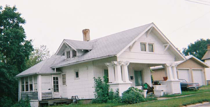


82 Deterioration Deterioration Deterioration, Obsolete, Vacant, Layout Stockton Redevelopment Area page 34
Tax Increment Finance City of Peoria Tax Increment Area Redevelopment Plan and Project Central Business District
 Tax Increment Finance City of Peoria Tax Increment Area Redevelopment Plan and Project Central Business District 2013 Amended Redevelopment Plan and Project March, 2013 Original Document (September,1986)
Tax Increment Finance City of Rock Island Watchtower Redevelopment Project Area. Redevelopment Plan and Project December 2013.
 Tax Increment Finance City of Rock Island Watchtower Redevelopment Project Area December 2013 Prepared by Tax Increment Finance City of Rock Island Watchtower Redevelopment Project Area Table of Contents
BUSSE/ELMHURST ROAD TIF REDEVELOPMENT PLAN AND PROJECT
 BUSSE/ELMHURST ROAD TIF REDEVELOPMENT PLAN AND PROJECT Prepared for: The Village of Elk Grove By: Camiros, Ltd. Date: March 2014 TABLE OF CONTENTS 1. Introduction 1 2. Project Area Description 5 3. Eligibility
TIF ASSISTANCE APPLICATION. Village of Lena, Illinois
 TIF ASSISTANCE APPLICATION Village of Lena, Illinois 1. Name and Address of Applicant: (Location where project will occur): 2. Are you a Tenant or Owner: 3. Description of Project (use back, or another
WEBER ROAD CORRIDOR TIF REDEVELOPMENT PLAN AND PROJECT
 WEBER ROAD CORRIDOR TIF REDEVELOPMENT PLAN AND PROJECT Prepared for: The City of Crest Hill By: Camiros, Ltd. Date: July 2017 TABLE OF CONTENTS 1. Introduction 1 2. Project Area Description 5 3. Eligibility
VILLAGE OF WINTHROP HARBOR, ILLINOIS TIF REDEVELOPMENT PLAN SHERIDAN ROAD TIF DISTRICT
 DRAFT DATED 01/08/2019 VILLAGE OF WINTHROP HARBOR, ILLINOIS TIF REDEVELOPMENT PLAN SHERIDAN ROAD TIF DISTRICT Redevelopment plan" means the comprehensive program of the municipality for development or
TAX INCREMENT FINANCING (TIF) ASSISTANCE. Application Packet
 ASSISTANCE. Application Packet") TAX INCREMENT FINANCING (TIF) ASSISTANCE Application Packet 1 General Application Information The Tax Increment Financing program is designed to serve the diverse needs of the business community and to
TAX INCREMENT FINANCING (TIF) ASSISTANCE Application Packet 1 General Application Information The Tax Increment Financing program is designed to serve the diverse needs of the business community and to
DRAFT Tax Increment Financing. Redevelopment Plan & Program. Green Bay Road TIF. Village of Kenilworth, IL
 DRAFT Tax Increment Financing Redevelopment Plan & Program Green Bay Road TIF Village of Kenilworth, IL Draft Plan March 2019 Prepared by: Teska Associates, Inc. 1 Table of Contents Introduction... 3 Tax
TIF REDEVELOPMENT PLAN
 PRELIMINARY 8/19/2013 CITY OF WAUKEGAN TIF REDEVELOPMENT PLAN DOWNTOWN TIF DISTRICT Redevelopment plan" means the comprehensive program of the municipality for development or redevelopment intended by
WAUKEE CENTRAL URBAN RENEWAL PLAN WAUKEE CENTRAL URBAN RENEWAL AREA WAUKEE, IOWA
 WAUKEE CENTRAL URBAN RENEWAL PLAN for the WAUKEE CENTRAL URBAN RENEWAL AREA WAUKEE, IOWA October 2017-1 - TABLE OF CONTENTS SECTION A. INTRODUCTION B. DESCRIPTION OF THE URBAN RENEWAL AREA C. AREA DESIGNATION
VILLAGE OF ALGONQUIN REDEVELOPMENT PLAN AND PROJECT TAX INCREMENT FINANCING DOWNTOWN TIF DISTRICT
 DRAFT DATED 06/25/14 VILLAGE OF ALGONQUIN REDEVELOPMENT PLAN AND PROJECT TAX INCREMENT FINANCING DOWNTOWN TIF DISTRICT Jointly Prepared By: Village of Algonquin, Illinois And Kane, McKenna and Associates,
Olde Town Station Urban Renewal Plan
 Olde Town Station Urban Renewal Area urban renewal plan october 2009 as amended june 2010 OldeTownArvada_Cover_Rev072110.indd 3 7/21/2010 9:57:44 AM Olde Town Station Urban Renewal Plan Prepared for: Arvada
Draft dated 12/28/17 revised 01/08/18 VILLAGE OF WEST DUNDEE MAIN STREET / ILLINOIS ROUTE 31 TIF REDEVELOPMENT PLAN AND PROJECT
 Draft dated 12/28/17 revised 01/08/18 VILLAGE OF WEST DUNDEE MAIN STREET / ILLINOIS ROUTE 31 TIF REDEVELOPMENT PLAN AND PROJECT Jointly Prepared By: Village of West Dundee, Illinois And Kane, McKenna and
Tax Increment Financing (TIF) Public Information Meeting October 11, 2011
 Public Information Meeting October 11, 2011") Tax Increment Financing (TIF) Public Information Meeting October 11, 2011 Village of Glen Ellyn Central Business District Maureen Barry Financial Advisor Office: 630-271-3341 Email: mbarry@ehlers-inc.com
Tax Increment Financing (TIF) Public Information Meeting October 11, 2011 Village of Glen Ellyn Central Business District Maureen Barry Financial Advisor Office: 630-271-3341 Email: mbarry@ehlers-inc.com
Main Street/Archer Avenue Redevelopment Project Area
 VILLAGE OF LEMONT, IL Main Street/Archer Avenue Redevelopment Project Area Tax Increment Financing Eligibility Study, and Redevelopment Plan and Project September 30, 2016 VILLAGE OF LEMONT, IL Main Street/Archer
City of Wichita. Union Station Redevelopment District. Union Station Project Plan. November 20, 2014
 City of Wichita Union Station Redevelopment District Union Station Project Plan November 20, 2014 Prepared by City of Wichita Office of Urban Development I N D E X 1. Comprehensive Financial Feasibility
Tax Increment Financing
 WHAT IS TIF? Tax Increment Financing (TIF) is a program that allocates future increases in property taxes from a designated area to pay for improvements only within that area. The program lasts for 23
TAX INCREMENT FINANCING Ten (10) Year Status Report
 Year Status Report") TAX INCREMENT FINANCING Ten (10) Year Status Report 2000-2011 LAKE CALUMET INDUSTRIAL Redevelopment Project Area Designated December 13, 2000 September 18, 2013 Pursuant to 65 ILCS 5/11-74.4-5 Prepared
TAX INCREMENT FINANCING Ten (10) Year Status Report 2000-2011 LAKE CALUMET INDUSTRIAL Redevelopment Project Area Designated December 13, 2000 September 18, 2013 Pursuant to 65 ILCS 5/11-74.4-5 Prepared
Madison County Zoning Department C. J. Nicholl, Administrator
 Madison County Zoning Department C. J. Nicholl, Administrator Courthouse at Winterset Madison County, Iowa Built in 1876 of native limestone. Posted Courthouse: 09-10-18 Emailed: 09-10-18 MADISON COUNTY
CHAPTER 7 VILLAGE TAX INCREMENT FINANCING CODES ARTICLE I: GENERAL PROVISIONS
 CHAPTER 7 VILLAGE TAX INCREMENT FINANCING CODES ARTICLE I: GENERAL PROVISIONS Sec. 7-0. GENERAL - APPLICABILITY. The provisions of this Chapter shall apply to all persons, departments, offices, businesses,
VULCAN LAKES TAX INCREMENT FINANCING REDEVELOPMENT PLAN AND PROGRAM. City of Crystal Lake, Illinois
 VULCAN LAKES TAX INCREMENT FINANCING REDEVELOPMENT PLAN AND PROGRAM City of Crystal Lake, Illinois DRAFT August 2005 TABLE OF CONTENTS INTRODUCTION 1 REDEVELOPMENT PROJECT AREA DESCRIPTION... 2 Legal Description...3
VIRGINIA TIF PROGRAM. 2. Property assembly costs, including acquisition, demolition, site preparation and improvement, etc;
 VIRGINIA TIF PROGRAM Illinois statute provides for municipalities to designate areas TIF districts (TID). These areas qualify for designation by suffering from such factors as blight, obsolescence, deterioration,
South Santa Fe Drive Corridor Redevelopment Plan (An Urban Renewal Plan)
") South Santa Fe Drive Corridor Redevelopment Plan (An Urban Renewal Plan) City of Sheridan Colorado December 2003 UrbanPlan.inc boulder estes park TABLE OF CONTENTS Preface...3 Urban Renewal Area Boundaries...3
South Santa Fe Drive Corridor Redevelopment Plan (An Urban Renewal Plan) City of Sheridan Colorado December 2003 UrbanPlan.inc boulder estes park TABLE OF CONTENTS Preface...3 Urban Renewal Area Boundaries...3
TIF REDEVELOPMENT PLAN
 6/16/14 VILLAGE OF LINCOLNWOOD TIF REDEVELOPMENT PLAN DEVON-LINCOLN TIF DISTRICT Redevelopment plan" means the comprehensive program of the municipality for development or redevelopment intended by the
TAX INCREMENT FINANCING Ten (10) Year Status Report
 Year Status Report") TAX INCREMENT FINANCING Ten (10) Year Status Report 2006-2014 63 RD /ASHLAND Redevelopment Project Area Designated March 29, 2006 December 2, 2015 Pursuant to 65 ILCS 5/11-74.4-5 Prepared by AND S. B.
TAX INCREMENT FINANCING Ten (10) Year Status Report 2006-2014 63 RD /ASHLAND Redevelopment Project Area Designated March 29, 2006 December 2, 2015 Pursuant to 65 ILCS 5/11-74.4-5 Prepared by AND S. B.
VILLAGE COMMONS URBAN RENEWAL AREA URBAN RENEWAL PLAN PREPARED FOR: ARVADA URBAN RENEWAL AUTHORITY
 VILLAGE COMMONS URBAN RENEWAL AREA URBAN RENEWAL PLAN PREPARED FOR: ARVADA URBAN RENEWAL AUTHORITY AUGUST 22, 2008 Village Commons Urban Renewal Area Urban Renewal Plan Prepared For: Arvada Urban Renewal
ORDINANCE NO AN ORDINANCE PROPOSING THE DESIGNATION OF THE DOWNTOWN REDEVELOPMENT PROJECT AREA AND THE
 ORDINANCE NO. 2014-4558 AN ORDINANCE PROPOSING THE DESIGNATION OF THE DOWNTOWN REDEVELOPMENT PROJECT AREA AND THE ADOPTION OF TAX INCREMENT FINANCING, CONVENING A JOINT REVIEW BOARD AND SCHEDULING A PUBLIC
HIGHLAND COMMONS TAX INCREMENT FINANCING PLAN PICAYUNE, MISSISSIPPI 2015
 HIGHLAND COMMONS TAX INCREMENT FINANCING PLAN PICAYUNE, MISSISSIPPI 2015 1 HIGHLAND COMMONS TAX INCREMENT FINANCING PLAN PICAYUNE, MISSISSIPPI 2015 ARTICLE I. PURPOSE AND INTENT Section 1.01 Preamble.
City of Oak Grove, Missouri. Economic Development Incentives Policy
 City of Oak Grove, Missouri Economic Development Incentives Policy March 2008 TABLE OF CONTENTS Policy Introduction 3 Page Tax Increment Financing (TIF) 4 Chapter 100 Industrial Development Bonds 6 Chapter
Northeast Gateway 2 Urban Renewal Plan. City of Des Moines, Iowa
 Prepared by: Carrie Kruse, Office of Economic Development, 400 Robert D. Ray Drive, Des Moines, IA 50309 Phone: 515/283-4012 Return Address: City Clerk City Hall, 400 Robert D. Ray Drive, Des Moines, IA
Joint-Review Board Green Bay Road TIF. Wednesday, April 17, 2019
 Joint-Review Board Green Bay Road TIF Wednesday, April 17, 2019 Agenda I. Call to Order / Roll Call II. Introductions III. Designation of Public Member IV. Election of Chairperson V. Background and Overview
VILLAGE OF SKOKIE TIF REDEVELOPMENT PLAN WEST DEMPSTER TIF DISTRICT
 Exhibit C VILLAGE OF SKOKIE TIF REDEVELOPMENT PLAN WEST DEMPSTER TIF DISTRICT Redevelopment plan" means the comprehensive program of the municipality for development or redevelopment intended by the payment
Syracuse General Redevelopment Plan Study Areas #1-3
 2010 Syracuse General Redevelopment Plan Study Areas #1-3 JEO Consulting Group, Inc. SYRACUSE GENERAL REDEVELOPMENT PLAN STUDY AREAS 1-3 Introduction/Background INTRODUCTION The Syracuse General Redevelopment
The Board of Supervisors of the County of Riverside ordains as follows:
 ORDINANCE NO. 887 AN ORDINANCE OF THE COUNTY OF RIVERSIDE APPROVING AND ADOPTING THE REDEVELOPMENT PLAN FOR THE MID-COUNTY REDEVELOPMENT PROJECT AREA, AMENDMENT NO. 2-GARNET AND WEST GARNET SUB-AREAS The
TAX INCREMENT DISTRICT NUMBER THREE CITY OF VOLGA TAX INCREMENT PROJECT PLAN
 TAX INCREMENT DISTRICT NUMBER THREE CITY OF VOLGA *********************************** TAX INCREMENT PROJECT PLAN Section 1. Introduction and Purpose 2 Section 2. General Definitions... 2 Section 3. Tax
TAX INCREMENT FINANCING
 TAX INCREMENT FINANCING Tax Increment Financing (TIF) is a mechanism under Iowa Code chapter 403 for municipalities (cities and counties) to use to finance public improvement projects or, added later,
AGENDA ITEM NO: IX.E. CITY OF STARKVILLE AGENDA DATE: RECOMMENDATION FOR BOARD ACTION
 AGENDA ITEM NO: IX.E. CITY OF STARKVILLE AGENDA DATE: 06-02-2015 RECOMMENDATION FOR BOARD ACTION PAGE: l SUBJECT: DISCUSSION AND CONSIDERATION OF A RESOLUTION OF THE MAYOR AND BOARD OF ALDERMEN OF THE
GILMORE & BELL A PROFESSIONAL CORPORATION ATTORNEYS AT LAW ONE METROPOLITAN SQUARE 211 NORTH BROADWAY, SUITE 2350 ST. LOUIS, MISSOURI
 314-436-1000 FAX: 314-436-1166 WWW.GILMOREBELL.COM GILMORE & BELL A PROFESSIONAL CORPORATION ATTORNEYS AT LAW ONE METROPOLITAN SQUARE 211 NORTH BROADWAY, SUITE 2350 ST. LOUIS, MISSOURI 63102-2733 KANSAS
CITY OF ASHLAND REDEVELOPMENT PLAN FOR THE ASHLAND INVESTMENT CO., LLC HOUSING DEVELOPMENT
 CITY OF ASHLAND REDEVELOPMENT PLAN FOR THE ASHLAND INVESTMENT CO., LLC HOUSING DEVELOPMENT I. INTRODUCTION. The City of Ashland, Nebraska, recognizes that blight is a threat to the continued stability
Often largest source of funds; not an additional tax
 Financing Strategies: During the January Study Session the topic of financing the downtown improvements was raised, and Staff was asked to consider and report to the Council on some of the more common
Often largest source of funds; not an additional tax
 Financing Strategies: During the January Study Session the topic of financing the downtown improvements was raised, and Staff was asked to consider and report to the Council on some of the more common
URBAN RENEWAL PLAN CRESTON ECONOMIC DEVELOPMENT DISTRICT 2006
 URBAN RENEWAL PLAN CRESTON ECONOMIC DEVELOPMENT DISTRICT 2006, Iowa This provides for the development of the Creston Economic Development District 2006. PARK LANE DEVELOPMENT ASSISTED LIVING PROJECT 8/25/06
Effective Date: December 19, 2006
 Article GB05-E TAX INCREMENT FINANCING ( TIF ) POLICY Effective Date: December 19, 2006 Sections: GB05-E-1 GB05-E-2 GB05-E-3 GB05-E-4 GB05-E-5 GB05-E-6 GB05-E-7 GB05-E-8 OBJECTIVES SCOPE DEFINITIONS PROVISIONS
City of Oak Creek, Wisconsin
 City of Oak Creek, Wisconsin Tax Incremental District No. 12 Project Plan (DRAFT 6-13-16) Approved by the City of Oak Creek Common Council (insert date) (Resolution No. insert Resolution No.) Prepared
TAX INCREMENT FINANCING Ten (10) Year Status Report
 Year Status Report") TAX INCREMENT FINANCING Ten (10) Year Status Report 2004-2012 47 th /STATE Redevelopment Project Area Designated July 21, 2004 November 18, 2013 Pursuant to 65 ILCS 5/11-74.4-5 Prepared by CITY OF CHICAGO
TAX INCREMENT FINANCING Ten (10) Year Status Report 2004-2012 47 th /STATE Redevelopment Project Area Designated July 21, 2004 November 18, 2013 Pursuant to 65 ILCS 5/11-74.4-5 Prepared by CITY OF CHICAGO
INTERGOVERNMENTAL AGREEMENT FOR PAYMENT OF CERTAIN IMPACT FEES AND COSTS BY AND BETWEEN THE CITY OF FARMER CITY, DEWITT COUNTY, ILLINOIS AND
 INTERGOVERNMENTAL AGREEMENT FOR PAYMENT OF CERTAIN IMPACT FEES AND COSTS BY AND BETWEEN THE CITY OF FARMER CITY, DEWITT COUNTY, ILLINOIS AND BLUE RIDGE COMMUNITY UNIT SCHOOL DISTRICT NO. 18, DEWITT COUNTY,
RESOLUTION NO
 PREPARED BY: City Attorney's Office 300 Sixth Street Rapid City, SD 57701 (605) 394-4140 RESOLUTION NO. 2017-031 RESOLUTION APPROVING THE PROJECT PLAN FOR THE VILLAGE ON MONROE TAX INCREMENT DISTRICT NUMBER
Tax Increment Financing Basics
 Tax Increment Financing Basics 10/29/2014 1 Overview TIF program history Basic TIF rules Approval process Sample cash flow 2 TIF Program History Original program created by the State Legislature in 1975
Tax Incremental District Number 23 City of Mitchell, SD. Economic Development Project Plan In conjunction with
 Tax Incremental District Number 23 City of Mitchell, SD Economic Development Project Plan In conjunction with Prepared by Dougherty & Company LLC May 2017 Table of Contents Introduction... 3 Purpose &
Redevelopment Project Financial Feasibility Study. For the Oread Project Within the 12 th and Oread Redevelopment District. City of Lawrence, Kansas
 Redevelopment Project Financial Feasibility Study For the Oread Project Within the 12 th and Oread Redevelopment District City of Lawrence, Kansas Final Draft: February 7, 2008 Table of Contents 1 OVERVIEW...
Second Amendment to the Urban Renewal Plan for the Ingersoll-Grand Commercial Urban Renewal Area
 Prepared by: Carrie Kruse, Office of Economic Development, 400 Robert D. Ray Drive, Des Moines, IA 50309 Phone: 515/283-4012 Return Address: City Clerk City Hall, 400 Robert D. Ray Drive, Des Moines, IA
ORIGINAL BROOMFIELD URBAN RENEWAL PLAN
 August 5, 2013 City and County of Broomfield ORIGINAL BROOMFIELD URBAN RENEWAL PLAN Ordinance 1979 1.0. PREFACE 2 The Area in this Plan contains approximately 343 acres. It is described in Exhibit A, and
The Board of Finance of Baltimore City Department of Finance Bureau of Treasury Management
 The Board of Finance of Baltimore City Department of Finance Bureau of Treasury Management Tax Increment Financing Policy and Project Submission Requirements January 23, 2012 PART I: TAX INCREMENT FINANCING
Ohio Legislative Service Commission
 Ohio Legislative Service Commission Bill Analysis Joe McDaniels H.B. 233 131st General Assembly () Reps. Schuring, Ashford, Baker, Blessing, Boyd, Fedor, Hackett, Hambley, Kraus, Lepore- Hagan, Patmon,
Reporting Fiscal Year: Fiscal Year End: Administrator Contact Information
 FY 2016 ANNUAL TAX INCREMENT FINANCE REPORT Name of Municipality: County: Unit Code: 016/225/32 First Name: Shubhra Last Name: Govind Address: 2121 Lake Street Title: Director of Community & Eco. Development
TO BE PUBLISHED: Saturday, March 23, 2019
 DATE: March 21, 2019 TO: Cindi / McAlester News Capital FROM: Kirk / City of McAlester ***************************************************************** TO BE PUBLISHED: Saturday, March 23, 2019 CITY OF
Geneva Fox River Redevelopment Project Area (TIF #3)
") CITY OF GENEVA, IL Tax Increment Financing ( TIF ) Eligibility Study, and Redevelopment Plan and Project Geneva Fox River Redevelopment Project Area (TIF #3) REPORT: February 23, 2016 Table of Contents
CITY OF GENEVA, IL Tax Increment Financing ( TIF ) Eligibility Study, and Redevelopment Plan and Project Geneva Fox River Redevelopment Project Area (TIF #3) REPORT: February 23, 2016 Table of Contents
GLOSSARY OF TERMS FOR ECONOMIC DEVELOPMENT STUDY
 GLOSSARY OF TERMS FOR ECONOMIC DEVELOPMENT STUDY BLIGHTED AREA A blighted area is an area that, by reason of the predominance of defective or inadequate street layout, unsanitary or unsafe conditions,
ANNUAL DEVELOPMENT ACTIVITY AND DISCLOSURE REPORT $4,115,000 CITY OF WHEELING, WEST VIRGINIA STONE BUILDING RENOVATION PROJECT SERIES 2005 A BONDS
 ANNUAL DEVELOPMENT ACTIVITY AND DISCLOSURE REPORT $4,115,000 CITY OF WHEELING, WEST VIRGINIA STONE BUILDING RENOVATION PROJECT SERIES 2005 A BONDS FOR THE PERIOD ENDING DECEMBER 31, 2008 Prepared by: MUNICAP,
Book No. 19 Page No. 7 CITY OF EAST PROVIDENCE, RHODE ISLAND Ordinance No. 578
 Book No. 19 Page No. 7 CITY OF EAST PROVIDENCE, RHODE ISLAND Ordinance No. 578 ADOPTING AN AMENDED EAST PROVIDENCE WATERFRONT SPECIAL DEVELOPMENT DISTRICT TAX INCREMENT FINANCING PLAN (THE AMENDED PROJECT
Illinois TIF Annual Reporting Covering the Basics
 Annual TIF Deadlines Annual TIF report must be submitted to the Illinois Office of the Comptroller 180 days after the municipal fiscal year ends (or as soon thereafter as the audited financial statements
First Amendment to the Urban Renewal Plan for the Northeast Gateway 1 Urban Renewal Area
 Prepared by: Carrie Kruse, Office of Economic Development, 400 Robert D. Ray Drive, Des Moines, IA 50309 Phone: 515/283-4012 Return Address: City Clerk City Hall, 400 Robert D. Ray Drive, Des Moines, IA
Fourth Amendment to the Southside Economic Development District Urban Renewal Plan
 Prepared by: Carrie Kruse, Office of Economic Development, 400 Robert D. Ray Drive, Des Moines, IA 50309 Phone: 515/283-4012 Return Address: City Clerk City Hall, 400 Robert D. Ray Drive, Des Moines, IA
DRAFT. Housing and Redevelopment Authority of the City of Annandale, Minnesota DDA. Tax Increment Financing District No. 1-14
 DRAFT Housing and Redevelopment Authority of the City of Annandale, Minnesota Tax Increment Financing Plan for Tax Increment Financing District No. 1-14 (HS Pintail, LLC Apartment Project) To be Adopted:
CHAPTER 6: ECONOMIC DEVELOPMENT INTRODUCTION CHAPTER 6: ECONOMIC DEVELOPMENT 6-1
 CHAPTER 6: ECONOMIC DEVELOPMENT INTRODUCTION The purpose of this chapter is to identify strategies to increase commercial and industrial development in the City of Dayton. There are currently few commercial
City of Wichita. Southfork Redevelopment District. Southfork Phase A Project Plan. March 5, 2013
 City of Wichita Southfork Redevelopment District Southfork Phase A Project Plan March 5, 2013 Prepared by City of Wichita Office of Urban Development I N D E X 1. Comprehensive Financial Feasibility Study
I. Is It Possible to Make Everybody Happy with a TIF Statute?
 I. Is It Possible to Make Everybody Happy with a TIF Statute? A. Proponents of TIF state: Tax revenues are created that would not otherwise be created. 1. Local government is not giving up any revenue,
Planning and Economic Development
 Planning and Economic Development SUBJECT: Public Hearing Regarding Proposed Waukegan Road/Golf Road Redevelopment Plan and Project Area AGENDA ITEM: 8.c. MEETING DATE: March 19, 2013 VILLAGE BOARD REPORT
Cities or counties that are
 TIF 101: Advice for MUNICIPALITIES considering the first use of tax increment financing Part 1 in a 3-part series: What is TIF and how is a TIF plan prepared? by David Bushek and Rich Wood This is the
Project Plan for TAX INCREMENTAL FINANCE DISTRICT #47 (SILICON PRAIRIE) City of Madison
 City of Madison") Date Adopted: September 19, 2017 Resolution Number: RES-17-00764 Expenditure Deadline: September 19, 2032 TID Expiration Date: September 19, 2037 Project Plan for TAX INCREMENTAL FINANCE DISTRICT #47 (SILICON
Date Adopted: September 19, 2017 Resolution Number: RES-17-00764 Expenditure Deadline: September 19, 2032 TID Expiration Date: September 19, 2037 Project Plan for TAX INCREMENTAL FINANCE DISTRICT #47 (SILICON
TRANSIT REVITALIZATION INVESTMENT DISTRICT ACT - OMNIBUS AMENDMENTS Act of Nov. 4, 2016, P.L., No. 151 Cl. 74 Session of 2016 No.
 SB 385 TRANSIT REVITALIZATION INVESTMENT DISTRICT ACT - OMNIBUS AMENDMENTS Act of Nov. 4, 2016, P.L., No. 151 Cl. 74 Session of 2016 No. 2016-151 AN ACT Amending the act of December 8, 2004 (P.L.1801,
September 24, Dear ITIA member:
 September 24, 2003 Dear ITIA member: Local taxing bodies and ITIA members have frequently raised questions about how overlapping local taxing bodies can legally be assisted using tax increment funds. In
fh~ Los Angeles Daily J ournal
 ' /. '', '! fh~ Los Angeles Daily J ournal ORDINANCE NO. 1 G-: 202 AN ORDINANCE OF THE CITY COUNCIL OF THE CITY OF LOS ANGELES APPROVING AND ADOPTING THE REDEVELOPMENT PLAN FOR THE HOLLYWOOD REDEVELOPMENT
TAX INCREMENT FINANCING IN RAPID CITY. A Guide for Applicants
 TAX INCREMENT FINANCING IN RAPID CITY A Guide for Applicants INTRODUCTION In 1978, the South Dakota Legislature approved the use of Tax Increment Financing (TIF) by municipalities to help finance redevelopment
Shakopee, Minnesota Shakopee Economic Development Authority
 Shakopee, Minnesota Shakopee Economic Development Authority Modification to Redevelopment Plan for Minnesota River Valley Housing and Redevelopment Project No. 1 And Tax Increment Financing Plan for Tax
Project Plan for TAX INCREMENTAL FINANCE DISTRICT #41 (UNIVERSITY-WHITNEY) City of Madison
 City of Madison") Project Plan for TAX INCREMENTAL FINANCE DISTRICT #41 (UNIVERSITY-WHITNEY) City of Madison Prepared by: Department of Planning and Community and Economic Development Economic Development Division Office
Project Plan for TAX INCREMENTAL FINANCE DISTRICT #41 (UNIVERSITY-WHITNEY) City of Madison Prepared by: Department of Planning and Community and Economic Development Economic Development Division Office
Tax Incremental District Number 24 City of Mitchell, SD
 Tax Incremental District Number 24 City of Mitchell, SD Project Plan MITCHELL AREA DEVELOPMENT CORPORATION DEVELOPER 1 Table of Contents Introduction... 3 Purpose & General Definitions as used in this
REQUEST FOR COUNCIL ACTION
 REQUEST FOR COUNCIL ACTION Date: June 22, 2015 Item No.: 15.a Department Approval City Manager Approval Item Description: Tax Increment Financing (TIF) District Overview 1 2 3 4 5 6 7 8 9 10 11 12 13 14
Local Redevelopment and Housing Law. (N.J.S.A. 40A:12A-1 et seq.)
") Local Redevelopment and Housing Law (N.J.S.A. 40A:12A-1 et seq.) Purposes: 1. Arrest and reverse conditions of deterioration of housing, commercial and industrial facilities. 2. Promote the advancement
Local Redevelopment and Housing Law (N.J.S.A. 40A:12A-1 et seq.) Purposes: 1. Arrest and reverse conditions of deterioration of housing, commercial and industrial facilities. 2. Promote the advancement
Project Plan for TAX INCREMENTAL FINANCE DISTRICT #46 (RESEARCH PARK) City of Madison
 City of Madison") Date Adopted: Sept 1, 2015 Resolution Number: RES-15-00676 Expenditure Deadline: Sept 1, 2030 TID Expiration Date: Sept 1, 2035 Project Plan for TAX INCREMENTAL FINANCE DISTRICT #46 (RESEARCH PARK) City
Date Adopted: Sept 1, 2015 Resolution Number: RES-15-00676 Expenditure Deadline: Sept 1, 2030 TID Expiration Date: Sept 1, 2035 Project Plan for TAX INCREMENTAL FINANCE DISTRICT #46 (RESEARCH PARK) City
OVERVIEW OF TAX INCREMENT FINANCING IN INDIANA
 OVERVIEW OF TAX INCREMENT FINANCING IN INDIANA APRIL 2016 PREPARED BY: Barnes & Thornburg LLP Note: These materials are intended for information only and are not to be considered legal advice. TIF OVERVIEW
TAX INCREMENTAL DISTRICT NUMBER 10, CITY OF SIOUX FALLS TAX INCREMENTAL PROJECT PLAN
 TAX INCREMENTAL DISTRICT NUMBER 10, CITY OF SIOUX FALLS TAX INCREMENTAL PROJECT PLAN I:\AD\025\01\1W25\1w25011.docx Table of Contents Introduction and Summary... 1 General Definitions as Used in This Plan...
Project Plan for TAX INCREMENTAL FINANCE DISTRICT #41 (UNIVERSITY-WHITNEY) City of Madison
 City of Madison") Project Plan for TAX INCREMENTAL FINANCE DISTRICT #41 (UNIVERSITY-WHITNEY) City of Madison Prepared by: Department of Planning and Community and Economic Development Economic Development Division Office
Project Plan for TAX INCREMENTAL FINANCE DISTRICT #41 (UNIVERSITY-WHITNEY) City of Madison Prepared by: Department of Planning and Community and Economic Development Economic Development Division Office
Project Plan for TAX INCREMENTAL FINANCE DISTRICT #45 (CAPITOL SQUARE WEST) City of Madison
 City of Madison") Date Adopted: June 16, 2015 Resolution Number: RES-15-00513 (File ID #38083) Expenditure Deadline: June 16, 2037 TID Expiration Date: June 16, 2042 Project Plan for TAX INCREMENTAL FINANCE DISTRICT #45
Date Adopted: June 16, 2015 Resolution Number: RES-15-00513 (File ID #38083) Expenditure Deadline: June 16, 2037 TID Expiration Date: June 16, 2042 Project Plan for TAX INCREMENTAL FINANCE DISTRICT #45
AMENDMENT TO THE AREA 2 AND AREA 8 REDEVELOPMENT PLANS OF THE CITY OF KEARNEY, NEBRASKA. (Younes Redevelopment Project)
") AMENDMENT TO THE AREA 2 AND AREA 8 REDEVELOPMENT PLANS OF THE CITY OF KEARNEY, NEBRASKA (Younes Redevelopment Project) The Community Redevelopment Authority for the City of Kearney, Nebraska (the CRA )
AMENDMENT TO THE AREA 2 AND AREA 8 REDEVELOPMENT PLANS OF THE CITY OF KEARNEY, NEBRASKA (Younes Redevelopment Project) The Community Redevelopment Authority for the City of Kearney, Nebraska (the CRA )
MUNICIPAL TAX INCREMENT FINANCING (TIF)
") MUNICIPAL TAX INCREMENT FINANCING (TIF) This has been prepared by NMDC with the goal of familiarizing the reader with how TIF works. This NOT intended to replace program regulations or state statute governing
MUNICIPAL TAX INCREMENT FINANCING (TIF) This has been prepared by NMDC with the goal of familiarizing the reader with how TIF works. This NOT intended to replace program regulations or state statute governing
TIF in Des Moines, IA. March 2010 City Manager s Office City of Des Moines
 TIF in Des Moines, IA March 2010 City Manager s Office City of Des Moines What is TIF? TIF = Tax Increment Financing It s a flexible economic development tool. TIF can only be used in an urban renewal
REDEVELOPMENT SUMMARY
 REDEVELOPMENT SUMMARY WHAT IS REDEVELOPMENT? Redevelopment is a set of tools provided under state law, Title 17C of the Utah Code, that empowers local governments in economic development, job creation,
TAX INCREMENT FINANCE DISTRICT NUMBER 11, CITY OF SIOUX FALLS
 TAX INCREMENT FINANCE DISTRICT NUMBER 11, CITY OF SIOUX FALLS TAX INCREMENT FINANCE PROJECT PLAN TABLE OF CONTENTS INTRODUCTION AND PURPOSE... 1 GENERAL DEFINITIONS AS USED IN THIS PLAN... 1 PROPERTY WITHIN
DEVELOPMENT TOOLS POLICY
 Policy No. 1.136 DEVELOPMENT TOOLS POLICY I. PURPOSE AND NEED FOR POLICY This policy provides the criteria that all business assistance shall be evaluated against. The criteria included in this policy
Havana North Urban Renewal Plan
 Havana North Urban Renewal Plan Aurora, Colorado December, 2010 Prepared for: Aurora Urban Renewal Authority Aurora, Colorado City Council 1 Havana North Urban Renewal Plan Aurora, Colorado Table of Contents
Copper Ridge at Northgate Urban Renewal Plan
 Copper Ridge at Northgate Urban Renewal Plan City of Colorado Springs, Colorado March 2010 (revised 4.23.10) Prepared for: Colorado Springs, Colorado City Council Prepared by: Leland Consulting Group 1
VILLAGE OF MUNDELEIN TIF ELIGIBILITY REPORT PROPOSED FIRST AMENDMENT TO THE DOWNTOWN TIF I
 VILLAGE OF MUNDELEIN TIF ELIGIBILITY REPORT PROPOSED FIRST AMENDMENT TO THE DOWNTOWN TIF I A study to determine whether an area in the Village of Mundelein qualifies as a Conservation Area as set forth
Amended Project Plan and Boundary for TAX INCREMENTAL FINANCE DISTRICT #46 (RESEARCH PARK) City of Madison
 City of Madison") Date Adopted: Sept 1, 2015 Resolution Number: RES-15-00676 Expenditure Deadline: Sept 1, 2030 TID Expiration Date: Sept 1, 2035 Boundary Amendment #1 Date: September 19, 2017 Boundary Amendment #1 Reso
Date Adopted: Sept 1, 2015 Resolution Number: RES-15-00676 Expenditure Deadline: Sept 1, 2030 TID Expiration Date: Sept 1, 2035 Boundary Amendment #1 Date: September 19, 2017 Boundary Amendment #1 Reso
URBAN RENWAL Frequently Asked Questions
 What is a Conditions Survey (Blight Study) and why do one? Tax Increment Financing (TIF) is a mechanism used by communities to fund eligible improvements within a designated area. TIF dollars can only
BLANCHARD ECONOMIC DEVELOPMENT PROJECT PLAN. Prepared by: CITY OF BLANCHARD, OKLAHOMA
 BLANCHARD ECONOMIC DEVELOPMENT PROJECT PLAN Prepared by: CITY OF BLANCHARD, OKLAHOMA MAYOR AND CITY COUNCIL MAYOR JOE DAVIS, WARD 1 SEDALL BROOKS, WARD 2 VICE-MAYOR MICHAEL SCALF, WARD 3 YVONNE LACKEY,
in October of 2015, that the Proposed Area qualifies as a "redevelopment project area" under Section of the Tl F Act; and
 Ordinance No. 16-20 AN ORDINANCE OF THE VILLAGE OF WEST DUNDEE, KANE COUNTY, ILLINOIS, APPROVING THE TIF REDEVELOPMENT PLAN SPRING HILL MALL TIF DISTRICT WHEREAS, the Village President and Board of Trustees
Athens-Clarke County, Georgia Urban Redevelopment Plan
 Athens-Clarke County, Georgia Urban Redevelopment Plan Prepared by Athens-Clarke County Department of Human and Economic Development 2011 1 Table of Contents Introduction 3 Urban Redevelopment Act 3 Athens-Clarke
Ordinance No
 Ordinance No. 2018-01 AN ORDINANCE OF THE VILLAGE WEST DUNDEE, KANE COUNTY, ILLINOIS, TO SET A DATE FOR, AND TO APPROVE A PUBLIC NOTICE OF A PUBLIC HEARING ON THE VILLAGE OF WEST DUNDEE MAIN STREET/ILLINOIS
Tax Increment Financing
 Tax Increment Financing Colorado Department of Local Affairs Division of Property Taxation Greg Schroeder 303-866-2681 greg.schroeder@state.co.us June 29, 2010 What is Tax Increment Financing? Tax increment