ROUTE FEASIBILITY STUDY. PUBLIC MEETING January 26, 2010
|
|
|
- Hector Miller
- 5 years ago
- Views:
Transcription


1 PHASE I - LUBBOCK OUTER ROUTE FEASIBILITY STUDY PUBLIC MEETING January 26, 2010


2 CONSTRUCTION SCHEMATIC DESIGN & ENVIRONMENTAL STUDY DETAILED DESIGN & RIGHT OF WAY ACQUISITION UTILITY ADJUSTMENTS ROUTE STUDY FEASIBILITY STUDY
3 Purpose of the Study Determine a preferred alternative for an Outer Route around the western and southern area of the City of Lubbock from US 84 northwest of Lubbock to US 84 southeast of Lubbock Investigate, through a fatal flaw analysis, improvements and continued development of a preferred route Support Local Transportation Goals: Create an integrated multi-modal transportation network to better serve the citizens in the Lubbock Metropolitan Area. (Lubbock MPO 2032 Plan) Ensure consistency with TXDOT statewide goals: Reduce congestion Enhance safety Expand economic opportunity Improve air quality Increase the value of transportation assets
4 The successful results of this project will provide: A National Environmental Protection ti Act (NEPA) Compliant Process A defensible Need and Purpose Statement A viable alternative which has logical termini and independent utility Informed consent from stakeholders Better defined corridor location and facility type ROW corridor for preservation A defensible phasing concept / implementation plan for the project A workable funding scheme
5 Project Schedule Begin Feasibility Study May 2009 Outline of Feasibility Study Jul 2009 First Public Meeting Sep 2009 Second Public Meeting Jan 2010 Draft Feasibility Study Mar 2010 Third Public Meeting Apr 2010 Final Feasibility Study May 2010 Complete Feasibility Study May Begin Route Study Jun 2010
6 FEASIBILITY STUDY SCHEDULE MONTH MAY JUN JUL AUG SEP OCT NOV DEC JAN FEB MAR APR MAY DEVELOPMENT OF CONTRAINTS AND TRAFFIC DEVELOP GIS & USGS BASE MAPS DEVELOP AND REFINE CONSTRAINTS FINALIZE TRAFFIC (PREFERRED ALTERNATIVES) DEVELOP NEED AND PURPOSE DEVELOP NEED AND PURPOSE DEVELOP NEED AND PURPOSE DEVELOP STUDY ALTERNATIVES ALTERNATIVES ANALYSIS SELECT PREFERRED ALTERNATIVE ITY STUDY BEGIN FEASIBILI DEVELOP STUDY ALTERNATIVES ALTERNATIVES ANALYSIS & DOCUMENTATION SELECT AND DOCUMENT PREFERRED ALTERNATIVE EASIBILITY STUDY COMPLETION OF F STAKEHOLDER MEETINGS PUBLIC INVOLVEMENT PLAN (PIP) FINAL REPORT FEASIBILITY STUDY AND REPORT OUTLINE OF FEASIBILITY STUDY DRAFT REPORT RECOMMENDATION OF FINDINGS PUBLIC MEETINGS STAKEHOLDER MEETINGS CONSTANT EFFORT INTERMITTENT EFFORT
7 Phase I Lubbock Outer Route Feasibility Study Need and Purpose Social, Economic, Environmental Studies and Public Involvement Evaluation of Existing Systems Establish Technical Methodology Alternative Analysis Refine Alternatives Funding Route Study Route and Design Studies Continued Environmental Investigation Continued Public Involvement Route Location Study Report
8 Feasibility Study Determine preferred alternative for an Outer Loop Route around western and southern sides of the City of Lubbock from US 84 northwest of Lubbock to US 84 southeast of Lubbock Investigate, through a fatal flaw analysis, improvements and continued development of a preferred route Steps Include: 1. Following the NEPA process, including public involvement process 2. Holding three (3) stakeholder meetings and three (3) public meetings 3. Recommending findings, which will then be used in the Route Study, which follows the Feasibility Study


9 Need and Purpose Investigation of need and purpose Creation of uncontrolled aerial mosaic Research previous studies Lubbock 2032 MTP Cities land use plans Ports to Plains ITS Plans
 map - Land Use - Political l boundaries - Cultural resources -")


10 Need and Purpose (continued) Development of Geographic Information System (GIS) map - Land Use - Political l boundaries - Cultural resources - Utilities - Constraints data: Location of schools, churches, cemeteries, large employers, parks, historical architecture, culturally significant sites, water features/wetlands, wildlife habitat, hazardous waste sites, geological formations, FEMA mapping, playa lakes, census areas, major roads, railroads, center pivots.
11 Need and Purpose (continued) Data Collection Population growth Employment characterization Draft Need and Purpose Report Record updated field inventories and reviews Summaries of data developed Catalog all information collected


12 Social, Economic, Environmental Studies and Public Involvement Public Involvement Plan Public awareness and coordination of public meetings to identify alternatives and facilitate the NEPA process SAFETEA-LU mandates the involvement of agencies and the public in development of need and purpose and study alternates.
13 Social, Economic, Environmental Studies and Public Involvement (continued) Three Stakeholder Meetings Benchmark Assessments: Development of need and purposep Development of study alternatives Refinement of study alternative Preferred alternative Results of Feasibility Study Stakeholders include representatives from: Lubbock Wolfforth Slaton Shallowater Lubbock County Lubbock Metropolitan Planning Organization
14 Social, Economic, Environmental Studies and Public Involvement (continued) Public meetings Plan, coordinate, participate and execute three public meetings Identify the location of and the logistics of the meeting Western Segment Eastern Segment Central Segment Produce documentation from meetings Bound report Follow 43 Texas Administrative Code (TAC) , 250 Code of Federal Regulations Title 23, Part 771, and the Environmental Manual
15 Social, Economic, Environmental Studies and Public Involvement (continued) Comprehensive Mailing List Informational Tools Flyers Newsletters Handouts TxDOT Website Media relations Bilingual materials, as necessary

16 Social, Economic, Environmental Studies and Public Involvement (continued) Environmental Considerations: Elements of the existing human and natural environment have been identified Constraints have been mapped in GIS for the study area and will be considered in all stages of alternatives analysis Environmental considerations will be documented and reported for use in future NEPA compliance studies

 National Historic Preservation Act (Sec 106) Farmland Protection Policy Act Section")
17 Social, Economic, Environmental Studies and Public Involvement (continued) Regulations and Policies guide study. Potential regulatory issues identified: Endangered Species Act Clean Water Act (Sec 401, 404) National Historic Preservation Act (Sec 106) Farmland Protection Policy Act Section 4(f)/6(f) E.O on Environmental Justice Indirect and Cumulative Impacts
, Yellow House Draw and tributaries may be USACE jurisdictional Threatened and Endangered species: Federal:")
 (e.g., old farmsteads) should be avoided.")
18 Social, Economic, Environmental Studies and Public Involvement (continued) Selected Known Constraints: t Floodplains, Playa lakes (usually not jurisdictional), Yellow House Draw and tributaries may be USACE jurisdictional Threatened and Endangered species: Federal: incidental migratory birds State: t Texas horned lizard Several monitored species: Plains spotted skunk Black-tailed prairie dog Western burrowing owl Bald Eagle Properties eligible for the National Register of Historic Places (NRHP) (e.g., old farmsteads) should be avoided.

 increased by 10.")
19 Social, Economic, Environmental Studies and Public Involvement (continued) Selected Known Constraints (continued): Land use considerations: Residences Businesses Community facilities, schools, parks Agricultural lands Hazardous materials Selected estimated Lubbock County changes in land use between 1992 and 1997: Cultivated cropland decreased by 3.5% Non-cultivated cropland decreased by 8.3% Rangeland increased by 11.4% Minor land cover/uses (Farm/ranch HQs, other farmland, etc.) increased by 10.9% Urban-small and large built-up increased by 23.9%
20 Social, Economic, Environmental Studies and Public Involvement (continued) Selected Known Constraints t (continued): BNSF/WTLR railroad crossings, oil and gas wells Socioeconomic considerations: Census analysis to determine potential for disproportionate, adverse effects on minority or low-income communities Consideration of equitable service provision to various parts of town Regional health of resources will be assessed for use in future indirect and cumulative effects analyses All other regulated resources will be investigated SAFETEA-LU (Safe, Accountable, Flexible, Efficient, Transportation Equity Act-A Legacy for Users) serves as backdrop


21 Evaluation of Existing Systems Confirm Study Area Prepare Data Collection Plan Existing Safety and Traffic Operational Analyses Accident reports/analysis Capacity level of service analysis Corridor Deficiencies Identify areas of congestion Identify high accident locations Study goals and objectives Refinement of need and purpose statement Create deficiency map
22 Lubbock Traffic What Drives Traffic Population Growth & Geographic Shift Employment Growth & Geographic Shift Overall VMT Increase of 87% by Measuring 2030Population & Employment Effects on Traffic Miles Driven Time Behind the Wheel Congestion Travel Times Accidents
23 Population Growth by Analysis Area , , ,500 (58%) Overall 71% of VMT Population Increase Growth of 87% by , in Region Occurs in the , ,800 (73%) SW Quadrant Lubbock Region , , ,800 (32%) , , , , , , ,300 (132%) + 12,600 (44%) + 1,000 (34%)
24 Employment Growth by Analysis Area , , ,800 (171%) ,700 Overall 52% of VMT Employment Increase of 87% by , Growth in Region Occurs + 2,700 (154%) in the SW Quadrant Lubbock Region , , ,000 (30%) , , , , , , ,800 (111%) + 2,900 (23%) + 1,000 (6%)
25 Total Miles Driven by Analysis Area - Typical Day , , ,600 (60%) , , ,100 (71%) Overall Almost VMT Half Increase (47%) of of Growth 87% by 2030 in Driven Miles in Region Occurs in the SW Quadrant Lubbock Region ,461,400, ,545, ,083,800 (47%) , , , , , , ,700 (151%) + 327,200 (82%) + 148,300 (65%)
26 Total Hours Spent Behind the Wheel by Analysis Area - Typical Day , ,900 +7,100 (72%) Almost Half (48%) of Overall VMT Increase of 87% by ,500 Growth in Hours in ,800 Region Occurs in the SW + 7,300 (84%) Quadrant Lubbock Region , , ,100 (51%) , , , , , , ,200 (165%) + 9,900 (85%) + 3,900 (67%)
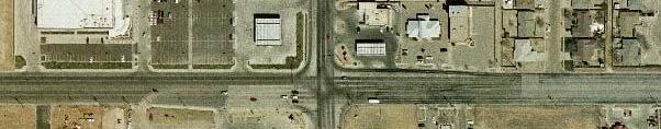
27 2000 Volumes
28 2030 Volumes
29 2000 AM Peak Volume-to-Capacity Ratio
30 2030 AM Peak Volume-to-Capacity Ratio
31 Highway Peak AM Travel Time (Minutes)
32 Arterial Peak AM Travel Time (Minutes)
33 2006 Accident Aug - Dec
34 2007 Accident
35 2008 Accident
36 2009 Accident Jan - Sept
37 Accident Count by Year 2006 Aug Dec 2009 Jan Sept % of accidents outside Loop 289 occur in this SW quadrant

38 Technical Methodology Identify Viable Alternatives Uncontrolled Aerial Photography Data Collection Digital aerial photos Color infrared photography County soil survey maps Hazardous materials database information Demographic maps / census information Environmental Constraints t Development plans Approximate Right of Way Requirements. Development of an Evaluation Matrix


39 Alternative Analysis (Minimum of Two Alternatives and a No-Build Alternative) Traffic Analysis Analyze traffic data to assist in evaluating the viability and impacts of proposed alternatives. Appropriate roadway a geometry Widening New Alignment Number of Lanes Type of Facility Phasing Access Interchanges At-Grade Diagrammatic Configurations Interchange Types Regional Mobility Local Access Route Continuity Lane Balance Interchange Spacing Right of Way Requirements e e Estimated Construction Costs Public Comments
40 Alternative Analysis (continued) (Minimum of Two Alternatives and a No-Build Alternative) Evaluation Matrix Environmental Considerations Right of Way Impacts / Potential Displacement Natural / Cultural l Resource Impacts Public Comments Roadway / Engineering Considerations Design Objectives Capital Cost Major Utilities Traffic and Mobility Studies Regional Mobility Travel Time Selection of a Recommended Alternative Logical Termini Narrative Descriptions

41 Alternative ROW ft ft ft ft
42 Alternative ROW ft ft ft ft


43 Alternative ROW ft ft ft ft

44 Alternative ROW ft ft ft ft
45 Refine Alternatives Refine alternatives based upon: Public / stakeholder input Design issues: Geometric features Traffic forecasts Mobility assessment Cost effectiveness: Capital costs Affordability and financing Economic impact analysis Funding results Environmental issues: Social and environmental evaluation Constraints Feasibility Recommendation
46 Funding Traditional Programmed dollars project is not currently using any program dollars. Innovative Direct users fees: Tolls Indirect user fees: pass-through h financing i agreements SIB Loans TIFIA Loans Advanced Construction Funding GARVEE bonds Value Capture Tax Increment financing Benefit Assessment Districts Other Federal and State discretionary funds Commission Discretionary Funds Governors Business Development Fund Congressional Earmarks Public Private Partnerships and Joint Development Agreements
47 Funding (continued) Evaluation of Tolls Based on a combination of traffic and toll rates Dependent on current and future land uses Dependent on interaction with the current and future transportation system Evaluation of Pass Through Financing Eligibility: TxDOT, Private, Local/County Government Identify Project Project Description Statement of benefits Description of Local Support Analyze project Estimate t traffic Evaluate project using conventional tolling Estimate of minimum and maximum repayment periods Determine impacts of conventional tolling
48 Funding (continued) Evaluation of State Infrastructure Bank Jurisdiction must qualify for federal aid under existing rules. Finance or financially enhanced transportation projects, which meet its selection criteria. SIB loans must be re-paid Selection Criteria Eligible transportation projects must be included in the associated planning document (e.g., Planning and Preliminary must be in the MTP) Repayment Increased taxes Property Sales TIF Program Dollars Benefit Assessment Districts, etc.
49 The successful results of this project will provide: A NEPA Compliant Process A defensible Need and Purpose Statement Viable alternative which has logical termini and independent d utility Informed consent from stakeholders Better defined d corridor location and facility type ROW corridor for preservation A defensible phasing concept / implementation plan for the project A workable funding scheme If proposed project is feasible, begin Route Study