ww.sustainable-landmanagement.net
|
|
|
- Jerome Lane
- 5 years ago
- Views:
Transcription

1 Indus Forum Workshop Switzerland Knowledge Exchange on Glaciers and Climate Oct. 2016, University of Zurich, Switzerland Experience with Water Management and Decision Support Systems from the Tarim Basin Prof. Dr.-Ing. Markus Disse Technical University of Munich ww.sustainable-landmanagement.net


2 Introduction 2


3 Introduction 3


4 Impact of climate change and socio-economic development on water availability Developing methods for analyzing ecosystem functions / ecosystem services Introducing transdisciplinary research by stakeholder participation Installation of a Decision Support System for supporting sustainable land and water management 4 Scientific objectives of SuMaRiO

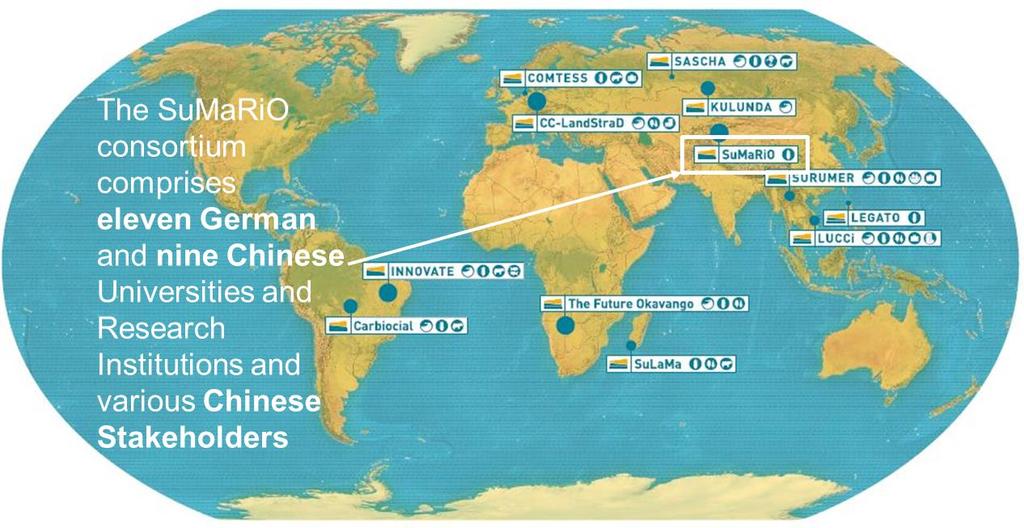
5 Today s outline 5 Project structure
 Annual reference evapotranspiration about 2,500 mm Climate")
6 extremely arid desert climate average annual temperature: 10.5 C to 11.5 C average annual precipitation: around 50 mm (lowland) Annual reference evapotranspiration about 2,500 mm Climate diagram Korla (weatherbase.com) 6 Climate and Hydrology
 7 Climate and")
7 Only water resource: River water that originates from the surrounding mountains Gauge Yengi Bazar (Tarim Watershed Administration) 7 Climate and Hydrology
8 Annual Runoff Aksu River upstream Aksu City Source: Tang, D. S.; Deng, M.J. (2010), On the Management of Water Rights in the Tarim River Basin, Beijing: Zhongguo Shili Shuidian Chubanshe Annual Runoff Tarim River near Alar 8 Climate and Societal Change

,")
 Duethmann et")
 054024 9 Climate")
9 Sari-Djaz Kakshaal black line:median grey area:5 95 percentile range of the ensemble projections: cold (light blue), warmwet (yellow), warm-dry (red) Tobias Bolch (2015) Duethmann et al. Environ. Res. Lett. 11 (2016) Climate Change Monitored and Modelled

 10 Spatial distributed modeling of groundwater recharge and impact of land use and climate")
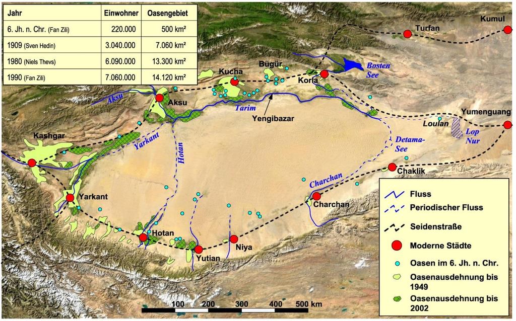
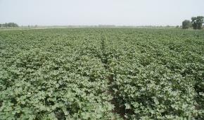
10 Yengibazar (Tarim River middle reach) - area (80 km²) located in the Tarim Populus Euphratica National Forest Park - land use systems: - agriculture - natural Tugai-forests - desert vegetation - Large natural floodplains with direct connection to the Tarim - dramatic land use change (cotton fields) 10 Spatial distributed modeling of groundwater recharge and impact of land use and climate change


11 Yengibazar (Tarim River middle reach) Groundwater recharge Spatial distributed modeling of groundwater recharge and impact of land use and climate change

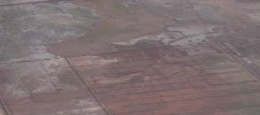
12 Yengibazar (Tarim River middle reach) 2004 Changes in flooding by land use changes 12 Spatial distributed modeling of groundwater recharge and impact of land use and climate change 12


13 Research domain: nearly km² with Cotton, Fruits, Tugai and Natural Vegetation Aim: Regional water allocation and ground water model for the whole basin 13 Macroscale Tarim River and riparian areas


14 MODFLOW: USGS three-dimensional finite-difference groundwater model Gridsize: 500 * 500 m, recharge by flooding, river seepage and irrigation Depth of the groundwater table in the irrigation period Kilometers 14 Macroscale Groundwater Module
 Output: Water demand in each")

15 Inflow Input: Modelled discharge for four different climate scenarios in Alar (Beginning of the Tarim River) Output: Water demand in each subcatchment and routing of the resulting water amount downstream SC 1 SC 2 SC 3 SC 4 Daixihezi Reservoir 15 Tarim Water Allocation in the DSS


16 Water use - yield relationship: (1 Y a Y m ) = K y (1 ET a ET c ) Water consumption Water allocation Water losses Water deficit daily Water balance monthly SC 1 SC 2 SC 3 SC 4 Taitema Lake Mike Hydro Water demand for crops Cultivation area in each SC MODFLOW Groundwater level DSS No. of cells for each crop Each cell water demand, vitality, salinization, 16 Coupling between Hydrology & DSS
![Inflow at Alar x 10 8 [m 3 /month] 17.20 Tarim Water Allocation Decision Support System 0.81 0.76 0.58 2.00 2.23 5.06 12.](/docs-images/89/100350587/images/17-0.jpg "01 9.65 3.35 0.94 0.")
17 Inflow at Alar x 10 8 [m 3 /month] Tarim Water Allocation Decision Support System Groundwater development Axis Title 17 Tarim Water Allocation in the DSS

18 Scenarios: Baseline 2012: discharge 5.4 billion m 3 Near future 2020: discharge 7 billion m 3 Far future 2080: discharge 3 billion m 3 Duethmann et al. Environ. Res. Lett. 11 (2016) Tarim Water Allocation in the DSS


19 Tarim Water Allocation in the DSS 19


20 User input: Planning years 20 Input / Output of the DSS

21 User input: Climate scenario 21 Input / Output of the DSS

22 User input: Socioeconomic scenario 22 Input / Output of the DSS


23 User input: Management alternatives 23 Input / Output of the DSS


24 User input: Weights and Goals 24 Input / Output of the DSS

25 User output: Landuse change 25 Input / Output of the DSS

26 User output: Soil salinization change 26 Input / Output of the DSS

27 User output: Available water Tarim River 27 Input / Output of the DSS

28 User output: ESS utility values 28 Input / Output of the DSS
29 DSS Chinese version 29 Input / Output of the DSS

: to China: 2 to")

30 - Workshops and conferences: 25 - Publications: Peer reviewed journals: > 70 Other reviewed journals: > 100 Proceedings: > 50 Books: 2 - PhD students: finished: China: 10 Germany: 22 current: China: 6 Germany: 3 - PostDocs: China: 2 Germany: 7 - Visiting scholars (more 3 months stay): to China: 2 to Germany: 8 - Persons involved in IPCC AR5 WG-II report: 3 - DFG / NSFC funded Cooperation Group started 2014 IWRM From Modeling to Adaptation 30 Products of SuMaRiO

31 How to Realize a Sustainable Land and Water Management in China? - DSS will serve different stakeholders (e.g. climate, hydrology, agriculture, forest, ecology, economy) - Transfer of knowledge by Sino-German workshops and conferences in a holistic way - Provision of technical training, summer schools, PhD and MSc students for education and capacity building - Scientific contribution for the 13 th Five-Years-Plan (national, provincial, regional and basin level) - Invitation of responsible officials of the Five-Year-Plan to workshops and summer schools (communication) 31 Conclusions

32 Thank you for your attention! 谢谢! 32