Owens Reeds Creek Ranch. Red Bluff, CA
|
|
|
- Donna Paul
- 5 years ago
- Views:
Transcription


1 Owens Reeds Creek Ranch Red Bluff, CA


2 Owens Reeds Creek Ranch Red Bluff, CA
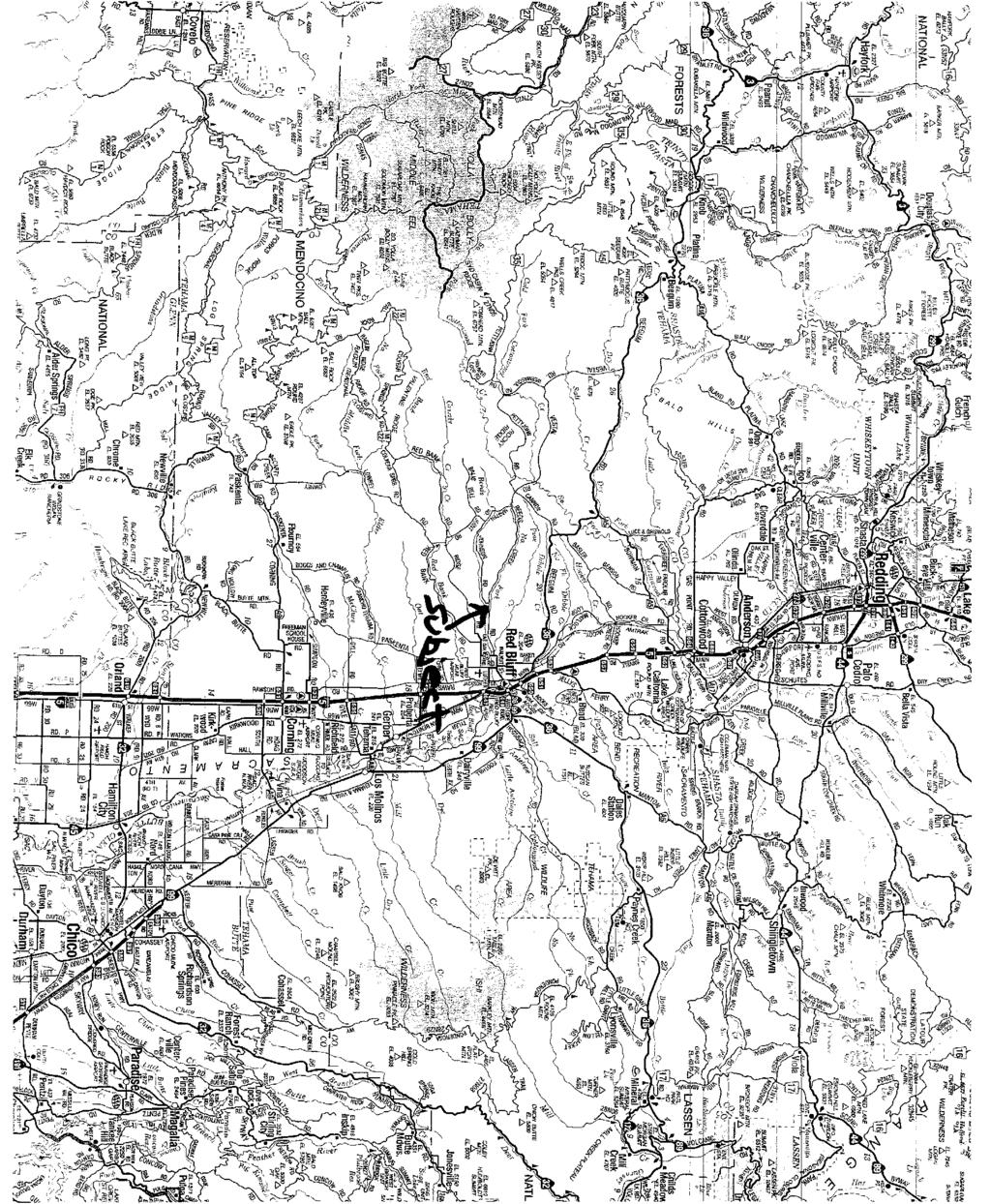
3 AG-LAND INVESTMENT BROKERS 275 Sale Lane, Suite 2 / P. O. Box 896 Red Bluff, CA office / fax Owens Reeds Creek Ranch Tehama County, California Property: /- acres of farm and range land with Reeds Creek running through this unique ranch property. Ranch is livestock ready including fencing, large hay barn, shop, horse barn and dog kennels. Owners residence has (3) bedrooms, two baths and fenced pool. 30 +/- acres of Class 1 Soil previously used for irrigated pasture. This ranch offers wildlife and privacy yet is not far from Red Bluff, CA. Location: The ranch is located 6 +/- miles (W) of Red Bluff, CA at Reeds Creek Road, Red Bluff, CA. The local area is comprised primarily of oak covered rolling hills with irrigated and dry grazing lands. The property is bordered by three county paved roads which provide access for development in the future. Soils: The Maywood Loam (Class I) soil located (N) of Reeds Creek was previously used for irrigated pasture. The Class II and III soils are used for livestock grazing. With irrigation, many of these soils may be suitable for orchard crops typically grown in Tehama County. Water: Irrigation water is provided by an irrigation well and 10 HP electric turbine motor. Residential and livestock water is provided by a smaller well and electric submersible pump. Water in this area is known to be of excellent quality. Irrigation: 30 +/- acres of Class I soil are level for flood irrigation using the AG well and buried concrete pipeline. The well and pipeline have not been used in a long time. Farmstead: The farmstead area is accessed using a private driveway from Reeds Creek Road winding down to Reeds Creek. Numerous fruitless Mulberry trees are planted around the outbuildings for summertime shade. The information contained herein is from sources deemed reliable, however, accuracy is not guaranteed. AG-LAND Investment Brokers assumes no liability as to errors, omissions or future operating and investment results. Buyer assumes responsibility to perform their own investigation and due diligence. This offering is subject to prior sale, price change or withdrawal from market without notice.
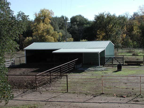
4 AG-LAND INVESTMENT BROKERS 275 Sale Lane, Suite 2 / P. O. Box 896 Red Bluff, CA office / fax Zoning: Tehama County Assessor Parcel Numbers ( acres) and (12.23 acres). Both parcels are zoned EA-AP Exclusive Agriculture, Ag Preserve (Williamson Act), 40 acre minimum. On September 30, 2004, the Owner filed a Notice of Non Renewal on the Williamson Act Contract. This contract will expire at the end of 2014 after which current zoning allows 20 acre minimum. Lot Line Adj: In 2007, the Owner hired a respected local Surveyor to assist Owner with a lot line adjustment with the goal of creating a /- acre parcel (N) of Reeds Creek and a /- acre parcel (S) of Reeds Creek. While researching and preparing the application, the Surveyor determined total acreage to be /- acres not /- acres as shown on the Tehama County Assessor Maps. Owner has since learned a lot line adjustment is not possible while the property is in the process of Williamson Act non-renewal. However, Owner believes the lot line adjustment would be possible if the property was reenrolled within the Williamson Act. Residence: 2,199 sqft home with three bedrooms and two baths. The residence is above average in quality and in good condition with new interior painting. The home has two fireplaces with kerosene fuel oil insert in the Family Room. There is a central heating and air conditioning as well. A 384 square foot storage room with bath is attached by breezeway to the carport. Outbuildings: A 3,328 sqft hay barn built of wood frame and metal roof, concrete perimeter foundation and partial concrete floor. A 1,200 sqft enclosed metal shop with concrete floor and an additional 1,200 sqft gravel floor open to front equipment shed. A 1,152 sqft metal horse barn with tack room and attached paddock. A covered dog kennel with runs for a total of (10) dogs. Many steel, plastic, and wire fences partition the farmstead and perimeter of the property. Topography: The property lies in approximately three different bench elevations which provide privacy and seclusion. Mineral Rights: Seller to transfer all oil, gas and minerals rights owned by Seller. The information contained herein is from sources deemed reliable, however, accuracy is not guaranteed. AG-LAND Investment Brokers assumes no liability as to errors, omissions or future operating and investment results. Buyer assumes responsibility to perform their own investigation and due diligence. This offering is subject to prior sale, price change or withdrawal from market without notice.
5 AG-LAND INVESTMENT BROKERS 275 Sale Lane, Suite 2 / P. O. Box 896 Red Bluff, CA office / fax Wildlife: In the past, Owner has had a wildlife feeding program to increase the black tail deer and wild turkey populations. There are quail, dove and other waterfowl on the property which enjoy the year around stream flow from Reeds Creek. Comments: This ranch has been owned by the same family for over 55 years, since It has been operated as the home headquarters for a large beef cattle operation which also leased uplands in Tehama and Glenn Counties in California as wells as Klamath and Lake Counties in Oregon. The property use could be expanded to other types of agricultural operations or held for future development of rural ranchettes. Listing Price: $710,000. Contact Info: Please contact Bert Owens or Sam Mudd. Bert Owens, California Brokers License Number , office / , cell bert.owens@aglandbrokers.com, website Sam Mudd, California Brokers License Number , office / , cell sam.mudd@aglandbrokers.com, website The information contained herein is from sources deemed reliable, however, accuracy is not guaranteed. AG-LAND Investment Brokers assumes no liability as to errors, omissions or future operating and investment results. Buyer assumes responsibility to perform their own investigation and due diligence. This offering is subject to prior sale, price change or withdrawal from market without notice.
6


7 AG-LAND Investment Brokers 645 Antelope Blvd., Suite 17 PO Box 896 Red Bluff, CA Fax Reeds Creek Ranch AG-LAND Office: Fax: Sam Mudd Bert Owens

8
9
10
11
12
13

14 WILLARD RD Irrigated Capability Class Tehama County, California (Owens Reeds ) NEWMAN RD Rg REEDS CREEK RD NrD PkA AvA Reeds Creek Rr Mf Az PkA Ay LIVE OAK RD Az Pm LIVE OAK RD Meters ,000 2,000 3,000 Feet Natural Resources Conservation Service Web Soil Survey 2.0 National Cooperative Soil Survey 2/14/2008 Page 1 of 4
15 Irrigated Capability Class Tehama County, California (Owens Reeds ) Area of Interest (AOI) Area of Interest (AOI) Soils Soil Map Units Soil Ratings Capability Class - I Capability Class - II Capability Class - III Capability Class - IV Capability Class - V Capability Class - VI Capability Class - VII Capability Class - VIII Not rated or not available Political Features Municipalities Cities Urban Areas Water Features Oceans Streams and Canals Transportation Rails MAP LEGEND State Highways Local Roads Other Roads MAP INFORMATION Original soil survey map sheets were prepared at publication scale. Viewing scale and printing scale, however, may vary from the original. Please rely on the bar scale on each map sheet for proper map measurements. Source of Map: Natural Resources Conservation Service Web Soil Survey URL: Coordinate System: UTM Zone 10N This product is generated from the USDA-NRCS certified data as of the version date(s) listed below. Soil Survey Area: Tehama County, California Survey Area Data: Version 4, Dec 17, 2007 Date(s) aerial images were photographed: 8/11/1998 The orthophoto or other base map on which the soil lines were compiled and digitized probably differs from the background imagery displayed on these maps. As a result, some minor shifting of map unit boundaries may be evident. Roads Interstate Highways US Routes Natural Resources Conservation Service Web Soil Survey 2.0 National Cooperative Soil Survey 2/14/2008 Page 2 of 4
16 Irrigated Capability Class Tehama County, California Owens Reeds Irrigated Capability Class Irrigated Capability Class Summary by Map Unit Tehama County, California Map unit symbol Map unit name Rating Acres in AOI Percent of AOI AvA Arbuckle gravelly loam, 0 to 3 percent slopes % Ay Az Mf NrD Arbuckle gravelly loam, clayey substratum, channeled Arbuckle-Tehama complex, 0 to 3 percent slopes Maywood loam, high terrace, 0 to 3 percent slopes Newville gravelly loam, 10 to 30 percent slopes PkA Perkins gravelly loam, 0 to 3 percent slopes Pm Rg Perkins-Kimball gravelly loams, 0 to 3 percent slopes Red Bluff gravelly loam, 0 to 3 percent slopes % % % % % % % Rr Riverwash % Totals for Area of Interest (AOI) % Natural Resources Conservation Service Web Soil Survey 2.0 National Cooperative Soil Survey 2/14/2008 Page 3 of 4
17 Irrigated Capability Class Tehama County, California Owens Reeds Description Land capability classification shows, in a general way, the suitability of soils for most kinds of field crops. Crops that require special management are excluded. The soils are grouped according to their limitations for field crops, the risk of damage if they are used for crops, and the way they respond to management. The criteria used in grouping the soils do not include major and generally expensive landforming that would change slope, depth, or other characteristics of the soils, nor do they include possible but unlikely major reclamation projects. Capability classification is not a substitute for interpretations that show suitability and limitations of groups of soils for rangeland, for woodland, or for engineering purposes. In the capability system, soils are generally grouped at three levels-capability class, subclass, and unit. Only class and subclass are included in this data set. Capability classes, the broadest groups, are designated by the numbers 1 through 8. The numbers indicate progressively greater limitations and narrower choices for practical use. The classes are defined as follows: Class 1 soils have few limitations that restrict their use. Class 2 soils have moderate limitations that reduce the choice of plants or that require moderate conservation practices. Class 3 soils have severe limitations that reduce the choice of plants or that require special conservation practices, or both. Class 4 soils have very severe limitations that reduce the choice of plants or that require very careful management, or both. Class 5 soils are subject to little or no erosion but have other limitations, impractical to remove, that restrict their use mainly to pasture, rangeland, forestland, or wildlife habitat. Class 6 soils have severe limitations that make them generally unsuitable for cultivation and that restrict their use mainly to pasture, rangeland, forestland, or wildlife habitat. Class 7 soils have very severe limitations that make them unsuitable for cultivation and that restrict their use mainly to grazing, forestland, or wildlife habitat. Class 8 soils and miscellaneous areas have limitations that preclude commercial plant production and that restrict their use to recreational purposes, wildlife habitat, watershed, or esthetic purposes. Rating Options Aggregation Method: Dominant Condition Component Percent Cutoff: None Specified Tie-break Rule: Higher Natural Resources Conservation Service Web Soil Survey 2.0 National Cooperative Soil Survey 2/14/2008 Page 4 of 4