Environmental Impact Assessment Report
|
|
|
- Gervais Henderson
- 5 years ago
- Views:
Transcription


1 Environmental Impact Assessment Report for Exploratory drilling in 10 wells in On-shore, NELP-VI, Block CY-ONN-2004/2 of Cauvery Basin,Ariyalur District, Tamil Nadu Oil and Natural Gas Corporation Ltd, Cauvery Basin, ONGC 11 th Floor, East Wing, CMDA Tower-1,No-1, Gandhi-Irwin Road, Egmore, Chennai , Tamil Nadu
2 Environmental Impact Assessment Report for Exploratory drilling in 10 wells in On-shore, NELP-VI, Block CY-ONN-2004/2 of Cauvery Basin, Ariyalur District, Tamil Nadu Project Leader & QCI Accredited EIA Coordinator Dr. J.S.Sharma General Manager(Chem), Head Environment Corporate HSE, Delhi 2014 Corporate Health Safety and Environment, Oil and Natural Gas Corporation Ltd. (A Govt. of India Enterprise), 8 th Floor, Scope Minar, South Tower, Laxmi Nagar, Delhi
3 EIA Report for Exploratory Drilling of 10 Appraisal wells in Onshore, NELP VI Block CY-ONN-2004/2 of ACKNOWLEDGMENT Completion of this Environmental Impact Report was possible with the constant, guidance and support of Shri M.C. Das GGM Chief HSE, ONGC and Shri J.S. Sharma, GM-Head Environment, ONGC, Delhi. Team CHSE/Basin HSE is gratefully acknowledges the encouragement and guidance given by Shri B.S. Josyulu, ED-Basin Manager, Cauvery Basin, Chennai and valuable inputs provided by Shri M. Ayyadurai, G.M. Block Manager, Cauvery Basin. Shri S.K. Lijhara, CC, CHSE, and all QCI Accredited Functional area Experts (FAE) are also acknowledged for their valuable and meaningful contribution in finalising the report.
4 EIA Report for Exploratory Drilling of 10 Appraisal wells in Onshore, NELP VI Block CY-ONN-2004/2 ofcauverybasin, Ariyalur District, TamilNadu. List of Contents PART 1 Description Page No. Executive Summary ES 1- ES 21 TOR( Terms of References) T 1 T 4 TOR Compliance TC 1 TC 5 Summary and Response to Queries Raised During Public Consultation PH 1 PH 6 Ariyalur District S. No Description Page No. PART Introduction 1.1 Purpose of the Report Brief History of the Project Details of the Project Proponent Address of the Project Proponent Brief Description of the Project Estimated Expenditure for Environment Protection of the Project Project Description 2.1 Project Benefits Employment Potential Improvement in the Future Economy Stages of Exploration Geological Setting of the Block Technical Justification for the Locations 2 5
5 EIA Report for Exploratory Drilling of 10 Appraisal wells in Onshore, NELP VI Block CY-ONN-2004/2 ofcauverybasin, Ariyalur District, TamilNadu. S. No Description Page No. 3.0 DrillingTechnology 3.1 Drilling Operations Electro Logging General Requirements of Drilling Drilling Muds Power Generation Water Requirement Domestic Waste Water Solids Removal Drill Cuttings and Waste Residual Muds Testing Chemical Storage Manpower Logistics Description of Environment 4.1 Introduction Sampling Locations Meteorological Conditions Meteorological Conditions Study Area Air Environment Water Environment Noise Environment Land Environment General Geology of the Area Land Utilisation in Study Area 4 51
6 EIA Report for Exploratory Drilling of 10 Appraisal wells in Onshore, NELP VI Block CY-ONN-2004/2 ofcauverybasin, Ariyalur District, TamilNadu. S. No Description Page No. 4.8 Soil Environment Biological Environment Vegetation of the Area Biodiversity of the Study Area Floral Analysis Faunal Analysis Shannon Diversity Index Demographic and Socio Economic Environment Population Sex Ratio Scheduled Caste and scheduled Tribe Population Literacy Occupation and Livelihood Socio Economic Environment Environmental Impact and Mitigation Measures 5.1 Key Potential Impacts of the Exploration Activities Potential impact on Air Quality Emissions from DG sets Fugitive Emissions Emissions from Heavy vehicles & Equipment Mitigation Measures Potential impact on Water Quality Mitigation Measures Potential impact on Ground Water Quality Mitigation Measures Potential impact on Noise Levels 5 6
7 EIA Report for Exploratory Drilling of 10 Appraisal wells in Onshore, NELP VI Block CY-ONN-2004/2 ofcauverybasin, Ariyalur District, TamilNadu. S. No Description Page No Mitigation Measures Potential impact on Land Environment Mitigation Measures Potential impact on Soil Quality Contamination of Soil Mitigation Measures Potential impact on Biological Environment Potential impact on Socio Economic Environment Environment Management Plan 6.1 Site Preparation Rig Transportation Decommissioning and Restoration of Site Air Environment Water Environment Water Requirement Waste Water Generation and Disposal Noise Environment Land Environment Material Handling Waste Management Biological Environment Socio Economic Environment Occupational Health Surveillance Program Environmental Management Program for Exploratory Drilling 6-13
8 EIA Report for Exploratory Drilling of 10 Appraisal wells in Onshore, NELP VI Block CY-ONN-2004/2 ofcauverybasin, Ariyalur District, TamilNadu. S. No Description Page No. PART Analysis of Alternatives 7.1 Directional Drilling Applications of Directional Drilling Air Drilling Foam Drilling Horizontal Drilling Project Benefits 8.1 Employment Potential Reserve accretion Economic Impact 8-1 List of Annexures S. No Description 1 Annexure I - Waste Management Association Memberships 2 Annexure II - HSE& Corporate Environment Policies of ONGC
9 EIA Report for Exploratory Drilling of 10 Appraisal wells in Onshore, NELP VI Block CY-ONN-2004/2 ofcauverybasin, Ariyalur District, TamilNadu. List of Tables Table. No Description Page No. Chapter 1 Introduction Estimated Environmental expenditures 1 6 Chapter 2 Project Description Stages of Exploration Details of Tentative Locations 2 8 Chapter -3 DrillingTechnology Special Additives for Drilling Mud and their Functions 3 7 Chapter- 4 Description of Environment Tentative Co-ordinates of Proposed exploratory Locations Villages in a radius of 10 Km of the Proposed Locations Sampling Locations Meteorological Measurements at Vanathirrayanpattinam Meteorological Measurements at Irumbilkurichi Meteorological Measurements at Kollapuram Meteorological Measurements at Cholamadevi Meteorological Measurements at Parukkal Meteorological Measurements at Gangaikondapuram Meteorological Measurements at Angarayanallur Meteorological Measurements at Keelkudyiruppu Ambient Air Quality Monitoring Data National Ambient Air Quality Standards Ground Water Analysis Results Ground Water Analysis Results Ground Water Analysis Results Surface Water Analysis Results Day time Noise Level Measurements 4 47
10 EIA Report for Exploratory Drilling of 10 Appraisal wells in Onshore, NELP VI Block CY-ONN-2004/2 ofcauverybasin, Ariyalur District, TamilNadu. Table. No Description Page No Night time Noise Level Measurements Administrative Divisions of Ariyalur District Land Use Classification of Ariyalur District Land Utilisation Pattern in Study Area Soil Sample Analysis Results Population profile of Study Area Work Force Details in the Study Area Demographic Profile of the Study Area Demographic Profile of the Study Area Literacy Status of Study Area Occupational Structure of the Study Area Category of Workers in the Study Area 4 86 Chapter 5 Environmental Impact and Mitigation Measures Key Potential Impacts of Exploration Activity 5-2 Chapter 6 Environment Management Plan EMP for Exploratory drilling Locations in CY-ONN-2004/ Chapter 7 Risk Assessment and Mitigation Measures Typical activities of Drilling Operations Typical Template for risk Management Indicative Risk Management Chart Risk Factors Associated with Blow Out Heat Radiation Effect due to Blowout of Well 7-19
11 EIA Report for Exploratory Drilling of 10 Appraisal wells in Onshore, NELP VI Block CY-ONN-2004/2 ofcauverybasin, Ariyalur District, TamilNadu. LIST OF FIGURES Figure. No. Description Page No. Chapter 1 Introduction ONGC s share of Exploration Area and Production Contribution Setup of ONGC 1 5 Chapter 2 Project Description Location map of NELP VI CY-ONN-2004/2 Block Map of NELP VI CY-ONN-2004/2 Block Proposed Tentative Locations Map Indicating the Tentative Locations 2 6 Chapter -3 Drilling Technology 3.1 Typical drilling Rig Typical Kelly Bushing Drill Bit\s Drill sting Stack Mud Pumps Mud Flow Diagram Layout of Mud Pump and Flow Lines Logging Unit Typical Power Generator set Water Balance Diagram for Exploratory Drilling Operations Typical Solid Removal equipment HDPE Lined Waste Pit Surface Control Equipment Transport of Material and Equipment Typical Process Flow Diagram/Drilling Rig Typical Drill Site Layout Plan 3 14
12 EIA Report for Exploratory Drilling of 10 Appraisal wells in Onshore, NELP VI Block CY-ONN-2004/2 ofcauverybasin, Ariyalur District, TamilNadu. 3.5 Typical Land Rig 3 15 Chapter- 4 Description of Environment Environmental Impacts due to Exploratory Drilling Sampling Locations Base map of CY-ONN-2004/2 Well A Base map of CY-ONN-2004/2 Well A2/NPAI Base map of CY-ONN-2004/2 Well B Base map of CY-ONN-2004/2 Well B Base map of CY-ONN-2004/2 Well B Base map of CY-ONN-2004/2 Well B Base map of CY-ONN-2004/2 Well B Base map of CY-ONN-2004/2 Well B Base map of CY-ONN-2004/2 Well NPAE Base map of CY-ONN-2004/2 Well BH1/NPAF Annual Mean Temperature Variations Annual variation in Relative Humidity Annual distribution of Normal Rainfall Wind Rose Diagram (Vanthirayanpattinam) Wind Rose Diagram (Irumbilkurichi) Wind Rose Diagram (Kollapuram) Wind Rose Diagram (Cholamadevi) Wind Rose Diagram (Paukkal) Wind Rose Diagram (Gangaikondapuram) Wind Rose Diagram (Kilkudiyiruppu) Wind Rose Diagram (Angarayanallur) Noise Level Measurements Leq Variations Land Utilisation Pattern in Study Area of Ariyalur District 4-52
13 EIA Report for Exploratory Drilling of 10 Appraisal wells in Onshore, NELP VI Block CY-ONN-2004/2 ofcauverybasin, Ariyalur District, TamilNadu Land Utilisation Pattern around Proposed Location B Land Utilisation Pattern around Proposed Location B Land Utilisation Pattern around Proposed Location B Land Utilisation Pattern around Proposed Location B Land Utilisation Pattern around Proposed Location B Land Utilisation Pattern around Proposed Location B Land Utilisation Pattern around Proposed Location A Land Utilisation Pattern around Proposed Location A2/NPAI Land Utilisation Pattern around Proposed Location BH1/NPAF Land Utilisation Pattern around Proposed Location NPAE Ariyalur District Soil Profile Map Sex Ratio in Study Area SC & ST Percentage in the Study Area Comparison of Literacy Rates Occupational Pattern of the Study Area Comparative Analysis of Work Force Work Force Analysis in the Study Area Analysis of Different Category of Workers 4 80 Chapter 5: Environmental Impact and Mitigation Measures 5.1 Schematic Representation of Project Environmental Interaction 5-1 Chapter 6Environment Management Plan Water Balance Diagram HDPE Lined Waste Pit Details of Septic Tank 6-6 Chapter 7: Risk Assesment and Mitigation Measures Risk Management Process Risk Metrics and Risk Matrix Evaluation 7-2
14 EIA Report for Exploratory Drilling of 10 Appraisal wells in Onshore, NELP VI Block CY-ONN-2004/2 ofcauverybasin, Ariyalur District, TamilNadu Fire Due to Blowout Under Balance Kick Induced Kick Parameters Characterising the Blowout Schematic Diagram showing the methods of Controlling Blowout Typical Blow out Preventers and Diverters Shut in Decision Tree Shut in Decision Tree 7-17 Chapter 8: Analysis of Alternatives Relief Wells Controlling the Vertical Wells Side Tracking Inaccessible Locations Fault Drilling Salt Dome Drilling Shore Line Drilling Horizontal Drilling techniques 8-5
15 EIA Report for Exploratory Drilling of 10 Appraisal wells in Onshore, NELP VI Block CY-ONN-2004/2 ofcauverybasin, Ariyalur District, TamilNadu. ABBREVIATIONS AAQM ACM BCA BMT BOD BOP BS CBA COD CPCB DC DF DG DMP DSA EAC EIA EMP ETP GLC GPM GSR H 2S HAZOP HCM HDPE Ambient Air Quality Monitoring Asbestos Contaminated Material Benefit Cost Analysis Billion Metric Tonnes Biological Oxygen Demand Blow out Preventor Bharat Stage Cost Benefit Analysis Chemical Oxygen Demand Central Pollution Control Board Drill Cuttings Drilling Fluids Diesel Generator Disaster Management Plan Drill Site Accommodation Expert Appraisal Committee Environment Impact Assessment Environmental Management Plan Effluent Treatment Plant Ground Level Concentrations Gallons per minute General statutory rules Hydrogen Sulfide Hazard and Operability Study Hydro Carbon Methane High Density Polyethylene
16 EIA Report for Exploratory Drilling of 10 Appraisal wells in Onshore, NELP VI Block CY-ONN-2004/2 ofcauverybasin, Ariyalur District, TamilNadu. HSD HWMH IMD IUCN KLD KVA MCA MMT MoEF MVA MVR MWP NAAQs NELP NEP NIHL NO X OBM OEG OH&S OHSAS ONGC PEL PM PPE PUCC SEIAA High Speed Diesel Hazardous Waste Management & Handling Indian Meteorological Department International Union for Conservation of Nature Kilo Litre Per Day Kilo Volt Ampere Maximum Credible Accident Analysis Million Metric Tonnes Ministry of Environment & Forests Motor Vehicle Act Motor Vehicle Rules Minimum Work Programme National Ambient Air Quality Standards New Exploration Licensing Policy National Environment Policy Noise Induced Hearing Loss Oxides of Nitrogen Oil Based Mud Oil Equivalent Gas Occupational Health & safety Occupational Health and Safety Assessment Series Oil and Natural Gas Corporation Ltd. Petroleum Exploration License Particulate Matter Personal Protective Equipment Pollution Under Control Certificate State Environment Impact Assessment Authority
17 EIA Report for Exploratory Drilling of 10 Appraisal wells in Onshore, NELP VI Block CY-ONN-2004/2 ofcauverybasin, Ariyalur District, TamilNadu. SO 2 SPCB SROI USEPA VOC WBM WMP WPA Sulfur Dioxide State Pollution Control Board Social Return on Investment United State Environmental Protection Agency Volatile Organic Components Water Based Mud Waste Management Plan Wildlife Protection Act
18 PART - 1
19 Executive Summary
20 Executive Summary Oil and Natural Gas Corporation Limited (ONGC) is a Mahanavaratna company public sector petroleum company in India. It is a Fortune Global 500 company with a ranking of 271, and contributes 77% of India's crude oil production and 48% of India's natural gas production. ONGC ranks 171 st position in Forbes Global 2000 list and 21 st in global players in oil and gas operations industry, and is also 39 th among 105 global corporations by Transparency International for ethical and transparent business practices. ONGC has the highest share of Hydrocarbon acreage in India. ONGC discovered 6 of the 7 domestic producing basins. All crudes are sweet and major portion being light. Domestic reserve replenishment ratio is more than one. ONGC accounts for 73% of crude reserves of the country. ONGC holds 52% PEL area and 67% ML area.73% of crude reserves in the country is due to Exploratory efforts of ONGC. The block CY-ONN-2004/2 covers an area of 140sq.Km in Udaiyarpalayam and SenduraiTaluks of Ariyalur District. Necessity of the Proposed Project As the Indian economy is growing at the rate of 6-7% the demand for petroleum products is increasing rapidly. Hence there is an urgent need to boost up the exploration efforts needed to increase the production and subsequently reduce the import of Petroleum from Gulf countries. Tentative Location of Wells: The proposed 10 tentative locations are Exploratory testing type and are classified under B Category. Objective of these proposed wells is to test the Basement, Andimadam and Bhuvanagiri formations. The target depth of drilling of these wells is m/ Basement. The co-ordinates of the tentative proposed locations are as under: ES-1
21 Name location of Lat. Long. Accessibility WGS-94 A Chennai-Gangaikondacholapuram X road- Kumbakonam NH (45c). 2.0 km from Gangaikondacholapuram X road towards Jayakondam (Highway 227). A2/NPAI Chennai-Gangaikondacholapuram X road-annaikarai- Kumbakonam NH (45c). Annaikarai-Periyavalayam junction-vanathirayanpattinam- Udayarpalayam road. Location just about 1.0 km north of Vanathirayanpattinam. B Chennai-Gangaikondacholapuram X road-kumbakonam NH. About 3 km from Gangaikondacholapuram X road in Kattagaram South village road. B B Chennai-Gangaikondacholapuram X road-annaikarai- Kumbakonam NH (45c). Annaikarai-Periyapalayam junction-udayarpalayam road. Periyapalayam X road - Angarayanallur East-Anaikudam road. Location 1.5 km East of Anaikudam. Chennai-Gangaikondacholapuram X road-annaikarai- Kumbakonam NH (45c). Annaikarai-Periyapalayam junction-udayarpalayam road. Periyapalayam X road - Angarayanallur East-Anaikudam road. 1.0 km west of Anaikudam x road. ES-2
22 B B B Chennai-Gangaikondacholapuram x road-kumbakonam NH. Gangaikondacholapuram X road- Jayamkondam- Udayarpalayam town. Udayarpalayam Thathanur. Location About 3 km east of Thathanur. Chennai-Gangaikondacholapuram X road-annaikarai- Kumbakonam NH (45c). Annaikarai-Periyapalayam junction-udayarpalayam road. Periyapalayam X road - AngarayanallurEast-Anaikudam road. 3.0 km west of Anaikudam x road. Chennai-Gangaikondacholapuram x road-kumbakonam NH. Gangaikondacholapuram X road- Jayamkondam- Udayarpalayam town. Udayarpalayam Thathanur. Location About 6.5 km east of Thathanur. NPAE Jayamkondam-Udayarpalayam- Paluvur Highway. About 4 km from Udayarpalayam towards Paranam Kumiliyan road. Location is nearer to Paranam village. BH1/ NPAF Chennai-Gangaikondacholapuram X road-annaikarai- Kumbakonam NH (45c). Annaikarai-Periyavalayam junction-vanathirayanpattinam- Udayarpalayam. Udaiyarpalayam- Managathiroad(Highway227).Location about 2.5 km north of Managathi village. ES-3
23 Drilling Operations Only water based drilling mud will be used for drilling appraisal wells in the NELP Block CY-ONN-2004/2. The rig will be electrically operated and it consists of a derrick floor and at the top of this floor is placed crown block and a travelling block attached with a hook. This is attached to a unit called swivel which is suspended into a hexagonal block called the Kelly which is connected to the rotary table. The rotary table is driven by a shaft powered by electrical motor. The electrical motor rotates the rotary table which in turn rotates the Kelly ºbush and rotations are transmitted to the drilling machine called the bit and when the bit rotates drilling progresses. After drilling a considerable depth drill pipes are added and at the end of the life of the drill bit it is changed by taking it out all the pipes and a fresh bit is added and the entire drill pipes are run back into the hole and further drilling is continued up to the desired target depth. During the process of drilling drill cuttings are generated by the rotation of the bit which is removed by the duplex/triplex mud pumps and the mud coming out of the bit pushes the cuttings uphold and transports them to the surface. The mud also helps in balancing the formation pressures and also a thin impermeable cake so that the formation does not collapse into the well board. The mud coming out of the well process through solid control equipments which removes different sizes of drill cuttings and the cleaned mud flows back into the suction tank and after suitable chemical treatment it flows back into the well. This is a continuous process. The mud is a colloidal suspension treated with caustic soda to ensure proper hydrogen iron concentration. ES-4
24 ES-5
25 Base Line Environmental Status Meteorology/Climate The base line data generation for the rapid EIA has been carried out during March 2014 to May Temperature: Ariyalur district has a warm, humid and tropical climate. The Normal Highest Maximum Temperature is C and the Minimum Temperature is C. The annual variation of temperature is less and diurnal variation is around 10 0 to 15 0 C. Humidity: The humidity is high and rises to 80% during monsoon. Average Maximum Humidity is 76% and Average Minimum Humidity is 51% Rain Fall: The North East Monsoon major contributor of the total annual rainfall starts in October and ends in December. The South West Monsoon rains from June to September. The Normal annual rainfall received is around 1043 mm. The North east monsoon contributes around 49.3 % and south west monsoon contributes around 33.5 % of annual rainfall. During the monitoring period of study area the temperature varied from 26 0 C C and Relative Humidity was in the range of 32% - 90%. Ambient Air Quality Eight number of Ambient Air Quality Monitoring stations were set up considering the meteorological parameters, topography, representative regional background for obtaining base line data and likely regional impact areas. AAQ locations were selected in upwind, down wind and cross wind directions of the proposed locations. At each sampling station monitoring was carried out for 24 hrs and the average values are reported. The 24 hourly average values of Particulate Matter <2.5µ is ranging between g/m 3 & that Particulate Matter <10µ is ranging between g/m 3 in the study area. The 24 hourly average values of SO 2 are in the range of g/m 3 and NOx are in the range of g/m 3 in the monitored Area. The constituents like Methane Hydro Carbons are in the range of ppb, Non methane Hydro carbons are in the range of ppb, VOCs are in the range of g/m 3 and Mercury is below detectable limits in the monitored Area. ES-6
26 These values are within the limits of national ambient air quality standards as presented in table and CPCB Limits Water Quality Status About 8 ground water samples and 4 Surface water samples were collected within the area considered for monitoring. These samples were collected from various sources like hand pumps, open wells and rivers within the area considered. The water samples collected were analyzed and results were compared with IS: drinking water standards The Analysed results are compared with IS10500, Indian Drinking Water Standards and the following are the observations: ph for Ground water samples is in the range of 6.8 to 8.5 and for surface water samples it is in the range of The ph value is within the limits as fixed in IS As per Is the fixed limits for ph are 6.5 to 8.5 The desirable limit for Total Dissolved Solids as per IS is 500 mg/l and permissible limit, in absence of alternate source is 200 mg/l. TDS in Ground water samples ranged between mg/l and surface water between mg/l. The TDS is within permissible limits for ground water and within desirable limits for Surface water. Ground water samples have Chloride in the range of mg/l and Surface water samples in the range of 33-77mg/l, both are within desirable and permissible limits. As per Is the desirable and permissible limits for chlorides are 250 mg/l and 1000 mg/l respectively Sulphates are in the range of 6 29 mg/l for Ground water and 9-21 mg/l for surface water samples. As per Is the desirable and permissible limits for sulphates as SO 4 are 200 mg/l and 400 mg/l respectively The Sulphates are within desirable limits for both ground water and Surface water samples. The desirable limits and permissible limits of Total Alkalinity is in the range of 200 mg/l and 600 mg/l as per IS The range of Total Alkalinity observed in Ground water samples is mg/l and for surface water mg/l. The Alkalinity is within permissible limits for ground water and within desirable limits for Surface water. ES-7
27 Total hardness is in the range of mg/l for Ground water and mg/l for surface water samples. As per Is the desirable and permissible limits for Hardness is 300 mg/l and 600 mg/l respectively The Hardness are within desirable limits for permissible limits for Ground water samples. Surface water samples and within The desirable limits and permissible limits of Flouride is in the range of 1 mg/l and 1.5 mg/l as per IS The range of Flouride observed in Ground water samples is mg/l and for surface water mg/l. The Flouride is within permissible limits for ground water and within desirable limits for Surface water. Copper, Zinc, Chromium, Cadmium etc. are below detectable limits in both ground water and Surface water samples Noise Environment Noise levels have been monitored at 8 locations within the study zone. Noise level measurement locations were identified for assessment of existing noise level status, keeping in view the land use pattern, residential areas in villages, schools, bus stands, etc., the day levels of noise have been monitored during 6 AM to 9 PM and the night levels during 9 PM to 6 AM. The day equivalents during the study period are ranging between db (A). Whereas the night equivalents were in the range of db (A). Day equivalents and the Night equivalents were within the Ambient Noise standards of residential areas standards and the industrial noise standards. Soil Environment 5 sampling locations were selected to assess the existing soil conditions. Flora& Fauna There are no endangered or endemic species of Flora and Fauna in 1km radius of the proposed drilling of 10 wells in the block CY-ONN-2004/2. ES-8
28 Anticipated Environment Impacts and Mitigation Measures Impact on Air quality The impact on air quality at the drill site and its surroundings is guided by two events The Emissions from Diesel generating sets used to generate power for the drilling operation Fugitive emissions caused during site preparation and during decommissioning process Sl No Input parameters Fuel Type BSIII 1 Diesel generator capacity 1000KVA 2 Fuel consumption(l/h) 100% Load 230lit/hr 3 Stack height 13m 4 Diameter of Stack 0.75m 5 Gas Exit velocity 19m/sec 6 Gas exit temperature 533K 7 Density of Diesel 800kg/M³ 8 Gas exit flow rate 8.4M³/Sec 9 Sulphur content 350ppm 10 Estimated NOₓ 5.1g/kg Emission Rates 1 PM g/s 2 SO g/s 3 NO g/s Mitigation Measures: Improvement of combustion efficiency by ensuring maintenance and replacement of air, fuel filters for DG sets; Water spraying will be done on the access roads to control re-entrained dust during dry season; Most of the equipment, machinery and vehicles have inbuilt pollution control devices. Thus selection of equipment and machinery will be considered as a measure for source prevention of air pollution ES-9
29 The engines and exhaust systems of all vehicles and equipment used in this project will be maintained as such, that exhaust emissions are low and do not breach statutory limits set for the concerned vehicle/equipment type; Impact on water quality Using Surface water the drill sites will primarily generate effluent because of discharges of sanitary (black water) wastewater (grey water). The wastewater from the process operation comprises of drain out from rig wash, cement preparation and other sources which will be generated intermittently. Potential impacts on groundwater resources that could arise from the proposed drilling operations include, Reduced Infiltration and Localized Drawdown. Possibility of subsurface groundwater contamination from site drainage or accidental spillage of fuel, lubricants and chemicals from storage areas, vehicles and machineries Mitigation Measures The Drilling activity is a temporary activity. Efforts will be made to reduce water requirement and recycling will be practiced wherever possible; All out efforts will be made to treat the effluent generated and discharge will be made only when the effluent parameters conform to CPCB standards; The domestic wastewater will be discharged into the septic tanks followed by soak pits; Garland canal will be constructed to prevent storm water overflow; During monsoon season identified monsoon locations will be given preference for drilling; All process waste will be disposed to TNPCB authorised waste recyclers which will conform to the stipulated disposal standards and comply with the regulatory requirements for such disposal; All chemical and fuel storage areas will have proper marking and bunds will be constructed so that contamination will not mix with the storm-water drainage system; By implementing proper designing of on-site storage disposal for process wastes in accordance with CPCB guidelines and with proper liner systems; Ensuring proper spill control and management at site ES-10
30 Impact on Noise Levels The potential impacts on noise level may arise out of the following: Noise from the Drilling Rig: Noise Emanated by Machineries &Equipments: Noise from Vehicular Traffic: Mitigation measures Sufficient engineering control during installation of equipments and machineries (like mufflers in DG sets) is to be ensured to reduce noise and vibration emission levels at source; Proper and timely maintenance of machineries is to be adopted; Effective noise barrier at the fence-line of the site needs to be setup. All noise generating operations, except drilling is to be restricted to daytime only to the extent possible; Personnel Protective Equipments (PPE) like ear plugs/muffs is to be given to workers at site. Undertake preventive maintenance of vehicles and machinery to reduce noise levels. Local labour will be hired to the maximum extent possible to reduce the requirement of DG sets in the camp; Impact on Land Environment The existing land and land use pattern of the site area will get affected from the construction of drilling site and associated activities, like elevation of land, installation of rig & machineries, temporary storage of domestic waste and other kind of waste material etc. Mitigation Measures Necessary efforts will be made during selection of drill site to minimize disruption of current land use to the extent possible and this should be a criteria as part of initial project planning; Temporary camp site will be provided with complete amenities and sanitation facilities for the labour to be deployed in the site during construction of the site as well as during drilling phase; Necessary restoration efforts will be made during decommissioning and site closure to restore the site back to its original condition to the extent possible; On completion of works (in phases), all temporary structures, surplus materials and wastes will be completely removed; ES-11
31 Optimization of land requirement through proper site lay out design will be a basic criteria at the design phase; In order to avoid any traffic congestion in the area, separate provision for truck parking will be kept within the drilling site; Temporary new approach roads can be constructed and existing roads can be improved, if required, for smooth and hassle free movement of personnel as well as materials and machineries; Proper restoration of site will be carried out to bring the physical terrain, soils and vegetation, as closely possible, to their original condition; Impact on Soil Environment Alteration of Topsoil Environment & Fertility Runoff and soil erosion Compaction of Soil Soil Sedimentation Soil Contamination Mitigation Measures Store, preserve and protect topsoil separately to use it during restoration period; Carry out adequate restoration of soil in the project site, to the extent possible; Restrict movement of vehicles only to designated areas within the site to the extent possible Dispose process waste and domestic waste as per regulation Install properly designed garland drains along the site to channelize the storm water properly. Management of spilling of contaminants on the soil The drilling mud cuttings and formation cuttings will be separated in the solid control system and conveyed to a specially designed pit (lined with HDPE) for temporary storage; The cuttings will be treated and disposed in accordance with CPCB regulations specified for onshore oil & gas industry; Proper arrangement of septic tanks and soak pits can be provided with the labour camp; Alternatively, labour can be locally sourced to the extent possible for avoiding the provision of labour camp; Provisions for mobile toilets can be kept for labourers, which can be finally transported to the designated disposal site; ES-12
32 The domestic waste can also be separated based on their types & will be sold through the contractors to approved municipal sites. Impact on Biological Environment The impacts would be due to potential sources of pollution viz. the discharge of drilling mud. Apart from this, the domestic wastewater would be discharged from rigs. The continuous flaring of gas at rigs would have repulsive effect on the local as well as migratory birds in the area. Mitigation Measures A range of measures will be adopted during the site preparation and reinstatement phases to mitigate potential impacts on the biological environment, which include the following. The working area which has to be disturbed will be kept minimal at all times; The working area will be reinstated taking into account nature conservation issues, to stabilize the replaced soils against consequent erosion; All accidental discharges would be controlled before it reaches any surface water body in order to avoid any disturbance to aquatic habitat from any sort of water contamination; All process and domestic waste water would be adequately treated before discharge; Impact on Socio-Economic Environment Proposed project during construction & operation phases will increase the employment opportunities positive impact on employment, industrial development transportation, communication & community health parameters which ultimately lead to economic development of the region. Environmental Monitoring Program Environmental Monitoring Program has been designed for assessing the efficiency of implementation of Environment Management Plan and to take corrective measures in case of any degradation in the surrounding environment. Different activities involved in the proposed project and their impact on various environmental attributes have been taken into account while designing a detailed environmental monitoring program. Implementation of EMP and periodic monitoring is proposed to be carried out at study area. Environmental protection measures like dust suppression, treatment and recycling ES-13
33 of wastewater, plantation and noise control in the premises, housekeeping, implementation of EMP and Environmental Clearance conditions will be monitored by the project site authorities. Project Benefits The proposed exploratory drilling of oil and gas will impose the following benefits to the society as well as the economy at a large scale. Following benefits are envisaged from the proposed drilling operation: a. Economic impact The provisional Initiallyinplace Reserves have been estimated for Basement as 7.59 MMt (O+OEG). However, the block is envisaged to have upside potential Inplace of around MMt (O+OEG) for the block. The proposed exploratory activity, if proved to be economically viable shall have impact on the production of oil in future and in turn on the economy b. Employment Potential The study area is mainly rural with agriculture as the major activity and this mainly depends on monsoon conditions.there are no major industries located in this area. The hydrocarbon discovery will bring in more industries and the employment potential will increase. During drill site preparation local villagers will be involved in the construction jobs and unloading of rig materials at site. The exploratory drilling involves preparation and maintenance of drilling fluid which requires addition of mud chemicals manually. Unskilled jobs will be given to local villagers. c. Improvements in the Physical Infrastructure The site development may lead to additional improvement in the access road connectivity in the area, if required. ES-14
34 Terms of Reference (TOR)
35 EIA Report for Exploratory Drilling of Appraisal wells in Onshore, NELP VI Block CY-ONN-2004/2 of Cauvery Basin, Tamil Nadu. T - 1
36 EIA Report for Exploratory Drilling of Appraisal wells in Onshore, NELP VI Block CY-ONN-2004/2 of Cauvery Basin, Tamil Nadu. T - 2
37 EIA Report for Exploratory Drilling of Appraisal wells in Onshore, NELP VI Block CY-ONN-2004/2 of Cauvery Basin, Tamil Nadu. T - 3
38 EIA Report for Exploratory Drilling of Appraisal wells in Onshore, NELP VI Block CY-ONN-2004/2 of Cauvery Basin, Tamil Nadu. T - 4
39 Terms of Reference (TOR) - Compliance
40 TOR compliance Sl. No TOR Compliance 1 Executive Summary Included in report Page No. ES1-ES14 2 Project description project objectives and project benefits 3 Site details within 1Km of the each proposed well, any habitation any other installation /activity, flora and fauna approachability to the site, other activities including agriculture/land satellite imagery 4 Details of forest land involved in the proposed project A copy of the clearance letter, if applicable 5 Permission from the state Forest Department considering the impact of the proposed plant on the surrounding National Park/Wild life sanctuary/reserve Forest/Eco sensitive area, if any. Approval obtained from the state/central Government under Forest (Conservation) Act 1980 for the forest land should be submitted. 6 Distance from the nearby critically/severely polluted area as per Notification dated 13 th January 2010 if applicable 7 Does proposal involves rehabilitation and resettlement? If yes, details thereof. Refer Section 2.1 of Chapter 2 Refer Section 2.4 of Chapter 2, Sections 4.2, and 4.9 of Chapter 4. No wild life sanctuaries or National parks Not applicable Not applicable as No Forest land is involved No critically polluted area nearby. Not applicable No 8 Details of Project Cost Refer Sec 1.3 of Chapter 1 9 Environmental considerations in the selection of the drilling locations for which environmental clearance is TC - 1
41 being sought. Present any analysis suggested for minimizing the foot print giving details of drilling and development options considered. 10. Baseline data collection for air, water and soil for one season leaving the monsoon season in an area of 10 km radius with centre of Oil Field as its centre covering the area of all proposed drilling wells, it includes; The locations are chosen with least impact on Environment and away from Residential areas Baseline Environmental monitoring was done during the period April- June 2014 and the results are given in Section 4.3, 4.4, and 4.8 of Chapter 4 i)topography of the project site Refer Sec. 2.4 of Chpter 4 for Base map of locations ii) Ambient Air Quality monitoring at 8 locations for PM 10, SO 2, NO X, VOCs Methane and non-methane HC iii) Soil sample analysis (physical and chemical properties) at the areas located at 5 locations. iv) Ground and surface water quality in the vicinity of the proposed wells site. v) Climatology and Meteorology including wind speed, wind direction temperature rainfall relative humidity etc. vi) Measurement of Noise levels within 1 km radius of the proposed wells Refer Sec 4.4 of Chapter 4 for AAQM results Refer Sec 4.8 of Chapter 4 for Soil samples test results Refer Sec 4.5 of Chapter 4 for Ground water and surface water sample test results Refer section 4.3 of Chapter 4 for Climatology and meteorological Details Refer section 4.6 of Chapter 4 for Noise level measurement details TC - 2
42 vii) Vegetation and Land Use, Animal resources Refer section 4.9 of Chapter 4 11 Incremental GLC as a result of DG set operation Refer section of Chapter 5 12 Potential environmental impact envisages during various stages of project activities such as site activation, development, operation / maintenance and decommissioning. 13 Actual source of water and `Permission for the drawl of water from the Competent Authority. Detailed water balance, wastewater generation, recycling and its final discharge. 14 Noise control and measures to minimize disturbance due to light and visual intrusions in case coastally located areas. Refer Section 6.1, 6.2 and 6.3 of Chapter 6 Tanker supply. Refer Section 6.5 of Chapter 6 Refer section 6.6 of Chapter 6. The locations are around km from coast 15 Treatment and disposal of waste water Refer Section 6.9 of Chapter 6 16 Storage, Treatment and management of solid waste 17 Disposal of packaging and loose material 18 Storage of chemicals and diesel at site Refer Section 6.9 of Chapter 6 Refer Section 6.9 of Chapter 6 Refer Section 6.9 of Chapter 6 19 Commitment for the use of WBM only Water Based Mud shall be used. Refer Section 6.9 of Chapter 6 20 Mud make up and mud and cutting disposal - all options considered should be listed with selective option Refer Section 6.9 of Chapter 6 TC - 3
43 21 Hazardous material usage, generation, storage accounting and disposal 22 Disposal of packaging waste from site. Refer Section 6.9 of Chapter 6 Refer Section 6.9 of Chapter 6 23 Oil spill control and emergency plans in respect of recovery / reclamation. For Oil spill contingency plan Refer Annexure III 24 H 2S emissions control No H2S atmosphere expected. However H₂S contingency plan placed Annexure III 25 Produced oil handling and storage. Not applicable as exploratory drilling 26 Details of scheme for oil collection system along with process flow diagram and its capacity. 27 Details of control of air, water and noise pollution in oil collection system. Not applicable as exploratory drilling Not applicable as exploratory drilling 28 Disposal of produced / formation water. Not applicable as exploratory drilling 29 Whether any burn pits being utilized for well test operations. 30 Restoration and decommissioning plans which should include mud pits and wastage restoration also and documentation and monitoring of site recovery. 31. Measures to protect ground water and shallow aquifers from contamination 32 Risk assessment and mitigation measures along with disaster management plan and prevention of blow out No only steel tanks used during testing operations Refer Section 6.3 of Chapter 6 Refer Section 6.5 of Chapter 6 Ref Section 7.2 and 7.3 of Chapter 7, TC - 4
44 Disaster management plan placed at Annexure III 33 Environmental management plan. Refer Section of Chapter 6 34 Documentary proof of membership of common disposal facilities, if any. 35 Details of environmental and safety related documentation within the company including documentation and proposed occupational health and safety Surveillance Safety Program for all personnel at site. This should also include monitoring program for the environment 36 Total capital and recurring cost for environmental control measures. 37 A copy of Corporate Environment Policy of the as per the Ministry s O.M.No.J-11013/41/2006-1A.II(I) dated 26 th April, 2011 available on the Ministry s website. 38. Any litigation pending against the project and or any direction / order passed by any court of law against the project. If so details thereof. Copies provided in Annexure-I Ref Section 6.12 and 6.13 of Chapter 6 Project cost Rs200crores recurring cost for environment control addressed in Section 1.3 of Chapter 1. Copy enclosed at Annexure II No litigation against the project is pending with any court of law TC - 5
45 _ Summary and Response to Queries Raised During Public Consultation Ariyalur District
46 . EIA Report for Exploratory Drilling of 10 wells in Onshore, NELP VI Block CY-ONN-2004/2 of _ SUMMARY AND RESPONSE TO QUERIES RAISED DURING PUBLIC CONSULTATION ARIYALUR DISTRICT (SCANNED COPY OF PROCEDINGS IN ANNEXURE ) The District Environment Engineer, Tamilnadu Pollution Control Board Ariyalur welcomed the District Revenue Officer, representatives of M/s Oil and Natural Gas Corporation Limited, public, press people and police who have gathered to attend the Public Hearing. He informed that the project proponent has applied for necessary Environmental Clearance before Ministry of Environment and Forests, Govt.of India, New Delhi and the above authorities have directed the project proponent to conduct Public Hearing as per EIA Notification dated The public can give their opinion either in oral or written petition. The oral opinions are recorded and along with written petitions will be forwarded to Ministry of Environment and Forests, Govt. of India, New Delhi. Based on the above, Environmental clearance will be considered for the above project. Then, the District Environmental Engineer informed the public to give their opinion after technical presentation by the industrial representative. The District Revenue officer, Ariyalur welcomed the gathering on behalf of District Administration and informed that the Public Hearing is for the proposed exploratory drilling of 10 wells by M/s Oil and Natural Gas Corporation Limited to obtain Environmental clearance. The public may inform their views/suggestions clearly regarding the above proposed project in oral or written petition. It will be taken into consideration while according Environmental Clearance to this project. Thiru P.Soundararajan, Dy.General Manager M/s. Oil and Natural Gas Corporation Ltd., Chennai. He welcomed the public on behalf of M/s. Oil and Natural Gas Corporation Limited who have gathered in the meeting. He informed that M/s. Oil and Natural Gas Corporation Limited is involved in exploring petrol and natural gas over five decades Nationwide and three decades in Tamil Nadu. It is a central government Public Undertaking organisation which is running under the guidelines of Petroleum Ministry and Ministry of Environment and Forest and the above Ministries can take action if they found any violations. Hence, we are taking all possible measures to ensure the safety of the people. He also added that M/s. Oil and Natural Gas Corporation Limited plays a vital role in increasing the revenue of the Nation. It is held at 270 th place among the 500 fortune global companies and contributes 77% of India s crude oil production and 81% of India s natural gas production. He informed that petrol plays prominent PH -1
47 . EIA Report for Exploratory Drilling of 10 wells in Onshore, NELP VI Block CY-ONN-2004/2 of _ role in the development of nay Nation. Only because of the petrol availability industries will survive and eventually the infrastructure of the Nation. State of Gujarat place the topmost ranker among the States only because of their petrol and natural gas availability. The establishment of this project will also results in large number of employment opportunities, appreciable infrastructure development and health facilities. Earlier, only because of our research and development activities petrol and natural gas was identified to be available abundant in the Cauvery Basin and subsequently exploration activities are carried out over three decades. Thereby contributing a considerable revenue as royalty to Tamilnadu Government. He explained that ONGC has selected ten villages in Ariyalur District to explore the availability of oil and natural gas. He added that it is necessary to commercialise the exploration activity for the economic development of the country He informed that the location of the proposed project is selected in such a way that there will not be any adverse impact to the nearby residential areas agriculture activities and flora and fauna. He further explained that during the time of project execution dust, noise and emission from generator are expected and necessary steps will be taken to curtail the pollution. He also explained that there will not be any ill effect to the ground water and surface water due to the above project. He informed that as per the data obtained from Forest Department there are no protected wildlife animals and birds exist in the proposed area. He also explained that oil drilling activities may take three to six months. He added that the trade effluent generated from their drilling activities will be neutralized and is disposed through polythene lined solar evaporation pan. He also added that the overburden obtained during their drilling activities may be utilised for land filling. He informed that under their Corporate Social Responsibility so far they have contributed Rs lakhs to Ariyalur District. Then the District Environment Engineer requested the public to express their views about the proposed project. PH -2
48 . EIA Report for Exploratory Drilling of 10 wells in Onshore, NELP VI Block CY-ONN-2004/2 of _ PUBLIC CONSULTATION-ARIYALUR DISTRICT Point wise reply to the Queries raised/received in the public Hearing held on at Jayankonam, Ariyalur District Sl. PH Minutes No. Page no Pt. No Issue Raised Clarification/Reply Thiru. Kulothungan, President, Guruvalappar Panchayat He informed that this area is a economically backward area. He raised his doubt whether is there any adverse effect to the agriculture activities due to exploration activity. Thiru T.Rajendran, General Manager, M/s. Oil and Natural Corporation Ltd replied for the queries stating that ONGC have been involved in exploration activity since Starting from 60cm and ending with 10cm drills along with concrete lining are to be executed for the exploration activity and finally there will be no landslide Thiru. Jayasankar, Chinnavalayam He raised his doubt whether ground water will be depleted due to the drilling activity. Thiru T,Rajendran, General Manager, M/s. Oil and Natural Corporation Ltd replied for the queries that piling methodology is adopted throughout the exploration process along with concrete lining and also the depth of exploration piling is well beyond the normal ground water aquifier available for public use. Hence ground water will not be effected. PH -3
49 . EIA Report for Exploratory Drilling of 10 wells in Onshore, NELP VI Block CY-ONN-2004/2 of _ Thiru. John Joseph, Keelamaichelpatti He informed that crude oil resource is essential for the development of any country. In Gulf countries oil exploration is a prominent industry, as the crude oil is available abundant. He raised his doubt whether this exploration process will yield similar production rate of crude oil as like in the Gulf countries. Also he raised a question that whether the drilling activity will create any adverse effect to the ground water path line. He welcomed the project. Thiru. M.Ayyadurai, Group General Manager, M/s. Oil and Natural Corporation Ltd replied for the queries that in Gulf countries the earth material available is mainly limestone and whereas here the earth material is sand rock. Hence, we don t expect the quantum of crude oil as found in the Gulf countries. In India more limestone rocks are available at Mumbai and hence there we may expect more crude oil Mullainathan, Ex-President, Guruvalappar Panchayat. He informed that ONGC has already drilled a well in his own farm land and the effluent generated from the drilling process was stored in tarpaulin lined storage tank. The tarpaulin often wear and tear in course of time and hence he raised a question that is there any percolation of effluent into the earth and what is the remedial measure Thiru V Kumaresan, Dy General Manager, M/s. Oil and Natural Corporation Ltd replied that Bentonite chemicals are used for drilling activities which are being approved by the competent authority and are declared to be non-hazardous by the above authority. He further informed that the material selection for lining is executed as per the guidelines of Ministry of Environment and Forest. He added that the cutting waste arise during drilling activity is collected and will be disposed as secured land fill. PH -4
50 . EIA Report for Exploratory Drilling of 10 wells in Onshore, NELP VI Block CY-ONN-2004/2 of _ taken by ONGC for the above problem. He added that in the press releases about the Public Hearing survey number of the villages was not included. compensation The process should be fair to the villagers who have contributed their lands to this project and the monetary benefit should be at par with the compensation as in Tiruvarur District. District Environmental Engineer also suggested that the unit authority shall adopt state of the art design for the solar evaporation plan. He also added that the unit authority shall properly close the abandoned well to avoid public complaints. Thiru V Kumaresan, Dy General Manager, M/s. Oil and Natural Corporation Ltd replied for the queries stating that a proposal for installing mobile effluent treatment plant to treat the trade effluent during rainy season. He also added that plugging arrangements are to be provided in the abandoned wells. Thiru Mohana Krishnan, Senior Human Resource Executive, M/s. Oil and Natural Corporation Ltd replied that as per the existing land acquisition Act & rules, compensation will be awarded. The current year interim compensation will be disbursed based on the available crop revenue data of the individual farmer up to and will be revised from Thiru. Sivagurunathan President, Anaikudam Panchayat He raised a doubt that will be there be any adverse effect on the human being Thiru T.Rajendran, General Manager, M/s. Oil and Natural Corporation Ltd replied that the unit authority will extend their service for the betterment of the public along with District Administration. PH -5
51 . EIA Report for Exploratory Drilling of 10 wells in Onshore, NELP VI Block CY-ONN-2004/2 of _ and livestock of this area. He District Environmental Engineer added that, is there any revenue for the local village panchayat as the case of royalty paid in case of mines. He also added whether is there any ill effect to the agriculture lands as the doubt raised by Thiru Mullainathan earlier. Ariyalur District is an economically backward area and hence this upcoming project should create job opportunities and the unit authority shall ensure that the operations of the unit does not create any adverse effect. The unit shall entrust contractual works to the local people. He welcomed the project. informed that under the Corporate Social Responsibility, the organisation will have to extend its service for the betterment of the public along with District Administration. PH -6
52 PART - 2
53 1.0 Introduction
54 1 Introduction 1.1 Purpose of the Report Oil and Natural Gas Corporation Ltd (ONGC) proposes to drill Ten wells in the NELPVI Block CY-ONN-2004/2. This block was awarded to ONGC (80%) & BPCL (20%) with ONGC as operator under NELP VI round in the year The Production Sharing Contract (PSC) between ONGC and BPCL was signed on Oil & Natural Gas Corporation Ltd. (ONGC) has proposed for the Exploratory Drilling in 10 wells in On-shore NELP-VI Block CY-ONN-2004/2 of Cauvery Basin, Tamil Nadu. The total cost of the project will be Rs Crores. The project activity is covered in 1(b) and falls in A Category under the Schedule of EIA Notification EC has been obtained for Four (4) Exploratory locations vide F.No /842/2007-IA II(I) dated 14 th January Wells PN-6, PN-7 and PN-8 were drilled. EC is available for one more location which will be taken up during Exploration Phase-II. Public hearing meeting was held on 8 th June, TOR was issued by EAC vide letter No, F.No.J-11011/188/2013-IA II (I) dated 27 th September ONGC being an operator in the block CY ONN 2004/2 of Cauvery Basin (Tamil Nadu) requires to carry out the Rapid Environmental Impact Assessment (EIA) study. The purpose of such study is to assess the environmental impacts arising due to the exploratory drilling proposed in block Brief History of the Project This block was awarded to ONGC (80%) & BPCL (20%) with ONGC as operator under NELP VI round in the year The Petroleum Exploration License (PEL) was granted with effect from for 7 years. As defined under Article 3.1 of the PSC, the total exploration period consisting of seven consequent years from the effective date, comprises two exploration phases. The first exploration Phase-I was for 4 years from to and the area available was 375 sq.km. During the First Exploration phase, three exploratory wells were drilled. Well Pandanallur-6 (PN-6) was drilled to a depth of 3226m and terminated, it gave 1-1
55 indications oil. Well Pandanallur-7(PN-7) was drilled to a depth of 4115m and terminated in Basement and it is a gas well. Well pandanallur-8(pn-8) was drilled to a depth of 2982m and was completed in Basement it indicated oil and gas. Based on the analysis of testing results of the wells Pandanallur-6,7 and 8which confirmed that the discovery is of potential commercial interest and merits appraisal, the consortium has applied for entering in to exploration Phase-II. Accordingly notification was submitted to DGH/MoPNG on Ten appraisal wells are planned in this block with an investment of Rs. 200 Crores Details of the Project Proponent Oil and Natural Gas Corporation Limited (ONGC) is a Mahanavaratna company public sector petroleum company in India. It is a Fortune Global 500 company with a ranking of 271, and contributes 77% of India's crude oil production and 48% of India's natural gas production. ONGC ranks 171 st position in Forbes Global 2000 list and 21 st in global players in oil and gas operations industry, and is also 39 th among 105 global corporations by Transparency International for ethical and transparent business practices. ONGC has the highest share of Hydrocarbon acreage in India. ONGC discovered 6 of the 7 domestic producing basins. All crudes are sweet and major portion being light. Domestic reserve replenishment ratio is more than one. ONGC accounts for 73% of crude reserves of the country. ONGC holds 52% PEL area and 67% ML area.73% of crude reserves in the country is due to Exploratory efforts of ONGC. ONGC has the state of the art Exploration facilities which include 27 (24 owned + 3 charter hired) Departmental Seismic Crew, 121 (77 owned +44 charter hired ) Drilling Rigs, 88 (58 owned + 30 charter hired) Work Over Rigs,107 Well Stimulation Units, 73 (27owned +46 charter hired) Logging Units ONGC also has 240 Onshore Installations,202 Offshore Installations,26,598 KM Length of pipeline, 65 (17 owned +48 charter hired) Offshore Supply Vessels (OSV) and Multi-Purpose Supply Vessels.(MSV) 1-2


56 Cairn 4% OIL 2% Percentage PEL Area BHP 3% HOEC 10% Percentage ML Area Cairn 10% PMT 7% Others 2% RIL 29% ONGC 52% RIL 1% OIL 13% ONGC 67% Percentage Crude oil Reserves OIL 10% Others 17% ONGC 73% Fig ONGC S Share of Exploration Area and Production Contributions 1-3
57 The Company is managed by the Board of Directors, which formulates strategies, policies and reviews its performance periodically. The Chairman& Managing Director (CMD) and Six Whole-Time Directors viz. Director (Onshore), Director (Technology & Field Services), Director (Finance), Director (Offshore), Director (Exploration) and Director (Human Resource), manage the business of the Company under the overall supervision, control and guidance of the Board. The Board of Directors has an adequate combination of Executive (Functional) and Non-Executive Directors. As on 11th December, 2012,the Board of Directors had 14 members, comprising of 6 Functional Directors (including the Chairman & Managing Director) and 8 Non-executive Directors (comprising 2 part-time official nominee Director and 6 part-time non-official Directors) nominated by the Government of India. To share the global experience and business strategies, Managing Director, ONGC Videsh Limited (OVL) is a permanent invitee to the meetings of the Board. The organisational structure is given Fig Address of the Project Proponent ED-Basin Manager, ONGC, Cauvery Basin 11 th Floor East Wing, CMDA Tower I Egmore,Chennai Brief Description of the Project The project involves exploratory drilling of 10 appraisal wells and all the locations fall in Ariyalur District Tamilnadu. Land requirement for the project will be taken from land owners on rent/ temporary lease. Water requirement will be met from tankers. Compensation for land acquisition shall be as per approved Government Rates. For the proposed project 4to 5 acres of land will be acquired for each well 1-4

58 Fig Setup of ONGC 1-5
59 1.3 Estimated Expenditure for Environment Protection for the Project The project is governed by the Tamil Nadu State Pollution Control Board (TNSPCB) rules and regulations which involves getting Consent for Establishment and Consent to Operate. The Estimated expenditure to be incurred under different heads is given below: Sl No Project head Name of the work Estimated Expenditure /Budget 1 Project cost Rs 200 Crores (INR) 2 Environment Protection Waste pit preparation and HDPE lining Rs 6lakhs per well 3 Environment Protection Restoration Rs 40 lakhs Per well(budgeted) 4 Environment protection Acoustic enclosure(noise control for Gen Set) Rs 5 Lakhs per year 5 Environment Protection Garland Canal for drill sites Rs 20Lakhs per year 6 Environment Monitoring AAQM,SM,NM Rs6 lakhs per year Table Estimated Environmental Expenditures 1-6
60 2.0 Project Description
61 2.0 Project Description India s demand for petroleum products is growing at a rapid rate. India is heavily dependent on imports to meet the rapidly growing demand for petroleum products. Substantial efforts are therefore, necessary to boost the level of exploration activity in the country, so that new finds can be made and the level of crude oil and gas production can significantly increase in the years to come With a view of meeting growing demand, the new hydrocarbon policy aims at encouraging investment in oil exploration and production. Oil & Natural Gas Corporation Ltd. (ONGC) has proposed for the Exploratory Drilling in On-shore NELP-VI Block CY- ONN-2004/2,Cauvery Basin Tamil Nadu. Location of the Block is in Ariyalur District. 2.1 Project Benefits The proposed exploratory drilling of oil and gas will impose the following benefits to the society as well as the economy at a large scale. Following benefits are envisaged from the proposed drilling operation: Employment Potential During exploratory phase, there will not be much scope of Socioeconomic welfare activities. However, a small scale temporary job generation will be there for unskilled workers towards road and site preparations and as guards. During site construction, approximately 35 to 40 workmen are likely to be involved per each well during exploratory drilling activity. People from adjoining areas would be given preference according to the skill sets possessed. The Light and heavy load construction and drilling materials will definitely need the cooperation of local people for unloading. During drilling fluid preparation the chemicals are to be loaded manually and this job is also done by local recruits who are trained by the contractor. Housekeeping of the Drill site accommodation is taken care by the locals. Provisions vegetables and other kitchen materials are procured from the local market Improvement in the Future Economy The proposed exploratory drilling activity may have the potential for future benefits, if proved to be economically viable for future production of oil the opening of hydrocarbon potential will attract industrialists for industrial investment leading to overall growth of the local economy 2-1
62 2.2Stages in Exploration Stage Activity Potential purpose 1 Desk study Identifies the favourable area with favourable 2 Seismic survey To search hydrocarbon bearing in the block 3 Exploratory drilling To Verify the occurrence of hydrocarbons in the identified reservoir and quantifies the reserves. 4 Appraisal To determine if the reservoir is commercially viable to develop. Table Stages of Exploration Fig Location Map of NELP-VI CY-ONN-2004/2 Block 2-2
63 Fig Map of NELP-VI CY-ONN-2004/2 Block 2-3
 falls in the southern part of Ariyalur Pondicherry sub-basin of the Cauvery Basin and oriented in NE-SW direction")
64 Fig Proposed Tentative locations 2.3 Geological Settling of the Block The NELP Block CY-ONN-2004/2 (Pandanallur area) falls in the southern part of Ariyalur Pondicherry sub-basin of the Cauvery Basin and oriented in NE-SW direction covering an area of 375 Sq Km. The Ariyalur-Pondicherry sub basin is the northern most Sub-Basin of the Cauvery Basin and is separated from the Tranquebar Sub Basin by the Kumbakonam- Madanam ridge in the South and the East respectively. The NELP block is located on the northern flank of Kumbakonam- Madanam ridge. During Pre-NELP regime three wells were drilled in the block area(pn-3, PN-4 and PN-5). All three wells have been drilled to the basement. The well PN-5 is the deepest and drilled to a depth of 2464m. The wells fall in the Eastern part of the block and have penetrated the late post rift and Tertiary passive margin sequences. 2-4
65 The deepest part in the block lies in the northern part and more than 4500m of sediment thickness is envisaged to have been deposited in this part.the synrift sediments of Albian age are wedging out against the Basement towards south. There are two conspicuous fault trends observed. The major faults are trending in NE-SW direction and the cross faults are trending NW-SE direction. The basement is made up of Charnokite and Granites of Pre Cambrian Age. The Albian sequence of the synrift phase followed by Turonian sequence of the lower part of the post rift phase deposited in the basement lows in the north and north eastern part of the block. The formation consists of alternations of alternations of sand and shale. Nannilam Formation comprises sand and shale beds of late Cretaceous deposited over the Bhuvanagiri Formation followed by Eocene and younger sequences. In the first phase of exploration under the NELP regime three exploratory wells Pandanallur-6, Pandanallur-7 and Pandanallur-8 have been drilled 2.4 Technical Justification for the Locations The Hydrocarbons have been discovered in basement and positive indication of Gas from Albian sands through production testing. Based on hydrocarbons show during drilling and electro logs analysis of the well, a few more leads have been identified for testing. In order to drill appraisal wells to delineate the Basement reservoir and also to test the other interesting horizons, 10 appraisal / exploratory wells are planned in this block. The details of the locations (tentative - to be firmed up) are given below: 2-5

66 Fig Map Indicating the Tentative Locations 2-6
67 Name of Type / TD (M) Lat. Long. Objective Accessibility location Cat. WGS-84 A1 Expl Chennai- Test / B /Basement Basement, Andimadam and Bhuvanagiri Formations Gangaikondacholapuram X road- Kumbakonam NH (45c). About 2.0 km from Gangaikondacholapuram X road towards Jayakondam (Highway 227). A2/ NPAI Expl Basement, Chennai- Test / /Basement Andimadam Gangaikondacholapuram B and X road-annaikarai- Bhuvanagiri Kumbakonam NH (45c). Formations Annaikarai-Periyavalayam junction- Vanathirayanpattinam- Udayarpalayam road. Location just about 1.0 km north of Vanathirayanpattinam. B2 Expl Basement, Chennai- Test / /Basement Andimadam Gangaikondacholapuram B and X road-kumbakonam NH. Bhuvanagiri About 3 km from Formations Gangaikondacholapuram X road in Kattagaram South village road. B3 Expl Basement, Chennai- Test / /Basement Andimadam Gangaikondacholapuram B and X road-annaikarai- Bhuvanagiri Kumbakonam NH (45c). Formations Annaikarai-Periyapalayam junction-udayarpalayam road. Periyapalayam X road -Angarayanallur East-Anaikudam road. 2-7
68 Location 1.5 km East of Anaikudam. B4 Expl Basement, Chennai- Test / /Basement Andimadam Gangaikondacholapuram B and X road-annaikarai- Bhuvanagiri Kumbakonam NH (45c). Formations Annaikarai-Periyapalayam junction-udayarpalayam road. Periyapalayam X road -Angarayanallur East-Anaikudam road. 1.0 km west of Anaikudam x road. B5 Expl Basement, Chennai- Test / /Basement Andimadam Gangaikondacholapuram B and x road-kumbakonam NH. Bhuvanagiri Gangaikondacholapuram Formations X road-jayamkondam- Udayarpalayam town. Udayarpalayam Thathanur. Location About 3 km east of Thathanur. B6 Expl Basement, Chennai- Test / /Basement Andimadam Gangaikondacholapuram B and X road-annaikarai- Bhuvanagiri Kumbakonam NH (45c). Formations Annaikarai-Periyapalayam junction-udayarpalayam road. Periyapalayam X road -Angarayanallur East-Anaikudam road. 3.0 km west of Anaikudam x road. 2-8
69 B7 Expl Basement, Chennai- Test / /Basement Andimadam Gangaikondacholapuram B and x road-kumbakonam NH. Bhuvanagiri Gangaikondacholapuram Formations X road-jayamkondam- Udayarpalayam town. Udayarpalayam Thathanur. Location About 6.5 km east of Thathanur. NPAE Expl Basement, Jayamkondam- Test / /Basement Andimadam Udayarpalayam-Paluvur B and Highway. About 4 km Bhuvanagiri from Udayarpalayam Formations towards Paranam Kumiliyan road. Location is nearer to Paranam village. BH1/ Expl Basement, Chennai- NPAF Test / /Basement Andimadam Gangaikondacholapuram B and X road-annaikarai- Bhuvanagiri Kumbakonam NH (45c). Formations Annaikarai-Periyavalayam junction- Vanathirayanpattinam- Udayarpalayam. Udaiyarpalayam- Managathiroad(Highway2 27).Location about 2.5 km north of Managathi village. Table Details of Tentative Locations 2-9
70 3.0 Drilling Technology


71 3.0 Drilling Technology Drilling is a temporary activity which will continue for about days for each well in the block. The rigs are self-contained for all routine jobs. Once the drilling operations are completed, and if sufficient indications of hydrocarbons are noticed while drilling, the well is tested by perforation in the production casing. This normally takes 5-7 days. If the well is found to be a successful hydrocarbon bearing structure, it is sealed off for future development, if any. Fig 3.1 Typical Drilling Rig Fig 3.2 Typical Kelly Bushing 3.1 Drilling Operations Drilling operations are carried out using an electrical type drilling unit for drilling of oil and gas wells consists of a derrick and the top of which is mounted a crown block and a hoisting block with a hook. From the swivel is suspended a Kelly stem passes through a square or hexagonal Kelly bush which fits into the rotary table The rotary table receives the power to drive it from an electric motor. The electric motor rotates the rotary table which passes through the Kelly bush and the rotations are transmitted to the bit as the drilling progresses, the drill pipe in singles are added to continue the drilling process. At the end of the bit life, the drill pipes are pulled out in stands and stacked on the derrick platform. 3-1


72 A stand normally has 3 single drill pipes. After changing the bit, the drill string is run back into the hole and further drilling is continued This process continues till the target depth is reached. During the course of drilling, cuttings are generated due to crushing action of the bit. These cuttings are removed by flushing the well with duplex/ triplex mud Pumps. Fig Drill bits Fig Drill String Stack Fig Mud Pumps The mud from the pump discharge through the rotary hose connected to stationery part of the swivel, the drill string and bit nozzles. The mud coming out of the bit nozzles pushes the cuttings up hole and transports them to the surface through the annular space between the drill string and the hole. The mud not only carries away crushed rock from the bottom of the hole but it also cools the bit as it gets heated due to friction with formation while rotating. The mud also helps in balancing subsurface formation 3-2


73 pressures and by forming a cake on the walls of the well diminishes the possibility of crumbling or caving of the wellbore. Fig Mud Flow Diagram At the surface, the mud coming out from well along with the cuttings falls in a trough passes through the solids control equipment i.e. Shale shaker, de-sander and desilter. Fig Layout of Mud Pump and Flow lines 3-3

74 These equipment remove the solids of different sizes which get mixed with the mud during the course of drilling. The cleaned mud flows back to the suction tanks to be again pumped into the well. The drilling mud/ fluid circulation is thus a continuous cyclic operation. The most suitable clay for mud preparation is bentonite which is capable of forming highly dispersed colloidal solutions. Various other chemicals are also used in mud preparation as per requirements dictated by the temperature/ pressure conditions of the wells. The mud is continuously tested for its density, viscosity, yield point, water loss, PH value etc. to ensure that the drilling operations can be sustained without any down hole complications. 3.2 Electro logging On reaching the target depth the well is made ready for Electro logging which uses an electrical device lowered into the well by means of cable through a mobile unit called logging unit Fig Logging Unit 3-4
75 The device is known as SONDE.This device has a transmitter and receiver which sends electrical pulse and the receiver receives the signal and is recorded in recorder placed at the Logging unit at the surface. The objective of log interpretation depends very much on the user. Different types of logs are recorded for different parameters Gama ray Log measurement of natural radioactivity in formation particularly useful for defining shale beds Neutron Log/ measurement of porosity Density log based on the effects of the formation on fast neutrons emitted by a source. Spontaneous Potenital log primarily as a lithology indicator and permeability indicator, shale volume indicator, porosity indicator, Potential log Quantitative analysis of well logs provides the analyst with values for a variety of primary parameters, such as: porosity water saturation, fluid type (oil/gas/water) lithology permeability From these, many corollary parameters can be derived by integration (and other means) to arrive at values for: hydrocarbons-in-place reserves (the recoverable fraction of hydrocarbons in-place) mapping reservoir parameters But not all users of wire line logs have quantitative analysis as their objective. Many of them are more concerned with the geological and geophysical aspects. These users are interested in interpretation for: well-to-well correlation facies analysis 3-5
76 regional structural and sedimentary history In quantitative log analysis, the objective is to define the type of reservoir (lithology) its storage capacity (porosity) its hydrocarbon type and content (saturation) its producibility (permeability) After logging the drillpipes are lowered and the drilling fluid is conditioned and casing pipes are lowered and cement slurry is pumped to hold against formation. Well head is fitted along with production BOP cement bond logs are run and the hydrocarbon layer is perforated tubings are run in and X-Mas tree is fitted and after displacing the drilling fluid the well becomes active producing oil and gas which is then connected to group gathering station. 3.3 General Requirements of Drilling Exploratory drilling programme requires the following common facilities: Drilling muds Drilling of wells requires specially formulated muds which basically comprise in earth materials like bentonite, barite in water with several additives to give mud weight, fluidity and filter cake characteristics while drilling. The drilling muds have several functions like lubrication and cooling of the drill bit, balancing subsurface formation, bringing out the drill cuttings from the well bore, thixotropic property to hold cuttings during nonoperations, formation of thin cake to prevent liquid loss along well bore etc. Several additives are mixed into the mud system to give the required properties. Water based mud will be used to the possible extent in exploratory drilling but use of synthetic based mud may require due to complexities associated with the geological formation and associated hold stability problems. The constituents of water based mud (WBM) are as follows: Barite Carboxyl Methyl Cellulose Bentonite Mud Thinner/Conditioner Resinated Lignite 3-6
77 Non-Weighted Spotting Fluid Weighted Spotting Fluid EP Lube Drilling Detergent Caustic Soda Potassium Chloride Soda Ash The special additives and their functions in WBM are shown Table Sr. No. Additives Functions 1. Sodium bicarbonate Eliminate excess calcium ions due to cement contamination 2 Sodium Chloride Minimize borehole washout in salt zone 3 Groundnut shells, mica ofcellethane 4 Cellulose polymers or starch Minimize loss of drilling mud to formation Counter thick, sticky filter cake, decrease filter loss to formation 5 Aluminium stearate Minimize foaming 6 Vegetable Oil lubricant 7 Pill of oil-based mud spotting fluid Reduce torque and drag on drill string. Counter differential pressure sticking of drilling string. Pill is placed down hole opposite contact zone to free pipe. Table Special Additives for Drilling Mud and their Functions Power Generation The drilling process requires movement of drill bit through the draw works which require power. The power requirement of the drilling rig will be met by using the six Diesel Generator sets with a diesel 3-7

78 consumption of about 6 KI/ day. The exhaust stacks of the DG sets are likely to vent the emissions. Fig Typical Power Generator Set Water requirements The water requirement in a drilling rig is mainly meant for preparation of drilling mud apart from washings and domestic use. While the former consumes the majority of water requirement, the water requirement for domestic and wash use is very less. The daily water consumption will be 25 m3/d of which 15 m3/d will be used for mud preparation and 10 m3/d will be used for domestic purposes including drinking Domestic Waste Water The operating personnel in the drilling rigs will operate from drill site accommodation (DSA) in the vicinity of the location. Suitable soak pits will be available at the DSA Solids removal The rock cuttings and fragments of shale, sand and silt associated with the return drilling fluid during well drilling will be separated using shale shakers and other solids removal equipment like desanders and desilters. The recovered mud will be reused while the rejected solids will be collected and discharged into the waste pit. 3-8

79 Water from Tanker 25KLD Mud preparation 12KLD Domestic usage 4KLD Kitchen usage 2KLD Cuttings washing at shale shaker 3KLD Desander 2KLD Desilter 2KLD Grey&Black Water2KLD(Grey- 0.44KLD/person/day& Grey Water0.22KLD /person/day Floor/Kelly Washing 1KLD Engine cooling/mudpump liner 1KLD Waste water Generation 6KLD after Leakage and Evaporation Fig Water Balance Diagram for Exploratory Drilling operations 3-9


80 Shale Shaker Fig Typical Solid Removal Equipment Drilling Cuttings and Waste Residual Muds During drilling operations, approx & m3 per well of wet drill cuttings are expected to be generated from each well depending on the type of formation and depth of drilling. In addition to the cuttings m3/day of waste water is likely to be generated during well drilling. The waste residual muds and drill cuttings which contain clay, sand etc. will be disposed into HDPE lined waste pit. Fig HDPE Lined Waste Pit Testing After drilling and cementing the production casing smaller diameter pipes called tubings are run and casing is pressure tested before perforating the hydrocarbon interval The Tubings are run back and 3-10

81 after displacing the drilling fluid with the lighter one i.e. water the hydrocarbon gushes out under its own pressure the Testing facilities will be available at drilling rig for separation of liquid phase and burning of all hydrocarbon gas during testing. The test flare boom will be located at a distance from the drilling rig. Fig Surface Control Equipment Chemical storage The drilling rig will have normal storage facilities for fuel oil, required chemicals and the necessary tubular and equipment.. The storage places will be clearly marked with safe operating facilities and practices as per established standards prescribed in Manufacture, Storage and Import of Hazardous Chemicals, 1989 by MoEF Manpower The drilling rig will be operated by approx. 30 persons on the rig at any time. The manpower will operate in two shifts with continuous rotations on the rig. 3-11

82 Fig Transport of Material and Equipment Logistics Crew transfers to and from the drilling rig, materials, diesel and chemicals will be through light vehicles, trucks and trailers. 3-12
83 Release of location by customer and Preparation location by Civil Rig Dismantling Transportation RigBuilding Transportation Fleet outsourced Spudding of well Casing lowering & cementation Coring as desired by the customer Kick off and deviation as per plan Drilling of well (Product Realisation) PT of well Preparation and maintenance of mud per GTO Electro logging and Mud logging outsourced Rig Electrical and Mechanical equipment maintenance Handover well to the customer Fig 3.3 Typical Process Flow Diagram/ Drilling Rig 3-13

84 Fig 3.4 Typical Drill Site Layout Plan 3-14

85 1 Crown 30 Mud Mixing Hopper 2 Mast 31 Mud Mixing Pumps 3 Calling boom 32 Mud Pumps 4 Racking Platform 33 Pulsation Dampners 5 Drill line 34 Shock Hoses 6 Travelling Block 35 Mud Discharge Lines 7 Hook 36 Brake Water Tank 8 Swivel 37 Mud Lab 9 Rotary Hose 38 Trip Tank 10 Standpipes 39 Mud Return Line 11 Draw works 40 Drilling Water tank 12 Driller's Console 41 SCR House 13 Pipe Setback 42 Cable Tray 14 Drill floor 43 Cable Elevator 15 Rotary Table 44 Engines& Generators 16 Substructure 45 Engines& Air compressors 17 Blowout Preventer Stack 46 Part Storage 18 Dog house 47 BOP Closing Unit 19 Choke manifold 48 Work Shop 20 Gas Flare 49 Pump Part Storage 21 Mud Gas Separator 50 Fuel Tank 22 Shale Shaker 51 Junk Bin 23 Degasser 52 Personnel Elevator 24 Desander 53 Wire line stand 25 Mud Cleaner 54 Stair way w/ pipe ramp 26 Mud Guns 55 Cat Walks 27 Mud Agitators 56 Drill pipes 28 Mud Tanks 57 Pipe Rack 29 Mud Sacks Storage 58 Auxilliary brake Fig 3.5 Typical Land Rig 3-15
86 EIA Report for Exploratory Drilling of 10 wells in Onshore, NELP VI Block CY-ONN-2004/2 ofcauverybasin, Ariyalur District, Tamil Nadu. 4.0 Description of Environment
87 EIA Report for Exploratory Drilling of 10 wells in Onshore, NELP VI Block CY-ONN-2004/2 ofcauverybasin, Ariyalur District, Tamil Nadu. 4.0 Description of Environment 4.1 Introduction Assessment of Environment condition at the start of the project and the estimation of impact of the proposed project on the environment are the key factors for the success of an environment impact study. The estimated impact need to be compared with the environment conditions at the start of the project mitigation measures need to be planned for the residual impacts if any. and the The impact assessment study is carried out prior to the implementation of the project so that the project proponent can implement the environment management plan in a sound technical, financial, and environmentally viable manner. The success of the impact assessment depends upon two factors: The estimation of impact from the proposed project on the environment An assessment of environmental condition These factors also help us to arrive at the post project scenario condition. Base line data depicts the existing environmental conditions of air, water, soil and demographic conditions in and around the proposed locations Hence the scope the base line studies include detailed characterization of the following environmental components which will have an impact on the environment due to setting up of exploratory drilling activities. Meteorological Condition Ambient Air Quality Noise Levels Water Quality: Surface and Ground Water Soil Quality Demographic and Socio Economic Conditions Collection of baseline data depicts the status of environment in the block CY-ONN- 2004/2 covering the area of all proposed exploratory wells and to assist the impact arising due to the exploratory drilling activities in this project. 4-1

88 EIA Report for Exploratory Drilling of 10 wells in Onshore, NELP VI Block CY-ONN-2004/2 ofcauverybasin, Ariyalur District, Tamil Nadu. Fig Environmental Impacts due to Exploratory Drilling The data generation with respect to meteorological condition, air pollution levels, noise levels, water quality, soil quality and socio economic condition were carried out during this period. Secondary meteorological data about the block area has been collected from IMD Station, Chennai. An area within 10 Km radius as the well as its centre has been considered for base line data collection. The tentative exploratory locations and the villages around which the base line data is collected is given 4-2
89 EIA Report for Exploratory Drilling of 10 wells in Onshore, NELP VI Block CY-ONN-2004/2 ofcauverybasin, Ariyalur District, Tamil Nadu. Name of Lat. Long. Name of Lat. Long. location location WGS-94 WGS-94 A B A2/NPAI B B B B NPAE B BH1/NPAF Table Tentative Co-ordinates of Proposed Exploratory Locations Sl.No Village Names Sl.No Village Names 1 Irumbilikurichi 19 Kattagaram (South) 2 Angarayanallur (East) 20 Devamangalam 3 Guruvalapparkovil 21 Udayanatham (West) 4 Kulothunganallur 22 Udayanatham (East) 5 Cholamadevi 23 Thenkatchiperumalnatham 6 Anaikudam 24 Edanganni 7 Vanathirayampattinam 25 Kodangudi (North) 8 Pilichikuzihi 26 Kodangudi (South) 9 Managethi 27 Periakrishnapuram 10 Parukkal (West) 28 Vangudi 11 Parukkal (East) 29 Koovathur (North) 12 Nayaganaipriyal 30 Keelakudiyiruppu 13 Ammbappur 31 Kundaveli (West) 14 Elayaperumalnallur 32 Kundaveli (East) 15 Karaikurichi 33 Sooriyamanal 16 Edayar 34 Elaiyur (West) 17 Muthuservamadam 35 Elaiyur (East) 18 Kattagaram (North) Table Villages in a Radius of 10 Km of the Proposed Locations 4-3
90 EIA Report for Exploratory Drilling of 10 wells in Onshore, NELP VI Block CY-ONN-2004/2 ofcauverybasin, Ariyalur District, Tamil Nadu. 4.2 Sampling Locations: The sampling locations in and around the exploratory locations within a radius of 10 Km are given in Table S.No Location AAQM NOISE GROUND WATER SURFACE WATER SOIL 1 Vanatharayampattinam X X X X 2 Irumbilikurichi X X X X X 3 Kollapuram X X X 4 Cholamadevi X X X x 5 Parukkal X X X X x 6 Gangaikondapuram X X X 7 KilKudiyiruppu X X X 8 Mahimaipuram X X 9 Angarayanallur X X X X Table Sampling Locations Sampling locations had been chosen considering direction of wind flow, drainage patterns like upstream/down stream of water bodies, Topography of area, density of population etc. 4-4
91 EIA Report for Exploratory Drilling of 10 wells in Onshore, NELP VI Block CY-ONN-2004/2 ofcauverybasin, Ariyalur District, Tamil Nadu. Legend Proposed Tentative Locations Sampling Locations Fig Sampling Locations 4-5
92 EIA Report for Exploratory Drilling of 10 wells in Onshore, NELP VI Block CY-ONN-2004/2 ofcauverybasin, Ariyalur District, Tamil Nadu. Fig BASE MAP OF CY-ONN-2004/2, WELL :A1 (10 km radius) Legend LOCATION.. VILLAGE --- ROAD RAIL STREAMS RIVERS 10 km RADIUS 4-6
93 EIA Report for Exploratory Drilling of 10 wells in Onshore, NELP VI Block CY-ONN-2004/2 ofcauverybasin, Ariyalur District, Tamil Nadu. Fig BASE MAP OF CY-ONN-2004/2, WELL :A2/NPAI (10 km radius) Legend LOCATION.. VILLAGE --- ROAD RAIL STREAMS RIVERS 10 km RADIUS 4-7
94 EIA Report for Exploratory Drilling of 10 wells in Onshore, NELP VI Block CY-ONN-2004/2 ofcauverybasin, Ariyalur District, Tamil Nadu. Fig BASE MAP OF CY-ONN-2004/2, WELL :B2 (10 km radius) Legend LOCATION.. VILLAGE --- ROAD RAIL STREAMS RIVERS 10 km RADIUS 4-8
95 EIA Report for Exploratory Drilling of 10 wells in Onshore, NELP VI Block CY-ONN-2004/2 ofcauverybasin, Ariyalur District, Tamil Nadu. Fig BASE MAP OF CY-ONN-2004/2, WELL :B3 (10 km radius) Legend LOCATION.. VILLAGE --- ROAD RAIL STREAMS RIVERS 10 km RADIUS 4-9
96 EIA Report for Exploratory Drilling of 10 wells in Onshore, NELP VI Block CY-ONN-2004/2 ofcauverybasin, Ariyalur District, Tamil Nadu. Fig BASE MAP OF CY-ONN-2004/2, WELL :B4 (10 km radius) Legend LOCATION.. VILLAGE --- ROAD RAIL STREAMS RIVERS 10 km RADIUS 4-10
97 EIA Report for Exploratory Drilling of 10 wells in Onshore, NELP VI Block CY-ONN-2004/2 ofcauverybasin, Ariyalur District, Tamil Nadu. Fig BASE MAP OF CY-ONN-2004/2, WELL :B5 (10 km radius) Legend LOCATION.. VILLAGE --- ROAD RAIL STREAMS RIVERS 10 km RADIUS 4-11
 Legend LOCATION.. VILLAGE --- ROAD RAIL STREAMS RIVERS 10 km RADIUS 4-12")
98 EIA Report for Exploratory Drilling of 10 wells in Onshore, NELP VI Block CY-ONN-2004/2 ofcauverybasin, Ariyalur District, Tamil Nadu. Fig BASE MAP OF CY-ONN-2004/2, WELL :B6 (10 km radius) Legend LOCATION.. VILLAGE --- ROAD RAIL STREAMS RIVERS 10 km RADIUS 4-12
 Legend LOCATION.. VILLAGE --- ROAD RAIL STREAMS RIVERS 10 km RADIUS 4-13")
99 EIA Report for Exploratory Drilling of 10 wells in Onshore, NELP VI Block CY-ONN-2004/2 ofcauverybasin, Ariyalur District, Tamil Nadu. Fig BASE MAP OF CY-ONN-2004/2, WELL :B7 (10 km radius) Legend LOCATION.. VILLAGE --- ROAD RAIL STREAMS RIVERS 10 km RADIUS 4-13
100 EIA Report for Exploratory Drilling of 10 wells in Onshore, NELP VI Block CY-ONN-2004/2 ofcauverybasin, Ariyalur District, Tamil Nadu. Fig BASE MAP OF CY-ONN-2004/2, WELL :NPAE (10 km radius) Legend LOCATION.. VILLAGE --- ROAD RAIL STREAMS RIVERS 10 km RADIUS 4-14
101 EIA Report for Exploratory Drilling of 10 wells in Onshore, NELP VI Block CY-ONN-2004/2 ofcauverybasin, Ariyalur District, Tamil Nadu. Fig BASE MAP OF CY-ONN-2004/2, WELL : BH1/NPAF (10 km radius) Legend LOCATION.. VILLAGE --- ROAD RAIL STREAMS RIVERS 10 km RADIUS 4-15
102 EIA Report for Exploratory Drilling of 10 wells in Onshore, NELP VI Block CY-ONN-2004/2 ofcauverybasin, Ariyalur District, Tamil Nadu. 4.3 Meteorological Conditions The meteorological conditions and the industrial process depend and influence each other. Favourable weather conditions help the successful operations, while the operations influence weather both in a positive and negative way. Dispersion of pollutants into the atmosphere, has impacts on the neighborhood, and depends on the weather conditions like wind speed, direction, temperature, relative humidity, mixing height, cloud cover and also rainfall. The variation of temperature throughout the year exhibits hot and dry climate with high temperature and low degree of humidity. The region experiences four main seasons: Cool Months - December to February Hot Months - March to May Windy Months - June to August and Rainy Months - September to November Generally, the region has a long spell of hot climate with a short spell of rainy season and winter. The district receives rainfall under the influence of both southwest and northeast monsoon. A good part of the rainfall occurs as very intensive storms resulting mainly from cyclones generated in the Bay of Bengal especially during northeast monsoon.the district has humid and tropical climate with hot summers, significant to mild winters and moderate to heavy rainfall. Temperature: Ariyalur district has a warm,humid and tropical climate. TheNormal Highest Maximum Temperature is C and the Minimum Temperature is C. The annual variation of temperature is less and diurnal variation is around 10 0 to 15 0 C. 4-16
103 EIA Report for Exploratory Drilling of 10 wells in Onshore, NELP VI Block CY-ONN-2004/2 ofcauverybasin, Ariyalur District, Tamil Nadu. Temperature in 0 C Mean Max Mean Min Fig: Annual Mean Temperature Variations Humidity: The humidity is high and rises to 80% during monsoon. Average Maximum Humidity is 76% and Average Minimum Humidity is 51% Relative Humiidty in % Fig Annual variaiton of Relative Humidity 4-17
104 EIA Report for Exploratory Drilling of 10 wells in Onshore, NELP VI Block CY-ONN-2004/2 ofcauverybasin, Ariyalur District, Tamil Nadu. Rain Fall: The North East Monsoon major contributor of the total annual rainfall starts in October and ends in December. The South West Monsoon rains from June to September. The Normal annual rainfall received is around 1043 mm. The North east monsoon contributes around 49.3 % and south west monsoon contributes around 33.5 % of annual rainfall. Rain fall in mm Fig Annual distribution of Normal Rainfall Meteorological Conditions Study Area The ambient Meteorological conditions were monitored in the selected area., with a primary objective of assessing the existing meteorological conditions.eight number of Monitoring stations were set up considering the, topography, representative regional background for obtaining base line data and likely regional impact areas During the monitoring period of study area the temperature varied from 26 0 C C and Relative Humidity was in the range of 32% - 90%. 4-18
105 EIA Report for Exploratory Drilling of 10 wells in Onshore, NELP VI Block CY-ONN-2004/2 ofcauverybasin, Ariyalur District, Tamil Nadu. Mean values measured during the monitoring period in study area are as given below: S.No Sampling Station Average Wind Speed Km/h Prevalent Wind Direction Average Temperature ( o C) Average Humidity % Rh 1 Vanathiraympattin 3.0 SE am 2 Irumbilikurichi 3.5 SE Kollapuram 3.6 SE Cholamadevi 3.5 SE Parukkal 6.0 SE Gangaikondapura 5.6 SE m 7 Angarayanallur 5.8 SE Keelkudyiruppu 6.0 SE The results are given in Table to and the windrose diagrams in Fig to
106 EIA Report for Exploratory Drilling of 10 wells in Onshore, NELP VI Block CY-ONN-2004/2 ofcauverybasin, Ariyalur District, Tamil Nadu. Time(Hrs) Wind Speed Wind Direction Temperature( o C) Humidity % Rh Rain fall (mm) Km/h East NE West SW SW West SE ESE ESE ENE ESE SE East Calm ENE ESE East East ENE ESE ESE ESE East East East SE Calm ESE SE SE SE Calm ESE Calm SW Calm WSW WSW WSW Calm WSW SW SSW SW WSW SW Calm SSE SSE Table Meteorological Measurements at Vanathiryanpattinam 4-20
107 EIA Report for Exploratory Drilling of 10 wells in Onshore, NELP VI Block CY-ONN-2004/2 ofcauverybasin, Ariyalur District, Tamil Nadu. Time(Hrs) Wind Speed Km/h Wind Direction Temperature( o C) Humidity % Rh Rain fall (mm) NE NE SW SW West West ESE ENE ESE ENE SE SE East ENE ENE ESE NE East ENE East ESE ESE SE SE SE SE East Calm ESE ESE SE ESE ESE Calm SW SW SW West West WSW SW SW SW SSW WSW SW Calm SE SE Table Meteorological Measurements at Irumbilkurichi 4-21
108 EIA Report for Exploratory Drilling of 10 wells in Onshore, NELP VI Block CY-ONN-2004/2 ofcauverybasin, Ariyalur District, Tamil Nadu. Time(Hrs) Wind Speed Km/h Wind Direction Temperature( o C) Humidity % Rh Rain fall (mm) NNE NE West West SW West ENE ENE ESE ESE East SE East East Calm ESE East East NE East SE SE SE ESE ESE SE Calm SE ESE ESE SE ESE ESE SE SW SW SW West West WSW SW SW SW SSW WSW SW SE Calm SE Table Meteorological Measurements at Kollapuram 4-22
109 EIA Report for Exploratory Drilling of 10 wells in Onshore, NELP VI Block CY-ONN-2004/2 ofcauverybasin, Ariyalur District, Tamil Nadu. Time(Hrs) Wind Speed Km/h Wind Direction Temperature( o C) Humidity % Rh Rain fall (mm) North North NW NW West NE NE ENE East ESE East Calm SE SE ESE East East ESE SE East ESE ESE Calm Calm ESE East East East ESE ESE ESE East East ESE South South Sw SW West SW SW West West Sw Sw SSW Calm ESE ESE Table Meteorological Measurements at Cholamadevi 4-23
110 EIA Report for Exploratory Drilling of 10 wells in Onshore, NELP VI Block CY-ONN-2004/2 ofcauverybasin, Ariyalur District, Tamil Nadu. Time(Hrs) Wind Speed Km/h Wind Direction Temperature( o C) Humidity % Rh Rain fall (mm) South South South SE SSE SSE ESE Calm East SE SE ESE ESE ESE SSE South South SE SSE SSE SE SE South SE ESE ESE Calm SE SE ESE East Calm SE Calm East SE East East Calm SE Calm East SE SSE SE SSE SE ESE ESE Table Meteorological Measurements at Parukkal 4-24
111 EIA Report for Exploratory Drilling of 10 wells in Onshore, NELP VI Block CY-ONN-2004/2 ofcauverybasin, Ariyalur District, Tamil Nadu. Time(Hrs) Wind Speed Km/h Wind Direction Temperature( o C) Humidity % Rh Rain fall (mm) South South SE SE East SE ESE SE Calm SE East SE SE ESE SE East SE SSE SSE SE SSE SE SE South East SE ESE ESE SE SE ESE Calm ESE East SE SE ESE East Calm ESE SE ESE Calm SSE SSE SE SE South South Table Meteorological Measurements at Gangaikondapuram 4-25
112 EIA Report for Exploratory Drilling of 10 wells in Onshore, NELP VI Block CY-ONN-2004/2 ofcauverybasin, Ariyalur District, Tamil Nadu. Time(Hrs) Wind Speed Km/h Wind Direction Temperature( o C) Humidity % Rh Rain fall (mm) SE South SE South East ESE ESE Calm Calm East East ESE SE ESE ESE SE SE ESE ESE SSE SSE ESE ESE South East ESE Calm East ESE SE ESE Calm ESE SE ESE East ESE East Calm ESE ESE SE SE ESE ESE SE ESE SE South Table Meteorological Measurements at Angarayanallur 4-26
113 EIA Report for Exploratory Drilling of 10 wells in Onshore, NELP VI Block CY-ONN-2004/2 ofcauverybasin, Ariyalur District, Tamil Nadu. Time(Hrs) Wind Speed Km/h Wind Direction Temperature( o C) Humidity % Rh Rain fall (mm) SE SE South East East SE ESE Calm SE ESE East SSE SE ESE East ESE SE SE ESE ESE SSE SSE East South SE SSE SE East SSE SE ESE ESE Calm SE ESE ESE SE SE SE SE ESE ESE Calm SSE SE SE SSE SE SSE Table Meteorological Measurements at Keelkudyiruppu 4-27
114 EIA Report for Exploratory Drilling of 10 wells in Onshore, NELP VI Block CY-ONN-2004/2 ofcauverybasin, Ariyalur District, Tamil Nadu. Prevalent Wind Direction SE Mean Wind Speed Km/hr 3.0 Fig Wind Rose Diagram (Vanathirayampattinam ) 4-28
115 EIA Report for Exploratory Drilling of 10 wells in Onshore, NELP VI Block CY-ONN-2004/2 ofcauverybasin, Ariyalur District, Tamil Nadu. Prevalent Wind Direction SE Mean Wind Speed Km/hr 3.5 Fig Wind Rose Diagram ( Irumbilikurichi ) 4-29
116 EIA Report for Exploratory Drilling of 10 wells in Onshore, NELP VI Block CY-ONN-2004/2 ofcauverybasin, Ariyalur District, Tamil Nadu. Prevalent Wind Direction SE Mean Wind Speed Km/hr 3.6 Fig Wind Rose Diagram (Kollapuram ) 4-30
117 EIA Report for Exploratory Drilling of 10 wells in Onshore, NELP VI Block CY-ONN-2004/2 ofcauverybasin, Ariyalur District, Tamil Nadu. Prevalent Wind Direction SE Mean Wind Speed Km/hr 3.5 Fig Wind Rose Diagram (Cholamadevi ) 4-31
118 EIA Report for Exploratory Drilling of 10 wells in Onshore, NELP VI Block CY-ONN-2004/2 ofcauverybasin, Ariyalur District, Tamil Nadu. Prevalent Wind Direction SE Mean Wind Speed Km/hr 6.0 Fig Wind Rose Diagram (Parukkal) 4-32
119 EIA Report for Exploratory Drilling of 10 wells in Onshore, NELP VI Block CY-ONN-2004/2 ofcauverybasin, Ariyalur District, Tamil Nadu. Prevalent Wind Direction SE Mean Wind Speed Km/hr 5.6 Fig Wind Rose Diagram (Ganagaikondapuram ) 4-33
120 EIA Report for Exploratory Drilling of 10 wells in Onshore, NELP VI Block CY-ONN-2004/2 ofcauverybasin, Ariyalur District, Tamil Nadu. Prevalent Wind Direction SE Mean Wind Speed Km/hr 6.0 Fig Wind Rose Diagram ( KeelKudiyurippu ) 4-34
121 EIA Report for Exploratory Drilling of 10 wells in Onshore, NELP VI Block CY-ONN-2004/2 ofcauverybasin, Ariyalur District, Tamil Nadu. Prevalent Wind Direction SE Mean Wind Speed Km/hr 5.8 Fig Wind Rose Diagram (Angarayanallur ) 4-35
122 EIA Report for Exploratory Drilling of 10 wells in Onshore, NELP VI Block CY-ONN-2004/2 ofcauverybasin, Ariyalur District, Tamil Nadu. 4.4 Air Environment The ambient air quality was monitored as per the MOEF guidelines in the selected area., with a primary objective of assessing the existing ambient air quality. Eight number of Ambient Air Quality Monitoring stations were set up considering the meteorological parameters, topography, representative regional background for obtaining base line data and likely regional impact areas. AAQ locations were selected in upwind, down wind and cross wind directions of the proposed locations. At each sampling station monitoring was carried out for 24 hrs and the average values are reported. The common Air pollutants namely Respirable Particulate Matter ( PM < 2.5 and PM<10 ), Sulphur dioxide (SO 2), Oxides of Nitrogen (NOx), VOCs, Hydro carbon Methane and Non hydro Carbon Methane were sampled as per MOEF guidelines. The 24 hourly values of Particulate Matter <2.5µ is ranging between g/m 3 & that Particulate Matter <10µ is ranging between g/m 3 study area. in the The 24 hourly e values of SO 2 are in the range of 6 12 g/m 3 and NOx are in the range of g/m 3 in the monitored Area. The constituents like Methane Hydro Carbons are in the range of ppm, Non methane Hydro carbons are in the range of ppm, VOCs are in the range of g/m 3 and Mercury is below detectable limits in the monitored Area. These values are within the limits of national ambient air quality standards as presented in table and CPCB Limits The results are givenin Table
123 EIA Report for Exploratory Drilling of 10 wells in Onshore, NELP VI Block CY-ONN-2004/2 ofcauverybasin, Ariyalur District, Tamil Nadu. S.No. Test parameters Unit Stn 1 Stn 2 Stn 3 Stn 4 Stn 5 Stn 6 Stn 7 Stn 8 1 Sulphur dioxide as SO2 µg/m Oxides Of Nitrogen as NO2 µg/m Particulate Matter (PM10) (Size Less than 10µm) Particulate Matter (PM2.5) (Size Less than 2.5µm) CPCB Limits µg/m µg/m Methane as CH4 ppm Volatile Organic Compounds (VOC) Non-Methane Hydro carbons µg/m ppm Mercury as Hg ng/m 3 BDL(DL:5.0) -- Table Ambient Air Quality Monitoring Data 4-37
124 EIA Report for Exploratory Drilling of 10 wells in Onshore, NELP VI Block CY-ONN-2004/2 ofcauverybasin, Ariyalur District, Tamil Nadu. Table National Ambient Air Quality Standards (Ministry of Environment & Forests, Notification, New Delhi 16 th November 2009, Schedule VII) Concentration Ambient Air in S. No Pollutant Time weighted average Industrial, residential, rural and other area Ecological sensitive area (Notify by Central Govt.) Method Measurement of 1 Sulphur Dioxide Annual * Improved West &Gaeke Method SO 2 µg/m 3 24 hrs** Ultraviolet Fluorescence 2 Nitrogen Dioxide Annual* Modified Jacob &Hochheiser (Na- Arsenic) NO 2 µg/m 3 24 hrs** Chemiluminescence 3 Particulate Matter Size Less Than 10 µm Annual * Gravimetric 24 hrs** TOEM Beta Attenuation Or PM 10 µg/m 3 4 Particulate Matter Size less Than 2.5 µm Or PM 2.5 µg/m 3 5 Ozone O 3 µg/m 3 Annual * Gravimetric 24 hours** TOEM Beta Attenuation 8 Hour** UV Photometric 1 Hour** Chemiluminescence Chemical Method 6 Lead µg/m 3 Pb Annual * AAS/Icp method after sampling on EPM 2000 or equivalent filter paper. 4-38
125 EIA Report for Exploratory Drilling of 10 wells in Onshore, NELP VI Block CY-ONN-2004/2 ofcauverybasin, Ariyalur District, Tamil Nadu. 24 hours** ED XRF using Teflon Filter 7 Carbon Monoxide CO mg/m 3 8 Ammonia NH 3 µg/m 3 9 Benzene (C 6H 6) µg/m 3 10 Benzo(α) Pyrene (BaP) Particulate Phase only ng/m 3 8 Hours** Non Dispersive Infra Red (NDIR) 1 Hour** Spectroscopy Annual * Chemiluminescence 24 hrs** Indophenol Blue Method Annual* Gas Chromatography based Continuous Analyzer Adsorption and desorption followed by GC analysis Annual* Solvent Extraction followed by HPLC/GC analysis 11 Arsenic As ng/m 3 Annual* AAS/ICP method after sampling on EPM 2000 or equivalent filter paper AAS/ICP method after 12 Nickel ng/m 3 Ni Annual* sampling on EPM 2000 or equivalent filter paper * Annual arithmetic mean of minimum 104 measurements in a year at a particular site taken twice a week 24 hourly at uniform intervals. ** 24hourly or 8 hourly or 1 hourly monitoring values, as applicable shall be complied with 98% of the time in a year 2% of the time, they may exceed the limits but not on two consecutive days of monitoring. NOTE: Whenever and Wherever monitoring results on two consecutive days of monitoring exceed the limits specifies above for the respective category, it shall be considered adequate reason to institute regular or continuous and further investigation. 4-39
126 EIA Report for Exploratory Drilling of 10 wells in Onshore, NELP VI Block CY-ONN-2004/2 ofcauverybasin, Ariyalur District, Tamil Nadu. 4.5 Water Environment About 8 ground water samples and 4 Surface water samples were collected within the area considered for monitoring. These samples were collected from various sources like hand pumps, open pondsand streams within the area considered. The water samples collected were analyzed and results were compared with IS: drinking water standards. The Analysed results are compared with IS10500, Indian Drinking Water Standards and the following are the observations: ph for Ground water samples is in the range of 6.8 to 8.5and for surface water samples it is in the range of The ph value is within the limits as fixed in IS As per Is the fixed limits for ph are 6.5 to 8.5 The desirable limit for Total Dissolved Solids as per IS is 500 mg/l and permissible limit, in absence of alternate source is 200 mg/l. TDS in Ground water samples ranged between mg/l and surface water between mg/l. The TDS is within permissible limits for ground water and within desirable limits for Surface water. Ground water samples have Chloride in the range of mg/l and Surface water samples in the range of 33-77mg/l, both are within desirable and permissible limits.as per Is the desirable and permissible limits for chlorides are 250 mg/l and 1000 mg/l respectively Sulphates are in the range of 6 29 mg/l for Ground water and 9-21 mg/l for surface water samples. As per Is the desirable and permissible limits for sulphates as SO 4 are 200 mg/l and 400 mg/l respectively The Sulphates are within desirable limits for both ground water and Surface water samples. The desirable limits and permissible limits of Total Alkalinity is in the range of 200 mg/l and 600 mg/l as per IS The range of Total Alkalinity observed in Ground water samples is mg/l and for surface water mg/l. The Alkalinity is within permissible limits for ground water and within desirable limits for Surface water. Total hardness is in the range of mg/l for Ground water and mg/l for surface water samples. As per Is the desirable and 4-40
127 EIA Report for Exploratory Drilling of 10 wells in Onshore, NELP VI Block CY-ONN-2004/2 ofcauverybasin, Ariyalur District, Tamil Nadu. permissible limits for Hardness is300 mg/l and 600 mg/l respectively The Hardness are within desirable limits for within permissible limits for Ground water samples. Surface water samples and The desirable limits and permissible limits of Flouride is in the range of 1 mg/l and 1.5 mg/l as per IS The range of Flouride observed in Ground water samples is mg/l and for surface water mg/l. The Flouride is within permissible limits for ground water and within desirable limits for Surface water. Copper, Zinc, Chromium, Cadmium etc. are below detectable limits in both ground water and Surface water samples The results are given Table
128 EIA Report for Exploratory Drilling of 10 wells in Onshore, NELP VI Block CY-ONN-2004/2 ofcauverybasin, Ariyalur District, Tamil Nadu. S.No. Test parameters Unit GW1 GW2 GW3 GW4 1 Colour Hazen Odour Agreeable Agreeable Agreeable Agreeable Agreeable 3 ph at 25 C Taste Agreeable Agreeable Agreeable Agreeable Agreeable 5 Turbidity NTU < 0.5 < 0.5 < 0.5 < Total Dissolved Solids mg/l Aluminium as Al mg/l BDL(DL:0.005) 8 Ammonia (as total ammonia-n) mg/l Anionic Detergents (as MBAS) mg/l BDL(DL:0.1) 10 Barium as Ba mg/l 0.21 BDL(DL:0.1) Boron as B mg/l BDL(DL:0.1) 12 Calcium as Ca mg/l Chloramines as Cl 2 mg/l BDL(DL:0.01) 14 Chloride as Cl mg/l Copper as Cu mg/l BDL(DL:0.01) 16 Fluoride as F mg/l 0.62 BDL(DL:0.1) Residual Free Chlorine mg/l BDL(DL:0.1) 18 Iron as Fe mg/l BDL(DL:0.05) Magnesium as Mg mg/l Manganese as Mn mg/l 0.15 BDL(DL:0.01) BDL(DL:0.01) BDL(DL:0.01) 21 Mineral Oil Absent Absent Absent Absent Absent 22 Nitrate as NO 3 mg/l Phenolic compounds as C 6H 5OH mg/l BDL(DL:0.001) 24 Selenium as Se mg/l BDL(DL:0.005) 25 Silver as Ag mg/l BDL(DL:0.005) 26 Sulphate as SO 4 mg/l Sulphide as H 2S mg/l BDL(DL:0.02) 28 Total Alkalinity as CaCO 3 mg/l Total Hardness as CaCO 3 mg/l Zinc as Zn mg/l BDL(DL:0.005) 31 Cadmium as Cd mg/l BDL(DL:0.01) 32 Cyanide as CN mg/l BDL(DL:0.01) 33 Lead as Pb mg/l BDL(DL:0.005) 34 Mercury as Hg mg/l BDL(DL:0.001) 35 Molybdenum as Mo mg/l BDL(DL:0.01) 36 Nickel as Ni mg/l BDL(DL:0.005) 37 Poly Chlorinated Biphenyls (PCB) µg/l ND(DL:0.1) 38 Poly Nuclear Aromatic hydrocarbons (PAH) µg/l ND(DL:0.1) 39 Total Arsenic as As mg/l BDL(DL:0.005) 40 Total Chromium as Cr mg/l BDL(DL:0.03) Table Ground Water Analysis Results 4-42
129 EIA Report for Exploratory Drilling of 10 wells in Onshore, NELP VI Block CY-ONN-2004/2 ofcauverybasin, Ariyalur District, Tamil Nadu. S.No. Test parameters Unit GW5 GW6 GW7 GW8 1 Colour Hazen Odour Agreeable Agreeable Agreeable Agreeable Agreeable 3 ph at 25 C Taste Agreeable Agreeable Agreeable Agreeable Agreeable 5 Turbidity NTU < 0.5 < 0.5 < 0.5 < Total Dissolved Solids mg/l Aluminium as Al mg/l BDL(DL:0.005) 8 Ammonia (as total ammonia-n) mg/l BDL(DL:0.01) 9 Anionic Detergents (as MBAS) mg/l BDL(DL:0.1) 10 Barium as Ba mg/l BDL(DL:0.1) 11 Boron as B mg/l BDL(DL:0.1) BDL(DL:0.1) 0.22 BDL(DL:0.1) 12 Calcium as Ca mg/l Chloramines as Cl 2 mg/l BDL(DL:0.01) 14 Chloride as Cl mg/l Copper as Cu mg/l BDL(DL:0.01) 16 Fluoride as F mg/l 0.14 BDL(DL:0.1) 0.13 BDL(DL:0.1) 17 Residual Free Chlorine mg/l BDL(DL:0.1) 18 Iron as Fe mg/l 0.06 BDL(DL:0.05) 0.06 BDL(DL:0.05) 19 Magnesium as Mg mg/l Manganese as Mn mg/l BDL(DL:0.01) 21 Mineral Oil Absent Absent Absent Absent Absent 22 Nitrate as NO 3 mg/l Phenolic compounds as C 6H 5OH mg/l BDL(DL:0.001) 24 Selenium as Se mg/l BDL(DL:0.005) 25 Silver as Ag mg/l BDL(DL:0.005) 26 Sulphate as SO 4 mg/l Sulphide as H 2S mg/l BDL(DL:0.02) 28 Total Alkalinity as CaCO 3 mg/l Total Hardness as CaCO 3 mg/l Zinc as Zn mg/l BDL(DL:0.005) 31 Cadmium as Cd mg/l BDL(DL:0.01) 32 Cyanide as CN mg/l BDL(DL:0.01) 33 Lead as Pb mg/l BDL(DL:0.005) 34 Mercury as Hg mg/l BDL(DL:0.001) 35 Molybdenum as Mo mg/l BDL(DL:0.01) 36 Nickel as Ni mg/l BDL(DL:0.005) 37 Poly Chlorinated Biphenyls (PCB) µg/l ND(DL:0.1) 38 Poly Nuclear Aromatic hydrocarbons (PAH) µg/l ND(DL:0.1) 39 Total Arsenic as As mg/l BDL(DL:0.005) 40 Total Chromium as Cr mg/l BDL(DL:0.03) Table Ground Water Analysis Results 4-43
130 EIA Report for Exploratory Drilling of 10 wells in Onshore, NELP VI Block CY-ONN-2004/2 ofcauverybasin, Ariyalur District, Tamil Nadu. S.No. Test parameters Unit GW1 GW2 GW3 GW4 MICROBIOLOGICAL PARAMETERS: 1 F.coli MPN/100ml Absent Absent Present 21 Present 33 2 Total Coliform MPN/100ml Absent Absent Present 170 Present 350 S.No. Test parameters Unit GW5 GW6 GW7 GW8 1 F.coli MPN/100ml Absent Absent Absent Absent 2 Total Coliform MPN/100ml Absent Absent Absent Absent GW1 Gangaikondapuram (Bore Well GW5 Parukkal Village (Bore Well Water) Water). GW2 Anagarayanallur (Bore Well Water). GW6 Cholamadevi (Bore Well Water) GW3 KilKudiyiruppu (Bore Well Water). GW7 Vanthirayampattinam (Bore Well Water) GW4 Kollapuram (Bore Well Water). GW8 Irumbilikurichi (Bore Well Water). Table Ground Water Analysis Results 4-44
131 EIA Report for Exploratory Drilling of 10 wells in Onshore, NELP VI Block CY-ONN-2004/2 ofcauverybasin, Ariyalur District, Tamil Nadu. S.No. Test parameters Unit SW1 SW2 SW3 SW4 1. Colour Hazen ph Electrical 25 C µmhos/cm Total Suspended Solids mg/l Total Dissolved Solids mg/l Alkalinity as CaCO3 mg/l Chloride as Cl mg/l Sulphate as SO4 mg/l Nitrate as NO3 mg/l BDL(DL:1.0) Phosphate as P mg/l Total Hardness as CaCO3 mg/l Calcium as Ca mg/l Magnesium as Mg mg/l BDL(DL:1.0) 14. Sodium as Na mg/l Potassium as K mg/l BDL(DL:0.5) 16. Fluoride as F mg/l BDL(DL:0.1) 0.2 BDL(DL:0.1) 17. Iron as Fe mg/l Lead as Pb mg/l 19. Manganese as Mn mg/l 20. Cadmium as Cd mg/l 21. Chromium as Cr mg/l 22 Copper as Cu mg/l 23 Cyanide as CN mg/l 24. Zinc as Zn mg/l BDL(DL:0.005) C for 3 days mg/l BDL(DL:2.0) 26. COD mg/l BDL(DL:4.0) 27. Dissolved Oxygen mg/l LOCATION DETAILS SW1 Gangaikondapuram (Pond water). BDL(DL:0.005) BDL(DL:0.01) BDL(DL:0.01) BDL(DL:0.03) BDL(DL:0.01) BDL(DL:0.01) NOTE : BDL: Below Detection Limit, DL: Detection Limit, SW:Surface Water. SW2 Cholamadevi (Pond water ). SW3 Irumbilikurichi (Pond water). SW4 Mahimaipuram (Stream water). Table Surface Water Analysis Results 4-45
132 EIA Report for Exploratory Drilling of 10 wells in Onshore, NELP VI Block CY-ONN-2004/2 ofcauverybasin, Ariyalur District, Tamil Nadu. 4.6 Noise Environment: Noise levels have been monitored at 8 locations within the study zone. Noise level measurement locations were identified for assessment of existing noise level status, keeping in view the land use pattern, residential areas in villages, schools, bus stands, etc., the day levels of noise have been monitored during 6 AM to 9 PM and the night levels during 9 PM to 6 AM. The day equivalents during the study period are ranging between db (A). Where as the night equivalents were in the range of db (A). Day equivalents and the Night equivalents were within the Ambient Noise standards of residential areas standards and the industrial noise standards. The results are presented below in Fig and Tables and Leq db(a) A1 A2 A3 A4 A5 A6 A7 A8 Leq -Day CPCB DAY LIMIT Leq-Night CPCB NIGHT LIMIT A1 Vanathirayampattinam A5 Parukkal A2 Irubmbilikurichi A6 Gangaikondapuram. A3 Kollapuram A7 Angarayanallur A4 Cholamadevi A8 Suryamanal Fig Noise level Measurements Leq Variations 4-46
133 EIA Report for Exploratory Drilling of 10 wells in Onshore, NELP VI Block CY-ONN-2004/2 ofcauverybasin, Ariyalur District, Tamil Nadu. DAY "L" Equielent Value (Leq) db(a) TIME A1 A2 A3 A4 A5 A6 A7 A "L" Equielent Value (Leq) db(a) A1 Vanathirayampattinam A5 Parukkal A2 Irubmbilikurichi A6 Gangaikondapuram. A3 Kollapuram A7 Angarayanallur A4 Cholamadevi A8 Suryamanal Table Day Time Noise level Measurements 4-47
134 EIA Report for Exploratory Drilling of 10 wells in Onshore, NELP VI Block CY-ONN-2004/2 ofcauverybasin, Ariyalur District, Tamil Nadu. DAY "L" Equielent Value (Leq) db(a) TIME A1 A2 A3 A4 A5 A6 A7 A "L" Equielent Value (Leq) db(a) CPCB LIMIT 45 db(a) A1 Vanathirayampattinam A5 Parukkal A2 Irubmbilikurichi A6 Gangaikondapuram. A3 Kollapuram A7 Angarayanallur A4 Cholamadevi A8 Suryamanal Table Night Time Noise level Measurements 4-48
135 EIA Report for Exploratory Drilling of 10 wells in Onshore, NELP VI Block CY-ONN-2004/2 ofcauverybasin, Ariyalur District, Tamil Nadu. 4.7 Land Environment: General Ariyalur District came into existence by the bifurcation of Perambalur District in Nov It is bounded on the North by Cuddalore, South by Thanjavur, East by Cuddalore and Thanjavur and West by Perambalur and Tiruchirapalli districts. The District has an area of 1949 Sq.Km. It is an inland district without any coast line. The District has Vellar River in the North and Kollidam River in the South and it has no well marked natural divisions.jayamkondam in UdayarpalayamTaluk is rich in Lignite, Oil and Gas reserves. Apart from the above major minerals the common use minor minerals viz Red Gravel, Brick Clay, filling earth and Kankar are also found in this District Ariyalur district has administrative division of 3 taluks, 6 blocks, 201 village panchayats, 2 town panchayats, 2 municipalities and 195 revenue villages. Name of the Blocks No. of Village Panchayats Ariyalur 37 Tirumanur 36 Sendurai 30 Andimadam 30 Jayankondam 35 T.Palur 33 Table Administrative Divisions of Ariyalur District 4-49
136 EIA Report for Exploratory Drilling of 10 wells in Onshore, NELP VI Block CY-ONN-2004/2 ofcauverybasin, Ariyalur District, Tamil Nadu. The land use classification for the district is given below. LAND UTILISATION (YEAR : ) Classification District (Area in Hectares) Forest Barren and Uncultivable uses Land put to Non-Agricultural uses Cultivable Waste Permanent Pastures and Other Grazing Land Land Under Miscellaneous Tree Crops and Groves not included in Net Area Sown Current Fallow Other Fallow Lands Net Area Sown Geographical Area According to Village Papers Total Cropped Area Area sown more than once (Source:District profile in public domain, Govt. of Tamil Nadu) Table Land use Classification of Ariaylur District Paddy, Coriander, Maize, Jowar, Varagu, Cumbu, Sugarcane, Mango, Lime, Tapioca, Pulses, Chillies are the major food crops cultivated and Cashenut, Cotton, Groundnut, Gingelly are the non food crops cultivated Geology of Area: The Ariyalur district, resting on fossil beds 65 million years old, contains macrofossils ranging from coelenterates, molluscs, echinoderms and chordates including plesosaurs and other reptiles. The fossil eggs of dinosaurs, found in the Ariyalur and Senthurai areas, reveal that these areas could have served as the breeding sites for these animals. Marine fossils further reveal that this area was 4-50
137 EIA Report for Exploratory Drilling of 10 wells in Onshore, NELP VI Block CY-ONN-2004/2 ofcauverybasin, Ariyalur District, Tamil Nadu. under sea at some stage. There are fossils of both lower and higher plant forms to a depth of 1 meter. The geology of the study area consists of various geological formations ranging in age from recent to Paleogene with litho units representing alluvium with sand and silt deposits comprising 101 Sq.km are found to be exposed along the S and SW parts of the study area. Shaly sandstone deposits representing cretaceous formations with an extent of 454 Sq.km are noted along the North and Northeastern parts of the study area, sandstone and conglomerate represents 5 Sq km of the study area belonging to gondwana formations, sandstone with clay intercalation represents 112 Sqkm belonging to Gondwana formations, limestone and marl and shale from paleogene formations represents 11Sq km of the study area, and fossiliferous limestone with an areal extent of 28 Sqkm representing cretaceous formations are the geological formation identified in the study area Land Utilisation in Study Area The Land Use/Land Cover of the study area i.e 10 km buffer zone of the proposed study area falling within Ariyalur district has been prepared using satellite data and field studies. The study area comprises of agricultural land which is more than 50% of the study area. Study area has Patches of Waste land, Water bodies and built up area The details of land use categories in the study area are given in Table and Fig Figs to depict the land use details in an area of radius of 1 Km around the proposed wells. Sl.No Category Area in Sq. Km 1 Agricultural Land 502 Wet Crop Land 159 Dry Crop Land 100 Plantation 229 Fallow Land 14 2 Forest Land 48 3 Waste Land 31 4 Water bodies 13 5 Built up Areas 27 Table Land Utilisation Pattern in Study Area 4-51

138 EIA Report for Exploratory Drilling of 10 wells in Onshore, NELP VI Block CY-ONN-2004/2 ofcauverybasin, Ariyalur District, Tamil Nadu. Fig Land Utilisation Pattern in Study Area of Ariyalur District 4-52

139 EIA Report for Exploratory Drilling of 10 wells in Onshore, NELP VI Block CY-ONN-2004/2 ofcauverybasin, Ariyalur District, Tamil Nadu. Fig Land Utilisation Pattern around Proposed location B2 4-53

140 EIA Report for Exploratory Drilling of 10 wells in Onshore, NELP VI Block CY-ONN-2004/2 ofcauverybasin, Ariyalur District, Tamil Nadu. Fig Land Utilisation Pattern around Proposed location B3 4-54

141 EIA Report for Exploratory Drilling of 10 wells in Onshore, NELP VI Block CY-ONN-2004/2 ofcauverybasin, Ariyalur District, Tamil Nadu. Fig Land Utilisation Pattern around Proposed location B4 4-55
142 EIA Report for Exploratory Drilling of 10 wells in Onshore, NELP VI Block CY-ONN-2004/2 ofcauverybasin, Ariyalur District, Tamil Nadu. Fig Land Utilisation Pattern around Proposed location B5 4-56

143 EIA Report for Exploratory Drilling of 10 wells in Onshore, NELP VI Block CY-ONN-2004/2 ofcauverybasin, Ariyalur District, Tamil Nadu. Fig Land Utilisation Pattern around Proposed location B6 4-57

144 EIA Report for Exploratory Drilling of 10 wells in Onshore, NELP VI Block CY-ONN-2004/2 ofcauverybasin, Ariyalur District, Tamil Nadu. Fig Land Utilisation Pattern around Proposed location B7 4-58

145 EIA Report for Exploratory Drilling of 10 wells in Onshore, NELP VI Block CY-ONN-2004/2 ofcauverybasin, Ariyalur District, Tamil Nadu. Fig Land Utilisation Pattern around Proposed location A1 4-59

146 EIA Report for Exploratory Drilling of 10 wells in Onshore, NELP VI Block CY-ONN-2004/2 ofcauverybasin, Ariyalur District, Tamil Nadu. Fig Land Utilisation Pattern around Proposed location A2/NPAI 4-60

147 EIA Report for Exploratory Drilling of 10 wells in Onshore, NELP VI Block CY-ONN-2004/2 ofcauverybasin, Ariyalur District, Tamil Nadu. Fig Land Utilisation Pattern around Proposed location BH1/NPAF 4-61

148 EIA Report for Exploratory Drilling of 10 wells in Onshore, NELP VI Block CY-ONN-2004/2 ofcauverybasin, Ariyalur District, Tamil Nadu. Fig Land Utilisation Pattern around Proposed location NPAE 4-62

149 EIA Report for Exploratory Drilling of 10 wells in Onshore, NELP VI Block CY-ONN-2004/2 ofcauverybasin, Ariyalur District, Tamil Nadu. 4.8 Soil Environment The major part of the district is covered by clay loam both black and red. Loamy soil, Black soil, Alluvial soil, Sandy loam and Sandy clay are the soil types found in the district The texture is usually loamy, the colour varying from red at the surface to yellow at the lower horizon. The soils are of medium depth with good drainage, free from accumulation of salt and calcium carbonate, ranging from 6.5 to 8.0 and contain low amounts of organic matter, nitrogen and phosphorus but with generally adequate amounts of potash and lime Red loam soil is found to be prevalent in Sendurai, T. Palur, Andimadam, Jeyankondam blocks of Ariyalur District. Block soil is found in Thirumanur and Ariyalurblocks of the district. Fig Ariyalur District Soil Profile Map 5 sampling locations were selected to assess the existing soil conditions. The soil samples collected at different locations were packed and were sent to laboratory for analysis. The important physical, chemical parameter concentrations were determined from all samples and are given in Table
150 EIA Report for Exploratory Drilling of 10 wells in Onshore, NELP VI Block CY-ONN-2004/2 ofcauverybasin, Ariyalur District, Tamil Nadu. S.No. Test parameters Unit S1 S2 S3 S4 S5 1. ph Electrical 25 C µmhos/cm Moisture Content % Organic carbon % Sodium Absorption Ratio meq/kg Potassium as K mg/kg Calcium as Ca mg/kg Magnesium as Mg mg/kg Bulk Density gm/cc Total Nitrogen as N mg/kg BDL(DL:10) BDL(DL:10) BDL(DL:10) BDL(DL:10) BDL(DL:10) 11. Phosphate as P mg/kg NOTE : BDL: Below Detection Limit, DL: Detection Limit, S:Soil S1 - Mahimaipuram Village S4 - Cholamadevi Village LOCATION DETAILS S2 - Irumbilikurichi Village S5 - Parukkal Village S3 - Angarayanallur Village Table Soil Sample Analysis Results 4-64
151 EIA Report for Exploratory Drilling of 10 wells in Onshore, NELP VI Block CY-ONN-2004/2 ofcauverybasin, Ariyalur District, Tamil Nadu. 4.9 Biological Environment Vegetation of the area The area supports diverse flora rich in rare and endemic elements. Area gets most of the rainfall during monsoon season i.e North East Monsoon season. Water bodies are filled up during monsoon and go dry during summer months. The vegetation of the area ranges from small herbs to very large trees including many aquatic plants. No ecologically sensitive areas such as National Park/Sanctuary/Biosphere Reserve/Elephant Reserve/ Tiger Reserve/ Historical or Archaeological Monument/ World Heritage Centre, etc. exist within 10 km radius of the study area. The area has no grazing, forest land in the close vicinity. No major river drains the study area. However tributaries of the river Velar are found to drain the central part of the study area and seasonal Rivers Marudaiyar and Kallar drain the region. Methodology The survey and sampling was planned considering the biophysical and socioeconomic environments in and around 10 KM radius of the study area. Secondary information from published research articles and reports were used for the present study. Vegetation Sampling Vegetation is an integral component of ecosystems that reflects the changing environmental conditions. Hence, careful analysis of vegetation has been attempted in the present study to identify the flora. Quadrat method of plant sensus was widely used. A quadrat of 10 x 10 m size, representing all the vegetation types, was laid, to study the flora of 10 KM radius, to estimate the density of the trees and other species. Previous floral studies were documented through literature survey. Faunal Sampling Various groups of animals found in the study area were recorded by both direct and indirect methods during the study period. The present study includes documentation of butterflies, fishes, amphibians, reptiles, birds and mammals. Butterflies The butterflies in and around the study area were documented by direct observations and random walk during two different time period one during the morning and the other during the evening hours using a pair of binoculars. Literatures were used to identify the correct names of the butterflies. 4-65
152 EIA Report for Exploratory Drilling of 10 wells in Onshore, NELP VI Block CY-ONN-2004/2 ofcauverybasin, Ariyalur District, Tamil Nadu. Avifauna The avifauna in and around the study site were documented by direct observations and random walk during two different time periods one during the morning and the other during the evening hours using binoculars. Herpetofauna Visual Survey was adapted to documents the amphibians and reptiles in the present study area. In this method the field personnel walks during a particular time for identifying animals. During the survey leaf litter, fallen logs, trees (bark, buttress, root and holes), shrubs, boulders, rocks and rock crevices were examined. Ichthyofauna Fish species reaching the market from fish catchers of local fisher folk around the study area were taken for consideration Biodiversity of the Study Area Floral Analysis The major trees recorded around the study area are :. Scientific Name Acacia Auriculiformis AzadirachtaIndica BombaxCeiba CeibaPentandra DalbergiaPaniculata FicusBenghalensis GmelinaArborea KhayaSenegalensis MorindaTinctoria Phoenix Sylvestre ProsopisJuliflora SpathodeaCampanulata SyzygiumCumini TamarindusIndicus ThespesiaPopulnea Common Name Northern Black Wattle Neem Cotton Tree Java Cotton Pachari Indian Fig Beechwood Khaya Wood Indian Mulberry, India Date Palm Algaroba African Tulip Tree, Java Plum Tamrhindi Indian Tulip Tree 4-66
153 EIA Report for Exploratory Drilling of 10 wells in Onshore, NELP VI Block CY-ONN-2004/2 ofcauverybasin, Ariyalur District, Tamil Nadu. The shrubs recorded around the study area are:. Scientific Name Abutilon Hirtum BarleriaCristata CalotropisGigantean FicusHispida FluggeaLeucopyrus JatrophaGossypifolia Lantana Camara PavettaIndica PlumbagoZeylanica RauvolfiaTetraphylla ZiziphusOenoplia Common Name Thuthi Semmulli Milkweed Fig Pandharphali Kattamanaku Vanachedi Pavettai, White Leadwort Long Pepper Jackal Jujube The major Herbaceous plants identified in the study area are: Scientific Name Common Name AcalyphaIndica Copper Leaf BorreriaOcymoides Purple Leaf Button Weed ClitoriaTernatea Butterfly Pea C. Longifolia Sand Reedgrass CorchorusTridens Wild Jute DesmodiumTriflorum Trick Treefoil Euphorbia Hirta Garden Spurge JusticiaProcumbens Water Willow PartheniumHysterophorus Carrot Grass Pseudarthria Viscid Nirmalli RuelliaPatula Grassland. 4-67
154 EIA Report for Exploratory Drilling of 10 wells in Onshore, NELP VI Block CY-ONN-2004/2 ofcauverybasin, Ariyalur District, Tamil Nadu. The common climbers/stragglers recorded in and around the study area are: Scientific Name Common Name CardiospermumHalicacabum Heart Seed OxystelmaEsculentum PassifloraFoetida Tiliacora Acuminate Tragia Involucrate Rosee Milkweed Wine Wild Water Lemon Wild Twiner Climbing Neetle T. Plukenetii Plukenet'sFlatsedge WattakakaVolubilis Cotton Milk Plant Grasses recorded in the study area are: Scientific Name AndropogonPumilus ArundoDonax BothriochloaPertusa ChrysopogonAsper EleusineIndica Oplismenus Composites SaccharumSpontaneum SetariaPumila Common Name Beard Grass Carrizzo Hurrican Grass Florida Beardgrass Indian Goosegrass Mountain Grass Pekkarimpu Yellow Foxtail The major hydrophytes observed during the present study period are:. Scientific Name EichhorniaCrassipes (Mart) Solms LemnaGibba Water Hyacinth Common Name Gibbous/Fat Duckweed 4-68
155 EIA Report for Exploratory Drilling of 10 wells in Onshore, NELP VI Block CY-ONN-2004/2 ofcauverybasin, Ariyalur District, Tamil Nadu. Lemna Minor (L.) Common Duckweed Lyngbya Spp. PistiaStratiotes (L.) SalviniaMolesta (D.S. Mitchell) SalviniaNatans SpirodelaPolyhiza (L.) Schleid CeratophyllumDesmersum (L.) CabombaCaroliniana EgeriaDensa Utricularia Vulgaris (L.) HydrillaVerticillata (L.F) Royle VallisneriaSpiralis (L.) Ipomoea Aquatica (L.) JuesiaeaRepens (L.) NelumboNucifera (Gaertn. Fruct) NymphaeaStellata (Willd) NympaeaOdorata OtteliaAlismoides (L.) Pers. BacopaMonnieri (L.) Pennell ColocasiaEsculentum (L.) Schott CyperusRotundus (L.) CyperusArticulatus (L.) CyperusIria (L.) Genus Of Cyanobacteria Cyanobacteria LyngbyaSpp African Payal Floating Fern Greater Duckweed Rigid Hornwort (Uk) Carolina Fanwort Brazilian Waterweed Bladderwort Water Weed Tape Grass Water Spinach Creeping Water Primrose Fruct Nil Padma Fragrant Waterlily Ducklettuce Waterhyssop Antiquorum Nut Grass Guinea Rush Small Flower Umbrella Plant 4-69
156 EIA Report for Exploratory Drilling of 10 wells in Onshore, NELP VI Block CY-ONN-2004/2 ofcauverybasin, Ariyalur District, Tamil Nadu. CynodonDactylon (L.) Pers. Devil Grass DactylocteniumAegyptium (L.) Willd Echinochola Colona (L.) Link EleocharisAcicularis MarsileaQuadrifolia (L.) PolygonumBarbatum (L.) ScirpusLacustris ScirpusArticulatus (L.) ScirpusSubterminalis ScirpusGrossus (L.F) Coast Button Grass Jungle Rice Hairgrass Water Clover Joint Weed Grass Weed Deer Grass Water Bulrush Coarse Bullrush Faunal Analysis Butterflies The butterfly species identified in the study area are; Scientific Name JunoniaIphita Delias Eucharis DanausChrysippus HypolimnasMisippus CorvusBrachyrhynchos PapilioDemoleus EuremaHecabe Common Name Chocolate Pansy Common Jezebel Plain Tiger DanaidEggfly Common Crow Lime Butterfly Common Grass Yellow 4-70
157 EIA Report for Exploratory Drilling of 10 wells in Onshore, NELP VI Block CY-ONN-2004/2 ofcauverybasin, Ariyalur District, Tamil Nadu. Avifauna The birds identified in the study area are: Scientific Name Lack Tawny Jungle Black Shrike CypsiurusBalasiensis Common Name Capped Kingfisher Bellied Babbler Babbler RumpedFlameback Southern Grey Asian Palm Swift T. Leucocephala White-Headed Babbler AcridotheresTristis) Macrorhynchos DicrurusMacrocercus PycnonotusCafer PycnonotusLuteolus PycnonotusLuteolus Common Myna Jungle Crow Black Drongo Red-Vented Bulbul White-Browed Bulbul Blue-Tailed Bee-Eater The aquatic birds identified in the study area are: Scientific Name Egrettagarzetta Nettapuscoromandelianus Anas Penelope Microcarboniger Pelecanusphilippensis) Common Name Little Egret Cotton Pygmy Goose Eurasian Wigeon Little Cormorants Spot- billed Pelican 4-71
158 EIA Report for Exploratory Drilling of 10 wells in Onshore, NELP VI Block CY-ONN-2004/2 ofcauverybasin, Ariyalur District, Tamil Nadu. Etheostomachermocki Vermilon Darter Ixobrychusflavicollis Ardeapurpurea Nycticoraxnycticorax Ardeacinerea Black Bittern Purple Heron Night Heron Grey Heron Herpetofauna Amphibian Species identified in the study area are: Scientific Name DuttaphrynusMelanostictus EuphlyctisCyanophlyctis EuphlyctisHexadactylus Fejervarya Dicroglossidae HoplobatrachusTigerinus SphaerothecaBreviceps Common Name Common Indian Toad Water Skipper Or Skipper Frog Indian Pond Or Green Frog Cricket Frog Mudduraja Indian Bull Frog Dicroglossidae Indian Burrowing Frog Microhyla Ornate Microhylidae Ornate Narrow-Mouthed Frog Ramanella UperodonSystoma Polypedates Maculates. Microhylidae Narrow-Mouthed Frog Microhylidae Lesser Or Marbled Balloon Frog RhacophoridaeChunam Or Common Tree Frog Reptile species recorded in and around the study area are:. Scientific Name GeocheloneElegans Common Name Indian Starred Tortoise 4-72
159 EIA Report for Exploratory Drilling of 10 wells in Onshore, NELP VI Block CY-ONN-2004/2 ofcauverybasin, Ariyalur District, Tamil Nadu. MelanochelysTrijuga Indian Black Turtle LissemysPunctata LygosomaPunctatus EutropisMacularius EutropisCarinata HemidactylusTriedrus HemidactylusFrenatus SitanaPonticeriana CalotesVersicolor ChamaeleonZeylanicus VaranusBengalensis Indian Flapshell Turtle Lizards Like Snake Skink Common Supple Skink Common Brahminy Skink Termite Hill Gecko Southern House Gecko Fan-Throated Lizard Common Garden Lizard Indian Chameleon Indian Monitor Lizard Ichthyofauna Species of fishrecorded in and around the study area are: Scientific Name Common Name CatlaCatla OrechromisMossambica ChannaStriatus LabeoRohita MystusVittatus ChannaOrientalis Anguilla - Bicolor, CtenopharyngodonIdella PseudeutropiusAtherinoides HypophthalmichthysMolitrix GlossogobiusGiuris MystusCavasius. Catla Tilapa/Jelabikendai Striped Snakehead Rohu Striped Dwarf Catfish Asiatic Snake Head Indian Shortfin Eel Grass Carp Indian Potassi Silver Carp Sleepy Goby GangeticMystus Mammals recorded in and around the study area are: Scientific Name Axis Axis CansisAureus Common Name Spotted Deer Jackal 4-73
160 EIA Report for Exploratory Drilling of 10 wells in Onshore, NELP VI Block CY-ONN-2004/2 ofcauverybasin, Ariyalur District, Tamil Nadu. FellisChaus Jungle Cat HerpestesEdwardsii LepusNigricollis MacacaRadiata Southern India Ii HystrixIndica BandicotaIndica FunambulusPalmarum ManisCrassicaudata Paradoxurus Hermaphrodites Mus Sp. CynopterusBrachyotis Common Mongoose Black Naped Hare Bonnet Macaque Indian Porcupine Bandicoot Rat Three-Striped Palm Squirrel Indian Pangolin Asian Palm Civet Mice Short-Nosed Fruit Bat ShannonDiversity Index The Shannon index was created by Claude E. Shannon, to deliver the diversity of species as well as the fraction of the individuals. The Shannon index is as follows: S S H = i=1(p i ln p i ) = ( n i i=1 N ln n i )(Magurran, 2004) N In this formula, S is the total number of species, N is the total number of individuals, and n iis the number of individuals of the ith species. n i is equivalent to pi, the probability of N finding the i-th speciesa greater H value implies greater species diversity. Species diversity can be measured in two different ways. One is species richness, which is the number of species in a given ecosystem. The other is species evenness, which is the distribution of individuals across the species present, also known as relative abundance. Both measures are important; in a high diversity community, one would expect to see different types of organisms. At the same time, if one abundant species dominates the community, we would not call that ecosystem diverse. The Shannon index is useful in the sense that the function takes into account both the richness and evenness of a given ecosystem. Hence from the index it is assumed that, greater the number of species (S), the larger the Shannon index (H) will become, since 4-74
161 EIA Report for Exploratory Drilling of 10 wells in Onshore, NELP VI Block CY-ONN-2004/2 ofcauverybasin, Ariyalur District, Tamil Nadu. there will be more n i ln n i to add.the Shannon-Wiener s index of diversity (H) was N N calculated using the software Species diversity and richness (version ). The Shannon-Weiner Index observed are as given below: Species SW Index Diversity Trees Medium Shrubs 3.26 High Herbaceous plants 2.71 High Climbers/Stragglers 2.71 High Hydrophytes 1.7 Low Butterflies 1.3 Low Birds 2.71 High Aquatic Birds 1.5 Low Herpetofauna 2.71 High Ichthyofauna 1.3 Low 4.10 Demographic and Socio Economic Environment: The Study area falls in the Ariyalur District. The demographic and socio economic description and analysis, given below, within the study area is based on the Census Data (CD based data) of Ariyalur District. Majority population in the study area is Rural. The following sections present the analysed results of various demographic and socio-economic parameters of the study area Population The study area Comprises mostly of area from UdaiyarpalayamTaluk and a small area form Senduraitaluk ofariyalur District. The study area consists of villagesirumbilikurichi, Angarayanallur (East), Guruvalapparkovil, Kulothunganallur, Cholamadevi, Anaikudam, Vanathirayampattinam, Pilichikuzihi, Managethi, Parukkal (West), Parukkal (East), Nayaganaipriyal, Ammbappur, Elayaperumalnallur, Karaikurichi, EdayarMuthuservamadam, Kattagaram (North), Kattagaram (South), Devamangalam, Udayanatham (West), Udayanatham (East), Thenkatchiperumalnatham, Edanganni, Kodangudi (North), Kodangudi (South), Periakrishnapuram, Vangudi,Koovathur (North), Keelakudiyiruppu, Kundaveli (West), Kundaveli (East),Sooriyamanal, Elaiyur (West), Elaiyur (East) etc. The total population of the study area 1,21,870. The salient population details are given at Table
162 EIA Report for Exploratory Drilling of 10 wells in Onshore, NELP VI Block CY-ONN-2004/2 ofcauverybasin, Ariyalur District, Tamil Nadu. No. of Households Sex Ratio Total Population Male Population Female Population House hold size 3.9 Sex ratio (Females per 1000 Males) 1007 Table Population profile of study area The sex ratio i.e No. of females per 1000 males, of study area is indicated in the Figure below. The sex ratio of study area(1007) is almost equivalent to the average of Ariyalur district(1015) which is more than that of the state (996). However, in the study area, the sex ratio in the age group 0-6 years(899) is almost equal to the district average (896), which is less than the statet average (943). No. of Females per 1000 Males Study Area Ariaylur District Tamilnadu Females Females 0-6 years Fig Sex ratio in the Study Area Scheduled Caste & Scheduled Tribe Population: The percentage of SC population in Tamilnadu state is 20 %, in Nagapattinam is 23.3 % and in study area is 26.1%. The SC population is study area is higher than the state average of SC population. The percentage of ST population for the state is 1.1% and that of state is 1.4%. The ST population percentage of study area, 2.1 % is more than that of the district and that of state. 4-76
163 EIA Report for Exploratory Drilling of 10 wells in Onshore, NELP VI Block CY-ONN-2004/2 ofcauverybasin, Ariyalur District, Tamil Nadu. Percentage (%) Study Area Ariaylur District Tamilnadu SC ST Fig SC & ST Percentage in the Study area Literacy: The literacy rate in the state is 71.85% and that in the district is 63.67%. The literacy rate in the study area is % which is less than that of state but slightly higher than that of district. The Male literacy rate of state is 77.59% and that of district is 71.95%. The male literacy rate of study area is 72.42% and is lower than that of state but slightly higher than that of district. The female literacy rate of state is 66.09% and that of district is 55.5%. The female literacy rate of study area is 56.1% which is is lower than that of state but slightly higher than that of district..female literacy rate is less than that of male literacy rate. Percentage (%) Total Literates Male Literates Female Literates Study Area Ariyalur Tamilnadu Fig Comparison of Literacy rates 4-77
164 EIA Report for Exploratory Drilling of 10 wells in Onshore, NELP VI Block CY-ONN-2004/2 ofcauverybasin, Ariyalur District, Tamil Nadu Occupation and Livelihood: The occupational pattern indicates that cultivation occupies 29.21%, agricultural labour 46.43%, house hold industry 4.81% and other work provides 19.55% of occupation for the people of the study area Cultivators Agricultural labourers House hold industry workers Other Workers Fig Occupational pattern of study area The total workmen in the study area form % of the total population, which is less than that of State average of 45.58% and that of district which is 41.57%. The non workers form 52.02% of the total population of study area, which is less than that of state average of 54.42% and almost equal to that of district which is 52.33% Percentage (%) Study Area Ariyalur Tamilnadu Workers Non workers Fig Comparative Analysis of Workforce 4-78
165 EIA Report for Exploratory Drilling of 10 wells in Onshore, NELP VI Block CY-ONN-2004/2 ofcauverybasin, Ariyalur District, Tamil Nadu. The details of the work force as compared to total population of study area are given in Table Category Male % Female % Total Workers Main Workers Marginal Workers Cultivators Agricultural labourers Household industry workers Other workers Table Work force details in the study area Among the workers total male workers form 28.22% part of total population of study area, out of which 76.5% are main workers and balance 23.5% are marginal workers. Among the workers total female workers form 19.76% part of total population of study are, out of which 58.72% are main workers and 41.28% are marginal workers Percentage (%) Total workers Main workers Marginal workers Male Female Fig Work force Analysis in the study area The employment pattern of the workmen in the study area indicates that male cultivators from 7.2 % of total population of the study area wheres as the female cultivators are only 2.49% of the total population of the study area. 8.51% of the total population of the study area are male agricultural labourers and 6.9% are female agricultural labourers. 4-79
166 EIA Report for Exploratory Drilling of 10 wells in Onshore, NELP VI Block CY-ONN-2004/2 ofcauverybasin, Ariyalur District, Tamil Nadu. Female household insdutry workers and male houlse hold industry workers are 0.62% and 0.98% of the toal population of study area. 4.9% of the total population of study area are male workers absorbed as workers in Other works, where as it is 1.59% in case of Female workers Percentage (%) Cultivators Agricultural labourers Household industry workers Other workers Male Female Fig Analysis of different category of workers Main source of water supply is through bore wells, hand pumps, ponds and few villages have water supply through taps. Most of the area has primary education facilities. Communication facilities in the area are quite good and approach route facilities are quite satisfactory and the connectivity is through bus service. Surrounding area s demography and socio economic pattern is likely to be affected due to the exploratory drilling activity due to its temporary nature Socio Economic Environment Certain welfare measures are implemented for the benefit of local population. Employment opportunities would be considered for local population during the exploratory drilling phase. Temporary Acquisition of Land is against cash compensation at Government rate. Communication with the local community shall be established to take local people into confidence.for social welfare activities to be undertaken by the project authorities, collaboration shall be sought with the local administration, gram panchayat etc. for better coordination. 4-80
167 EIA Report for Exploratory Drilling of 10 wells in Onshore, NELP VI Block CY-ONN-2004/2 ofcauverybasin, Ariyalur District, Tamil Nadu. During the last few years CSR activities had been carried out in Ariyalur District area by ONGC. Expenditures to the tune of Rs lakhs had been incurred during Some of the villages in Airyalur district were provided with fcailiteis like furniture in schools, water and sanitation facilities. Some of the vilalges where the facilities wer provided are Gurvalapparkoil, Thirumanaur block, T.Palur. Sendurai, Jayankondam etc. Visits were made to villages Guruvallappar koil, Kattaram South, Anaikudam, Nayakanaipiriyal, Chlonkurichi, Devamangalam of Udyar palayam and Paanam, Valarakkurichi of Sendurai blocks in Ariaylur districts in whose viscinity the proposed exploratory wells fall. Few stakeholders were met which included the village presidents also. During the intercactions they expressed their expectations of help from ONGC for water and sanitation facilities and infrastructural facilities. After due deliberations it has been identified that the area needs the support in the areas of infrastructural facilities in educational institutions, water and sanitation facilities and in agricultural sector like soil and water testing labs, skill trainings etc. Based on above information an amount of Rs. 20 lakhs per annum shall be ear marked for the above identified activities, initially. The amount can however be increased based on the activities taken up and the project proposals received. 4-81
168 EIA Report for Exploratory Drilling of 10 wells in Onshore, NELP VI Block CY-ONN-2004/2 ofcauverybasin, Ariyalur District, Tamil Nadu. Name Number of House holds Population Population aged 0-6 yrs SC Population ST Population Total Male Female Sex ratio Total Male Female Sex Ratio SC % Total Male Female ST % Total Male Female Irumbilikurichi Angarayanallur (East) Guruvalapparkovil Kulothunganallur Cholamadevi Anaikudam Vanathirayampattinam Pilichikuzihi Managethi Parukkal (West) Parukkal (East) Nayaganaipriyal Ammbappur Elayaperumalnallur Karaikurichi Edayar Muthuservamadam Kattagaram (North) Kattagaram (South) Table Demographic Profile of the Study Area 4-82
169 EIA Report for Exploratory Drilling of 10 wells in Onshore, NELP VI Block CY-ONN-2004/2 ofcauverybasin, Ariyalur District, Tamil Nadu. Name Number of House holds Population Population aged 0-6 yrs SC Population ST Population Total Male Female Sex ratio Total Male Female Sex Ratio SC % Total Male Female ST % Total Male Female Devamangalam Udayanatham (West) Udayanatham (East) Thenkatchiperumalnatham Edanganni Kodangudi (North) Kodangudi (South) Periakrishnapuram Vangudi Koovathur (North) Keelakudiyiruppu Kundaveli (West) Kundaveli (East) Sooriyamanal Elaiyur (West) Elaiyur (East) Table Demographic Profile of the Study Area 4-83
170 EIA Report for Exploratory Drilling of 10 wells in Onshore, NELP VI Block CY-ONN-2002/2 ofcauverybasin, Nagapattinam District, Tamil Nadu. Name Literates Illiterates Total Male Female Total Male Female Irumbilikurichi Angarayanallur (East) Guruvalapparkovil Kulothunganallur Cholamadevi Anaikudam Vanathirayampattinam Pilichikuzihi Managethi Parukkal (West) Parukkal (East) Nayaganaipriyal Ammbappur Elayaperumalnallur Karaikurichi Edayar Muthuservamadam Kattagaram (North) Kattagaram (South) Devamangalam Udayanatham (West) Udayanatham (East) Thenkatchiperumalnatham Edanganni Kodangudi (North) Kodangudi (South) Periakrishnapuram Vangudi Koovathur (North) Keelakudiyiruppu Kundaveli (West) Kundaveli (East) Sooriyamanal Elaiyur (West) Elaiyur (East) Table Literacy Status of Study Area 4-84
171 EIA Report for Exploratory Drilling of 10 wells in Onshore, NELP VI Block CY-ONN-2002/2 ofcauverybasin, Nagapattinam District, Tamil Nadu. Name Total Workers Non Workers Main Workers Marginal Workers Total Male Female Total Male Female Total Male Female Total Male Female Irumbilikurichi Angarayanallur (East) Guruvalapparkovil Kulothunganallur Cholamadevi Anaikudam Vanathirayampattinam Pilichikuzihi Managethi Parukkal (West) Parukkal (East) Nayaganaipriyal Ammbappur Elayaperumalnallur Karaikurichi Edayar Muthuservamadam Kattagaram (North) Kattagaram (South) Devamangalam Udayanatham (West) Udayanatham (East) Thenkatchiperumalnatha Edanganni Kodangudi (North) Kodangudi (South) Periakrishnapuram Vangudi Koovathur (North) Keelakudiyiruppu Kundaveli (West) Kundaveli (East) Sooriyamanal Elaiyur (West) Elaiyur (East) Table Occupational Structure of Study Area 4-85
172 EIA Report for Exploratory Drilling of 10 wells in Onshore, NELP VI Block CY-ONN-2002/2 ofcauverybasin, Nagapattinam District, Tamil Nadu. Name Cultivators Agricultural Labourers House Hold Industry Other Workers Total Male Female Total Male Female Total Male Female Total Male Female Irumbilikurichi Angarayanallur (East) Guruvalapparkovil Kulothunganallur Cholamadevi Anaikudam Vanathirayampattinam Pilichikuzihi Managethi Parukkal (West) Parukkal (East) Nayaganaipriyal Ammbappur Elayaperumalnallur Karaikurichi Edayar Muthuservamadam Kattagaram (North) Kattagaram (South) Devamangalam Udayanatham (West) Udayanatham (East) Thenkatchiperumalnatha Edanganni Kodangudi (North) Kodangudi (South) Periakrishnapuram Vangudi Koovathur (North) Keelakudiyiruppu Kundaveli (West) Kundaveli (East) Sooriyamanal Elaiyur (West) Elaiyur (East) Table Category of Workers in Study Area 4-86
173 5.0 Environmental Impact and Mitigation Measures
174 5.0 Environmental Impact and Mitigation measures The Exploratory drilling involves various process and its anticipated impacts on environment are varied in nature. However the impacts are temporary and reversal to original state occurs once the project activity is completed. DRILLING PROGRAMME DESIGN ENVIRONMENTAL DESCRIPTION HAZARD IDENTIFICATION HHAZARD CHARACTERISATION ENVIRONMENTAL ACTIVITIES IDENTIFICATION OF PROJECT - ENVIRONMENT INTERACTIONS ENVIRONMENTAL IMPACT ASSESSMENT MITIGATION MEASURES Fig 5.1 Schematic Representation of Project- Environmental Interaction 5.1 Key Potential Impacts of Exploration Activities Potential impacts Potential Environment Impact for onshore activities Potential Physical Environmental Impacts o o o Disturbance of sensitive areas Soil compaction and disturbance Groundwater disturbance o Drainage alteration, surface seepage, drainage lines and creek disturbance o o Hydrocarbon contamination Fire 5-1
175 Potential Biological Environmental Impacts o o o o o o Disturbance to fauna including breeding seasons or migration paths Noise and light disturbance Disturbance of rare and endangered flora and fauna and threatened ecological communities Introduction of noxious weeds and vermin, exotic species, flora and animal diseases Encroachment into quarantine areas Disturbance to habitats and vegetation communities Potential Social Environmental Impacts o Disturbance to heritage/archeological/ scientific study sites o Disturbance to tourism o o o o o o o Public disruption Disturbance to pastoral or farming activities Disturbance to horticultural activities Disturbance to aesthetics (visual impact) Disturbance to ethnographic sites Third party access denial or creation Interaction with other industries Table Key Potential Impacts of Exploration Activities 5.2 Potential Impact on Air Quality The environment impacts for exploratory drilling, on air quality are due to : Gaseous emission from DG sets used as part of the drilling rig. Fugitive emission during site preparation and closure phases Emissions from DG sets Exploratory drilling involves continuous rotation of the bit with mud circulation to remove the cuttings. This involves considerable amount of electrical power 5-2
176 which is supplied by the DG sets. Three DG sets are 1000 KVA is installed for fulfilling the power requirements. Air pollution is mainly due to the emissions from DG sets which consist of particulate matter oxides of Sulphur and Nitrogen. The existing background level of gas and gaseous pollutant during the study of baseline parameters are very less and are within the permissible limits. The emission rates were calculated based on field studies at different locations as per air disposal model. The pollutants which are released into the atmosphere will disperse in the downward direction and will reach ground at a distance from the source. This will depend on the strength of the emission source and meteorology of the area. The following options have been used to predict the ground level concentrations due to the proposed exploratory drilling activity. Multiple stacks were considered as source of emissions. Prediction has been carried out to estimate concentration values over a radial distance of 10 KM around the stores. A uniform Cartesian respecter network has been considered. Emission rates from the sources were considered as constant during the entire period. A land use type is considered in all the directions of the drill site. The ground level concentration was considered without taking into account of decay co-efficient. During the study period cyclone or heavy winds were absent and calm wind only is recorded. The twenty four hour average meteorological data collected during the study period as per guidelines of IMD/CPCB have been used to compute the average ground level concentration. For prediction of GLC s the following had been considered: DG set capacity: No. of DG sets: Fuel Type & Consumption Stack Height Stack Diameter Gas Exit Velocity 1000 KVA 2 No s BSIII & 230 lit/hr 13 m 0.75 m 19 m/sec 5-3
177 Gas Exit Temperature 533 K Emission rates: PM g/sec SO g/sec NO x 0.26 g/sec Parameter Amb. Max. Total Ground Direction Baseline Incremental level Data Concentration Concentration ( g/m 3 ) ( g/m 3 ) ( g/m 3 ) SO NW NO x NW PM NW The prediction reveals maximum GLC of PM, SO₂ and oxides of nitrogen, are below the stipulated standards. These values will not pose adverse impacts in the surrounding area Fugitive Emissions The fugitive emissions are principally associated during site preparation and closure phases. This has an effect on the nearby residential properties and agricultural lands. Emissions in the form of dust is expected during transportation of rig materials by heavy vehicles like bull-dozer, trailer and tractor. This depends upon the wind speed because at a particular wind direction emitted particles can act as key factors which will impact the agricultural crops and other buildings within the acquired block. Some fugitive emission are also anticipated from the storages of volatile chemicals and diesel at drill site. If not capped properly or not handled with due care such emissions will affect workers health at site. 5-4
178 5.2.3 Emissions from Heavy Vehicles and Equipment These kind of emissions mainly arise while moving rig equipment from one site to another site. Though these equipment have in-built air pollution control devices the equipment/vehicles will affect the air quality. There will be a chance that workers on the site would get exposed to these type of emissions from the heavy vehicles. Normally during the dry season the air pollution caused by reentrainment of dust from the vehicle operations on dry roads Mitigation Measures The mitigation measures for air quality impacts are given below: The exhaust of diesel generating set will be at sufficient height to allow dispersion of the pollutant and the DG sets will be properly maintained so that emissions are within the norms. Improvement of combustion efficiency by ensuring maintenance of air filters in the DG set. The storage and handling of top soil and materials will be carefully managed to minimize the windblown dust. Water spraying will be resorted to contain the dust on the access roads. The oil filled equipment have an in-built pollution control devices, hence the procurement of such equipment will go in a long way to contain air pollution. The engines and exhaust of all vehicles and equipment used in drilling activity will be maintained so that the exhaust emissions is almost more or less conforming to the statutory limits set for the equipment. 5.3 Potential Impact on Water Quality The water requirement for the drilling operation is met by the water tankers. The waste water includes waste from cutting, drilling fluid and domestic use. Water based drilling fluid is used for drilling the well. The waste water generated from such fluids contains clay, caustic soda, soda ash, then partially hydraulised, polyacrylamide and other chemicals. The waste water generated from drilling activities, i.e. mainly rig wash, cement preparation and other sources which will be generated intermittently and this will be treated to get the statutory discharge parameters. However, the pollution effect from waste water discharge will not be very high. 5-5
179 5.3.1 Mitigation Measures All out efforts will be to reduce the water consumption and maximize recycling of water. Waste water will be collected in high density polyethylene lined waste bits and this will be treated with chemicals which will induce segmentation and Coagulation and the remaining waste water will be solar evaporated. The domestic waste will be discharged to septic tanks followed by soap pits. The storm water drainage system will be maintained efficiently. Efforts will be made to avoid drilling activity during monsoon season. All the drill cuttings will be disposed in the HTPE line pit. The fuel and chemical storage area will have proper bunds so that the contamination will not run off to the storm water drainage system. 5.4 Potential Impacts on Ground Water Quality The hardening of the drill site area by bull-dozers increases the compaction and this reduces ground water re-charge. However, the drilling operation is a short term activity which will not have any permanent effect on the ground water recharge. Possibility ground water contamination is not ruled out during accidental discharge of fuel, lubricants and chemicals Mitigation Measures The storage area disposal for process based waste will follow the CPCB and TNPCB guidelines. Proper well engineering techniques will be used during exploratory drilling. Adherence to spill control and management plan at site will be strictly monitored Potential Impact due to Noise Levels During exploratory drilling considerable emission of noise is observed. This will have a significant impact on the surrounding communities in terms of increased in noise level. The workers are provided with noise protectors, e.g. ear plugs. Silencers are fitted in the exhaust pipes of the gensets. Noise monitoring during drilling is carried out by Tamil Nadu Pollution Control Board.Piling of conductor casing causes increase in noise level in the surrounding areas. 5-6
180 5.5.1 Mitigation Measures Acoustic barriers are installed to reduce the noise level Condition monitoring of equipment is carried out to plan and execute preventive maintenance of equipment Operations which create high noise levels are restricted to daytime only. Planned maintenance of equipment is carried out to restrict noise level Personnel Protective equipment like ear plugs /muffs are provided to workers to offset the effect due to noise 5.6 Potential Impact on Land Environment Drill site is prepared after clearing vegetation, leveling, hardening the area for heavy vehicular movement may results in the change in land use temporarily, aesthetic looks of the area, and changes in soil characteristics of the area due to temporary dumping of earth and fill material used for elevation of drill site. During drilling drill cuttings,domestic waste, wastewater from cuttings washings and sewage from domestic toilet will be generated which may effect land environment Mitigation Measures Temporary drill site accommodation with Bunk houses are provided to employees with all amenities and sanitation facilities. Wastes are segregated into Bio-degradable and Non Bio-degradable waste. Land requirement will be minimized by adopting a proper layout design Proper restoration process shall be implemented which will regain the land to its near original condition 5.7 Potential Impact on Soil Quality The preparation of Drill site and shifting of heavy equipment to the new drill site results a change in the degradation of soil quality and structure. However the project design involves preserving of top soil for site restoration. The Rig foundation, Power control room foundation, mud pump foundation, mud tank foundation requires strong base to take heavy loads. This requires piling and placing concrete slurry after compaction of the soil, which may result in a change in the soil hydrology, soil texture, thus affecting the percolation rates, drainage patterns and water logging in nearby areas Contamination of soil The contamination of soil can take place due to various factors like 5-7
181 Spillage of chemicals, lubricants, cement during cementing operation during transportation and drilling operations Overflow of mud from mud tanks leakage from gland packing of centrifugal pumps Improper storage of waste generated during drilling process The process waste mainly drill cuttings and drilling fluid generated during drilling are disposed as per GSR 546(E).The drilling fluid is reused and the drill cuttings sent to TSDF for further processing and for landfill Mitigation Measures Typical measures adopted to mitigate the effect of soil contamination are Top soil is stored preserved and protected for restoration The movement of vehicles shall be restricted only to designated areas within the site to the extent possible Domestic waste will be segregated like recyclable and nonrecyclable wastes. Recyclable waste is sent to Tamil Nadu Pollution Control Board authorized recyclers Properly designed garland drains shall be made along the site to channelize the storm water properly Prevention of contaminants spilling on soil The drill cuttings are processed as per GSR 546(E) Provision for toilets can be kept for labour Proper sanitary arrangements kept for toilets and soak pits at the drill site 5.8 Potential Impact on Biological Environment The study area is mainly agricultural area and is devoid of any wildlife habitat system. However the drilling activity being a short time activity covering a period of 3to 4 months and this will not have any permanent impact on the Flora and Fauna of that area. Further the exploratory drilling activity will not disturb the ecological balance of that area. The impact on vegetation will be very low. 5-8
182 5.9 Potential Impact on Socio-Economic Environment During site preparation movement of heavy vehicles carrying heavy loads by trailers will generate noise,dust and the nearby rural population will be exposed to it. Land Use : During site preparation the land use is affected and this is minimized by choosing the drilling period on a non-sowing period Migration of population: The proposed drilling activity requires limited manpower and this will not have any effect on drilling activity Noise Discomfort : Ongoing drilling activity is likely to have adverse impacts in the increasing noise level of the surrounding areas only during drilling period which is very limited Positive impacts Likely to create temporary employment Generation during exploration phase Likely to increase the infrastructural facilities and educational/medical benefits as part of CSR activities. If project proven economically viable, industrial development around the area and employment opportunity generation, both direct and indirect, is likely. 5-9
183 6.0 Environment Management Plan
184 6.0 Environment Management Plan EMP ensures that the best available technology is used for drilling and environmental protection. Effluent waste generated is collected, handled, and disposed as per the standard practice to minimize potential impacts. Resources like water and chemical are used in a way to reduce overall burden on the environment. The Environmental Management Plan details the strategies for all the stages of the proposed project. The EMPs cover the likely impact from drilling of exploratory wells in the proposed area. The plan has both generic good practices and activity specific control measures. ONGC will work together with Directorate General of Mines Safety (DGMS), Oil Industry Safety Directorate (OISD), Andhra Pradesh Pollution Control Board (APPCB) etc to manage any potential major impact on the local environment and people in addition to meeting the necessary compliance, ONGC is also committed to strive beyond and will adopt all the necessary measures and will carry out ongoing monitoring to ensure their implementation and effectiveness. To develop EMP, the operations of exploratory drilling may be broadly divided in following categories 1. Drill site preparation 2. Mobilization & De-mobilization of drilling rig 3. Emissions and discharges from actual drilling operations 4. Blowout and Oil spill Combatment 5. H2S emission 6. Restoration of site. Impacts of above activities and Mitigation measures to avoid these impacts are described below 6.1 Site Preparation For site preparation purposes, padding and fill materials will have to be brought in and laid over the site area to heighten it to above ground level or parallel to ground level. While carrying on the fill operation, the slope of the padded area and the storm water drainage system will be maintained so that the runoff 6-1
185 from the site drains out. A garland drain will be built all around the padded area to collect runoff. In to waste water pit. At the commencement of site preparation activities, the top soil of the land acquired for the project will be carefully stripped to its full depth and stored separately. Top soil will be stored where it will not be compacted by vehicles or contaminated and will be stored in a manner that will minimize its loss or degradation. Top soil will not be mixed with sub soil or any other inert material during the entire drilling activity. After the completion of drilling and the dismantling and removal of all drilling equipment from site, and levelling of soil to pre existing contours, top soil will be in order to allow the affected area to be returned to its preproject use and productivity. 6.2 Rig Transportation The Drilling Project would include trucking loads of rig and related equipment to and from site during the site preparation and closure activities. Transportation would also involve bringing in soil / stone from quarries, raw material and supplies for drilling and movement of workers and personnel. This will require up-gradation of an approach road. All transportation work undertaken will be conducted in compliance with relevant regulations and best practices generally prevailing in India. Measures for mitigating the impacts due to transportation are as follows: The route of access roads, other infrastructure, re fuelling stations, service stations, etc. to be used for transportation will be selected such that they take into account socio-economic considerations. Access routes to be used by traffic will be properly signposted to prevent vehicles from leaving the designated routes and ensure that the appropriate speed limits are enforced particularly through the residential areas. Measures to prevent damage to public roads is taken, to the extent feasible. At least a day of advance notice is given to nearby residents for any proposed road diversions and closures Traffic flows will be timed, wherever practicable, to avoid periods of heavy traffic flow along main roads. Movement of project related traffic during night-time will be restricted to the extent possible. 6-2
186 Clear signs and signals will be set up where necessary. Access to adjacent commercial and residential properties are maintained and speed limits are established and enforced for vehicles being used for project related transportation over all traffic routes. An effort are made to minimize vehicle traffic during hours that children are traveling to and from school. Speed breakers are installed on the roads, to control the speed of vehicles moving on the road. 6.3 De commissioning and Restoration of site The immediate decommissioning of material will take place only at the unviable drilled oil wells. a. Removal of Equipment and Materials If the drilled well is found unviable or the producing well economic feasibility is over, the well will be suspended with a wellhead in place, and all other equipment and materials will be removed from the site. All empty drums, wastes, used and unused drilling fluids, fuel and lubricants will be removed from the drilling site. Water supply and effluent discharge hoses and associated equipment will be removed. The access road(s) would be reinstated. b. Restoration of Cutting Containment Area At the conclusion of well testing at each drilling site, flocculating the contents and allowing the water phase to evaporate away will dewater drilling fluids. Alternatively the lined pit will be covered with soil and left onsite. The cuttings and mud are inert and with appropriate lining of the pit in place it does not pose any scope of environmental hazard. c. Restoration of Well sites Grading will take place to ensure natural runoff. Any remaining topsoil that has been stocked during site clearance will be re-spread over appropriate portions of the site. 6-3
187 6.4 Air Environment All equipment shall be operated within specified design parameters during construction, drilling and operational phases. Any dry, dusty materials (chemicals), mud etc. shall be stored in sealed containers. Well testing shall be undertaken so as to minimize impacts of emissions by minimizing the duration of testing through careful planning. Sulphur content in the Diesel which shall be used for DG sets is 0.035%, hence SO2emissions will be negligible. Water spraying will be done on the access roads to control re-entrained dust during dry season. The engines and exhaust systems of all vehicles and equipment used in this activity will be maintained as such, that exhaust emissions are low and do not breach statutory limits set for the concerned vehicle/equipment type. 6.5 Water Environment Water Requirements During drilling operation, approximately 25 KLD of water will be required per well and 6KLD of wastewater will be generated at each drilling activity. The total volume of drill cuttings and wastewater generated for each well is presented in the water balance diagram as given at Wastewater Generation and Disposal Wastewater generated during drilling operations would be around 6KLD per well. The Wastewater generated during drilling operations is recommended to be collected in cement lined waste pits or will be stored in tanks. Wastewater characteristics would be of varied nature and likely to contain soil particulate matter along with organics. The treatment scheme comprises of Sedimentation cum Coagulation Tank and clarification by settling and the treated wastewater will be sent to waste lined pit for solar evaporation. The settled sludge in pits will be separated to decant moisture. The drill cuttings and wastewater will be 6-4
188 sent to waste lined pit. Domestic wastewater will be sent to septic tank followed by soak pit at the site. Fig Water Balance Diagram 6-5


189 Fig HDPE lined Waste pit Fig Details of Septic Tank 6-6
190 6.6 Noise Environment Drilling activities will have short term impacts on surroundings and ONGC adopts a systematic approach to manage these impacts to the extent possible. ONGC will make sure that the machineries and equipment being used comply with the noise emission standards stipulated by the standards. It shall be ensured that sufficient engineering (e.g. mufflers) are installed to reduce noise levels at source for vehicle and machinery. In addition to the measures taken during the design and planning phase, further of these impacts can be achieved through management practices and some of the key measures that can be taken up during the drilling phase are laid down below: o o o Enclosures will be provided for DG sets to reduced noise levels. Preventive maintenance of vehicles and machinery to be undertaken as and when required Provide Personnel Protective Equipments (PPEs) like ear plugs / muffs to all workers who are supposed to work in high noise areas and provide them adequate training in using the same. 6.7 Land Environment Soils in the region have moderate infiltration rates and are amenable to groundwater pollution. Considering this fact and poor ground water quality, every precaution would be taken to avoid spillages of chemicals on soils. This avoids further deterioration of groundwater quality and danger to soil microbial populations in soils, which are sensitive to hydrocarbon. The top soil generated at drill site will be used either for land filling or construction of new drill site. The top soil will be collected and transported daily to the identified sites, if this is uneconomical a separate platform at a corner of drill site will be made for its dumping and used for restoration. 6.8 Material Handling It shall be ensured that the Contractors employed for site preparation shall carry out proper storage and handling of spoil, sub-soils, top-soils and also solid powdery raw materials to minimize the risk of wind blown material and dust. 6-7
191 All loading and unloading activities shall be carried out as close as possible to the storage facilities. Dry cement handling will be carried out using silos and manual handling of cement bags shall be avoided to the extent possible. It will be ensured that lids of all containers containing volatile substances/chemicals are properly fitted. All chemical and fuel storage areas will have proper barriers so that contaminated run-off cannot escape as runoff into the storm water drainage system. Personal protective equipment shall be provided to all workers involving in handling of hazardous materials The drilling rig will have normal storage facilities for fuel oil, required chemicals and the necessary tubulars & equipment. The storage places will be clearly marked with safe operating facilities and practices. The chemicals used (mainly organic constituents) should be biodegradable. 6.9 Waste Management Drill cuttings, Water Based Muds (WBM) will be used for exploratory drilling in these blocks. WBM is non-toxic (LC50>30,000). The drill cuttings generated while drilling with WBM will be non-hazardous and disposed as per GSR 546, Drilling project is likely to generate a considerable amount of drill cuttings (~225 M 3 /well) which are collected in an impervious lined pit. The cuttings pit after being filled up will be covered with a thick layer of local top soil provided with proper top slope, after the drilling operations are over. Other Solid Waste The other types of wastes generated at site will be handled as follows: Waste generated at drill site will segregated into bio-degradable and nonbiodegradable components. Bio-degradable waste will be disposed in a pit and non-biodegradable waste will be sent to base for further safe disposal. All waste storage area within the site will have proper bunds to prevent any escape of contaminated runoff. It shall be ensured that any runoff from such temporary storage area will be channelized into the waste-water pit, where it will be treated and discharged in compliance with the regulatory 6-8
192 requirements. Waste Oil and lubricants generated in the drilling process will be sent to base where it will be given to authorized recyclers. All spent lead acid batteries will be sent for recycling to manufacturers. Wastewater Wastewater from the drilling activity will primarily arise of the following sources: Wastewater generated from operational areas and primarily comprising of rig wash water ( M3 approx. per well ) & domestic wastewater (1-2 M3 per day approx). The wastewater is collected in a HDPE lined pit and solar evaporated 6.10 Biological Environment The proposed drilling sites have low vegetation cover there is no demarcated forest patch. The economically important herb, shrub & trees are very much distributed. No rare, threatened or endangered flora & fauna are recorded from this area. Hence the impacts on vegetation are negligible. The impacts on terrestrial biological Environment (flora & fauna) can be only from air pollution problem. However, it was found that the levels are within the standard limits Socio-economic Environment Programs for environmental education and public participation would be developed with the help of audio visual aids to create awareness about the activities.. Certain welfare measures are implemented for the benefit of local population. Employment opportunities would be considered for local population during the exploratory drilling phase. The following measures shall be taken up to avoid undesirable impacts in the future. Minimising dust emissions during construction and transportation activities During construction/drilling activity, local people may be given preference regarding jobs in semi-skilled and unskilled categories on temporary basis, to the extent possible Temporary Acquisition of Land is against cash compensation at Government rate 6-9
193 Communication with the local community shall be established to take local people into confidence. For social welfare activities to be undertaken by the project authorities, collaboration shall be sought with the local administration, gram panchayat etc. for better coordination. During the last few years CSR activities had been carried out in Ariyalur District area by ONGC. Expenditures to the tune of Rs lakhs had been incurred during After due deliberations it has been identified that the area needs the support in the areas of infrastructural facilities in educational institutions, water and sanitation facilities and in agricultural sector like soil and water testing labs, skill trainings etc. Based on above information an amount of Rs. 20 lakhs per annum shall be ear marked for the above identified activities, initially. The amount can however be increased based on the activities taken up and the project proposals received Occupational Health Surveillance Program: Occupational Health Occupational hazards associated with on land exploratory drilling include illness from exposure to geographical and climatic elements. Work in can involve exposure to hazardous substances, noise, vibrations, hot or cold conditions, heavy manual handling activity on the derrick floor etc. Psychological stress may result from physical isolation due to remoteness of site and shift duty pattern. Harsh climate, parasitic diseases and infections may result in respiratory tract diseases. Qualified personnel available 24 hrs on the drilling rig for the immediate treatment and first aid. For serious injuries and diseases patient is evacuated by the ambulance exclusively meant for emergencies to the nearest base. Occupational Health Hazards Occupational health hazards identified during drilling operation are given 6-10
194 below: Chemical Noise Radiation Illumination Vibration Hazards Hazards Hazards Hazards Hazards Temperature Biological Ergonomical Stress Related Hazards Extremes Hazards hazards Health Hazard Control is done by adopting following measures: Prioritize the hazards based on their risk potential. Identify specific work groups affected by each hazard. Determine the controls required to manage these identified hazards. The cost of each identified control versus benefits of its implementation may be evaluated. The health and hygiene of the personnel working at the Drilling Rig will be monitored through periodic health checks of the persons. All employees undergo a periodic medical examination. The record of the health check up will be maintained centrally by medical section. The medical officer at base recommends appropriate treatment for the persons found to be having any health problems requiring attention. During the proposed drilling operations, inspections of cleanliness will be carried out. First aid boxes will be provided at different strategic locations on the drilling rig. Regular inspection of the first aid boxes is done to ensure that their contents are in order. Majority of the employees on the drilling rig will be trained in first aid. Regular drills and lectures on first aid will be carried out at the rig. Occupational Health Surveillance programme is summarized below: Summary of Proposed Occupational Health Surveillance Programme Cause of health hazard Risk Recommendations Noise (Draw works, DG sets, Cranes, Fire, Water pump etc.) Hearing Loss Noise survey is conducted to identify high noise areas and PPE recommended for working in these areas 6-11
195 Handling of heavy equipment and material (Manual handling of material) Back Problem PPE recommended for working in these areas Handling of chemicals (Chemical stores, Chemical dosing areas, Chemical labs) Eye Problems, Chemical ingestion, Dermal effect of chemicals MSDS of all hazardous chemicals available at site Periodic Medical Examination Policy Periodic Medical Examination (PME) shall be applicable to all regular employees. PME shall be carried out at regular intervals depending on the nature and extent of the risk involved, after the initial pre-employment health examination is as given below: Type of PME Employees to be covered Periodicity General Employees upto 45 years age 5 years Employees in age group of 46 to 55 years. Employees in age group of 56 years and above. 3 years 2 years Specific Employees having hazard based profiles As per requirement Random On need basis- Upto 10 % of employees will be examined. Every year PME is conducted at accredited laboratories. 6-12
196 6.13 Environmental Monitoring Program for Exploratory Drilling Sl. Environmental Monitoring Parameter Period and Frequency No. Indicator 1 Compliance of air standards The running hours of Machinery and Equipment in use which meets emission standards After the deployment of machineries and equipment at drill sites carried out by Monitoring Agency 2 Compliance of noise standards The running hours of Machinery and Equipment in use which meets emission standards After the deployment of machineries and equipment at drill sites carried out by Monitoring Agency 3 Chemical and Fuel Storage Location of Chemical and fuel storage area. Maintenance and of such storage area Height of chemical stacking and fuel storage During the drilling process 4 Emissions during flaring, height of flare stack Location of flare stack with respect to drill site accommodation and habitations Once in production testing (very negligible emissions) 5 Top soil Area occupied/planned for top soil storage Weekly during site preparation 6 Fugitive emission of dust during site preparation /material transportation/ Visual observation of test in air by haziness Daily during site preparation and drilling activates 6-13
197 material storage 7 Air emission from vehicles and machinery Vehicle which possess valid PUC (pollution under control) certificate Contractor selection on case to case basis 8 Supervision of movement of heavy vehicle within site No. of vehicles reported in the drill site area Daily during rig building 9 Quality of water Visual observation Daily during site preparation 10 Local labour force No. of temporary land losers employed in drilling activities Once in drilling activity life cycle 11 Gaseous pollutant emissions from DG set Maintenance parameters (air fuel filters and air fuel ratio) of DG set influencing air emissions Monthly during drilling 12 Noise emission from drilling rig Noise pressure level in decibel Once in drilling activity life cycle 13 Wastage from spillage containment Quantity of generated waste Once in entire life cycle of drilling activity 14 Oil / Chemical spill ONGC has its own oil spill contingency plan which will be followed in any emergency As and when spill occurs 6-14
198 15 Engineering control at the disposal site Supervision of waste disposal within the drill site Fortnightly during drilling phase 16 Waste oil and lubricants Volume of waste generated, details of storage and disposal method Once in entire life cycle of drilling activity 17 Spent batteries Supplier takes back Based on requirement 18 Metallic ONGC has forward base Once in entire life cycle of drilling backing scrap stores where they activity waste separate scrap waste is collected and then sent to MSTC. 19 Domestic solid waste Segregation will be done at the source itself like organic/inorganic and recyclable waste Daily during entire life cycle of drill site 20 Quality of CPCB Pollution Once in entire life cycle of drilling process water Parameters activity from rig operations 21 Air emission from DG sets Emission rates PM10, NOx, SOx, HC Based on emission factors Monitoring once in drilling life cycle by Monitoring Agency 22 Emergency response during BOP drill No. and availability of trained personnel and contingency plan Daily during drilling activity 6-15
199 23 Fugitive emission of dust during dismantling of drilling facilities Visual observation of dust in air by haziness Daily during entire dismantling period 24 Drill site restoration Visual observation of clearing the left over material, levelling of site, re-laying of top soil and regeneration After dismantling period 25 Soil fertility Fertility parameters like ph, NPK Ratio Consultation with villagers regarding site restoration Once after completion of site restoration before starting of demobilization and restoration of site to near original condition Table EMP for Exploratory Drilling 6-16
200 PART - 3
201 7.0 Analysis of Alternatives

202 7.0 Analysis of Alternatives The exploratory drilling is site specific and generally the well is spudded in the pre-determined coordinates as the center of the cellar pit.however the alternate site is chosen in case the well undergoes complication. The several techniques for drilling to reach the target depth 7.1 Directional Drilling Directional drilling Air Drilling Foam drilling Directional drilling is defined as the science of direction a wellbore along a predetermined trajectory to intersect a designated subsurface target Applications of Directional Drilling Relief wells: Directional techniques are used to drill wells in order to kill blowouts. Relief wells are deviated to pass as close as possible to the uncontrolled well. Heavy mud is pumped into the reservoir to overcome the pressure and bring the wild well under control Fig Relief wells Controlling vertical wells: Directional techniques are used to straighten crooked holes when deviation occurs in a well which is supposed to be vertical 7-1


203 various techniques can be used to bring the well to vertical. This was one of the earliest applications of directional drilling Fig Controlling the vertical wells Sidetracking : Sidetracking out of an existing well bore is another application of Directional drilling.this is done to bypass an obstruction(fish) in the original well bore to explore the extent of a producing zone in a certain sector of a field or sidetrack a dry hole to a more promising target. Wells are also sidetracked to access more reservoir by drilling a horizontal hole section from the existing wellbore Fig Sidetracking 7-2


204 Inaccessible Locations: Directional wells are often drilled because the surface location directly above the reservoir is inaccessible either because of natural or manmade obstacles Fig Inaccessible locations Fault Drilling: Directional wells are also drilled to avoid drilling a vertical well through a steeply inclined fault plane which could slip and shear the casing Fig Fault drilling 7-3


205 Salt dome drilling: Directional programs are used to overcome the problems of drilling near salt domes. Instead of drilling through the salt the well is drilled at one side of the dome and is then deviated around and underneath the overhanging cap Fig Salt Dome Drilling Shore line Drilling: In the case where a reservoir lies in the offshore but quite close to the land the most economical way to exploit the reservoir may be to drill directional wells from a land rig on the coast. Fig Shoreline drilling 7.2 Air Drilling These technologies are developed to offset the formation damage created by drilling with mud. In Air drilling the drilling fluid is air and compressed air is used to lift up the cuttings. 7-4

206 However air has the possibility of making an explosive mixture with the hydrocarbon encountered during drilling and hence sufficient precautions should be taken during air drilling. 7.3 Foam Drilling Foam drilling uses foam as a drilling fluid.in this technique foam lifts up cuttings and this prevents loss circulation where the formation pressures are sub hydrostatic. 7.4 Horizontal Drilling Another technique called horizontal drilling is used. to drill reservoir which are not accessible through conventional drilling methods horizontal drilling is classified into the following types: Long Radius 2-6 /100ft ft radii Medium Radius 8-25 /100ft ft radii Intermediate Radius /100ft ft radii Short Radius /100 ft 40-20ft radii Fig Horizontal Drilling Techniques 7-5
207 8. Project Benefits
208 8. Project Benefits The Exploratory drilling in NELP-VI block CY-ONN-2004/2(additional 10 appraisal wells) will benefit the surrounding area 8.1 Employment Potential The study area is mainly rural with agriculture as the major activity and this mainly depends on monsoon conditions.there are no major industries located in this area. The hydrocarbon discovery will bring in more industries and the employment potential will increase. During drill site preparation local villagers will be involved in the construction jobs and unloading of rig materials at site. The exploratory drilling involves preparation and maintenance of drilling fluid which requires addition of mud chemicals manually. Unskilled jobs may be given to local villagers. 8.2 Reserve accretion Block CY-ONN 2004/2 was awarded to ONGC(80%) and BPCL (20%), with ONGC as operator under NELP regime in Based on the analysis of testing results of the wells Pandanallur-6,7 and 8 which confirmed that the discovery is of potential commercial interest and merits appraisal, the consortium has applied for entering in to exploration Phase-II. DGH has been notified of the discovery. As a follow up of the discovery and to estimate full potential of the field an appraisal programme of drilling of few more wells is planned. The additional 10 appraisal wells drilled in this area will increase the reserves and also it will boost up the present production capacity of the Cauvery Asset. It will increase the overall profitability of the Cauvery asset 8.3 Economic impact The provisional Initially in place Reserves have been estimated for Basement as 7.59 MMt (O+OEG). However, the block is envisaged to have upside potential In place of around MMt (O+OEG) for the block. The proposed exploratory activity, if proved to be economically viable shall have impact on the production of oil in future and in turn on the economy. If the proposed exploration activity if proved to be economically viable, many direct and indirect employment opportunities would be available and probability of industrial development also exists. 8-1
209 It has been observed that the area needs the support in the areas of infrastructural facilities in educational institutions, water and sanitation facilities and in agricultural sector like soil and water testing labs, skill trainings etc. and it is proposed that an amount of Rs. 20 lakhs per annum shall be ear marked for the above identified activities, initially. The amount can however be increased based on the activities taken up and the project proposals received. As a part of Corporate Social Responsibility obligations additional allocations may be done for educational and infrastructural projects, thus benefitting the project area. 8-2
210 Annexures
211 Annexure I Waste Management Association Memberships
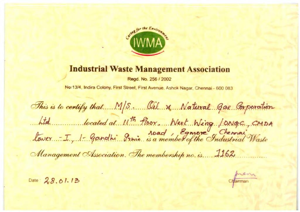
212 An I - 1
213 An I - 2