Prairie Hydrology. If weather variability increases, this could degrade the viability of many aspects of ecosystems, human activities and economy
|
|
|
- Vivien Rogers
- 5 years ago
- Views:
Transcription


")
1 Prairie Hydrology John Pomeroy, Xing Fang, Robert Armstrong, Tom Brown, Kevin Shook Centre for Hydrology, University of Saskatchewan, Saskatoon, Canada Climate Change for the Prairies? Highly variable and harsh climate has limited settlement and development possibilities over the last century. If weather variability increases, this could degrade the viability of many aspects of ecosystems, human activities and economy However, moderation of some variability (less cold or dry weather) might open up new possibilities for the Prairies 1

2 Prairie Climate is Variable and Extreme 1 April Average Temperature, Saskatoon 9 Air Temperature C Year Drought


3 THE DIRTY THIRTIES "Saskatchewan, Saskatchewan, there's no place like Saskatchewan; we sit and gaze across the plains and wonder why it never rains " These words from the song Saskatchewan were written during the 193s. Prairie Snow 3


4 Prairie Rain Fishing Lake Flooding, Spring 27 4
 basins that are locally important but non-contributing to river systems that drain the")
5 North American Regional Predictions Climate Difference from to A1B balanced scenario IPCC 27 Prairie Hydrology Major river flow is primarily from mountain runoff, but prairie runoff supplies smaller rivers, streams, wetlands, and lakes Prairie Runoff forms in internally drained (closed) basins that are locally important but non-contributing to river systems that drain the prairies, OR drains directly to small prairie rivers (Battle, Souris, Assiniboine) >8% of runoff during snowmelt period Redistribution of snow to wetlands and stream channels in winter is critical to formation of runoff contributing area Drainage of small streams and wetlands ceases completely in summer when actual evaporation* consumes most available water. Baseflow from groundwater often nonexistent. Prairie streams are almost completely ungauged and often altered by dams, drainage, water transfers, etc *evaporation used here as transpiration + evaporation + sublimation 5


6 Prairie Runoff Generation Snow Redistribution to Channels Spring melt and runoff Dry non-contributing areas to runoff Water Storage in Wetlands PRAIRIE HYDROLOGY Limited Contributing Areas for Streamflow Localized hydrology affected by poor drainage, storage in small depressions Non-contributing areas for streamflow extensive in Canadian Prairies 6
7 Prairie Hydrology don t blink Smith Creek, Saskatchewan Streamflow m 3 per second Average High Year 2 Low Year 27-Dec 27-Nov 28-Oct 28-Sep 29-Aug 3-Jul 3-Jun 31-May 1-May 1-Apr 2-Mar 31-Jan 1-Jan Modelling Prairie Hydrology Need a physical basis to calculate the effects of changing climate, land use, drainage Need to incorporate key prairie hydrology processes: snow redistribution, frozen soils, spring runoff, wetland fill and spill, noncontributing area Frustration that hydrological models developed elsewhere do not have these features 7
8 Cold Regions Hydrological Modelling Platform: CRHM Modular purpose built from C++ modules Modules based upon +45 years of prairie hydrology research at Univ of Saskatchewan Hydrological Response Unit (HRU) basis natural landscape units with horizontal interaction, ponds, no need for stream HRUs assumed to represent one response type, basis for coupled energy and mass balance HRUs connected aerodynamically for blowing snow and via dynamic drainage networks for streamflow Incorporate wetlands directly using fill and spill algorithm CRHM Module Development DATA ASSIMILATION Data interpolation to the HRUs SPATIAL PARAMETERS Basin and HRU parameters are set. (area, latitude, elevation, ground slope, aspect) PROCESSES Infiltration into soils (frozen and unfrozen) Snowmelt (prairie & forest) Radiation level, slopes Evapotranspiration Snow transport Interception (snow & rain) Sublimation (dynamic & static) Soil moisture balance Pond water balance Sub-surface runoff Routing (hillslope & channel) 8


9 Prairie Hydrology Studies Bad Lake IHD: semi-arid, well drained St Denis: sub-humid internally drained non-contributing zone Lethbridge Ameriflux Station: semi-arid Smith Creek: sub-humid, wetland dominated, variable contributing area Drought and Climate Change Studies Creighton Tributary of Bad Lake -well drained semi-arid upland St. Denis National Wildlife Area -internally drained subhumid upland 9


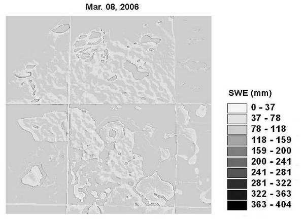
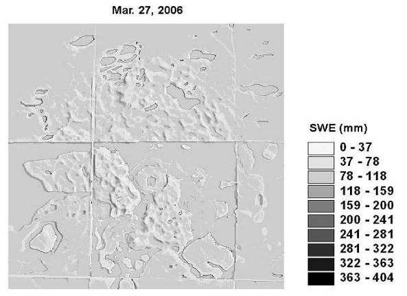
10 Spatially Distributed Snow Redistribution Snow mass balance equation St Denis, Saskatchewan Results Spatially distributed SWE Fang and Pomeroy, HydrolProc, 29 1

11 Spatially distributed SWE cont Spatially distributed SWE cont 11

12 Spatially distributed SWE cont Spatially distributed SWE cont 12
13 CRHM HRU Configurations Fallow Stubble Cultivated Grass Coulee Wooded Wetland Stream Pond Creighton Tributary, Bad Lake Wetland 19, St Denis Prairie wheat field snow accumulation test Water Balance Creighton-Stubble 1981/82 mm CRHM Runoff CRHM Snowfall CRHM Infiltration CRHM M elt CRHM Ground SWE M easured M elt M easured SWE Nov 2-Dec 29-Jan 1-Mar 19-Apr 13


14 Snowmelt Runoff Test at Bad Lake Snow Accumulation in Drought and Wet Years at Wetland 19, St Denis 14
15 Effect of Warmer Winter on Blowing Snow and Snow Accumulation Bad Lake mm water equivalent SWE (Normal) SWE(5 C Rise in Temp) Sublimation (Normal) Sublimation (5 C Rise in Temp) 1 1/1/ /1/1974 3/11/1974 3/12/ /1/ /2/1975 3/3/ /4/1975 Fang and Pomeroy, 27 Effect of Drier Winter on Blowing Snow and Snow Accumulation Bad Lake mm water equivalent SWE (Normal) SWE(5% Decrease in Snowfall) Sublimation (Normal) Sublimation (5 % Decrease in Snowfall) 1 1/1/ /1/1974 3/11/1974 3/12/ /1/ /2/1975 3/3/ /4/
16 Cold Season Hydrology Bad Lake Climate Sensitivity Test Drought Factors -Winter Precipitation -Winter Air Temperature -Fall Soil Moisture -Summer Vegetation Growth Drought Response -Winter Evaporation -Maximum Snowpack -Spring Infiltration -Spring Stream Discharge Fang and Pomeroy, 27 Snowmelt Runoff over Frozen Soils Bad Lake: Semi-arid SW Saskatchewan Soil moisture is FALL soil moisture Snowmelt runoff is Spring Physically based Infiltration equations (Zhao & Gray, 1999) Cold Regions Hydrological Model 16
17 Prairie Streamflow and Climate Change First more, then less? Toyra et al. 24: median of three most reliable climate change scenarios suggests increases in annual prairie winter temperature and precipitation from the average: ºC and +11% ºC and +15.5% Using this scenario in Bad Lake Research Basin (SW Sask) with CRHM results in a 24% rise in 25 spring runoff, but a 37% drop by 28, compared to the basin runoff (54 mm) in spring of 1975 (Fang and Pomeroy, 27). Climate Change Winter Snow Winter Snow Accumulation at Bad Lake, SK Normal SWE (Winter of 1974/75) SWE (Winter of 249/5) SWE (Winter of 279/8) 1 1/1/ /1/ /1/ /11/ /11/1974 1/12/ /12/1974 7/1/ /1/1975 4/2/ /2/1975 4/3/ /3/1975 1/4/ /4/ /4/1975 SWE (mm) 17
18 Climate Change Spring Runoff Spring Runoff from Creighton Tributary at Bad Lake, SK Normal Spring Runoff (Spring of 1975) Spring Runoff (Spring of 25) Spring Runoff (Spring of 28) 1 1/1/ /1/ /1/ /11/ /11/1974 1/12/ /12/1974 7/1/ /1/1975 4/2/ /2/1975 4/3/ /3/1975 1/4/ /4/ /4/1975 Runoff (mm) Soil Moisture, Evaporation and Runoff Should be Easy! If R =, then P = E Not that easy.. E = P - S This is when sub-surface coupling becomes critical to the atmosphere Storage is dynamic during dry periods. Decreasing surface area of open water, increased root depths, increased depth to water table Seasonality most runoff is from snowmelt (snowfall), most evaporation is from rainfall + snowmelt Precipitation or melt at times of low evaporative energy goes into storage (including soil moisture) or runoff Episodic Events runoff removes water before it can infiltrate and form storage for evaporation. Snowmelt over frozen soil Intense rainfall rates (convective storms). 18
19 Simulation in a Dry Period CRHM: Cold Regions Hydrological Model Rainfall Evaporation Infiltration Interception/Ponding Recharge Zone Soil Surface Runoff Sub-surface Runoff Groundwater Groundwater Flow Page 1 of 1 The Cold Regions Hydrological Model Platform C:\CRHM\Bad_DLL_7374_pasture.prj cum_soil_runoff (1) cumhru_rain(1) hru_cum_actet(1) soil_moist(1) 18 (mm) P>E R > S little change Energy control on evaporation 6 8 No Drought /5/ /6/1974 3/6/ /7/1974 3/7/ /8/ /8/
20 Page 1 of 1 The Cold Regions Hydrological Model Platform C:\CRHM\Bad_DLL_7374_pasture.prj cum_soil_runoff (1) cumhru_rain(1) hru_cum_actet(1) soil_moist(1) (mm) P/3 T + 3 o C R = E > P S declines Plant, roots and soil moisture Become important Early Drought 4 31/5/ /6/1974 3/6/ /7/1974 3/7/ /8/ /8/1974 Page 1 of 1 The Cold Regions Hydrological Model Platform C:\CRHM\Bad_DLL_7374_pasture.prj cum_soil_runoff (1) cumhru_rain(1) hru_cum_actet(1) soil_moist(1) (mm) P/3 T + 3 o C Si/4 R = E P S depleted Soil moisture critical and limiting 6 Full Drought /5/ /6/1974 3/6/ /7/1974 3/7/ /8/ /8/1974 2
21 Lethbridge Ameriflux Site (21) Synthetic Drought Progression No Drought mm of water 1 st Summer Full Drought Rainfall Evaporation Storage Change Runoff


22 Smith Creek Hydrology Study Problem: Inability to reliably model the basins of the Upper Assiniboine River and other prairie basins where variable contributing area, wetlands, nonsaturated evaporation, frozen soils, snow redistribution and snowmelt play a major role in hydrology. Objectives Develop a Prairie Hydrological Model computer program that can simulate the response of streams, wetlands, and soil moisture to weather inputs for various basin types. Evaluate the model performance in Smith Creek by comparing to observations of streamflow, wetland extent, and snowpack. Use the Prairie Hydrological Model to estimate the sensitivity of streamflow, wetland water storage, and soil moisture to changes in drainage and land use. Instrumentation of Smith Creek Completed Summer 27 Hydrometeorological Station 11 dual rain gauges 7 wetland level recorders 22


23 Main Hydrometeorological Station Temperature, humidity, wind speed, shortwave radiation, longwave radiation, soil moisture, soil temperature soil heat flux, snow depth, rainfall, snowfall Telemetry of Hydrometeorological Data to Website community access Telemetry to U of Sask website 23


 2 15 1 5")

24 Snow and Wetland Surveys Streamflow over Time 3 25 Smith Creek Annual Streamflow Top 4 years for streamflow since 1995 Annual Streamflow (m 3 )
25 Peak Flow over Time Maximum Daily Discharge (m 3 /s) Maximum Daily Discharge of Smith Creek during Top 6 peak daily flows since Changing Climate? 5 Mean Annual Air Temperature at Yorkton Mean Annual Temperature ( C) y =.239x R 2 =.44 Warming but high variability An nual R ainfall an d Sn ow fall at Yorkto n 5 Rainf all (mm) Snow f all (mm) No trend in rainfall and snowfall

26 Drainage of Wetlands? Drainage of Wetlands? 26


27 Modelling Approach Smith Creek Basin Characteristics Drainage Network Spot Image 27

 HRU Configuration for Smith")
28 CRHM Prairie Hydrological Model Configuration Flow Chart in Cold Regions Hydrological Model Platform (CRHM) HRU Configuration for Smith Creek 28


29 Parameterisation without Calibration: LiDAR DEM to Calculate Depression Storage Derivation of Wetland Depressions for Basin 29
30 Remote Sensing Supervised Classification LT-2/SCR-4 LR-5 SCR-8 SCR-9 CRHM Tests Smith Creek No Calibration Snow Accumulation (mm SWE) Observed SWE vs Simulated SWE at Smith Creek Sub-basin 1 Fallow Obs. SWE Channel Obs. SWE Wetland Obs. SWE Fallow Sim. SWE Channel Sim. SWE Wetland Sim. SWE 7-Feb 18-Feb 29-Feb 11-Mar 22-Mar 2-Apr 13-Apr 28 Volumetric Soil Moisture Volume tric Soil M oisture at Smith Cree k during Spring Snowmelt Pe riod Observed Simulated 22-Mar 31-Mar 9-Apr 18-Apr 27-Apr 6-May 28 3

31 Runoff Prediction: No LiDAR & Calibration = old basin LiDAR & No Calibration = new basin Smith Creek Discharge with LiDAR Uncalibrated and No LiDAR Calibrated Parameters Conclusions Possible to model Prairie hydrology without calibration using physically based landscape scale simulations. Prairies are expected to become warmer and wetter with an initial increase in spring runoff followed by a substantial decrease in spring runoff generation later in the 21 st Century. Drought sensitivity is extreme which will lead to magnification of drought-wet cycles in streamflow responses. Drainage is increasing streamflow and peak flow in wet and normal years 31