Powel Shoreline Restoration Design Project Project # N Final Report May 20, 2011
|
|
|
- Peregrine Eaton
- 5 years ago
- Views:
Transcription
1
2 Powel Shoreline Restoration Design Project Project # N Final Report May 20, 2011 Report Prepared for: The Bainbridge Island Land Trust Prepared by: Jim Brennan, Project Manager & Coastal Geologic Services Contributing Authors: Jim Brennan, Washington Sea Grant Brenda Padgham, Bainbridge Island Land Trust Engineering and Design: Coastal Geologic Services Jim Johannessen Andrea McLennan Jon Waggoner Alexis Blue Ted Hammer, P.E., WGC, Inc. Vegetation: Northwest Ecological Services Michele Bodtke Molly Porter Cultural and Historical Resources: Cultural Resource Consultants Glenn Hartmann Bainbridge Island Land Trust 221 Winslow Way West, #103, P.O. Box Bainbridge Island, WA (206)
3 ACKNOWLEDGEMENTS The successful outcome of this project would not have been possible without the support and active participation by a very large and diverse set of people. We are particularly appreciative of the Powel family members the landowners for their vision, dedication to conservation and restoration of their shoreline property, willingness to actively participate in the development of a restoration design, learning about how to do that with the project sponsor and other stakeholders, and for their patience throughout this process. We recognize the pride and love they have for their beautiful property and were completely honored to work with Ann Powel, who has lived on this property for nearly 57 years and was open and willing to consider all information presented to her. We would also like to thank the participants of stakeholder meetings (and reviewers of this document), including the Powel family members (Ann Powel, Jake Powel, Dorothy Babe Kehres and Jeff Powel), Rich Brooks (Suquamish Tribe), Doris Small and Chris Waldbillig (Washington Department of Fish and Wildlife), Frank Stowell (Bainbridge Island Land Trust), Jess Jordan (U.S. Army Corps of Engineers) and Jennifer Sutton (City of Bainbridge Island), for their ideas, attention to detail and active participation in the deliberations and selection of a restoration design. We appreciate their recognition of what a unique opportunity this project represented to restore a large segment of privately owned shoreline in Puget Sound and for wanting to be a part of ensuring this project is a success. All the stakeholders took time out of their busy lives to participate because of the special nature of this project. Special thanks go to Dennis Lewarch, Suquamish tribal historic preservation officer, and Paul Dorn, Suquamish tribal biologist. Dennis took the time to visit the property on a number of occasions to help guide us through many aspects of archaeological issues we needed to know and understand. Paul graciously included the Powel site in his routine beach seining surveys to help initiate monitoring and provide some baseline fish data. Glenn Hartman with Cultural Resources Consultants also helped guide us through our cultural resources survey, educating us along the way and bringing to the table his vast knowledge of local historical and cultural resource items we needed to weigh when considering our design alternatives. We also feel extremely privileged to have had the expertise of the Coastal Geologic Services team, headed by Jim Johannesen, which brought its expertise on geomorphic, shoreline and restoration alternatives to our project. Their interaction with our stakeholder group, especially the Powel family, was always done in a respectable, inclusive and open manner, even when tough decisions about design alternatives needed to be made a key when working with private landowners who have strong ties to their land. Dave Caudill, Washington State Recreation and Conservation project manager, was very helpful in ensuring that the contracting and funding for this project went smoothly and in resolving questions or coordinating with other entities, such as the Washington State Department of Archaeology and Historic Preservation. We would like to acknowledge Kathy Peters, coordinator for the West Sound Watersheds Council, and members of the technical advisory group for helping acquire funding for this project. Additionally, we thank Pete Granger at Washington Sea Grant, who recognized this project as a fit with the marine advisory services group. Finally, we acknowledge the board of directors of the Bainbridge Island Land Trust for its vision and support, and for its members willingness to work outside their normal range of conservation actions by supporting a nearshore restoration project of this scope and scale. Powel Shoreline Restoration Design Project # N Final Report i
4 TABLE OF CONTENTS Acknowledgments... i Executive Summary... v Introduction... 1 Background and Genesis of this Project... 2 Description of the Problem Regional Context... 6 Early Evaluation of the Problem at the Project Site... 8 Goals and Objectives for Addressing the Problem Funding Process Used to Meet Objectives Methods Site Surveys and Assessments Coastal Geomorphic and Engineering Survey and Assessment Vegetation Survey and Assessment Cultural Resources Survey Alternatives Analysis and Development of a Restoration Design Benefits Analysis Results and Discussion Site Surveys and Assessments Geomorphic and Engineering Survey and Assessment Rationale and Restoration Project Description by Reach Engineering Vegetation Survey and Assessment Cultural Resources Survey and Assessment Alternatives Analysis and Development of a Restoration Design Benefits Analysis Sea-level Rise Benefits Projections Permitting Monitoring Cultural Resources Monitoring Plan and Contingencies for Discovery Restoration Monitoring Plans Vegetation Monitoring Plan Physical and Biological Monitoring Plan Cost Summary Methods for Determining Costs and Estimates Engineering Plan Cost Estimate Results and Limitations Vegetation Plan Cultural Resources Monitoring Plan and On-site Monitoring Conclusions and Recommendations References Powel Shoreline Restoration Design Project # N Final Report ii
5 TABLES, FIGURES AND APPENDICES List of Tables Table 1. Powel restoration design project stakeholder group members Table 2. Stakeholder group members and interests Table 3. Other participants in stakeholder group meetings Table 4. Summary of stakeholder interests and concerns Table 5. Summary decision matrix attributes used to track proposed design changes Table 6. Nearshore habitat areas and characteristics for the Powel site Table 7. Tidal datums for NOAA Seattle station (# ) for the present epoch Table 8. Chronology of shore armor installation by shoreline reach at the Powel property Table 9. General descriptions and characteristics of each site reach, including shore modifications present Table 10. Reach 1 planting specifications Table 11. Reach 2 planting specifications Table 12. Reach 3 planting specifications, Area E Table 13. Reach 3 planting specifications, Area F Table 14. Reach 4 planting specifications Table 15. Reach 5 planting specifications Table 16. Reach 6 planting specifications Table 17. Reach 7 planting specifications Table 18. Reach 8 planting specifications Table 19. Summary of restoration design alternatives Table 20. Habitat areas by shore reach, before and after armor removal Table 21. Comparison of restored habitat areas and future projections with sea-level rise Table 22. Vegetation 10-year maintenance tasks Table 23. Cost method A quantities and costs Table 24. Cost method B quantities and costs Table 25. Powel restoration project total cost summary List of Figures Figure 1. Location map Figure 2. Site shoreline inventory map details overlay on aerial photo of Powel site Figure 3. Aerial photo of project site, with insert of 1868 T-Sheet from original survey to illustrate change in landform as a result of site development Figure 4. Typical cross-section for benefits analysis Figure 5. Area geology map Figure 6. Net shore-drift map Figure 7. Site shoreline reaches and armor Figure 8. Existing site conditions overview (Appendix 10) Figure 9. Projected habitat areas for 2050 site plan (Appendix 10) Figure 10. Projected habitat areas for 2050 site plan with sea-level rise (Appendix 10) Powel Shoreline Restoration Design Project # N Final Report iii
6 Appendices Appendix 1. Summary of project costs Appendix 2. Project tasks and timelines Appendix 3. Vegetation report Appendix 4. Cultural resources report Appendix 5. Final engineering drawing sheet set Appendix 6. Subsurface soil exploration technical memo Appendix 7. Geotextile specification technical memo Appendix 8. Return wall stability calculations Appendix 9. Fish screening criteria Appendix 10. Benefits Analysis Maps Powel Shoreline Restoration Design Project # N Final Report iv
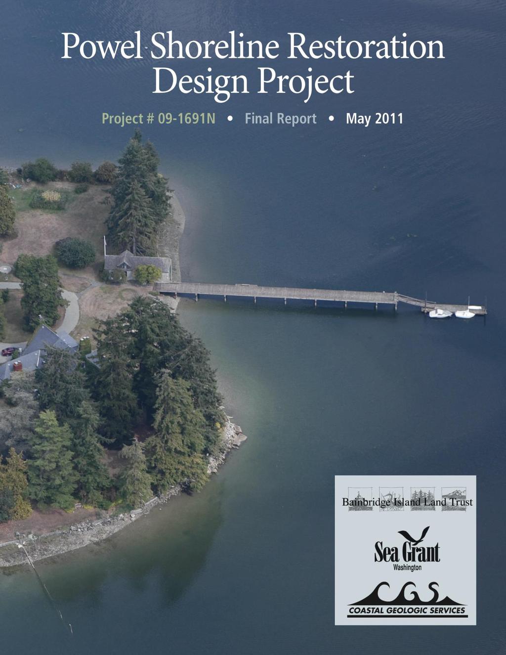
7 Executive Summary The Powel Shoreline Restoration Design Project, RCO Project N, produced a design plan to restore more than 1,500 lineal feet of nearshore habitat on privately owned property in Port Madison Bay, Bainbridge Island, Washington. The project was created following a request for assistance by the Powel family and grew into a shore and riparian restoration plan, involving armor removal, native vegetation plantings and the engagement of a willing private shoreline property landowner and a number of stakeholders. Ann Powel and her family have resided on their property since With the exception of small portions of the northeast and western shores, the entire 1,800 lineal feet of shore that bounds the Powel site is armored with a variety of armoring materials, with shore modifications appearing to have begun in the 1920 s and continued to present day. The armor (e.g., bulkheads, riprap), most of which is in a state of disrepair, and associated backfill are located within the intertidal zone at various tidal elevations, which results in a loss of shallow water habitat, loss of salt marsh and disruption of natural erosion and sediment transport and deposition. In addition to the armor, most of the riparian corridor has been altered by replacement of native vegetation with grasses and other nonnative vegetation. The Powel property is not unlike other residential properties throughout the Puget Sound region, where development pressures have altered approximately 90 percent of shorelands from their historic conditions. The types and extent of development that have occurred, and continue to occur, have a significant effect on the health and integrity of nearshore marine habitats, habitat important to Endangered Species Act (ESA)-listed Chinook and chum salmon, bull trout and orcas as well as forage fishes, which are important prey resources for these species. Shore armor and alterations of riparian areas result in the loss and degradation of nearshore habitats. Restoration is a key component of the salmon recovery management strategy, and is supported by local, state and federal agencies with management responsibilities, Native American tribes, nongovernmental organizations and other conservation organizations. Bainbridge Island Land Trust, a nonprofit conservation organization whose work is focused on Bainbridge Island, Kitsap County, Washington, has a relationship with the Powel family, who placed a conservation easement on their property with BILT in The Powel family asked for assistance from BILT in 2009 regarding alternatives to bulkhead repair or reconstruction. Recognizing the potential to regain important nearshore habitat, Bainbridge Island Land Trust began a collaborative process of evaluating the potential for restoration of the Powel shoreline, working with the landowners and representatives of the city, county and state by conducting a preliminary assessment. Nearshore experts, representatives of the West Sound Watersheds Council and others conducted site visits to evaluate the site and help develop a restoration concept. BILT facilitated discussions among the various entities and provided a conceptual proposal to the landowners for their approval to move forward with a grant-funding proposal. The BILT successfully applied for and received a Salmon Recovery Funding Board (SRFB) grant for $127,216 from the Recreation and Conservation Office (RCO) to support the project elements. The grant is a design-only project, and per the grant terms with RCO, 100 percent of Powel Shoreline Restoration Design Project # N Final Report v
8 the costs covered under the grant terms were reimbursable. This unique grant does not require match or in-kind contributions from the project sponsor or partners but requires that the grant work be completed in 18 months. The project expiration date is June 1, This project was designed to be inclusive, allowing broad participation of a number of parties to help inform the restoration design, beginning with the early stages and throughout the process. The project sponsor believed the goals of the project were obtainable if multiple parties helped inform the decisions about the shoreline design along the way, rather than comment on the design after completion. Deliverables of this project include: Implementation of a process that engaged a diverse range of stakeholders to familiarize them with the project background and utilize their input in the restoration design. The stakeholder group included representation from the Powel family, Washington Department of Fish and Wildlife, City of Bainbridge Island, Suquamish Tribe, U.S. Army Corp of Engineers, and Bainbridge Island Land Trust. The stakeholder group met eight times during a 12-month period to review various drafts of the design and specific design details, ask questions, recommend revisions and resolve differences in preferences for alternative restoration actions, including no action or limits on proposed actions. Additional site visits and communications via and phone contact were made with stakeholders by the project manager and sponsor during the project period to provide additional information, clarification, meeting materials and work products for review and to address any outstanding questions or concerns raised by stakeholders. The consultant design team provided plan revisions until the stakeholder group ultimately agreed on a final design in March Education of stakeholders on restoration goals and objectives generally and specifically to this site. Outreach to the BILT board, the 700-plus BILT membership (publicity) and adjoining landowners also took place. Contracting for professional management and design services to complete site surveys and reporting on the engineering and cultural/historical resource elements, which need to be addressed for implementation of the restoration design. Jim Brennan, Marine Habitat Specialist with Washington Sea Grant, provided project management, education and ecological assessment services. Coastal Geologic Services and its subcontractors provided coastal geomorphic, engineering design and vegetation restoration plan services. Cultural Resource Consultants provided archeological and historic survey assessment services. Completion of an analysis of alternatives for restoration of the site, using input from stakeholders and outside professional contractors, to arrive at a preferred restoration alternative. Site surveys and assessments, including coastal geomorphic, geologic and engineering conditions, vegetation and cultural resources were conducted to determine baseline conditions and opportunities and potential constraints for restoration. The results of these analyses produced a set of recommended restoration alternatives to the stakeholder group for their review and evaluation. Findings of this analysis concluded that wave energy and erosion potential on this property was low, and shoreline armoring could be removed without impacts to existing infrastructure. Production of a final design, including engineered drawings and riparian vegetation enhancement plan, ready for use in the implementation phase of the restoration project (yet to be funded). The final design includes removal of more than 1,500 lineal feet of shore Powel Shoreline Restoration Design Project # N Final Report vi
9 armor, an anticipated two-fold increase in salt marsh habitat area and enhancement of approximately 32,795 square feet of riparian area, which will restore nearshore marine processes and functions that are of benefit to fishes and wildlife, and create a more natural and resilient shore. The design also provides protection for existing infrastructure through the construction of return walls (where needed) and allows for compatible living conditions for the landowners. In addition, a unique feature of the analysis and design was the consideration of sea level rise over time to help plan for and project potential benefits of restoration, as well as inform the restoration design. Provision of recommendations for monitoring the site. This includes the development of a monitoring plan, monitoring parameters and suggested methods. Initiation of permitting for the project. A pre-application conference was conducted with the City of Bainbridge Island, and full permit applications have been or will be submitted to the City of Bainbridge Island, Washington Department of Fish and Wildlife and U.S. Army Corps of Engineers. Preparation of a final report, including cost estimates, to be used for project implementation. Cost estimates for implementing the engineering component of this restoration design, ranging from approximately $140,000 to more than $400,000, were based on different estimation approaches used by the engineering contractor (Coastal Geographic Services) for this project and several outside marine contractors. Since the estimate of about $210,000 provided by the project design team fell in the approximate middle of the range of estimates, we feel it is a good estimate, although the actual cost will depend upon the implementation approach used, and some additional costs may need to be included for project management, administration, monitoring and reporting. The total cost of restoration implementation, including revegetation and archaeological monitoring, is estimated at approximately $305,000. At about $300 per foot, the total cost to replace the now-failing shore armor at this site would be about $462,200. Therefore, the proposed restoration design offers an incentive to the landowners, as well as economic and ecological benefits to society. This final design and results of the restoration design process offer a rare opportunity to restore nearshore intertidal and riparian habitats and demonstrate that conducting nearshore restoration on private shorelands is feasible and achievable. While this project was conducted to produce only a design, the process has engaged a diverse group of stakeholders, who now have an interest in its implementation. The project team feels that this project has a good chance of continued support and hopes to realize the ultimate goal: full implementation. Getting there will still require a substantial amount of work by the project sponsor, including: funding acquisition, completing the permitting process, preparation of bidding documents and review of bids, selection of contractors for the various aspects of implementation, scheduling and coordination with the contractors and landowners, monitoring and reporting. However, completion of the design phase of work is a giant step forward toward restoring this shore and setting an example for restoration throughout Puget Sound. Powel Shoreline Restoration Design Project # N Final Report vii
. The Powel property consists of two parcels, including nearly 7.")


10 Introduction The Powel Shoreline Restoration Design Project (Recreation and Conservation Office Project # ) was conducted to produce a 100 percent design plan to restore approximately 1,500 lineal feet of nearshore habitat on privately owned property in Port Madison Bay, Bainbridge Island, Wash. (Figure 1). The Powel property consists of two parcels, including nearly 7.5 acres of land, which is surrounded by marine shoreline on the east, south and west boundaries of the property. The project is located at and Broom St. N.E., Bainbridge Island, Washington. This project report summarizes the design phase of a large shoreline restoration project on private residential property. When implemented, the design recommends removal of failed or poor-condition shoreline armoring, along with riparian vegetation enhancement, to result in a net gain of enhanced and restored Property Description and Location This project occurs in Port Madison Bay, Bainbridge Island, within Central Puget Sound, Kitsap County, Washington. Section 34, Township 26 North, Range 2 East, Willamette Meridian. Kitsap County tax parcels: and estuarine, nearshore (beach, bank and marine riparian) habitats that are critically important to forage fishes, juvenile salmonids and other fishes and wildlife. The project will restore and or enhance the natural character and ecological attributes of the shoreline to allow for natural nearshore processes, enhance ecological structure and functions to increase natural functions and values, provide for a more resilient shoreline and demonstrate how such actions may be taken on privately owned shorelands in a way that balances restoration with residential use. Examples of existing armor on the Powel property. Under the restoration design, the armor in these areas would be removed. Powel Shoreline Restoration Design Project # N Final Report 1
 was established in 1989 to permanently preserve and protect the diverse ecosystems on Bainbridge Island through land")
11 Figure 1. Location map of project site. Background and Genesis of this Project The Bainbridge Island Land Trust (BILT) was established in 1989 to permanently preserve and protect the diverse ecosystems on Bainbridge Island through land protection agreements with private landowners through land acquisition and restoration efforts. BILT s 45 currently held conservation easements on private and publicly owned lands permanently protect nearly 700 acres of forest, wetland, shoreline, agricultural and other lands with conservation value. The Powel family has owned two shoreline parcels on Bainbridge Island since In 1992, John and Ann Powel placed permanent protections on their property through a conservation Powel Shoreline Restoration Design Project # N Final Report 2
12 easement with the Bainbridge Island Land Trust. Since that time, BILT has had a formal and positive relationship with the Powel family. When John and Ann Powel placed a conservation easement on their 7.5 acres, they permanently protected the nearshore and upland environment from extensive development. The Powel Shoreline Restoration Design Project grew out of a request by the Powel family in 2008 for advice on rebuilding failing bulkheads on their shoreline and asked if there were a more conservation-oriented solution for protecting existing infrastructure on their property. Brenda Padgham, BILT stewardship director, and Peter Namtvedt Best, City of Bainbridge Island (COBI) planner, suggested that the family consider a restoration alternative to rebuilding their bulkheads. The Powel family members currently living on the property, including Ann Powel, her daughter Dorothy ( Babe ) Kehres and Dorothy s husband Larry Kehres, agreed to consider restoration options and requested additional information. An initial inventory of shoreline armoring structures on Bainbridge Island, including the Powel property (Figure 2), had been performed by the City of Bainbridge Island (Williams et al. 2004) indicating that a majority of the approximately 1,800 lineal feet of shoreline of the Powel property is armored, and about 70 percent of that armoring was in failed or poor condition. The landowners identified areas of the shoreline where they were supportive of potential restoration efforts that would remove a majority of existing failed or poor-condition bulkheads and would restore intertidal and riparian habitat. Early in the process, the landowners communicated that protecting existing residences and infrastructure, as well as meeting restoration goals, were important. Powel Shoreline Restoration Design Project # N Final Report 3

13 Figure 2. Site shoreline inventory map details (from Williams et al. 2004), overlay on aerial photo of Powel site. The Stewardship Committee and Board of Directors of BILT reviewed the potential for a restoration project on the Powel property. As BILT had not taken on a restoration project of this scope and size before, careful consideration and definition of BILT s role in the project was discussed. COBI was not in a position at that time to take on sponsorship of a project of this scope and size. BILT recognized that an opportunity to restore this amount of shoreline on private property with a willing landowner was rare. Participating in efforts leading to the recovery of Puget Sound and shoreline ecosystems is identified in BILT s mission and five-year strategic plan. The BILT board agreed in May 2009 to pursue input and support from area shoreline ecologists and experts to evaluate the potential for a restoration project. Powel Shoreline Restoration Design Project # N Final Report 4
14 During the spring and summer of 2009, BILT and COBI, which agreed to a partnership role, arranged for outside nearshore experts to visit the site to evaluate and report on its restoration potential. The Powel family hosted representatives from state and county resource management agencies, the University of Washington and the Suquamish Tribe. The resource managers recommended that the restoration project be moved forward as a project proposal for grant funding through the West Sound Watersheds Council, the lead entity and coordinator for Salmon Recovery Funding Board (SRFB) grants in WRIA 15. The West Sound Watersheds Council, along with their technical advisory group, ranked the project highly on their list of potential restoration actions to be put forward for funding. The West Sound Watershed Council (WSWC) is responsible for evaluating and coordinating restoration projects, with a focus on salmon restoration, proposed for state funding within their region. The WSWC supports a technical review panel, comprising restoration and resource management professionals, who evaluate project proposals, provide feedback to improve projects and ultimately rank all proposals within their region to prioritize the list of projects for funding. They also provide technical assistance and guidance in the development of funding applications. The WSWC was supportive of the concept and recommended submission of a grant proposal for funding a restoration design. The WSWC tracks the progress of the local grant proposals, coordinates and attends site reviews with project sponsors and SRFB representatives and provides assistance for improving the grant proposal. The restoration actions proposed for this project fit within the local and regional salmon recovery and restoration planning efforts. The Bainbridge Island Nearshore Assessment (Williams et al. 2004) ranked Port Madison Bay as mostly moderate to high impact, which makes it a focus area for nearshore restoration. The nearshore environment has been identified in both the West Sound Watersheds Salmon Recovery Plan (2004) and the Puget Sound Action Agenda (2009). Specifically, key issues and action recommendations for Port Madison include: Shoreline armoring is a major limiting factor for re-establishing shoreline processes and functions. Shoreline armoring is a major limiting factor for salmon recovery. Port Madison historically contained significant fringe marsh; most has been lost as a result of filling and shoreline armoring. Sediment supply and sediment transport and deposition have been disrupted as a result of shoreline armoring. Native riparian vegetation and riparian ecological functions have been lost as a result of shoreline development. Restoring natural processes and functions will require removal of armoring and restoring shoreline vegetation. Implementing stewardship incentives will increase private landowner restoration projects. Providing landowner education will encourage removal of bulkheads and other activities to protect and restore shoreline habitats. Powel Shoreline Restoration Design Project # N Final Report 5
15 The proposed restoration effort strives to address all of the above priorities and also offers additional benefits. The protective conservation easement already in place on the Powel property increases the certainty that future high-density development or other high-impact land uses on the parcels will not impact restoration efforts. In addition, to fulfill its obligation to ensure conservation values are maintained, BILT monitors all of its conservation easements each year. The ongoing and perpetual presence of BILT on the property will help ensure the success of the proposed restoration project. This project also provides an opportunity to showcase how restoration can occur on private shorelands, while remaining compatible with residential living on the shores of Puget Sound. Description of the Problem Regional Context The Puget Sound region has experienced substantial growth and development in recent decades, and human population projections indicate ongoing increases. Because shoreline areas are highly desirable for commerce, recreation and residential living, these areas will continue to receive increasing development pressures. Shorelines throughout the Puget Sound region have been subjected to a variety of development pressures, and most have been altered from their historic conditions. Alterations to shorelines range from historic logging practices (e.g., conversion of vegetation communities and structure) and minor conversion for human habitation and use to complete alteration for residential and commercial purposes. While major urban water bodies focal points for commercial and industrial development account for less than 10 percent of the Puget Sound shoreline (Shipman 1997), the remaining 90 percent of the shoreline is available for residential development (Broadhurst 1998). Bainbridge Island is no exception, with nearly 80 percent of its shoreline having some form of development on it. Historically, many early residential homes along the shores were constructed for seasonal use and were relatively small structures (Carman and Small 2005). From early settler history through the early 1970 s, shoreline landowners were able to create or expand residential building lots by filling tidelands without much regulatory oversight (Carman and Small 2005). Such filling and creation of uplands necessitated shoreline armoring to prevent erosion of fill materials. As shoreline property values have increased, along with the sizes of residential and associated structures and year-round habitation of shoreline residences, the actual or perceived threat of shoreline erosion has prompted more landowners to armor shorelines. This has resulted in a significant increase in the amount of shoreline armoring and loss of intertidal, backshore and riparian habitats. The adverse impacts of shoreline armoring and other shoreline modifications associated with shoreline development have been well documented (e.g., Thom et al. 2004; Canning and Shipman 1995; Broadhurst 1998; Williams and Thom 2001; Williams et al. 2001; Toft et al. 2004; Brennan and Culverwell 2004; National Research Council 2007; Sobocinski et al. 2010; and others) and have been recently summarized in Shipman et al. (2010) and EnviroVision et al. (2010). The following four paragraphs, adapted from the 2010 EnviroVision report and other sources as cited, summarize the impacts of armoring and vegetation loss and capture the two key modifications being addressed by this restoration design. Powel Shoreline Restoration Design Project # N Final Report 6
16 Riprap, retaining walls (i.e., bulkheads), and other forms of shoreline armoring structures can have a number of adverse impacts on the marine shoreline environment. The adverse effects of these structures can occur through a variety of mechanisms that have been well documented. These adverse effects on beaches are particularly evident in areas where these structures have been constructed below the ordinary high water (OHW) elevation. The construction of these types of structures promotes loss of terrestrial, shallow water, and benthic habitat. The construction of bulkheads and associated activities also cause local erosion, new sediment deposits in the vicinity of the structure, turbidity and, hence, water quality degradation. New sediment deposits are often silty and thus can degrade forage fish spawning areas, smother benthic organisms and vegetation and reduce bottom habitat diversity. Bulkheads also promote erosion of the foreshore because waves can reflect off the face of these structures with sufficient energy to transport fine sediments along the shoreline or offshore. This erosion can be severe in many cases, leading to down-cutting (lowering) of the beach and the eventual loss of the higher elevation portion of the intertidal zone. Down-cutting may eventually undermine the bulkhead itself, leading to its eventual failure. Bulkheads can also interfere with the recruitment of sediment from bluffs and the transport of sediment within drift cells, starving adjacent beaches of sediment. These two mechanisms can lead to the gradual loss of fine sediments in the nearshore environment and lowering of the beach profile, leading to a loss of shallow water habitat. Over time, decreased inputs of sand and gravel-size sediment within an active drift cell can result in coarsening of nearshore substrate, potentially degrading forage fish spawning habitat. There are several additional mechanisms through which shoreline armoring can impact the nearshore environment, and they can be complex in nature. The cumulative impacts from multiple shoreline armoring projects are potentially significant, especially when considering other modifications in addition to shoreline armoring, such as vegetation removal, installation of impervious surfaces, overwater structures and filling intertidal areas. Shoreline armoring and other shoreline development practices result in the loss or reduction of native riparian vegetation (Brennan and Culverwell 2004; Brennan 2007). Marine riparian vegetation provides a number of important functions in the nearshore environment: habitat structure; shade; microclimate regulation; fish prey habitat; large wood and organic debris recruitment; habitat for numerous riparian dependent species; and corridors for wildlife movement and migration. Riparian vegetation also provides a number of well-documented ecological benefits, including filtering surface water runoff and associated sediments, nutrients and other pollutants and providing soil stability and stabilization of erosion-prone bluffs and shorelines. Such ecological functions are often considered ecological goods and services, in that they provide benefits to fish and wildlife (many of which are of economic importance for commerce and recreation) and to humans, through improved water quality improvements, more stable banks and bluffs and reduced erosion and landslides. Powel Shoreline Restoration Design Project # N Final Report 7
17 The 1999 Endangered Species Act listing of Chinook and chum salmon and subsequent listings of bull trout and orcas, in addition to the declining populations of many marine fishes and birds, have intensified the need and requirements for improved marine conditions and management strategies to reduce the threats associated with shoreline modifications. The widespread decline of native salmon populations in Puget Sound watersheds and the reduced quality and quantity of their aquatic habitats are indicative of the cumulative effects and unintended consequences of past and present land- and water-use decisions over the last 150 years (Ralph and Poole 2002). Juvenile salmon, particularly Chinook and chum, are highly dependent upon healthy nearshore ecosystems, which support their growth and survival. It is recommended that the recovery of Pacific salmonid habitats should involve a two-pronged strategy that emphasizes protection of the remaining intact aquatic systems while making intelligent, strategic decisions on restoring important ecological processes and functions of riparian and nearshore habitats. (Ralph and Poole 2002). While regional differences in the type and extent of shoreline development exist, it is clear that residential development and all its features (e.g., clearing, grading, filling, seawalls, bulkheads, docks) are incrementally and insidiously changing and reducing the amount of nearshore habitat in Puget Sound (Broadhurst 1998). Shoreline armoring and loss of riparian vegetation, in particular, have been identified as key disruptors in nearshore processes and significant contributors to the degradation and loss of nearshore habitats and species. By 1999, the ShoreZone Inventory (Washington State Department of Natural Resources [DNR] 2000) revealed that approximately one-third of the shoreline in Puget Sound had already been armored; shoreline armoring has increased since that time. As with many other local jurisdictions, COBI conducted a shoreline inventory and assessment (Williams et al. 2004) to determine the types of shoreline modifications and their associated impacts. At that time, approximately one-half of the shoreline, which is almost entirely composed of private residential properties, was already armored. Early Evaluation of the Problem at the Project Site One method for evaluating general changes to the shoreline is through a simple comparison of its current condition (e.g., see ShoreZone Inventory [DNR 2000] or local nearshore assessments) to the original survey maps, developed in the late 1800s by the U.S. Geodetic Survey. The U. S. Coast Survey, renamed the U. S. Coast and Geodetic Survey in 1878, mapped the Puget Sound nearshore at a reconnaissance level in the 1840s, and then at a more detailed scale (1:10,000 and 1:20,000) in the following decades. The agency created two map series: topographic sheets, commonly referred to as "T-sheets, concentrated on intertidal and supratidal areas; hydrographic sheets, or "H-sheets," showed soundings. More detailed mapping and analyses of local and regional geographic areas have also been conducted, revealing extensive modifications of shorelines, particularly as a result of private residential development, which occupies most of the Puget Sound shoreline. The most detailed set of shoreline inventory and assessment for Bainbridge Island and Port Madison Bay may be found in Williams et al. (2004). To inform the restoration design, the types and extent of alterations were determined by comparing the current condition of the subject property (Figure 3) to the 1886 T-Sheet image Powel Shoreline Restoration Design Project # N Final Report 8
, and the extent of fill and other alterations may be estimated by comparing the two images.")

18 (Figure 3 insert). The type and extent of armoring were mapped as part of the Bainbridge Island Nearshore Assessment (Williams et al. 2004), and the extent of fill and other alterations may be estimated by comparing the two images. This comparison serves as a basis for approximating what the shoreline landform would look like in its natural condition and for evaluating potential restoration and enhancement approaches. Based on information provided by the Powel family, a previous landowner in the 1930 s originally developed the saltwater pool area as a dry dock, which was created by filling intertidal and salt marsh areas and armoring the outside of the fill. Most of the rest of the shoreline was armored with rock and mortar walls during the same time period. Subsequently, various materials, including creosote-treated piles and timbers, rock riprap, concrete debris and a concrete wall, were used to fill and armor the remaining shoreline, with the exception of a couple of small segments on the northeastern and southern segments of shoreline. Figure 3. Aerial photo of project site, with insert of 1868 T-Sheet from original survey to illustrate change in landform as a result of site development. With the exception of a small portion of the northeast shoreline, the entire 1,800 lineal feet of shoreline that bounds the Powel site is armored with a variety of armoring materials. Shoreline modifications appear to have begun in the 1930s and have continued to present day. In addition to the development of the uplands (two houses, garage, carriage house, boathouse), shoreline modifications have included dredging and filling an intertidal area to create a dry dock (now a concrete-lined saltwater pool) and development of a large pier, a concrete boat ramp, a boat Powel Shoreline Restoration Design Project # N Final Report 9
19 launch rail system associated with the boathouse, stone and mortar walls, creosote-treated timber walls, concrete debris, a concrete wall and stone riprap walls. Most of the armoring is in a state of disrepair. The armoring and associated backfill are located within the intertidal zone at various tidal elevations, resulting in loss of shallow water habitat and salt marsh and disruption of natural erosion and sediment transport and deposition. In addition to the armoring, most of the riparian corridor has been altered by replacement of native vegetation with grasses and other nonnative vegetation. This has resulted in a loss of natural riparian structure and functions, such as feeding, refuge, breeding, temperature moderation, pollution abatement and prey production, which are important to nearshore fishes and wildlife. Some segments of the riparian area also contain large conifers and other native vegetation, which illustrate some of the remnant natural characteristics of this shoreline. The COBI Nearshore Assessment (2004) assigned a nearshore reach impact rating from armoring, construction, docks and other manmade modifications that alter nearshore function to all of the island s marine shoreline. The majority of the nearshore associated with the Powel property is identified as having a moderate/high impact rating, the second-highest impact rating for the island. A smaller section of the nearshore property is identified as low/moderate impact. Restoration of the Powel property shoreline will change the moderate/high impact rating to a low impact rating by eliminating most of the armoring and increasing the amount shallow intertidal habitat, salt marsh and riparian native vegetation. Cumulatively, it will also increase the amount of contiguous and noncontiguous low-impacted shoreline in Port Madison Bay. Goals and Objectives for Addressing the Problem The Powel Shoreline Restoration Design Project engages a willing private landowner in a large nearshore and riparian restoration project to develop a full design to be used for restoration implementation. The goals of this project include: 1) Creation of a restoration design, which, when implemented, is expected to result in an increase of nearshore habitat critically important to juvenile salmon and specifically addressing the following components of lost salt marsh and intertidal habitats and loss of riparian habitat and associated functions: Removal of shoreline armoring and fill. Armoring and filling of intertidal areas at this site have altered natural shoreline processes, structure and functions. These processes include the recruitment, transport and deposition of sediment and wood debris from eroding banks, littoral drift, salt marsh, beach and mud flat productivity, natural plant establishment and succession and nutrient exchange. Removal of armoring and fill will provide for a broad range of habitat features and functions. Another focus is on recreating shallow intertidal habitat for salmonids, particularly ESA-listed Chinook. The shallow intertidal habitat is important for juvenile salmon migration, feeding, refuge and physiological transition. Re-establishment of intertidal and shallow subtidal vegetation. Intertidal and shallow subtidal vegetation have been adversely affected by shoreline armoring through displacement (fill/burial of shallow intertidal and salt marsh), creating a physical barrier to natural habitat formation and maintenance and a higher energy regime through wave refraction and altering natural sediment transport and deposition. Loss of eelgrass and salt marsh habitat are of specific concern. Powel Shoreline Restoration Design Project # N Final Report 10
20 Re-establishment of shoreline riparian vegetation. A significant loss of natural shoreline riparian vegetation has occurred as a result of upland development and landscaping. Riparian vegetation provides a suite of functions, including pollution abatement (water quality), wildlife habitat, primary and secondary productivity (allocthanous inputs), bank stability, temperature and moisture moderation (microclimate), provision of large woody debris and sediment/erosion control. The re-establishment of riparian vegetation will provide for and/or enhance most of these functions, resulting in a net gain in ecological functions. 2) Restoration of nearshore processes, structure and functions in the single large tributary found within the bay (Coho Creek), where there is a documented run of coho salmon, documented presence of Chinook salmon, documented presence of forage-fish (herring, sand lance, surf smelt and northern anchovy) and where eelgrass is abundant along the semi-protected shorelines of Port Madison Bay. 3) Provision of an opportunity to showcase this project to other landowners to increase awareness of the importance and possibility of restoring nearshore habitats on private lands in Puget Sound. Large-scale restoration projects on private property are uncommon, with most shore restoration projects taking place on public shorelands. 4) Engagement of partners, including the Powel Family, BILT, Washington Sea Grant, COBI, Washington Department of Fish and Wildlife (WDFW), U.S. Army Corps of Engineers (USACE) and the Suquamish Tribe, in the technical review and design of the project to ensure successful completion of the restoration design and to help with implementation. This project was designed to be inclusive, allowing broad participation of a number of parties to help inform the restoration design, beginning with the early stages and throughout the process. The project sponsor believed the goals of the project were obtainable if multiple parties helped inform the decisions about the shoreline design along the way, rather than comment on the design after completion. Therefore, the objectives of the project included: 1) Implementation of a process that included meetings with a diverse range of stakeholders to familiarize them with the project background and utilize their input in the restoration design; 2) Education of stakeholders on restoration goals and objectives generally and specifically to this site; 3) Contracting for professional management and design services to complete site surveys and reporting on the engineering and cultural/historical resource elements, which need to be addressed for implementation of the restoration design; 4) Completion of an analysis of alternatives for restoration of the site, using input from stakeholders and outside professional contractors, to arrive at a preferred restoration alternative; 5) Production of a final design; 6) Provision of recommendations for monitoring the site; 7) Initiation of permitting for the project; and 8) Preparation of a final report, which may be used for project implementation. Powel Shoreline Restoration Design Project # N Final Report 11
21 Funding BILT, in conjunction with the Powel family, agreed that writing a grant proposal for designing a restoration plan would be a first step, or a Phase I, allowing all parties to fully understand and help design the actual restoration details. If successful in obtaining a Phase I grant and completing a design, an implementation, or Phase II, grant could then be pursued at a later date. Therefore, BILT wrote a 100 percent restoration design grant proposal, with review by the entire Powel family (joint landowners), including Ann Powel, Dorothy Kehres, Michael Powel, Jeffrey Powel and Jake Powel. BILT and the Powels recognized that a project manager and an engineering team would need to be hired to perform the functions of the restoration design, as BILT did not have that level of professional expertise in-house. BILT submitted a grant proposal to the Salmon Recovery Funding Board for consideration during the 2009 funding cycle. This funding entity typically funds projects that align with the state goal of recovery of endangered or depleted stocks of salmon and recovery of Puget Sound, and the project sponsor believed this was the most likely source for grant funds available at the time. Although the project was not initially selected for funding because of its ranking among the many other projects considered for funding in the West Sound region, the project received reconsideration because of the high ranking and positive attributes, and the SRFB agreed to fund the project in December The Salmon Recovery Funding Board (SRFB) is a special board, formed under the state Office of Recreation and Conservation, designed to coordinate and provide guidance on salmon recovery and funding for salmon restoration projects throughout the state. Its managers coordinate with regional watershed councils and project proponents in the review and management of restoration project proposals. The SRFB also consists of a technical review panel, whose members conduct site visits and provide evaluations of the merits of each project, along with recommendations on ways the project could be improved to increase its effectiveness toward restoration and contribution to salmon recovery. The grant proposal review process is highly competitive, and each region typically has more projects and costs than available funds can cover. Upon the successful award of the grant from RCO to BILT, BILT met with the Powel family in January 2010 with proposed Project Manager Jim Brennan of Washington Sea Grant (WSG) to get final concurrence on their desire to move forward with the restoration design project. The family agreed, and BILT proceeded to exercise its agreement with RCO to implement the Powel Shoreline Restoration Design Project, # N. BILT received a grant for $127,216 from the RCO for the Project. The grant was for a designonly proposal, and per the grant terms with RCO, 100 percent of the costs associated with the Powel Shoreline Restoration Design Project # N Final Report 12
22 design project and covered under the grant terms are reimbursable. This unique grant does not require match or in-kind contributions from the project sponsor or partners but requires that the grant work be completed in 18 months. The project expiration date is June 1, Appendix 1 provides a summary of project costs. The timetable and tasks associated with the project, aligned with the terms of the project contract with RCO, are provided in Appendix 2. Process used to meet objectives The process for the development and implementation of any restoration project is typically complex and involves substantial coordination and collaboration between a broad range of interested parties, stakeholders, resource managers, landowners, funding entities, permitting agencies, restoration practitioners and restoration coordination bodies. Once the project sponsor, BILT, signed its contract with RCO, it had a substantial amount of work to do to get the project up and running. This section identifies each of the entities involved in the implementation of this restoration design project and briefly describes their roles in the process. The project needed a project manager who would work with the sponsor to develop tasks and timelines, hire contractors, coordinate meetings and generally coordinate efforts to complete the work needed to develop an acceptable design. BILT did not have the dedicated staff available with the expertise needed on this project, so it was important to BILT that the project manager had expertise in shoreline ecological processes, restoration design methods and permitting. It was also important for the project manager to establish good rapport with the Powel family and have established contacts with natural resource managers, who would be important in helping design the project. Jim Brennan, WSG marine habitat specialist, had been involved in the early evaluation of the proposed project. WSG provides technical assistance on restoration design and implementation to a broad range of interested parties, including private landowners, local, state, and federal government agencies, ports, tribes and nongovernmental organizations. WSG was able to integrate this project into its 2010 and 2011 work plans. A scope of work and budget was developed with WSG in which Brennan would be responsible for assisting with development of a restoration design strategy; the identification, interviews and selection of subcontractors for engineering and cultural resources services; the development and implementation of a process for completing a restoration design; coordination and facilitation of meetings with stakeholders, contractors and the project sponsor; initiation of permitting; development and implementation of tasks and timelines; and development and production of interim and final reports. The project manager and project sponsor met with the Powel family members in January 2010 to discuss project goals and intended outcomes and to identify any concerns the family might have with the general concept of taking this project to full implementation. The family was made aware that a substantial amount of time, effort and public dollars would be expended to create a design, with the expectation that the project would eventually be implemented. They were also informed that they would be key decision makers in the process, since the project was occurring on their property. The family was supportive of the general concept and agreed to participate in the planning process. The Powel s and BILT developed a landowner agreement to outline roles and responsibilities of the parties for the duration of the project. While this is typically not required as part of a design project, BILT wanted to ensure that all parties, especially the Powel Shoreline Restoration Design Project # N Final Report 13
23 landowners, were made aware of the project scope and timeline and their roles and responsibilities for assisting in successful project completion. The project required an engineered design. The project manager and BILT stewardship director issued a request for proposals. Respondents had the opportunity to visit the site, and a panel of professionals selected by the project sponsor reviewed the applications. The panel interviewed three applicants (consulting firms), and the team led by Coastal Geologic Services (CGS) of Bellingham, Washington., was selected to serve under contract to BILT as the engineering and design team. CGS is a firm with substantive shoreline restoration design experience, including more than 40 beach nourishment, bulkhead removal and similar nearshore habitat project designs, as well familiarity with Bainbridge Island coastal and geologic conditions. A scope of work, budget and contract was established. As part of the design team, Northwest Ecological Services (NES) was hired as a subcontractor to CGS, responsible for the vegetation design. Western Geotechnical was also hired as a physical engineer subcontractor to CGS, responsible for engineering review and approval of design. In addition to the development of project management and design teams, key stakeholders were identified and asked to participate in a stakeholder group for the project. The development of a stakeholder group is a critical element of developing and implementing any restoration design or implementation project. Stakeholders play an important role in the identification of restoration opportunities and constraints, review and analysis of alternative restoration actions and decisions on the selection of preferred restoration alternatives. This restoration design project assembled representatives of various interests to participate in a stakeholder group, which met on a regular basis. Members communicated their particular interests or concerns via phone and correspondence throughout the design process and provided input, guidance and direction toward achieving the restoration design goals of the project. Stakeholder representation and interests are represented in Table 1. Additional information on the stakeholder process and participants determinations may be found in the methods and results sections of this report. Powel Shoreline Restoration Design Project # N Final Report 14
24 Table 1. Powel Restoration Design Project stakeholder group members and interests. Name Affiliation Interest/Responsibilities Brenda Padgham BILT staff Project sponsor; landowner relations; meeting coordination; notes; oversight of implementation and BILT contractual obligations; billings and invoices; RCO communications Frank Stowell BILT volunteer Volunteer; former BILT board member Dorothy Babe Family member Property owner; resides on property Kehres Ann Powel Family member Property owner; resides on property Jake Powel Family member Property owner Jeff Powel Family member Property owner Jennifer Sutton City of Bainbridge Planning Department; permitting Island Jess Jordan U.S. Army Corp of Environmental review; permitting Engineers Rich Brooks Suquamish Tribe Natural resource co-manager; environmental review; fisheries biologist Doris Small Washington Department of Fish and Wildlife Natural resource co-manager; environmental review; permitting; marine biologist; regulatory responsibility Methods Site Surveys and Assessments A number of site surveys and assessment methods were used to evaluate the project site, identify potential restoration opportunities and constraints and generate restoration alternatives in the development of a final design for restoration. The site surveys and assessments included engineering, vegetation and cultural resources. The development of a stakeholder group was also used to provide input into the selection and design of restoration alternatives by providing various stakeholder interests and concerns, review of site survey and assessment results, evaluation of feasibility and, ultimately, selection of preferred restoration alternatives. The methods for each of these processes are provided in this section. Coastal Geomorphic and Engineering Survey and Assessment Site Mapping Site mapping was completed by CGS and augmented by pre-existing survey data. Initial site survey mapping was acquired from the Powel family, as produced by McLearnsberry Inc. in 1992 and supplemented with annotated site features by the family. CGS carried out new topographic mapping on June 8 and 9, 2010, using a Leica TCR-1105 total station with direct rod measurements. Survey control was based on two rebar stakes placed in the uplands of the property and one masonry nail placed near the water end of the dock. The first rebar was set in the southwest portion of the property, near the primary residence. The second was placed in Michaels Point (the northwest point) in the northwest corner of the property. Two temporary benchmarks were utilized during the survey as well, but consisted of temporary marks only Powel Shoreline Restoration Design Project # N Final Report 15
25 expected to last for the duration of the survey. A Trimble GeoHX 2008 for later shifting of the assumed coordinate grid to NAD83 State Plane North occupied all control points. The ground survey covered the entire shoreline of the property, from the sandy spit on the northeast to the concrete bulkhead at the property line in the northwest. The landward extent was typically 25 feet landward of the top of bank or bulkhead, except where visibility was too poor to get coverage. The waterward extent typically extended to +1 foot mean lower low water (MLLW), although the northwest portion only reached +4 feet MLLW. Within that area, topographic and shoreline features were mapped, including qualitative sediment grain sizes, shoreline armoring and the waterward extent of salt tolerant vegetation. Multiple water level observations were made at low tide during both days of the site survey. These were correlated to published NOAA tide predictions for the Port Madison station (# ) and observed values for the Seattle station (# ). Elevations for the entire survey were then shifted to reflect local MLLW based on the above NOAA data. Survey points were imported in AutoCAD Civil 3D for processing and development of a topographic map. GPS data were post-processed using data obtained from the Washington State Reference Network. Monument locations were then imported and used to locate the survey in NAD83 State Plane North coordinates. Additional shoreline features mapped by GPS were also imported to aid in development of a site plan. Topographic survey points were used to create a 3D surface model of the site for use in development of a final design. The landowners provided an older survey and additional site information. The older survey was completed by McLearnsberry Inc. in 1992 in an assumed horizontal grid and included details on the location of upland improvements. CGS also surveyed several features shown in the McLearnsberry survey and used the similar features to align the two surveys to each other. Houses, driveways, paths, ponds, shore armor structures, the pools and similar features that are still present on the property were used from this survey. While structures appear to have been located accurately, many of the major tree and vegetation areas required verification and some adjustment (particularly major trees) using new mapping information and aerial photos, and locations were updated for the new CGS mapping. As some buildings have changed since 1992, most notably the secondary residence in the eastern portion of the property, these were digitized from orthorectified aerial photographs prior to inclusion in the site plan. Field Reconnaissance Coastal geomorphic features were mapped and assessed during the period of topographic mapping. The project manager, sponsor, family members and CGS staff conducting the topographic mapping were onsite for a full day of reconnaissance and investigation. NES also participated in the full day of field assessment, examining site vegetation characteristics and context. Additionally, Jim Johannessen completed a subsequent site visit to investigate several areas. A site map from a previous property survey (McLearnsberry 1992), provided and augmented by the Powel family, was used as a template and for locating irrigation pipes, other plumbing, electrical, septic systems and other features needing to be identified in advance of any potential ground disturbing activities. Powel Shoreline Restoration Design Project # N Final Report 16
26 The features assessed included bank geology, armor structures, backshore and intertidal substrate composition and beach and bank slopes and elevations. Site characteristics such as distance to improvements, vegetation assemblages and other relevant site characteristics were also assessed. The condition and configuration of the shore armor structures and were assessed by the project professional engineer and licensed engineering geologist. Once mapped and compiled, the information was shared with the stakeholder group to evaluate the feasibility of alternatives for restoration actions, as described in the alternatives analysis and development of a restoration design section below. Sub-surface Soil Exploration On June 8, 2010, Ted Hammer, P.E., a geotechnical engineer from Western Geotechnical Consultants Inc. (subcontractor to CGS), excavated a series of test pits using hand excavation equipment. Sample locations were selected in the areas just landward of candidate shore armor removal reaches to investigate the amount and type of fill soils. Soils encountered in the test pits were continuously logged and classified using the Unified Soils Classification System (USCS). Representative soil samples were also collected for further analyses and testing. A total of nine test pits were logged and observations were made at a bank exposure. The locations of soil test pits were also mapped. The purpose of the subsurface investigation and subsequent lab testing was to evaluate the presence of fill soils on the site, the erosion potential of site soils and to determine if excavated material (during implementation) could be used as fill. Grain-size analyses, using standard drysieving procedures, were also performed to classify the soils and to aid in determining the erosion potential. Wave Analysis An analysis of the wave energy at the site examined the context of the sites within Port Madison harbor and characterized the level of exposure of individual shore reaches to wind-generated waves. Existing USGS and NOAA mapping was used to measure fetch (the open water distance over which wind waves can form) and characterize wave energy and potential wave heights using established coastal engineering methods. The USACE Coastal Engineering Research Center Shore Protection Manual was used for this application. Published information characterizing general wave energy (Cox et al. 1994) was also used to put the site in Puget Sound context. No wave gauge data or other direct wave measurements were made for this project. No other direct wave measurement data are known to exist for this portion of the northern Bainbridge Island bays and harbors. Feasibility Assessment The feasibility assessment for nearshore restoration and enhancement consisted of synthesis and analysis of the results of a field reconnaissance, site mapping, project constraints and opportunities (initially provided by BILT and augmented by key staff of the CGS team) and physical and habitat conditions at the site. The design team provided preliminary armor removal and vegetation enhancement recommendations to the project management team and stakeholder Powel Shoreline Restoration Design Project # N Final Report 17
27 group. Several memos were written by the design team in support of the design development, including memos on soil conditions, technical specifications, erosion potential, armor removal recommendations, a vegetation analysis and enhancement report and design detail sheets for different sections of the project shore. Additional information incorporated into the feasibility assessment included review and summary of other relevant information documenting site history and local coastal geomorphic, engineering and habitat conditions. Professional experience with nearshore processes and habitats was utilized by the project management and design team to determine the preferred alternatives for each of the different shore reaches of the project area. The results of the site assessment and mapping were presented to the project stakeholders for evaluation and selection of a preferred alternative. The CGS design team also provided responses to questions from stakeholders, drawing revisions and professional advice to inform alternative considerations and for meeting project goals. Additional details of the process for selection of the preferred design alternative are included in following sections of this report and include the conditions, goals and rationale for selection and development of the final design components. Vegetation Survey and Assessment NES conducted a vegetation survey and completed a revegetation plan for the Powel shoreline restoration design project. A site survey on June 8, 2010, evaluated and described existing conditions, identified potential constraints and led to a set of recommended revegetation alternatives for each of eight pre-established reaches along the shoreline of the project site. The walking survey consisted of visual observations, recording field notes, planting area measurements and photographs. Existing vegetation and other conditions were noted in each reach, from the shoreline to approximately 50 feet landward. Subsequent to the site survey and assessment, NES prepared a report of existing site conditions and a recommended plan. The criteria used to determine an appropriate design and plants for the restoration design included the following: The design must be in line with the project goals. Plants must be native to this region. Plants must be common to the shoreline type and reach conditions (i.e., typically found in such conditions). Survivability needs to be typically high for successful establishment and survival. Plants need a degree of salt tolerance (for some areas). Plants need to be readily available. Cost must be considered, with a preference for purchasing in large quantities to be cost effective. The recommended planting areas and species composition were presented in the form of a draft report to the stakeholder group. The group reviewed the report, and the Powel family provided extensive feedback on species type, location, planting area and density. The project team, including native plant specialist and BILT volunteer Jane Wentworth, made an additional site visit and provided NES with its assessment of the draft recommendations, questions regarding certain species and suggestions for alternatives to some species. NES evaluated the suggested revisions, provided feedback to the stakeholder group and finally revised its plan to reflect final Powel Shoreline Restoration Design Project # N Final Report 18
28 agreement on the preferred design. Additional information on the methods used to develop vegetation alternatives may be found in the full report from NES (Appendix 3). Cultural Resources Survey Cultural Resource Consultants (CRC) conducted a cultural resources survey on August 16 and 17, 2010, to determine the presence or absence of cultural and historic resources. The assessment was conducted to ensure that no cultural or historic resources are disturbed during construction of the proposed project and to determine the potential for any as yet unrecorded cultural or historical resources within the project area. The project team decided to conduct a cultural resources survey in the design phase so that information could be used to inform the design, even though that was not a part of the original scope of work. Typically, cultural resources surveys are conducted just prior to construction, but the project team believed it would be more efficient to conduct the survey at this time to avoid a design element that might have to be changed should cultural resources be found at the site. Additionally, CRC s work was intended to help address state regulations pertaining to the identification and protection of cultural resources (e.g., E.O , RCW 27.44, RCW 27.53) and compliance with Section 106 of the National Historic Preservation Act. The Archaeological Sites and Resources Act (RCW 27.53) prohibits knowingly disturbing archaeological sites without a permit from the Washington Department of Archaeology and Historic Preservation (DAHP), and the Indian Graves and Records Act (RCW 27.44) prohibits knowingly disturbing Native American or historic graves. Under Section 106, agencies involved in a federal undertaking must take into account the undertaking s potential effects on historic properties (36 CFR (l)(1)). Assessment methods included review of relevant environmental, archaeological, historical and ethnographic information; review of geotechnical information; review of archaeological and historical inventory records in the DAHP s WISAARD database; field investigations that included survey and excavation of shovel probes; in-field consultation with the Suquamish Tribal Historic Preservation Officer; and preparation of a report. CRC conducted a field investigation, beginning with a walking survey of the site for project orientation with the project manager. After initially walking the Powel property shoreline, shovel test probe (STP) excavations began at the northeast corner and fieldwork proceeded south and westward. In all, 22 STPs and five postholes were excavated along the shoreline. The soils excavated in the shovel probes were then screened to assist in the sorting and identification of any potential archaeological materials. The STPs were located to characterize subsurface deposits along the shoreline. Almost all probes were located within about 25 feet of the existing shoreline, with the exception of three postholes, which were excavated in the horse pasture in the northeast corner of the property. The latter were excavated there after disturbed midden deposits were identified along the shoreline in an attempt to better define the distribution of archaeological materials and condition of the cultural deposits. Additional details of the methods used in the site assessment are contained in the full report (Appendix 4). Powel Shoreline Restoration Design Project # N Final Report 19
29 Alternatives Analysis and Development of a Restoration Design In order to meet the goals of this restoration design project, the project sponsor and project manager needed to establish a process for identifying restoration opportunities and constraints, engage and collaborate with stakeholders to establish an agreeable outcome and develop a restoration design that would be competitive for funding implementation within a set timeline and budget. After hiring CGS, the next step was to engage stakeholders who would have an interest in the outcome of the project and who could provide input into the development of the design. Stakeholders play a key role in the successful outcome of any restoration design project and should be engaged early and throughout the process. This helps to ensure that all potential issues, which could influence the successful outcome of the project, are identified and addressed during the development of the design, rather than learning about potential issues or constraints after a design is developed. Stakeholder participation helps ensure that the project sponsor and manager were aware of varied interests, that interests are shared with other stakeholders and that all interests are considered in the development of a restoration design. The primary stakeholders were identified as the landowners, the project sponsor and representatives of resource management and permit agencies (Table 2). The names and affiliations of the stakeholders are provided in Table 1. These people were selected by the project sponsor and manager, or were appointed by their respective agency, to help ensure a successful outcome of the design. Stakeholders were asked to participate in the design decision-making process, with the understanding that they would be active participants with specified roles and responsibilities (see insert). Table 2. Powel Restoration Design Project stakeholder representation and interests. Stakeholder Representation Bainbridge Island Land Trust Powel family members Washington Department of Fish and Wildlife Suquamish Tribe City of Bainbridge Island U.S. Army Corp of Engineers Stakeholder Roles and Responsibilities Serve in an advisory capacity to this restoration design project to: a) Provide input to help ensure that the project is meeting its goals and objectives; b) Help ensure that we are meeting the needs/desires of each stakeholder; c) Provide input and help with the decision making process in the review and selection of alternative and final designs; d) May help with outreach efforts of project. Interest Project sponsor Property owners Regulatory responsibility (restoration project permitting); technical assistance Resource co-manager; property is within U & A; cultural resources Regulatory responsibility (permitting) Regulatory responsibility (permitting) Initially, the family members were asked to provide one representative at the stakeholder meetings. However, three family members were regular attendees and active participants in the process from the beginning. One additional family member attended about half of the meetings. Other participants in the stakeholder meetings are listed in Table 3. Powel Shoreline Restoration Design Project # N Final Report 20
30 Table 3. Other participants in stakeholder group meetings. Name Affiliation Interest/Responsibilities Jim Brennan Washington Sea Grant/ University of Washington Project management; meeting organizer/facilitator; ecological assessment/input Chris Waldbillig Washington Department of Fish and Wildlife (Alternate) Natural resource co-manager; environmental review; permitting The funding proposal for the restoration design was based on an established regional responsibility to recover salmon stocks and restore nearshore habitats, the best professional judgment of those who reviewed the proposal and an agreement with the landowners on the concept. However, the primary purpose of developing a design was to evaluate the site and acquire input from stakeholders to determine the type and level of restoration opportunities and potential constraints. In order to develop a common vision for the project and to determine potential constraints, the stakeholders were asked to provide a list of interests and concerns, from their perspective. These could also be interpreted as potential opportunities or constraints. Table 4 presents a summary of their collective responses. This information was used to begin populating a decision matrix, which was then used to track discussions about the project among stakeholders throughout the decision making process, as the group worked toward selection of a preferred restoration alternative(s). Table 4. Summary of interests and concerns provided by project stakeholders. Interests Increased nearshore habitats (salt marsh, intertidal and riparian) Concerns Potential impacts to cultural resources Improving habitat for fishery resources reserved to the Suquamish Tribe under the 1855 Treaty of Point Elliott Protect archaeological resources that are of religious or cultural importance to the tribe Create a demonstration project: provide education and outreach opportunities to the general public, elected officials and policy makers, and private shoreline owners Have all regulating and permitting agencies onboard throughout the process to address their questions or concerns early on Keep Powel family engaged in a manner that provides full opportunity to participate in the design, decisions and outcomes. Protect existing infrastructure and maintain residential living areas for landowners Stay on time, on task, on budget Restrict vegetation planting areas to 40-foot widths Ensure that we will meet restoration goals to achieve maximum ecological benefits Assure that conservation easements, written agreements or other measures are in place to assure long term success for the project With project site constraints, design the project to make a meaningful contribution to restoring habitat processes Long-term maintenance of restored area Develop a design that meets restoration goals, landowner needs and regulatory requirements and attracts funding to support implementation Powel Shoreline Restoration Design Project # N Final Report 21
31 Additional information used to populate the decision matrix included the results of field assessments to characterize the site, describe potential and known constraints and describe the various alternative design options. List of decision matrix attributes: Reach number Littoral drift Fetch (mi.) Reach length (ft.) Bank type Setback distance (ft.) Beach characteristics Structure footprint (sf.) Toe of bank elevation (ft. MLLW) Upland edge elevation (ft.) Vegetation characteristics Armoring characteristics Constraints Alternatives for restoration Projected benefits After the field assessment work was completed, stakeholders met to review the plans and proposed design, ask questions, provide input and agree on next steps in the process. The mapping for the design segregated the site into eight reaches to distinguish each segment of shoreline-by-shoreline characteristics, type of armoring, potential constraints or restoration approach. This enabled more detailed discussions about the restoration design within each reach. Following the review of each set of plan revisions, or set of questions that needed to be addressed, the recommended revisions and/or questions were relayed to the design team, and a response was prepared for the next meeting. As the details of the design options and potential constraints within each reach were clarified, changes were recorded in a summary decision matrix (Table 5). In addition, notes of each stakeholder meeting were recorded and circulated to all stakeholders to ensure that all relevant points were being addressed and were a part of the record. Table 5. Summary decision matrix attributes used to track proposed design changes and arrive at a preferred design alternative for each reach. Reach Reach 1 Reach 2 Initial Proposed Action Alternatives Explored Preferred Design Alternative Cause for Change Uncertainties and Remaining Issues Reach 8 Powel Shoreline Restoration Design Project # N Final Report 22
32 Benefits Analysis A quantitative analysis of the future nearshore habitat areas with armor removal as described in the preferred alternative was developed to assess the habitat benefits. The site topographic mapping and design drawings formed the base information from which to start. Different elevation bands representing key habitat areas were the units of analysis. The surface areas of the different elevation bands were calculated using a set of assumptions to quantify the trajectory of the bank areas both immediately following armor and fill removal and also for a later stage in the anticipated evolution of the nearshore habitat band areas, expecting that the steep slopes would become somewhat flatter over time. The habitat types/areas included the mid-intertidal to supratidal (i.e., backshore) are outlined in Table 6 and illustrated in a typical cross-section in Figure 4. Elevation boundaries for each habitat area were determined by the physical habitat characteristics at the site. For example the elevation boundaries were determined for the mid-intertidal, starting from +4.5 feet MLLW and extending up to the elevation where salt marsh vegetation began at the site (+8.0 feet MLLW). Salt marsh was the next highest potential habitat band, extending up to feet MLLW. For reference, the elevation of MHHW is ft MLLW. The habitat areas were calculated for current conditions and for three stages in the evolution of the nearshore of the site: Immediately after armor removal Approximately 2050, considering the long-term implications of minor bank erosion with associated bank slope adjustments The result of projected sea level rise for 2050 with the same associated bank slope adjustments. Table 6. Nearshore habitat areas and characteristics for the Powel site, all in feet above MLLW. Habitat Area Lower Elevation without sea level rise Upper Elevation without sea level rise Lower Elevation with sea level rise Upper Elevation with sea level rise Assumed Slope After Bank Adjustment (year 2050; H:V) Mid- intertidal :1 Salt marsh :1 Backshore :1 Topographic mapping and information from the fieldwork on physical characteristics of the site were used to calculate habitat areas for current conditions. Current habitat areas were determined by polygonal areas within boundary elevations and within physical characteristics of the described habitat. All polygonal areas between +4.5 feet and +8.0 feet MLLW were determined to be mid-intertidal habitat areas. Current salt marsh habitat was only considered to be in Powel Shoreline Restoration Design Project # N Final Report 23
33 existence if an area was between +8.0 feet and feet MHHW and was within salt marsh vegetation. Therefore, no armoring footprints, lawn or unvegetated areas were considered. Current backshore areas were determined the same way as salt marsh habitats. The polygon for each habitat area within each reach was digitized with elevation boundaries and vegetation boundaries. The first scenario estimated the amount of armor and backfill removal as the only change to current site conditions. Area of armor was estimated by calculating the cross-sectional length of newly exposed ground surface (see cross-section Figure 4) and multiplying by length of removal action per reach. Current armoring occurs only in backshore or salt marsh elevation, since all armoring that is being removed is between +8 feet and 14.4 feet MHHW. Some additional detail on methods used for calculating future habitat areas is included in the Results section, as it would be too confusing to describe these methods without the example of the actual data provided. Figure 4. Typical cross-section for benefits analysis. The benefits analysis for the marine riparian area used a different method and was a simple calculation (summation) of area proposed for restoration planting within each reach, using the vegetation planting plan as the template (see vegetation report, Appendix 3). The marine riparian assessment method projected marine riparian habitat areas into the future, without reference to specific elevations as in the previous method described for mid-intertidal through backshore habitat bands. This approach does not account for existing native vegetation, but rather assumes that because the areas have been modified and are not in a natural state, there is reduced ecological function. Planting native vegetation and maintaining these areas to allow for natural succession creates a functional buffer, enhancing riparian processes, structure and functions, which will increase over time as the replanted area matures. Therefore, the planted area within each shore reach is assumed to be a net gain in riparian area benefits. One exception to using this Powel Shoreline Restoration Design Project # N Final Report 24
34 approach is how a value was calculated for Reach 7, which is not armored, and is already mostly comprised of native vegetation. For this reach, a restored area estimate of 365 square feet is used to represent the net gain. Also note that the riparian area calculations are based only upon the area being restored/enhanced and does not account for the remaining riparian areas within each reach. Since the upland boundary of the proposed riparian restoration area will likely remain fixed over time, it is also assumed that there will be reductions in the width of these low bank riparian areas as sea level rises and riparian habitat is converted to salt marsh and backshore habitats. Shore reaches or portions of shore reaches with bank heights that exceed the 15.5-foot tidal elevation are assumed to remain the same by areal coverage over time, under the year 2050 SLR scenario. Results and Discussion Site Surveys and Assessments This section presents the results of site surveys and assessments used to evaluate the project site, identify potential restoration opportunities and constraints and the restoration alternatives reviewed in the development of a final design for restoration. These results include surveys and assessments from engineering, vegetation and cultural resources surveys. The results of the stakeholder meetings and development of a final design, along with restoration implementation cost estimates, are also provided. Geomorphic and Engineering Survey and Assessment Geology The geology of the uplands was mapped as Qgu Quaternary, undifferentiated glacial deposits and undifferentiated Pre-Vashon deposits (Haugarud 2005) (Figure 5). The limited nature of the upland elevation breaks, minimal bank exposures and perhaps access in the area likely led to this very general level of prior geologic mapping by Haugarud (2005). Field reconnaissance for this project revealed that the best exposures of native geologic deposits were present in the southwest property shore at the eroding low bank, landward of the armor. This unit was composed of pebbly, sandy silt and clay, also known as a diamicton. The unit appeared to be dense and fairly resistant to erosion and was interpreted as glacial till, very likely of the Vashon Stade (most recent ice advance) of the Fraser Glaciation (Booth 1994, Easterbrook 1992). Other areas of the site were obstructed by bank armoring and were therefore not characterized in detail, but were assumed to be of similar composition. The low spit and beach on the far northeastern portion of the site appeared to be composed of beach sediment. Powel Shoreline Restoration Design Project # N Final Report 25

35 Powel Shoreline Restoration Design Project # N Final Report 26
36 Coastal Geomorphic Conditions The Powel site is fairly typical of very protected central Puget Sound shores. The shores within protected bays of the Puget Sound basin are differentiated from the more exposed Puget Sound shores, which typically have more active gravel and sand beaches that undergo more dynamic change (Johannessen and MacLennan 2007). The eastern shore of the Powel property is encompassed within the terminus of drift cell KS-14-4, which extends from southeast of Agate Point to the southeast point of the property near the boathouse (Figure 6). Some intermittent drift likely occurs beyond the boathouse, but the presence of considerable Salicornia virginica and barnacle-covered sediment on the beach face suggests that sediment transport occurs infrequently to the west. Beyond the mapped end of the drift cell in the vicinity of the pier, the wave energy is not sufficient to produce appreciable littoral sediment transport; hence the termination of the drift cell here. Powel Shoreline Restoration Design Project # N Final Report 27

37 Powel Shoreline Restoration Design Project # N Final Report 28
38 Recent coastal geomorphic mapping conducted by CGS of Bainbridge Island documented considerable shoreline armoring in this drift cell (76%). However, this degree of sediment source reduction is not unusual for Bainbridge Island (MacLennan et al. 2010). Feeder bluffs or nearshore sediment sources currently account for only 16 percent of the drift cell, while historically, 60 percent of the cell was composed of feeder bluffs. This cumulatively accounts to a 74 percent reduction in the lineal extent of sediment sources (feeder bluffs) in the drift cell (MacLennan et al. 2010). A reduction of sediment source to this degree could result in erosion of historically neutral or depositional shores. However, as the study area is within the down-drift end of the drift cell, where the wave energy is at its lowest level within the entire drift cell, and the remainder of the site is beyond the end of the cell, the loss of sediment input from feeder bluffs does not appear to critically change conditions at the Powel site in terms of erosion or accretion potential. The areas mapped as no appreciable drift (NAD) are not likely to experience erosion from up-drift sediment impoundment because of the lack of wave energy available to transport sediment. Upper beach substrate composition within the Powel property is variable across the site. Consistent with most Puget Sound regional beaches, finer (sandy) sediment is found in the upper elevations of the beach, which then coarsens (pebbles and cobbles armoring over coarse sand) moving down the high tide beach or beach face. The toe or the high tide beach marks the transition to a finer, lower gradient sand flat commonly referred to as the low tide terrace. At the Powel property, upper beach sediment composition typically consists of coarse to medium sand with variable quantities of pebble, shell hash and limited cobble in some locations. More sand is found along the beaches in the eastern portion of the shoreline where there is more littoral drift. Beaches without considerable drift, which are mapped as NAD shores, typically include a greater ratio of fine sediment. Tides The NOAA Seattle and Port Madison water level stations were used to develop various tidal datums for the site. The site is located on the northwest shore of Port Madison harbor (Appendix 5; Sheet 1). The Seattle station is representative of conditions at the site, as the tidal elevations are almost identical. Key tidal elevations such as MHHW were almost identical between the Seattle station and the Port Madison correction location. The time of low and high tides varies from the Seattle station, generally within 10 minutes. The tidal range, as defined by 0 tide (MLLW) up to mean higher high water (MHHW), is feet (Table 7). Powel Shoreline Restoration Design Project # N Final Report 29
39 Table 7. Tidal datums for NOAA Seattle station (# ) for the present epoch based on continuous water level observations. Published tide predictions for Port Madison station (# ) listed by NOAA as 99 percent of the predicted Seattle water levels. HOWL is highest observed water level, LOWL is lowest. Datum Elevation (ft MLLW) HOWL (1/27/1983) MHHW MHW MTL 6.66 MLW 2.83 MLLW 0.0 LOWL (1/4/1916) The highest observed water level in the long record period was feet MLLW (recorded on 1983), considerably higher than MHHW (+11.4 feet MLLW). The highest water events occur during low-pressure frontal systems that pass through the area at times of high astronomical tides. Site Mapping The existing conditions site map is presented in Appendix 5; Sheet 2. The map shows all major natural and development features, with legends that explain map symbols. The surveying and map compilation steps were explained in the Methods section, above. The mapping of topography and other features was also used in the detailed project drawing sheets that are presented in the Results section, below. A total shore length of 1,544 feet was mapped, with shore armor or bulkheads of one type or another, which is further described in the Reach Descriptions section below. Chronology of Shore Modifications The property was purchased by the Powel family during the 1950s, at which time the saltwater pool and associated fill that surrounds the pool were already in place, as well as the rock and mortar vertical bulkheads found in reaches 3, 4, 5 and 6. Very little formal documentation is available on when each armor structure was constructed, such that historic air photos were chosen for review to inform the progression of modifications. Based on review of these photos, it appears that most armoring was constructed between 1951 and This included work in reaches 3, 4 and 5 along the entire southern shore of the site. Some of this area (the western portion of Reach 4 and the more exposed portions of Reach 5) showed some amount of scour and settling of the poorly engineered walls by The results of this review are summarized in Table 8. Powel Shoreline Restoration Design Project # N Final Report 30
40 Table 8. Chronology of shore armor installation by shoreline reach at the Powel Property based on historic air photo analysis. Year Reach Visible Changes to Shoreline and Structure(s) , 5, 6 Saltwater pool constructed with associated fill contained by rock and mortar vertical bulkheads and weir. Stairs adjacent (west) to dock apparently constructed in , , 4, 5 Rock and mortar wall not visible in air photos. Bank appears exposed in most locations. Marine riparian vegetation shades the face of the bank in some locations. Note: current landowner believes that much of this armor was placed in the 1930 s Possible structure along north shore of minor embayment , 4, 5 Wing walls visible along SW shore. Bank scarp appears to be in more waterward location, suggesting placement of fill to push shoreline waterward and create more lawn area, particularly in front of home and driveway in Reach , 3, 8 Concrete wall with wing walls (Reach 3), creosote wall (Reach 2) and boat launch visible in 1965 air photo. Uplands west of Reach 3 and east of Reach 8 appear to be in process of regrading. Reach 8 does not appear to be filled or armored Timber bulkhead installed. Lobe almost completely unvegetated, indicating likely fill placement occurring at/near time of photo , 5 Additional material appears on the upper beach/toe of bank. Visible scour landward of armoring. 1990s 2 Reach 2 rock bulkhead reconstructed in front of residence in the 1990s Considerable progradation of the accretion shoreform from Powel Shoreline Restoration Design Project # N Final Report 31
. Reach and structure characteristics are displayed in Table 9.")
41 Reach Descriptions The approximately 1,890 feet of shoreline encompassed within the Powel property was divided into eight shore reaches of unique character, for which restoration alternatives were evaluated to arrive at a preferred alternative. The reaches are numbered from northeast to northwest (Figure 7). Reach and structure characteristics are displayed in Table 9. Powel Shoreline Restoration Design Project # N Final Report 32
42 Table 9. General descriptions and characteristics of each site reach, including shore modifications present. Reach Drift? Length (ft) Bank Type Beach Characteristics Shoreline Modifications Addressed in Engineering Design 1 Yes 170 No bank Fine sand, depositional, unique vegetation assemblages, 0.3 mi fetch. 2 Yes 218 Low bank Pebble armoring over coarse sand. Little upper beach. Marsh/halophytic vegetation found landward of both structures miles fetch. Spring/seep flows out on beach. 3 Partial 233 Low bank Sand with moderate pebble, 0.3 miles fetch, marsh/halophytic vegetation found waterward and landward of structures. 4 No 204 Low bank Sand with moderate pebble, 0.4 mi fetch. Considerable marsh vegetation found waterward and landward of armoring. Basement pump outflow on the beach and seeps. Some driftwood accumulated. 5 No 373 Mod bank Pebble armoring over sand with fines, 0.4 mi fetch, glacial soils exposed on the beach face in several places. Marsh/halophytic vegetation found waterward and atop armoring. None. Creosote bulkhead and stacked vertical rock wall. Infringing structures. Rock wall will be maintained to protect landward home. Rock and mortar vertical bulkhead with wing walls, concrete boat launch, boathouse. Rock and mortar vertical bulkhead. Considerably deteriorated, toppled in some locations. Regularly overwashed during high water events. Two stairwells, both in poor condition. Rock and mortar vertical bulkhead covered with concrete rubble; infringes low on beach face. One stairway and intake pipe extends across beach face along southwest shore. Bank crest considerably landward of structure. Saltwater pool, outfall from pool. Powel Shoreline Restoration Design Project # N Final Report 33
43 Reach Drift? Length (ft) Bank Type Beach Characteristics Shoreline Modifications Addressed in Engineering Design 6 No 291 Mod bank Pebble armoring over sand with fines, 0.25 mi fetch. 7 No 161 Low bank Pebble armoring over sand, 0.25 mi fetch, freshwater flowing from heads of minor embayments north and south of pool. Narrow beach face. Estuarine vegetation assemblages. 8 No 242 Low bank Pebble armoring over sand, 0.3 mi fetch. Marsh/halophytic vegetation covers most of fill area and waterward of creosote bulkhead. Rock and mortar vertical wall with wing walls. Wall leaning and buckled in some locations. Fill has eroded and bank crest considerably landward of structure in some locations. No armoring. Creosote pile and lagging wood bulkhead containing fill and reported debris. Fill is eroding. Vertical concrete bulkhead to north infringes on intertidal considerably. Total Length 1892 Reaches were delineated based on shore characteristics such as bank height, beach substrate composition, the presence of structures and the ability to prescribe restoration opportunities and alternatives for the entire shore reach. No armoring will be removed in Reach 6 due to the constraints presented by the saltwater pool on the property, as explained below. The existing homes, pier and boathouse will not be altered in any way. Engineered restoration recommendations will also not be applied to reaches 1 and 7 because of the lack of shore armor or other features that are clearly causing detrimental effects to the condition of these shores. Sub-surface Soil Exploration Sub-surface soil and groundwater conditions at the site were explored on June 8, 2011, using hand excavation equipment. A total of nine test pits were excavated to a maximum depth of 6 feet where native soils were encountered. The locations of the test pits are shown in Appendix 6; Sheet 1. Ted Hammer, P.E., continuously logged and classified the soils encountered in the test pits using the Unified Soils Classification System (USCS) and obtained representative soil samples for further analyses and testing. A bank exposure was also logged and sampled. Edited, tabulated test pit logs are included in this report, along with a USCS chart explaining soil descriptions (Appendix 6). The test pits were loosely backfilled upon completion of the explorations. Powel Shoreline Restoration Design Project # N Final Report 34
44 Our investigation revealed fill soils in all test pits except for Test Pit 2 and the bluff exposure at the southwest shore (Reach 5). The depth of the fill soils ranged from two to 4.3 feet below ground surface. The fill material was similar across the site, generally consisting of a silty fine to medium sand with some coarse sand and gravel (SM by USCS). Below the fill soils we generally encountered silty sand, similar to the fill soils (SM by USCS). Auger refusal was encountered in four of the test pits, and glacial till was observed in the bluff exposure below about two feet. We speculate that some of the silty sand native soils may be derived from glacial till (weathered till). Additional detail is provided in Appendix 6. Wave Erosion Potential and Recommended Armor Removal Areas The site is located within Port Madison harbor and is therefore fairly protected from wind waves of size and completely protected from swell. The wave fetch, or open water distance over which wind waves can form, is limited to 0.4 miles or less throughout the site. The maximum fetch from the southeast and south at the site is 0.25 miles or less. The region experiences predominant (strongest) and prevailing (most commonly occurring) wind-generated waves from the south and southeast. Winter low-pressure systems bring the highest winds, with the general pattern of southeast winds (winds from the southeast to northwest), gradually veering to south and then, typically with diminishing wind speeds, to southwest. The southeast and south wind-generated waves are limited in size by the less than 0.25-mile fetch. Since the majority of the area has such a low fetch from all directions, it can be characterized as low wave energy category (Cox et al. 1994). Although there is not a universally accepted definition of the term low wave energy in the Puget Sound region, one definition is a fetch of one mile or less (Cox et al. 1994). Waves formed by winds within this small an embayment will generally be limited to less than 1 foot in height. Wave energy increases exponentially with wave height, and the small waves at this site therefore transmit considerably less wave energy than waves that reach the remainder of Bainbridge Island shores outside of embayments. The short fetch distance and associated potential wave energy can be characterized using the USACE Coastal Engineering Research Center Shore Protection Manual. The manual has a method for determining wave heights based on fetch lengths of one nautical mile to 1,000 nautical miles, whereas the fetch at the site from the south and southeast is only 0.25 nautical miles. The manual predicts a 1.8-foot wave height resulting from a sustained 30-knot wind over one nautical mile (approximately 1.1 statute miles). Therefore the 1.8 foot predicted wave height would be much higher than what is expected to occur at the site. Wave refraction occurs where bathymetric and intertidal contours are not parallel with incoming wave fronts. Refraction is the bending of wave fronts due to the shoaling, causing the wave forms to slow from friction. Refraction results in wave energy being focused on the points and dispersed away from the minor and major bays along a nonlinear shore. At the Powel property, this results in relatively greater wave energy at the southwest and southeast points and less wave energy reaching the minor bays waterward of the two homes. Powel Shoreline Restoration Design Project # N Final Report 35
45 Shore Armor Impacts and Benefits of Armor Removal The site presents a very good opportunity for coastal restoration/enhancement. The greatest opportunity at the site for habitat restoration would result from removal of the large amount of shore armor, or bulkheads, many of which are not necessary in the context of the coastal processes and other physical conditions, coupled with the existing setbacks of the homes and other key improvements (as described in more detail below). The shoreline armor covers a substantial amount of upper beach and backshore habitat and has altered natural processes, which will be outlined in this section. Many negative impacts have been associated with shore armoring, or hard shore protection structures, in the Puget Sound region and elsewhere. Impacts include direct and indirect changes to the nearshore environment. The impacts as understood by the scientific community in the Puget Sound region are summarized in MacDonald et al. (1994), Williams et al. (2001), Williams and Thom (2001), Shipman et al. (2010), Johannessen and MacLennan (2007), Clancy et al. (2009), Rice (2006), Brennan (2007), Brennan and Culverwell (2004) and Schlenger et al. (in review). In general, the bulkhead-induced impacts include limiting the resiliency of the beach-bank system by direct burial, reducing natural sediment input and altering hydraulic processes. Many researchers have associated vertical bulkheads with increased beach erosion. A synopsis of bulkhead impacts is summarized below, while more details may be found in the references cited above. At the present location extending into the intertidal zone at the site, the bulkheads likely have significant impacts by covering nearshore habitats, resulting in a direct loss of backshore and shallow intertidal area and associated biota. The impact of the physical size of the shoreline armor such as bulkheads covering portions of the beach is termed direct burial or placement loss. This represents the area covered, which appears to be up to approximately 10 feet wide at the site. This represents a moderate surface area of beach and backshore that has been lost. The bulkheads likely cause a number of biological impacts to the beach system. These include loss of upper beach area; loss of migration, feeding and refuge for juvenile salmonids; loss of onand off-site sediment supply to maintain habitats such as spawning areas for forage fish; loss of backshore and riparian vegetation; reduction in organic matter input; reduction in insect input; reduction in the amount of drift logs; and associated loss of habitat complexity and microhabitats, such as cooler areas where vegetation can become established. The details of these impacts are complex and are covered in other publications that review the impacts of shore armor similar to that found at this site. One of the key impacts of the bulkheads is that, if functioning as intended, the walls prohibit sediment from a bank/bluff from entering the net shore-drift cell and being transported by littoral drift to the beach both within the property and in the remainder of the drift cell. The majority of the low bank at this site very likely served as a source of minor sediment input, which formed and maintained the beach in pre-development conditions. A recent study by Rice documented the effects of shoreline modifications on surf smelt egg mortality on a Puget Sound beach. Results of the study show that anthropogenic alteration of the Powel Shoreline Restoration Design Project # N Final Report 36
46 shoreline typically makes beaches less suitable for surf smelt embryo survival when compared with unmodified shores. The loss of shade (vegetation canopy) from the adjacent riparian area results in a beach exposed to greater solar radiation, increased temperature extremes and variation in the physical environment, all creating a harsher environment for egg survival (Rice 2006). Loss of marine riparian vegetation is commonly associated with shoreline development and anthropogenically modified shores. Loss of these valuable areas has caused a loss of the ecosystem services and functions. Brennan and Culverwell (2004) and Brennan (2007) summarized marine riparian areas and their functions, which include: water quality/pollution abatement, soil and slope stability, sediment control, wildlife habitat, microclimate control, shade, nutrient inputs, fish prey production and habitat structure/large woody debris. Rationale and Restoration Project Description by Reach Engineering This section provides a description and rationale for armor removal and/or reconstruction, where feasible, to achieve the goals of this project. Specifically, the intent was to remove armor where possible to maximize restoration potential, while retaining or modifying armor in areas where it was required to protect existing facilities. Armor removal is recommended for all shore reaches, with the exception of those currently without armor and Reach 6. Where existing infrastructure is located very near the shore and full armor removal is not feasible, some armor will be retained or modified to protect existing infrastructure and allow for partial removal to maximize the restoration potential. The information in this section describes the final engineering drawing sheet set, which is presented in Appendix 5. This set includes plan view maps of the entire site showing existing and proposed conditions, four detail sheets showing proposed conditions in the more complex portions of the site and a cross-sections sheet. These plans were completed after the suite of recommended actions were explored in adequate detail and then fully agreed upon by project sponsor and stakeholders. The drawing set presented in this report has been refined to show additional details such as specific dimensions, elevations and construction notes. The preferred alternative for restoration and enhancement actions are described below for each reach running from northeast to west. Reach 1 Reach 1 does not contain shore armor and will not require an engineered alternative. See the vegetation section for vegetation enhancement for this reach. Reach 2 Reach 2 contains one of the two homes on the property and currently has a rockery wall at the edge of the yard. The failing creosoted-wood bulkhead wall in the northeast end of Reach 2 will be removed as the erosion potential is low and there are no improvements or infrastructure very near the top of bank. The creosoted wood wall lagging height varies between 2-5 feet (some of the lagging is no longer in place), with an unknown pile length and depth of embedment. The full length of piles will be excavated during removal, with piles and all planks/lagging removed and creosoted wood disposed of at approved hazardous materials facility. Nonnative backfill will be Powel Shoreline Restoration Design Project # N Final Report 37
47 removed for maximum horizontal distance of 4 feet, avoiding disturbance of all in situ native soils. All household waste/exotic materials, if present, must be removed within excavated area and disposed of at an approved facility. The east yard by the house is considerably higher than the upper beach surface, and a deck is present on the waterward side of the house. The southeast corner of the house is closest to the upper beach. The armored shore has generally 5-6 feet of vertical change from beach to lawn area in less than a 5-foot horizontal distance. Due to the lack of room to regrade the upper beach and backshore to a more natural slope, and the desire expressed by the landowner to maintain a yard, the majority of this rockery wall by the house in Reach 2 will be retained, with the ends of the wall reshaped and redirected landward to create new wall segments (called return walls). The return walls will be constructed out of salvaged, large angular rock, using a design similar to but more stable than the existing rockery wall. These wall sections are designed to prevent flanking or end erosion of the land behind the wall. The return walls are to be constructed back into the bank to prevent the chance of flanking erosion from jeopardizing the yard area in any way for at least years. Return walls will be constructed following modern engineering standards, with separation geotextile, quarry spall rock on the landward side and tightly-placed, large armor rocks (2.5-4 feet), with minimal void space for the armor rock (Appendix 5; Sheet 7). Quarry spall rock (back drain rock) will be inch angular, sound and free of fractures rock at a thickness of 12 inches, using salvaged rock from on-site. Once an area for the return walls is excavated, separation geotextile will first be placed against soil landward of the quarry spall, using Layfield Plastic Lagoon Point-10 or equivalent material (See Appendix 7 for specifications). The return wall section will be 6-8 feet long, curving gently into the surrounding bank. The toe of the walls will be below beach grade by at least 18 inches at the waterward end, or at least an average of 12 inches into firm bearing soil. The rockery face will taper up at approximately 1:1 (horizontal:vertical) slope and will not exceed 1.5:1 (H:V), with a total height of approximately 4.5 feet (including portion below grade). The stability of the new return wall was calculated and verified to be stable by the project engineer (Appendix 8). The top of the new return wall will be slightly below grade (as the yard rises in the landward direction), so that vegetation could be planted over the top of it. The northeastern end of the retained wall will be immediately adjacent to the new swale that will be constructed on the waterward side of the existing large catch basin, where a change in elevation and slope is present. The area waterward of the existing catch basin will have a reduced slope with the proposal. Drainage water from the catch basin will flow over quarry spall rock (using the angular 4-12-inch rock salvaged from the site), which will be installed on top of new geotextile fabric. The quarry spall and geotextile fabric will protect against erosion of underlying soils. Imported and placed cobble will cover quarry spall at a gentle slope. Drainage water will then flow through the cobble to the upper beach surface. A set of relatively flat rock steps will be placed at the end of the wall in this location to make crossing this area to the beach easy for Powel Shoreline Restoration Design Project # N Final Report 38
48 residents. A return wall will be constructed at the south end of the retained rockery wall using the same design as described above. Other than the retained section of rockery by the house, the other shore armor in Reach 2 will be removed for restoration of the upper beach and bank, as proposed in project drawings. The erosion potential for the areas where the bulkheads will be removed, with the 0.25-mile southerly fetch, is generally characterized as quite low. After the bulkheads and associated fill are removed from the shore (limited to several feet), the erosion in the next 30 years in these reaches is expected to be minimal. Anticipated erosion following bulkhead removal in Reach 2 should be limited to 2-3 feet horizontal over the next 30 years. Reach 3 The preferred alternative for Reach 3 called for shore armor removal, including the concrete boat ramp, along the entire shore, except for the modification of armor immediately adjacent to the east side of the boathouse. Other than the removal of what appears to be limited amounts of backfill, there will be no re-grading of the low bank. The bank will be allowed to reshape itself naturally over time. Shore armor in this area is not required, as there are no improvements near the shore other than the boathouse, and the erosion potential continues to be low. A stem wall, constructed above a beach-level footing that is partially protected by the rock and mortar wall, supports the boathouse. In order to ensure that the boathouse is protected from bank erosion and undercutting, the removal of the rock and mortar wall on the east side of the boathouse will be immediately followed by construction of a short return wall (angling to the northeast). The return wall will be 10 feet long, constructed of angular rock, with a front slope of 1:1 (H:V), and will extend at least 1.5 feet higher than the bulkhead that is being removed. The return wall will use the same design as that described in Reach 2. The project engineer has inspected the boathouse foundation and walls and has proposed the described wing wall to protect the integrity of the boathouse. See details in drawings contained in Appendix 5; Sheet 7. The erosion potential for the areas where the bulkheads will be removed, with the 0.25-mile southerly fetch, is generally characterized as quite low. Once the bulkheads and immediately adjacent fill area are removed (limited to several feet), anticipated erosion in these reaches should be limited to 2-4 feet horizontal over the next 30 years. The erosion of most of the shore should be in the lower end of the range, with erosion at the southeast point in the upper end of the range due to wave refraction (as outlined above). Reach 4 Reach 4 contains the pier and area surrounding the older house (Ann s house). Partial removal of the fill area west of the pier base is planned, with the retention of a short portion of the rock and mortar wall extending westward from the pier to the existing stairway, in order to maintain protection for the base of the pier. The stairway is failing at present, and the steps will need to be removed, along with the wall west of the stairway. The portion of the mortar work with the year stamp will be retained and incorporated into the finished work. The return wall will be rebuilt in the place of the steps, with minor fill removal here. This return wall will be constructed using the same design as described in Reach 2, but with slightly smaller (2-3-foot angular) rock for this Powel Shoreline Restoration Design Project # N Final Report 39
49 lower wave energy environment, and will be approximately 20 feet long. Refer to the description of the similar structure provided for the return wall in Reach 2 (Appendix 5; Sheet 7). The rock and mortar wall waterward of Ann s house is of low elevation, with an approximately 2-foot high exposed face. The septic drain field for the house is located in the yard just waterward of the patio and house, although the exact location has not been accurately identified. Salt marsh vegetation is present in a broad band along much of the upper beach in the reach near the house. No evidence of recession of the upper beach or bank was observed in the field or in the historic photo research. Due to the low fetch, lack of erosion, presence of salt marsh vegetation (which is an indicator of both low wave energy and stability) and house and patio setback, removal of the shore armor is the preferred restoration alternative in this reach. To facilitate continued future use of the yard and drain field south of the house, given the potential for sea level rise, the installation of a narrow gravel berm has been designed for this area to protect against higher water levels. The berm would be constructed similarly to other protective gravel berms for low-energy shores, with an 8-10-foot-wide (cross-shore) band of washed, rounded gravel. The material specification is 1-2-inch-diameter rounded gravel, with at least 40 percent by weight exceeding 1.5 inches in diameter. The berm would span most of the minor slope break and extend beyond the house and drain field area in both directions. The upper portion of the berm would meet the existing yard grade. The berm is shown in Appendix 5; Sheet 7 and also in Profile E, Appendix 5; Sheet 5. Of note in this area is the existence of a sump pump drainpipe from the house, which needs to be retained. Although the landowner expressed concerns regarding the potential impacts of sea level rise (i.e., flooding), the project design team determined that the preferred restoration alternative would not alter potential inundation of the yard, as the existing wall is currently at a lower elevation than the highest tides, and the yard between the existing wall and house rises in elevation. The removal of the bulkhead wall waterward of the house and installation of the gravel berm would slightly increase the permeability of the yard waterward of drain field, which would constitute a minor (not substantial) change in drainage conditions. The berm would, however, offer increased protection from potential erosion. Once the bulkheads and immediately adjacent fill area are removed (limited to several feet), anticipated erosion in the eastern half of Reach 4 (surrounding the house) should be limited to about 1-2 feet horizontal over the next 30 years. Anticipated erosion of the southwest point area over the next three decades should be limited to about 2-4 feet, because of the position of the current armor and wave refraction (as outlined above). Reach 5 Full armor removal is the preferred structural restoration alternative for Reach 5, with the exception of the final 20 feet of bulkhead wall that extends to the saltwater pool spillway. This portion of the wall will be retained as a buffer to ensure that the pool spillway and pool walls remain in working order and are not structurally compromised by removal of the remainder of shore armor in this reach. The west shore protects this area from direct wave attack, and the Powel Shoreline Restoration Design Project # N Final Report 40
50 wave energy appears insufficient for the development of a sand or gravel beach in this area. The wave energy that reaches the pool spillway is considerably more limited than wave energy reaching the remainder of the site, so erosion potential is negligible. At the western end of the 20 feet of wall to be retained, another short rockery return wall will be constructed that will tie into the existing bank (using the same cross-section design described above for Reach 4). This wall section will be 8 feet long, as the erosion potential is quite low here. Details of construction will be the same as in Reach 2, except that the depth of burial below grade will be 18 inches or more. The intake pump and pipe for the saltwater pool is located in this reach and will need to be moved to complete armor removal. After the armor is removed, the pump will be repositioned at or near its original location along the shoreline, and the intake pipe will be reinstalled. The WDFW, however, has requested that the new pipe be fitted with a fish screen to prevent small fishes, particularly juvenile salmonids, from being sucked through the intake pump. It is likely that this will be a condition of the permit for the restoration project. We are therefore recommending that the new intake pipe be designed with fish screening, following criteria provided by the National Marine Fisheries Service (1997). These criteria are provided in Appendix 9 of this report. Reach 6 Reach 6 contains the majority of the shore near the saltwater pool and the extensive fill that surrounds this portion of the pool. The pool walls have a number of cracks. Much of the area west of the pool consists of fill, and the instability of the walls and fill has created concern over removal of existing armor. Because of the presence of potentially unstable fill soils, the moderate amount of grade that would need to be altered and the proximity of the old pool walls, the rock and mortar bulkhead wall will be retained in this area to avoid possible negative structural implications. This is due more to the potential for vibration and/or disturbance of unstable fill soils surrounding the very old pool walls than to potential erosion issues. After receiving the news about the vulnerability of the pool, and because of their desire for shoreline restoration, the family asked the project team to look into options. The project and engineering team explored reduction in the size of the pool landward to potentially allow for shoreline restoration, alternative soft shore armoring options and installation of sheet piling between the pool and the shoreline. After evaluation of all options, none were believed to be agreeable to the landowner or viable from a cost and implementation perspective. Thus, a no-action alternative for wall removal was selected as the preferred alternative for this reach. Reach 7 Reach 7 does not contain shore armor and will not require an engineered alternative. See the vegetation section for vegetation enhancement for this reach. Reach 8 This reach contains a creosoted-wood wall surrounding Michaels Point (northwest point), and a concrete wall that extends toward the northwest property line. There are no improvements to protect here, and the erosion potential is quite low, with relatively low fetch and a broad intertidal area that diminishes wave energy. Both of these bulkhead walls are recommended for removal, along with the outer edges of the fill soil and debris behind the creosoted-wood wall. Powel Shoreline Restoration Design Project # N Final Report 41
51 The creosoted-wood wall lagging height varies between 4 and 6 feet, with an unknown pile length and depth of embedment. The full length of piles will be excavated during removal, with piles and all planks/lagging removed and creosoted wood disposed of at approved hazardous materials facility. Nonnative backfill will be removed for maximum horizontal distance of 16 feet, avoiding disturbance of all in situ native soils. All household waste/exotic materials, if present, must be removed within excavated area and disposed of at approved facility. The concrete will be removed to a point approximately even with the north side of the end of the rock wall from the adjacent property. This is located at 2.5 to 3 feet south of northeast concrete wall corner. The concrete wall will be saw-cut (vertical cut) at that point. The remainder of the concrete wall extending south on the Powel property will be excavated and removed, including all of the footing. At the point where the neighbor s rockery wall ends near the removed concrete wall, a new rock return wall will be constructed, extending 10 feet into the existing upland area, using the same design described above for Reach 2 (1:1.5 to 1:1 front face slope [H:V], keying into the substrate a minimum of 18 inches, with minimal void spaces). The project engineer verified the stability of this design (Appendix 8). The constructed return wall will extend into the adjacent ground surface, meeting the grade on the north side of the new wall (following the description provided for the return wall in Reach 2), with a minimum depth of burial for the base of the structure of 18 inches below grade (Appendix 5; Sheet 9). This new return wall section should be more long-lasting than the adjacent rockery wall. This wall section was designed to completely protect the neighboring property from erosion. This wall section will be constructed entirely on the Powel property. The return wall will extend the neighbor s rockery wall landward toward the east. The new wall will curve slightly at first, and will then run approximately parallel with the assumed property line (fence line). The return wall is intended to eliminate the chance for flanking erosion of any portion of the adjacent property. This design was developed with the project engineer, is designed to meet or exceed current engineering standards and should eliminate flanking erosion for the life of these structures. Vegetation Survey and Assessment This section summarizes the results of the site survey and recommendations for vegetation restoration and enhancement. The full details of the site survey results and recommendations, including restoration opportunities, constraints and planting specifications for each area, may be found in the NES vegetation report for this project (Appendix 3). The site survey revealed a broad range of plant species composition and coverage, ranging from areas dominated by native mature conifers and shrubs to areas dominated by invasive species and/or lawn. All reaches had some component of invasive plant species, including English ivy, periwinkle and Himalayan blackberry. In addition, shoreline armoring and fill constrained salt marsh and backshore vegetation coverage in many of the reaches. A total of 15 planting areas were identified and mapped throughout the eight reaches of proposed shoreline restoration (figures 4, 5, 6; Appendix 3). Species selections were made based on hardiness of individual species that are generally known to do well in recently disturbed soils Powel Shoreline Restoration Design Project # N Final Report 42
52 that are typical in restoration areas. Species selections were chosen to mimic the limited diversity naturally found along similar established marine riparian areas. Degree of salt tolerance was also considered. In our experience, projects that install a fewer number of tolerant species are typically more successful than those with a wide variety of moderately tolerant species. This approach generally results in quicker species establishment and project success. After the initially installed plant species are established, and the canopy species begin to provide shade, additional species may be installed for added diversity. Diversity of species was increased in certain planting areas at the request of the property owners. Generally, a limited species selection allows for purchasing bare root plant material in bulk (usually sold in bundles of 25, 50, etc.), which can significantly reduce project costs. Native trees and shrubs are recommended in all reaches. Multiple strata provide more functions, such as increased shade, cover, structural habitat, and slope stability. Native species are adapted to our yearly weather cycle of wet winters and springs followed by summer droughts. Their roots tend to be deep and spreading. Native species also provide nutrients and native-food-source (invertebrate) inputs into the nearshore marine environment. A different approach was taken for species selection in front of the two residences. In these areas, emergent vegetation or a mix of emergent and shrub vegetation was selected. The selection of emergent species and shrubs (that may be pruned) provides an opportunity to retain current views while also providing diversity of habitat and enhanced functions along the shoreline. Recommended plant spacing is based on moderate density in most areas. Experience has shown that restoration sites become established more quickly if planted at higher densities, thus providing ecological functions to the marine riparian shoreline more quickly. Specific recommendations for removal of invasive plant material and soil amendments are included in Section 4.0 of the full report (Appendix 3). Salvaging salt marsh vegetation is recommended where areas of vegetation are large enough to warrant the salvage effort. Additional areas of salt marsh vegetation are anticipated to colonize through natural recruitment over time. Removing all invasive plant material within the project area is recommended. Soil amendments are recommended around all plantings. Tables provide a summary of specifications for plant species, condition (bare-root or container), grade (size), spacing and number of individual species for each shoreline reach and planting area. The details of the recommended planting plan, including aerial dimensions, potential constraints, plant installation, invasive species removal and soil amendments may be found in the full report. Powel Shoreline Restoration Design Project # N Final Report 43
53 Table 10. Reach 1 planting specifications (Area A, 600 sq. ft.). Scientific Name Common Name Condition Grade (min. size) Trees Spacing # Plants Pinus contorta Shore pine B/C 2 yrs. 18-inch 8 3 Shrubs min 1 gallon Rosa nutkana Nootka rose B/C 4 30 Emergent Leymus mollis Dunegrass B/C 1yr. 4-inch min 2 40* Fragaria chiloensis Coastal strawberry B/C 5 10** B=bare-root, C=container Total 83 * Plant in a 4-foot wide area just above the MHHW line ** Plant scattered throughout the high dune area Powel Shoreline Restoration Design Project # N Final Report 44
54 Table 11. Reach 2 planting specifications (Area B, 2,000 sq. ft.; Area C, 40 sq. ft.; Area D, 375sq. ft.). Scientific Name Trees Common Name Condition Grade (min. size) Spacing Area # Plants Comments Pinus contorta Pseudotsuga menziesii Shrubs Symphoricarp os albus Shore pine B/C 15 B 7 Douglas fir B/C 2 yrs. 18- inch min 1 gallon 15 B 2 Snowberry B/C 4 B 40 Rosa nutkana Rosa nutkana Nootka rose Nootka rose B/C 4 B 75 B/C 4 D 20 Symphoricarp os albus Snowberry B/C 4 D 20 Sub for Dune grass Emergent Leymus mollis Dunegrass B/C 1 yr. 4- inch min 2 D 50 Do not plant if snowberry & rose are planted Carex obnupta Carex lyngbyei Slough sedge Lyngby sedge B/C 1 C 25* B/C 1 C 15* B=bare-root, C=container Total 214 * plant Lyngby sedge near or at the MHHW line and slough sedge landward Powel Shoreline Restoration Design Project # N Final Report 45
55 Table 12. Reach 3 planting specifications (Area E, 4,000 sq. ft.). Scientific Name Common Name Condition Grade (min. size) Trees Pseudotsuga menziesii Douglas fir B/C Spacing # Plants Comments Acer glabrum Douglas maple B/C Prunus emarginata var. mollis Bitter cherry B/C 10 5 Shrubs Amelanchier alnifolia Western serviceberry B/C 6 25 Ribes sanguineum Amelanchier alnifolia Pachistima myrsinites Symphoricarpos albus Red-flowering currant 2 yrs. 18- B/C inch min gallon Serviceberry B/C 6 25 Oregon boxwood B/C 4 30 >20 from shoreline Snowberry B/C 4 60 Rosa nutkana Nootka rose B/C 4 60 Gaultheria shallon Salal B/C 2 25 B=bare-root, C=container Total 275 Fruit trees may be retained. Powel Shoreline Restoration Design Project # N Final Report 46
56 Table 13. Reach 3 planting specifications (Area F, 3,200 sq. ft.). Scientific Name Common Name Condition Grade (min. size) Trees Pseudotsuga menziesii Douglas fir B/C Spacing # Plants 15 5 Comments Thuja plicata Western red cedar B/C 15 5 In shade, will need water initially Shrubs Corylus cornuta Beaked hazelnut B/C 6 10 >20 from shoreline Acer circinatum Vine maple B/C 10 8 Symphoricarpos albus Snowberry B/C 4 50 Vaccinium ovatum Evergreen huckleberry 2 yrs. 18- inch min B/C gallon Mahonia nervosa Oregon grape B/C 2 30 Gaultheria shallon Salal B/C 2 50 Groundcover Polystichum munitum Sword fern B/C 2 40 B=bare-root, C=container Total 213 Powel Shoreline Restoration Design Project # N Final Report 47
57 Table 14. Reach 4 planting specifications (Area G, 300 sq. ft.; Area H, 450 sq. ft.; Area I, 2,400 sq. ft.). Scientific Name Common Name Condition Grade (min. size) Spacing Area # Plants Comments Trees Pinus contorta Shore pine B/C 15 I 5 Shrubs Ribes Red-flowering currant B/C 2 yrs. 18-inch 6 I 10 min Rosa nutkana Nootka rose B/C 1 gallon 4 I 75 Pachistima myrsinites Oregon boxwood B/C 4 I 30 >20 from shoreline Symphoricarpos albus Symphoricarpos albus Snowberry B/C 4 I 30 Snowberry B/C 3 G 25 Pachistima myrsinites Oregon boxwood 4 G 10 >20 from shoreline Gaultheria shallon Salal B/C 2 G 40 Emergent Leymus mollis Dunegrass B/C 1yr. 4-inch min 2 H 100 B=bare-root, C=container Total 325 Powel Shoreline Restoration Design Project # N Final Report 48
58 Table 15. Reach 5 planting specifications (Area J, 9,000 sq. ft.). Scientific Name Common Name Condition Grade (min. size) Trees Spacing # Plants Pseudotsuga menziesii Douglas fir B/C Shrubs Acer circinatum Corylus cornuta Vine maple Beaked hazelnut B/C B/C 2 yrs. 18-inch min gallon Oemleria cerasiformis Indian plum B/C 6 50 Amelanchier alnifolia Serviceberry B/C 6 50 Vaccinium ovatum Evergreen huckleberry B/C 6 50 Symphoricarpos albus Snowberry B/C Gaultheria shallon Salal B/C Mahonia nervosa Oregon grape B/C 2 50 Ground cover Polystichum munitum Sword fern B/C 1yr. 4-inch min 2 50 B=bare-root, C=container Total 640 Powel Shoreline Restoration Design Project # N Final Report 49
59 Table16. Reach 6 planting specifications (Area M, 2,000 sq. ft.). Scientific Name Shrubs Common Name Condition Grade (min. size) Spacing Area # Plants Philadelphus lewisii Symphoricarpos albus Gaultheria shallon Mock-orange B/C 6 M 10 Snowberry B/C 4 M 50 Salal B/C 2 M 50 B=bare-root, C=container Total 110 Table 17. Reach 7 planting specifications (Area N, 1,500 sq. ft.; Area O, ~5,000 sq. ft.; Area P, 300 sq. ft.). Scientific Name Trees Common Name Condition Grade (min. size) Spacing Area # Plants Comments Thuja plicata Western red cedar B/C 2 yrs. 18- inch min 8 N 10 Thuja plicata Western red cedar B/C 1 gallon 8 O 15 Shrubs Cornus sericea Salix sitchensis Spiraea douglasii Rubus spectabilis Red-osier dogwood B/C 6 N 10 Sitka willow B/C 4 P 5 Hardhack B/C 4 P 10 Salmonberry B/C 4 N 25 Rosa nutkana Nootka rose B/C 4 P 40 Rosa gymnocarpa may be planted in addition to the Thuja plicata in area O. Number of plants would depend on space available Emergent Carex obnupta Slough sedge B/C 1yr. 4-inch min 2 N 50 B=bare-root, C=container Total 165 Powel Shoreline Restoration Design Project # N Final Report 50
60 Table 18. Reach 8 planting specifications (Area Q, 900 sq. ft.). Scientific Name Common Name Condition Grade (min. size) Shrubs Spacing # Plants Holodiscus discolor Oceanspray B/C 2 yrs. 18-inch 6 10 Amelanchier alnifolia Serviceberry B/C min gallon Rosa nutkana Nootka rose B/C 4 25 B= bare-root, C= container Total 45 Cultural Resources Survey and Assessment Midden deposits (shell, bone and fire-cracked rock within a dark organic matrix) were discovered in the initial shovel test probe (STP). However, there was evidence that these probably were not intact, as evidenced by soil mottling, shell fragments on edge and an absence of discrete stratigraphic units suggestive of depositional integrity. Shovel test probes 1-5 in project reaches 1 and 2 in the northeast corner of the project contained weathered shell and organic staining with small amounts of fire-cracked rock and bone, all indications of midden, but sediments in all of these units appeared to have been previously disturbed (see Table 1 in Appendix 4). A small pocket of apparently intact midden, approximately 5 centimeters thick, was exposed in the cut bank along the shoreline in Reach 2, and it is possible that other intact cultural deposits may be present here. The decision was made not to excavate this exposure, because it appeared to be intact and also because CRC understood that the planned restoration would not affect subsurface deposits along this length of the shoreline. Southwestward from the Segment 4 in Reach 5, only a very few shell fragments were found in the STPs. A single piece of fire-cracked rock was found on the surface near STP 15. The excavation units in the vicinity of the swimming pool and in the northwest corner did not contain any archaeological deposits. STPs were not excavated in reaches 6 and 7, as no shoreline construction (i.e., bulkhead removal and/or grading) would occur there. Excavations of STPs in Segment 8 did not identify archaeological materials. No archaeological features, such as hearths or living surfaces, were identified in the STPs or on the beach. It is probable that the historic era artifacts (glass, roofing slate, a nail) relate to more recent developments of the Powel property rather than to earlier occupation. The STPs that produced historic materials were in proximity to each of the houses and the more modern house was constructed at the location of a demolished building. The survey identified previously disturbed archaeological deposits in several of the STPs. Sediments were mottled and contained shells intermixed with the sands and silts. Shells were often found on edge, which is not a depositional mode indicating integrity. The modern ground Powel Shoreline Restoration Design Project # N Final Report 51


61 surface in much of the project area appeared to have been graded at some time in the past, and the absence of large old-growth tree stumps underscores this interpretation. The reaches most likely to contain intact archaeological deposits are reaches 1 and 2. However, no solid evidence for intact archaeological deposits was noted in the STPs. Present shoreline restoration plans indicate that ground disturbance would be minimal in Reach 1, which has the highest potential to contain intact cultural deposits. The small exposure of apparently intact midden was noted in Reach 2. There are indications of disturbed archaeology in reaches 3, 4, and 5, with minimal evidence in the latter. Despite the lack of solid evidence for intact archaeology, it is possible that pockets of intact midden could be present along the Powel property shoreline. Therefore, it is recommended that a professional archaeologist monitor shoreline restoration activities. The author and representatives of BILT met on-site with Dennis Lewarch, Suquamish tribal historic preservation officer (THPO), on September 16, 2010, to review assessment results and discuss appropriate protocols for archaeological monitoring. It was agreed that a qualified professional archaeologist, in consultation with the Suquamish THPO, should develop an archaeological monitoring plan and an inadvertent discovery plan. Alternatives Analysis and Development of a Restoration Design With information that included a site map, site conditions, reach characteristics and a primary list of restoration opportunities and constraints within each reach, the stakeholder group met eight times during a 12-month period to review various drafts of the design and specific design details, ask questions, recommend revisions and resolve differences in preferences for alternative restoration actions, including no action or limits on proposed actions. Additionally, the project manager communicated with stakeholders by and telephone during the entire project period to provide additional information, clarification, meeting materials and work products for review and to address any outstanding questions or concerns raised by stakeholders. Major design discussions and decisions were captured in meeting notes and are summarized in the summary decision matrix (Table 19) in the form of a brief narrative description of the major topics discussed regarding each reach. The reaches are delineated on the site map (Figure 7). The discussion and determinations of a preferred alternative within each shoreline reach required attention to specific details of the draft engineering and planting designs and the constraints identified by stakeholders. Constraints ranged from protecting existing infrastructure (e.g., buildings, saltwater pool and septic drain field) to vegetation planting area widths and plant species composition. Additionally, Reach 8 had restoration actions adjoining another property that needed to be Powel Shoreline Restoration Design Project # N Final Report 52
62 communicated to that landowner. In order to address such details, each of the eight reaches was evaluated independently through a review of both engineering design and vegetation design elements. The basis for development of a preferred alternative for both elements within each reach included meeting the goals of the project and working to satisfy the desires of all stakeholders, especially the landowners. Collectively, the established consensus for each reach ultimately became the preferred alternative for the restoration design. The landowners provided substantial input on the planting plan so the proposed design would meet their desires for view corridors, retention of upland yard area and aesthetics. There was an established agreement at the beginning of the project that the planting areas would not exceed 50 feet. The draft design had some planting area widths of 40 feet, which were reduced in two areas to 30 feet once the landowners gained a better visual perspective of the plan on the ground. Although the proposed planting area widths do not provide full functional effectiveness of the riparian area, the stakeholders found the proposed widths a reasonable compromise and agreed to these changes. Similarly, the landowners found the first draft of the planting plan to contain more large trees than anticipated, obstructing some view corridors, and found some plant species undesirable. The vegetation design contractor was asked to review other suggested plant species and provide revisions that would meet project goals and objectives (e.g., a diverse mix of native plant species appropriate for the area) and the landowners desires. Powel Shoreline Restoration Design Project # N Final Report 53
63 Table 19. Summary of restoration design alternatives. Reach 1 2 Initial Proposed Action Remove nonnative vegetation; minor bank grading; plant native vegetation on bank. Remove creosote timber bulkhead; remove fill and grade bank; remove nonnative vegetation; replant with native vegetation. Alternatives Explored No bank grading; mow existing vegetation to ground level, cover with weed block cloth and mulch, replant through cloth. Relocate fence landward. Maintain trail. No-Action Alternative. No grading of bank; realign fence to allow for riparian corridor; replant with native vegetation; create swale for drainage at edge of rock bulkhead; full removal of bulkhead; partial removal of bulkhead; create return walls from existing rock bulkhead to maintain most of existing wall; steps built into north return wall into swale. No-Action Alternative. Final Design/Preferred Alternative Bank revegetation; no/minimal disturbance to soils. Prior vegetation plan modified to fit family s desires for vegetation composition and density. See final vegetation plan for details. Remove creosote wood bulkhead, backfill and invasive species and restore riparian vegetation. Only remove timber bulkhead and artificial fill allow bank to reshape itself naturally. Realign fence line further landward to ensure that it is not too close to newly established top of bank, as bank reestablishes natural gradient, and to allow for new plant establishment. Riprap bulkhead in front of the residence to remain, but will include return walls that taper into the bank to blend in with the newly exposed bank. Existing outfall pipe to be shortened (landward) to allow drainage to flow onto beach through vegetated/gravel swale adjacent to wing wall. Add steps through wing wall for beach Cause for Change Potential disturbance of shell midden. Family s request for alterations to vegetation plan. Potential disturbance of shell midden; realign fence (~20 ) to offset potential impacts to cultural resources and to allow for natural erosion and reshaping of bank; family wants to maintain most of existing rock bulkhead in front of house. Family s request for modifications to planting area width and plant species composition. Uncertainties Remaining Issues Final approach will require agreement with DAHP/tribal archaeologist; archaeological monitoring. Will require agreement with tribal archaeologist/d AHP and monitoring during construction to avoid disturbance of cultural resources. Address in monitoring plan. Powel Shoreline Restoration Design Project # N Final Report 54
64 3 4 Remove rock and mortar wall and backfill; grade bank; remove concrete boat ramp, buttress walls, remnant rail system and other debris; retain large conifers; remove nonnative vegetation; replant with native vegetation; soil enhancement; protect boathouse. Remove rock and mortar wall, stairs; protect boathouse; walkway and approach to pier remain; minor grading of bank; revegetation with native plants. Retain native vegetation; remove all vegetation and replant with natives; native plant salvage/replanting; bank grading/no grading; soft bank protection on SW portion of reach, near boathouse; leave, remove or snag large conifers due to potential threat of erosion following bulkhead removal. Various riparian planting widths explored. No-Action Alternative. Create new path to beach following removal of stairs; remove armor and fill and grade bank near pier entrance to increase shallow intertidal habitat; create small pocket beach; leave a portion of armor to avoid any potential disturbance to septic drain field; build a gravel berm waterward of septic drain field to minimize potential inundation and/or erosion of bank in front of drain field; relocate drain field because of age and/or potential access. See final vegetation plan for details. Only remove manmade materials (rock and mortar wall/ramp/ backfill); no grading of bank; allow for natural erosion/reshaping of bank; leave some fruit trees on top of bank; replant riparian area with native plants; allow for natural recruitment of fringe salt marsh. Snag tree next to boathouse; monitor other conifers for response to armor removal; build wing wall to protect boathouse foundation. See final vegetation plan for details. Remove rock and mortar wall all along reach; build wing wall adjacent to approach to pier to protect pier, walkway and boat house; grade bank to decrease slope, create a pocket beach; build berm waterward of septic drain field; keep sump pump pipe; reset date-stamp stair adjacent to walkway; revegetate with native vegetation and allow for natural recruitment of salt marsh vegetation. See final vegetation plan for details. Septic drain field issues resolved family may relocate. Avoid potential disturbance to archaeology; maintain some fruit trees based on landowner request; replanting, snagging tree, based on botanist recommendations and stakeholder review/ comment. Family s request for modifications to planting area width and plant species composition. Determined that septic drain field would not be a regulatory issue and could remain in place, but must not disturb; will provide additional protection with gravel berm, per family request; opportunity to create additional intertidal area with pocket beach. Prior Archaeological monitoring potential; final shape and form of bank over longer time period and full extent of salt marsh to be estimated/ modeled, based on restored upper intertidal area. Monitor conifers after restoration. Minimal archaeology discovered during site assessment, but additional discovery possible monitoring potential. Keep sump pump pipe. Family would like to maintain a view corridor south and would like to be present when plants are placed during implementation planting area Powel Shoreline Restoration Design Project # N Final Report 55
65 5 Remove rock and mortar wall, all rubble overlying intertidal and buried rock wall beneath; remove stairs; let bank toe reshape naturally; riparian revegetation following invasive species removal; set back pool intake pump. threat of tidal inundation. No-Action Alternative proposed by family members in February 2011 because of concerns over potential damage to septic drain field. Full rock wall, riprap, and concrete debris removal; partial removal of wall adjacent to pool spillway; addition of return wall off of remaining wall adjacent to pool spillway, leaving 20 feet of existing wall; realignment of pool pump and intake; fish screening of pump intake; identify native plants to remain and/or be relocated (rhododendron) following wall removal. Explored full wall, possible sheet pile placement for removal and realignment of pool spillway as part of resizing pool in Reach 6. Family proposed eliminating planting Area K, but agreed to a bit wider Area J. Full rock wall, riprap, and concrete debris removal, except 20 feet of wall adjacent to pool spillway; add return wall off remaining wall adjacent to pool spillway; setback of pool pump and intake; fish screening of pump intake. See final vegetation plan for details. vegetation plan modified to fit family s desires for vegetation composition, density and planting area. Need to maintain pool integrity and must therefore retain partial wall adjacent to spillway. Pool downsizing, sheet pile wall and other modifications to plans in this reach related to pool modifications disregarded following decision to leave pool intact. Prior vegetation plan modified to fit family s desires for vegetation composition, density and planting area. I. Identify pool pump and intake location; pump will need to be relocated further landward to allow for restoration actions; design for fish screening on pump intake; archaeological monitoring due to discovery of minimal disturbed archaeology. 6 Remove as much rock and mortar wall as possible, while maintaining pool integrity; No-Action Alternative. Initially, any alterations to the pool were not to be considered. However, once it No Action. Redraw reach boundary to west to include vegetation Existing rock and mortar walls are in a state of disrepair, but Existing walls are currently failing and will continue to fail. Existing fill will Powel Shoreline Restoration Design Project # N Final Report 56
66 7 8 maintain existing native vegetation; include vegetation enhancement. Invasive species control; possible planting of native species. Remove creosote timber bulkhead and fill, including debris; grade bank height down to near was determined that the wall could not be removed without potentially compromising the pool integrity, modifications to the pool dimensions were evaluated, including armor and fill removal. Resize pool and reconstruct west wall; armor and partial fill removal, along with installation of sheet pile wall, while retaining existing pool footprint and existing pool walls. Considered increasing intertidal area in cove north of pool leading to pond to increase intertidal area. No-Action Alternative. Varying levels of nonnative plant species control and revegetation; exploration of pond restoration and expanded estuarine area. No-Action Alternative. Removal of creosote timber bulkhead, fill and debris; determination of fill volume to be enhancement of bank above armor. Control nonnative/ invasive plant species; plant native species. Removal of creosote timber bulkhead, fill and debris; establish mound-shaped landform to mimic their removal would require substantial effort and cost to address the volume of fill and potential threat to pool integrity if removed. Pool downsizing, sheet pile wall and other modifications to plans in this reach related to pool modifications disregarded following decision to leave pool intact. Increasing intertidal area in cove was disregarded when it was discovered that existing infrastructure would constrain such efforts. Pond water used for irrigation, so saltwater inundation not feasible; pond pump and buried infrastructure too expensive to move erode over time. Landowners likely to repair existing armor at some point in time. Vegetation enhancement was removed from the plan in part of this area due to potential disturbance during reconstruction. Nonnative plant control will require monitoring and maintenance. Adjacent landowner has received all engineering plans and Powel Shoreline Restoration Design Project # N Final Report 57
67 adjacent elevations (mound shape); remove concrete bulkhead and backfill to achieve more gradual bank grade; construct rock bulkhead return wall into upland edge at end of adjacent property bulkhead to prevent flanking erosion. removed to establish pre-fill and armor placement conditions; removal of concrete bulkhead; grade bank and enhance native vegetation; build wing wall to protect integrity of adjacent neighbor s property after consulting with them June No-Action Alternative. pre-disturbance conditions; removal of concrete bulkhead; grade bank and enhance native vegetation; build wing wall to protect integrity of adjacent neighbor s property. specifications regarding wing wall and how it will protect owner s property once the concrete bulkhead is removed. Project sponsor will continue to work with adjacent landowner to answer questions. Although Table 19 reflects the major changes and alternatives explored to arrive at a final design/preferred alternative for each individual reach, a substantial amount of detailed discussions and additional information were reviewed and discussed during and outside of the stakeholder meetings. Such details are not easy to report, but it should be noted that such discussions, fact-finding, analysis and development of consensus required substantial time and consideration by stakeholders. The discussion of vegetation species composition and planting area widths was much more detailed and time consuming than anticipated. In addition, despite project and design team efforts to provide assurances that the proposed restoration actions, along with protective wing walls in several locations and a protective berm in Reach 4, would not jeopardize existing infrastructure, these issues were revisited several times during design discussions with the landowners. However, the preferred alternatives selected for each reach collectively, the preferred alternative for the overall design meets the original goals of the project and has a high likelihood of restoring natural processes, structure and functions, increasing diverse nearshore marine and riparian habitats and improving conditions for nearshore species, including ESA-listed salmonids. The only area where nearshore habitats will not be restored or enhanced is in the majority of Reach 6, where a no-action alternative was selected. Initially, the saltwater pool was not part of the area to be considered for restoration. However, following an evaluation of the potential for reducing the size of the pool to allow for the restoration of a more natural beach slope and the use of sheet pile placed landward of the existing armor to achieve a similar result, it was determined that the cost would be prohibitive. In addition, the pool may be classified as a structure of historic significance, which would create additional constraints to its reconstruction, if even possible at all. Building a sheet pile wall was also eliminated as an option, because it would be cost-prohibitive and could compromise the structural integrity of the aged and cracked pool walls during installation because of vibrations as sheets are driven into the ground. Although it was determined that a no-action alternative would be appropriate for the engineering design elements in Reach 6, some opportunity remains to provide vegetation enhancement on the west side of the pool. The proposed vegetation on the south side was eliminated because of the Powel Shoreline Restoration Design Project # N Final Report 58
68 potential for loss of effort when the old rock wall is replaced at some future date. Note however, that an opportunity will remain to excavate some of the existing fill to regain some intertidal habitat when the wall is replaced. Although this is not part of this proposed restoration action, it is worth consideration by the landowners when the existing wall is replaced. Benefits Analysis Four nearshore habitat areas (mid-intertidal, salt marsh, backshore and marine riparian) were calculated for current conditions (with armor) (Appendix 10; Figure 8) and for three stages in the evolution of the site: current habitat area; post-restoration habitat area; and projected habitat area in the year This analysis considers the various habitat areas to be currently in degraded condition, as the majority of the site shore is currently modified with shore armor, nonnative plants and other impediments to natural processes, structure and functions (e.g., as would be determined by an assessment of Proper Functioning Condition, or PFC, a methodology for assessing riparian/wetland ecosystems). For areas degraded by armor, removal would result in an increase in habitat area. For riparian areas, the total area where vegetation enhancement will occur would not change the size of the area but would convert that area to native vegetation. Taking this action assumes a total improvement of that area and an ongoing increase in backshore and other vegetation cover, structure and functions over time as plants mature and density increases, up to mature conditions. Therefore, there would be a net gain in ecological structure and functions of these restored areas within shore reaches, even though the numbers for the current habitat area and post-restoration surface areas remain the same in some reaches. The calculated post-armor removal scenarios are: Immediately following armor removal 2050 conditions, considering minor bank erosion with associated bank slope adjustment without sea level rise (SLR) 2050 conditions, considering minor bank erosion with associated bank slope adjustment with SLR. Table 20 depicts the calculated results of the future habitat area analysis for three of the habitat areas under the first two scenarios. The results of the last scenario that considers SLR are presented in the following section. The fourth column in Table 20 shows the increase in habitat area associated with the armor removal in each reach. These values were added to current areas to arrive at the first scenario totals shown in the fifth column. The post-armor-removal scenario increased total salt marsh habitat from 15,217 square feet (sf) to 20,676 sf, a 36 percent increase over current conditions. The greatest increase in salt marsh area would occur in reaches 3, 4, 5 and 8 (Table 20). Backshore habitat was increased by 10 percent immediately after removal, to about 14,160 sf. Since the existing armor is currently within the salt marsh and backshore elevation bands throughout the site, with the exception of Reach 5, mid-intertidal habitat increased in Reach 5 only. Total mid-intertidal beach area increased by 10 percent, to about 10,649 sf immediately following armor removal. Powel Shoreline Restoration Design Project # N Final Report 59
69 Table 20. Habitat areas by shore reach, before and after armor removal. A no-slr scenario is also provided for comparison to Table 21. (Areas in square feet.) Reach Total Habitat Type Current, Degraded Habitat Area Increase in Habitat Area Post- Restoration Total Habitat Area Post- Restoration Habitat Area in 2050, No SLR mid IT 7,327 7,327 7,327 salt marsh 9,384 9,384 9,384 backshore 2,060 2,060 2,060 mid IT 5,340 5,340 5,340 salt marsh ,297 5,916 backshore ,497 mid IT 8,400 8,400 8,400 salt marsh 1, ,540 8,050 backshore 2, ,548 2,123 mid IT 5,957 5,957 5,957 salt marsh 1,263 1,140 2,403 6,285 backshore mid IT 9,641 1,008 10,649 10,794 salt marsh 307 1,133 1,439 10,223 backshore 2, ,428 2,110 mid IT 4,560 4,560 4,560 salt marsh backshore 0 0 mid IT 3,100 3,100 3,100 salt marsh 1,205 1,205 2,600 backshore 1,388 1,388 1,514 mid IT 7,800 7,800 7,857 salt marsh 622 1,710 2,332 3,840 backshore 3, ,985 3,733 mid IT 52,125 1,008 53,133 53,335 salt marsh 15,217 5,460 20,676 46,374 backshore 12,896 1,264 14,160 14,011 Grand Total 80,238 7,732 87, ,720 The second scenario, in the last column of Table 20, propagated the assumed relaxed slopes landward for locations where armor was removed to calculate potential habitat areas in the year As outlined in the Methods section, the low bank slopes are expected to become less steep Powel Shoreline Restoration Design Project # N Final Report 60
70 after exposure to waves generated within Port Madison Harbor, along with natural sloughing of soil material. The extent of the various habitat areas under this scenario are mapped in Appendix 10; Figure 9. This figure shows the polygons of each habitat area in each reach (corresponding with data in the sixth column of Table 20). The 2050 condition without SLR scenario significantly increased the salt marsh habitat (by 2050) from current conditions, by a factor of more than two (20,676 sf to 46,374 sf). Total mid-intertidal and backshore habitats are projected to increase by approximately 1210 sf and 1115 sf, respectively, in the absence of SLR. Collectively, the projected increase in all habitat bands is 30 percent over current conditions, from 80,238 to 113,720 square feet. In the riparian area above the backshore elevation band, a total of 32,795 sf will be enhanced by removal of non-native plants and installation of native vegetation. Sea Level Rise Benefits Projections The last scenario for the benefits analysis used the same methods as the second scenario and added 46 centimeters (1.5 feet) to the habitat band elevations to account for projected SLR. The SLR value comes from Management Measures for Protecting the Puget Sound Nearshore (Clancy et al. 2009), a recent report contracted by WDFW and the USACE to facilitate planning of habitat restoration projects in the Puget Sound area over the next 50 years. Sea level rise projections are specific to different Puget Sound sub-basins, with the Powel site in the northcentral sub-basin. The nearshore habitat bands are fully dependant on tidal water levels and are expected to translate or shift landward with SLR (Johannessen and MacLennan 2007). This method generally moved the habitat bands 12 horizontal feet landward because of the 1.5-foot rise in elevation and generalized measured slope of 8:1 (H:V) in the mid- to upper intertidal habitat areas. The use of the higher elevations with projected SLR approximates the more landward positions and areas of the habitat bands with SLR. Table 21 and Figure 10 (Appendix 10) depict the results of the last habitat area evolution scenario, with a SLR of 1.5 feet by This scenario had a total increase of all habitat bands of 24 percent over current conditions, from 80,238 to 99,147 sf, or by a combined area of approximately 0.5 acres. Projections with SLR result in less habitat area gain than without SLR because of the shoreline alignment of the project site. Translation of the projected relaxed slopes will result in more habitat areas in concave shorelines (concave-appearing from the water side, similar to pocket beaches). This is because the new higher shoreline will be longer when projected landward at a concave shore. However, only reaches 2, 4 and 7 are concave beaches in the project area. The project is dominated by convex shorelines, resulting in less habitat area when comparing the no-slr to the SLR scenario. The largest habitat area increase with SLR projected through to 2050 was again in potential salt marsh habitat. The projected property-wide increase was substantial, with a 163 percent increase over the current habitat area (Table 21). The largest increases in salt marsh habitat were in reaches 3, 5 and 8. Both the total mid-intertidal and backshore habitat areas decreased slightly with projected SLR rise, with fluctuations again varying by reach depending on whether the shore was concave or convex. The enhanced riparian habitat area is also expected to decrease in areas, with bank heights lower than 15.5-feet under the SLR scenario, since tidal waters are predicted to inundate areas up to 15.5-feet. Powel Shoreline Restoration Design Project # N Final Report 61
71 The major limitation of this habitat area benefit analysis is that topographic survey data do not extend far enough landward for accurate bank erosion translation predictions for backshore and marine riparian habitats. Photographic analysis and the project team s familiarity with the site provided guidance on expected band elevation projections. In addition, until an improved method of quantifying marine riparian habitat is developed and applied to this site, quantification of restored riparian functions contains a high degree of uncertainty. Table 21: Comparison of restored habitat areas and future projections with SLR. (Areas in square feet.) Reach Habitat Type Current habitat Area Habitat Area in 2050 with SLR mid IT 7,327 6,794 1 salt marsh 9,384 8,966 backshore 2,060 2,871 mid IT 5,340 5,272 2 salt marsh 745 3,275 backshore 651 1,017 mid IT 8,400 7,726 3 salt marsh 1,615 6,740 backshore 2,123 1,460 mid IT 5,957 5,465 4 salt marsh 1,263 4,688 backshore mid IT 9,641 9,388 5 salt marsh 307 8,749 backshore 2,000 1,964 mid IT 4,560 4,106 6 salt marsh 76 backshore 0 mid IT 3,100 2,603 7 salt marsh 1,205 2,847 backshore 1,388 1,909 mid IT 7,800 7,485 8 salt marsh 622 4,706 backshore 3, mid IT 52,125 48,839 Total salt marsh 15,217 39,971 backshore 12,896 10,337 Grand Total 80,238 99,147 Powel Shoreline Restoration Design Project # N Final Report 62
72 Permitting A number of permits will be required to implement this project. The design team understands that the various types of regulatory permits and approvals must be considered, and permit applications will be submitted for a final determination by the respective regulatory agency. The permits to be considered are listed below, along with a description of their purpose and our understanding of an anticipated outcome: COBI Shoreline Substantial Development Exemption (SSDE); State Environmental Policy Act (SEPA). The local jurisdiction (i.e., City of Bainbridge Island) has a responsibility to regulate shoreline development projects under local building codes and the Washington State Shoreline Management Act and State Environmental Policy Act to ensure that environmental considerations are accounted for in any development activity. Since this is a restoration project, as confirmed by the city and state, the project sponsor will be required to complete an SSDE application and SEPA checklist. The city planning department may request additional information. (Fees waived for restoration projects.) WDFW Hydraulic Project Approval (HPA). The purpose of this permit is to see that needed construction is done in a manner to prevent damage to the state's fish and shellfish and their habitat. By applying for and following the provisions of the HPA issued under Chapter RCW, most construction activities that affect the bed or flow of state waters can be allowed with little or no adverse impact on fish or shellfish. The project sponsor will need to submit a completed JARPA to WDFW. (No fee.) Washington State Archaeological Excavation Permit. A permit from the Department of Archaeology and Historic Preservation (DAHP) must be obtained prior to any excavation that will alter, dig into, deface or remove archaeological resources, Native Indian graves, cairns or glyptic records. The purpose of obtaining this permit in advance of implementing restoration is to avoid delays in the event of discovery during restoration activities. If archaeological artifacts are discovered, the project and tribal archaeologist will make a determination on how to proceed (e.g., leave artifacts, remove and preserve in a specified manner). The project sponsor will need to have a licensed archaeologist submit this application. (No fees for this permit.) MOA/MOU between DAHP and the project sponsor and/or funding entity (e.g., RCO) (No fee.) USACE Section 404 for construction activity in a regulated wetland. The purpose of a Section 404 permit is to prohibit the discharge of dredge or fill material into waters of the United States. The project sponsor will submit a JARPA for review by the USACE, but it is unlikely that this permit will be required because the project does not occur within Corps jurisdiction. (No fee for review/concurrence.) USACE Section 10 permit for construction activity in a navigable waterway. The purpose of a Section 10 permit is to prohibit the obstruction or alteration of navigable waters of the United States. The project sponsor will submit a JARPA for review by the USACE, but it is unlikely that this permit will be required because the project does not occur within Corps jurisdiction. (No fee for review/concurrence.) Powel Shoreline Restoration Design Project # N Final Report 63
73 Under the Corps' federal permit program, permit applications must be reviewed for the potential impact on threatened and endangered species pursuant to Section 7 of the ESA. The Corps, through informal and formal consultation procedures with the National Marine Fisheries Service (NMFS) and U.S. Fish and Wildlife Service (USFWS), must evaluate information on the presence of threatened and endangered species (including timing and life stages), habitat for such species and their prey sources and other parameters. The consultation process involves review and negotiations to identify potential impacts of the proposed work and conservation measures that can help protect threatened and endangered species and their habitat. If the Corps determines that the work proposed in a permit application would have "no effect" on all threatened or endangered species, consultation with NMFS and USFWS is not required. If the Corps determines that the work proposed in a permit application may affect any threatened or endangered species, some type of consultation with NMFS and USFWS is required. To streamline the ESA consultation process, the Seattle District Corps is working closely with NMFS and USFWS on programmatic consultations for broad categories of activities that require permits. Once a programmatic consultation for a particular activity and species is completed, ESA requirements are met for that activity as long as it complies with the terms and conditions of the programmatic consultation. While streamlined coordination or reporting may be required, individual consultation between the Corps and USFWS and NMFS generally is not required for activities covered by programmatic consultations. Activities covered by programmatic ESA consultations must still comply with Corps notification and permitting requirements. If permits are required by the USACE, it is highly likely that this project would be eligible for a Nationwide 27 Exemption Permit, because it meets the criteria for exemption as a restoration project. To streamline the environmental permitting process, multiple regulatory agencies joined forces to create one application that can be used for more than one permit at a time the Joint Aquatic Resources Permit Application (JARPA). Completing and submitting a JARPA should provide all of the information necessary for initiating the permit processes for city, state and federal permitting for implementation of this project, with the exception of the MOA/MOU between DAHP and the project sponsor, and the Archaeological Excavation Permit. In addition, the project team believes that this restoration project will be eligible for an expedited process, since it is intended to improve habitat. It is anticipated that the permit fees will be waived, since this is a restoration project that should be eligible for the streamlined process and will likely be exempted from permit fees. Acquiring these permits will require considerable lead time before construction activity can begin. The permit process was begun as a part of the design process but must be completed by the project sponsor before the start of construction. In addition, the project sponsor will need to coordinate with the regulatory agencies to establish the implementation approach and timing and will be required to report any design changes. Each permitting agency will also require notification of the project start and end dates and may impose specified timing and other restrictions as part of its permits. Powel Shoreline Restoration Design Project # N Final Report 64
74 Monitoring Three distinct facets of the Powel restoration project should be monitored: cultural resources at the site, vegetation restoration efforts and the site s physical and biological attributes. Cultural Resources Monitoring Plan and Contingencies for Discovery Cultural resources monitoring will be required during implementation to ensure that cultural resources are not disturbed and to determine appropriate actions if archaeology is discovered. An explicit cultural resources monitoring plan will be required before project implementation can proceed. The plan should consider the nature and extent of likely ground disturbance and identify those areas of the Powel shoreline requiring monitoring during bulkhead removal and shoreline restoration. The monitoring plan should also contain provisions for modifications to the restoration plan if discoveries occur during implementation. While the likelihood of discovery is minimal in some areas (e.g., reaches 6, 7 and 8), other areas have shown some signs of midden and may require altering the implementation process. The plans should also include provisions for obtaining a Washington state archaeological excavation permit before monitoring to minimize project delays in the event of an unexpected discovery. In the unlikely event that ground disturbance or other activities result in the discovery of archaeological deposits, work should be halted in the immediate area and contact made with the THPO and DAHP. Work should not resume until further investigation and appropriate consultation is concluded. In the unlikely event of the discovery of human remains, work should be immediately halted in the area, the discovery covered and secured against further disturbance and contact effected with law enforcement personnel, DAHP and authorized representatives of the Suquamish Tribe. Restoration Monitoring Plans Monitoring vegetation and various physical and biological attributes of this site are recommended to establish baseline conditions and evaluate the success of the restoration actions. Although monitoring plans were not part of the scope or budget for this restoration design project, this report provides some recommendations for developing monitoring plans, including specified attributes and procedures that should be considered. We recommend that monitoring plans be included in the scope and budget of the implementation plan, that monitoring of physical and biological attributes begin prior to implementation (i.e., armoring removal) and be developed as early as possible to begin quantifying baseline conditions, which should be used as a basis for evaluating a response to restoration actions. Recommendations for each monitoring plan are summarized below. Vegetation Monitoring Plan In general, it takes about three years for plantings to become established. Maintenance, particularly in the first three years, is essential to the success of installed plant material. Table 22 details general maintenance activities. As with the physical and biological characteristics, a detailed monitoring plan will be needed for implementation. Powel Shoreline Restoration Design Project # N Final Report 65
75 Table year maintenance tasks. Task Description Schedule Weed suppression Continued invasive species removal Mow or weed whack during the growing season (May to Sept.) See section 4.3 for recommendations to treat individual species 3 times per growing season in years 1, 2 2 times per growing season in year 3 Annually in years 4, 5 As needed in years times per growing season in years 1, 2, 3 2 times per growing season in years 3, 4, 5 Annually in years 6-10 Replace dead plants Make species substitutions if necessary Any in year 1 Typically, replace to achieve 80 percent survival years 2-10 Irrigation New plant material shall be irrigated, if possible, once a week whenever less than an inch of rainfall occurs over any 2- week period from June 1 through Aug. 15; and once every other week from Aug. 16 through Sept. 30 for the first year after installation Western red cedar located in areas of prolonged sun exposure may need more irrigation during periods of little to no rainfall Year 1 Irrigation of Western red cedar may need to be continued for up to 3 years, or until such time as saplings are hearty enough to survive drought. Physical and Biological Monitoring Plan Monitoring and assessment are essential components of any restoration project. Monitoring is the systematic repetition of the assessment process; that is, measurement of the same attributes in the same way, on a regular schedule. Assessment is the quantitative evaluation of selected ecosystem attributes (Zedler 2001). Monitoring is typically used to evaluate site conditions, provide information that may inform the design and/or modifications of a design and evaluate the progress of a restored system toward meeting the goals of the restoration effort. Information gathered from the monitoring of a specific restoration project is also useful for informing other restoration efforts and may also provide an opportunity for education and participation of volunteers. Most importantly, it provides an opportunity to greatly reduce the uncertainty of taking particular restoration actions and contributes to larger-scale management strategies. Powel Shoreline Restoration Design Project # N Final Report 66
76 Unfortunately, many restoration projects do not include monitoring, or do not provide the level of monitoring necessary to provide adequate information or guidance for future restoration efforts. Ralph and Poole (2002) argue that: 1) monitoring the outcome of actions is a fundamental underpinning of an iterative and adaptive process designed to manage resources in the face of uncertainty; 2) widespread myths about monitoring currently ensure that monitoring programs will not succeed; and therefore, 3) iterative, adaptive approaches to resource management cannot succeed without fundamental changes in the design, implementation and integration of monitoring programs. We therefore strongly encourage the development of a monitoring plan for this restoration effort to determine if restoration goals have been met and to allow for adaptive management of this project and improvements in similar restoration efforts. The development of a monitoring plan must be thoughtful, recognize specific characteristics of the site, address project restoration and monitoring goals, provide information that is useful and aligned with other restoration and recovery goals and be achievable within time and resource constraints (e.g., funding, manpower, skills of monitoring team). To be valid and credible, it must also follow a standard scientific process. In order for monitoring programs to provide reliable and timely information required by iterative and adaptive approaches to ecosystem restoration and management, monitoring programs must serve as a scientifically rigorous framework for empirical management of natural resources (Ralph and Poole, 2002). The following physical and biological monitoring plan recommendations were developed for the Powel restoration project, with consideration for the integration and use of volunteer help in the collection of monitoring data. The purpose of these recommendations is to establish a set of principles and repeatable practices for describing baseline conditions and eventually quantifying responses to restoration actions taken at this site. However, the specific sampling methods for the collection and analysis of each attribute will need to be identified and described in a fully developed monitoring plan. In addition, the selection of appropriate reference or control sites in the vicinity of the restoration project will be critical to analysis of monitoring data in order to identify trends that are not project-related (Diefenderfer and Thom 2003). Features to consider in identifying a reference site include: functional similarity climatological and hydrological similarity similarity in influences of human access, habitation and economic activities and in the quantity and quality of water runoff from these activities to the nearshore similarity in the history of and potential for such activities as pruning, mowing and other landscaping activities similarity in size, morphology, water depth, zonation and their proportions and general vegetation types similarity in soils and nonsoil substrates similarity in access by fish and wildlife. The shoreline at the Powel restoration site is not homogeneous and contains various restoration opportunities and constraints. In the original survey and analysis, the shoreline was broken into segments (reaches 1-8) to evaluate restoration alternatives and apply appropriate restoration approaches. The original survey characterization serves as a basis for many of the site Powel Shoreline Restoration Design Project # N Final Report 67
77 characteristics (physical and vegetative). A biological baseline is currently lacking but should be initiated prior to implementing the restoration actions. Reference points for monitoring physical and biological attributes (e.g., visual/observation points, photo points, transects) also need to be established. A number of attributes are being suggested here for consideration for inclusion in a monitoring plan for this project. The attributes listed below were selected for the following reasons: Protocols have been established for collecting data on each of these attributes. Data collected may be compared to other sites because monitoring protocols have been established, and such data may contribute to the information base at a larger scale. We feel that these attributes will serve as good indicators for measuring a response to restoration actions applied at this site. There is adequate information on these attributes in the scientific literature to provide a basis for modeling and measuring expected outcomes and ecological benefits. The monitoring of these attributes offers a diverse collection of various species assemblages and habitat types and is most likely to be achievable within reasonable staff and budget constraints for a project of this type and size. The attributes below were selected following the Estuarine Habitat Assessment Protocol (EHAP) (Simenstad et al. 1991), developed to provide a standardized approach for assessing the performance of restored or constructed estuarine systems in the Pacific Northwest. The EHAP sampling protocols emphasize attributes of estuarine habitats that promote functions such as fish and wildlife utilization and fitness and provide design criteria for habitat restoration. Attributes selected for EHAP were based on a comprehensive survey of about 200 estuarine scientists in the region and supported by published information. A total of 105 protocol species were identified, including fish, invertebrates, birds and mammals. The occurrence of the species in each major habitat type was shown, and the use of the habitat (e.g., feeding, rearing, reproduction, resting) was provided. The EHAP further identifies three levels of sampling complexity: minimum, recommended and preferred. The attributes selected for the Powel restoration project are simply recommendations, based upon the design team s experience and familiarity with the site. However, the implementation team will need to evaluate these recommendations and develop their own monitoring plan, based upon their best professional judgment and experience and time and funding constraints. Attributes Vegetation Tidal wetland vegetation (salt marsh and backshore (dune and strand) vegetation Intertidal algae and eelgrass Riparian vegetation Soils Composition/characteristics Distribution Topography Powel Shoreline Restoration Design Project # N Final Report 68
78 Biota Vegetation (type, density, distribution, growth) Birds Insects Intertidal infauna and epifauna Fishes Metrics and Methods 1. Map and describe location, aerial coverage and other characteristics of existing vegetation Type (species; presence/absence) Density (% cover) and shoot density (.25m 2 ). Elevation (relative to MLLW for salt marsh, backshore and fringing riparian) Extent/distribution (length and width relative to tidal elevation) Soils characteristics 2. Map and describe bank composition and characteristics (soils, armor, etc) Soils Armor slope height, angle Locations of seeps, springs Demarcation of elevations (relative to MLLW) and characteristics at (X) intervals to establish profile 3. Map and describe beach Sediment type/composition Slope Locations, size and composition of LWD and beach wrack Locations of seeps Demarcation of tidal elevations and characteristics at (X) intervals to establish profile 4. Faunal associations Birds (date, time, location, association with site [e.g., on beach, in vegetation, on water] and behavioral notes [e.g., feeding/foraging, swimming, roosting, nesting]) Tidal epifauna (along perpendicular transect) and in association with beach structure (horizontal transect along wrack line and in association with woody debris) Tidal infauna (taken with cores) Insects (collected with one or more types of traps, including fallout traps, stick-um posts, pit-fall traps) Fishes (collected using a standardized beach seine and methods) Note: Some beach seining of this site was conducted during the design phase, but data are too limited to provide a meaningful representation of species composition, timing, age classes or other characteristics of fish use of this area 5. Ambient conditions Powel Shoreline Restoration Design Project # N Final Report 69
79 Air temperature Wind speed, direction Wave energy, direction, fetch Substrate temperature and moisture (if probes are available) especially in association with overhanging vegetation (shaded and unshaded beach), beach wrack and woody debris. Water temperature Salinity 6. Other considerations Photographic records from fixed points, highlighting specific attributes Timing, frequency and duration of sampling (annual/seasonal, depending upon the specific attribute and assessment method) Anticipated structural change (examples: o increased intertidal area o increased backshore area o increased hydrophytic vegetation o increased native riparian vegetation) Anticipated functional response (examples: o provision of habitat for nearshore-dependent species o support for food chains o transformation of nutrients o maintenance of plant populations o resilience [ability to recover from disturbances] o resistance to invasive species [plant or animal] o resistance to herbivore outbreaks o pollination o maintenance of local genetic diversity o access to refuges during high water o accommodation of sea level rise [resiliency]) Cost Summary Methods for Determining Costs and Estimates Several methods were used to estimate costs for implementing the restoration design. The engineering contractor for this project (CGS) estimated engineering costs (e.g., armor removal and disposal, reconstruction of return walls, etc.) using two different cost estimation methods for comparison. Cost estimates were also acquired from several commercial marine contractors for comparison. The costs associated with vegetation enhancement of the riparian area and for cultural resources plan development and monitoring were provided by NES and CRC, respectively. The cost estimates provided by the commercial marine contractors, NES and CRC, are based on professional experience with similar projects and current costs for labor and materials. CGS also used best professional judgment and experience with similar projects to determine cost estimates but also used a newly developed model for comparison. The CGS Powel Shoreline Restoration Design Project # N Final Report 70
80 design team also had an intimate familiarity with the site and plan details, which the marine contractors did not. A description of the CGS cost estimation methods is provided below. Engineering Plan Two different approaches were used to estimate total project construction costs based on design details. The two separate construction cost estimates used slightly different material and labor unit costs and slightly different ways of grouping the required restoration actions. The redundant approaches were used to determine if there would be significant variability between the two methods and to offer greater assurance that the final cost estimate would be reasonably accurate. Method A grew from past work by CGS and encompasses the range of actions for this project. Consultant team leads (including Johannessen of CGS) recently developed Method B for the Puget Sound Nearshore Ecosystem Restoration Project (PSNERP) as part of the process for selecting and developing restoration designs for a number of Puget Sound nearshore sites. This method was first applied to a suite of different restoration projects in early The template was simplified to include only the items needed for this project. Both methods relied upon calculated volumes and costs of material, plus additional construction costs, including labor and more significant items such as barge time. Volumes of both removal and placement were first calculated in computer-aided design and drafting, using the design cross-sections and plan view drawings. The starting point for volume estimation for items that required removal and demolition, excluding concrete wing walls and the pool intake pipe, were determined by multiplying cross-sectional areas and the reach length. Volume estimates for removal of below-ground material were based on site measurements, observations and professional judgment. Johannessen estimated all concrete wing wall (extending onto the beach) removal volumes. The pool intake pipe was reported in lineal feet only. Volumes for new materials were determined by multiplying plan view area by an estimated average height needed for new, protective structures. Johannessen estimated rock steps, marine railway and household debris quantities. Densities for associated materials were defined and used to determine weight in tons for each action item. Weight of material is needed because some unit costs are by weight instead of volume. Method A unit costs were estimated based on past project experience after considering the general amount of each type of material import and export. Method B unit costs were derived from the work completed for PSNERP, with an adjustment to the estimated cost of mobilization, which was a calculated percentage of total in-field work costs, increased from 10 percent used in the PSNERP process to 15 percent because of the relatively small project size and difficult access at the Powel site. For Methods A and B, all unit costs were then multiplied by material quantities to determine total material costs per action item. Method A also included additional labor costs for action items that would require significant time. Cost Estimate Results and Limitations The two different construction cost estimation methods were completed following the methods outlined in the above section. Uncertainties remain in some of the quantities and material costs, as outlined below. Also, it must be noted that construction costs can vary significantly because of Powel Shoreline Restoration Design Project # N Final Report 71
81 geographic location, uncertainties such as the need for archaeological supervision, and economic and industry conditions. The estimated construction cost using Method A (CGS method) is approximately $173,500. The material volumes of individual action items, depicted in the first column of Table 23, were estimated for each shoreline reach. Each action item can be referenced to the project drawings by the associated cross-sections and reaches in columns 3 and 4, respectively. Additional construction labor costs used for Method A are identified in Table 23. Erosion control/best management practices costs of $7,000 (lump sum) and construction oversight costs of $7,000 are additional construction costs included in Method A. These additional construction and labor costs were determined based on professional experience on past project designs and in-field construction costs. Powel Shoreline Restoration Design Project # N Final Report 72

82 Table 23. Method A cost estimate. Powel Shoreline Restoration Design Project # N Final Report 73

83 Powel Shoreline Restoration Design Project # N Final Report 74
84 The estimated construction costs using Method B is approximately $168,000. Additional construction costs depicted in Table 24 include mobilization, barge access, haul to offsite disposal, erosion Best Management Practices (BMPs) and construction oversight. Mobilization and erosion BMPs were both percentages of total in-field work costs, at 15 percent (increased from 10 percent in PSERNP method because of the smaller project size and difficult site access) and 7.5 percent, respectively. Total in-field work costs were calculated by summing site demolition activities, contaminated waste removal and earthwork items. Barge access was calculated by multiplying the estimated number of days barge access is needed by $4,000 per day. Haul to offsite location costs were determined by multiplying cubic yards of concrete, rock revetments and toppled rock by an estimated 30 roundtrip miles at 50 cents/mile/cubic yard (CY) to an assumed offsite location. Construction oversight was calculated by multiplying the estimated number of weeks of construction by $3,333 per week. Estimated survey costs of $3,500 and cultural resources investigation and implementation oversight costs of $6,000 were included in both A and B cost estimates. Powel Shoreline Restoration Design Project # N Final Report 75

85 Table 24. Method B cost estimate. Powel Shoreline Restoration Design Project # N Final Report 76
86 The two different construction cost estimation methods yielded quite similar results, with less than 5 percent variance. These estimates did not include the vegetation component, project management, permitting and other management expenses. NES provided a cost estimate of $50,455 for the vegetation work as shown in the vegetation plan section below. Due to several significant uncertainties listed in the following paragraph, a contingency of 20 percent is recommended for planning purposes. If these numbers are added to the two different cost estimate results, the projects costs are as follows: Method A estimated construction cost (with vegetation and 20 percent contingency): $268,500. Method B estimated construction cost (with vegetation and 20 percent contingency): $262,500. Limitations on the accuracy of both cost estimates are barge accessibility, permit restrictions, unknown quantity of backfill landward of bulkheads, offsite disposal location and duration due to cultural resource observation. Hidden Cove is very shallow near the Powell Project location, making barge access questionable. An offsite disposal location has not been determined at this time. If the actual offsite disposal location varies significantly from 15 miles, the costs will vary. Some of the construction work will need supervision by a cultural resources expert and may slow the construction time significantly more than estimated. As another means of comparison, we received three separate cost estimates from marine contractors who work in Puget Sound. The estimates provided were based simply upon review of a site map, restoration plan engineering sheets and a verbal description of the intended restoration plan. These contractors did not have an opportunity to visit the site and based their estimates on a number of assumptions. However, these estimates offer a method of determining the range and validity of various approaches for estimating costs for such a project. The outside marine contractors and cost estimates were as follows: Manson Construction, $206,605. JTC Inc., $140,000 Harley Marine, $457,000. Each of these estimates included only the removal and disposal of shore armor and did not include vegetation restoration, archaeological monitoring or reconstruction (e.g., return walls). Some of the wide variation in costs may be attributed to the methods proposed for removal, transportation distance and disposal. For example, Manson proposed using an excavator on the beach, rather than grounding and working from a barge. They also have an offloading site in the lower Duwamish River, Seattle, as opposed to hauling disposal materials to Tacoma, as proposed by Harley Marine. Despite the various methods proposed, these additional estimates confirm that the CGS estimates are within a reasonable range for implementation planning purposes. Powel Shoreline Restoration Design Project # N Final Report 77
87 Vegetation Plan Based on the provided site plan and the planting specifications in this report, 2,070 plants would be required to complete this restoration project. The total estimated cost for this project would be $50,455. [Note: the estimated cost is an estimate only provided for planning purposes and not intended to represent the actual cost. Plant prices are based on average prices from wholesale native plant price lists. Installation costs could vary significantly depending on who performs the actual installation (a hired restoration contractor versus volunteers). To obtain a more accurate cost estimate, obtain contractor bids based on project specifications.] The following items are included in the cost estimate amount for this project: Initial invasive species removal (mow and spray) $1,200 Plants (2,070 $3.50/plant) $7,245 Mulch (2,070 $4.00/plant) $8,280 Plant protectors $1.00 each) $2,070 Installation: (2,070 $3.00/plant) $6,210 Compost: $15/cubic yard) $450 Biological overview during installation (10 hours/1 day) $1,000 Monitoring ($1,500/per year, assuming 6 years) $9,000 Maintenance (10 years) $15,000 Total: $ 50,455 Cultural Resources Monitoring Plan and On-site Monitoring The cultural resources survey for this design project was conducted to determine known or likely occurrence of archaeology during implementation. Since some archaeology was discovered during the site investigation, the archaeological consultant, the Suquamish Tribal archaeologist and the state DAHP concur that a cultural resources monitoring plan be developed prior to implementation and that on-site monitoring should occur during bulkhead removal and initial ground disturbing activities. (See Appendix 4 for the archaeology report on communications between RCO and DAHP.) Cost estimates for development of a cultural resources monitoring plan, permitting, site monitoring and reporting were provided by the project archaeologist (CRC), based on professional expertise, experience with similar projects and familiarity with the proposed restoration design. The cost estimates include preparation of an archaeological monitoring plan, on-site archaeological monitoring, preparation and acquisition of a permit from DAHP, development of a memorandum of agreement and reporting. On-site archaeological monitoring assumes five days of onsite monitoring and includes training for the construction crew and project management and coordination with the Suquamish Tribe cultural resources program. Monitoring would require two-weeks notice of preliminary schedule, 72-hours notice of the actual schedule, and onsite observations during deconstruction. A cost estimate (contingency) for discovery is not provided here but will be estimated in the archaeological monitoring plan. Powel Shoreline Restoration Design Project # N Final Report 78
88 Archaeological monitoring plan $500 Archaeological excavation permit prep. (DAHP) $500 Site monitoring and management $3,670 Reporting $1,000 Contingency (discovery and excavation/preservation costs) TBD in monitoring plan Total $5,670 The development of a total cost estimate for this project is based on the estimates provided by the engineering, vegetation and cultural resources contractors who have worked on this site and have expertise and experience in what it will take to fully implement the restoration design. Table 25 provides a summary of anticipated costs and the estimated total costs for implementation with and without monitoring. Powel Shoreline Restoration Design Project # N Final Report 79
89 Table 25. Powel restoration project total cost summary. Item Cost Restoration engineering (avg. of 2 cost estimates) $156,500 Vegetation prep. and planting $35,455 Vegetation maintenance $15,000 Archaeology Monitoring plan development Archaeological excavation permit prep. (DAHP) Site monitoring and management Reporting $500 $500 $3,670 $1,000 Subtotal $212, % of subtotal $42,525 Sponsor admin./mgt. $12,000 Project manager $20,000 Reporting $10,000 Permitting $8,000 Subtotal (total project cost without monitoring) $305,150 Restoration monitoring plan development $5,000 Restoration site monitoring (5 years; incl. veg.) $80,000 Total Project Cost (incl. monitoring) $390,150 A number of assumptions go along with the development of these cost estimates, and actual costs may only be determined when bids are received from contractors. Variables include the potential for archaeological discovery and preservation costs, project management and administrative costs, monitoring and maintenance costs and other details that the project implementation team will have to determine. Regardless, we feel that the cost estimates are very good for planning purposes and provide a realistic estimate of costs for implementation. One additional consideration is that a no-action alternative could lead to the landowners seeking to reconstruct large portions of the now-failing shore armor at the site. The entire length of armor at the site is 1,544 feet. The PSNERP preliminary design process cost estimation method (introduced in the cost estimate section) produced an estimate of $300-$1,000/foot for new rock slope protection. The walls needed at this site would likely fall in the low end of this range. If the entire length of armor were to be replaced, the estimated cost would be on the order of $463,200, without fully considering the cost of removal of the old armor structures. Conclusions and Recommendations This design report provides a synopsis of the process and procedures used in the development of a restoration design, along with detailed design plans, for private residential property located in Port Madison Bay, Bainbridge Island, Washington. The results of this process have provided a full design, cost estimates and other considerations for implementation and for evaluating the success of the restoration effort, if implemented (i.e., monitoring). The landowners were deeply involved in the development of the concept and restoration design effort and will continue to be an important part of the continuing efforts to implement the restoration. Therefore, every effort Powel Shoreline Restoration Design Project # N Final Report 80
90 should be made to continue communications with the landowners and include them in the next phase of planning and implementing the restoration effort. Although the project management team anticipated the need to engage the landowners, among other stakeholders, the time and effort required for addressing stakeholder issues and concerns, questions and design details were greater than anticipated. For example, the representative from the Suquamish Tribe recommended that we conduct a cultural resources survey during the design phase. While this was not required, nor funded as part of the design grant funding, the project team felt that this was an essential element for informing the design rather than risking discovery of archaeology during implementation. Having found evidence of archaeology at the site, we were able to adjust our design to avoid or minimize the potential for disturbance, and we have incorporated archaeological monitoring into our recommendations for implementation. With input from the landowners, we were also able to ensure that the design will protect existing infrastructure and provide restoration that is compatible with use of the property. The final restoration design, which is technically termed site rehabilitation, as we will not be able to fully restore the site to pre-development conditions, involves actions along almost the entire shore of the property. More than 1,500 lineal feet of armor will be removed, out of a total shore length of approximately 1,890 ft. Existing shore armor will be removed from all shore areas except at the eastern house and west of the large saltwater pool. The removal of the armor will result in significant increases in various habitats, including an overall increase of 163 percent in current intertidal habitat area, almost tripling the amount of salt marsh habitat over time, and an enhancement of 32,795 square feet of riparian habitat. Specific design details are included for armor and fill removal, protecting infrastructure, addressing the ends of the short reaches of armor that will remain, and reestablishing native riparian vegetation. Note that uncertainty remains in the exact extent of armor, archeology and other issues below the ground surface at the site. Although this report is a final step in completing the design phase of this project, a substantial amount of work will be required to fully implement the restoration. The following list is provided as guidance for next steps and considerations for implementation and sequencing. 1) Although the permitting process has been started as a part of this design phase, permit applications will need to be completed, submitted and tracked with the various regulatory agencies, including the City of Bainbridge Island, Washington Department of Fish and Wildlife and U.S. Army Corps of Engineers. 2) Funding acquisition is critical to implementing the restoration design. A project sponsor will need to identify appropriate funding sources, write and submit proposals, potentially find matching funds and develop contracts, if funding is granted. 3) The sponsor will need to assemble a qualified project team with various roles and responsibilities, including managing the project and contracting earthwork, transportation, vegetation and archaeology services. Project management will be required for various implementation phases and activities, including: Project sponsor contract management and general project oversight; Powel Shoreline Restoration Design Project # N Final Report 81
91 Project Manager liaison between the project sponsor, stakeholders and contractors and for ensuring that site work is conducted according to plans; Contractors to complete work; Technical oversight of site work and contract management, including armor removal, construction of new features, vegetation planting and archaeological monitoring. 4) The implementation approach, including access to the site, will need to be finalized. This will need to consider what work will be completed by barge access and which by land access. Land access, where feasible, will result in considerably lower costs than barge-only access. 5) The implementation of this restoration effort should be coordinated with other potential work to be conducted at this site. For example, in Reach 4, the landowner plans to relocate the septic drain field and is in the process of obtaining necessary permits. Cost savings and reduced disturbance of the uplands could be realized if both activities are conducted during the same timeframe. One of the aspects of the analysis and results of this project is the consideration of projected changes in local sea level over time, which is an important consideration for long-term planning. Sea levels in Puget Sound are expected to change over the coming century as a result of global climate change. While this document does not provide explicit guidance on how to incorporate sea level rise into planning and permit review, planners and regulators should familiarize themselves with projected trends in their areas and incorporate a long term perspective into marine shoreline management decisions, whether for development or restoration. For this project, the incorporation of sea level rise projections helped to inform the restoration design, expected restoration outcomes over time and the landowners consideration of land use practices. Regardless of the individual or collective experience or inexperience of the participants in this process of conducting a restoration design, many lessons were learned. For example, despite the experience of the project sponsor, manager and consultants, a number of site and design details could not be anticipated, resulting in more time than expected in the development of design alternatives. Similarly, the landowners needed more detail than we anticipated on draft design options; and because there was more than one landowner/decision maker, they also required time to better understand restoration goals and make group decisions about the acceptability of specific design options. Fortunately, persistence, patience and the commitment of all participants resulted in a mutually agreeable design. In some cases, this was the result of compromise. In other cases, it was the result of an improved understanding of the perspective of various stakeholders. One important note for those conducting a similar restoration design process or implementing restoration on private or public lands: the costs reflected in a budget do not accurately reflect the total amount of time expended by participants of the process. For this project, the time dedicated by participants of the stakeholder group, which included the property owners and staff from city, state and federal agencies, the Suquamish, Tribe and other technical and nontechnical reviewers, is an unaccounted expense. It is important to keep this in mind, because their participation was essential and invaluable for the successful completion of the project. Yet salaries for agency and Powel Shoreline Restoration Design Project # N Final Report 82
92 other staff come from taxpayers or other sources, and restoration projects may be ancillary to their regular work programs. Other participants donate significant amounts of time. Collectively, restoration work takes hundreds of hours of donated time and effort. In addition, now that a substantial amount of time, money and effort has been expended to create a restoration design, it is hoped that this design will be taken to full implementation. The landowners have made a huge commitment to this effort and are hopeful that it will be implemented as soon as possible to realize their vision, and to ensure that it is completed before any potential transfer of the property to a different landowner. This final design and results of the restoration design process offer a rare opportunity to restore nearshore intertidal and riparian habitats and demonstrate that conducting nearshore restoration on private shorelands is feasible and achievable. While this project was conducted only to produce a design, the process has engaged a diverse group of stakeholders who now have an interest in its implementation. The project team feels that this project has a good chance of continued support and hopes to realize the ultimate goal: full implementation. Getting there will still require a substantial amount of work by the project sponsor, including: funding acquisition, completion of the permitting process, preparation of bidding documents and review of bids, selection of contractors for the various aspects of implementation, scheduling and coordination with the contractors and landowners, monitoring and reporting. However, completion of the design phase of work is a giant step forward toward restoring this shore and setting an example for restoration throughout Puget Sound. References Booth, Derek B., Glaciofluvial infilling and scour of the Puget Lowland, Washington, during ice-sheet glaciation. Geology, v. 22: p Brennan, J.S Marine Riparian Vegetation Communities of Puget Sound. Puget Sound Nearshore Partnership Report No Published by Seattle District, U.S. Army Corps of Engineers, Seattle, Washington. Brennan, J.S., and H. Culverwell, Marine Riparian: An assessment of riparian functions in marine ecosystems. Published by Washington Sea Grant Program Copyright 2005, UW Board of Regents, Seattle, Washington. 27p. Broadhurst, G Puget Sound nearshore habitat regulatory perspective: A review of issues and obstacles. Puget Sound/Georgia Basin Environmental Report Series: Number 7. 49pp. Canning, D. J. and H. Shipman Coastal erosion management studies in Puget Sound, Washington: Executive Summary. Coastal Erosion Management Studies, Volume 1. Shorelands and Coastal Zone Management Program, Washington Department of Ecology, Olympia, Washington. Powel Shoreline Restoration Design Project # N Final Report 83
93 Carman and D.J. Small Marine shoreline armoring in Puget Sound and the Washington State Hydraulic Code. IN: Proceedings of the 2005 Puget Sound Georgia Basin Research Conference. Clancy, M., I. Logan, J. Lowe, J. Johannessen, A. MacLennan, F. B. Van Cleve, J. Dillon, B. Lyons, R. Carman, P. Cereghino, B. Barnard, C. Tanner, D. Myers, R. Clark, J. White, C. Simenstad, M. Gilmer and N. Chin, Management Measures for Protecting the Puget Sound Nearshore. Puget Sound Nearshore Ecosystem Restoration Project Report No Published by Washington State Department of Fish and Wildlife, Olympia, Washington. Cox J., K. MacDonald and T. Rigert, Engineering and Geotechnical Techniques for Shoreline Erosion Management in Puget Sound: Coastal Erosion Management Studies, vol. 4, Shorelands Program, Washington Dept. of Ecology, Olympia, DOE Report Diefenderfer, H.L. and R.M. Thom Systematic approach to coastal ecosystem restoration. Prepared for NOAA Coastal Services Center, Contract EA RQ pp. Easterbrook, D.J., Advance and retreat of the Cordilleran ice sheets in Washington, U.S.A. Geographie Physique et Quaternaire, v. 46: p EnviroVision, Herrera Environmental, and AHG Protecting nearshore habitat functions in Puget Sound. White paper prepared for the Aquatic Habitat Guidelines Program, Olympia, Washington. Haugerud, A. R., U.S. Geological Survey Open-File Report Geologic Map of Bainbridge Island, Washington. Johannessen, J. and A. MacLennan, Beaches and Bluffs of Puget Sound. Puget Sound Nearshore Partnership Report No Published by Seattle District, U.S. Army Corps of Engineers, Seattle, Washington. MacDonald, K., D. Simpson, B. Paulsen, J. Cox and J. Gendron, Shoreline armoring effects on physical coastal processes in Puget Sound, Washington: Coastal Erosion Management Studies, vol. 5, Shorelands Program, Washington Dept. of Ecology, Olympia, DOE Report MacLennan, A., J. Johannessen and S. Williams, Bainbridge Island Current and Historic Coastal Geomorphic/Feeder Bluff Mapping. Prepared for the City of Bainbridge Island Planning and Community Development. 49p. Powel Shoreline Restoration Design Project # N Final Report 84
94 NRC Mitigating shore erosion along sheltered coasts. Committee on mitigating shore erosion along sheltered coasts, National Research Council. National Academies Press, Washington, D.C. Rice, C. A., Effects of Shoreline Modification on a Northern Puget Sound Beach: Microclimate and Embryo Mortality in Surf Smelt (Hypomesus pretiosus). Estuaries and Coasts, v 29, n 1, p Schlenger, P., A. MacLennan, E. Iverson, K. Fresh, C. Tanner, B. Lyons, S. Todd, R. Carman, D. Myers, S. Campbell and A. Wick. In review. Strategic Needs Assessment Report. Prepared for the Puget Sound Nearshore Ecosystem Restoration Project. Technical Report No XX. Shipman, H., M.N. Dethier, G. Gelfenbaum, K.L. Fresh and R.S. Dinicola (eds) Puget Sound Shorelines and the Impacts of Armoring Proceedings of a State of the Science Workshop, May 2009: U.S. Geological Survey Scientific Investigations Report , 266 p. Sobocinski, K.L., J.R. Cordell and C.A. Simenstad. Effects of shoreline modifications on supratidal macroinvertebrate fauna on Puget Sound, Washington beaches. Estuaries and Coasts 33: Thom, R.M., D.K. Shreffler and K. Macdonald Shoreline armoring effects on coastal ecology and biological resources in Puget Sound, Washington. Coastal Erosion Management Studies, Volume 7; Report Washington Department of Ecology, Olympia, Washington. Zedler, J.B Handbook for restoring tidal wetlands. J.B. Zedler (ed). CRC Press LLC, Boca Raton, Florida. Ralph, S.C. and G.C. Poole Putting monitoring first: Designing accountable ecosystem restoration and management plans. IN: Restoration of Puget Sound Rivers, edited by D.R. Montgomery, S. Bolton, D.B. Booth and L. Wall. UW Press, Seattle, Washington. Toft, J.D., J.R. Cordell, C.A. Simenstad and L.A. Stamatiou Fish distribution, abundance, and behavior along city shoreline types in Puget Sound. North American Journal of Fisheries Management 27: Williams, G. and R. Thom Marine and Estuarine Shoreline Modifications Issues. White paper prepared for Wash. Dept. of Fish and Wildlife, Ecology, and Transportation. Battelle NW. 99pp. +Apps Williams, G.D., R.M. Thom, J.E. Starkes, J.S. Brennan, J.P. Houghton, D. Woodruff, P.L. Striplin, M. Miller, M. Pedersen, A. Skillman, R. Kropp, A. Borde, C. Freeland, K. McArthur, V. Fagerness, S. Blanton and L. Blackmore Reconnaissance Assessment of the State of the Nearshore Ecosystem: Eastern Shore of Central Puget Sound, Including Vashon and Maury Powel Shoreline Restoration Design Project # N Final Report 85
95 Islands (WRIAs 8 and 9). J.S. Brennan, Editor. Report prepared for King County Department of Natural Resources, Seattle, Washington. Williams, G.D., R.M. Thom and N.R. Evans Bainbridge Island nearshore habitat characterization & assessment, management strategy prioritization, and monitoring recommendations. Report prepared for the City of Bainbridge Island, Bainbridge Island, Washington. Powel Shoreline Restoration Design Project # N Final Report 86

96 BAINBRIDGE ISLAND LAND TRUST 221 WINSLOW WAY WEST, SUITE 103, P.O. BOX 10144, BAINBRIDGE ISLAND, WA Powel Shoreline Restoration Design Project # N Final Report 87 (206)