MIAMI VALLEY REGIONAL PLANNING COMMISSION SANITARY SEWER FEASIBILITY STUDY FINAL REPORT 2015
|
|
|
- Alberta McCoy
- 5 years ago
- Views:
Transcription

1 MIAMI VALLEY REGIONAL PLANNING COMMISSION SANITARY SEWER FEASIBILITY STUDY FINAL REPORT 2015 Prepared for: Glenwood Community Preble County Commissioners Twin and Lanier Township Prepared By: IBI Group, Inc. 635 Brooksedge Blvd. Westerville, Ohio Fax
2 TABLE OF CONTENTS Page Chapter 1 Executive Summary 7 Purpose of Study 7 Alternatives Considered 7 Conclusion 7 Recommendation 8 Chapter 2 Introduction 10 Background 10 Objective 10 Planning Area 11 Scope of Study 11 Methodology 12 Chapter 3 Existing Conditions 14 Existing Water Systems 14 Existing Wastewater Systems 14 Environmental Conditions 15 Soils 16 Topography 16 Surface Water 17 Wetlands 17 Flood Hazard Area 17 Land Use 17 Chapter 4 Future Conditions 26 Development 26 Population Trends 26 Chapter 5 Wastewater system alternatives 29 Collection System Alternatives 29 Gravity Sewer 29 STEP Sewer System 32 Grinder Pump Sewer System 35 Vacuum Sewer System 38 Treatment System Alternatives 41 New Mechanical Treatment Plant Extended Aeration 42 Facultative Lagoon System 44 Packed Bed Media 46 Regionalize with Adjacent Community - Transport Wastewater to West Alexandria 48 Transport Wastewater to Eaton 49 Glenwood Area Sewer Feasibility Study IBI Group Page 1
3 TABLE OF CONTENTS CONTINUED Chapter 6 Other Cost 61 Contingency 61 Non-construction Costs 61 Operation, Maintenance, and Repair 62 Chapter 7 Selected Plan 65 Summary 65 Conclusion 68 Recommendation 68 Chapter 8 Funding 70 Federal Funding 70 State Funding 71 Chapter 9 Arrangement for Implementation 74 Institutional Responsibilities 74 Implementation Steps 74 Operation, Maintenance, and Monitoring 75 Chapter 10 Summary of Environmental Considerations 76 Future Environment without Project 76 Environmental Evaluation of Alternatives and Selected Plan 76 Public Health 77 Environmental Aesthetics 77 Historical and Cultural 77 Noise and Odor 77 Selected Plan Environmental Impacts 77 Mitigation Measures 78 Erosion/Dust Control 78 Archaeological/Historical Preservation 78 Vegetation 78 Noise Control Practices 78 Odor Control Practices 78 Appendix 79 Glenwood Area Sewer Feasibility Study IBI Group Page 2
4 LIST OF FIGURES Figure 2-1: Planning Area Figure 3-1: Area Soils Figure 3-2: Area Bedrock-North Figure 3-3: Area Bedrock-South Figure 3-4: Wetlands Figure 3-5: 100 Year Flood-North Figure 3-6: 100 Year Flood-South Figure 3-7: Land Use Map Figure 5-1: Conventional Gravity Sewer Connection Figure 5-2: Gravity Sewer Layout Figure 5-3: Conventional STEP Sewer Connection Figure 5-4: Conventional Grinder Sewer Connection Figure 5-5: STEP/Grinder Sewer System Layout Figure 5-6: Conventional Vacuum Sewer Connection Figure 5-7: Vacuum Sewer Layout Figure 5-8: Extended Aeration Treatment Process Figure 5-9: Packed Bed Media Treatment System Layout Figure 5-10: Force Main to West Alexandria Figure 5-11: Possible WWTP Location Figure 7-1: Alt. Areas STEP/Grinder Sewer System Layout Glenwood Area Sewer Feasibility Study IBI Group Page 3
5 LIST OF TABLES Table1-1: Funding Summary Table 2-1: Alternate Areas Table 3-1: OEPA Water Sample Results Table 3-2: Existing Land Use Table 4-1: Population Trends Table 4-2: Projected Population Table 4-3: Design Flow Table 5-1: Gravity Sewer Cost Analysis Table 5-2: STEP Sewer Cost Analysis Table 5-3: Grinder Pump Sewer Cost Analysis Table 5-4: Vacuum Sewer Cost Analysts Table 5-5: Design Effluent Table 5-6: Extended Aeration Treatment Cost Analysis Table 5-7: Lagoon Treatment System Cost Analysis Table 5-8: Packed Bed Media Treatment System Cost Analysts Table 5-9Transport to West Alexandria Cost Analysts Table 6-1: Collection Systems O,M&R Costs Table 6-2: Treatment Systems O,M&R Costs Table 7-1: Average Cost per Customer Table 8-1: Funding Summary Glenwood Area Sewer Feasibility Study IBI Group Page 4
6 APPENDIX Public Involvement Summary Steering Committee Meeting Agenda #1 October 21, 2014 Steering Committee Meeting Minutes #1 October 21, 2014 Steering Committee Meeting Agenda #2 January 20, 2015 Steering Committee Meeting Minutes #2 January 20, 2015 Steering Committee Meeting Agenda #3 April 21, 2015 Steering Committee Meeting Minutes #3 April 21, 2015 Public Meeting Handout Public Meeting Minutes May 12, 2015 Press Releases Environmental Overview Ohio EPA Proposed Administrative Orders Glenwood Area January 27, 2015 Ohio EPA Glenwood, Unsewered Area in Twin and Lanier Townships March 6, 2014 Glenwood, Unsewered Area Fact Sheet April 23, 2014 Biological and Water Quality Study of Twin Creek and Selected Tributaries 1995 Updated Twin Creek Watershed Action Plan April 2010 Glenwood Area Sewer Feasibility Study IBI Group Page 5
7 ABBREVIATIONS EPA Environmental Protection Agency GPD Gallons Per Day STEP Septic Tank Effluent Pump Mg/L Milligrams Per Liter MGD Million Gallons Per Day BOD Biochemical Oxygen Demand CBOD5 Five Day Carbonaceous Biochemical Oxygen Demand MVRPC Miami Valley Regional Planning Commission D.O. Dissolved Oxygen WWTP Wastewater Treatment Plant R/D Recirculation/Dilution FPA Facility Planning Area O,M&R Operation, Maintenance, and Repair E. coli Escherichia coli Glenwood Area Sewer Feasibility Study IBI Group Page 6
8 Chapter 1 - Executive Summary Purpose of Study The purpose of this study is to identify, evaluate, and present information pertaining to the existing and future wastewater system within the Glenwood Area. This study will also gain a sense of the potential growth expected in the area, and present options of different wastewater collection and treatment systems. In addition, the study develops cost-effective alternatives for wastewater service in the area. This study will be used by the Miami Valley Regional Planning Commission (MVRPC) and Preble County for the purpose of future planning needs. The Glenwood Area was selected for this study because of the inability to stay within the health regulations when replacing failing septic tanks. Alternatives Considered The existing and future wastewater needs were analyzed to help determine different collection and treatment options. These options include: Wastewater Collection System Alternatives considered the following: Gravity Sewer System Septic Tank Effluent Pumping (STEP) System Grinder Pump Sewer System Vacuum Sewer System Wastewater Treatment System Alternatives considered the following: Construct new Wastewater Treatment Plant (WWTP) o Extended Aeration o Lagoon o Packed Bed Media Filter Regionalize with Adjacent Community o Transport Wastewater to West Alexandria o Transport Wastewater to Eaton Conclusion All of the different collection and treatment alternatives listed above were analyzed incorporating the Glenwood base area (approximately 192 homes) and additional alternate areas (approximately 129 homes). Each scenario looked at the cost of the project, O,M&R, and different environmental factors. All of these factors helped determine a best case scenario for Preble County and residents of the Glenwood area. Glenwood Area Sewer Feasibility Study IBI Group Page 7
9 Recommendation After considering the economic cost-effective analysis and the environmental conditions, the following solution is recommended: Preble County should install a Grinder Pump collection system with connection to the Village of West Alexandria collection and treatment system. West Alexandria is experiencing capacity issues and has an older treatment facility. Based on discussions with West Alexandria, the Village is looking into expansion or replacement of their facility. If they proceed with expansion, they MAY consider expanding enough to incorporate the Glenwood area, but there is no commitment at this time. Preble County may choose to construct only the base area or expand and construct the base area plus the additional service areas. If the base area option is selected and does not reconcile stream and sampling data performed by the EPA, the system will need to be expanded further and funding may be limited having used available funding on the base project. If negotiations with West Alexandria do not work, the next best scenario for Preble County is to construct a Grinder Collection system and construct its own new mechanical treatment plant extended aeration system. A revised funding table would need to be developed as the construction cost would increase. Glenwood Area Sewer Feasibility Study IBI Group Page 8
10 Table 1-1: Funding Summary BASE PROJECT (192 CUSTOMERS) BASE + ADDTL. AREAS (321 CUSTOMERS) OPWC/EPA Loan RD Grant/Loan OPWC/EPA Loan RD Grant/Loan CUSTOMERS/EDUs PROJECT COST- Collection System $2,820,540 $2,820,540 $4,907,147 $4,907,147 PROJECT COST- Treatment System $444,118 $444,118 $444,118 $444,118 TOTAL PROJECT COST $3,264,658 $3,264,658 $5,351,265 $5,351,265 ANNUAL O,M&R $93,000 $93,000 $102,000 $102,000 FINANCING CDBG Formula Grant $30,000 $30,000 $30,000 $30,000 Residential Public Infrastructure Grant $480,000 $480,000 $480,000 $480,000 OPWC Grant $400,000 $400,000 $400,000 $400,000 Unsewered Area Assistance Program $250,000 $250,000 $250,000 $250,000 Local Funds - Capacity Fee $2,000/Customer $0 $0 $0 $0 Rural Development Grant (up to 35% of Project Cost) $0 $1,142,630 $0 $1,872,943 OPWC Loan % $800,000 $400,000 $800,000 $800,000 OWDA Loan % $0 $0 $0 $0 OEPA WPCLF Loan % $1,304,658 $0 $3,391,265 $0 Rural Development Loan % $0 $562,028 $0 $1,518,322 Total Financing $3,264,658 $3,264,658 $5,351,265 $5,351,265 ANNUAL DEBT Annual OPWC Payment $26,667 $13,333 $26,667 $26,667 Annual OWDA Payment $0 $0 $0 $0 Annual OEPA WPCLF Payment $43,489 $0 $113,042 $0 Annual Rural Development Payment $0 $23,342 $0 $63,058 ANNUAL DEBT PAYMENT $70,155 $36,675 $139,709 $89,725 DEBT PAYMENT PER MONTH PER EDU $30.45 $15.92 $36.27 $23.29 O,M&R PAYMENT PER MONTH PER EDU $40.36 $40.36 $26.48 $26.48 TOTAL PAYMENT PER MONTH PER EDU $70.81 $56.28 $62.75 $49.77 Glenwood Area Sewer Feasibility Study IBI Group Page 9
11 Chapter 2 - Introduction Background In accordance with the Water Pollution Control Act amendments of 1972, the Miami Valley Regional Planning Commission (MVRPC) serves as the Designated Water Quality Planning Agency for the 5-county Miami Valley Region. In this role, MVRPC prepared and continually maintains an Areawide Water Quality Management Plan (AWQMP), also known as the 208 Plan. Also, under Section 208 of the EPA s Clean Water Act, MVRPC has the responsibility for reviewing and approving individual Wastewater Treatment Facility Plans and their associated Facility Planning Areas. Within the AWQMP for Preble County, the Glenwood Area, among other communities, was designated as a localized area of concern as noted by the Preble County Combined Health District, Preble County Soil and Water Conservation District and Ohio EPA as a result of failing septic systems In 2014, MVRPC received a grant sponsored by Ohio EPA to evaluate and provide wastewater collection and treatment alternatives for several communities within the 5-county region agreeing to take part in the study. The Preble County Commissioners selected to participate in this study identifying the Glenwood Area. This report is the result of that commitment. On January 27, 2015 the Preble County Commissioners received Ohio EPA Findings and Orders from the Division of Surface Water for the discharge of raw or partially treated sewage from failing septic systems in the Glenwood area causing a public health nuisance. These Findings and Orders allow eighteen (18) months from the effective date of these orders to submit to the Ohio EPA for approval a General Plan for sewage improvements or other methods of abating pollution and correcting the unsanitary conditions, pursuant to ORC Chapter Objective The primary objective of this study is to provide a cost-effective and environmentally sound wastewater collection and treatment system for Preble County s Glenwood planning area. As noted in the EPA s Findings and Orders, the General Plan shall address, at a minimum, the following items: a. Alternatives for addressing the unsanitary conditions in the affected areas, including, but not limited to the following options: i. Provisions of a sanitary sewer collection system and a new wastewater treatment plant with a proposed discharge location or ii. Provision of a sanitary sewer collection system for the affected area with connection to existing sewers and directing sanitary sewage flows to the nearest regional wastewater treatment plant. Glenwood Area Sewer Feasibility Study IBI Group Page 10
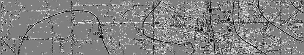
12 b. The chosen alternative must include: i. Proposed locations of collection and treatment facilities; ii. Cost estimates for the required improvements and cost effectiveness analysis of the alternatives based on a total present worth. The cost effectiveness analysis must include the total construction costs of each alternative as well as operation, maintenance, and replacement costs, and should use the following assumptions: iii. The analysis must be for a twenty (20) year period; and iv. Assume an interest rate of 6.5% per annum v. The financial mechanisms to be used to fund the required improvements, as well as the operation, maintenance, and replacement costs; vi. An implementation schedule for submitting a complete permit to install (PTI) application and approvable detail plans, awarding construction bids, starting and completing construction, and attaining compliance with ORC Chapter 6111 and the administrative rules promulgated thereunder. The design of a sewer system will take into account growth and development of the area. The new system will meet these requirements as established by the Ohio EPA. Planning Area The Glenwood Area is a small unincorporated community located in the center of Preble County. Glenwood is located along US 35 between the City of Eaton and the Village of West Alexandria. For the purpose of this study, the Glenwood Area is divided into five separate areas. The limit of the base area was determined by the limits of a gravity sewer system. The locations of these areas are shown in Figure 2-1. Table 2-1 provides the locations and number of homes located in the alternate areas. Table 2-1: Alternate Areas AREA LOCATION NUMBER of HOMES 1 West Side of Glenwood Along SR 35 and Yost Rd Quinn Rd Stover Rd Rebecca Dr. and Vanessa Dr. (Stoneridge) 48 BASE Remaining Area in Glenwood 192 Scope of Study A brief summary of the scope of this study is presented below. The planning period for this study is 25 years or through the year 2040, exceeding OEPA s requirement for a 20 year analysis. Glenwood Area Sewer Feasibility Study IBI Group Page 11
13 Data Collection and Review - Data relevant to the Planning Area was collected, reviewed and analyzed. This data included previous studies concerning wastewater needs, OEPA documented inspection and water quality data. Develop Population & Sewer Needs Forecasts Based on historical and existing population data, the projected future wastewater needs for the designated study area over a 25-year planning period was developed. Factors such as cost, environmental impacts, regulatory and permitting requirements must be taken into consideration when evaluating wastewater collection and treatment alternatives. Develop and Evaluate Alternatives- In establishing the criteria for the design of wastewater systems, several factors were considered. These included the length of time the facilities should serve before replacement or expansion is necessary, the population to be served, the type of customers to be served (i.e. residential, commercial, industrial, etc.) and the projected wastewater flows ( both average daily and peak hourly flows) over the span of the planning period. Draft Report- Based on the work generated in the above tasks, a Draft Report summarizing the findings and recommendations is to be prepared. The draft report will be reviewed with Preble County and other stakeholders and comments/ feedback will be incorporated into the Final Report. Final Report- After review of the draft report and revisions made pursuant to comments received, a final report will be prepared and delivered to Preble County, MVRPC, and the Ohio EPA. Methodology Brief descriptions of the methods used in the preparation of this study are shown below. Study Area Boundary- The general study area was determined by MVRPC and was refined during the first steering committee meeting. Projections of Sewer Needs for the Study Area - The following calculations were used to determine the average daily flow and the peak hourly flow. Wastewater Systems Average Daily Flow = Population x 100 gallons/day/person Peak Hourly Flow = Average Daily Flow x 4.0 peaking factor Glenwood Area Sewer Feasibility Study IBI Group Page 12

14
15 Chapter 3 - Existing Conditions Existing Water Systems There is one water main in the area owned and operated by the City of Eaton. The water main goes along US 35 and up Julie Drive and serves a few customers. The remaining residences and commercial establishments in the Glenwood Area receive their drinking water from private wells. With shallow private wells, there is potential for contamination with the onsite septic systems failing. The installation of a centralized wastewater system will help in preservation the drinking water in the area. Existing Wastewater Systems A centralized collection and treatment system does not exist within the Glenwood Area. Each residence and business is responsible for its own on-site treatment system. Many of these onsite systems are comprised of steel or masonry septic tanks with minimal leaching fields or even direct or indirect connections to drainage tiles. Many of these on-lot treatment systems are failing and discharging raw or partially treated sewage to drainage swales which finds its way into the water table and adjacent streams. These systems do not meet Ohio EPA discharge standards. OEPA sampled tributaries of Bantas Fork in Glenwood on May 26, 2010 for E.coli bacteria with the intent to sample again within 30 days. Stream conditions and/or staff commitments did not allow samples to be obtained with 30 days. On August 7, 2013 sampling was again conducted, this time within 2 hours of each other. The results, as noted below in Table 3-1, demonstrated that a public health nuisance does exist in Glenwood with unsanitary conditions in violation of Ohio s general water quality criteria set forth in OAC Rule Glenwood Area Sewer Feasibility Study IBI Group Page 14
16 Table3-1: OEPA Water Sample Results Site Location Date/Time 8/7/13 9:00 AM 8/7/13 11:05 AM 8/7/13 9:15 AM 8/7/13 11:15 AM 8/7/13 9:20 AM 8/7/13 11:21 AM 8/7/13 9:30 AM 8/7/13 11:31 AM E. coli Result #/100 ml Field Observation/Description Slight odor Clear no color Algae Slight odor Clear no color Algae Slight odor Greyish color Slight odor Greyish color Slight odor Clear no color Sludge deposits Slight odor Clear no color Sludge deposits Slight odor Clear no color Algae Slight odor Clear no color Algae Location Upstream of pond at 2937 US 35 Upstream of pond at 2937 US 35 West side of bridge on Quaker Trace Rd. approx. 300 south of Sample Dr. West side of bridge on Quaker Trace Rd. approx. 300 south of Sample Dr Est of intersection of Quaker Trace Rd. and US 35 (south side) 1200 Est of intersection of Quaker Trace Rd. and US 35 (south side) Trib. ½ mile South of US 35 on west side of Stover Rd. Trib. ½ mile South of US 35 on west side of Stover Rd. Environmental Conditions The environmental conditions in Preble County and the study area are important factors in determining the wastewater collection and treatment alternatives that are viable for the study area. The environmental conditions are analyzed in the following sections. Glenwood Area Sewer Feasibility Study IBI Group Page 15
17 Soils The majority of the study area is located within two soil classifications; the soils within the Glenwood Area generate the Celina and Kokomo soil groups. The following information is generated from the United States Department of Agriculture National Resource Conservation Service. Figure 3-1, shows all the soil associations within the Glenwood planning area. The Celina soil group has two associations in this area: Celina silt loam and Crosby-Celina silt loams. The dominant soil classification is the Celina silt loam. This soil has a slope ranging from 2-6 percent. The slight slope leads this classification to have a moderately well drained natural drainage class. A slight slope also leads to the soil having little to no flooding or ponding. The depth to the water table is from inches below the surface. The available water storage in profile is about 6.4 inches, which is a moderate rating. The Crosby-Celina silt loams soil in the area has a slope ranging from 0-2 percent. These slopes help generate a somewhat poorly drained natural drainage class. The depth to the water table is from approximately 6-18 inches. The runoff has a medium rating which helps create little to no flooding or ponding. The available water storage in profile has a low rating with the ability to store about 5.3 inches of water. The second soil classification of Kokomo silt loam has a slope ranging only from 0-1 percent. The low slope in the soil creates a very poorly drained drainage class. There is frequent ponding with this soil type. This indicates the depth of the water table is very shallow ranging from 0 6 inches. Also, the amount of available water storage in profile has a high rating with about 11.7 inches of storage. Topography The topography for the Glenwood Area has a general downward slope from the City of Eaton toward the Village of West Alexandria. The highest elevation in the area is approximately 1030 feet on the west side and the lowest elevation is about 930 feet on the east side of the area. The distance between these two areas is roughly 2.3 miles. As such, there is a general 0.8 percent slope across the planning area. The bedrock in the area slopes down from the west to the east similarly to the topography. The Highest elevation of the bed rock is 928 feet, which is located in the western part of the Area. The lowest bedrock elevation of 835 is also located at the eastern end of the Area. The average depth to the bedrock is 100 feet. Figures 3-2 and 3-3 indicate the elevation of the bedrock in the Area. Glenwood Area Sewer Feasibility Study IBI Group Page 16
18 Surface Water There is one identifiable body of water within the area. It is an Exceptional Warm Water Habitat known as Lower Bantas Fork. This stream is located just west of the Glenwood Area. Bantas Fork flows southeasterly for approximately 3 miles until it joins Twin Creek. Bantas Fork has a good Invertebrate Community Index with a drainage area of 7,279 acres as identified in the Updated Twin Creek Watershed Action Plan dated April, 2010 and Biological and Water Quality Study of Twin Creek and Selected Tributaries 1995 (see appendix). Bantas Fork could be used as a possible discharge point for a future wastewater treatment plant depending on stream flow of the creek. Additional coordination with the Ohio EPA will be required for discharge limitations to Bantas Fork. Wetlands There are a few wetlands identified by the National Wetlands Inventory Program in the area. These wetlands do not interfere with the planning of the collection or treatment systems. The location of these wetlands can be found in Figure 3-4. Flood Hazard Area (100 yr. flood plain) Flood plains are formed by the periodic overflow of the stream and its resulting sediment deposition and realignment of the stream course. They are characteristically flat and fertile, and can extend over large areas of land. Although flood plains are often perceived as desirable development sites, they are potentially hazardous in terms of loss of life, property, and land. The 100-year flood reoccurrence interval is most commonly accepted as a reasonable measure of flood-prone areas. Figures 3-5 and 3-6 show the aerial extent of the 100-year flood of the Bantas Fork stream and its tributaries, as identified on the Federal Emergency Management Agency (FEMA) map. Land Use The planning area has three different land categories. The three different categories for this study are residential, vacant/agriculture, and commercial. Figure 3-7 shows the locations of each of the land categories. The residential category, which is the largest, is comprised of single-family dwellings, multifamily dwellings, and vacant residences with a potential of human habitation. The primary residential area lies on the main roads in the area. Residential land use in the planning area is comprised of approximately 473 acres, which is 61 percent of the total area. The second largest land use category, vacant/agriculture, is composed of 192 acres and is approximately 24 percent of the land. The majority of this land is located just off of the main roads in the area. Glenwood Area Sewer Feasibility Study IBI Group Page 17
19 Commercial land comprises the third largest percentage of acres in the planning area. Commercial land is located along SR 35. This land is comprised of lots used to conduct business instead of homes. Commercial land use makes up approximately 15 percent of the planning area and contains approximately 115 acres. Table3-2: Existing Land Use LAND USE TYPE ACREAGE PERCENTAGE Residential Vacant/ Agriculture Commercial Total Glenwood Area Sewer Feasibility Study IBI Group Page 18

20


21


22
23
24