Stream Restoration in the Urban Environment Concepts and Considerations
|
|
|
- Steven Blake
- 5 years ago
- Views:
Transcription

1 Stream Restoration in the Urban Environment Concepts and Considerations The Restoration of Our Rivers; October 5, 2012 Matthew A. Van Eps, PE & Sandi J. Formica: Watershed Conservation Resource Center

2 What is Stream Stability? Ability of a stream, over time, in the present climate to transport sediment and streamflow produced by its watershed in a manner such that the stream maintains its dimensions, pattern, and profile without either aggrading or degrading (Rosgen, 1996)
3 2002 (Pre-Flood) 2004 (Post Flood)

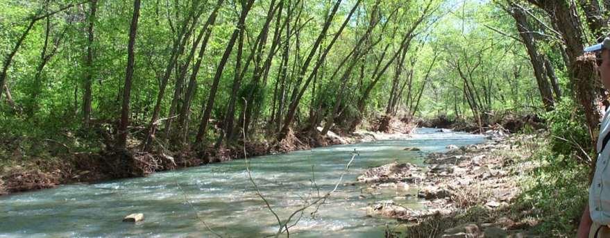
4 Streambank Erosion Is this river stable?


5 Erosion in the Urban Environment 11 ft April 2010 March 2011

6 Why Does it Matter? Impacts to Infrastructure Creates Safety Concerns Decreased Aesthetics Water quality impacts Property Loss Lowering of Water Table Effects on Aquatic Habitat Etc.


7 What Causes Stream Instability? Change to any one variable in the definition of stability can cause an imbalance Ability of a stream, over time, in the present climate to transport sediment and streamflow produced by its watershed in a manner such that the stream maintains its dimensions, pattern, and profile without either aggrading or degrading Sediment Supply Streamflow Dimension (Cross-Section) Pattern Profile


8 Examples of Cross-Section Change Channel excavation and cross-channel obstructions result in deposition, over-widening, and lateral erosion of streambanks. Low water crossings Channel enlargement projects Water lines Check dams Etc.


9 Examples of Pattern Change Straightening of urban channels increases stream slopes and raises the erosion potential Development Flood Control Transportation projects Etc.


10 Examples of Profile Change Changes in slope can result in greater potential for localized scour and downstream instability Utility crossings Flood control Linear road projects Etc.
 1980 (forested)")
 (Q forest to Q impervious )")
11 Changes in Stream Discharge caused by changes in land use Forest to Pasture (Q forest to Q pasture ) 1980 (forested) Pasture to Impervious (Q pasture to Q impervious ) Forest to Impervious 2004 (cleared) (Q forest to Q impervious ) Reservoirs


12 Change in Sediment Supply Reduction or Increase in Sediment Supply Can Cause Instability Decrease Supply Armoring Channels Reservoirs Land-use Changes Increase Supply Streambank Erosion Mass Wasting Construction Sites


13 Common Approaches to Improving/Maintaining Channel Stability Armoring Banks Bank Stabilization Straightening Do Nothing Channel Clearing Bioengineering Natural Channel Design


14 Natural Channel Design Seek to Restore: Dimension, Pattern, and Profile using data from a stable stream reach. Same stream type in the same valley type Consider the Natural Tendencies of the Stream!

15 Urban Stream Restoration Considerations


16 Project Goals Demonstrate an urban stream restoration using a natural channel design approach Mullins Niokaska Branch Creek Sweetbriar Gulley Park Park

17 Project Partners & Funding

18 Urban Stream Restoration Typical Objectives Reduce streambank erosion Improve water quality Protect infrastructure Reduce safety concerns Provide amenity to public Enhance aquatic habitat Re-establish riparian areas Improve aesthetics Public outreach


19 Site Selection Sites Identified by partners Selection criteria Internal or public priority Risks to infrastructure Safety concerns Water quality concerns Probability of success Visibility of project
20 Drainage Area Site Characteristics Niokasaka Gulley: 1.25 mi 2 Niokasaka Sweetbriar: 4.8 mi 2 Mullins Branch: 0.75 mi 2 Impervious Surfaces USGS gage station at two sites 1,000 to 1,600 feet Incised channels (common) Decreased sediment supply Increased streamflow 4 to 8 ft. high eroding streambanks Rosgen Stream Classification: B4c

 Decreased sediment supply Increased streamflow 4 to 8 ft.")
21 Drainage Area Site Characteristics Niokasaka Gulley: 1.25 mi 2 Niokasaka Sweetbriar: 4.8 mi 2 Mullins Branch: 0.75 mi 2 Impervious Surfaces USGS gage station at two sites 1,000 to 1,600 feet Incised channels (common) Decreased sediment supply Increased streamflow 4 to 8 ft. high eroding streambanks Rosgen Stream Classification: B4c

22 Pre-Restoration Site Monitoring Streambank Erosion Analysis Establish Site Monitoring Quantify water quality benefits Sample bank materials Estimate annual loads: Niokaska - Sweetbriar Sediment 2,000 ton/yr Total Phosphorus 600 lb/yr Total Nitrogen 1,600 lb/yr
 Infrastructure Trails/Sidewalks")

23 Stream Restoration Design Development Typical Site Constraints No change to 100 year flood elevation or revised flood map($$) Infrastructure Trails/Sidewalks Bridges Sewer Lines Water Lines Stormwater outfalls Fixed flood prone width Adjacent buildings Vegetation preservation Presence of public Controlling access Communicating intent


24 Stream Restoration Design Detailed Data Evaluation Topographic Survey Geomorphologic Analysis Hydrology Analysis Step-wise Engineering Process Reference reach data Dimension, Pattern, Profile Flow Capacity Sediment Transport Bankfull Discharge: 130 cfs Design Cross Section: 30 ft 2 Bankfull Slope: ft/ft Bankfull Shear: 1.04 lb/ft 2

25 Stream Restoration Design Reference Reach Provides a blueprint from which design variables can be developed


26 Stream Restoration Design In-stream Structures Control near-bank shear forces Maintain desired pool depth Provide grade control J-Hook vanes Cross vanes Rock Sizing Based on shear force Flat edges Bigger is usually better Structure design Length W bkf Angle 20 Slope = 5% J-Hook Vane w/step Cross Vane


 Additional planting in late")
27 Stream Restoration Design Re-vegetation Plans Critical Element of the Restoration Design Provides stability Habitat Forage Aesthetics Consult with local specialists Locate plants based on sun & water needs Inland Sea Oats, Prairie Drop Seed Button Bush, Spice Bush Green Ash, Plum, Wafer Ash, Sycamore Irrigate through 1 st summer (at least) Additional planting in late fall


 two to")
28 Implementation Schedule Construction Site Preparation 1 to 6 months Apply and obtain applicable permits Apply and obtain no-rise certification Select, order, and move rocks to site Utility line and other infrastructure location Order and obtain other materials, such as, erosion control, plants, compost, etc. Construction (heavy) (Depends on Scale, Complexity) Earth work and constructing new channel and floodplain/bankfull benches Constructing rock structures Construction (finishing) two to three months Touch-up work on structures Building soil mattresses Planting

29 Expect Post Construction Rain If you build it, IT WILL RAIN T-storms, Tropical Storms, Tropical Depressions (you name it!)

30 Niokaska Creek at Gulley Park Upstream - Before Restoration Infrastructure Constraints Fiber Optic Line Elevated Sewer Line


31 Niokaska Creek at Gulley Park Upstream - After Restoration After two years Cross-Vane to direct flow and create backwater Force water over SSL to improve aesthetics

32 Niokaska Creek at Gulley Park Upstream - After Restoration Improved access point After four years

33 Niokaska Creek at Gulley Park Mid Section Before Restoration Incised Channel

34 Niokaska Creek at Gulley Park Mid Section One Week After Terrace Elevation Bankfull Elevation Use of rock along toe Incised Channel

35 Niokaska Creek at Gulley Park Mid Section One Year After Restoration

36 Niokaska Creek at Gulley Park Mid Section Two Years After Restoration

37 Niokaska Creek at Gulley Park Mid Section Four Years After Restoration

38 Niokaska Creek at Gulley Park Lower Mid Section Before Restoration Trail Encroachment

39 Niokaska Creek at Gulley Park Lower Mid Section Before Restoration Trail Encroachment

40 Niokaska Creek at Gulley Park Lower Mid Section After Restoration

41 Niokaska Creek at Gulley Park Lower Mid Section One Year After Restoration

42 Niokaska Creek at Gulley Park Lower Mid Section Almost Four Years After Restoration

43 Niokaska Creek at Gulley Park Lower Section Before Restoration Infrastructure Trail Encroachment Channel Incision

44 Niokaska Creek at Gulley Park One Week After Restoration

45 Niokaska Creek at Gulley Park One Year After Restoration

46 Niokaska Creek at Gulley Park Lower Section Four Years After Restoration

47 March 18, 2008 Storm Event Before Restoration

48 After Restoration August 23, 2008 Storm Event Three Days After Major Construction Completed

49 After Restoration August 23, 2008 Storm Event Receding Flow After Storm Event

50 Niokaska Creek at Sweetbriar Park High Pressure Waterline Before Restoration Infrastructure Constraints Check Dam psi water main

51 Niokaska Creek at Sweetbriar Park High Pressure Waterline After Restoration Cross-vane used to bring stream down from water line elevation
52 Niokaska Creek at Sweetbriar Park Waterline Section Before Restoration Infrastructure Constraints Adjacent Structures psi water main


53 Niokaska Creek at Sweetbriar Park Waterline Section After Restoration Infrastructure Constraints Adjacent Structures

54 Niokaska Creek at Sweetbriar Park Waterline Section Before Restoration

55 Niokaska Creek at Sweetbriar Park Waterline Section Before Restoration

56 Niokaska Creek at Sweetbriar Park Post Construction Flooding
57 Mullins Branch Upstream Section Before Restoration Infrastructure Constraints Triple Box Culvert 18 Sewer Line

58 Mullins Branch Upstream Section Before Restoration Infrastructure Constraints 18 Sewer Line Encased and finished with native sandstone

59 Mullins Branch Upstream Section After Restoration 18 Sewer Line

60 Mullins Branch Middle Section Before Restoration Infrastructure Constraints Fixed width under bridge

61 Mullins Branch Middle Section After Restoration Infrastructure Constraints
 Establish a contingency fund (see above) Get your permits")

62 Conclusions Some general reminders Design for bankfull but expect and be prepared for the big one Plan for repairs (see above) Establish a contingency fund (see above) Get your permits Local, State, Federal Carefully evaluate site constraints Select experienced contractors Plant and irrigate the site Better project performance Improves habitat Improves aesthetics Develop a PR plan


63 Watershed Conservation Resource Center Thanks to Our Project Partners Arkansas Natural Resources Commission City of Fayetteville University of Arkansas U.S EPA Region VI Questions? Matthew Van Eps, PE Watershed Conservation Resource Center (501)