Basics of Watershed Planning
|
|
|
- Charlene Lamb
- 5 years ago
- Views:
Transcription


 Designated Uses of the lake or")
1 Basics of Watershed Planning Watershed Area of land that catches all the flow of water Julia Kirkwood Water Resources Division Nonpoint Source Program * Clean Water Act Section 319 *Directed states to: 1. Assess extent of NPS 2. Prepare management plan to correct it *Provides for funding *Federal Register: *Guidelines to states All surface waters of the state are designated for and shall be protected for all the following uses: 1.Agriculture 2.Industrial water supply 3.Public water supply at the point of intake 4.Navigation 5.Warmwater fishery 6. Other indigenous aquatic life and wildlife 7. Partial body contact recreation 8. Total body contact recreation-may 1-Oct Cold water fishery where applicable ****Part 4 Rules, Part 31, PA 451, as amended**** State s yardstick to measure health of waters The goals are in three areas: 1) Designated Uses of the lake or stream 2) Safe levels to protect the uses 3) Protection of high quality waters. Part 31: Part 4 Rules PA 451, as amended: sets the standards for chemical and physical components
 *Status and trends assessment of publicly owned lakes: 314 Integrated Report Total")
 list Includes * Available information to determine potential")
 Part")

2 Doesn t meet criteria to support its designated use/s Clean Water Act requires: *Water Quality Assessment:305(b) *List of waters not meeting designated uses/attaining standards: 303(d) *Status and trends assessment of publicly owned lakes: 314 Integrated Report Total Maximum Daily Load WHAT * Process to determine pollutant load a lake or stream can handle & still meet water quality standards WHY * Required by EPA when water body not attaining designated uses (d) list Includes * Available information to determine potential sources of pollutants * Identifies location, use impairments, pollutant, length of impairment, possible sources and causes *1988: Non-Point Source Program created pursuant to Federal Guidelines *MI Natural Resources and Environmental Protection Act 451 (NREPA) Part 88: Clean Michigan Initiative (CMI) NPS Control Grants *Sets guidelines for watershed plans, best management practices and grant funding. Grants Two Goals 1) RESTORE: Priority Impaired Waterbodies 2) PROTECT High quality waters NPS Program Partnerships Watershed Management Process


 Watershed:")

3 Watershed Approach: A collaborative ongoing process Approved Watershed Plan Requirements State: Federal: CMI EPA s 9 Key Elements What size Watershed? HUC = Hydrologic Unit Codes Characterize/Understand Your Watershed: Gathering data Subwatershed (12-digit HUC or small urban drainage) Watershed (10-digit HUC) River Basin (6-Digit HUC) Characterize/Understand Your Watershed: Gathering data Characterize/Understand Your Watershed: Inventory: Identify sources and causes NPS Awareness Survey


4 Inventory: Find the source/cause! What to do? What is your watershed? Urban/Rural? River/Stream/Lake? Problems? Erosion Sediment or nutrient E. Coli Lots of wetland loss? Flashiness/flooding? High quality areas? Inventory/Assessment Tools Aerial Photo review Soil surveys Land Use Analysis Master Plan/Ordinance Reviews Landscape Level Wetland Functional Analysis Step 1: Conduct desktop analysis Inventory/Assessment Tools Field Inventory: Stream walks, monitoring *Road Crossing Information on Poor Alignment- Is the culvert aligned properly with the stream channel. Inadequate Armoring- Rip-Rap not installed or installed improperly. Impounding Water- Is the culvert ponding water upstream. (Culvert Problems) Obstructed- Is the flow of water blocked from passing through the culvert. Structural Integrity- Is the culvert falling apart and need repair. Poor erosion control methods along roadways result in stream sedimentation.


.")


5 Uncontrolled Animal access An example of a rill (a) compared to the size of a gully (b). Where should the work begin? Calculate pollutant loads Prioritize pollutants, sources, causes Determine objectives Define critical areas


 319 Level")


")
6 WMP: Protecting the Healthy Areas WMP: Solutions Watershed plans: BMPs, Costs, Resources, Timeline, Milestones, Evaluation CMI Level (Older Plans) 319 Level Approved Plans Grants State: Clean Michigan Initiative No planning FY 2017 $2 million Implementation: Restoration Project Critical Site: Arcadia Creek Federal: Section 319(h) and 205(j) FY million Planning $172,000 Before


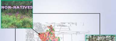
7 Implementation: Restoration Project Critical Site: Arcadia Creek After Implementation: Protection Project Priority Area: Prairieville Creek WHY PRAIRIEVILLE CREEK? 60% total stream inflow into Gull Lake = about 21% of the lake s annual water. Over 50% of the PCA now permanently protected White outline the Priority Conservation Area Who to contact? *Questions