ENVIRONMENTAL ASSESSMENT FOR MISSION BAY TRANSIT LOOP PROJECT SAN FRANCISCO, CALIFORNIA
|
|
|
- Justina Mitchell
- 5 years ago
- Views:
Transcription


1 ENVIRONMENTAL ASSESSMENT FOR MISSION BAY TRANSIT LOOP PROJECT SAN FRANCISCO, CALIFORNIA May 6, 2013
2 This page intentionally left blank.
3 ENVIRONMENTAL ASSESSMENT for prepared pursuant to National Environmental Policy Act Title 42, United States Code, 4332(2)(c) Title 23, Code of Federal Regulations, Part 771 by Unites States Department of Transportation Federal Transit Administration 201 Mission Street, Room SFMTA Municipal Transportation Agency One South Van Ness Ave, 7th Floor 94103
4 This page intentionally left blank.
5 nvironmental Assessment CONTENTS Page 1. INTRODUCTION AND BACKGROUND Purpose and Need Project Location Roles and Responsibilities Project Funding Environmental Review CEQA NEPA Process Required Permits and Approvals 5 2. DESCRIPTION OF PROPOSED ACTION AND ALTERNATIVES Proposed Action Trackway Overhead Contact (Power) System Signalization Curb Ramps/Sidewalk Street Resurfacing Removal of Abandoned Freight Trackway Utility Relocation Provision for Passenger Platform Operation Alternatives Considered for Detailed Study Alternative 1: No Action Alternative Alternatives Considered but Rejected AFFECTED ENVIRONMENT and ENVIRONMENTAL CONSEQUENCES Resources with No Impact Aesthetics Air Quality Climate Change 21 i
6 3.5 Historic and Archeological Resources Resources Subject to Section 4(f) of the Department of Transportation Act Land Use Noise Vibration Parks and Recreation Areas Safety and Security Transportation Vehicular Traffic Intersection Performance Lane Configuration Driveway Access Transit Parking Bicycle and Pedestrian Facilities Construction Effects on Transportation Environmental Justice Other Considerations Growth and Secondary Effects Cumulative Effects Irretrievable and Irreversible Commitment of Resources Local Short-Term Impacts and Resource Uses Verses Long-Term Productivity CONSULTATION AND COORDINATION Public Meetings Notice of Availability and Distribution List LIST OF PREPARERS REFERENCES 69 ii
7 Environmental Assessment FIGURES Figure 1-1. Figure 1-2. Figure 2-1. Figure 3-1. Figure 3-2. Figure 3-3. Figure 3-4. Figure 3-5. Figure 3-6. Figure 3-7. Figure 3-8. Figure 3-9. Figure Location and features of the proposed Mission Bay Loop T-Third Street Light Rail Line Existing and proposed lane configurations Race and income distribution for tracts along the T-Third Street rail line View of Eighteenth and Illinois Streets looking north on Illinois Street View of Eighteenth Street facing west toward Third Street from the corner of Eighteenth and Illinois Streets View of Illinois Street from corner of Eighteenth and Illinois Streets facing northeast View of Nineteenth and Illinois Streets facing south on Illinois Street View of Nineteenth Street towards Third Street facing west View of Nineteenth Street toward Illinois Street facing east Area of Potential Effects Project vicinity and surrounding neighborhoods Recreation areas (parks and open space) planned for Pier 70 at the Port of San Francisco TABLES Table 2-1. Table 3-1. Table 3-2. Table 3-3. Table 3-4. Alternative loop locations considered and reason for their rejection Street Parking Supply and Utilization General Census Information by Population, Race, and Household Income within a 1/2-Mile Radius of the Project Site General Census Information by Population, Race, and Household Income for Block Groups within Tract 226 Summary of Race and Household Income Distribution for Population Along the T-Third Rail Line iii
8 APPENDICES Appendix A. Appendix B. Appendix C. Appendix D. Appendix E. Appendix F. Photographs of Alternative Loop Locations Considered Biological Constraints Assessment Letter from FTA to State Historic Preservation Officer Requesting Concurrence on Finding of No Adverse Effect Noise and Vibration Assessment Notice of Public Meeting Distribution List ACRONYMS ADA APE BAAQMD CEQA CFR DOT EA EIR EIS FTA LOS NEPA NHPA NRHP SFMTA TIGER Americans with Disabilities Act Area of Potential Effects Bay Area Air Quality Management District California Environmental Quality Act Code of Federal Regulations United States Department of Transportation Environmental Assessment Environmental Impact Report Environmental Impact Statement Federal Transit Administration level of service National Environmental Policy Act National Historic Preservation Act National Register of Historic Places San Francisco Municipal Transit Authority Transportation Investment Generating Economic Recovery iv
9 Environmental Assessment 1. INTRODUCTION AND BACKGROUND This Environmental Assessment (EA) for the Mission Bay Transit Loop (Mission Bay Loop or the Loop) portion of the Third Street Light Rail Project has been prepared in accordance with the National Environmental Policy Act (NEPA) of 1969 codified in Title 40 of the Code of Federal Regulations (CFR), Chapter V, Parts , Council on Environmental Quality. An Environmental Impact Statement/Environmental Impact Report (EIS/EIR) for the Third Street Light Rail Project was completed and approved in 1999 by the Federal Transit Administration (FTA) and the City and County of San Francisco and construction of the light rail project was completed in Due to budget constraints, a portion of the Third Street Light Rail Project, the Mission Bay Loop, was not completed. The construction of the Loop was deferred, as the bulk of the increased service the Loop was intended to accommodate is not needed until the beginning of the operation of the Central Subway planned for Because approximately 12 years have passed since the EIS/EIR for Third Street Light Rail Project was completed, the San Francisco Municipal Transit Authority (SFMTA) has prepared this EA to identify and evaluate any conditions that might have changed after 1999 that could potentially result in adverse effects from construction of the Mission Bay Loop. The FTA is the federal lead agency pursuant to NEPA and SFMTA is the project sponsor. 1.1 Purpose and Need The SFMTA, in cooperation with the FTA, propose to construct the Mission Bay Loop in the Central Waterfront area of the City and County of San Francisco, on city roads and right-of-ways on the block of Eighteenth, Illinois, and Nineteenth Streets. Figure 1-1 depicts the location of the proposed Loop and the surrounding area. The Loop is a proposed component of the Third Street Light Rail Project, which connects the City s growing southeastern neighborhoods with the Financial District and Chinatown, and was designed to support the increasing public transit needs for these areas. Between 1990 and 1996 approximately 45 percent of new housing built in San Francisco was in areas adjacent to the Third Street Light Rail corridor. It is estimated that by 2025, the population in the Central Waterfront area will increase from the 2000 population of 1,704 residents to approximately 8,500 residents (City and County of SF, 2007). Approximately 65 percent of the City s job growth and over 50 percent of the residential growth are projected to be located along the T-Third Street line corridor (City of South SF, 2009). Given San Francisco s small size and built-out character, the eastern portion of the city, including Mission Bay and Central Waterfront, represents the largest area of developable land. To support the growth projected for this area, the long-range public transit plan for Third Street Light Rail corridor consists of two phases: Phase 1, development of the T-Third Street line 1
10 (completed in 2003, except for the Loop); and Phase 2, construction of the Central Subway allowing for the addition of 24 new trains to the system, and the implementation of short- and long-line service on the T-Third Street service line (SFMTA, 2011). The SFMTA began service on the T-Third Street line between Embarcadero and Sunnydale in 2007 (Figure 1-2). The line is a 5.1-mile surface route serving Caltrain, AT&T Park, Mission Bay, the UCSF campus, the Central Waterfront, and the residential areas of Bayview-Hunters Point, Visitacion Valley, and Little Hollywood. Phase 2 will extend the T-Third Street line by a 1.7-mile surface-and-subway route to the new Central Subway that will include four new stations: Chinatown: subway station and terminus; Union Square-Market Street: subway station with connection to the Powell Street Muni-BART station; Moscone: subway station serving the convention center and Yerba Buena museum district; and Fourth and Brannan: surface station serving SOMA. After completion of Phase 2, short-line service would extend from Chinatown to Mission Bay with trains returning northbound on Third Street via the Loop. The long-line trains would travel from Chinatown to the southern terminus of the T-Third Street line in Sunnydale. The Mission Bay Loop is key to efficient integration of the T-Third Street line with service on the Central Subway. Population growth in Mission Bay and the Central Waterfront is anticipated to create northbound transit demand from these neighborhoods to access jobs and services downtown and in other northern parts of the city. Ridership on the T-Third Street segment in Mission Bay and the Central Waterfront neighborhoods is also anticipated to increase with rising need to access new high-density retail, and commercial establishments in these neighborhoods. The Loop is needed to accommodate more frequent transit service from the Mission Bay and Central Waterfront back to downtown (Figure 1-2), as originally intended in the design of the Third Street Light Rail Project in It is estimated that the additional trains and service options available in 2019 would increase service to and from the Mission Bay area by approximately 50 percent over current service levels. The location of the Loop between Eighteenth and Nineteenth Streets would allow for increased service in the most heavily traveled portions of the Central Subway Corridor with the most efficient and effective route that serves the majority of present and future ridership concentrated between the Central Subway stations and the Mission Bay area. The Loop at this location would also provide the SFMTA with an ability to remove disabled trains from this portion of the T-Third Street line, thereby minimizing effects on system service levels. Beginning in 2016 (prior to its integration with the Central Subway in 2019), the Mission Bay Loop would allow trains to turn around for special events (e.g., baseball games, concerts, street fairs) and during peak periods to meet the projected service needs between Mission Bay and the Market Street Muni Metro corridor. If resources permit, the N-Judah line would to be extended to the Mission Bay Loop from its current terminus at Caltrain to provide this service. 2
11 Environmental Assessment 1.2 Project Location The location of the proposed Loop is within the area of San Francisco known as the Central Waterfront, just east of Potrero Hill and south of SOMA (Figure 1-2). The project site lies immediately adjacent to Pier 70 at the Port of San Francisco. 1.3 Roles and Responsibilities The following public agency roles and responsibilities for the proposed project were established via an agreement between SFMTA and FTA for the allocation of Transportation Investment Generating Economic Recovery (TIGER) funds by the United States Department of Transportation s (DOT) for the Mission Bay Loop project: The FTA is the lead agency as defined by NEPA; The SFMTA is the project sponsor and is responsible for completion of the preliminary conceptual design, design engineering, construction and operation of the Loop. As the project sponsor, SFMTA is responsible for providing guidance to the City and County of San Francisco and FTA regarding funding requirements; and The SFMTA is responsible for leading the completion of the environmental studies, project design; would be responsible for project management and oversight. 1.4 Project Funding The project would be funded by a discretionary grant under the TIGER program and funds from the Lifeline Transportation Program, administered by the Metropolitan Transportation Commission to support projects that address mobility and accessibility needs in low-income communities in the Bay Area. Funds from the Lifeline Transportation Program are appropriate for the proposed project since its implementation would support improved transit service to low-income communities south of Mission Bay. The estimated cost of the Loop is $6,257,000, including environmental assessment, design, and construction. 1.5 Environmental Review In accordance with California Environmental Quality Act (CEQA) Guidelines (Title 14 of the California Code of Regulations et. seq.) and NEPA (40, CFR, Part 1500 et. seq.), an EIR/EIS was prepared for the Third Street Light Rail Project that included the proposed action (FTA, 1998b). 3
12 1.5.1 CEQA The EIR/EIS process for the Third Street Light Rail Project was initiated in 1996 with the Notice of Preparation distributed on October 18, 1996 (California State Clearinghouse Number ) and amended on June 27, Public scoping meetings and workshops were conducted in 1997, including workshops in the Visitacion Valley, Little Hollywood, Bayview, Hunters Point, Potrero Hill, South of Market, Chinatown, and Downtown neighborhoods. A total of 300 people attended the workshops. The SFMTA established a community advisory group early in the planning and design phase of the project to receive input on design options and to select specific design options for evaluation in the environmental review. As a result of the public input, SFMTA modified early design options and added new ones to ensure that the project fully reflected the community s desires (FTA, 1998a). The Draft EIS/EIR for the Third Street Light Rail Project was available for public review in early Incorporating changes to address comments received during the public review period, a Final EIS/EIR for the Third Street Light Rail Project was prepared and certified by the City of San Francisco Planning Department on November 6, 1998 (FTA, 1998b). In October 2012, San Francisco Planning Department reviewed the proposed Loop project in light of the prior CEQA analysis and determined that no further assessment is required (Ahmadi, 2012) NEPA Process In accordance with NEPA, the FTA must determine if the proposed action would have adverse effects on area resources. NEPA is a nationwide mandate for the protection of the environment and applies to all federally funded projects and projects that require permits or approvals from a federal agency. The purpose of NEPA is to provide public disclosure of the environmental effects associated with federal actions and to ensure that the programs of the federal government promote improvement of the quality of the environment. The process required under NEPA enables public officials to make decisions that are based on an objective understanding of environmental consequences, and take actions that protect, restore, and enhance the environment. The process also insures that environmental information is available to public officials and citizens before decisions are made and before actions are taken. While the proposed action was evaluated in the EIS/EIR for the Third Street Light Rail Project and the FTA issued a Record of Decision in 1999, the FTA determined that sufficient time had lapsed since this evaluation to require review of the proposed action for any potential new effects on resources in the Mission Bay area. Based on informal scoping activities, a review of planning and environmental studies associated with adjacent infrastructure projects, and known changes in the project location, the FTA determined the following areas of interest warrant additional review: Aesthetics Air quality 4
13 Environmental Assessment Climate change Environmental justice Historic and archeological preservation Land use Noise and vibration Parks and recreation areas Transportation Cumulative effects This EA evaluates the potential effects of the proposed action and alternatives on the physical, biological, and human resources in the area. If significant adverse effects were identified in the EA that cannot be reduced through mitigation measures, a detailed environmental impact statement would be required. If the FTA decides that there are no significant adverse effects, it would make a finding of no significant impact. 1.6 Required Permits and Approvals The following approvals are required for the proposed project: City and County of San Francisco Public Works Department approval of construction in streets and changes to sewers; City and County of San Francisco Department of Public Health review of project for compliance with Maher Ordinance (Article 22A of the San Francisco Public Health Code); California Public Utilities Commission permits for pedestrian crossings of light rail tracks; and Metropolitan Transportation Commission funding approval. 5

14 Source: Project detail from SFMTA. Figure 1-1. Location and features of the proposed Mission Bay Loop 6


 Figure 1-2.")
15 Environmental Assessment Source: SFMTA (Existing rail line in red. Proposed service to and from the Loop shown in blue.) Figure 1-2. T-Third Street Light Rail Line 7
16 2. DESCRIPTION OF PROPOSED ACTION AND ALTERNATIVES The proposed action and the no action alternative were evaluated and the evaluation is presented in this section. 2.1 Proposed Action The Mission Bay Transit Loop was part of the original design for the Third Street Light Rail Project that resulted in the construction of transit facilities along the Third Street corridor extending from Third and King Streets to the north, to the Caltrain Bayshore Station near Bayshore Boulevard to the south. As discussed in Section 1, the Loop portion of the project was not completed due to budget constraints and the fact that the Loop s critical service enhancements would not be needed until the beginning of the operation of the Central Subway. The Loop was designed to provide turn-around capabilities for the T-Third Street light rail line via a connection of trackway from Third Street to Eighteenth, Illinois, and Nineteenth Streets (Figure 1-1) to facilitate a 50 percent increase in frequency of transit service in the Chinatown, Mission Bay, and SOMA neighborhoods. The increase in service would be achieved by allowing up to half of the trains traveling on Third Street via the Central Subway during peak hours to turn around at the Mission Bay Loop and proceed back toward downtown San Francisco to Stockton and Washington Streets. Twenty-four additional trains will be added as part of the Central Subway project currently being constructed to augment levels of transit service along the Third Street corridor to Chinatown and to the Hunters Point neighborhood (south of the Loop). Transit service for residents of the Third Street corridor south of Mission Bay would be enhanced because diversion of trains at the Loop would allow for the addition of service to Sunnydale (after the opening of the Central Subway) in 2019; decreasing the current 9-minute headways (distance in time between trains) to 7.5 minutes. North of the Loop, a decrease from 9- minute to 4-minute headways is indicated in the Central Subway Service Plan. Design of the Loop and preparation of a construction bid package is anticipated to take nine months. Construction of the Loop project would take approximately four to five months, including removal of existing trackway along Illinois Street and installation of supporting power facilities. Specific features of the proposed action are described in detail below Trackway In 2007, portions of trackway were installed on approximately two-thirds of the block of Eighteenth and Nineteenth Streets between Third and Illinois Streets. These trackways would be 8
17 Environmental Assessment extended a distance of 60 feet to Illinois Street to complete the Loop (Figure 1-1). The direct fixation trackway would be 16 inches thick and would require excavation of approximately 18 inches below grade. Included in the trackway would be track drains connected to the existing combined sewer and storm system. New trackway would be installed on one full block of Illinois Street (between Eighteenth and Nineteenth Streets). A maximum of 900 feet of single-track trackway would be installed in the street right-of-way on Eighteenth, Nineteenth, and Illinois Streets. The centerline of the trackway would be located in the center of the 66-foot right-of-way of Eighteenth and Nineteenth Streets. Presently, the right-of-way includes 12-foot sidewalks and parking on both sides of each street, along with two lanes going east and west. The trains on the trackway would make a right turn from eastbound Eighteenth Street to southbound on Illinois Street. The right-of-way on Illinois Street is 80 feet with a 15-foot sidewalk on the west side and a fence along what would be the curb line of a planned 15-foot sidewalk on the east side to be installed by Port of San Francisco as part of the Pier 70 redevelopment (Port of SF, 2010) that includes the development of Crane Cove Park east of Illinois Street between Mariposa and Nineteenth Streets along the Bay shoreline (Port of SF, 2012) to be completed at a later date. Presently, there is no sidewalk on the east side of Illinois Street due to a difference in elevation between the street and the adjoining eastern parcel of Pier 70. The centerline of the trackway on Illinois Street would be located 37.5 feet from the western property line. Illinois Street currently has one lane of traffic in the northern and southern directions and parallel parking on the east side. Configuration of the trackway from west to east would include a 15-foot sidewalk, a 17-foot traffic lane (with the existing six-foot bike lane), an 11-foot trackway right-of-way, a 16-foot traffic lane, and 15-foot sidewalk to be constructed by the Port of San Francisco. To avoid reduction in roadway capacity while trains are making their way onto Illinois Street from Eighteenth Street or onto Third Street from Nineteenth Street, the SFMTA would implement one of the three design options listed below after consideration of public comments. Figure 2-1 provides a diagram representing these lane configuration options. Design Option 1: To ensure clear right-of-way for light rail vehicles to use Eighteenth and Nineteenth Streets, vehicular access would be controlled by signalization at the four intersections surrounding the Loop: Third and Eighteenth Streets; Illinois and Eighteenth Streets; Illinois and Nineteenth Streets; and Third and Nineteenth Streets. Vehicles would be stopped at Third and Illinois Streets until trains have left Eighteenth or Nineteenth Streets; after which time, vehicular traffic would resume use of Eighteenth or Nineteenth Streets. Flashing light signals would be installed by the exit from each driveway and on the street to warn vehicles to wait until the train clears before entering the street and to then proceed with caution. Design Option 2: Vehicles and trains would be allowed to travel in the same direction in mixed traffic. To provide sufficient width for vehicle and train traffic, parking would be limited to the south side of Eighteenth Street and the north side of Nineteenth Street. No Parking and No 9
18 Stopping, 7 a.m. to 6 p.m. signs would need to be installed along the north side of Eighteenth and the south side of Nineteenth Streets. Design Option 3: Eighteenth and Nineteenth Streets would be converted into one-way couplets. Vehicles access would be controlled until trains have left Eighteenth or Nineteenth Streets, with vehicles traveling on Eighteenth Street in the eastbound direction only, and vehicle travel on Nineteenth Street in the westbound direction only. Installation of flashing light signals by the exit from each driveway and on the street would warn vehicles to wait before entering the street until the train clears and to then proceed with caution Overhead Contact (Power) System To provide electric power to the trains, 17 trolley poles would be installed; streetlights would be affixed to eight of these poles. There would be two poles on each side of Eighteenth Street, two poles on each side of Nineteenth Street, seven poles on the west side of Illinois Street, and six poles on the east side of Illinois Street (Figure 1-1). All proposed poles would be installed 18 inches from the curb edge. Six bulb-outs would be installed to accommodate the poles on the east side of Illinois Street, in case the planned sidewalk installation is not completed prior to construction of the Loop. The bulb-outs would extend into Illinois Street approximately 18 inches in order to provide the necessary positioning required for power connection. Poles would measures between 10 and 12 inches in diameter and have three-foot diameter caisson foundations at a maximum depth of 10 feet. The streetlights would be standard cobra-head streetlight fixtures Signalization Traffic, pedestrian, and train signals would be installed at the intersections of Eighteenth and Illinois Streets and Nineteenth and Illinois Streets. The train signals would allow trains to safely make the right turn from Eighteenth Street to Illinois Street and from Illinois Street to Nineteenth Street. The train signals would be activated by the train operator and would require vehicular traffic to wait at the red signal Curb Ramps/Sidewalk A curb ramp compliant with the requirements of the Americans with Disabilities Act (ADA) would be installed at the northwest corner of intersection of Nineteenth and Illinois Streets. Existing ADA-compliant curb ramps are at the intersection of Nineteenth and Illinois Streets and at the southwest corner of Nineteenth and Illinois Streets intersection. Approximately 228 feet of concrete sidewalk would be installed: 128 feet on the west side of Illinois Street, and 100 feet on the north side of Nineteenth Street. 10
19 Environmental Assessment Street Resurfacing Approximately 60 feet of Eighteenth Street, 60 feet of Nineteenth Street, and 500 feet of Illinois Street would be resurfaced after the tracks are installed Removal of Abandoned Freight Trackway In order to install new trackway along Illinois Street, a 534-foot portion of the abandoned freight rail tracks owned by the Union Pacific Railroad, from approximately 25 feet north of the intersection of Eighteenth and Illinois Streets to approximately 25 feet south of the intersection at Nineteenth and Illinois Streets, would be removed (Figure 1-1) Utility Relocation Sewer manholes serviced by the San Francisco Public Utilities Commission currently located at the intersections of Eighteenth and Illinois Streets and Nineteenth and Illinois Streets would be relocated to outside of the proposed trackway right-of-way Provision for Passenger Platform While not part of the proposed action, a passenger platform could be constructed at Illinois Street pending sufficient right-of-way clearance, operational support, additional funding, and community benefit. The proposed trackway would be located sufficiently to the center of Illinois Street so that an eight-foot-wide and 138-foot-long concrete platform with a ramp and landing could be built on the west side of the trackway. The landing of the platform would be set back from the intersection of Nineteenth and Illinois Streets by approximately 35 feet and its 138-foot length would extend northward along Illinois Street. Construction of the platform would require that the sidewalk along Illinois Street be cut back from the existing 15-foot width to the legislated 10-foot width Operation Beginning in 2016, the Mission Bay Loop would provide a means to turn trains for special events and during peak periods to accommodate additional service needed between Mission Bay and the Market Street Muni Metro (Figure 1-2). To provide this service, the N-Judah line could be extended to the Mission Bay Loop from its current terminus at Caltrain. Beginning in 2019, the integration of the T-Third Street rail line with the Central Subway would establish a continuous 6.8- mile service route between Chinatown and Sunnydale. Concurrently in 2019, the service on the T-Third Street light rail line would include a 2.9-mile route between Chinatown and the Mission Bay Loop to complement the service to Sunnydale. The combined service frequency of the line to Sunnydale and the line to the Mission Bay Loop would result in trains arriving and departing at Chinatown station every three minutes 45 seconds. 11
20 2.2 Alternatives Considered for Detailed Study Alternative 1: No Action Alternative The no action alternative assumes that the proposed action project is not constructed and existing service level along the T-Third Street light rail line remains unchanged. The no action alternative would not increase the frequency of transit service in the Chinatown, Mission Bay, and SOMA neighborhoods and would not accommodate projected growth in transit ridership and demand for access to the downtown from Mission Bay. 2.3 Alternatives Considered but Rejected Alternatives, including increased Transportation System Management, a Sixteenth Street-I- 280-King Street alignment through Mission Bay, a Central Subway alignment via Kearny Street, and a downtown surface route via Market or Washington Streets, were analyzed in EIS/EIR for the Third Street Light Rail Project. Additionally, alternate Loop locations were evaluated in the planning process for the T-Third Street rail line. These locations are listed in Table 2-1, along with reasons for their unsuitability. Photographs of these locations are provided in Appendix A. During outreach conducted by the SFMTA in February 2013, residents of the Dogpatch area suggested an alternative location for the Loop. The suggested location was the Muni Metro East facility located about a mile south of the proposed Loop, on Illinois and 25th Streets, a block from the T-Third Light Rail Line. The Muni Metro East facility does not currently have the infrastructure for a revenue service turnaround. Using the Muni Metro East facility for this purpose would increase travel time on the T-Third Street rail line to Sunnydale by approximately 20 minutes, increase capital costs by roughly $30 million, and increase annual operation and maintenance costs by an estimated $3.7 million. Furthermore, constructing a train turnaround at the facility would limit SFMTA s ability to store trains and utilize the needed maintenance flexibility of the yard. Given these challenges, this option was not evaluated in this EA. 12
21 Environmental Assessment Table 2-1. Alternative loop locations considered and reason for their rejection Alternate Location Between Streets Reason for rejection of alternative Third Street Mariposa Street (Intersection) At this location conflict with future boarding platform on Mariposa Street would occur. Vehicular impact would also be caused by I-280 access ramp. Mariposa Street Third Street Tennessee Street Vehicular impact would be caused by I-280 access ramp. Tennessee Street Mariposa Street Eighteenth Street Conflict with existing 90-degree parking would occur. Loop requires travel on Mariposa Street. Vehicular impact would be caused by I-280 access ramp. Eighteenth Street This location has a slope in excess of the nine Third Street Tennessee Street percent, which the Breda vehicles cannot climb. Eighteenth Street At this location, layover would conflict with traffic Tennessee Street Indiana Street overpass to Potrero Hill and highway on-ramp. The street is on a slope. Tennessee Street Eighteenth Street Nineteenth Street This location would require a steep descent down Nineteenth Street. Nineteenth Street Third Street Tennessee Street This location has a slope in excess of the nine percent slope, which the Breda vehicles cannot climb. A conflict with driveways would occur at this location. Twentieth Street A conflict with future boarding platform north of Third Street (Intersection) Twentieth Street would occur at this location. Twentieth Street At this location, layover would conflict with traffic Third Street Tennessee Street overpass to Potrero Hill. Street is on slope. Tennessee Street Twentieth Street Nineteenth Street This location would require a steep descent down Nineteenth Street.. Illinois Street Nineteenth Street Twentieth Street A loop at this location would eliminate both sides of parking because of light rail vehicles and offsetting United Pacific rail tracks. Traffic and parking problems in area are most difficult at corner of Twentieth and Illinois Streets and would be made worse by removal of parking on these streets. There are plans for property development along this site. Twentieth Street Third Street Illinois Street This is a good location for one layover because there is a bus stop, but getting to this area eliminates parking along Illinois Street. Having loop located at Illinois and Twentieth Street would be a major conflict for existing Port tenants and Port development plans at Pier 70 by making access to multiple Port properties difficult. Twenty-Second Street Tennessee Street Third Street Some parking would have to be eliminated at this location. The location has mixed residential and commercial area. Twenty-Second Street Tennessee Street Dead End This location has residential use and dead end at Tennessee. There would be no way to continue a loop at this location. Twenty-Second Illinois Street Third Street Driveway conflicts would occur at this location. 13
22 Table 2-1. Alternative loop locations considered and reason for their rejection Alternate Location Between Streets Reason for rejection of alternative Street There would be no way to continue a loop at this location. At this location, the street is narrower and would Twenty-Second Street Illinois Street Twenty-Third Street create interference with driveway of west side businesses. Parking would need to be eliminated. Twenty-Third Street Illinois Street The Bay United Pacific rail crossing is at this location. Twenty-Fourth Street Illinois Street The Bay United Pacific rail crossing is at this location. Twenty-Fourth Michigan is too narrow of a street. There would be Street Michigan Street The Bay Tennessee Street Twenty-Third Twenty-Fourth Street Street Twenty-Fourth Twenty-Fifth Tennessee Street Street Street Twenty-Fourth Tennessee Street Street Third Street Twenty-Fourth Street no way to continue a loop at this location. 90-degree parking would be eliminated at this location. Additional cost to purchase light rail vehicles would be incurred. This location is a heavy warehouse, trucking area. Conflicts with trucking would occur. Conflicts with trucking and driveway would occur at this location. Tennessee Street Minnesota Street Conflicts with trucks would occur at this location. 14
23 Environmental Assessment Source: CHS Consulting Group. Data provided by SFMTA. Figure 2-1. Existing and proposed lane configurations 15
24 This page intentionally left blank 16
25 Environmental Assessment 3. AFFECTED ENVIRONMENT AND ENVIRONMENTAL CONSEQUENCES Evaluation of potential effects on the proposed action, inclusive of the design options described in Section 2.1.1, is presented in this section. 3.1 Resources with No Impact Based on a review of previous environmental documents, early coordination, and public outreach, the proposed action would have no adverse effect on the following: farmlands, floodplains, hazardous materials, coastal barrier resources, coastal zone management, wild and scenic rivers, wilderness areas, wildlife, threatened and endangered species, wetlands, and water quality (FTA, 1998b). Due to the project s proximity to San Francisco Bay (approximately a quarter mile), a technical analysis for biological resources was conducted to confirm that no adverse effects would occur as a result of the proposed project. This analysis is included in Appendix B. 3.2 Aesthetics This section provides a discussion of the aesthetic resources in the vicinity of the Loop. Aesthetics pertain to the elements that make an environment visually pleasing. While the criteria to evaluate this perceived quality of the environment are subjective, contributing elements may include a distinct element or the juxtaposition of multiple elements that compose a visual setting. Key aesthetic elements may include open space, scenery, historic features, vegetation, public artwork, and/or architecture. Adverse effects may occur through the removal, alteration, or addition of these important visual resources. Currently, the Central Waterfront is comprised mostly of man-made landscapes, including mixed-use development, piers, and vacant lots. The creeks, marshes, waters, and hills that dominated the area prior to 1850 have been replaced with fill that supported the early development of industrial, maritime, and residential uses (City and County of San Francisco, General Plan). The area surrounding the project site is highly urbanized with a mixture of single and multi-story residential and commercial buildings, as shown in the photographs in Figure 3-2 through Figure 3-5. Structures associated with shipping (Figure 3-7) and light industry (Figure 3-4) are also present, as are several vacant lots (Figure 3-5). To the east, immediately adjacent to Illinois Street is Pier 70, owned by the Port of San Francisco. Overhead utility lines occupy the skyline view from most vantage points around the project site, as well as in many parts of the city. Various structures associated with Pier 70, including two large cranes located at Pier 70 near Nineteenth Street dominate the skyline view. There are very limited bay views to the east from some portions of Nineteenth Street, between Illinois and Third Streets; these views are either completely or partially obstructed by numerous structures associated with Pier 70 (Figure 3-7). 17
26 The topography of the surrounding area is predominately flat; views from this area consist of other nearby residential and commercial buildings, adjacent roadways, and buildings and structures associated with Pier 70, including a seven-foot tall fence that runs immediately along Illinois Street. Current aesthetics in the project area are considered to be very urban in quality due to the presence of industrial structures, fences, overhead utility lines, empty lots, lack of public open space, and limited views of San Francisco Bay. No distinct visual elements, open space, or vegetation are present. No designated State Scenic Highways or National Scenic Byways or ones eligible for such designation are present near the project area (Caltrans, 2013). However, the Central Waterfront area does contain three historic districts: Pier 70, Dogpatch, and the Potrero Point Historic District as discussed in Section 3.5 (SF Planning Dept., 2008a). As detailed in Section 3.5, Pier 70 is the only district eligible for listing on the NRHP. The City of San Francisco Board of Supervisors designated Dogpatch as a local historic district, and the Potrero Point Historic District is considered eligible as a local district (SF Planning Dept., 2008a). Neither Dogpatch nor Potrero Point is considered eligible for the NRHP. The Dogpatch Historic District is separated from the project location by the T-Third Street line. View of San Francisco Bay from the Dogpatch is obstructed by existing catenary wires and light-rail trains traveling along the T-Third Street line. Addition of the Loop would not create substantial additional obstruction of these views, and the presence of trains traveling on the Loop is consistent with the current transportation infrastructure observed from the Dogpatch neighborhood. Pier 70 contains architectural features that may be of aesthetic value. Views of these features would not be obstructed as a result of the proposed project. Installation of rail trackway, overhead light and power supply lines, and the addition of light rail cars in the neighborhood would be consistent with the existing visual character and setting in the project area. The Loop would also be located within the Potrero Point Historic District, also referred to as the Third Street Industrial District, which is considered eligible as a local district (SF Planning Dept., 2008a). As discussed in Section 3.5, catenary wires, cobrahead lights, and other features of the project would not alter the integrity of any of the districts by changing the location, setting, feeling, workmanship, materials, and association or other characteristics of the property that make it eligible for inclusion in the NRHP or listing as a local historic resource. The addition of eight streetlights to the landscape would not change the overall visual setting. The cobra head streetlights direct light toward the street and do not create objectionable glare. Proposed Action: No adverse effects on the aesthetic resources would result from the proposed action. Due to the short duration of construction (four to five months) and the low quality of existing visual resources in the project area, no adverse effects on aesthetics would result from the construction phase of the proposed action. No Action: If the Loop were not to be constructed, no change to aesthetic resources in the project area would occur. 18
27 Environmental Assessment 3.3 Air Quality The proposed project site is located within the 5,540 square mile San Francisco Bay Area Air Basin, which includes all of Alameda, Contra Costa, Marin, Napa, San Francisco, San Mateo, and Santa Clara counties, as well as the southern portion of Sonoma County and the southwest portion of Solano County. The air basin is designated as a state non-attainment area and as a marginal federal non-attainment area for ozone. The Bay Area Air Quality Management District (BAAQMD), in cooperation with the Metropolitan Transportation Commission and the Association of Bay Area Governments, has prepared the Bay Area 2005 Ozone Strategy to meet the state air quality requirements (BAAQMD, 2006). The strategy includes measures that encourage cities and counties in the air basin to develop and implement local plans, policies, and programs to reduce automobile use and to improve air quality. San Francisco has also adopted a Climate Action Plan (SF Dept. of Environment, 2004) to reduce greenhouse gas emissions, chiefly carbon dioxide, by encouraging alternative modes of transportation, including public transit, to reduce vehicle trips. The proposed project is included in the Transportation 2035 Plan for the San Francisco Bay Area, adopted on April 22, 2009 by the Metropolitan Transportation Commission (MTC, 2009). 1 The Transportation 2035 Plan aims to stimulate the use of public transit, increase the safety, utility and appeal of bicycling and walking, and reduce miles traveled and emissions by cars and trucks in the Bay Area while increasing the efficiency of the roadway and transit systems for all users. An adverse effect would occur if the project would result in: the long-term violation of any ambient air quality standard; increase the number or frequency of violations; contribute substantially to an existing or projected air quality violation; conflict with or obstruct implementation of the applicable air quality plan; result in a cumulatively considerable net increase of any criteria pollutant for which the project region is non-attainment under an applicable ambient air quality standard; expose sensitive receptors to substantial pollutant concentrations; or create objectionable odors affecting a substantial number of people. Potential effects of the operation of the Third Street Light Rail, including the Loop, on air quality were evaluated in the EIS/EIR for the Third Street Light Rail Project (FTA, 1998b). No adverse effects were found to result from the project during that evaluation. The Loop would increase the frequency of transit service on the T-Third Street rail line to the Mission Bay area, enhance the overall transportation system, increase alternatives to vehicular travel, and provide improved services for transit-dependent population; all of which would result in the reduction of emissions of vehicle- 1. The proposed project is part of the Extension of the Third Street Light Rail from Fourth and King Streets to Bayshore Caltrain Station, Project Reference See page 114 of Appendix to the Transportation 2035 Plan for the San Francisco Bay Area (MTC, 2009). 19
28 related criteria pollutants. The cars on Muni s electrified light rail generate zero emissions on-site. Consequently, operation of the Mission Bay Loop is likely to have a positive effect on air quality since it would allow for increase in transit trips and a consequent decrease in automobile trips. Sensitive receptors are defined as children, the elderly, people with illnesses, or others who are especially sensitive to the effects of air pollutants. Hospitals, schools, convalescent facilities, and residential areas are examples of examples of facilities or areas that may house or attract sensitive receptors. Potential sensitive receptors nearest to the proposed project site are located in residential units located along the north and south sides of Eighteenth Street between Third Street and Illinois Street, as well as units along the southwest corner of Illinois Street near Eighteenth Street. Construction equipment, such as excavators and loaders, would criteria air pollutants including carbon monoxide, sulfur dioxide, particulate matter (PM 10, and PM 2.5 ); reactive organic gases and oxides of nitrogen; and greenhouse gases from exhaust. Soil disturbing activities would generate particulate matter emissions. Asphalt placement would results in fugitive emissions of volatile organic compounds, carbon monoxide, sulfur, nitrogen oxides, and polycyclic aromatic hydrocarbons. The expected emissions over the three to four month construction period would be less than significant due to the limited amount of ground disturbance and the limited project duration. All construction vehicles and equipment would be required to comply with BAAQMD requirements for diesel exhaust emissions. The following best management practices recommended by the BAAQMD would be required by SFMTA to be implemented by the construction contractor to reduce vehicle and fugitive dust emission to insignificant levels (BAAQMD, 2012): All exposed surfaces (e.g., parking areas, staging areas, soil piles, graded areas, and unpaved access roads) shall be watered two times per day. All haul trucks transporting soil, sand, or other loose material off-site shall be covered. All visible mud or dirt track-out onto adjacent public roads shall be removed using wet power vacuum street sweepers at least once per day. The use of dry power sweeping is prohibited. All vehicle speeds on unpaved roads shall be limited to 15 mph. All roadways, driveways, and sidewalks to be paved shall be completed as soon as possible. Building pads shall be laid as soon as possible after grading unless seeding or soil binders are used. Idling times shall be minimized by shutting equipment off when not in use and reducing the maximum idling time to five minutes as required by the Title 13 of the California Code of Regulations 2485, Airborne Toxic Control Measure to Limit Diesel-Fueled Commercial Motor Vehicle Idling. Clear signage stating this requirement shall be provided for construction workers at all access points. 20
29 Environmental Assessment All construction equipment shall be maintained and properly tuned in accordance with manufacturer s specifications. A certified visible emissions evaluator shall check all equipment. A publicly visible sign with the telephone number and person to contact at the lead agency regarding dust complaints shall be posted. This person shall respond and take corrective action within 48 hours. The Air District s phone number should also be visible to ensure compliance with applicable regulations. Proposed Action: With implementation of these best management practices, no adverse effects on air quality would result from construction or operation of the Loop. No Action: Without the Loop and the consequent transit enhancement, traffic congestion and related air emissions in the area would likely increase as planned developments are constructed, and vacant and underutilized land is occupied. 3.4 Climate Change Gases that trap heat in the atmosphere are referred to as greenhouse gases because they capture heat radiated from earth as it is reflected back into the atmosphere, much like a greenhouse does. A global increase in concentrations of greenhouse gases has been implicated as the driving force in climate change. The primary greenhouse gases are carbon dioxide, methane, nitrous oxide, ozone, and water vapor. The most common greenhouse gases resulting from human activity are carbon dioxide, methane, and nitrous oxide. The State of California and the City of San Francisco have adopted programs for reducing greenhouse gas emissions. In 2006, the California legislature passed AB 32 (codified in the California Health and Safety Code, Division 25.5, Sections et seq.) that requires the California Air Resources Board to develop and implement emission limits, regulations, and other measures to reduce greenhouse gas emissions to 1990 levels by Two years earlier, in 2004, The Climate Action Plan for San Francisco, was adopted and included an accounting of greenhouse gas emissions and emission reduction recommendations for transportation, energy efficiency, renewable energy and solid waste management sectors (San Francisco Environment Code, Chapter 9: Greenhouse Gas Emissions Targets and Departmental Action Plans). Under this plan, each city department must produce and update a Departmental Climate Action plan annually. The SFMTA has prepared a Clean Air Plan Zero Emissions 2020 outlining measures needed to achieve emission reduction targets set by the City of San Francisco (SFMTA, 2012) and, in 2011, released a Climate Action Strategy for addressing the city s transportation sector emissions, detailing new research and conclusions from extensive planning model runs and an analysis of best practices from around the world (SFMTA, 2012). Additionally, Section 8A.115 of the San Francisco Charter sets out a Transit-First Policy which requires that the City and County of San Francisco to promote the use of regional mass transit and the continued development of an integrated, reliable, regional public transportation system. The Loop project furthers SFMTA s goals of reducing greenhouse gas pollution by enhancing public transportation. Increased rail ridership results in fewer vehicle and bus trips and less greenhouse gas production. SFMTA s rail vehicles generate near-zero greenhouse gases as almost all of the electricity on which these vehicles run is generated by the Hetch Hetchy 21
30 hydroelectric system as required by the city charter (SFMTA, 2012). Thus, operation of the Loop is expected to decrease the emissions of greenhouse gases. Proposed Action: Operation of the Loop would have no adverse effect on climate. Greenhouse gas emissions during the construction phase would be temporary (up to five months in duration) and are therefore not considered to be a significant contribution to pollution implicated in climate change. No Action: Without the Loop, traffic congestion in the area would likely increase as planned developments are constructed and vacant and underutilized land is occupied. Without effective transit options, a likely increase in vehicle travel from Mission Bay would increase emissions of greenhouse gases. 3.5 Historic and Archeological Resources This section describes the existing regulatory and environmental conditions, and discusses the consequences of implementing the project (or no action) on cultural resources, such as buildings, sites, structures, or objects that may have historical, architectural, archaeological, cultural, or scientific importance and/or historic properties (e.g., sites, buildings, or districts that are included or eligible for inclusion in the National Register of Historic Places [NRHP]). Section 106 of the National Historic Preservation Act (NHPA) of 1966, as amended, requires federal agencies to take into account the effects of their undertakings on historic properties and, if appropriate, afford the Advisory Council on Historic Preservation an opportunity to comment on such undertakings. The council s implementing regulations, Protection of Historic Properties, can be found in 36 CFR Part 800. The goal of the review process mandated in Section 106 of the NHPA is to offer a measure of protection to sites determined eligible for listing or listed in the NRHP. The criteria for determining NRHP eligibility are found in 36 CFR Part 60. Recent amendments to the NHPA (1986 and 1992) and subsequent revisions to the implementation regulations have strengthened the provisions for Native American consultation and participation in the review process required by Section 106. The criteria at 36 CFR 60.4(a)-(d) for determining the significance and eligibility of prehistoric and historic sites for inclusion in the NRHP include the following: The quality of significance in American history, architecture, archaeology, culture, and engineering is present in districts, sites, buildings, structures, and objects that possess integrity of location, design, setting, materials, workmanship, feeling, and association, and: a) that are associated with events that have made a significant contribution to the broad patterns of our history; b) that are associated with the lives of persons significant in our past; 22
31 Environmental Assessment c) that embody the distinct characteristics of a type, period, or method of construction or that represent the work of a master, or that possess high artistic values, or that represent a significant and distinguishable entity whose components may lack individual distinction; or d) that have yielded, or may be likely to yield, information important in prehistory or history. The process set out in Section 106 includes the completion of a Memorandum of Agreement that identifies measures to resolve any adverse effects that the project would have on cultural resources, including historic properties listed in or eligible for the NRHP. Cultural resources must be identified if an area of potential effects (APE), which is defined at 36 CFR (d) as the geographic area in which an undertaking may directly or indirectly cause alterations in the character or use of historic properties, is present. The APE for the proposed project is 900 feet in length and includes the width of the street along one-third of the block of Eighteenth and Nineteenth Streets near their intersection with Illinois Street, and the width of the street along one full block of Illinois Street between Eighteenth and Nineteenth Streets, as well as the footprint of bulb-outs required for installation of trolley poles along these same streets (as shown in Figure 3-8). The vertical APE extends to a maximum depth of two feet below the surface along the proposed alignment of the trackway and a maximum depth of ten feet below ground surface beneath the trolley poles. The area within which the APE is located is within the boundaries of San Francisco s Central Waterfront Planning Area. The area was previously investigated as part of the Third Street Light Rail Project (FTA, 1998a and FTA, 1998b), the Central Waterfront Cultural Resources Survey (SF Planning Dept. et. al., 2001), the Eastern Neighborhood Rezoning and Area Plans Final EIR (SF Planning Dept., 2008b), and the 720 & 740 Illinois Street and 2121 Third Street Project Certificate of Determination (SF Planning Dept., 2011a). A detailed description of the history of this area is presented in the Central Waterfront Cultural Resources Survey (2001). The Central Waterfront Planning Area is historically significant as a mixed-use industrial and residential district. Ship builders moved to the area from the South of Market district to Potrero Point. The resulting development of shipyards and industrialization of Potrero Point provided jobs for the residents of the Irish Hill and Dogpatch neighborhoods (see Figure 3-8), and also demonstrated the potential of the area to become a major shipbuilding center. Changes to the landscape played an important role in the physical development of the Central Waterfront Area. The first major leveling of Potrero Point occurred in conjunction with the construction of the Union Iron Works in the 1880s. The iron works business grew into one of the Central Waterfront s largest industries between the 1880s and the early 20th century. These mills provided iron for the railroads, I-beams for bridges, iron rails for streetcars and San Francisco s cable cars, and produced numerous small ships. By the beginning of the 20th century, major shipbuilding, repair and refitting industry and railroad companies occupied most of Potrero Point, creating the current industrial waterfront (SF Planning Dept., 2013). Development of Central Waterfront s residential enclaves, Irish Hill and Dogpatch, began in 1867 with the completion of Long Bridge, a wooden causeway across Mission Bay marshlands through the Islais Creek basin to Hunters Point covering a segment of what is now Third Street 23
32 (known at the time as Kentucky Street). Irish Hill, a small eight block residential neighborhood, was located between Illinois, Maryland, Twentieth, and Humboldt Streets. Over the past 100 years, the hill has been reduced in size to the extent that only a T-shaped portion remains at the southern end of the Pier 70 area. The gravel and soil taken from Irish Hill was used as fill material for the reclamation of land from the Bay at Islais Creek Basin and Mission Bay. The Irish Hill neighborhood was characterized by single, working-class, Irish male immigrants, who comprised the first primarily residential neighborhood in the Central Waterfront Area. Dogpatch developed as an isolated company town that grew up around the fringes of the heavy industries of Potrero Point. Several of the oldest surviving dwellings in Dogpatch, such as 718 Twenty Second Street and 707 Eighteenth Street, reflect the early history of the neighborhood (SF Planning Dept., 2013). Investigations of archaeological and historic resources, including standing buildings and structures, in the area were conducted as part of for the Third Street Light Rail Project (FTA, 1998b), the Central Waterfront Cultural Resources Survey (SF Planning Dept., 2001), Eastern Neighborhood Rezoning and Area Plans Final EIR (SF Planning Dept., 2008b), and the 720 & 740 Illinois Street and 2121 Third Street Project Certificate of Determination (SF Planning Dept., 2011a). The Pier 70 area was recommended as eligible for listing on the NRHP as a historic district under Criterion A and C in studies conducted for the Central Waterfront Cultural Resources Survey. The Dogpatch was recommended in this survey as a local historic district. In 2008, the San Francisco Planning Department completed an update to the Central Waterfront Cultural Resources Survey. This survey entailed further evaluations of potential historic resources in the Dogpatch and the Potrero Point areas. According to a record from the Department of Parks and Recreation District prepared as part of the 2008 survey, the Central Waterfront Area contains three historic districts: Pier 70, Dogpatch, and the Potrero Point Historic District also referred to as the Third Street Industrial District. According to this record, Pier 70 is a district eligible for listing on the NRHP; Dogpatch was designated as a local district by the City of San Francisco Board of Supervisors; and the Potrero Point Historic District is considered eligible as a local district (SF Planning Dept., 2008a). SF Planning Department Staff confirmed that of these three districts only Pier 70 is considered eligible for the NRHP. 2 In 2011 Carey & Co. Inc. prepared a nomination for the Pier 70 Historic District (Carey & Co. Inc., 2011). This document identifies the district as eligible for the NRHP under Criterion A for its association with the development of the maritime industry. The district is also eligible under Criterion C as an example of industrial architecture from the late nineteenth century to World War II. Current assessment of the project included a review of prior cultural resources evaluations in the current project APE and a physical survey of the APE. The document review identified that the project APE is within the Central Waterfront Planning Area and Potrero Point Historic District; located east of the Dogpatch Historic District, bordering the Pier 70 Historic District to the west; and is adjacent to 720 and 740 Illinois Street, formerly occupied by a small oil plant that was identified as 2. Moses Corrette (Historic Resources Survey Team, San Francisco Planning Department) in telephone conversation with Kimberly Demuth (Technical Director Cultural Resources/Vice President, Cardno Entrix) and Jennifer Flathman (Project Architectural Historian, Cardno Entrix), February 21,
33 Environmental Assessment a contributing element to the Central Waterfront Planning Area/Potrero Point Historic District (a field visit on February 16, 2013 indicated that the oil plant has been demolished). Based on the current survey, no historic properties are present within the APE (see Figure 3-8). The 534-foot portion of abandoned freight rail tracks located within the APE, and slated for removal as part of the proposed action (see Figure 1-1), was not considered a historic resource or eligible for listing as one. The track, owned by Union Pacific Railroad, was built in 1909 and has been reconstructed and upgraded several times since then. Analyses of historic resources in several studies in the area, including the Central Waterfront Cultural Resources Survey (SF Planning Dept., 2001) and the nomination for the Pier 70 Historic District (Carey & Co. Inc., 2011), did not identify the track as a historic resource individually eligible for the NRHP or as a contributing resource to the Pier 70 Historic District; consequently, the track segment was not considered for further analysis as a historic resource. Contributing resources to the Pier 70 Historic District are located adjacent to the APE on the east side of Illinois Street between Eighteenth and Nineteenth Streets. The Dogpatch Historic District is located approximately two blocks from the APE and the APE is located within the boundaries of the locally eligible Potrero Point Historic District. One contributing resources is located at 2201 Third Street and is adjacent to the portion of the APE between Third and Illinois Street on Nineteenth Street. However, both of these districts are only eligible as a local district and are not considered eligible for listing on the NRHP or subject to the requirements of Section 106. The contributing resources to Pier 70 Historic District are located outside of the APE; therefore, there would be no direct effect to these resources or the historic district from operation of the project. Although catenary wires and other features of the project would be visible from the contributing resources, these effects would not be adverse as they would not alter the integrity of the district by changing the location, feeling, workmanship, materials, and association or other characteristics of the property that make it eligible for inclusion in the NRHP. There are existing tracks and overhead wires in the area; therefore, the new features would be compatible with the existing setting and would not be an adverse effect. In compliance with Section 106, a letter requesting consultation regarding the proposed project was transmitted to the State Historic Preservation Officer on March 27, 2013 (Appendix C). As of the issuance of the Draft EA consultation is ongoing. Review of studies discussed above did not identify buried deposits of cultural resources within the APE; consequently, no federally recognized Indian tribes were contacted regarding the proposed project. It is possible that implementation of the proposed action could result in the potential alteration of currently unknown and unidentified buried resources that could be eligible for inclusion in the NRHP since use of the area began in the mid-1800s with ironworking and shipbuilding, as well as residential development (SF Planning Dept. et. al., 2001). Results of a geotechnical investigation conducted in the APE indicate that the immediate vicinity of the proposed project location consists of Quaternary artificial fill and sand deposits, which may contain historic artifacts (Northgate, 2009). The likelihood of encountering pre-contact archaeological materials is low due to the artificial fill deposits and historic modifications. 25
34 Mitigation Measure H1: Prior to any ground disturbing activities associated with the project, all contractors and crew involved in the ground disturbing activities shall participate in training to identify potential cultural resources, or be presented a copy of the archaeological resource ALERT sheet issued by the City of San Francisco Planning Department to inform them of the possibility of uncovering cultural resources during project activity. The contractors and crew shall sign an attendance sheet to verify their participation in the training session or receipt of an ALERT sheet. The attendance sheet shall be made available to staff of the FTA, SFMTA, and/or a City of San Francisco s Environmental Review Officer. If, during ground-disturbing activities, cultural resources are discovered work shall be halted immediately within 50 feet of the discovery, appropriate staff from the SFMTA and/or the Environmental Review Officer shall be notified, and a professional archaeologist shall be retained to determine the significance of the discovery and, if necessary, to present measures to protect the discovery, including avoidance, preservation in place, excavation, documentation, curation, data recovery, or other appropriate measures. If human remains are encountered, the coroner s office will also be contacted. Federally recognized Indian tribes with interest in the area will be notified and the SFMTA, in consultation with the FTA and the SHPO, shall consider and implement appropriate measures for the protection of any unanticipated discoveries of cultural resources. Implementation of Mitigation Measure H1 will limit or negate potential adverse effects on inadvertently discovered significant cultural resources during the implementation of ground disturbing project activities. Construction of the Loop would also generate temporary noise, dust, and vibration. As discussed in Sections 3.8 and 3.9, best management practices required by SFMTA to be implemented during construction would minimize potential noise and vibration impacts; consequently, no adverse effects on historic resources would result from construction activities. Proposed Action: With the implementation of Mitigation Measure H1 there would be no adverse effects to historic properties from the proposed action. No Action: If the Loop were not constructed, no adverse effects to historic resources in the area would occur. 3.6 Resources Subject to Section 4(f) of the Department of Transportation Act Section 4(f) of the Department of Transportation Act of 1966 (49 USC 303), as amended, requires consideration of: Parks and recreational areas of national, state, or local significance that are both publicly owned and open to the public; Publicly owned wildlife and waterfowl refuges of national, state, or local significance that are open to the public to the extent that public access does not interfere with the primary purpose of the refuge; 26
35 Environmental Assessment Historic sites of national, state, or local significance in public or private ownership regardless of whether they are open to the public (see 23 USC. 138(a) and 49 U.S.C. 303(a)). The Act specifies that the Secretary of Transportation may approve a transportation program or project requiring the use of the above listed lands only if: 1. There is no prudent and feasible alternative to using that land; and 2. The program or project includes all possible planning to minimize harm to the park, recreation area, wildlife and waterfowl refuge, or historic site resulting from the use. As defined in Section 4(f), use can occur under three circumstances: (1) when protected land is permanently acquired for a transportation facility, (2) when a temporary occupancy is considered adverse, or (3) when there is constructive use of the resource. As defined in 23 CFR (d) temporary occupancy is permitted in these circumstances: 1. Duration must be temporary, i.e., less than the time needed for construction of the project, and there should be no change in ownership of the land; 2. Scope of the work must be minor, i.e., both the nature and the magnitude of the changes to the Section 4(f) property are minimal; 3. There are no anticipated permanent adverse physical impacts, nor will there be interference with the protected activities, features, or attributes of the property, on either a temporary or permanent basis; 4. The land being used must be fully restored, i.e., the property must be returned to a condition which is at least as good as that which existed prior to the project; and 5. There must be documented agreement of the official(s) with jurisdiction over the Section 4(f) resource regarding the above conditions. There are no park or recreation properties officially designated as such by a federal, state, or local agency and no wildlife or waterfowl refuges in the project area. Although Illinois Street is used by bicyclists for transportation it has not been formally designated as a recreation area that would be subject to Section 4(f). The closest park to the project site is Esprit Park, located approximately four blocks (approximately one-quarter mile) away at Minnesota Street, between Nineteenth and Twentieth Streets. Other recreation areas within a half-mile of the project site include: Bay Front Park to the north located south of Pier 52; Mission Bay Commons Park located just east of Third Street and Bridgeview Way; and Jackson Playground and Tennis Court to the west at Seventeenth and Arkansas Streets (Figure 3-9). The Port of San Francisco is planning to construct a park at Crane Cove on land which is part of the Pier 70 Historic District. Construction on the park is planned to begin in late 2014 or early Crane Cove Park will be adjacent to the Proposed Project but 3. David Beaupre (Port of San Francisco) in correspondence with Peter Brown (SFMTA) regarding Port 70 Crane Cover Park construction timeline, March 11,
36 neither the construction nor operation would result in a use of this resource under Section 4(f). The additional transportation facilities could facilitate further use of the proposed park by the public. Historic sites, including buildings, objects, historic districts, historic bridges, archaeological sites, and properties with religious and cultural significance qualify for protection under Section 4(f), if they are listed on or eligible for listing on the NRHP (23 CFR ). Unlike parks, recreation areas, and refuges, historic sites do not require public ownership in order to qualify for protection under Section 4(f). An individual property within an NRHP historic district is significant if it is individually listed or eligible for the NRHP or if it is a contributing element of a district listed or eligible for the NRHP. Proposed Action: As discussed in Section 3.5, no historic properties are present in the APE and it does not appear that any of the existing buildings or structures immediately adjacent to the APE within the boundaries of the Pier 70 Historic District would be adversely affected by the proposed project. As discussed in Section 3.5, the construction of the Loop would not affect any of characteristics of the Pier 70 Historic District that make it eligible for inclusion in the NRHP. The Dogpatch Historic District and the Potrero Point Historic District are not recommended as eligible for the NRHP; therefore, their use is not subject to evaluation under Section 4(f). There is only one historic district, Pier 70 that has been identified as a resource subject to Section (4)f. This resource will not be adversely affected by the project as it is outside of the APE, therefore, the proposed action will have no use of resources subject to Section 4(f). No Action: If the Loop were not constructed, no use of resources subject to Section 4(f) would be necessary; consequently, no adverse effect on such resources would occur. 3.7 Land Use Potential effects of the project and the no action alternative on current and future land use are discussed in this section. The potential for the proposed project to conflict with the objectives of federal, regional, state, and local land use plans, policies, and controls for the area; and to induce changes in the pattern of land use, population density, or growth rate is examined. The location of the proposed Loop is the northern portion of the Central Waterfront area of San Francisco. The Central Waterfront is bounded by Mariposa Street on the north, San Francisco Bay on the east, Islais Creek to the south, and Interstate 280 to the west. The Loop would be accessed from a number of streets in the Central Waterfront, including Third Street, Eighteenth Street, Nineteenth Street, and Illinois Street. Land uses in the vicinity of the proposed Loop include warehouses, residential, retail, and vacant parcels. Developed land in the area is located mostly along Third Street and Illinois Street, and includes a network of paved and dirt paths, restrooms, picnic facilities, two fishing piers, paved lookout points, and an unused boat launch facility. Industrial uses, warehouses, and residential use are found along Illinois Street from southeast to northeast. Land use to the west of Illinois Street and north of Nineteenth Street includes light industrial, warehouse distribution, and warehouse retail. The 28
37 Environmental Assessment block to the south of the project area contains residential, industrial, and warehouse uses. There are no historic landmarks in the project area (NPS, 2013). Directly east of the project site is Pier 70, situated on approximately 69-acres of the Central Waterfront. The area has been identified as the most intact nineteenth century industrial complex west of the Mississippi River and is an important part of the maritime history of the Bay Area. It is consequently eligible for listing as a National Historic District. Proposed future redevelopment of Pier 70 would include rehabilitation of historic resources, new shoreline, open space and recreation development, infill development, and continuation of historic ship repair operations. Land use in the project area is governed by the City of San Francisco General Plan; which includes the Central Waterfront Area Plan (SF Planning Dept., 2013) and the San Francisco Municipal Code. The vision for land use and transportation changes in Central Waterfront was first articulated in the Eastern Neighborhoods Community Program that covers the neighborhoods of Mission District, East South of Market, Central Waterfront, Showplace Square, and Potrero Hill. The vision for each of these neighborhoods was incorporated into area plans included in the General Plan, of which the Central Waterfront Area Plan is one (SF Planning Dept., 2013). The Central Waterfront Area Plan was adopted in 2008 (superseding a 1990 Central Waterfront Area Plan adopted by Planning Commission) and included the following major goals: 1) ensuring a stable future for production, distribution, and repair (PDR) businesses in the city, mainly by reserving a certain amount of land for this purpose; and 2) providing a significant amount of new housing affordable to low, moderate, and middle income families and individuals, along with complete neighborhoods that provide appropriate amenities for these new residents. The plan also called for increased transit use in the area, specifically: Decrease in transit travel time and improved reliability through a variety of means, such as transit-only lanes, transit signal priority, transit queue jumps, lengthening of spacing between stops, and establishment of limited or express service. Establishment of a land use pattern that supports and encourages transit use, walking, and biking. Favoring investment in transit infrastructure and services over investment in highway development and other facilities that accommodate the automobile is consistent with both the Central Waterfront Area Plan as well as the three other area plans for the Eastern Neighborhoods: East SOMA, Mission, and Showplace Square/Potrero Hill. By expanding the frequency of transit service from the Central Waterfront area to Chinatown, Mission Bay, and SOMA neighborhoods, the proposed action would help to achieve the goal articulated in the area plans for the Eastern Neighborhoods to establish public transit as the primary mode of transportation in San Francisco and as a means through which to guide future development and improve regional mobility and air quality. Providing residents of the Central Waterfront with more frequent transit service towards downtown San Francisco is also consistent with the policy objectives of the Central Waterfront Area Plan to establish a land use pattern that supports and encourages transit use. The availability of frequent 29
38 transit service toward downtown is likely to attract more transit-oriented residential and other development. The Mission Bay Loop project is consistent with the city s laws, regulations, plans, and policies concerning land use and would be consistent with regional transportation and development plans, including the Transportation 2035 Plan for the San Francisco Bay Area (MTC, 2009). The Loop would be constructed within an existing transportation right-of-way; therefore, none of the existing land uses described above would be converted for the project. No substantial change to the existing built environment is anticipated to result from the Loop construction that would change the existing character of the site and vicinity. The San Francisco Planning Commission recently approved a residential development on the west side of Illinois Street, bounded by Third, Eighteenth, and Nineteenth Streets; directly adjacent to the site of the Mission Bay Loop. A commercial fueling facility was demolished and two lots were merged into a single lot to accommodate the construction of an approximately 65-foot tall, 117,198 square foot residential building containing 104 residential units, 78 off-street parking spaces and 40 bicycle parking spaces. Effects on land use related to the development of the Loop identified in the EIS/EIR for the Third Street Light Rail Project included conversion of vacant and underutilized land in the area to residential and commercial uses and the land conversion was determined to have a positive effect and require no mitigation. The current condition reflects the anticipated conversion of land use to more residential and commercial. Proposed Action: No substantial change to the existing character or land uses of the site and vicinity is anticipated to result from construction and operation of the Loop. The proposed action is consistent with the city s ordinances, regulations, plans, and policies concerning land use and would be consistent with regional transportation and development plans. No Action: No action is inconsistent with the objectives of adopted plans and policies that aim at establishing transit as a primary mode of transportation in San Francisco. Additionally, under the no action scenario, transit service to the Mission Bay would not meet the projected ridership demand to downtown San Francisco. 3.8 Noise Major sources of existing noise in the project area originate from vehicular traffic and large trucks associated with industrial activities in the project area. Land uses near the proposed Loop include warehouses, residential, light industry, and several vacant parcels. Sensitive receptors in the area consist of residential units located on the north and south sides of Eighteenth Street and on the northwest corner of Illinois Street. In addition, the Dogpatch Campus of the La Scuola Internazionale di San Francisco, an Italian emersion school is located at the corner of Twentieth and Tennessee streets. The school is approximately 400 feet from the project site. Open space and parks, including Crane Cove Park, are proposed for the Pier 70 site and would be located adjacent to the proposed Loop on the east side of Illinois Street (Figure 3-10). 30
39 Environmental Assessment Existing noise levels at the proposed project site were measured over a period of 72 hours beginning on January 8, The day-night average sound level was found to range from 71 decibels to 76 decibels, with the peak hour average sound level reaching 70 to 78 decibels. As mentioned above, the project is located adjacent to several existing residential buildings, proposed open space and parks, and about 400 feet from a school. Based on FTA guidance manual Transit Noise and Vibration Impact Assessment, when existing noise levels are 70 decibels or higher, an increase less than one decibel constitutes no impact, an increase of one decibel constitutes a moderate impact, and an increase of three decibels constitutes a severe impact for both the day-night average sound level and peak hour average sound level (FTA, 2006). The CEQA threshold for a significant noise impact is three decibels or more regardless of background noise level. Appendix D provides a noise study conducted from January 8 to January 11, 2013 for the proposed Loop project, the results of which are summarized herein. Using average outbound noise levels recorded on January 11, 2013 at similar SFMTA turnaround facilities, noise increase associated with the Loop was calculated using the following assumptions: SFMTA estimates that the Loop would support six to eight light rail vehicles daily with an estimated 77 total street cars per day; and These vehicles would use the Loop as part of weekday operations (7:00 a.m. to 6:00 p.m. on weekdays) to increase service to and from Mission Bay. Using the above assumptions and existing ambient noise levels, the increase in both daynight average and peak hour average noise levels on nearby residences or the open space and parks from operation of the Loop would be less than one decibel. Further, the noise contribution of six to eight light rail vehicles per hour during peak commute hours would not significantly elevate existing noise levels. The impact of the increased day-night average and peak hour average sound levels from operation of the Loop on the La Scuola Internazionale di San Francisco would be less than one decibel. Based on the FTA s guidance manual, the increase in the noise levels would have no impact on the residences or the school (FTA, 2006). Construction activities may cause a short-term increase in noise levels. The increased noise would be constrained to hours specified by the city s ordinances. According to the City of San Francisco Noise Ordinance, construction equipment noise should not exceed 80 decibels when measured at 100 feet. Since construction activity could occur as close as 20 feet from sensitive receptors, the allowable noise limit would be increased to 94 db at 20 feet. Construction noise levels may at times exceed the San Francisco Noise Ordinance limit resulting in a short-term significant noise impact. The following best management practices for noise control should be implemented as applicable during construction to minimize any potential adverse effects from construction noise: 1. All internal combustion engine-driven construction equipment should be equipped with the best available mufflers and kept in good condition. 2. When feasible, quiet gasoline or electric-powered compressors should be used. 31
40 3. When feasible, electric rather than gasoline or diesel-powered forklifts should be used, unless load demands cannot be handled by electric lifts. 4. Where feasible, minimize the use of impact wrenches. 5. Where possible, sound barriers should be erected around stationary noise generating operations. 6. Construction vehicles should be required to turn off engines and compressors when not in operation. 7. Truck routes should be defined with the Planning Department to confine noisy trucks to streets that currently have the heaviest traffic. 8. Where feasible, truck staging area should be located away from acoustically sensitive areas. 9. An acoustical consultant should be retained to periodically measure noise levels and provide assistance with developing additional noise attenuation techniques where needed. 10. Where reasonable, hammer drilling should be avoided; instead, core bits should be used. 11. Where possible, powder-actuated fasteners should be avoided; instead, concrete screws should be used. 12. The general contractor should maintain awareness among all trades of the noise sensitivity of project. 13. An owner or contractor noise disturbance coordinator should be appointed to act as a liaison between the SFMTA and adjacent neighbors. The disturbance coordinator responsibilities and authority should be as follows: a. Familiarity with the project and construction schedule; b. Attendance at weekly construction meetings; c. Monitoring project compliance with respect to noise; d. Rescheduling, as practicable, noisy construction activities to minimize effects on surrounding noise sensitive receivers; e. Site supervision of all potential sources of noise (e.g., material delivery, shouting, debris box pick-up and delivery) for all trades; and f. Intervening and/or discussing noise control options with contractor. Proposed Action: No adverse noise effects would result from operation of the Loop. With implementation of the best management practices impacts would have no adverse effects would result from the construction of the Loop. No Action: Under this alternative, no changes to the existing environment would occur, and no adverse noise effects would result. 32
41 Environmental Assessment 3.9 Vibration Vibration effects were evaluated in accordance with the FTA guidance manual Transit Noise and Vibration Impact Assessment, and the evaluation is included in Appendix D (FTA, 2006). Land uses specified in the San Francisco General Plan were utilized in the evaluation. The assessment of vibration effects from the proposed action is based on a comparison of existing and projected future vibration exposure at potentially sensitive land uses in the project area. Sensitive receptors in the project area include residential units located along Eighteenth and Illinois Streets and La Scuola Internazionale di San Francisco, located approximately 400 feet from the project site at the corner of Twentieth and Tennessee Streets. FTA guidelines for vibration criteria are based on the number of events that occur in one day and range from 72 velocity decibels for frequent events (greater than 70 events) to 80 velocity decibels for infrequent events (less than 30 events) (FTA, 2006). For the proposed action, the SFMTA plans 77 additional events per day placing the project in the frequent events category. FTA recommends that frequent events not exceed 72 velocity decibels, which corresponds to the threshold of human vibration detection. Based on FTA prediction methodology, measured vibration levels experience gains and losses in energy due to foundation coupling (how the receiver buildings are attached to the ground), floor-to-floor propagation (height of the building), and building resonance. For the proposed action it was assumed that such factors would contribute to a four-velocity decibel reduction over measured vibration levels. The maximum levels measured for most regular streetcars would be 72 velocity decibels or lower. To determine expected vibration values associated with the operation of the Loop, vibration measurements were recorded in field tests conducted on January 11, 2013 at a similar light rail turnaround north of the project site at Third and Channel Streets (see Appendix D). This sample location is less than one mile from the proposed Loop location and was chosen because the inbound and outbound rail lines had turning distances similar to those on the proposed Loop. The inbound rail line at Third and Channel Streets closely matches the distance (40 feet from receiver) of the proposed left turn at the Loop onto Eighteenth Street from the receiver. The outbound rail line (20 feet from receiver) closely matched the distance of the Loop rail line turning right onto Illinois and onto Nineteenth Street. Speed of the trains on the lines at the measurement location also closely matched speeds of the trains that would use the Loop. Vibration measurements collected at the Third and Channel Streets location ranged from velocity decibels for inbound trains and velocity decibels for outbound trains, suggesting that the operation of the Loop would not exceed the vibration values provided in FTA s guidelines. While the measured events did comply with the FTA guidelines for vibration, there may be times when train activity exceeds the FTA recommendations. Factors that would affect vibration levels include the condition of the wheels and trackway, as well as the speed of the train. The SFMTA routinely inspects and maintains trackways and rail vehicles. To further lower the vibration velocity, the speed of the trains would be under five miles per hour when turning corners at the Loop. During construction of the Loop, vibration levels would not affect the La Scuola Internazionale di San Francisco, one of the sensitive receivers near the proposed project location, 33
42 since the school is approximately 400 feet away from the proposed project site. However, vibration levels at the residences on Eighteenth and Illinois Streets along the Loop may exceed the FTA vibration guidelines at various times during construction. Similarly, buildings at the Pier 70 (considered eligible for the NHRP as a historic district as discussed in Section 3.5) could be extremely susceptible to vibration damage if levels were to exceed 90 velocity decibels. The closest structures at Pier 70 are located approximately 200 feet from the Loop. The following best practices would be implemented into the construction plan to reduce vibration levels at adjacent residences and other sensitive receivers: 1. Routing of heavily loaded trucks away from sensitive receivers; 2. Phasing of demolition activities so that earth-moving and ground-impacting activities do not occur simultaneously; 3. Conducting vibration inducing activities only during permitted daytime hours; 4. Minimizing demolition activities that incorporate ground-impacting operations; and 5. Use of vibratory rollers and packers, if used, away from sensitive receivers. Proposed Action: No adverse vibration effects would result from operation of the Loop. Potential adverse vibration effects associated with construction activities would be avoided by implementation of best management practices described above. No Action: Without construction of the Loop, no changes to the existing environment would occur and no adverse vibration effects would result Parks and Recreation Areas The closest park to the project site is Esprit Park, located approximately four blocks (approximately one-quarter mile) away at Minnesota Street, between Nineteenth and Twentieth Streets. Other recreation areas within a half-mile of the project site include: Bay Front Park to the north located south of Pier 52; Mission Bay Commons Park located just east of Third Street and Bridgeview Way; and Jackson Playground and Tennis Court to the west at Seventeenth and Arkansas Streets (Figure 3-9). Directly east of the project site is Pier 70, situated on approximately 69-acres of the Central Waterfront. The Port of San Francisco recently completed a Pier 70 Preferred Master Plan (Port of SF, 2010) in which the agency outlined an approach to providing new shoreline open space at Pier 70. Figure 3-10 shows open space and parks proposed for the Pier 70 site, including Crane Cove Park, which would be located just east of the project area. A preliminary transportation analysis conducted during the planning process for Pier 70 improvements suggested that, given the available vehicle capacity of the existing street network, successful development at Pier 70 would require significant use of alternative modes of travel. Thus, the Port and its development partners would have a joint interest and responsibility to design and manage new development at Pier 70 in a manner that actively promotes high levels of transit, pedestrian, and bicycle access and would prioritize resources and services to increase transit service levels (Port of San Francisco, 2010). The Mission Bay Loop 34
43 nvironmental Assessment would support recreation goals that have been planned for the Pier 70 area and would not create adverse effects. Noise associated with the operation of the Loop is expected to increase no more than one decibel, which would not result in a noise impact on any nearby recreation areas (see Section 3.8), including the proposed Crane Cove Park at Pier 70. Proposed Action: No adverse effects to recreation resources would result from the construction of the Loop, since the construction activities would be short in duration (four to five months). Similarly, the operation of the Loop would not adversely affect present or future recreational resources in the vicinity of the project site. The increase in operational noise would be no more than one decibel; consequently no adverse noise impact would result. No Action: By maintaining existing conditions (not constructing the Loop), benefits of improved pedestrian and bicycle access to existing and future recreational facilities would not occur as compared to the proposed action Safety and Security The goal of FTA's Safety and Security Program is to achieve the highest practical level of safety and security for all modes of transit. In order to protect passengers, employees, revenues, and property, all transit systems are encouraged to develop and implement a proactive system safety program plan. FTA supports these efforts by developing guidelines and best practices, providing training and by performing system safety analyses and reviews (FTA, 2013). The SFMTA s Sustainable Streets Division has implemented the following safety initiatives to increase the safety of passengers, employees, and the public: Regular Collision Totals Review New Signals and Signal Upgrades Pedestrian Countdown Signals Pedestrian Safety Educational and Enforcement Efforts Bicycle Safety Signal Timing Changes Traffic Calming Programs School Safety Program and Crossing Guards Collision data for incidents involving Muni vehicles are collected in SFMTA s Transit Safe database and reviewed for potential system upgrades (SFMTA, 2012). The Loop section of the T-Third Street light rail would be signalized and managed within the current SFMTA safety framework. No adverse effects on safety are anticipated. 35
44 The SFMTA also has an emergency response program to ensure that emergencies are addressed within reasonable timeframes. The proposed Loop would be located in a sparsely vegetated urban area not subject to wildfires. Potential urban fires would be addressed through applicable planning and building codes, and a fire suppression and alarm system that would notify local fire departments of fires. SFMTA trains and facilities are policed by the San Francisco Police Department. The potential need for one additional security officer was identified for the entire T-Third Street light rail line in the EIS/EIR for the Third Street Light Rail Project. The Loop is a very small fraction of the T- Third Street line and would not require additional security beyond that available for the T-Third Street line. In the event of a major regional disaster, coordination and response activities are guided by the Regional Transportation Emergency Management Plan (MTC, 2008). The purpose of the plan is to improve the ability of Bay Area public transportation agencies to recover operations and deliver basic transportation services after a significant regional disaster. The plan defines procedures for interagency communication and decision-making to provide basic transportation for the general public and defines the roles and responsibilities of state, regional, and local agencies (MTC, 2008). The proposed action would be in compliance with Executive Order 13045, Protection of Children from Environmental Health Risks and Safety Risks. This executive order states that each federal agency must make it a high priority to identify and assess environmental health risks and safety risks that may disproportionately affect children. Under Executive Order 13045, federal agencies must also ensure that its policies, programs, activities, and standards address disproportionate risks to children that result from environmental health risks or safety risks. There are no facilities that service children in the immediate vicinity of the proposed Loop. La Piccola Scuola Italiana di San Francisco, a K-8 school, is located one block southwest of the proposed Loop. Operation of the Loop a block away would not affect the safety of children at this location. The SFMTA has implemented a School Area Safety Program (discussed in SMFTA, 2012) as part of the Transportation Engineering/Livable Streets Subdivisions and strives to make streets near San Francisco s public and private schools safer for walking, bicycling, and public transportation. Proposed Action: Operation of the Mission Bay Loop would not result in any adverse environmental health or safety risks to children in the project area. Due to the small footprint of the project and the short construction period, construction of the Loop would not result in adverse effects to safety and security. No Action: Not constructing the Loop would not change the existing safety condition and would therefore have no adverse effect on safety or security Transportation The potential effects of the proposed action and the no action alternative on traffic, transit operation, parking, and pedestrian and bicycle access are discussed in this section. 36
45 Environmental Assessment Vehicular Traffic The existing street network in the project area is largely a grid (Figure 1-1). Third Street is the principal north-south arterial street connecting Downtown San Francisco to the north and Visitacion Valley in the south. It has two travel lanes and street parking in each direction, and the T- Third Street light rail line runs in a center median. Illinois Street also runs in the north-south direction, parallel to and east of Third Street. Illinois Street has one travel lane in each direction and street parking on both sides of the street. Illinois Street has primarily industrial and warehouse uses with limited residential buildings on the northern end of the street. Eighteenth and Nineteenth Streets are local streets running in the east-west direction connecting Third and Illinois Streets, with one travel lane in each direction and street parking on both sides of the street. Land use on Eighteenth and Nineteenth Streets is mostly residential with some warehouse buildings. An average weekday traffic volume on Third Street is approximately 28,100 vehicles; and the traffic volume on Illinois is approximately 5,290 vehicles per day. 4 Traffic volume on Eighteenth and Nineteenth Streets is observed to be generally low, and the streets provide a sufficient capacity for daily trips and peak-hour traffic in the study area. Level of service (LOS) is a quality measure of traffic operations based on the delay to drivers. The scale ranges from LOS A to LOS F with LOS A representing free flow or excellent conditions with short delays, and LOS F representing congested or overloaded conditions with extremely long delays. In the City of San Francisco, LOS D or better is considered acceptable. Based on traffic counts collected in July 2012, the intersection of Nineteenth and Third Streets currently operates at LOS B during the PM peak hour (SF Planning Dept., 2012). The Final EIS/EIR for the Third Street Light Rail Project showed the intersection of Eighteenth and Third Streets also operated at LOS B. While there is no data for the intersections along Illinois Street, a minimum condition of LOS B is expected at these intersections because traffic volume along Illinois Street is substantially lower than that of Third Street, according to the SFMTA traffic count data Intersection Performance Implementation of the proposed project is not expected to generate any additional vehicle trips on the street network nor reduce the roadway capacity significantly. It would generate approximately additional eight light rail vehicle trips per hour during the AM and PM peak periods. Therefore, the streets would continue to provide sufficient capacity for daily trips and the peak hour traffic in the project area. 4. Traffic volumes on Third Street and Illinois Street are estimated based on the count data collected in the past by the SFMTA combined with estimated traffic growth from recent developments in the vicinity of the project since SFMTA s data collection. Third Street is estimated to carry approximately 28,100 vehicles per day accounting for 24,040 vehicle trips recorded in 1997 plus 4,060 additional vehicle trips from recent developments such as 2051 Third Street, 720 & 740 Illinois Street, 2020 Third Street, Third Street and 2235 Third Street. Illinois Street is estimated to carry approximately 5,290 vehicle trips a day based on 4,640 vehicle trips recorded in 2008 plus additional 650 vehicle trips from recent developments at 720 & 740 Illinois Street and 2121 Third Street. 37
46 Operating conditions at the intersections in the project area would potentially change due to the proposed exclusive turns at intersections along Third Street and Illinois Street and the addition of two signalized intersections along Illinois Street at Eighteenth and Nineteenth Streets. Intersections along Third Street at Eighteenth and Nineteenth Streets: Trains on the T- Third Street light rail line would make an exclusive left-turn at the intersection of Third Street and Eighteenth Street to enter the Loop and make an exclusive right-turn at the intersection of Third and Nineteenth Streets. These movements could potentially cause additional delays for northbound traffic on Third Street. These movements would occur every 7.5 to 10 minutes between 7:00 a.m. and 6:00 p.m. and cause approximately 9 seconds of additional delays at the intersections. This would have minimal effect on intersection LOS. The intersection of Third and Nineteenth Streets would continue to operate at LOS B. The intersection of Third Street and Eighteenth Street would also have minimal effect from the proposed project. Intersections along Illinois Street at Eighteenth and Nineteenth Streets: Trains on the Loop would make exclusive right-turns at the intersections of Illinois and Eighteenth Streets and Illinois and Nineteenth Streets to return northbound on Third Street. These intersections are currently not signalized. Signals to regulate train, vehicular, and pedestrian traffic at these two intersections are proposed as part of the project to allow trains to make the turns on an exclusive phase. The new signals would be actuated when train controls are not in place. Since the traffic volumes at these two intersections are generally low, the proposed project is not anticipated to substantially increase average delays or cause the conditions at these intersections to deteriorate to an unacceptable LOS. 5 Implementation of the proposed project is expected to improve operating conditions at these intersections by offering improved transit service (see Section ), which encourages a shift in transportation mode from automobiles to transit. Proposed Action: The proposed project would result in no adverse effect on intersection performance Lane Configuration Eighteenth and Nineteenth Streets: The curb-to-curb width on Eighteenth and Nineteenth Streets is 42 feet including parking on both sides of the street. The existing segments of the 11-foot trackway constructed in 2003 would be extended in the center of both Eighteenth and Nineteenth Streets between the existing two travel lanes, with one lane in each direction. A minimum of 10 feet is typically required for a travel lane and a minimum of seven feet is required for a parking lane. Therefore, proposed project would result in reduction in roadway capacity as there would not be sufficient width to retain vehicular flow while trains are making their way onto Illinois Street from Eighteenth Street or onto Third Street from Nineteenth Street. To avoid reduction in roadway capacity, the SFMTA would require implementation of one of the three design options listed below. 5. Peak-hour traffic data is not available for Illinois Street, thus no LOS analysis was conducted. However, based on the average daily traffic volume collected by SFMTA and discussed in Section , the traffic volume on Illinois Street is very low with less than one-fifth of the volume of traffic on Third Street. Therefore, the intersections along Illinois Street are expected to operate at a better LOS than that on Third Street (LOS B or better). 38
47 Environmental Assessment Cross sections for these options are presented in Figure 2-1. Implementation of one of the design options would ensure that lane capacity would not be reduced. Design Option 1: To ensure clear right-of-way for light rail vehicles to use Eighteenth and Nineteenth Streets, vehicular access would be controlled by signalization at the four intersections surrounding the Loop: Third and Eighteenth Streets; Illinois and Eighteenth Streets; Illinois and Nineteenth Streets; and Third and Nineteenth Street. Vehicles would be stopped at on Third and Illinois Streets until trains have left Eighteenth or Nineteenth Streets; after which time, vehicular traffic would resume use of Eighteenth or Nineteenth Street. No adverse effect on traffic are anticipated to occur with implementation of this option because train movement along Eighteenth or Nineteenth Streets would take less than one minute and vehicle volumes on these streets are generally low. 6 Potential conflicts may occur between trains and vehicles exiting adjacent driveways or on-street parking. However, installation of flashing light signals by the exit from each driveway and on the street warning vehicles to wait until the train clears and to then proceed with caution would minimize potential adverse effect on safety. The flashing light signals are described in Section Design Option 2: Vehicles and trains would be allowed to travel in the same direction in mixed traffic. To provide sufficient width for vehicle and train travel, parking would be limited to the south side of Eighteenth Street and the north side of Nineteenth Street. No Parking and No Stopping, 7 a.m. to 6 p.m. signs would need to be installed along the north side of Eighteenth and the south side of Nineteenth Streets. Prohibiting parking from 7 a.m. to 6 p.m. along Eighteenth and Nineteenth Streets would cause a loss of approximately 15 parking spaces, including seven spaces along Eighteenth Street and eight spaces along Nineteenth Street. This loss could potentially cause drivers to circulate looking for parking spaces (potentially west of Third Street) and create secondary traffic impacts. However, as San Francisco does not consider parking supply as part of the permanent physical environment, the city does not consider changes in parking conditions to be environmental impacts. Parking deficits are considered to be social effects, rather than impacts on the physical environment. Therefore, no adverse effect on parking is anticipated to occur with this design option. Improved light rail service north of Nineteenth Street would help to reduce the need for automobiles and subsequently the need for parking. There are several streets in the city where light rail trains and vehicles safely travel in mixed traffic, such as Market Street and Duboce Avenue. Safe operation of light rail under similar conditions in other parts of the city indicates that mixed traffic do not pose significant safety problems to train operation. Therefore, no adverse effect on safety is anticipated to occur as a result of implementation of this design option. 6. Assuming trains would travel at five miles per hour, it would take approximately 40 seconds to clear Eighteenth or Nineteenth Street (300 feet segment). Traffic volume on Nineteenth Street was observed to be approximately 33 vehicles per hour during the PM peak hour in July 2012 according to the Third Street Transportation Impact Study (SF Planning Dept., 2012). With the completion of 70-unit residential development on Illinois Street currently under construction, the traffic volume is expected to increase, but not substantially. 39
48 Design Option 3: In order to ensure the safety of the public and train operation, Eighteenth and Nineteenth Streets may be converted into one-way couplets. Vehicles access would be controlled until trains have left Eighteenth or Nineteenth Streets, with vehicles travel on Eighteenth Street in the eastbound direction only, and vehicle travel on Nineteenth Street in the westbound direction only. Potential conflicts may occur between trains and vehicles exiting adjacent driveways or on-street parking. However, installation of flashing light signals by the exit from each driveway and on the street (described in Section ) would warn the vehicles to wait until the train clears and to then proceed with caution, and would minimize any potential adverse effect on safety. No impact on LOS or on adjacent intersections would result from implementation of this design option due to the low volumes of traffic in the area. Illinois Street: The curb-to-curb width on Illinois Street is 50 feet, including parking on both sides of the street. The lane configuration with the proposed project from west to east would include a 17-foot travel lane, an 11-foot Muni right-of-way, and a 22-foot traffic lane. Therefore, Illinois Street would continue to have sufficient right-of-way for travel lanes and parking on both sides of the street with the proposed project. Figure 2-1 illustrates detailed lane configurations on Eighteenth, Nineteenth, and Illinois Streets under the existing condition and with the construction of the proposed project. Proposed Action: With implementation of one of the three design options, the proposed project would result in no adverse effect on roadway capacity Driveway Access There are two main driveways off Eighteenth Street on the south side of the street and a proposed driveway off the west side of Illinois Street. These driveways serve the adjacent multifamily residential developments. When a light-rail train would be present, there may be potential conflicts between the train and vehicles exiting the garage and making a left turn across the trackway. It is anticipated that the vehicles turning left into the driveway across a trackway would have lesser safety issues because both the train and the vehicle would have sufficient sight distance to yield to each other. There are a number of locations in the city where similar conflicting movements are present, such as at Thirtieth Street between Church and Chenery Streets and Fifteenth Street between Taraval and Ulloa Streets. While SFMTA does not currently have any special protocols or rules to manage the safety at these locations, safe operation of light rail under similar conditions in other parts of the city indicates that the vehicle turns do not pose significant safety problems to train operation. Therefore, it is anticipated that the proposed project would not cause significant safety problems for vehicle driveway access. However, SMFTA would install flashing light signals by the exit from each driveway in order to warn the exiting vehicles to wait until the train clears and proceed with caution. Proposed Action: The proposed project would result in no adverse effect on the safety of driveway access. 40
49 Transit The project area is served by T-Third Street light rail line and a local bus line (22-Fillmore) provided by the San Francisco Municipal Railway (Muni). The T-Third Street light rail line operates along Third Street between the Bayshore neighborhood and Downtown San Francisco with 9- to 10- minute headway throughout the day. The nearest northbound stop is located on Third Street just south of Nineteenth Street. The 22-Filmore line serves the Central Waterfront and Mission neighborhoods with 8- to 9-minute headway throughout the day. The nearest stop is located at the intersection of Third Street and Eighteenth Street. By providing turnaround capabilities for the T-Third Street light rail line through a connection from Third Street to Eighteenth, Illinois, and Nineteenth Streets, the Loop would increase the frequency of service on the T-Third Street line from the project area to the north between 7:00 a.m. and 6:00 p.m. The Loop would also allow for enhanced frequency of train service on the T- Third Street line south of the project area in conjunction with the opening of the Central Subway (anticipated in 2019) and addition of 24 trains to the line. Since the proposed project would enhance the existing transit system, no adverse effect to the transit system was identified. Proposed Action: The proposed project would improve transit service and would not result in an adverse effect on transit Parking Street parking in the project area is generally unrestricted (unmetered or unregulated). Table 3-1 presents a summary of the street parking supply, and the weekday, midday, and evening occupancies. There are a total of 95 street parking spaces in the project area. During the midday period, existing occupancy of street parking is high (94 percent), and about 31 percent of the spaces were occupied in the evening period. There are no public parking structures or lots nearby. Table 3-1. Street Parking Supply and Utilization Street From To Supply Midday (1-3PM) Occupancy PM (6-8:30PM) Occupancy Eighteenth Street Third Street Illinois Street (100%) 8 (57%) Nineteenth Street Third Street Illinois Street (100%) 1 (6%) Third Street Eighteenth Street Nineteenth Street (90%) 7 (23%) Illinois Street Eighteenth Street Nineteenth Street (91%) 13 (38%) Total (94%) 29 (31%) Source: Third Street Transportation Impact Study, September 4, 2012 (SF Planning Dept., 2012) San Francisco does not consider parking supply as part of the permanent physical environment and therefore does not consider changes in parking conditions to be environmental impacts. The San Francisco Planning Department acknowledges, however, that parking conditions 41
50 may be of interest to the public and the decision makers. Therefore, this section presents parking analysis for informational purposes. Parking conditions are not static, as parking supply and demand vary from day to day, from day to night, from month to month, and seasonally. Hence, the availability of parking spaces (or lack thereof) is not a permanent physical condition, but changes over time as people change their modes and patterns of travel. The City of San Francisco also recognizes that the price of parking contributes to its availability and supply. The social inconvenience of parking deficits, such as having to hunt for scarce parking spaces, can have an environmental impact, such as increased traffic congestion at intersections, air quality impacts, safety impacts, or noise impacts caused by congestion. Parking may be removed on one side of Eighteenth and Nineteenth Streets as one of the three design options presented above; however, removing parking for the Loop project would have a small impact on the overall neighborhood supply. Furthermore, the absence of a substantial supply of parking spaces both in the vicinity of the proposed project as wells as city-wide, combined with available alternatives to automobile travel (e.g., transit service, taxis, bicycles, or travel by foot) and a relatively dense pattern of urban development, induces many drivers to seek and find alternative parking facilities, shift to other modes of travel, or change their overall travel habits. Any such resulting shifts to transit service in particular would be in keeping with the city s Transit First Policy. The policy, established in the city s Charter Article 8A, 8A.115, provides that parking policies for areas well served by public transit shall be designed to encourage travel by public transportation and alternative transportation. Alternative transportation includes bicycling and walking to destinations and transit stops. The proposed project includes an alternative configuration for Illinois Street, which calls for the installation of six bulb outs on the east side of the street to accommodate light poles. These bulb outs could potentially cause a loss of parking on Illinois Street of up to six parking spaces. Parking analysis conducted by CHS Consulting in January 2013 for this EA, indicate that the unmet parking demand due to loss of parking spaces could potentially be accommodated in other parts of Illinois Street or along Third Street. This would potentially cause very high parking occupancy rate along Illinois Street and secondary traffic impacts of vehicle circulating for parking during weekdays midday. Design option 2 discussed above would prohibit parking from 7 a.m. to 6 p.m. along Eighteenth and Nineteenth Streets, resulting in a loss of approximately 15 parking spaces along these streets. This loss could potentially cause drivers to circulate looking for parking spaces (potentially west of Third Street) and create secondary traffic impacts. However, as San Francisco does not consider parking supply as part of the permanent physical environment, the city does not consider changes in parking conditions to be environmental impacts. Parking deficits are considered to be social effects, rather than impacts on the physical environment. Therefore, no adverse effect on parking is anticipated to occur with this design option. Proposed Action: The proposed project would result in no adverse effect on parking. 42
51 Bicycle and Pedestrian Facilities Eighteenth and Nineteenth Streets have 12-foot sidewalks on both sides of the streets. Illinois Street has a 15-foot sidewalk on the west side of the street and none on the east side. Crosswalks and pedestrian signals are provided at the intersections of Eighteenth and Third Streets and Nineteenth and Third Streets. There are Class II bike lanes on Illinois Street in the northbound direction. In the project area, pedestrian and bicycle volumes are generally low throughout the day. No conflicts among pedestrians, motor vehicles, or bicycles were observed during field visits. 7 Signals regulating vehicular, train, and pedestrian traffic would be installed at the intersections of Eighteenth, and Illinois Streets and Nineteenth and Illinois Streets. A curb ramp would be installed at the northwest corner of the intersection of Nineteenth and Illinois Streets. Approximately 128 feet of concrete sidewalk would be installed on the west side of Illinois Street and 100 feet of concrete sidewalk on the north side of Nineteenth Street, for a total of 228 feet. These improvements would help connect the existing sidewalk system and improve multi-modal transportation connections. Additionally, the Port of San Francisco plans to construct new sidewalks along the east side of Illinois Street to connect to the Bay Trail, which would further enhance the pedestrian infrastructure. The proposed project would not eliminate the existing bike lanes on Illinois Street. Therefore, there would be no adverse effect on bicycle circulation. Overall the proposed project is expected to benefit pedestrians and bicyclists within the project area by improving the transit system, providing improved pedestrian facilities, and facilitating the extension of pedestrian and bicycle trips. Proposed Action: No adverse effect to bicycle and pedestrian facilities would result from the proposed project Construction Effects on Transportation The construction of the proposed project would involve a number of elements, including the installation of trackways and the overhead contact system, intersection signalization, utility relocation, street resurfacing, and the construction of curb ramps and sidewalks. The construction would last approximately four to five months. Construction related activities would typically occur Monday through Friday between 7:00 a.m. and 4 p.m. and would be in compliance with the San Francisco Noise Ordinance and the SFMTA Blue Book. It is anticipated that the construction would include temporary closure of one or more travel lanes to facilitate construction of the trackways. A traffic control plan would be developed to minimize these temporary traffic and access impacts. Any temporary sidewalk or traffic lane closures would be coordinated with the city in order to minimize adverse effects on traffic. 7. Field observations were conducted for the Third Street Transportation Impact Study (SF Planning Dept., 2012). An independent field observation was made by CHS Consulting on January 4, 2013 between 11:00 a.m. and 12:00 p.m. 43
52 Proposed Action: Due to their temporary and limited duration, construction would not create an adverse effect on traffic. No Action: Not constructing the Loop would not be consistent with the transportation plans for the Mission Bay area that aim to improve public transit in the area Environmental Justice This section of the EA discusses potential environmental justice issues associated with the Mission Bay Loop project and the no action alternative. The methodology used in the environmental justice analysis follows Executive Order 12898, Title 49 CFR 21 and Title 23 CFR 200, DOT Order (a), and FTA Circular Neighborhoods with a one-quarter mile radius around the proposed project and in the surrounding areas (Figure 3-1) are evaluated. Neighborhoods serviced by the T-Third line south of the project locations were also evaluated. On February 11, 1994, President Clinton signed Executive Order 12898, Federal Actions to Address Environmental Justice in Minority Populations and Low-Income Populations. Executive Order requires the federal agencies named in the order, including the DOT, to identify and address disproportionately high and adverse human health or environmental effects of their actions on minority and low-income populations, using all the statutory and regulatory authorities that already exist. The federal agency must ensure that its activities do not discriminate against persons or groups on the basis of race, national origin, or income. The DOT published Departmental Order , Actions to Address Environmental Justice in Minority Populations and Low-Income Populations, in April 15, 1997, which set out the agency s procedures for meeting the requirements of Executive Order In 2012, the DOT issued an update to the order. Order (a) sets forth the current policy to consider environmental justice principles in all DOT programs, policies, and activities. It describes how the objectives of environmental justice will be integrated into planning and programming, rulemaking, and policy formulation. The order defines an adverse effect as the totality of significant individual or cumulative human health or environmental effects, including interrelated social and economic effects on minority populations and low-income populations; which may include, but are not limited to: bodily impairment, infirmity, illness, or death; air, noise, and water pollution and soil contamination; destruction or disruption of man-made or natural resources; destruction or diminution of aesthetic values; destruction or disruption of community cohesion or a community s economic vitality; 44
53 destruction or disruption of the availability of public and private facilities and services; vibration; adverse employment effects; displacement of persons, businesses, farms, or non-profit organizations; increased traffic congestion, isolation, exclusion or separation of individuals within a given community or from the broader community; and the denial of, reduction in, or significant delay in the receipt of benefits of DOT programs, policies, or activities. The order states that an adverse effect is disproportionately high on a minority and/or a lowincome population if: 1) it is predominantly borne by a minority and/or a low-income population or 2) it would be suffered by the minority or and/or a low-income population in an appreciably more severe and greater magnitude than a non-minority and/or non-low income population. The order sets forth steps to prevent disproportionately high and adverse effects to minority or low-income populations through environmental justice analyses conducted as part of Federal transportation planning and NEPA provisions. It also describes the specific measures to be taken to address instances of disproportionately high and adverse effects. In administering policies, programs, and activities subject to the requirements of NEPA and other statutes that involve human health or environmental matters, or interrelated social and economic effects, the DOT has committed to: Ensure that new investments and changes in transit facilities, services, maintenance, and vehicle replacement deliver equitable levels of service and benefits to minority and low-income populations; Avoid, minimize, or mitigate disproportionately high and adverse effects on minority and low-income populations; and Enhance public involvement activities to identify and address the needs of minority and low-income populations in making transportation decisions. FTA s Circular builds on Order (a), and provides further guidance for promoting principles of environmental justice in plans, projects, and activities that receive funding from FTA. It defines a minority population as any readily identifiable group or groups of minority persons who live in geographic proximity, and if circumstances warrant, geographically dispersed or transient persons such as migrant workers or Native Americans who will be similarly affected by a proposed DOT program, policy or activity. Figure 3-1 shows the project area, census tracts within a one-quarter-mile and one-half-mile radius of the project site, and boundaries of block groups within tract 226, in which the Loop would be located. Table 3-2 lists general census information by population, race, and household income within a one-half-mile radius of the project site; while demographic information for the two block groups in tract 226 is provided in Table 3-3. Information derived from the census data suggests that well over 50 percent the population in the immediately affected community is non-minority and that household incomes in the area exceed the city average. None of the households in the block groups 45
54 or census tracts in the vicinity of the proposed Loop meet the criteria for low-income families (those with incomes below 150 percent of the poverty guidelines defined by the United States Department of Health and Human Services [78 Federal Register 5182]). The effects of the construction or operation of the proposed Loop would be borne by both non-minority and minority populations in the vicinity, with no disproportionate effect on the minority populations in the area. No disproportionate effect on a low-income population would result, since the income of the population in the vicinity of the proposed Loop is above the city s median. Impacts on populations in census tracts not in the immediate location of the proposed Loop but those that extend south of the Loop along the T-Third Street corridor (Table 3-4) were also evaluated. Census tracts extending approximately one quarter-mile from the rail tracks were analyzed. 8 Minority populations and populations with incomes below the city median household income are present in some of these tracts as shown on Figure 3-1. No tracts have populations that meet the criteria for low-income families as defined by the United States Department of Health and Human Services poverty guidelines. Table 3-4 lists the race and/or ethnicity of the residents of these tracts and the median household income. Concerns regarding the frequency of service to these minority and low-income neighborhoods were raised during public outreach meetings summarized in Section 5.1. Frequency of service south of the Loop would not be adversely affected by the proposed Loop and after integration of the T-Third Street line with the Central Subway the service would improve. Currently, trains on the T-Third line are diverted from the line at the Muni Metro East facility located south of the location of the proposed Loop, on Illinois and 25th Streets, a block from the T-Third Street line when additional service is needed to accommodate ridership toward downtown associated with special events or when a train needs to be removed from service. The Loop would allow a larger volume to trains to be diverted toward downtown than the volume that can be managed at the Muni Metro East facility. Additionally, the N-Judah line is expected to be extended to the Mission Bay Loop from its current terminus at Caltrain to increase service on the T-Third line prior to the integration of the T-Third line with the Central Subway. Consequently, the project would not affect minority and lower-income communities in neighborhoods south of the project location, such as Bayview-Hunters Point, and Visitacion Valley. Service to these neighborhoods would increase with the opening of the Central Subway as the current 9-minute headways (defined as a measurement of the distance or time between vehicles in a transit system) decrease to 7.5 minutes by Transit service for residents of the Third Street corridor south of Mission Bay would also be enhanced after the opening of the Central Subway with this decrease in headways. The increase in train service would result in a potentially positive effect on minority and lower-income communities south of the project location by enabling residents south of the Loop better access to employment opportunities throughout the region without the high expense of an automobile, and without the need to spend several hours per day in transit. 8. Census tracts within approximately one-quarter mile of the T-Third Street rail line were evaluated. The area evaluated was based on the level of detail available, the size of the project, and the potential area affected. 46
55 Improved transit connections to the rest of the region would also reduce travel time to key destinations, major activity centers, shopping, recreation, and various other points. Analysis of potential effects of the Loop on aesthetics, air quality and other resources as discussed in Sections 3.1 through 3.12 indicates that no adverse effects will result from the project. Proposed Action: No minority or low-income populations are located within or near the project area; therefore no disproportionate adverse effect on environmental justice populations would occur during construction of the Loop. Operation of the Loop as proposed would not have disproportionately high and adverse effects on minority and low-income populations in the immediate area or areas south of the Loop serviced by the T-Third Street light rail line. No Action: Not constructing the Loop would not change the existing condition and would therefore have no adverse effect on disadvantaged populations. 47
56 Table 3-2. General Census Information by Population, Race, and Household Income within a 1/2-Mile Radius of the Project Site San Francisco County Census Tract 1 City of San Francisco Tract Population 1,534 2,060 9,083 5, of One Race 1,472 1,954 8,661 5, ,576 % of One Race 96% 95% 95% 94% 95% of Two or More Races ,659 % of Two or More Races 4% 5% 5% 6% 5% White 2 1,144 1,598 4,450 2, ,387 % White 2 75% 78% 49% 53% 48% Black or African American ,870 % Black or African American 2 4% 2% 4% 17% 6% American Indian and Alaska Native ,024 % American Indian and Alaska Native % 0.10% 0.41% 0.63% 0.50% Asian , ,915 % Asian 2 14% 11% 39% 14% 33% Native Hawaiian and Other Pacific Islander ,359 % Native Hawaiian and Other Pacific Islander % 0% 0.08% 2% 0.42% Hispanic or Latino ,774 % Hispanic or Latino 3 9% 12% 8% 17% 15% Other ,021 % Other 2% 3% 3% 8% 7% City Population ,235 Median Income $125,952 $124,038 $104,545 $72,143 $71,745 Average Household Size Federal Household Size-based Poverty Guideline 4 $15,510 $15,510 $15,510 $15,510 11% 5 Is the Tract Below Federal Poverty Guideline? No No No No -- Notes: 1. See Figure 3-1 for tract locations. Tract numbers are from 2010 US Census 2. Includes persons reporting only one race 3. Hispanics may be of any race and are also included in applicable race categories 4. Poverty guidelines for a household size of two from the 2013 Poverty Guidelines for the 48 Contiguous States and the District of Columbia table published by the United States Department of Health and Human Services (78 Federal Register 5182) 5. City-wide poverty rate based on US Census American Community Survey data obtained from Source: Race and household size data from 2010 US Census; income based on data from US Census American Community Survey obtained from 48
57 Table 3-3. General Census Information by Population, Race, and Household Income for Block Groups within Tract 226 Block Group No. 1 Demographic Information 1 2 Block Group Population White % White 2 73% 75% Black or African American % Black or African American 1 4% 4% Native (American Indian, Alaska Native, Hawaiian Native, etc % Native (American Indian, Alaska Native, Hawaiian Native, etc. 2 2% 0.78% Asian % Asian 2 14% 13% Hispanic or Latino 2, % Hispanic or Latino 2, 3 7% 10% of One Race, Other % of One Race, Other 2 2% 2% of Two or More Races % of Two or More Races 3% 4% Median Income $127,440 $121,756 Average Household Size Federal Household Size-based Poverty Guideline 4 $15,510 $15,510 Is the Block Group Below Federal Poverty Guideline? No No Notes: 1. See Figure 3-1 for block group locations in Tract Includes persons reporting only one race 3. Hispanics may be of any race and are also included in applicable race categories 4. Poverty guidelines for a household size of two from the 2013 Poverty Guidelines for the 48 Contiguous States and the District of Columbia table published by the United States Department of Health and Human Services (78 Federal Register 5182) Source: Block group, race and household size data from 2010 US Census; income based on data from US Census American Community Survey obtained from 49
58 Table 3-4. Summary of Race and Household Income Distribution for Population Along the T-Third Rail Line San Francisco County Census Tract(s) 1 Total pop. Hispanic or Latino 2 White 3 Black or African American 3 American Indian and Alaska Native 3 Asian 3 Native Hawaiian and Other Pacific Islander 3 Other Two or More Races Median Household Income 226 1,534 9% 75% 4% 0.46% 14% 0.91% 2% 4% $125, ,060 12% 78% 2% 0.10% 11% 0.00% 3% 5% $124, ,093 24% 13% 25% 0.90% 42% 0.34% 15% 4% $76, ,478 16% 9% 62% 0.66% 13% 0.78% 9% 5% $26, ,582 39% 13% 40% 1% 14% 1.27% 24% 6% $50, ,624 21% 8% 11% 0.80% 64% 0.38% 12% 4% $66, ,660 33% 10% 34% 0.38% 20% 5.19% 24% 7% $36, ,960 22% 18% 8% 0.36% 57% 0.15% 12% 4% $46, ,118 21% 17% 10% 0.53% 56% 0.75% 12% 4% $59, ,140 16% 11% 5% 0.53% 70% 0.89% 9% 4% $48, ,083 8% 49% 4% 0.41% 39% 0.08% 3% 5% $104, ,610 16% 15% 13% 0.78% 55% 0.42% 10% 5% $92, ,089 37% 19% 32% 0.81% 22% 0.44% 21% 4% $43, ,395 17% 53% 17% 0.63% 14% 2.45% 8% 6% $72, % 61% 11% 0.29% 9% 0.57% 13% 5% $149,914 City of San Francisco 805,235 15% 48% 6% 0.50% 33% 0.42% 7% 5% $71,745 Note: 1. See Figure 3-1 for tract locations 2. Hispanics may be of any race and are also included in applicable race categories 3. Includes persons reporting only one race Source: Tract and race data from 2010 US Census; income based on data from US Census American Community Survey obtained from 50
. Figure 3-1.")
59 Source: Tracts and block groups based on US Census Bureau 2010 Census. Race data based on US Census Bureau 2010 Census. Income data based on US Census American Community Survey (obtained from Figure 3-1. Race and income distribution for tracts along the T-Third Street rail line 51

60 Source: Weiss Associates. January 2013 Figure 3-2. View of Eighteenth and Illinois Streets looking north on Illinois Street 52


61 Source: Weiss Associates. January 2013 Figure 3-3. View of Eighteenth Street facing west toward Third Street from the corner of Eighteenth and Illinois Streets 53


62 Source: Weiss Associates. January 2013 Figure 3-4. View of Illinois Street from corner of Eighteenth and Illinois Streets facing northeast Source: Weiss Associates. January 2013 Figure 3-5. View of Nineteenth and Illinois Streets facing south on Illinois Street 54


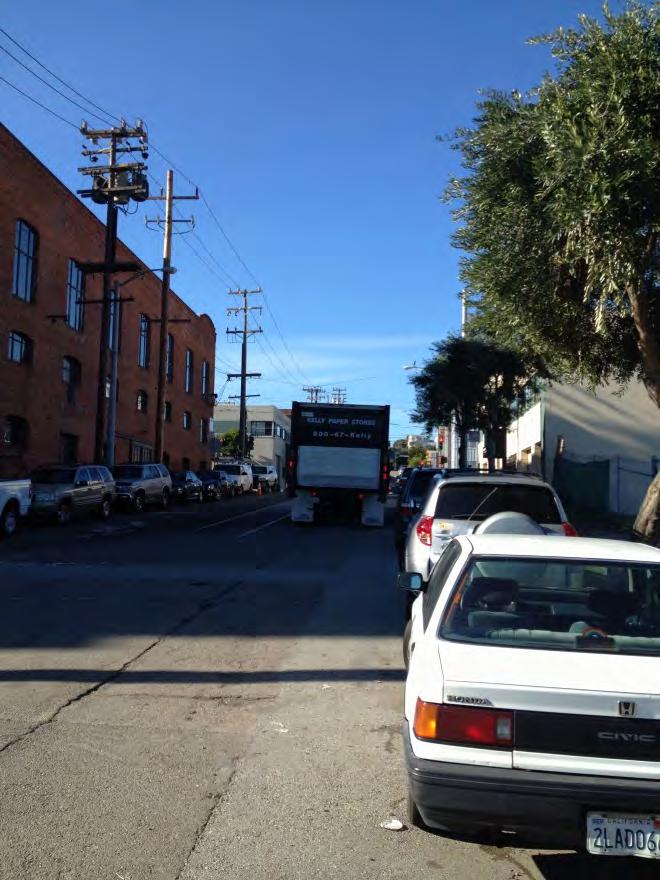
63 Source: Weiss Associates. January 2013 Figure 3-6. View of Nineteenth Street towards Third Street facing west 55

64 Source: Weiss Associates. January 2013 Figure 3-7. View of Nineteenth Street toward Illinois Street facing east 56


65 Figure 3-8. Area of Potential Effects 57

66 Source: data.sfgov.org. Figure 3-9. Project vicinity and surrounding neighborhoods 58
 planned for Pier 70 at the Port of San Francisco 59")
67 Source: Port of San Francisco, Pier 70 Preferred Master Plan (Port of SF, 2012) Figure Recreation areas (parks and open space) planned for Pier 70 at the Port of San Francisco 59
68 This page intentionally left blank. 60
69 4. OTHER CONSIDERATIONS 4.1 Growth and Secondary Effects Under NEPA, federal agencies preparing an EA must consider indirect effects of the proposed action, including growth-inducing affects and other effects related to induced changes in the pattern of land use, population density, or growth rate (40 CFR ). Growth can be induced in a number of ways, including the elimination of obstacles to growth, or through the stimulation of economic activity within the region. The discussion of removal of obstacles to growth relates directly to the removal of infrastructure limitations or regulatory constraints that could result in growth. In general, a project may foster spatial, economic, or population growth in a geographic area if it meets any one of the criteria identified below: The project removes an impediment to growth (e.g., the establishment of an essential public service, or the provision of new access to an area); The project results in the urbanization of land in a remote location (leapfrog development); The project establishes a precedent-setting action (e.g., a change in zoning or general plan amendment approval); or Economic expansion or growth occurs in an area in response to the project (e.g., changes in revenue base, employment expansion, etc.). If a project meets any one of these criteria, it may be considered growth inducing. Generally, growth inducing projects are either located in isolated, undeveloped, or underdeveloped areas, necessitating the extension of major infrastructure such as sewer and water facilities or roadways, or encourage premature or unplanned growth. The Mission Bay Loop would be improving transit service in a predominately built-out urban environment. The project would be expected to gradually increase levels of service and flexibility on the existing T-Third Street light rail line by 2019 when the Central Subway project is complete. The project would not be expected to stimulate additional or higher intensity development over what is already planned for the immediate project area and surrounding areas. Further the project would help accommodate transit needs associated with presently planned development projects in the City of San Francisco. As a result, the proposed action would not result in significant growth-inducing effects. 4.2 Cumulative Effects NEPA states that federal agencies preparing an EA must consider the cumulative effects that result from incremental impacts of a proposed action and other actions. For the purpose of NEPA, 61
70 cumulative effects are defined in 40 CFR as impact(s) on the environment which results from the incremental impact of the action (project) when added to other past, present, and reasonably foreseeable future actions. In addition to redevelopment of the Pier 70 area by the Port of San Francisco, planned projects in the general vicinity of the Mission Bay Loop include improvements to street elements across the Mission Bay area at UCSF Medical Center, Mission Bay Tech/Biotech Corridor, traffic circle connectors, as well as the Mission Bay/UCSF Hospital Multimodal Transportation Project undertaken by the SFMTA (Reiskin, 2012). These projects may contribute to cumulative impacts during construction including traffic disruption such as lane closures and detours, and construction-related noise and air quality effects. These impacts would be temporary and do not result in a cumulative adverse effect. Air Quality: As noted in section 3.3, no substantial effects related to air quality are expected from the proposed action, including increases in air pollutant emissions or deterioration of ambient air quality. Air quality effects related to growth and non-transportation projects can be expected to contribute to long-term cumulative effects. Other proposed projects in the area, including residential developments and the planned redevelopment of Pier 70, may produce adverse air quality effects. However, operation of additional trains on the Mission Bay Loop would alleviate air quality effects of currently approved development in the area by improving and increasing zero-emissions transportation options. As a result, no cumulative effects on air quality would occur from implementation of the Loop project. Land Use: The acceleration of change in land use in the southeastern quadrant of San Francisco was identified as a potential effect of the Third Street Light Rail Project. Such land use changes would be reviewed for consistency with the adopted goals, policies, and objectives of the Central Waterfront Area Plan; would improve rather than degrade the existing character of the area; and were consequently deemed not to result in any adverse effects. Noise: Existing development in the project vicinity is residential, industrial, and commercial/retail warehousing operations. Planned and possible future commercial and residential development in the Mission Bay area may contribute cumulatively to noise in the project vicinity. Contribution of the proposed action to cumulative noise impacts within the project vicinity would be non-substantial. Mitigation of project specific and cumulative impacts would be the responsibility of future developers as well as the City and County of San Francisco. See section 3.7 for a discussion of specific noise impacts related to the Loop project. Transportation: The purpose of the proposed action is to increase the levels of transit service, reliability, and flexibility to the existing Third Street light rail line through the addition of a turn-around loop. Further, the project site is located in a highly developed urban area with and extensive existing transportation network. Analysis of the potential impacts of the project on transportation concluded that the proposed action would not contribute to cumulative transportation impacts. The benefits of increased public transit service and reliability are anticipated to outweigh the need to convert the project area to other uses in the future. As a result, there would be a low potential 62
71 for substantial contributions to cumulative impacts upon resources, ecosystems, and human communities as the result of the proposed action. 4.3 Irretrievable and Irreversible Commitment of Resources A review of irreversible and irretrievable commitment of resources is required under NEPA. Implementation of the proposed action involves a commitment of a range of natural, physical, human, and fiscal resources. Land used in the construction of the Loop is considered to require an irreversible commitment during the time period that the land is used for the transportation system. However, if a greater need arises for use of the land or if the transportation system is no longer needed, the land can be converted to another use. At present, there is no reason to believe such a conversion will ever be necessary or desirable. The Loop project would be constructed within an existing transportation right-of-way that is already used for transportation use. As a result, no change in the commitment of this resource would occur. Additionally, labor and natural resources would be used in the fabrication and preparation of construction materials and in constructing the Loop. Under the proposed action, fossil fuels, labor, and construction materials such as cement, aggregate, and steel would be expended in construction the Loop. The commitment of energy and labor for construction would also be irretrievable and irreversible. These resources are not in short supply, and their use would not have an adverse effect on continued availability of these resources. Any construction would require an expenditure of both state and federal funds, which are not retrievable. The commitment of these non-renewable resources is based on the premise that area residents would benefit from the improved quality of the transportation system. Benefits include improved accessibility to public transit, reduced vehicle miles traveled, time savings, and greater availability of services. The benefits are anticipated to outweigh the commitment of these resources. No Action: No commitment of resources would occur if the Loop is not built. 4.4 Local Short-Term Impacts and Resource Uses Verses Long-Term Productivity A review of the balance between short-term impacts and resources used and long-term productivity of resources within the project area is required under NEPA (40 CFR ). Shortterm would be considered for the duration of the construction period, and long-term would be for the life of the project (30 years). Long-term productivity refers to sustainable uses of existing environment and increases in environmental quality such as low noise levels, clean air, pure water, and low levels of other kinds of pollutants. Short-term local impacts include disruption of community or economic activities during construction, minor noise increase on Eighteenth, Nineteenth, and Illinois Streets, and changes in the transportation flow due to new signalization of intersections. 63
72 The Mission Bay Loop would be constructed in an area historically and currently used for transportation; rail operations would improve levels of service in the project area as well as other at segments of the transportation system, increase operational safety and efficiency, and make future light rail service more feasible and accessible. Transportation improvements resulting from the construction of the Loop are based on state and local comprehensive planning, which considers present and future transportation needs within the context of present and future land use development. The local short-term impacts and use of resources associated with the proposed action are consistent with the maintenance and enhancement of long-term productivity for the city. 64
73 5. CONSULTATION AND COORDINATION The Mission Bay Loop project was presented to various agencies at the federal, state, and regional/local levels as part of the EIS/EIR to the Third Street Light Rail Project approved by the City and County of San Francisco Planning Department. Presentations, community meetings, and information gathering sessions were conducted to identify concerns, potential solutions, and anticipated environmental effects of the T-Third Street light rail. Information about the proposed action and various alternatives was presented. Additional outreach to the community was conducted in late 2012 and early Contact was made with the following agencies: City and County of San Francisco Planning Department City and County of San Francisco Department of Public Works California State Historic Preservation Office Bay Area Air Quality Management District Outreach and early coordination allowed the SFMTA to identify issues and concerns to be incorporated in the environmental assessment process. 5.1 Public Meetings The SFMTA held a public meeting at 654 Minnesota Street on February 11, 2013 to determine if there were any significant concerns or issues from the surrounding community with regards to the proposed action. Notice of the meeting was mailed to over 400 owners of residential and commercial units with one-quarter of a mile of the proposed location of the Loop. A copy of the notice provided to area residents and business owners is included in Appendix E. Information about the proposed meetings was also posted on SFMTA s website ( MissionBayLoop.htm), the Potrero Dogpatch Merchants Association s website ( on San Francisco Eastern Neighborhoods United Front s Facebook page, the SF Streets blog ( and other social media outlets. A Cantonese and Mandarin-speaking interpreter was present and translation into Spanish was available at the February 11, 2013 meeting. SFMTA staff presented information about the project scope, construction, operation, service improvements, and integration with long-term transportation projects to those attending the 90-minute meeting. About 30 people were in attendance; they asked questions and provided feedback about the proposed project. Eight written comments were received. The discussion centered on the short-term and long-term service implications of the Loop and whether the Loop would accommodate desired service improvements, including service to Pier 70 and Mission Bay and more reliable service to the Sunnydale area. 65
74 Specific questions and/or comments included clarification regarding the volume of trains that would service the Sunnydale area, whether riders on the southbound T-Third rail line would be required to disembark at the Loop and board another train to Sunnydale, how many trains would use the Loop on a daily basis, how the Loop would be used prior to the launch of the Central Subway, whether historic cars would be able to travel on the Loop to access Pier 70 and Dogpatch Historic Districts, whether a train platform would be constructed as part of the project, and whether relocation of the Loop to a more southern location was a better option that may avoid train-related noise and vehicle access to garages at residences on Eighteenth and Nineteenth Streets. Questions regarding the Loop s service hours were raised and a desire for longer service hours was expressed by some. Positive feedback regarding service improvements resulting from the Loop project was also provided. The SMFTA staff presented detailed information about integration of the Loop with other upcoming and long-range transportation projects, including the option to create additional turnaround locations south of the proposed Loop, the need for the Loop to allow flexibility in long-range planning on and around the T-Third Line, the planned route change on the T-Third line that will route the trains directly to downtown instead of via The Embarcadero and near term improvements in signalization in the Central Waterfront area. The SFMTA considered the input obtained from the public in developing the proposed action. Comments that related to the larger transportation network are being considered as part of the ongoing transportation service plan and other improvements to which those comments related. Some of those present articulated various long-term improvements desired for the Central Waterfront neighborhood. The SFTMA encouraged those persons to work with the agency in developing longterm improvements. 5.2 Notice of Availability and Distribution List A Notice of Availability of the EA dated May 6, 2013 was sent to the distribution list provided in Appendix F. 66
75 6. LIST OF PREPARERS United States Department of Transportation Federal Transit Administration 201 Mission Street, Room Raymond Sukys, Director, Office of Planning and Program Development Alexander Smith, Community Planner Mary Nguyen, Environmental Protection Specialist San Francisco Municipal Transportation Agency 1 South Van Ness Ave, 7th Floor Consultants Edward D. Reiskin, Director of Transportation Peter Brown, Project Manager Sustainable Streets-Strategic Planning & Policy peter.brown@sfmta.com Weiss Associates 2200 Powell Street, Suite 925 Emeryville, California Robert Devany, Principal Scott Bourne, Program Manager Agata Sulczynski, Senior Project Manger Jessica Mosby, Administrative Assistant Ward & Associates Environmental Consultants 870 Market Street, Suite William Ward, Principal Dennis Kearney, Senior Project Manager Mike Wood, Senior Biologist 67
76 CARDNO ENTRIX 2300 Clayton Road Concord, California Kimberly Demuth, MS, Technical Director Cultural Resources, Vice President Jennifer Flathman, MS, Project Architectural Historian Rachel Tamigniaux, MSc, Project Coordinator Jennifer M. Ferris, MAProject Archaeologist CHS Consulting Group 30 Sutter Street, Suite Chi-Hsin Shao, Principal Transportation Planner Migi Lee, Transportation Planner Charles M. Salter Associates, Inc. 130 Sutter Street, Floor Eric A. Yee, Noise and Vibration Analysis 68
77 7. REFERENCES Ahmadi, Rana. Memorandum titled Environmental Review for the Mission Bay Loop Project sent to Monica Pereira on October 3, : San Francisco Municipal Transportation Agency. Association of Bay Area Governments (ABAG), San Francisco Bay Area Housing Needs Plan, Bay Area Air Quality Management District (BAAQMD), Bay Area 2005 Ozone Strategy, Volume 1. California: Bay Area Air Quality Management District. BAAQMD, California Environmental Quality Act, Air Quality Guidelines. California: Bay Area Air Quality Management District. California Department of Transportation (Caltrans), Officially Designated Scenic Highways. Last updated July 11, Carey & Co. Inc, Union Iron Works National Register Nomination. Accessed March 08, City and County of San Francisco (City and County of SF). General Plan. City and County of SF, Eastern Neighborhoods Draft Environmental Impact Report - Rezoning and Area Plans, June 30. City of South San Francisco, General Plan. United States Department of Transportation (DOT), Transit Safety Management and Performance Measurement Volume 1: Guidebook. United States: U.S. Department of Transportation Federal Transit Administration Office of Safety and Security. Federal Transit Administration (FTA), 1998a. Third Street Light Rail Project, Draft Environmental Impact Statement/Draft Environmental Impact. : City of San Francisco Planning Department. FTA, 1998b. Third Street Light Rail Project, Final Environmental Impact Statement/Final Environmental Impact Report (City of San Francisco Case No E, State Clearinghouse No ). : City of San Francisco Planning Department. 69
78 FTA, 1998c. Third Street Light Rail Project, Programmatic Agreement (Reference FTA980703A). : San Francisco Public Transit Department. FTA, Transit Noise and Vibration Impact Assessment (No. FTA-VA ). United States: Office of Planning and Environment, Federal Transit Administration. FTA, Safety & Security. Last updated Metropolitan Transportation Commission (MTC), San Francisco Bay Area Regional Transportation Emergency Management Plan Baseline Operating Plan. Oakland, CA: Metropolitan Transportation Commission. MTC, Transportation 2035 Plan for the San Francisco Bay Area. Oakland, CA: Metropolitan Transportation Commission. National Park Service (NPS), National Historic Landmarks Program. Accessed January 23, Northgate Environmental Management, Inc. (Northgate), Geotechnical Investigation Report, Mission Bay Loop Extension. : San Francisco Department of Public Works. Port of San Francisco (Port of SF), Pier 70 Preferred Master Plan. : Port of San Francisco. Port of SF, Draft Master Plan. Last updated Reiskin, Edward. Memorandum titled SFMTA Response, With Related Materials, to Leslie Rogers, Letter of November 26, 2012 sent to Leslie Rogers (Regional Administrator, Federal Transit Administration Region IX) on December 19, : San Francisco Municipal Transportation Agency. San Francisco Department of the Environment (SF Dept. of the Environment), Climate Action Plan for San Francisco. : San Francisco Public Utilities Commission. San Francisco Municipal Code (SF Municipal Code), Environment Code (last amended by Ordinance , File No ). San Francisco, CA: City and County of San Francisco. San Francisco Municipal Transportation Agency (SFMTA), San Francisco Charter Section 8A.115, Transit-First Policy. : San Francisco Municipal Transportation Agency. SFMTA, Third Street Light Rail Phases Service Integration Plan For Operations, Fleet, and Financial Planning. 70
79 SFMTA, 2012a. Departmental Climate Action Plan Fiscal Year : San Francisco Municipal Transportation Agency. SFMTA, 2012b San Francisco Collisions Report. : San Francisco Municipal Transportation Agency. San Francisco Planning Department, Central Waterfront Advisory Committee, San Francisco Architectural Heritage, Dogpatch Neighborhood Association, and Page and Turnbull (SF Planning Dept. et. al.), Central Waterfront Cultural Resources Survey, Summary Report and Draft Context Statement. Rohnert Park, California: Northwest Information Center. City of San Francisco Planning Department (SF Planning Dept.), Central Waterfront District Record. Rohnert Park, California: Northwest Information Center. SF Planning Dept., 2008a. Potrero Point (Common Name: Central Waterfront) Historic District Record. : City of San Francisco Planning Department. SF Planning Dept., 2008b. Eastern Neighborhoods Rezoning and Area Plans Final Environmental Impact Report (Case No E, State Clearinghouse No ). San Francisco, California: City of San Francisco Planning Department. SF Planning Dept., 2011a. Certificate of Determination, Exemption from Environmental Review (Case No.: E, 720 & 740 Illinois Street and 2121 Third Street Project). San Francisco, California: City of San Francisco Planning Department. SF Planning Dept., 2011b. San Francisco Neighborhoods Socio-Economic Profiles, American Community Survey. : City of San Francisco Planning Department. SF Planning Dept., Third Street Residential Retail Project Transportation Impact Study (Case Number E). : City of San Francisco Planning Department. SF Planning Dept., Central Waterfront Area Plan San Francisco General Plan Last updated #CW_HIS. United States Department of Health and Human Services, 2013, Annual Update of the HHS Poverty Guidelines. Notice. 78 Federal Register 5182, Pages
80 This page intentionally left blank.
81 APPENDIX A PHOTOGRAPHS OF ALTERNATIVE LOOP LOCATIONS CONSIDERED
82 This page intentionally left blank.
83 Table A. Alternative loop locations considered and rejected Alternate Location Between Streets Photograph Number Third Street Mariposa Street (Intersection) 1 Mariposa Street Third Street Tennessee Street 2 Tennessee Street Mariposa Street Eighteenth Street 3 Eighteenth Street Third Street Tennessee Street 4 Eighteenth Street Tennessee Street Indiana Street 5 Tennessee Street Eighteenth Street Nineteenth Street 6, 7, 8, 9 Nineteenth Street Third Street Tennessee Street 10,11,12 Twentieth Street Third Street (Intersection) 13, 14 Twentieth Street Third Street Tennessee Street 15 Tennessee Street Twentieth Street Nineteenth Street 16 Illinois Street Nineteenth Street Twentieth Street 17, 18, 19 Twentieth Street Third Street Illinois Street 20, 21 Twenty-Second Street Tennessee Street Third Street 22 Twenty-Second Street Tennessee Street Dead End 23 Twenty-Second Street Illinois Street Third Street 24 Twenty-Second Street Illinois Street Twenty-Third Street 25, 26 Twenty-Third Street Illinois Street The Bay 27 Twenty-Fourth Street Illinois Street The Bay 28, 29 Twenty-Fourth Street Michigan Street The Bay 30 Tennessee Street Twenty-Third Street Twenty-Fourth Street 31, 32 Tennessee Street Twenty-Fourth Street Twenty-Fifth Street 33, 34, 35, 36 Twenty-Fourth Street Tennessee Street Third Street 37 Twenty-Fourth Street Tennessee Street Minnesota Street 38 Source: SFMTA


84 Photograph No. 1: Intersection of Third Street and Mariposa Street Photograph No. 2: Mariposa Street between Third Street and Tennessee Street


85 Photograph No. 3: Tennessee Street between Mariposa Street and Eighteenth Street Photograph No. 4: Eighteenth Street between Third Street and Tennessee Street


86 Photograph No. 5: Eighteenth Street between Tennessee Street and Indiana Street Photograph No. 6: Tennessee Street between Eighteenth Street and Nineteenth Street


87 Photograph No. 7: Tennessee Street between Nineteenth Street and Eighteenth Street Photograph No. 8: Tennessee Street between Nineteenth Street and Eighteenth Street


88 Photograph No. 9: Tennessee Street between Nineteenth Street and Eighteenth Street Photograph No. 10: Nineteenth Street between Third Street and Tennessee Street


89 Photograph No. 11: Nineteenth Street between Third Street and Tennessee Street Photograph No. 12: Nineteenth Street between Third Street and Tennessee Street


90 Photograph No. 13: Intersection at Twentieth Street and Third Street Photograph No. 14: Intersection at Twentieth Street and Third Street


91 Photograph No. 15: Twentieth Street between Third Street and Tennessee Street Photograph No. 16: Tennessee between Nineteenth Street and Twentieth Street


92 Photograph No. 17: Illinois Street between Nineteenth Street and Twentieth Street Photograph No. 18: Illinois Street between Nineteenth Street and Twentieth Street


93 Photograph No. 19: Illinois Street between Nineteenth Street and Twentieth Street Photograph No. 20: Twentieth Street between Illinois Street and Third Street


94 Photograph No. 21: Twentieth Street between Illinois Street and Third Street Photograph No. 22: Twenty-Second Street between Tennessee Street and Third Street


95 Photograph No. 23: Twenty-Second Street between Tennessee Street and dead end Photograph No. 24: Twenty-Second Street between Illinois Street and Third Street
 between")
 between Illinois")
96 Photograph No. 25: Twenty-Second Street (E/S) between Illinois Street and Twenty-Third Street Photograph No. 26: Twenty-Second Street (W/S) between Illinois Street and Twenty-Third Street


97 Photograph No. 27: Twenty-Third Street between Illinois Street and San Francisco Bay Photograph No. 28: Twenty-Fourth Street between Illinois Street and San Francisco Bay


98 Photograph No. 29: Twenty-Fourth Street between Illinois Street and San Francisco Bay Photograph No. 30: Twenty-Fourth Street between Michigan Street and the San Francisco Bay

 between Twenty-Third")
99 Photograph No. 31: Tennessee Street between Twenty-Third Street and Twenty-Fourth Street Photograph No. 32: Tennessee Street (E/S) between Twenty-Third Street and Twenty-Fourth Street


100 Photograph No. 33: Tennessee Street between Twenty-Fourth Street and Twenty-Fifth Street Photograph No. 34: Tennessee Street between Twenty-Fifth Street and Twenty-Fourth Street


101 Photograph No. 35: Tennessee Street between Twenty-Fifth Street and Twenty-Fourth Street Photograph No. 36: Tennessee Street between Twenty-Fourth Street and Twenty-Fifth Street


102 Photograph No. 37: Twenty-Fourth Street between Tennessee Street and Third Street Photograph No. 38: Twenty-Fourth Street between Tennessee Street and Minnesota Street
103 APPENDIX B BIOLOGICAL CONSTRAINTS ASSESSMENT
104 This page intentionally left blank.
105 WOOD BIOLOGICAL CONSULTING, Inc. 65 Alta Hill Way Walnut Creek, CA Tel: (925) Fax: (925) January 28, 2013 Subject: Biological Constraints Assessment, Mission Bay Loop, Third Street Light Rail Project, San Francisco This report presents an evaluation of potential biological constraints to the proposed extension of the Third Street Light Rail Project in the City and County of San Francisco. An Environmental Impact Statement/Environmental Impact Report (EIS/EIR) for the Third Street Light Rail Project was completed and approved in 1999 by the Federal Transit Administration (FTA) and the City of San Francisco and construction of the light rail project began. Due to budget constraints, a portion of the Third Street Light Rail Project, the Mission Bay Loop, was not completed. Because approximately 12 years have passed since the EIS/EIR for Third Street Light Rail Project was completed, the FTA has prepared this EA to identify and evaluate any conditions that might have changed after 1999 that could potentially result in significant environmental impacts from construction of the Mission Bay Loop. This report has been prepared to address concerns regarding the potential for adverse effects on special status biological resources. Biological constraints consist of federally and state listed endangered and rare species and their habitats, other special status species regulated under state or local laws or ordinances, wetlands and other riparian habitats, and other special status plant communities. The objective of this report is to verify that the proposed project would have no significant adverse effects on special status species or habitats. PROJECT DESCRIPTION In 2003, the San Francisco Municipal Transportation Agency (SFMTA) began service on the T Third Street line between Embarcadero and Sunnydale. The new Mission Bay Loop would allow trains on the T Third Street line to turn around via connection from Third Street to
106 Page 2 January 28, 2013 Eighteenth, Illinois, and Nineteenth Streets in order to increase service frequency to downtown. The project would improve transit service in the Mission Bay, SOMA, and Chinatown neighborhoods once the Central Subway is complete (2019). Transit service for residents of the Third Street corridor south of Mission Bay would also be enhanced. The proposed project location is within the area of San Francisco known as the Central Waterfront area, just east of Potrero Hill and south of SOMA. The project site lies immediately adjacent to Pier 70 at the Port of San Francisco. METHODS This evaluation of potential biological constraints is based on a review of aerial photographs, and a single reconnaissance level site inspection. The findings for this biological constraints assessment are based on the following: 1) database queries for the San Francisco North, Hunters Point, San Francisco South, Point Bonita, San Rafael, Oakland West, Richmond, San Quentin, and San Mateo 7.5 minute USGS quadrangles maintained by the California Natural Diversity Database (CNDDB 2012), California Native Plant Society (CNPS 2013), and U.S. Fish and Wildlife Service (USFWS 2011) (see Attachment A); 2) an assessment of habitat types and surrounding land uses during a reconnaissancelevel site inspection performed by biologist Michael Wood on January 27, Additional information regarding special status and common plant and wildlife species was obtained by review of published lists and floras (CDFG 2011 a,b; CDFG 2012 a,b; Howell, et al. 1958; Wood 2012; Wood, in prep.). Nomenclature for common, widespread plants and animals conforms to Baldwin, et al. (2012) and CDFG (2005), respectively; plant names have been updated to conform to the Jepson Online Interchange. 1 Nomenclature for special status plants and animals conforms to CDFG (2012a and 2011a respectively). SETTING The study area is confined to a section of Third Street between 18 th Street and 19 th Street on the eastern edge of the City and County of San Francisco. The site is completely developed with a paved street, sidewalks, multi story apartment buildings and commercial and industrial development adjacent to the Central Waterfront area and Pier 70. The only nearby green area is the 2.7 acre urban park known as Dogpatch Park, located approximately 850 feet southwest of the study area. 1 Available online at Wood Biological Consulting, Inc. Mission Bay Loop
107 Page 3 January 28, 2013 Illinois Street is a two lane paved surface road with curb side parking and sidewalks (in part). Pavement typically extends to the buildings fronting the street. The west side of the street includes paved and graveled parking areas and buildings; a graveled vacant lot separated from the east side of the street by a six foot tall chain link fence. At its nearest, the study area is approximately 300 feet west of the edge of San Francisco Bay and 3500 feet southeast from heavily industrialized Islais Creek. No remnants of natural habitats are present on site. Onsite, the only vegetation includes planted ornamental street trees and a small amount of ruderal vegetation. Street trees on site include two southern magnolia trees (Magnolia grandiflora; ca 10 tall), and three European olive trees (Olea europea; ca 12 tall). The only other vegetation in the study area consists of patches of ruderal species (i.e., plants that colonize disturbed land from which all vegetation has been previously removed) on strips of unpaved ground and vacant lots. This vegetation consists of non native herbaceous species including sweet fennel (Foeniculum vulgare), Bermuda buttercup (Oxalis pescaprae), annual bluegrass (Poa annua), pellitory (Perietaria hespera), burclover (Medicago polymorpha), cheeseweed (Malva parviflora), and white stem filaree (Erodium moschatum). In the southeastern waterfront area of San Francisco, as many as 29 bird species were recorded utilizing waterfront structures during the summer months in 2007 and 2008; nesting by five species was confirmed (Weeden and Lynes 2009). No successful rearing of chicks by these species was observed at Pier 70. These structures are approximately 1000 feet from the project site. Bird species observed utilizing street trees and ruderal vegetation at the time of the present survey include house sparrow (Passer domesticus), rock pigeon (Columba livia), and European starling (Sturnus vulgaris). Adjacent structures such as the eaves of structures and adjacent cranes were inspected for evidence of nesting; no nest structures were observed. Rooftops, which may support nesting by western gull (Larus occidentalis) and Caspian tern (Hydroprogne caspia), were not inspected as part of this effort. SPECIAL STATUS BIOLOGICAL RESOURCES Special status plant and animal species are regarded as endangered, threatened, rare (or candidates for such listing) under the federal or State endangered species acts, as well as those listed as special by the California Department of Fish and Wildlife (CDFW) 2 and California Native Plant Society (CNPS). Special status habitat types or classifications are those that receive regulatory protection, for example, under Section 404 of the Clean Water Act (CWA) or Section 1600 of the California Fish and Game Code (CFGC), those designated as Critical 2 As of January 1, 2013, the Cal. Dept. of Fish and Game has been renamed the Cal. Dept. of Fish and Wildlife. Wood Biological Consulting, Inc. Mission Bay Loop
108 Page 4 January 28, 2013 Habitat under Section 4(B)(2) of the Federal Endangered Species Act (FESA), and communities that are of limited distribution statewide or within a county or region. Based on a review of the databases cited above, a total of 82 special status plant species have been recorded from the nine 7.5 minute USGS quadrangles covering northern San Mateo County, San Francisco County, southern Marin County and western Contra Costa and Alameda counties (see Attachment A). Of these, 35 special status plant species have been recorded from San Francisco County. Based on the lack of suitable habitat, there is no potential for occurrence of any special status plant species within the study area. Based on a review of the databases cited above, a total of 69 special status animal species have been recorded from the nine 7.5 minute USGS quadrangles covering northern San Mateo County, San Francisco County, southern Marin County and western Contra Costa and Alameda counties (see Attachment A). Of these, 30 special status animal species have been recorded from San Francisco County. In addition, numerous species of migratory birds protected under the Migratory Bird Treaty Act (MBTA) occur in the project region. Based on the lack of suitable habitat, there is no potential for occurrence of any special status animal species within the study area. Potentially suitable nesting habitat in the immediate project vicinity (i.e., within 250 feet) for migratory birds is restricted to rooftops and building eaves; existing street trees are small (maximum height: 12 feet) and are unlikely to support successful breeding of migratory birds. No special status natural communities or habitat types are present within the study area. No wetlands or other waters of the U.S./waters of the State are present on site. CONCLUSIONS The study area supports no natural or artificial plant communities or habitat types. Potential wildlife habitats are restricted to a few small ornamental street trees and structures. Due to the highly altered nature of the study area and the high level of continuous human disturbance (e.g., noise, lights, human activity), the likelihood of occupation by wildlife is extremely low. Only species inured to such high levels of human activity would be expected to periodically forage or potentially breed in the immediate project vicinity, including birds such as rock pigeon, house sparrows, European starling, and house finch (Carpodacus mexicanus), and mammals such as Norway and black rats (Rattus norvegicus and R. rattus). The proposed project would be restricted to the paved portion of Illinois Street and would involve the removal of existing pavement, laying of new rail tracks, repaving of the street. Disturbances would include temporary increases in noise and activity associated with this work. The project would not involve the removal of any street trees or ruderal vegetation, or the demolition of structures that could potentially support nesting birds or roosting bats. Wood Biological Consulting, Inc. Mission Bay Loop

109 Page 5 January 28, 2013 Project implementation would not result in any adverse effects on special status plant or animal species, either directly, indirectly or cumulatively. Project implementation would not result in any direct, indirect or cumulative adverse effects on special status natural communities or habitat types, including wetlands or other waters of the U.S./waters of the State. If you have any questions about this evaluation, please don t hesitate to contact me. Sincerely, Michael Wood Enclosures: Literature Cited Attachment A Database printouts Wood Biological Consulting, Inc. Mission Bay Loop
110 Page 6 January 28, 2013 LITERATURE CITED Baldwin, B.G, D.H. Goldman, D.J. Keil, R. Patterson, T.J. Rosatti, and D.H. Wilken, editors The Jepson Manual: Vascular Plants of California. Second edition. Univ. Calif. Press, Berkeley pp. Jepson eflora available online at California Department of Fish and Game (CDFG) Natural Communities List Arranged Alphabetically by Life Form. Vegetation Classification and Mapping Program, Biogeographic Data Branch. September. Available online at a. Special Animals. California Natural Diversity Data Base. January. Available online at b. State and Federally Listed Endangered and Threatened Animals of California. Habitat Conservation Division, California Natural Diversity Data Base. January. Available online at a. Special Vascular Plants, Bryophytes, and Lichens List. Biannual publication, Mimeo. May. Available online at b. State and Federally Listed Endangered, Threatened, and Rare Plants of California. Habitat Conservation Division, California Natural Diversity Data Base. May. Available online at California Native Plant Society (CNPS) Inventory of Rare and Endangered Plants. Online search of the San Francisco North, Hunters Point, San Francisco South, Point Bonita, San Rafael, Oakland West, Richmond, and San Quentin USGS 7.5 Quadrangles. California Native Plant Society. Sacramento, CA. Online edition, v7 06d. Accessed on January 25, 2013 at California Natural Diversity Data Base (CNDDB) Data Base Print out for San Francisco North, Hunters Point, San Francisco South, Point Bonita, San Rafael, Oakland West, Richmond, San Quentin, and San Mateo USGS 7.5 Quadrangles. RareFind California Department of Fish and Game, Habitat Conservation Division. Sacramento, California. Information dated December 30, Howell, J.T., P.H. Raven, and P. Rubtzoff A Flora of. Univ. of San Francisco. 157 pp. United States Fish and Wildlife Service (USFWS) Federal Endangered and Threatened Species that Occur in or may be Affected by Projects in the San Francisco North, Hunters Point, San Francisco South, Point Bonita, San Rafael, Oakland West, Richmond, San Quentin, and San Mateo 7.5 minute USGS Quadrangles. Threatened and Endangered Species System (TESS) Wood Biological Consulting, Inc. Mission Bay Loop
111 Page 7 January 28, 2013 printout. Database updated September 18, 2011, accessed January 25, 2013, at overview.htm. Weeden, N. and M Lynes Summary Report of Avian Surveys Conducted in 2008 at Dilapidated Piers and Other Structures along the Port of San Francisco s Southern Waterfront Properties. Unpublished report (GGA ). Golden Gate Audubon Society, Berkeley, California. Available on line at Wood, M.K Preliminary Checklist of the Extant Flora of San Francisco County. Co chairman, Rare Plant Committee, California Native Plant Society, Yerba Buena Chapter. Revised December 10. Wood, M.K. In preparation. Rare and Locally Significant Plants of San Francisco County. Rare Plant Committee, California Native Plant Society, Yerba Buena Chapter. Wood Biological Consulting, Inc. Mission Bay Loop
112 ATTACHMENT A DATABASE PRINTOUTS Wood Biological Consulting, Inc. Mission Bay Loop
113 California Department of Fish and Game Natural Diversity Database Mission Bay Loop, Third Street Light Rail Project Query for the San Francisco North, Hunters Point, San Francisco South, Point Bonita, San Rafael, Oakland West, Richmond, San Quentin, San Mateo USGS quadrangles Scientific Name/Common Name Element Code Federal Status State Status GRank SRank CDFG or CNPS 1 Acanthomintha duttonii San Mateo thorn-mint PDLAM01040 Endangered Endangered G1 S1 1B.1 2 Accipiter cooperii Cooper's hawk ABNKC12040 G5 S3 3 Adela oplerella Opler's longhorn moth IILEE0G040 G2G3 S2S3 4 Allium peninsulare var. franciscanum Franciscan onion PMLIL021R1 G5T2 S2.2 1B.2 5 Ambystoma californiense California tiger salamander AAAAA01180 Threatened Threatened G2G3 S2S3 SC 6 Amorpha californica var. napensis Napa false indigo PDFAB08012 G4T2 S2.2 1B.2 7 Amsinckia lunaris bent-flowered fiddleneck PDBOR01070 G2? S2? 1B.2 8 Antrozous pallidus pallid bat AMACC10010 G5 S3 SC 9 Archoplites interruptus Sacramento perch AFCQB07010 G3 S1 SC 10 Arctostaphylos franciscana Franciscan manzanita PDERI040J3 G1 S1 1B.1 11 Arctostaphylos imbricata San Bruno Mountain manzanita PDERI040L0 Endangered G1 S1 1B.1 12 Arctostaphylos montana ssp. montana Mt. Tamalpais manzanita PDERI040J5 G3T2 S2.2 1B.3 13 Arctostaphylos montana ssp. ravenii Presidio manzanita PDERI040J2 Endangered Endangered G3T1 S1 1B.1 14 Arctostaphylos montaraensis Montara manzanita PDERI042W0 G2 S2.2 1B.2 15 Arctostaphylos pacifica Pacific manzanita PDERI040Z0 Endangered G1 S1 1B.2 16 Arctostaphylos pallida pallid manzanita PDERI04110 Threatened Endangered G1 S1 1B.1 17 Arctostaphylos virgata Marin manzanita PDERI041K0 G2 S2.2 1B.2 18 Ardea alba great egret ABNGA04040 G5 S4 19 Ardea herodias great blue heron ABNGA04010 G5 S4 20 Arenaria paludicola marsh sandwort PDCAR040L0 Endangered Endangered G1 S1 1B.1 21 Asio flammeus short-eared owl ABNSB13040 G5 S3 SC 22 Astragalus pycnostachyus var. pycnostachyus coastal marsh milk-vetch PDFAB0F7B2 G2T2 S2.2 1B.2 23 Astragalus tener var. tener alkali milk-vetch PDFAB0F8R1 G2T2 S2 1B.2 Commercial Version -- Dated December 30, Biogeographic Data Branch Page 1 Report Printed on Friday, January 25, 2013 Information Expires 06/30/2013
114 California Department of Fish and Game Natural Diversity Database Mission Bay Loop, Third Street Light Rail Project Query for the San Francisco North, Hunters Point, San Francisco South, Point Bonita, San Rafael, Oakland West, Richmond, San Quentin, San Mateo USGS quadrangles Scientific Name/Common Name Element Code Federal Status State Status GRank SRank CDFG or CNPS 24 Athene cunicularia burrowing owl ABNSB10010 G4 S2 SC 25 Atriplex joaquinana San Joaquin spearscale PDCHE041F3 G2 S2 1B.2 26 Banksula incredula incredible harvestman ILARA14100 G1 S1 27 Caecidotea tomalensis Tomales isopod ICMAL01220 G2 S2 28 Calicina minor Edgewood blind harvestman ILARA13020 G1 S1 29 California macrophylla round-leaved filaree PDGER01070 G2 S2 1B.1 30 Callophrys mossii bayensis San Bruno elfin butterfly IILEPE2202 Endangered G4T1 S1 31 Calochortus tiburonensis Tiburon mariposa-lily PMLIL0D1C0 Threatened Threatened G1 S1 1B.1 32 Calystegia purpurata ssp. saxicola coastal bluff morning-glory PDCON040D2 G4T2 S2.2 1B.2 33 Carex comosa bristly sedge PMCYP032Y0 G5 S Castilleja affinis ssp. neglecta Tiburon paintbrush PDSCR0D013 Endangered Threatened G4G5T1 S1 1B.2 35 Charadrius alexandrinus nivosus western snowy plover ABNNB03031 Threatened G4T3 S2 SC 36 Chloropyron maritimum ssp. palustre Point Reyes bird's-beak PDSCR0J0C3 G4?T2 S2.2 1B.2 37 Chorizanthe cuspidata var. cuspidata San Francisco Bay spineflower PDPGN04081 G2T2 S2.2 1B.2 38 Chorizanthe robusta var. robusta robust spineflower PDPGN040Q2 Endangered G2T1 S1 1B.1 39 Cicindela hirticollis gravida sandy beach tiger beetle IICOL02101 G5T2 S1 40 Circus cyaneus northern harrier ABNKC11010 G5 S3 SC 41 Cirsium andrewsii Franciscan thistle PDAST2E050 G2 S2.2 1B.2 42 Cirsium fontinale var. fontinale fountain thistle PDAST2E161 Endangered Endangered G2T2 S1 1B.1 43 Cirsium hydrophilum var. vaseyi Mt. Tamalpais thistle PDAST2E1G2 G2T2 S2 1B.2 44 Cirsium occidentale var. compactum compact cobwebby thistle PDAST2E1Z1 G3G4T2 S2.1 1B.2 45 Clarkia franciscana Presidio clarkia PDONA050H0 Endangered Endangered G1 S1 1B Coastal Brackish Marsh CTT52200CA G2 S2.1 Coastal Terrace Prairie CTT41100CA G2 S2.1 Commercial Version -- Dated December 30, Biogeographic Data Branch Page 2 Report Printed on Friday, January 25, 2013 Information Expires 06/30/2013
115 California Department of Fish and Game Natural Diversity Database Mission Bay Loop, Third Street Light Rail Project Query for the San Francisco North, Hunters Point, San Francisco South, Point Bonita, San Rafael, Oakland West, Richmond, San Quentin, San Mateo USGS quadrangles Scientific Name/Common Name Element Code Federal Status State Status GRank SRank CDFG or CNPS 48 Collinsia corymbosa round-headed Chinese-houses PDSCR0H060 G1 S1 1B.2 49 Collinsia multicolor San Francisco collinsia PDSCR0H0B0 G2 S2.2 1B.2 50 Corynorhinus townsendii Townsend's big-eared bat AMACC08010 G4 S2S3 SC 51 Danaus plexippus monarch butterfly IILEPP2010 G5 S3 52 Dipodomys venustus venustus Santa Cruz kangaroo rat AMAFD03042 G4T1 S1 53 Dirca occidentalis western leatherwood PDTHY03010 G2G3 S2S3 1B.2 54 Dufourea stagei Stage's dufourine bee IIHYM22010 G1? S1? 55 Egretta thula snowy egret ABNGA06030 G5 S4 56 Elanus leucurus white-tailed kite ABNKC06010 G5 S3 57 Emys marmorata western pond turtle ARAAD02030 G3G4 S3 SC 58 Enhydra lutris nereis southern sea otter AMAJF09012 Threatened G4T2 S2 59 Eriogonum luteolum var. caninum Tiburon buckwheat PDPGN083S1 G5T2 S2 1B.2 60 Eriophyllum latilobum San Mateo woolly sunflower PDAST3N060 Endangered Endangered G1 S1 1B.1 61 Eucyclogobius newberryi tidewater goby AFCQN04010 Endangered G3 S2S3 SC 62 Euphydryas editha bayensis Bay checkerspot butterfly IILEPK4055 Threatened G5T1 S1 63 Falco peregrinus anatum American peregrine falcon ABNKD06071 Delisted Delisted G4T3 S2 64 Fissidens pauperculus minute pocket moss NBMUS2W0U0 G3? S1 1B.2 65 Fritillaria biflora var. ineziana Hillsborough chocolate lily PMLIL0V031 G1QT1Q S1 1B.1 66 Fritillaria lanceolata var. tristulis Marin checker lily PMLIL0V0P1 G5T2 S2 1B.1 67 Fritillaria liliacea fragrant fritillary PMLIL0V0C0 G2 S2 1B.2 68 Geothlypis trichas sinuosa saltmarsh common yellowthroat ABPBX1201A G5T2 S2 SC 69 Gilia capitata ssp. chamissonis blue coast gilia PDPLM040B3 G5T2 S2.1 1B.1 70 Gilia millefoliata dark-eyed gilia PDPLM04130 G2 S2.2 1B.2 Commercial Version -- Dated December 30, Biogeographic Data Branch Page 3 Report Printed on Friday, January 25, 2013 Information Expires 06/30/2013
116 California Department of Fish and Game Natural Diversity Database Mission Bay Loop, Third Street Light Rail Project Query for the San Francisco North, Hunters Point, San Francisco South, Point Bonita, San Rafael, Oakland West, Richmond, San Quentin, San Mateo USGS quadrangles Scientific Name/Common Name Element Code Federal Status State Status GRank SRank CDFG or CNPS 71 Grindelia hirsutula var. maritima San Francisco gumplant PDAST470D3 G5T1Q S Helianthella castanea Diablo helianthella PDAST4M020 G2 S2 1B.2 73 Helminthoglypta nickliniana bridgesi Bridges' coast range shoulderband IMGASC2362 G2T1 S1 74 Hemizonia congesta ssp. congesta white seaside tarplant PDAST4R065 G5T2T3 S2S3 1B.2 75 Hesperevax sparsiflora var. brevifolia short-leaved evax PDASTE5011 G4T2T3 S2S3 1B.2 76 Hesperolinon congestum Marin western flax PDLIN01060 Threatened Threatened G2 S2 1B.1 77 Hoita strobilina Loma Prieta hoita PDFAB5Z030 G2 S2 1B.1 78 Holocarpha macradenia Santa Cruz tarplant PDAST4X020 Threatened Endangered G1 S1 1B.1 79 Horkelia cuneata var. sericea Kellogg's horkelia PDROS0W043 G4T2 S2? 1B.1 80 Horkelia tenuiloba thin-lobed horkelia PDROS0W0E0 G2 S2.2 1B.2 81 Hydrochara rickseckeri Ricksecker's water scavenger beetle IICOL5V010 G1G2 S1S2 82 Hydroporus leechi Leech's skyline diving beetle IICOL55040 G1? S1? 83 Hydroprogne caspia Caspian tern ABNNM08020 G5 S4 84 Ischnura gemina San Francisco forktail damselfly IIODO72010 G2 S2 85 Kopsiopsis hookeri small groundcone PDORO01010 G5 S1S Lasionycteris noctivagans silver-haired bat AMACC02010 G5 S3S4 87 Lasiurus blossevillii western red bat AMACC05060 G5 S3? SC 88 Lasiurus cinereus hoary bat AMACC05030 G5 S4? 89 Laterallus jamaicensis coturniculus California black rail ABNME03041 Threatened G4T1 S1 90 Layia carnosa beach layia PDAST5N010 Endangered Endangered G2 S2 1B.1 91 Leptosiphon rosaceus rose leptosiphon PDPLM09180 G1 S1 1B.1 92 Lessingia arachnoidea Crystal Springs lessingia PDAST5S0C0 G1 S1 1B.2 93 Lessingia germanorum San Francisco lessingia PDAST5S010 Endangered Endangered G1 S1 1B.1 Commercial Version -- Dated December 30, Biogeographic Data Branch Page 4 Report Printed on Friday, January 25, 2013 Information Expires 06/30/2013
117 California Department of Fish and Game Natural Diversity Database Mission Bay Loop, Third Street Light Rail Project Query for the San Francisco North, Hunters Point, San Francisco South, Point Bonita, San Rafael, Oakland West, Richmond, San Quentin, San Mateo USGS quadrangles Scientific Name/Common Name Element Code Federal Status State Status GRank SRank CDFG or CNPS 94 Lessingia micradenia var. micradenia Tamalpais lessingia PDAST5S063 G2T1T2 S1S2 1B.2 95 Lichnanthe ursina bumblebee scarab beetle IICOL67020 G2 S2 96 Malacothamnus arcuatus arcuate bush-mallow PDMAL0Q0E0 G2Q S2.2 1B.2 97 Malacothamnus davidsonii Davidson's bush-mallow PDMAL0Q040 G2 S2 1B.2 98 Malacothamnus hallii Hall's bush-mallow PDMAL0Q0F0 G2Q S2 1B.2 99 Masticophis lateralis euryxanthus Alameda whipsnake ARADB21031 Threatened Threatened G4T2 S2 100 Melospiza melodia pusillula Alameda song sparrow ABPBXA301S G5T2? S2? SC 101 Melospiza melodia samuelis San Pablo song sparrow ABPBXA301W G5T2? S2? SC 102 Microcina leei Lee's micro-blind harvestman ILARA47040 G1 S1 103 Microcina tiburona Tiburon micro-blind harvestman ILARA47060 G1 S1 104 Microseris paludosa marsh microseris PDAST6E0D0 G2 S2.2 1B Microtus californicus sanpabloensis San Pablo vole AMAFF11034 G5T1T2 S1S2 SC 106 Mylopharodon conocephalus hardhead AFCJB25010 G3 S3 SC 107 Navarretia rosulata Marin County navarretia PDPLM0C0Z0 G2? S2? 1B Northern Coastal Salt Marsh CTT52110CA G3 S3.2 Northern Maritime Chaparral CTT37C10CA G1 S Nycticorax nycticorax black-crowned night heron ABNGA11010 G5 S3 111 Nyctinomops macrotis big free-tailed bat AMACD04020 G5 S2 SC 112 Oncorhynchus kisutch coho salmon - central California coast ESU AFCHA02034 Endangered Endangered G4 S2? 113 Pentachaeta bellidiflora white-rayed pentachaeta PDAST6X030 Endangered Endangered G1 S1 1B Phalacrocorax auritus double-crested cormorant ABNFD01020 G5 S3 115 Plagiobothrys chorisianus var. chorisianus Choris' popcornflower PDBOR0V061 G3T2Q S2.2 1B Plagiobothrys diffusus San Francisco popcornflower PDBOR0V080 Endangered G1Q S1 1B Plagiobothrys glaber hairless popcornflower PDBOR0V0B0 GH SH 1A Commercial Version -- Dated December 30, Biogeographic Data Branch Page 5 Report Printed on Friday, January 25, 2013 Information Expires 06/30/2013
118 California Department of Fish and Game Natural Diversity Database Mission Bay Loop, Third Street Light Rail Project Query for the San Francisco North, Hunters Point, San Francisco South, Point Bonita, San Rafael, Oakland West, Richmond, San Quentin, San Mateo USGS quadrangles Scientific Name/Common Name Element Code Federal Status State Status GRank SRank CDFG or CNPS 118 Plebejus icarioides missionensis Mission blue butterfly IILEPG801A Endangered G5T1 S1 119 Pleuropogon hooverianus North Coast semaphore grass PMPOA4Y070 Threatened G2 S2 1B Polemonium carneum Oregon polemonium PDPLM0E050 G4 S Polygonum marinense Marin knotweed PDPGN0L1C0 G1Q S Pomatiopsis binneyi robust walker IMGASJ9010 G1 S1 123 Quercus parvula var. tamalpaisensis Tamalpais oak PDFAG051Q3 G4T1 S1.3 1B Rallus longirostris obsoletus California clapper rail ABNME05016 Endangered Endangered G5T1 S1 125 Rana boylii foothill yellow-legged frog AAABH01050 G3 S2S3 SC 126 Rana draytonii California red-legged frog AAABH01022 Threatened G4T2T3 S2S3 SC 127 Reithrodontomys raviventris salt-marsh harvest mouse AMAFF02040 Endangered Endangered G1G2 S1S2 128 Riparia riparia bank swallow ABPAU08010 Threatened G5 S2S3 129 Sanicula maritima adobe sanicle PDAPI1Z0D0 Rare G2 S2.2 1B Scapanus latimanus insularis Angel Island mole AMABB02032 G5T1 S1 131 Scapanus latimanus parvus Alameda Island mole AMABB02031 G5T1Q S1 SC 132 Serpentine Bunchgrass CTT42130CA G2 S Sidalcea calycosa ssp. rhizomata Point Reyes checkerbloom PDMAL11012 G5T2 S2.2 1B Sidalcea hickmanii ssp. viridis Marin checkerbloom PDMAL110A4 G3T2 S2.2? 1B Silene verecunda ssp. verecunda San Francisco campion PDCAR0U213 G5T2 S2.2 1B Sorex vagrans halicoetes salt-marsh wandering shrew AMABA01071 G5T1 S1 SC 137 Speyeria callippe callippe callippe silverspot butterfly IILEPJ6091 Endangered G5T1 S1 138 Speyeria zerene myrtleae Myrtle's silverspot IILEPJ6089 Endangered G5T1 S1 139 Stebbinsoseris decipiens Santa Cruz microseris PDAST6E050 G2 S2.2 1B Sternula antillarum browni California least tern ABNNM08103 Endangered Endangered G4T2T3Q S2S3 141 Streptanthus batrachopus Tamalpais jewel-flower PDBRA2G050 G1 S1.2 1B.3 Commercial Version -- Dated December 30, Biogeographic Data Branch Page 6 Report Printed on Friday, January 25, 2013 Information Expires 06/30/2013
119 California Department of Fish and Game Natural Diversity Database Mission Bay Loop, Third Street Light Rail Project Query for the San Francisco North, Hunters Point, San Francisco South, Point Bonita, San Rafael, Oakland West, Richmond, San Quentin, San Mateo USGS quadrangles Scientific Name/Common Name Element Code Federal Status State Status GRank SRank CDFG or CNPS 142 Streptanthus glandulosus ssp. niger Tiburon jewel-flower PDBRA2G0T0 Endangered Endangered G4T1 S1 1B Streptanthus glandulosus ssp. pulchellus Mount Tamalpais bristly jewel-flower PDBRA2G0J2 G4T1 S1.2 1B Suaeda californica California seablite PDCHE0P020 Endangered G1 S1 1B Symphyotrichum lentum Suisun Marsh aster PDASTE8470 G2 S2 1B Taxidea taxus American badger AMAJF04010 G5 S4 SC 147 Thamnophis sirtalis tetrataenia San Francisco garter snake ARADB3613B Endangered Endangered G5T2 S2 148 Trachusa gummifera San Francisco Bay Area leaf-cutter bee IIHYM80010 G1 S1 149 Trifolium amoenum showy rancheria clover PDFAB40040 Endangered G1 S1 1B Trifolium hydrophilum saline clover PDFAB400R5 G2 S2 1B Triphysaria floribunda San Francisco owl's-clover PDSCR2T010 G2 S2.2 1B Triquetrella californica coastal triquetrella NBMUS7S010 G1 S1 1B Tryonia imitator mimic tryonia (=California brackishwater snail) IMGASJ7040 G2G3 S2S3 154 Valley Needlegrass Grassland CTT42110CA G3 S Vespericola marinensis Marin hesperian IMGASA4140 G2G3 S2S3 156 Xanthocephalus xanthocephalus yellow-headed blackbird ABPBXB3010 G5 S3S4 SC 157 Zapus trinotatus orarius Point Reyes jumping mouse AMAFH01031 G5T1T3Q S1S3 SC Commercial Version -- Dated December 30, Biogeographic Data Branch Page 7 Report Printed on Friday, January 25, 2013 Information Expires 06/30/2013
120 CNPS Inventory Results Page 1 of 4 1/25/2013 Plant List 97 matches found. Click on scientific name for details Search Criteria Found in 9 Quads around 37122G4 Scientific Name Common Name Family Lifeform Amorpha californica var. napensis Amsinckia lunaris Napa false indigo bent-flowered fiddleneck Fabaceae perennial deciduous shrub Rare Plant Rank State Rank Global Rank 1B.2 S2.2 G4T2 Boraginaceae annual herb 1B.2 S2? G2? Arabis blepharophylla coast rockcress Brassicaceae perennial herb 4.3 S3.3? G3 Arctostaphylos franciscana Arctostaphylos imbricata Arctostaphylos montana ssp. montana Arctostaphylos montana ssp. ravenii Arctostaphylos montaraensis Franciscan manzanita San Bruno Mountain manzanita Mt. Tamalpais manzanita Presidio manzanita Montara manzanita Ericaceae Ericaceae Ericaceae Ericaceae Ericaceae perennial evergreen shrub perennial evergreen shrub perennial evergreen shrub perennial evergreen shrub perennial evergreen shrub 1B.1 S1 G1 1B.1 S1 G1 1B.3 S2.2 G3T2 1B.1 S1 G3T1 1B.2 S2.2 G2 Arctostaphylos pacifica Pacific manzanita Ericaceae evergreen shrub 1B.2 S1 G1 Arctostaphylos pallida pallid manzanita Ericaceae Arctostaphylos virgata Marin manzanita Ericaceae Arenaria paludicola marsh sandwort Caryophyllaceae Aspidotis carlotta-halliae Carlotta Hall's lace fern Pteridaceae perennial evergreen shrub perennial evergreen shrub perennial stoloniferous herb perennial rhizomatous herb 1B.1 S1 G1 1B.2 S2.2 G2 1B.1 S1 G1 4.2 S3.2 G3 Astragalus breweri Brewer's milk-vetch Fabaceae annual herb 4.2 S3.2 G3 Astragalus nuttallii var. nuttallii Astragalus tener var. tener Atriplex joaquinana ocean bluff milk-vetch Fabaceae perennial herb 4.2 S3.2 G3T3 alkali milk-vetch Fabaceae annual herb 1B.2 S2 G2T2 San Joaquin spearscale Chenopodiaceae annual herb 1B.2 S2 G2 Calamagrostis ophitidis serpentine reed grass Poaceae perennial herb 4.3 S3.3 G3 Calandrinia breweri Brewer's calandrinia Montiaceae annual herb 4.2 S3.2? G4 California macrophylla round-leaved filaree Geraniaceae annual herb 1B.1 S2 G2
121 CNPS Inventory Results Page 2 of 4 1/25/2013 Calochortus tiburonensis Tiburon mariposa lily Liliaceae Calochortus umbellatus Oakland star-tulip Liliaceae Calystegia purpurata ssp. saxicola coastal bluff morningglory Carex comosa bristly sedge Cyperaceae Castilleja affinis ssp. neglecta Centromadia parryi ssp. parryi Chloropyron maritimum ssp. palustre Chorizanthe cuspidata var. cuspidata Chorizanthe robusta var. robusta Tiburon paintbrush perennial bulbiferous herb perennial bulbiferous herb 1B.1 S1 G1 4.2 S3.2 G3 Convolvulaceae perennial herb 1B.2 S2.2 G4T2 Orobanchaceae perennial rhizomatous herb perennial herb (hemiparasitic) 2.1 S2 G5 1B.2 S1 G4G5T1 pappose tarplant Asteraceae annual herb 1B.2 S1 G4T1 Point Reyes bird'sbeak San Francisco Bay spineflower Orobanchaceae annual herb (hemiparasitic) 1B.2 S2.2 G4?T2 Polygonaceae annual herb 1B.2 S2.2 G2T2 robust spineflower Polygonaceae annual herb 1B.1 S1 G2T1 Chorizanthe valida Sonoma spineflower Polygonaceae annual herb 1B.1 S1 G1 Cirsium andrewsii Franciscan thistle Asteraceae perennial herb 1B.2 S2.2 G2 Cirsium hydrophilum var. vaseyi Cirsium occidentale var. compactum Mt. Tamalpais thistle Asteraceae perennial herb 1B.2 S2 G2T2 compact cobwebby thistle Asteraceae perennial herb 1B.2 S2.1 G3G4T2 Cistanthe maritima seaside cistanthe Montiaceae annual herb 4.2 S3.2 G3G4 Clarkia franciscana Presidio clarkia Onagraceae annual herb 1B.1 S1 G1 Collinsia corymbosa Collinsia multicolor round-headed Chinese-houses San Francisco collinsia Dirca occidentalis western leatherwood Thymelaeaceae Elymus californicus California bottle-brush grass Equisetum palustre marsh horsetail Equisetaceae Eriogonum luteolum var. caninum Plantaginaceae annual herb 1B.2 S1 G1 Plantaginaceae annual herb 1B.2 S2.2 G2 perennial deciduous shrub 1B.2 S2S3 G2G3 Poaceae perennial herb 4.3 S3.3 G3 perennial rhizomatous herb 3 S1S2 G5 Tiburon buckwheat Polygonaceae annual herb 1B.2 S2 G5T2 Eriophorum gracile slender cottongrass Cyperaceae Erysimum franciscanum San Francisco wallflower perennial rhizomatous herb 4.3 S3.3 G5 Brassicaceae perennial herb 4.2 S3.2 G3 Fissidens pauperculus minute pocket moss Fissidentaceae moss 1B.2 S1 G3? Fritillaria lanceolata var. tristulis Marin checker lily Liliaceae Fritillaria liliacea fragrant fritillary Liliaceae Gilia capitata ssp. chamissonis Gilia capitata ssp. tomentosa perennial bulbiferous herb perennial bulbiferous herb 1B.1 S2 G5T2 1B.2 S2 G2 blue coast gilia Polemoniaceae annual herb 1B.1 S2.1 G5T2 woolly-headed gilia Polemoniaceae annual herb 1B.1 S2 G5T2
122 CNPS Inventory Results Page 3 of 4 1/25/2013 Gilia millefoliata dark-eyed gilia Polemoniaceae annual herb 1B.2 S2.2 G2 Grindelia hirsutula var. maritima San Francisco gumplant Asteraceae perennial herb 3.2 S1 G5T1Q Helianthella castanea Diablo helianthella Asteraceae perennial herb 1B.2 S2 G2 Hemizonia congesta ssp. congesta Hesperevax sparsiflora var. brevifolia white seaside tarplant Asteraceae annual herb 1B.2 S2S3 G5T2T3 short-leaved evax Asteraceae annual herb 1B.2 S2S3 G4T2T3 Hesperolinon congestum Marin western flax Linaceae annual herb 1B.1 S2 G2 Hoita strobilina Loma Prieta hoita Fabaceae perennial herb 1B.1 S2 G2 Holocarpha macradenia Santa Cruz tarplant Asteraceae annual herb 1B.1 S1 G1 Horkelia cuneata var. sericea Kellogg's horkelia Rosaceae perennial herb 1B.1 S2? G4T2 Horkelia tenuiloba thin-lobed horkelia Rosaceae perennial herb 1B.2 S2.2 G2 Iris longipetala coast iris Iridaceae Kopsiopsis hookeri small groundcone Orobanchaceae perennial rhizomatous herb perennial rhizomatous herb (parasitic) 4.2 S3.2 G3 2.3 S1S2 G5 Layia carnosa beach layia Asteraceae annual herb 1B.1 S2 G2 Leptosiphon acicularis bristly leptosiphon Polemoniaceae annual herb 4.2 S3.2 G3 Leptosiphon grandiflorus large-flowered leptosiphon Polemoniaceae annual herb 4.2 S3.2 G3 Leptosiphon rosaceus rose leptosiphon Polemoniaceae annual herb 1B.1 S1 G1 Lessingia germanorum Lessingia hololeuca Lessingia micradenia var. micradenia San Francisco lessingia woolly-headed lessingia Asteraceae annual herb 1B.1 S1 G1 Asteraceae annual herb 3 S3 G3 Tamalpais lessingia Asteraceae annual herb 1B.2 S1S2 G2T1T2 Malacothamnus arcuatus arcuate bush-mallow Malvaceae perennial evergreen shrub 1B.2 S2.2 G2Q Meconella oregana Oregon meconella Papaveraceae annual herb 1B.1 S1 G2G3 Micropus amphibolus Mt. Diablo cottonweed Asteraceae annual herb 3.2 S3.2? G3 Microseris paludosa marsh microseris Asteraceae perennial herb 1B.2 S2.2 G2 Navarretia leucocephala ssp. bakeri Navarretia rosulata Pentachaeta bellidiflora Perideridia gairdneri ssp. gairdneri Plagiobothrys chorisianus var. chorisianus Plagiobothrys diffusus Plagiobothrys glaber Baker's navarretia Polemoniaceae annual herb 1B.1 S2 G4T2 Marin County navarretia white-rayed pentachaeta Polemoniaceae annual herb 1B.2 S2? G2? Asteraceae annual herb 1B.1 S1 G1 Gairdner's yampah Apiaceae perennial herb 4.2 S3.2 G5T3 Choris' popcorn-flower Boraginaceae annual herb 1B.2 S2.2 G3T2Q San Francisco popcorn-flower hairless popcornflower Boraginaceae annual herb 1B.1 S1 G1Q Boraginaceae annual herb 1A SH GH
123 CNPS Inventory Results Page 4 of 4 1/25/2013 Pleuropogon hooverianus North Coast semaphore grass Poaceae perennial rhizomatous herb 1B.1 S2 G2 Polemonium carneum Oregon polemonium Polemoniaceae perennial herb 2.2 S1 G4 Polygonum marinense Marin knotweed Polygonaceae annual herb 3.1 S1.1 G1Q Quercus parvula var. tamalpaisensis Ranunculus lobbii Tamalpais oak Lobb's aquatic buttercup Fagaceae perennial evergreen shrub 1B.3 S1.3 G4T1 Ranunculaceae annual herb 4.2 S3.2 G4 Sanicula maritima adobe sanicle Apiaceae perennial herb 1B.1 S2.2 G2 Sidalcea calycosa ssp. rhizomata Silene verecunda ssp. verecunda Point Reyes checkerbloom San Francisco campion Malvaceae perennial rhizomatous herb 1B.2 S2.2 G5T2 Caryophyllaceae perennial herb 1B.2 S2.2 G5T2 Stebbinsoseris decipiens Santa Cruz microseris Asteraceae annual herb 1B.2 S2.2 G2 Streptanthus albidus ssp. peramoenus Streptanthus batrachopus Streptanthus glandulosus ssp. niger Streptanthus glandulosus ssp. pulchellus most beautiful jewelflower Tamalpais jewelflower Brassicaceae annual herb 1B.2 S2.2 G2T2 Brassicaceae annual herb 1B.3 S1.2 G1 Tiburon jewel-flower Brassicaceae annual herb 1B.1 S1 G4T1 Mount Tamalpais bristly jewel-flower Suaeda californica California seablite Chenopodiaceae Symphyotrichum lentum Suisun Marsh aster Asteraceae Brassicaceae annual herb 1B.2 S1.2 G4T1 perennial evergreen shrub perennial rhizomatous herb 1B.1 S1 G1 1B.2 S2 G2 Trifolium amoenum two-fork clover Fabaceae annual herb 1B.1 S1 G1 Trifolium hydrophilum saline clover Fabaceae annual herb 1B.2 S2 G2 Triphysaria floribunda San Francisco owl'sclover Orobanchaceae annual herb 1B.2 S2.2 G2 Triquetrella californica coastal triquetrella Pottiaceae moss 1B.2 S1 G1 Suggested Citation California Native Plant Society (CNPS) Inventory of Rare and Endangered Plants (online edition, v8-01a). California Native Plant Society. Sacramento, CA. Accessed on Friday, January 25, Search the Inventory Simple Search Advanced Search Glossary Information About the Inventory About the Rare Plant Program CNPS Home Page About CNPS Join CNPS Contributors Jenkins Family Bilisoly Bequest Grant California Natural Diversity Database The Calflora Database Studio Simple TRC Copyright 2010 California Native Plant Society. All rights reserved.
124 Sacramento Fish & Wildlife Office Species List Page 1 of 1 1/25/2013 United States Department of the Interior FISH AND WILDLIFE SERVICE Sacramento Fish and Wildlife Office 2800 Cottage Way, Room W-2605 Sacramento, California January 25, 2013 Document Number: Michael Wood Ward and Associates Subject: Species List for Mission Bay Loop, Third Street Light Rail Project, San Francisco Dear: Mr. Michael Wood We are sending this official species list in response to your January 25, 2013 request for information about endangered and threatened species. The list covers the California counties and/or U.S. Geological Survey 7½ minute quad or quads you requested. Our database was developed primarily to assist Federal agencies that are consulting with us. Therefore, our lists include all of the sensitive species that have been found in a certain area and also ones that may be affected by projects in the area. For example, a fish may be on the list for a quad if it lives somewhere downstream from that quad. Birds are included even if they only migrate through an area. In other words, we include all of the species we want people to consider when they do something that affects the environment. Please read Important Information About Your Species List (below). It explains how we made the list and describes your responsibilities under the Endangered Species Act. Our database is constantly updated as species are proposed, listed and delisted. If you address proposed and candidate species in your planning, this should not be a problem. However, we recommend that you get an updated list every 90 days. That would be April 25, Please contact us if your project may affect endangered or threatened species or if you have any questions about the attached list or your responsibilities under the Endangered Species Act. A list of Endangered Species Program contacts can be found here. Endangered Species Division
125 Sacramento Fish & Wildlife Office Species List Page 1 of 6 1/25/2013 Listed Species U.S. Fish & Wildlife Service Sacramento Fish & Wildlife Office Federal Endangered and Threatened Species that Occur in or may be Affected by Projects in the Counties and/or U.S.G.S. 7 1/2 Minute Quads you requested Document Number: Invertebrates Euphydryas editha bayensis Database Last Updated: September 18, 2011 Quad Lists bay checkerspot butterfly (T) Critical habitat, bay checkerspot butterfly (X) Haliotes cracherodii black abalone (E) (NMFS) Haliotes sorenseni white abalone (E) (NMFS) Icaricia icarioides missionensis mission blue butterfly (E) Speyeria callippe callippe callippe silverspot butterfly (E) Fish Speyeria zerene myrtleae Myrtle's silverspot butterfly (E) Acipenser medirostris green sturgeon (T) (NMFS) Eucyclogobius newberryi critical habitat, tidewater goby (X) tidewater goby (E) Hypomesus transpacificus delta smelt (T) Oncorhynchus kisutch coho salmon - central CA coast (E) (NMFS) Critical habitat, coho salmon - central CA coast (X) (NMFS) Oncorhynchus mykiss Central California Coastal steelhead (T) (NMFS) Central Valley steelhead (T) (NMFS) Critical habitat, Central California coastal steelhead (X) (NMFS) Critical habitat, Central Valley steelhead (X) (NMFS) Oncorhynchus tshawytscha California coastal chinook salmon (T) (NMFS) Central Valley spring-run chinook salmon (T) (NMFS)
126 Sacramento Fish & Wildlife Office Species List Page 2 of 6 1/25/2013 Critical habitat, winter-run chinook salmon (X) (NMFS) winter-run chinook salmon, Sacramento River (E) (NMFS) Amphibians Rana draytonii California red-legged frog (T) Critical habitat, California red-legged frog (X) Reptiles Caretta caretta loggerhead turtle (T) (NMFS) Chelonia mydas (incl. agassizi) green turtle (T) (NMFS) Dermochelys coriacea leatherback turtle (E) (NMFS) Lepidochelys olivacea olive (=Pacific) ridley sea turtle (T) (NMFS) Masticophis lateralis euryxanthus Alameda whipsnake [=striped racer] (T) Critical habitat, Alameda whipsnake (X) Thamnophis sirtalis tetrataenia San Francisco garter snake (E) Birds Brachyramphus marmoratus Critical habitat, marbled murrelet (X) marbled murrelet (T) Charadrius alexandrinus nivosus western snowy plover (T) Diomedea albatrus short-tailed albatross (E) Pelecanus occidentalis californicus California brown pelican (E) Rallus longirostris obsoletus California clapper rail (E) Sternula antillarum (=Sterna, =albifrons) browni California least tern (E) Strix occidentalis caurina northern spotted owl (T) Mammals Arctocephalus townsendi Guadalupe fur seal (T) (NMFS) Balaenoptera borealis sei whale (E) (NMFS) Balaenoptera musculus blue whale (E) (NMFS) Balaenoptera physalus finback (=fin) whale (E) (NMFS)
127 Sacramento Fish & Wildlife Office Species List Page 3 of 6 1/25/2013 Enhydra lutris nereis southern sea otter (T) Eubalaena (=Balaena) glacialis right whale (E) (NMFS) Eumetopias jubatus Critical Habitat, Steller (=northern) sea-lion (X) (NMFS) Steller (=northern) sea-lion (T) (NMFS) Physeter catodon (=macrocephalus) sperm whale (E) (NMFS) Reithrodontomys raviventris salt marsh harvest mouse (E) Plants Acanthomintha duttonii San Mateo thornmint (E) Arctostaphylos hookeri ssp. ravenii Presidio (=Raven's) manzanita (E) Arctostaphylos pallida pallid manzanita (=Alameda or Oakland Hills manzanita) (T) Arenaria paludicola marsh sandwort (E) Calochortus tiburonensis Tiburon mariposa lily (T) Castilleja affinis ssp. neglecta Tiburon paintbrush (E) Chorizanthe robusta var. robusta robust spineflower (E) Cirsium fontinale var. fontinale fountain thistle (E) Clarkia franciscana Presidio clarkia (E) Eriophyllum latilobum San Mateo woolly sunflower (E) Hesperolinon congestum Marin dwarf-flax (=western flax) (T) Holocarpha macradenia Critical habitat, Santa Cruz tarplant (X) Santa Cruz tarplant (T) Layia carnosa beach layia (E) Lessingia germanorum San Francisco lessingia (E) Pentachaeta bellidiflora white-rayed pentachaeta (E) Streptanthus niger
128 Sacramento Fish & Wildlife Office Species List Page 4 of 6 1/25/2013 Tiburon jewelflower (E) Suaeda californica California sea blite (E) Trifolium amoenum Proposed Species showy Indian clover (E) Plants Arctostaphylos Franciscana Critical Habitat, Franciscan Manzanita (X) Quads Containing Listed, Proposed or Candidate Species: HUNTERS POINT (448A) SAN FRANCISCO SOUTH (448B) SAN MATEO (448D) RICHMOND (466A) SAN QUENTIN (466B) SAN FRANCISCO NORTH (466C) OAKLAND WEST (466D) SAN RAFAEL (467A) POINT BONITA (467D) Key: County Lists No county species lists requested. (E) Endangered - Listed as being in danger of extinction. (T) Threatened - Listed as likely to become endangered within the foreseeable future. (P) Proposed - Officially proposed in the Federal Register for listing as endangered or threatened. (NMFS) Species under the Jurisdiction of the National Oceanic & Atmospheric Administration Fisheries Service. Consult with them directly about these species. Critical Habitat - Area essential to the conservation of a species. (PX) Proposed Critical Habitat - The species is already listed. Critical habitat is being proposed for it. (C) Candidate - Candidate to become a proposed species. (V) Vacated by a court order. Not currently in effect. Being reviewed by the Service. (X) Critical Habitat designated for this species Important Information About Your Species List How We Make Species Lists We store information about endangered and threatened species lists by U.S. Geological Survey 7½ minute quads. The United States is divided into these quads, which are about the size of San Francisco. The animals on your species list are ones that occur within, or may be affected by projects within, the quads covered by the list. Fish and other aquatic species appear on your list if they are in the same watershed as your quad or if water use in your quad might affect them.
129 Sacramento Fish & Wildlife Office Species List Page 5 of 6 1/25/2013 Amphibians will be on the list for a quad or county if pesticides applied in that area may be carried to their habitat by air currents. Birds are shown regardless of whether they are resident or migratory. Relevant birds on the county list should be considered regardless of whether they appear on a quad list. Plants Any plants on your list are ones that have actually been observed in the area covered by the list. Plants may exist in an area without ever having been detected there. You can find out what's in the surrounding quads through the California Native Plant Society's online Inventory of Rare and Endangered Plants. Surveying Some of the species on your list may not be affected by your project. A trained biologist and/or botanist, familiar with the habitat requirements of the species on your list, should determine whether they or habitats suitable for them may be affected by your project. We recommend that your surveys include any proposed and candidate species on your list. See our Protocol and Recovery Permits pages. For plant surveys, we recommend using the Guidelines for Conducting and Reporting Botanical Inventories. The results of your surveys should be published in any environmental documents prepared for your project. Your Responsibilities Under the Endangered Species Act All animals identified as listed above are fully protected under the Endangered Species Act of 1973, as amended. Section 9 of the Act and its implementing regulations prohibit the take of a federally listed wildlife species. Take is defined by the Act as "to harass, harm, pursue, hunt, shoot, wound, kill, trap, capture, or collect" any such animal. Take may include significant habitat modification or degradation where it actually kills or injures wildlife by significantly impairing essential behavioral patterns, including breeding, feeding, or shelter (50 CFR 17.3). Take incidental to an otherwise lawful activity may be authorized by one of two procedures: If a Federal agency is involved with the permitting, funding, or carrying out of a project that may result in take, then that agency must engage in a formal consultation with the Service. During formal consultation, the Federal agency, the applicant and the Service work together to avoid or minimize the impact on listed species and their habitat. Such consultation would result in a biological opinion by the Service addressing the anticipated effect of the project on listed and proposed species. The opinion may authorize a limited level of incidental take. If no Federal agency is involved with the project, and federally listed species may be taken as part of the project, then you, the applicant, should apply for an incidental take permit. The Service may issue such a permit if you submit a satisfactory conservation plan for the species that would be affected by your project. Should your survey determine that federally listed or proposed species occur in the area and are likely to be affected by the project, we recommend that you work with this office and the California Department of Fish and Game to develop a plan that minimizes the project's direct and indirect impacts to listed species and compensates for project-related loss of habitat. You should include the plan in any environmental documents you file. Critical Habitat When a species is listed as endangered or threatened, areas of habitat considered essential
130 Sacramento Fish & Wildlife Office Species List Page 6 of 6 1/25/2013 to its conservation may be designated as critical habitat. These areas may require special management considerations or protection. They provide needed space for growth and normal behavior; food, water, air, light, other nutritional or physiological requirements; cover or shelter; and sites for breeding, reproduction, rearing of offspring, germination or seed dispersal. Although critical habitat may be designated on private or State lands, activities on these lands are not restricted unless there is Federal involvement in the activities or direct harm to listed wildlife. If any species has proposed or designated critical habitat within a quad, there will be a separate line for this on the species list. Boundary descriptions of the critical habitat may be found in the Federal Register. The information is also reprinted in the Code of Federal Regulations (50 CFR 17.95). See our Map Room page. Candidate Species We recommend that you address impacts to candidate species. We put plants and animals on our candidate list when we have enough scientific information to eventually propose them for listing as threatened or endangered. By considering these species early in your planning process you may be able to avoid the problems that could develop if one of these candidates was listed before the end of your project. Species of Concern The Sacramento Fish & Wildlife Office no longer maintains a list of species of concern. However, various other agencies and organizations maintain lists of at-risk species. These lists provide essential information for land management planning and conservation efforts. More info Wetlands If your project will impact wetlands, riparian habitat, or other jurisdictional waters as defined by section 404 of the Clean Water Act and/or section 10 of the Rivers and Harbors Act, you will need to obtain a permit from the U.S. Army Corps of Engineers. Impacts to wetland habitats require site specific mitigation and monitoring. For questions regarding wetlands, please contact Mark Littlefield of this office at (916) Updates Our database is constantly updated as species are proposed, listed and delisted. If you address proposed and candidate species in your planning, this should not be a problem. However, we recommend that you get an updated list every 90 days. That would be April 25, 2013.
131 APPENDIX C LETTER FROM FTA TO STATE HISTORIC PRESERVATION OFFICER REQUESTING CONCURRENCE ON FINDING OF NO ADVERSE EFFECT
132 This page intentionally left blank.

133

134

135

136
137
138

139

140

141

142

143

144
145 APPENDIX D NOISE AND VIBRATION ASSESSMENT
146 This page intentionally left blank.
147 Mission Bay Rail Line San Francisco, CA 3 rd Street Turnaround 13 March 2013 Prepared for: Dennis Kearny Ward & Associates Prepared by: Charles M. Salter Associates, Inc. Eric A. Yee 130 Sutter Street, Floor 5 San Francisco, CA Phone: Fax: eric.yee@cmsalter.com CSA Project Number:
148 Mission Bay Rail Line 3 rd Street Turnaround 13 March 2013 Page 2 INTRODUCTION The SFMTA plans to complete a street car turnaround at 18 th and 3 rd Street to increase transportation service to the Mission Bay area. The turnaround would allow more Muni street cars in Mission Bay during peak morning and evening hours. These additional trains would increase noise and vibration to residences and business located around 18 th and 19 th Street between 3 rd Street and Illinois. In 1999, the initial EIS/EIR sited no impacts from the 3 rd Street rail line project because there were no residential developments in that area. Since that report, two multi-family projects were completed on 18 th Street and a third residential project is currently under construction. In addition to residences, there is also the Dogpatch Campus of the La Scuola Internazionale di San Francisco, an Italian emersion school at the corner of 20 th Street and Tennessee Street 400, feet from the project and Pier 70, which is 200 feet from the project. The FTA asked the SFMTA to update the EA to reevaluate any potential impacts related to the completion of the turnaround. This report summarizes the result of our noise and vibration study to determine any acoustical impacts related to the completion of the Muni street car turnaround at 3 rd Street. For those readers unfamiliar with environmental acoustics and vibration, please refer to Attachment A at the end of this report. ACOUSTICAL CRITERIA The CEQA guidelines and the FTA contain relevant acoustical and vibration criteria to assess any potential impact from the proposed project. Acoustical - California Environmental Quality Act (CEQA) The CEQA guidelines (October 1998) include a checklist of items related to noise and vibration. The checklist asks if the project will exceed any established standards or substantially increase existing ambient noise levels. CEQA defines a substantial increase to be 3 db or more. A change of more than 5 db would be noticeable and have potential to cause a community response. For the purpose of this analysis, the increase to noise environment will be compared the Land Use Compatibility Chart from the City s General Plan, Policy See Figure 1 below.
149 Mission Bay Rail Line 3 rd Street Turnaround 13 March 2013 Page 3 Figure 1: Land Use Compatibility Chart Land Use Category Community Noise Exposure DNL, (db) Residential - all dwellings, group quarters Transient Lodging - motels, hotels Schools, Libraries, Churches, Hospitals, Nursing Homes, Etc. Auditoriums, Concert Halls, Amphitheaters, Music Shells Sports Arena, Outdoor Spectator Sports Playgrounds, Parks Golf Courses, Riding Stables, Water-Based Recreation Areas, Cemeteries Office Buildings Commercial Normally Acceptable Satisfactory, with no special noise insulation requirements Conditionally Acceptable New construction or development should be undertaken only after a detailed analysis of the noise reduction requirements is made and needed noise insulation features included in the design. Normally Unacceptable New construction or development should generally be discouraged. If new construction or development does proceed, a detailed analysis of the noise reduction requirements must be made and needed noise insulation features included in the design. Clearly Unacceptable New construction or development should generally not be undertaken.

150 Mission Bay Rail Line 3 rd Street Turnaround 13 March 2013 Page 4 Acoustical Federal Transit Administration (FTA) The FTA evaluates the noise impact of a project by the noise the project is expected to generate. The greater the existing noise level is the less noise a project can generate before it is considered an impact. The Figure 2 1 illustrates the relation of the existing noise exposure to noise exposure increase. Figure 2: Noise Impact Levels Vibration FTA For residential uses, the FTA vibration criteria are based on the number of events that occur in one day. The Table 1 below outlines the maximum vibration levels allowed. Table 1 Maximum Vibration Velocity Category GBV Impact Levels (VdB re: 1 micro-inch/sec) Frequent Events greater than 70 Occasional Events Infrequent Events less than 30 Category 2: Residential Land Use 72 VdB 75 VdB 80 VdB Category 3 Institutional Land primary daytime use (i.e. schools, piers) 75 VdB 78 VdB 83 VdB Construction Noise and Vibration FTA The FTA has not developed any standardized criteria for evaluating the noise and vibration of construction noise. The FTA states that project specific criteria should be developed unless the local municipality has ordinances that apply. 1 Excerpted from Defining the Levels of Impact in the FTA Transit Noise and Vibration Impact Assessment May 2006
151 Mission Bay Rail Line 3 rd Street Turnaround 13 March 2013 Page 5 The City of San Francisco Noise Ordinance contains the following specific noise requirements: SEC CONSTRUCTION EQUIPMENT. (a) Except as provided for in Subsections (b), (c), and (d) hereof, it shall be unlawful for any person to operate any powered construction equipment if the operation of such equipment emits noise at a level in excess of 80 dba when measured at a distance of 100 feet from such equipment, or an equivalent sound level at some other convenient distance. (b) The provisions of Subsections (a) of this Section shall not be applicable to impact tools and equipment, provided that such impact tools and equipment shall have intake and exhaust mufflers recommended by the manufacturers thereof and approved by the Director of Public Works or the Director of Building Inspection as best accomplishing maximum noise attenuation, and that pavement breakers and jackhammers shall also be equipped with acoustically attenuating shields or shrouds recommended by the manufacturers thereof and approved by the Director of Public Works or the Director of Building Inspection as best accomplishing maximum noise attenuation. (Amended by Ord , App. 8/10/73; Ord , File No , App. 11/25/2008) SEC CONSTRUCTION WORK AT NIGHT. It shall be unlawful for any person, between the hours of 8:00 p.m. of any day and 7:00 a.m. of the following day to erect, construct, demolish, excavate for, alter or repair any building or structure if the noise level created thereby is in excess of the ambient noise level by 5 dba at the nearest property plane, unless a special permit therefor has been applied for and granted by the Director of Public Works or the Director of Building Inspection. For construction induced vibration levels, the FTA applies the same criteria as those stated in Table 1. Though, the FTA emphasizes the potential damage to adjacent structures due to excessive vibration levels more than the annoyance factor when reviewing construction related vibration. EXISTING NOISE MEASUREMENTS Project Site Existing Conditions On 8 January, three sound level meters were set up for 72 hours to measure the existing ambient noise along 3 rd Street, 18 th Street, and Illinois Street. Each of these streets has a residential façade that would be exposed to the future street car activity. These meters were hung on power poles 12 feet above the ground and measured the background noise levels in terms of the day-night average sound level (DNL or Ldn) as well as the peak hour average sound level (Leq). Figure 3 shows the location of these meters. 3 rd Street Illinois Street

152 Mission Bay Rail Line 3 rd Street Turnaround 13 March 2013 Page 6 Figure 3 Noise Measurement Locations The results of these measurements are summarized in Table 2 and Table 3 below. Table 2. Existing Ambient Noise Levels (DNL) Location Description DNL per Day feet from centerline of 18 th Street 72 db 71 db 71 db 2 45 feet from centerline of 3 rd Street 76 db 76 db 76 db 3 25 feet from centerline of Illinois Street 71 db 71 db 71 db Locations 2 and 3 were located away from 18th street to minimize noise contamination from the current construction project. Table 3 Existing Ambient Noise Levels (max Leq) Location Description Peak Hour Leq per Day feet from centerline of 18 th Street 72 db 72 db 72 db 2 45 feet from centerline of 3 rd Street 76 db 78 db 75 db 3 25 feet from centerline of Illinois Street 69 db 70 db 69 db
153 Mission Bay Rail Line 3 rd Street Turnaround 13 March 2013 Page 7 Street Car Noise and Vibration Measurements On 11 January 2013, Salter and Associates measured noise and vibration of street cars turning at Channel Street and 3 rd Street to estimate the increase in noise at the project site. Noise and vibration monitoring equipment were deployed at 30 feet to the centerline of both tracks. The near track (or outbound line) was 20 feet from our measurement location. The far track (or inbound line) was 40 feet from our measurement location. The results of our measurements are summarized in Table 4. Table 4 Noise and Vibration Results of Turning Streetcars Time Notes Inbound (40 Feet from Measurement Location) Outbound (20 Feet from Measurement Location) Noise (dba) Vibration (VdB) Noise (dba) Vibration (VdB) 9: : : : : : : : :05 Bell ringing : : :20 Screeching breaks : : :33 Trolley Style : DAILY OPERATIONS Noise Analysis The project is located next to two existing residential buildings with a third residence currently under construction. Additionally, La Scuola Internazionale di San Francisco is located one block south and one block west on 20 th Street. The DNL around the project site ranges from 71 db to 76 db with the peak hour Leq reaching 70 db to 78 db. Based on the FTA guidance, when existing noise levels are 70 db or higher, an increase less than 1 db constitutes no impact; an increase of 1 db constitutes a moderate impact and an increase of 3 db constitutes a severe impact for both the DNL and peak hour Leq. CEQA threshold for significant impact is 3 db or more regardless of background noise level. Using the average outbound noise level (i.e. the receiver is 20 feet from the noise source), we calculated the noise increase due to the new turn around with the following assumptions: 1. SFMTA estimates that the turnaround loop will support 6-8 light rail vehicles per hour between 7:00 a.m. and 6:00 p.m. with an estimated 77 total street cars. 2. All of these events would occur during weekday operations to increase service to Mission Bay.
154 Mission Bay Rail Line 3 rd Street Turnaround 13 March 2013 Page 8 At the Residences Finding: No Impact. Noise increase on the residences due to project is less than 1 db to both the DNL and peak hour Leq. The noise contribution of 6-8 light rail vehicles per hour during peak hours do not significantly elevate the existing noise levels. At the School Finding: No Impact. Noise increase on the school due to the project is less than 1 db to both the DNL and peak hour Leq. The school is over 400 feet from the new rail project. At this distance, project-generated noise will be below the FTA and CEQA guidelines. Vibration Analysis The FTA guideline for vibration guidelines depends on the number of events in one day. For this study, the SFMTA plans 77 additional events per day placing the project in the frequent category for events. The FTA recommends that events not exceed 72 VdB, which corresponds to the threshold of human vibration detection. When measuring streetcar pass bys at 3 rd Street and Channel Street, the inbound rail line (40 feet from receiver) closely matches the distance of the new turn around rail line that turns left onto 18 th Street. The outbound rail line (20 feet from receiver) closely matches the distance as the new rail line turns right onto Illinois and onto 19 th Street. Based on FTA prediction methodology, measured vibration levels experience gains and losses in energy due to foundation coupling (that is how the receiver buildings are attached to the ground), floor-to-floor propagation (how high the building is), and building resonance. For this report, we have assumed these factors contribute to a 4-VdB reduction over the measured vibration levels based on the FTA methodology. The predicted vibration levels from rail activity in the residences would be the stated values of Table 4 minus 4 VdB. The maximum levels measured for most regular streetcars would be 72 VdB or lower. At Residences When the correction factor is applied, the predicted vibration levels in the nearby residences should conform to the FTA vibration guideline of 72 VdB based on our measurements. Finding: No Impact. Vibration levels of rail activity generally comply with the FTA guidelines. One streetcar exceeded the FTA vibration guideline of 72 Vdb. Vibration levels from this streetcar represent an anomaly. This car was the historic trolley style and may have had more wearing at the wheels or have a longer wheel base.
155 Mission Bay Rail Line 3 rd Street Turnaround 13 March 2013 Page 9 At the School The school is over 400 feet from the new rail project. At this distance, project-generated vibration will be below the stated FTA guideline 75 VdB. Finding: No Impact. Vibration levels of rail activity comply with the FTA guidelines. At Pier 70 Historic District The nearest applicable structures of Pier 70 are 200 feet from the new rail project. At this distance, project-generated vibration will be below the stated FTA guideline 75 VdB. Finding: No Impact. Vibration levels of rail activity comply with the FTA guidelines. Optional Mitigation Even though our measured events comply with the FTA guidelines, an occasional streetcar activity could exceed them. Factors that affect the vibration levels are the condition of the wheels and rail lines as well as the speed of the street car. Wheels and rail lines should be reviewed and maintained according a regular schedule. Speeds of street cars should be kept under 5 mph to lower vibration velocity specially when turning corners. In particular, the trolley style street car generated noise levels exceeding the limit of the FTA guidelines. Possible reasons for increased vibration include worn wheels, higher speed, or different wheel base. To prevent this event from happening, SFMTA should not use trolley style street cars on the turnaround. PROJECT CONSTRUCTION Noise Analysis Based on the review of the project site plan, demolition and new construction may occur as close as 20 feet to residences and the private school. Construction typically happens in phases over the course of several months. Table 5 lists construction noise levels at a distance of 50 feet by phase. These data are based on data for similar construction activities and published data. Table 5: Typical Noise Levels of Construction Activities Phase L eq (db) at 50 Feet i,ii,iii Leq (db) at 20 Feet Demolition Earthmoving Excavation Grading Pre-Construction Materials staging Site Preparation Construction See Table 7
156 Mission Bay Rail Line 3 rd Street Turnaround 13 March 2013 Page 10 A list of construction equipment is provided in Table 7 below. Based on data from other construction noise monitoring projects, typical noise levels generated by each piece of equipment are summarized in Table 6. Table 6: Typical Noise Levels of Construction Equipment Equipment Type Sound Level (db) at 50 feet 2 Sound Level at 20 feet Backhoe Excavator 84 to to 94 Demolition Bed Dump Truck Compactor Wheel Dump Truck Loader 78 to to 92 Concrete Truck 82 to to 94 Concrete Pump 82 to to 94 Air Compressor Welding Machine Concrete Saw Truck Back-up Beeper At Residences Although construction may cause short-term elevated noise levels, it is typically constrained to specific hours based on the City s zoning restrictions. According to the City s Noise Ordinance, certain construction equipment noise should not exceed 80 db when measured at 100 feet. Since construction is located at 20 feet, the allowable noise limit would be increased to 94 db at 20 feet. Construction is to be done between the hours of 8:00 a.m. to 7:00 p.m. The construction sequencing and equipment list have not yet been generated. It is likely that the elevated demolition and construction noise levels would at times exceed the San Francisco Noise Ordinance constituting a short-term significant impact. At the School La Scuola Internazionale di San Francisco is located over 400 feet from the project site. The school is also partially shielded by other existing buildings. Construction noise should be reduced at least 20 db from the stated source levels. These levels would comply with the San Francisco Noise Ordinance. Mitigation The following noise control and management measures should be considered prior to construction. An owner or contractor Noise Disturbance Coordinator should be appointed to act as a liaison between the SFMTA and adjacent neighbors. The Disturbance Coordinator responsibilities and authority should be as follows: 1. Familiarity with the project and construction schedule, including attending weekly construction meetings. 2. An active role in monitoring project compliance with respect to noise. 2 CSA Projects and , and Page 58 in Acoustics, Charles M Salter Associates, 1998
157 Mission Bay Rail Line 3 rd Street Turnaround 13 March 2013 Page Consider rescheduling noisy construction activities to minimize effects on surrounding noise sensitive receivers. 4. Site supervision of all potential sources of noise (e.g., material delivery, shouting, debris box pick-up and delivery) for all trades. 5. Intervene or discuss mitigation options with contractor. The General Contractor should implement the following construction noise mitigation measures: 1. All internal combustion engine-driven construction equipment should be equipped with the best available mufflers and kept in good condition. 2. When feasible, quiet gasoline or electric-powered compressors should be used. 3. When feasible electric rather than gasoline or diesel-powered forklifts should be used. However, we understand that the load demands cannot be handled by electric lifts. 4. Where feasible, welded rather than bolted steel connections should be used when possible to minimize the use of impact wrenches. 5. Where possible, barriers should be erected around stationary noise generating operations. 6. Construction vehicles should be required to turn off engines and compressors when not in operation. 7. Define truck routes to confine noisy trucks to streets that currently have the heaviest traffic. We understand that these routes will be determined by the City s Planning Department 8. Where feasible, develop a truck staging area away from acoustically sensitive areas. 9. Use structural steel frames in lieu of concrete structural frames to yield a much shorter assembly time. 10. Retain an acoustical consultant to periodically measure noise levels and provide assistance with developing additional noise attenuation techniques where needed. 11. Where reasonable, avoid hammer drilling; use core bits, instead. 12. Where possible, avoid using powder-actuated fasteners; use concrete screws, instead. 13. The General Contractor should maintain awareness among all trades of the noise sensitivity of project. Vibration Analysis The construction plan includes the removal of old rail lines and ties, excavating the ground to lay the foundation for new rail lines, and compacting the finished road once the new rail lines are installed. These activities will likely be some of the largest contributors of ground-borne vibration to the adjacent land uses. Table 7 lists typical construction activities (and their associated vibration levels) that may be used for the construction of this project. Table 7: Typical Vibration Levels for Construction Equipment Approximate Vibration Level (VdB) at 25 feet 3 Jack Hammer Small Bulldozer Vibratory Roller Loaded Trucks 79 VdB 58 VdB 94 VdB 86 VdB The most sensitive vibration receivers are the residences located within 25 feet of the project. Additionally, Pier 70 which is eligible for listing on the NRHP as a historic district is located east of the project and La Scuola Internazionale di San Francisco located 400 feet south west of the project. 3 Data sourced from Section 12.2 of the FTA Transit Noise and Vibration Impact Assessment May 2006
158 Mission Bay Rail Line 3 rd Street Turnaround 13 March 2013 Page 12 Vibration levels may be elevated above the FTA guidelines during certain times of construction. These levels constitute an adverse effect. Residences Because of the residences close proximity to the construction, these levels would exceed the FTA vibration guidelines and constitute an adverse effect. Pier 70 Historic District The primary concern at Pier 70 is the potential damage excessive vibration can cause to historic structures. The closest structures at Pier 70 are located 200 feet from the project. Vibration damage typically is dependent on the buildings construction method. This report assumes the historic buildings are extremely susceptible to vibration damage when levels exceed 90 VdB 4. La Scuola Internazionale di San Francisco The school is over 400 feet away and would not be directly impact by construction. However, trucks removing debris or bringing materials to the project site should be appropriately routed away from all sensitive receivers. Mitigation The following measures should implemented as part of the construction plan to reduce vibration levels at the adjacent residences and other sensitive receivers: 1. Route heavily loaded trucks away from sensitive receivers. 2. Phase demolition so that earth-moving and ground-impacting activities do not happen at the same time. 3. Conduct these activities during the permitted daytime hours. 4. Minimize demolition activities that incorporate ground-impacting operations. 5. Do not use vibratory rollers and packers near sensitive receivers. CONCLUSION The Mission Bay Loop will increase the number of trains and introduce new train noise to the residential projects along 18 th Street. However, the overall noise increase is expected to be less than 1 decibel and the daily operations should not create a significant impact. The vibration from street car activity should also comply with the FTA guidelines provided the streetcars and tracks are maintained in good working order. Operators must keep their speeds under 5 mph to reduce the risk of increased vibration levels. The construction of the Mission Bay Loop may temporarily increase noise and vibration levels above those in the FTA guidance. Limiting construction to the hours per the San Francisco Noise Ordinance and following the prescribed mitigation should help reduce adverse effects on adjacent land uses. 4 Vibration velocity level sourced from Section 12.2 of the FTA Transit Noise and Vibration Impact Assessment May 2006
159 Mission Bay Rail Line 3 rd Street Turnaround 13 March 2013 Page 13 Bibliography i Kaiser Medical Center, San Francisco North Wing Addition Construction Monitoring Program, Charles M. Salter Associates, Inc., February 1989-August ii Construction Noise in California, California Research, February iii Noise from Construction Equipment and Operations, Building Equipment, and Home Appliances, U.S. Environmental Protection Agency, 31 December 1971.
160 This page intentionally left blank.
161 APPENDIX E NOTICE OF PUBLIC MEETING
162 This page intentionally left blank.
 began Third Street T-Line service between Embarcadero and Sunnydale.")


163 Mission Bay Loop Mission Bay Loop Public Meeting Reunión Pública sobre el Proyecto de Tránsito en Mission Bay 米慎灣街車迴圈公開會議 Please join us to discuss the Mission Bay Loop Transit Project. In 2007, the San Francisco Municipal Transportation Agency (SFMTA) began Third Street T-Line service between Embarcadero and Sunnydale. Upon completion of the Central Subwa y, the Mission Bay Loop will allow for more frequent service between Mission Bay, SOMA and Chinatown by finishing the train turnaround at Third, 18th, 19th and Illinois Streets. Transit frequency south of Mission Bay will also be increased. SFMTA is now completing the required federal Environmental Assessment. We are eager to hear your thoughts about the project and to update you on the proposed schedule, with construction anticipated for FEBRUARY 11, 2013 Monday, 6-7:30 PM Meeting Location: 654 Minnesota Street 3rd Floor, Tivoli Room San Francisco, CA FOR MORE INFO, CONTACT: ADA ACCESSIBLE Peter Brown San Francisco Municipal Transportation Agency (415) :(415) Para información en Español llamar al: (415) Please join us! This public meeting made possible in pa rt by the San Francisco County Transportation Authority through a grant of Proposition K Local Transportation Sales Tax funds.