Progress on South Florida Estuaries Restoration: C-111 Western Spreader Canal and Biscayne Bay Coastal Wetland CERP Project
|
|
|
- Elvin Phillip Nicholson
- 5 years ago
- Views:
Transcription


1 Progress on South Florida Estuaries Restoration: C-111 Western Spreader Canal and Biscayne Bay Coastal Wetland CERP Project American Water Resources Association 2016 ANNUAL WATER RESOURCES CONFERECNCE Bahram Charkhian South Florida Water Management District November 15, 2016


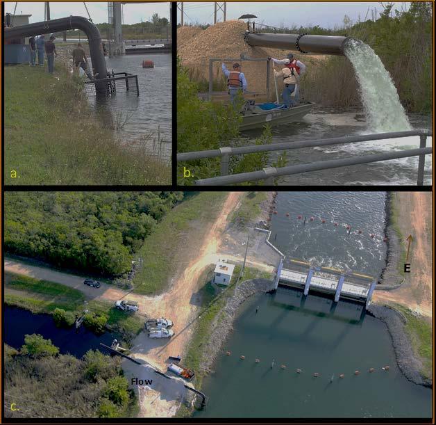
2 C-111 WSC Project Objectives Improve hydroperiods and hydropatterns in the Southern Glades and Model Lands Restore the quantity, timing, and distribution of water delivered to Florida Bay via Taylor Slough Improve coastal zone salinities in central and eastern Florida Bay S-199 Pump Station Aerojet Canal S-200 Pump Station and FPDA Lined Channel

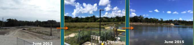
3 C-111 WSC Project SFWMD expedited the design, construction, and operations of the first increment of restoration (major portions of the PIR recommended plan) in order to achieve early benefits Construction Completion Timelines: Frog Pond Detention Area - June 2011 S-199 & S-200 Pump Stations - January 2012 Aerojet Lined Channel, Weirs, Plugs - April 2012 Completed Operational Testing and Monitoring Period - June


 [Note: Dry season is")

4 C-111 WSC Project C-111 Western Spreader Canal pump stations S-199 and S-200 wet and dry season discharges (ac-ft.) [Note: Dry season is November April and wet season is May October.] Pump Station S-199 Pump Station S-200

5 C-111 WSC Coastal Zone Salinity Statistical summary of daily salinity data collected in WY2016 Salinity monitoring stations in Florida Bay. [Note: TB Terrapin Bay; TR Upstream of Taylor River; TM Taylor Mouth; TC Trout Creek; and MBTS Manatee Bay.] Daily Average Terrapin Taylor Upstream of Trout Manatee Salinity Bay Mouth Taylor River Creek Bay Minimum Mean Maximum < & < & < & < Pre-project Mean ange of Pre-project Data

6 Biscayne Bay Coastal Wetlands Alternative O-Phase 1 Project Objectives Improve freshwater and estuarine habitat. Improve salinity distribution and reestablish productive nursery habitat along the shoreline. Restore the quantity, quality, timing and distribution of fresh water to Biscayne Bay and Biscayne National Park Preserve and restore the spatial extent of natural coastal glades habitat within the BBCW Project s study area. The BBCW Phase 1 Project will maintain the current level of flood protection within the drainage basin

7 BBCW Expedited Project (ACCELER 8) Expedited design, construction and pilot testing on several Phase 1 project components L-31E Tidal Restoration Components L-31E Pilot Pump Test L-31E Interim Pump Deering Estate Flow-way Cutler Flow-way Provides for early ecosystem restoration benefits by distribution flows along coast and near shore including Biscayne National Park Alt O Phase I Planned Cost $164M


8


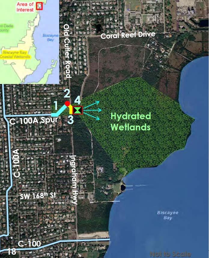
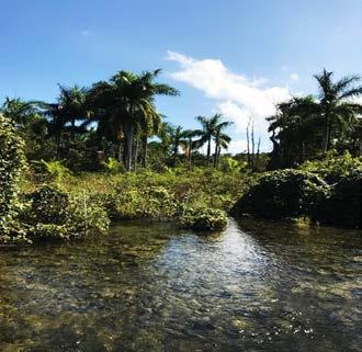
9 Approximately 62,000 ac-ft of freshwater redirected to historic remnant wetlands Timing of flows to the wetlands at Deering Estate Flow-way has been improved


10 Delineation of the Historical Freshwater Wetland Slough in Deering Estate and Areas of Inundation at Different Pump Rates Estimated Acreage of Impounded Surface Water Under Different Pumping/Flow Rates within Deering Estate
11


12
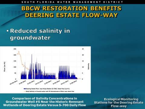
 operation Reduced salinity in surface")
13 Water levels in the Deering Estate Flowway historical sloughs responded to the Deering Estate Flow-way Pump Station (S-700) operation Reduced salinity in surface water


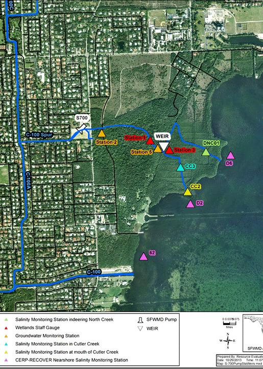
14 Box-plot comparisons between daily mean salinities at Deering Estate nearshore and creeks monitoring sites by water year.

15 November,2016 November,2016


16 SFWMD Expedited Project L-31E Tidal Restoration Construction Completed June 2010 C-102 S-23A S-23B S-21A Military Canal L-31E S-20G Biscayne National Park S-23C S-23D C Existing Culverts S-20F


17 L-31E Culverts diverted +28,638 ac-ft of water from the C-102 and C-103 canals since November 2010 Monthly average flow for the S-23A, S-23B, S-23C and S-23D culverts


18 EAST East Summary of daily average stage at monitoring station S-23E in the L-31E Canal


19
 in Biscayne Bay nearshore L31E area, normalized by")


20 Total flow (at S--20F and S-21A) and rain (averaged over S-20F, S-20G and S-21A) in Biscayne Bay nearshore L31E area, normalized by total flow / respectively total rain for the interval WY2011- WY2016, by water year, and box plots of daily mean salinity values (registered at BICS14, BISC22, BISC28, BISC40 and BISCA8) by water year. CERP RECOVER IBBEAM Sampling Site (source: Annual report IBBEEAM May 30, 2016)
21 S-20 F
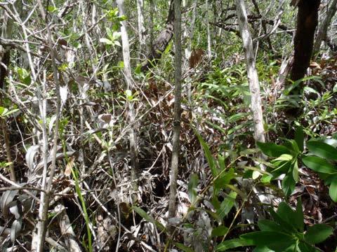
 Six L-31 Culverts Freshwater wetland between C-103 Canal and North Canal USACE began design of remaining Phase I Project")
22 REMAINING PAHSE 1 PROJECT FEATURES Five pump stations S-303 (50 cfs) S-705 (100 cfs) S-709 (40 cfs) S-710 (40 cfs) S-711 (40 cfs) Inverted siphon (S-707) Six L-31 Culverts Freshwater wetland between C-103 Canal and North Canal USACE began design of remaining Phase I Project Features

23 CUTLER FLOW-WAY Design Completed in 2009 Project features: S-701 pump station Concrete flow-way Spreader canal Next Steps: SFWMD to update design of Cutler Flow-way and complete permit acquisition
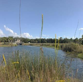
24 Environmental benefits from the Deering Estate Flow-way are already being realized Reduced point source discharge from canals has been reduced Improved quality of water and timing of flows to the wetlands has been improved Percent cover of category I and II invasive exotic plants within the vicinity of the Deering Estate Flow-way has been reduced to less than five percent Rehydration of historic coastal wetlands Wetland plant species are proliferating including expansion of sawgrass, upland plants have died off and new wetland vegetation species are emerging During the reporting period, salinity in Cutler Creek, North Creek, and nearshore at the mouth of Cutler Creek was reduced in both groundwater and surface water During WY2016 water quality at station S700 did not exceed any Class III fresh water criteria Groundwater stage rose noticeable at groundwater monitoring stations, and water levels varied according to pump operations All metrics indicate a successful project.
25 Environmental benefits from the L-31E Culverts are already being realized Point source discharges from the C-103 Canal were reduced or eliminated Monitoring results demonstrated an improvement of hydrologic conditions in response to the pump test The L-31E Pilot Pump Test resulted in improved saltwater wetlands salinity regimes, enhanced sheet flow, rehydration of freshwater and saltwater wetlands Pumping maintained the stage within the L-31E Canal at the optimal level of approximately 2.20 feet NGVD Percent cover of category I and II invasive exotic plants within the vicinity of the L-31E Culverts has been reduced to less than five percent In Biscayne Bay nearshore L31E area, during WY2016 there were no exceedances of Class III marine water criteria and water quality improved over time All metrics indicate a successful project.
26 Discussion