Harbour Constructions
|
|
|
- Chloe Marybeth Woods
- 5 years ago
- Views:
Transcription
1 Harbour Constructions


2 River and Coastal morphology: They provide morphological services based on one-, two- and threedimensional computer models. These models are used to answer the questions of clients in an economically and scientifically justified way. The nature of these questions differs, such as: - erosion - siltation - transport of sand and silt in rivers, estuaries, coastal waters, harbours. The combination of scientific modelling and a solid experience in monitoring and measurements guarantees a pragmatic approach and reliable results. siltation and sedimentation of trenches, navigation channels and harbours; meandering of rivers; optimisation of the layout of harbour basins to minimise siltation; siltation in inundation areas; safeguarding of water intakes; beach renourishment schemes (design, selection of borrow area, concept planning..); use of satellite images (remote sensing).


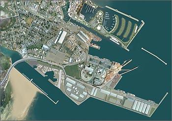
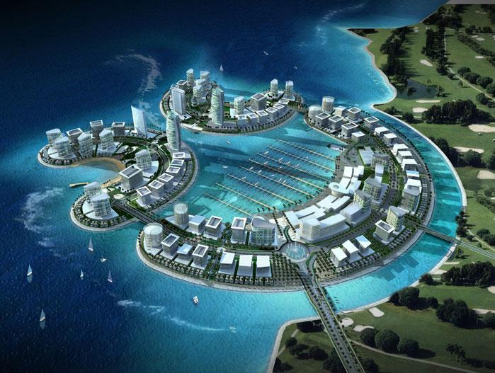
3 Civil and Harbour engineering: harbour dams; design criteria; quay walls and jetties; bank protection structures; under water dams; harbour basins; industrial areas; fish traps; flood retention basins; locks.


; environmental monitoring of dredging projects (turbidity generation.")
4 Dredging: capital dredging works (ports, canals, navigation channels, reclamation works..); maintenance dredging works (dredging and disposal ); evaluation of dredging divisions; optimisation of dredging projects (type of equipment, frequency of dredging campaigns, disposal areas..); environmental monitoring of dredging projects (turbidity generation..); specification and selection of dredging equipment; environmental impact analysis; disposal and treatment of dredged material.


5 Coastal protection: For coastal protection projects they use the obtained know-how of the hydraulic and morphological experience of the marine environment, more specifically, of wave and sediment transport. This know-how is a solid base for specialised projects and studies, taking into account all parameters including coastal zone management, in order to evaluate and design protective and structural measures. calculation of the wave climate; analysis of wave spectra; statistical analysis hydrodynamic parameters; analysis of coastal erosion phenomena; inundation risk analysis; design of protective structures (groins, headlands, beach nourishment schemes, ); dune erosion.


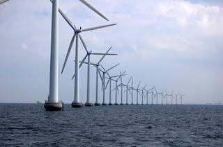
6 Off shore engineering: Their thorough knowledge of the hydraulic and morphological characteristics of coastal areas combined with the frequently applied dredging know-how is often the base for our offshore projects. These projects are very often located in the near shore zone. outfalls for sewerage water; landfalls for gas- and oil pipelines; off shore windmill parks; estimation of hydraulic and morphological threats for offshore projects; sand and gravel exploitation; determination of the wave climate on every spot on the globe.


7 River basin management: For proper management of river basins and the utilisation of the available water, an integrated approach is required. On the one hand, people living in the area must be protected against flooding. On the other hand, desertification, caused by an accelerated evacuation of excess water towards the sea, must be avoided. A balanced management of the available water should be obtained between the different users (nature development, recreation, agriculture, industry ) inventory studies; set up of environmental or sectoral analysis of the basin; nature development programs; hydrological surveys; bathymetrical surveys; morphological surveys; statistical analysis; river modelling; set up of river management strategies; design of river training systems


8 Coastal management: Also in the management of coastal areas, this integrated approach combines flood protection with nature development and recreation. Because of profound knowledge of hydrology, statistics, river modelling combined with GIStechniques, a solid knowledge in ecology and specialised experience concerning EIA, they are the preferred partner for this type of projects. Services : hydrological surveys; bathymetrical surveys; morphological surveys; statistical analysis; river modelling; set up of river management strategies; design of river training systems; analysis of the use of water in a complete river basin.


9 Inundation risk: The expected sea level rise due to climatic change creates considerable problems for managers of coastal and estuarine environments considering the water level in their study areas. Sometimes the safety of a certain protective structure (dunes or dikes) is lower than assumed due to piping, aging or other phenomena. They are rapidly building experience in a series of specific projects to improve the evaluation of these risks. Specific attention is given to the best probabilistic methods to estimate failure risks and inundation damage, including human lives. statistical analysis of extreme wave events at sea and tidal water levels in estuaries; definition of critical boundary conditions; selection of probabilistic analysis methods; calculation of failure risks taking into account failure modes of dunes and dikes; calculation of inundation damage with one- and two-dimensional models and GIS- techniques; risk analysis.


hydrology, hydraulics and morphology.")
; water quality (salinity, turbidity.")
10 Survey techniques and campaigns: In order to realise numerous technical studies, the engineers collects accurate and reliable data to validate and calibrate computer models. In order to acquire specific data, an in-house survey department was established about 10 years ago. The Survey departement plans, organizes, executes and reports survey campaigns in different fields. The Survey division has gathered a solid experience in the use of advanced equipment, automatic data registration and data processing. Specific experience has been built up in the following domains: (geo)hydrology, hydraulics and morphology. meteorological surveys (wind, rain, temperature ); hydraulic measurements (waterlevels, currents, waves ); morfological measurements (sediment transport, turbidity, suspensions ); water quality (salinity, turbidity...); geohydrology (ground water level, sampling,monitoring ); sub bottom sampling (coring, vibrocoring, surface sampling ); non destructive measurements of dikes.


11 Nautics: Recently the company accumulated experience on inland navigation projects. This experience is mainly focused on the design of navigation routes and on the automation of management techniques of navigation canals. These techniques can be applied for steering and control of navigation as well as automation of infrastructure (locks, bridges, ) in rivers and canals. nautical design of navigation routes; inventory of the needs of the users; lock planning systems; specification for specialized information systems; radar control systems; telemetry; ECDIS-charts