Please complete the sign-in sheet and review display materials.
|
|
|
- Briana Oliver
- 5 years ago
- Views:
Transcription
1 Municipal Class Environmental Assessment Please complete the sign-in sheet and review display materials. As you move through the information presented today, we encourage you to ask questions and provide feedback. Your input is valued! Please fill out a comment form. Welcome! 1


2 Municipal Class Environmental Assessment The Wayne Drive and Waratah Avenue Area has experienced surface flooding during major storm events (particularly noted on June 14, 2014 and July 8, 2016). The Town is hosting this meeting to present proposed solutions that can address flooding in the Wayne and Waratah Area Study. Here you will learn about: Project background, study scope and feedback from PIC #1 and Flooding Survey Confirmation of flooding areas Field investigation findings Alternatives evaluation Recommended strategy Next steps 2
3 Municipal Class Environmental Assessment Potential causes of flooding in the Wayne Drive and Waratah Avenue include: Depression areas Road Sags; Reverse sloped driveways along major overland flow path; Major overland flow path in some areas on private property including some backyards increased head (ponding) upstream and limited capacity downstream causes pressure; and Rear yard flooding difficult to define causes. The objective of this project is to develop a stormwater management strategy to reduce flooding related impacts to public and private property. Problem Statement 3
 and major (overland) drainage systems and ultimately into natural areas including creeks, wetlands, and")


4 Municipal Class Environmental Assessment What is Stormwater? Stormwater runoff is water that flows over surfaces and across the land when it rains. The water is routed into minor (sewers) and major (overland) drainage systems and ultimately into natural areas including creeks, wetlands, and lakes. Storm sewers (minor system) convey up to 1 in 5 year storms. Streets (major system) convey major storms that exceed the storm sewer capacity. Temporary ponding on streets is expected during major rain storms. Design Standards: Water level in the storm & sanitary sewer is below basement elevation. Street flow depth should not exceed the street right-of-way limits. Source: Stormwater in Urban Areas, SSWM.info Sanitary Sewer Water Cycle Street Right of Way Storm Sewer to convey 5 year design storm Storm System Drainage Street to convey Stormwater flows above Storm sewer design capacity 4

5 Municipal Class Environmental Assessment Over 30 people attended Public Information Centre #1 and provided input to causes of flooding including possible solutions. Flooding Survey A survey was created and provided to property owners in the Wayne and Waratah study area to identify specific areas of concern and help develop solutions. Over 45 completed surveys were received. PIC #1 - Wednesday October 12,
6 Municipal Class Environmental Assessment Known Flooding Areas and Issues 6


7 Municipal Class Environmental Assessment Study Overview Public Lands made within infrastructure. Any improvements to the sewer and drainage system to be Data Collection and Inventory of Existing Conditions Private Property Improvements Recommendations may be made for flood proofing private properties such as back flow prevention valves and / or minor grading, however each homeowner or business is responsible for implementing paying for improvements including the operation and maintenance of drainage systems on private property. Identify Causes of Flooding and Potential Solutions Identify & Recommended Solutions/Overall Strategy PIC #1 PIC #2 WE ARE HERE Develop Conceptual Design for Preferred Solutions Prepare & File EA Report 7


")


")
 are")


")


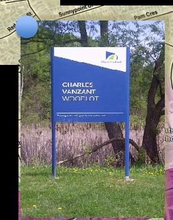

8 Municipal Class Environmental Assessment Consists of woodland and watercourse Dominated by a mature Fresh Moist White Cedar Coniferous Forest (FOC4-1) and a Fresh Moist Sugar Maple Hemlock Mixed Forest Marginal fish habitat Includes a confirmed Species at Risk (SAR) and potential for additional SAR Primarily consists of manicured lawn with two small natural communities including Cultural Woodland and a complex of Cultural Meadow (CUM1) and Reed Canary Meadow Marsh (MAM2-2) Stormwater Management Ponds (SWMP) are generally surrounded by manicured lawn. The two (2) westerly SWMPs are poorly connected to the downstream watercourse in Charles Van Zant Park while the two (2) easterly SWMPs require further assessment due to access restrictions The study area is predominantly Residential with Commercial along Leslie Street There is some redevelopment potential along Leslie Street There are several parks designated as Open Space and Natural Heritage Existing Conditions Natural environment features are limited to remaining East Holland River Tributaries (within Charles Van Zant Park) which is regulated by LSRCA, Philmore Hamilton Park (not regulated by LSRCA), Wooded Areas and street trees Land Use and Natural Environment 8
9 Municipal Class Environmental Assessment Alternative Solutions 9

10 Natural Environment 1. Impact on aquatic environment such as receiving water quality, fisheries, Species at Risk and floodplain 2. Impact on terrestrial environment such as street trees, wetlands and habitats including Species at Risk Alternative 4 Divert Flows from Industrial Area toward Elgin Street - New Leslie and Elgin Street Storm Sewer Increased flow at downstream outlet - impact to East Holland River Minimal loss of vegetation (possible street tree removals) 3. Groundwater, soils and geology Assume moderate to high groundwater conditions based on proximity to watercourse near Wayne Drive (Assume not so much for Leslie Street pipe segment) X Evaluation Matrix Alternative 5b Construct SWM Facilities within Philmore Hamilton Park - 3,240m3 storage available No impact no aquatic features were identified within the park Loss of some vegetation - no significant natural features or unevaluated wetlands or woodlots in the park. Primarily consists of manicured lawn with two small natural communities including Cultural Woodland and a complex of Cultural Meadow (CUM1) and Reed Canary Meadow Marsh (MAM2-2) No Species at Risk A single regionally rare plant, Thimbleweed (Anemone cylindrical) was observed within the Cultural Woodland Assume moderate to high groundwater conditions based on proximity to watercourse near Wayne Drive. Alternative 5d Install Berm Around Waratah Avenue Channel Outlet Marginal habitat conditions of unnamed watercourse Moderate impact to wetland features to be confirmed by additional spring field studies No aquatic SAR habitat Moderate impact to wetland features to be confirmed by additional field studies between summer 2017 and spring 2018 Berm removal results in loss wetland and/or woodland habitat Increased water retention capacity, dependant on the frequency of flooding, may result in a change in the vegetation capable of growing in the wetland and/or wildlife using the wetland SAR impacts to be confirmed by additional spring study Woodland habitat removal may be subject to longer term (16 months+) SAR permitting if confirmed as SAR bat habitat Assume high groundwater conditions based on work in wetland Conditions to be confirmed by future geotech bore hole X Alternative 7 Town/Glen Cedar Public School Partnership - Construct SWM Facility on School Property No impact to sensitive aquatic features (manicured lawn-field) No impact to sensitive terrestrial features Assume moderate to high groundwater conditions based on proximity to watercourse near Wayne Drive and Waratah Avenue Evaluation Summary (6) (7) (6) (8) Social/Cultural Environment 1. Impacts on existing and future land use, including property requirements Temporary impacts to fronting property owners and travelling public on Leslie and Elgin Street during construction 2. Potential noise effects on adjacent community Potential sensitive areas include residential properties on Elgin Street 3. Temporary impacts to residents, institutions and businesses during construction disruption to travelling public, access, vibration and dust Temporary impacts to fronting residential dwellings and business property owners and traveling public on Leslie and Elgin Streets during construction Temporary access disruptions to businesses and private entrances as construction passes 4. Impact on archaeological resources Low potential for uncovering archaeological resources (all work in disturbed road allowance) X Loss of open space park Potential sensitive areas includes residential properties surrounding Philmore Hamilton Park Temporary impacts to surrounding residential dwellings and rear yards Moderate potential for uncovering archaeological resources X Minor loss of open space wooded park Potential sensitive areas include residential properties surrounding Waratah Avenue and Elgin Street area Temporary impacts to surrounding residential dwellings and rear yards Moderate potential for uncovering archaeological resources Temporary loss of sports playing field on school property (would be reinstated as part of SWMF concept) Potential sensitive areas include residential properties surrounding school property Temporary impacts to surrounding residential dwellings Low potential for uncovering archaeological resources (all work in disturbed playing field) 5. Impact on built heritage resources and cultural heritage landscapes No impact to built heritage resources or cultural heritage landscapes No impact to built heritage resources or cultural heritage landscapes No impact to built heritage resources or cultural heritage landscapes No impact to built heritage resources or cultural heritage landscapes 6. Potential impact on Indigenous lands and resources Study area is urbanized and has limited fishery resources Study area is urbanized and has limited fishery resources Study area is urbanized and has limited fishery resources Study area is urbanized and has limited fishery resources Evaluation Summary (14) (13) (14) (15) Technical Considerations 1. Effectiveness ability to mitigate flooding and erosion issues 2. Constructability Opportunities to coordinate SWM project with road improvements - construction Physical conflicts including deep pipe construction, utility relocation and protection, alignment changes and other potential challenges during construction Ability to maintain existing services during construction Phasing Considerations 3. Feasibility Space availability and accessibility complexity of system (configuration, operation and maintenance control) 4. Performance Ability to mitigate flooding and erosion issues Impacts on downstream infrastructure Impacts on existing infrastructure 50% reduction in flows to upstream porting of the creek in Flooding Area 2 10% reduction in flooding depth at Waratah in Flooding Area 4 Potential flood risk increasing for downstream properties can be mitigated through detailed design Able to meet existing storm pipe invert (bottom of pipe) and achieve gravity flow Anticipate significant utility conflicts requiring relocation and protection on Leslie Street (under jurisdiction of York Region) and Elgin Street No plans to improve Elgin Street Likely limited space for new pipe on Leslie Street York Region preference is to protect available space for future York Region services Technically feasible however the Region has indicated their preference for limited disruption in this area and that there is no construction programs within the next 10 years that could tie into this work 50% reduction in flows to upstream porting of the creek in Flooding Area 2 10% reduction in flooding depth at Waratah in Flooding Area 4 Potential flood risk increasing for downstream properties can be mitigated through detailed design 5. Potential opportunities for LID system Limited to works in road right-of-way/boulevard X X 6% reduction in flooding depth at Waratah in Flooding Area 4 Able to meet existing storm pipe invert (bottom of pipe) and achieve gravity flow Low potential for utility conflicts 15% reduction in flooding depth at Waratah in Flooding Area 4 Potential increase in flooding along Leslie St and Waratah Avenue where backyards drain toward park - can be mitigated through detailed design Able to meet existing storm pipe invert (bottom of pipe) and achieve gravity flow Low potential for utility conflicts Technically feasible Technically feasible Technically feasible 6% reduction in flooding depth at Waratah in Flooding Area 4 15% reduction in flooding depth at Waratah in Flooding Area 4 Potential increase in flooding along Leslie St and Waratah Avenue where backyards drain toward park - can be mitigated through detailed design 31% reduction in flooding depth at Waratah in Flooding Area 4 Able to meet existing storm pipe invert (bottom of pipe) and achieve gravity flow Low potential for utility conflicts 31% reduction in flooding depth at Waratah in Flooding Area 4 Can be design basis for SWMF Can be design basis for SWMF Can be design basis for SWMF Evaluation Summary (10) (13) (13) (12) Cost 1. Estimated capital cost $350,000 $200,000 $50,000 (subject to SAR investigations) $700,000 including restoration of sports playing fields X 2. Estimated operations / maintenance cost including cost Moderate Higher X Moderate Moderate per benefiting home (value for money spent) Good cost to cost benefit ratio Poor cost to cost benefit ratio Good cost to cost benefit ratio Poor cost to cost benefit ratio Evaluation Summary (5) (3) (6) (3) Evaluation Summary Total Score (35) (36) (39) (38) LEGEND Most Preferred (3) (2) Least Preferred (1) Recommended Alternative 10


 Public Side Improvements The preferred strategy")


11 Municipal Class Environmental Assessment Rain Barrel Program Underground Storage Tank (E.g. Commercial Parking Lot) Backflow Preventers Install Berm Construct SWM Facility Improve lot grading Private Side Improvements LID Facility (E.g. Bioretention) Public Side Improvements The preferred strategy will be based on Town initiated solutions in combination with Private Property initiated solutions This considers the amount of stormwater during large wet weather events and study area opportunities and limitations In response to the stormwater management rate (user fee) commercial and industrial properties will also be encouraged to implement their own site specific stormwater management solutions (e.g. Implement various LID measures, build underground storage in parking lots etc.) Preference for Community Based Treatment Train Approach Recommended Strategy Solutions 11
12 Municipal Class Environmental Assessment Involves constructing a deep stormwater detention facility in Philmore Hamilton Park Partially addresses downstream flooding along Wayne Drive and Area 1 Approximately 6% reduction in flooding depth at Waratah in Flooding Area 4 Estimate Cost is $200,000 Philmore Hamilton Park The facility will displace natural and public use areas Alternative 5b: Construct SWM Facilities within Philmore Hamilton Park - 3,240 m3 storage available 12


 Proposed Waratah Berm and Outlet After the storm event has passed")
13 Municipal Class Environmental Assessment Involves tree removal and construction of a 1.5 metre high earth berm The berm is designed to retain water during large storm events and act as a dry detention facility during non-storm events Partially addresses flooding in Area 4 (Downstream of Waratah) Approximately 15% reduction in flooding depth at Waratah in Flooding Area 4 Upstream properties will not be impacted Requires tree/vegetation removal Project feasibility is dependent on LSRCA and MNRF approval requirements (E.g. Species at Risk - SAR) that will be confirmed as part of future investigations Estimated cost is $50,000 (May change based on SAR findings and permitting requirements) Proposed Waratah Berm and Outlet After the storm event has passed water will drain down in approximately 24 hours Existing Waratah Outlet Wetland Area Upstream of Existing Waratah Outlet Example of Berm/Outlet Alternative 5d: Install Berm Around Waratah Ave Channel Outlet 13


14 Municipal Class Environmental Assessment Monitoring Typical Stream Gauge The Town will continue to: Monitor weather and ensure municipal conveyance systems are maintained and ready to respond to big wet weather events Monitor and record pre and post weather events using upstream gauges and flooding observations to better understand what caused flooding and confirm how improvements are working (If previous recommended projects are built) Natural Environment Source: Chris Council, Aspen Daily News Ensure all regulatory requirements to protect the environment are followed during construction to ensure minimal impact to the natural environment Work with LSRCA to address potential impacts related to construction Social Environment Ensure a traffic management plan is developed to minimize disruption during construction Work within day shift and comply with Noise By-laws Ensure all disturbed areas are restored EA Commitment Highlights 14


15 Municipal Class Environmental Assessment The following steps will be completed next: Spring 2017 Receive public comments by June 2, 2017 Following this PIC Project Team will review and consider your comments in the evaluaiton of alternative solutions Spring/ Summer 2017 PIC #2 will present the recommended strategy and associated solutions Prepare EA Master Plan Report File EA Master Plan Report for 30-day public review period. Summer/Fall 2017* Detailed Design including approvals Select Projects (e.g. Philmore Hamilton Park SWM Facility) Tender Construction Post construction monitoring * Subject to Council Approval Next Steps 15


16 Municipal Class Environmental Assessment We appreciate the time you have taken to learn more about the project and value your input. Stay involved and up-to-date as the project progresses: Visit the project website: Contact us with additional comments or questions at any time: *Kindly drop off your completed Comment Form in Ms. Jen Slykhuis Ms. Pippy Warburton the Comment box before you leave or mail it to us. Senior Environmental Coordinator Manager, Water Resources Town of Newmarket AECOM Canada Ltd. 395 Mulock Drive 50 Sportsworld Crossing Road P.O. Box 328, STN Main Kitchener, ON Newmarket, ON L3Y 4X7 N2P 0A4 Phone: ext Thank You for Attending 16