Design and Status of the Elevationl Transect and Monitoring Systems for Nevada s NSF EPSCoR Climate Change Research Program
|
|
|
- Philippa Bennett
- 5 years ago
- Views:
Transcription
1 University of Nevada, Las Vegas Digital 2010 Annual Nevada NSF EPSCoR Climate Change Conference 2010 Annual Nevada NSF EPSCoR Climate Change Conference Feb 2nd, 1:35 PM - 1:50 PM Design and Status of the Elevationl Transect and Monitoring Systems for Nevada s NSF EPSCoR Climate Change Research Program Brian M. Bird University of Nevada, Las Vegas, brian.bird@unlv.edu Scotty Strachan University of Nevada Reno, scotty@dayhike.net David B. Simeral Desert Research Institute, David.Simeral@dri.edu Richard L. Jasoni Desert Research Institute, Richard.Jasoni@dri.edu Repository Citation Brian M. Bird, Scotty Strachan, David B. Simeral, and Richard L. Jasoni, "Design and Status of the Elevationl Transect and Monitoring Systems for Nevada s NSF EPSCoR Climate Change Research Program" (February 2, 2010) Annual Nevada NSF EPSCoR Climate Change Conference. Paper This Event is brought to you for free and open access by the Conferences/Meetings (NNE) at Digital Scholarship@UNLV. It has been accepted for inclusion in 2010 Annual Nevada NSF EPSCoR Climate Change Conference by an authorized administrator of Digital Scholarship@UNLV. For more information, please contact digitalscholarship@unlv.edu.


2 Brian Bird, Scotty Stracham, Dave Simeral, and Richard Jasoni


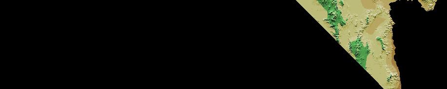
3 ` NEVADA Reno Snake Range Mn bn Sheep Range Las Vegas

 Site 2")


4 Sheep Range Transect Las Vegas Site 1 Creosotebush h( (900m) Site 2 Blackbrush (1,670m) Site 3 Pinyon Juniper (2,065m) Site 4 Ponderosa Pine (2,320m) Site 5 Hayford Peak Subalpine (3,015m) *Fish and Wildlife Permits
 Site 2 Long Now Montane (2,810m) Site 3")
 Great Basin")
 Site 6* GBNP Pinyon Mahogany (2,590m)")
 200m) Site 9* BLM SV6")
5 Snake Range Transect Site 1 Long Now Sagebrush (1,790m) Site 2 Long Now Montane (2,810m) Site 3 Long Now Subalpine (3,355m) 355m) Site 4 NV Land Conservancy Sagebrush (1,835m) Great Basin National Park Site 5 Snake Valley Phreatophytic (1,560m) Site 6* GBNP Pinyon Mahogany (2,590m) Site 7* GBNP Subalpine (3,070m) Site 8* BLM Pinyon Juniper (2,200m) 200m) Site 9* BLM SV6 Phreatophytic (3,070m)
6 Current status of Transects Sheep Range Transect (5 sites) fully permitted through Fish and Wildlife Service. Site access agreement acquired from the Long Now Foundation for Snake Range (sites 1, 2 and 3). Snake Range site 4 access granted through the Nevada Land Conservatory. Waiting for site permit approval on sites 8,9 and 6,7 from BLM and GBNP respectively. Tower installed at North Las Vegas UWCC for testing of sensors and communications. Installation of towers will begin winter 2010 at lower elevational sites within the Sheep Range. Site Network communications testing will begin March April
7 Core Site Instrumentation Image courtesy of: J. Arnone, D. Simeral and L. Wable
8 Meteorological Instrumentation Wind speed/direction (Met one anemometer) Air temperature/relative humidity (Vaisala chip) Precipitation GEONOR (High elevation) Hydrologic Services (Low elevation) Net Radiation (CNR1, Kipp and Zonen) Solar Radiation diti (Apogee PYR) Snow Depth (Ultra sonic depth)


 Soil heat")

9 Vadose Zone esensors s Dual probe heat pulse (DPHP) sensor (soil thermal conductivity, diffusivity and specific heat) Soil water matric potential Ψ ( 10 to 2500 kpa) Soil heat flux (G) plate (self calibrating Van den Bos Hoeksma method, 30 o to 70 o C)

 Soil temperature Copper constant")
10 Time domain reflectometry (TDR) volumetric water content, soil water storage, water infiltration rates, depth of wetting front and infer ground water recharge. (installed at 3 depths) Soil temperature Copper constant thermocouple (installed at 3 depths)


 Point Dendrometers")


11 Vegetation Zone Sensors TDP Sap Flow Sensors, Dynamax Inc., Houston TX. (sensors installed at all dominant shrub and/or tree species) Point Dendrometers (sensors installed at all dominant tree species) TDP Image from Kansas State Univ.
12 Testing Tower at UNLV s UWCC 100 Tree Tower Testing Facility
13 VB-C60 PTZ Internet Camera Features: Remotely t l controlled Motion detection Auto Day/Night Programmable fixed location recording 40X Optical Zoom Image Stabilizer 360 Degree view


 Aboveground")


 Atmospheric")


14 VB-C60 PTZ Internet Camera Potential Measurements/Uses: LAI/Canopy greenness Canopy phenology (timing of start, peak, senescence of plant growth) Aboveground plant productivity (pics calibrated with harvests) Quick visual indicator of snow cover and depth (with depth stakes) Atmospheric cloudiness (spatial & temporal dist.) Herbivory y of marked plants Surface soil erosion Remotely troubleshoot plausibility of sensor measurements, e.g. sensor obstruction, rain/ snow day, cable herbivory, etc.


15 Addition to Core Site Sensors Fiber optic Distributed Temperature (DTS) System NDVI, WBI Ground Based Sensors (Skye, PP Systems) Acclima TDT Soil Moisture, Salinity & Temperature Monitoring System
16 Questions?