Report from the 2 nd GIS meeting in Ryn, Poland (act. 1.4)
|
|
|
- Rolf Ellis
- 5 years ago
- Views:
Transcription
1 1. General Data Country: Organizer: Date & Place: Report from the 2 nd GIS meeting in Ryn, Poland (act. 1.4) Poland GWP Lithuania & GWP Poland 5 November 2014, Ryn castle 2. Agenda Objective of the workshop: The main objective of the meeting was to discuss draft GIS maps for the Nemunas (Neman) and Pregolya river basins prepared by the GIS experts from Belarus, Lithuania, Kaliningrad Oblast (Russia) and Poland, information sources used for map compilation and their confidence level. Agenda Annex 1 in the attachment 3. Report (max 2000 characters) On 5 th November, 2014 the 2 nd workshop on GIS mapping of water bodies in Lithuania, Poland, Belarus and Kaliningrad Oblast (Russia) for the management of transboundary Neman and Pregolya river basins organized by GWP-Poland and GWP-Lithuania was held in Ryn, Poland. The meeting was organized back-to-back with the joint workshop of Stockholm International Water Institute (SIWI), GWP-Lithuania and GWP-Poland on Project Development and Design Workshop - Indicative River Basin Management Plan, Program of measures and Investments for the South East Baltic Sea Region Neman/Pregolya Basin Micro-Region. The main goal of the GIS meeting was to discuss draft GIS maps on hydrology and human pressures for the Nemunas (Neman) and Pregolya compiled by GIS experts from Belarus, Lithuania, Kaliningrad Oblast (Russia) and Poland. Another important issue was to present and discuss information sources, their confidence level and other technical details of GIS mapping. Presentations on development of common databases and visualization of hydrological and human pressure information was also included into the agenda (see Annex 1). 17 water management and GIS experts attended the workshop: 9 from Lithuania, 2 from Belarus, 2 from Kaliningrad and 4 from Poland. Criteria for classification of chemical and ecological status of water bodies, delineation and classification of groundwater bodies and mathematical modelling for the assessment of quantitative, chemical status and interaction between surface waters and groundwaters were presented and discussed. GIS experts from the participating countries presented and discussed information sources that were used for compilation of national GIS layers and data reliability. It was mentioned that only official (Lithuania, Poland) and open information sources were used (Belarus, Kaliningrad Oblast). Draft interactive map, video movie on visualization of GIS information and GeoClip database were also presented and discussed. Interactive maps are user friendly sources of project information and the possibility of using them online should be found. 1
2 4. Conclusions Outcomes of the workshop: Working procedure: It was agreed by the participants that the deadline for sending corrected final GIS information to Edvinas Stonevicius, GWP-Lithuania is 1st December. Edvinas will compile and submit final maps until 20 December Final GIS maps will be supplemented by the explanatory note which will facilitate understanding of GIS map content. Next steps: Joint GIS maps will be included into river basin management plans for in Poland and Lithuania. 5. Attachments Annex 1: Programmme of the meeting Annex 2: List of participants Annex 3. Information sources used for GIS map compilation Annex 4: Draft GIS maps Annex 5: Draft interactive map Annex 6: Photos 2
3 ANNEX 1. PROGRAMME OF THE MEETING Technical Workshop: GIS mapping of water bodies in Lithuania, Poland, Belarus and Kaliningrad Oblast (Russia) for the management of transboundary Neman and Pregolya river basins 09:00-09:15 Registration 09:15-09:30 Opening/Welcome - Marek Gielczewski, Global Water Partnership Poland/Warsaw University of Life Sciences, WULS. Introduction of workshop participants 09:30-09:45 Presentation of agenda and objectives of the workshop - Bernardas Paukstys, Global Water Partnership -Lithuania. 09:45-10:05 2 nd cycle of river basin management planning. Criteria for classification of chemical and ecological status of water bodies - Audrone Pumputyte, Environmental Protection Agency, Lithuania. 10:05-10:25 Delineation and classification of groundwater bodies in Lithuania Jurga Arustiene, Geological Survey of Lithuania 10:25-10:45 Mathematical modelling for assessment of quantitative and chemical status of groundwater bodies. Surface water - groundwater interaction Marius Gregorauskas, Vilnius University 10:45-11:00 Discussion on delineation and classification of water bodies 11:00-11:30 Coffee break 11:30-11:50 GIS maps for the Neman and Pregola River Basin Management in Poland: classification criteria, information sources and confidence level Katarzyna Tarnowska, Regional Water Management Authority in Warsaw, Poland 11:50-12:10 GIS maps for the Neman River Basin in Belarus: information sources and confidence level Aliaksandr Pakhomau, Central Research Institute for Complex Use of Water Resources, Belarus 12:10-12:30 GIS maps for the Neman and Pregolya River Basins in Kaliningrad oblast: information sources and confidence level Dmitry Domnin, Baltic Institute for Ecology of Hydrosphere, Kaliningrad 12:30-12:50 Challenges and results of compilation of joint GIS maps Edvinas Stonevičius, GWP- Lithuania/Vilnius University 12:50-14:00 Lunch 14:00-14:30 Interactive map of Neman and Pregola river basins Ignacy Kardel, GWP-Poland/Warsaw University of Life Sciences, WULS 14:30-15:00 Visualization of hydrology and human pressures - Bernardas Paukstys, GWP- Lithuania 15:00-15:15 Project database ( GeoClipSolo system or other) Aliaksandr Pakhomau, CRICUWR, Belarus 15:15-15:45 Questions & Discussion 15:45-16:15 Coffee break 3
4 16:15-17:00 Next steps and closure 18:30 Dinner ANNEX 2. LIST OF PARTICIPANTS No Name, surname Organization 1. Audronė Pumputytė Environmental Protection Agency, Lithuania 2. Audrius Šepikas Environmental Policy Center, Lithuania 3. Edvinas Stonevičius Department of Hydrology and Climatology, Vilnius University/ GWP- Lithuania 4. Bernardas Paukštys GWP-Lithuania 5. Jūratė Kriaučiūnienė Institute of Energy 6. Diana Šarauskienė Institute of Energy 7. Jurga Arustienė Geological Survey 8. Virgilija Geological Survey Gregorauskienė 9. Marius Gregorauskas Vilnius University 10. Aliaksandr Pakhomau Central Research Institute for Complex Use of Water Resources, Belarus 11. Olga Vasniova State Scientific and Research Centre for Geology, Belarus 12. Dmitry Domnin Atlantic Branch of P.P.Shirshov Institute of Oceanology of Russian Academy of Sciences, Kaliningrad 13. Ivan Kesoretskikh Atlantic Branch of P.P.Shirshov Institute of Oceanology of Russian Academy of Sciences, Kaliningrad 14 Katarzyna Tarnowska Regional Water Management Authority in Warsaw, Poland 15. Magdalena Augustyniak GWP-Poland and Warsaw University of Life Sciences 16. Marek Gielczewski GWP-Poland and Warsaw University of Life Sciences 17. Ingacy Kardel GWP-Poland and Warsaw University of Life Sciences 4
5 ANNEX 3. INFORMATION SOURCES USED FOR GIS MAP COMPILATION Country Information sources Lithuania Hydrological network, surface and groundwater monitoring stations: Nemunas River Basin District Management Plan 2009, based on official national surface water monitoring data from the EPA, groundwater monitoring data from Geological Survey; Human pressures: official data from the Department of Statistics. Poland Hydrological network: Hydrological map of Poland (MPHP 10) September 2013 scale 1: ; Monitoring stations and network: Data are from RBM and Chief Inspector of Environmental Protection (GIOŚ) and Institute of Meteorology and Water Management - National Research Institute (IMGW-PIB; Human pressures: River basin management plans Belarus River basins: information was used from: Surface water resources, Hydrometeo USSR ; Maps 1: ; Current hydrological monitoring stations: National Register of hydrological monitoring stations Existing surface water monitoring network: National Register of Monitoring System. Additional geo-referencing with SAS.Planet. Map of groundwater bodies /aquifers paper maps from the National Atlas on Groundwater, etc; Groundwater monitoring network data from the Scientific Research Centre for Geology; Point Sources - data from the Water Cadastre; Diffuse pollution sources - data from National State Statistical Committee; Official Statistical Data: Hydropower plants - national data from the literature sources, National programme of Small HydroPower Plants reconstruction and creation. Kaliningrad Hydrological network: digitized map of Kaliningrad Oblast scale 1: Current hydrological monitoring stations: Scheme of complex use and protection of water bodies for Neman River Basin and River Basin of the Baltic Sea, 2012 (based on Hydromet Data); Groundwater monitoring network (stations and wells): 1) Regional information bulletin The state of the subsoil in the North-West Federal District of the Russian Federation for 2013 (based on Hydromet Data); 2)Regional information bulletin The state of the subsoil in the North-West Federal District of the Russian Federation for 2013 (based on Hydromet Data); 3) Geo-ecological estimation of natural groundwater security to pollutions, Mikhnevitch, 2010; Groundwater aquifers (bodies): Regional information bulletin The state of the subsoil in the North-West Federal District of the Russian Federation for 2013 ; Pressures & impacts: Hydropower stations- Annual Report JSC Yantarenergo (publicly available); Diffuse pollution (mineral nitrogen and phosphorus) - Federal State Statistics Service Territorial Department of the Kaliningrad region, 2013; Point sources- Scheme of complex use and protection of water bodies for Neman River Basin and River Basin of the Baltic Sea, 2012 (based on Hydromet Data). 5


.")
6 ANNEX 4. DRAFT GIS MAPS Hydrological network and monitoring stations Surface water monitoring network Groundwater monitoring network Number of point sources (wastewater discharges): Lithuania Kaliningrad Oblast - 21 Poland Belarus - 72 Nitrogen load from point sources, t/year Phospohorus load from point sources, t/year Lithuania 1500; Poland 80; Belarus 2130; Kaliningrad Obl (to be corrected). Lithuania 120; Poland 11; Belarus 480; Kaliningrad Obl (to be corrected) 6


7 Diffuse pollution sources. Mineral phosphorus, kg/ha Diffuse pollution. Mineral nitrogen, kg/ha Hydropower plants Groundwater bodies have been discussed Impact of climate change. Annual run-off. Impact of climate change. Spring flood run-off. 7

8 Impact of climate change. Summer minimum Impact of climate change. Winter minimum. 8

9 ANNEX 5. DRAFT INTERACTIVE MAP Hydrological network Surface and groundwater monitoring stations 9


10 Hydropower plants Point sources 10

 11")
11 Diffuse pollution sources (total nitrogen) Diffuse pollution sources (total phosphorus) 11


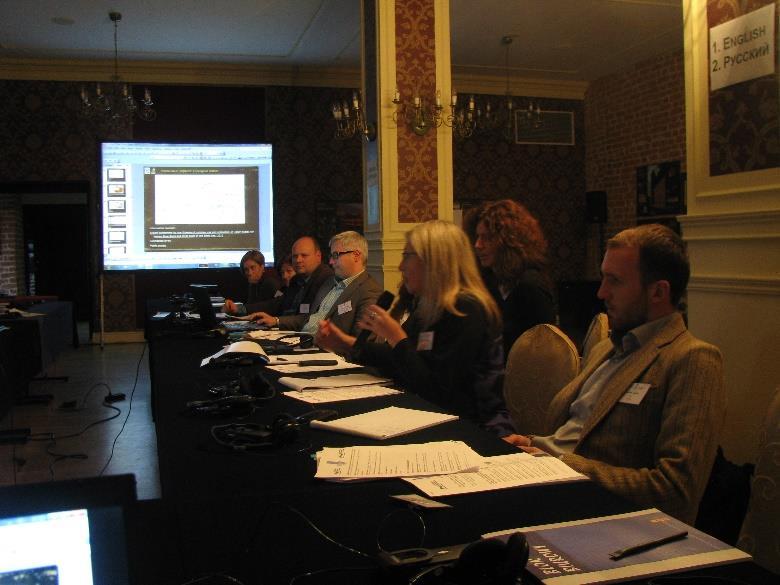
12 ANNEX 6. PHOTOS