Flood Analysis: Hydrologic Principles & Analysis. Charles Yearwood. Drainage Unit, Ministry of Public Works Sept 2007
|
|
|
- Lorena Fowler
- 5 years ago
- Views:
Transcription
1 Flood Analysis: Hydrologic Principles & Analysis. Charles Yearwood Drainage Unit, Ministry of Public Works Sept 2007 Research interest: Hydrologic data collection; Early warning systems; & Integrated flood management
2 Presentation Content Introduction Objective Theory Data Collection Analysis

, Guyana (1996, 2005); and Trinidad and Tobago (1988, 1993, 1998, 1999)")

3 Over the past few years the disharmony between human use systems and natural systems has resulted in repeated flooding in the Caribbean, eg: Jamaica (1979, 1984, 1985, 1986, 1988, 2004, 2005), Barbados (1970, 1984, 1986, 1988, 1998, 2004), Guyana (1996, 2005); and Trinidad and Tobago (1988, 1993, 1998, 1999) Recently disastrous flooding in Haiti and the Dominican Republic, Trinidad and Tobago, and Barbados reinforces this reality. Introduction Guyana 2005 Barbados 2004 Jamaica Nov 2004
4 Uses & Users of Flood Analysis Conduct Flood assessments Hazard maps Vulnerability assessments Risk assessment Develop Flood mitigation, prevention, preparedness and flood reduction measures to the flood risk Set criteria and guidelines for sound risk management four types of users: Town planners Emergency managers Community groups Private sector
5 Propose of Flood Analysis Watercourse/River planning Flood discharge Water resource Low flow rate Flood runoff analysis Peak discharge Hydrograph Flood forecasting River discharge in several hours in advance (e.g. 3 hours, 6 hours) Long-term runoff analysis Low flow rate
6 Objective of Flood Analysis Identify factors affecting runoff from watersheds Determine areal rainfall estimation from point data Understand the cause effect relation between rainfall and stage/runoff Development of runoff hydrographs from rainfall, Rainfall probability analysis, Design storm, Estimation techniques for runoff hydrographs Methods of controlling runoff.
7 Flooding in the Caribbean often result from one of the following: Severe rainfall events Hurricanes, tropical storms between June to November Riverine flooding excess runoff to gullies, streams, rivers Flash flooding High intensity - short/long duration rainfall events; Prolonged rainfall events
8 Why Flooding Occurs? High elevation:short reach (gullies lengths); Coincidence of high tide with rainfall events; Development pressures; Dense development on flat lands; Inadequate drainage systems and structures; and/or High sand build-up at the outfall;
9 Flood Issues Inundation of properties; Lost of Business; Soil loss & erosion; Degradation beaches & reefs; Publics nuisance and inconvenience; Increased development and assoc. runoff; Disruption to traffic flows; utilities & businesses Illegal dumping;


10 Theory Hydrological Principles Hydrological processes in agricultural watersheds
11 Rainfall-Runoff in Watersheds Rainfall (unity) Interception Loss (retention in the soil) Groundwater flow Unsaturated flow Overland flow River discharge Depression storage
12 Infiltration in the Soil Infiltration rate (mm/hr) Potential infiltration Rainfall Actual infiltration Time(hr) Infiltration rate decreases as time passes.
13 Rainfall Effective Rainfall Rainfall loss due to infiltration and local storage Saturation Time
14 Factors affecting runoff magnitude Scale of features, vegetation Total rainfall, rainfall intensity, duration, spatial distribution Soil wetness, initial flow rate, evaporation, air temperature, season Land-use
15 Procedure of flood runoff analysis Investigation of flood data Calculation of flood runoff 1)Method of flood runoff calculation 2)Division of catchment 3)Verification of runoff model and allowable errors
16 Procedure of flood runoff analysis Investigation of flood record 1)Preparation of lists of existing flood data Check records of rainfall, water level, discharge at observation stations within the area to be studied. 2)Determination of floods to be analyzed and floods to be estimated based on the records in (1) Floods to be analyzed are used for the parameter calibration and should have sufficient information on the measured discharge hydrograph. It is recommended to use three events for small, medium and large floods. Floods to be estimated are the floods for which the hydrograph must be estimated by a certain method.
17 Procedure of flood runoff analysis Investigation of flood record 3)Supplementing records for missing observed values of rainfall Missing records of rainfall should be supplemented with the records at other rain gauge stations based on the correlation analysis. 4)Calculation of average rainfall depth in watershed If there are sufficient number of rain gauge stations: 1)Arithmetic mean method 2)Thiessen polygon method 3)Isohyetal method If there are insufficient rain gauge stations: Representative coefficient method
18 Hydrological Data Analysis: Barbados Case Study Watershed studies Rainfall: elevation relationships Wells Infiltration Watercourse Surveys Rainfall:Stage Rainfall:Runoff Storage (check dam/retention pond) Monitoring Flood Observations and Surveys
19 Rainfall (mm) Rainfall:Elevation Relationships Comparative Rainfall:Elevation Between Indian Ground and Indian Ground Jun-04 Aug-04 Oct-04 Dec-04 Feb-05 Apr-05 Jun-05 Aug-05 Oct-05 Monthly Rainfall Indian Ground at 262m The Rock at 160m Dec-05 Feb-06 Apr-06 Jun-06 2 per. Mov. Avg. (The Rock at 160m) 2 per. Mov. Avg. (Indian Ground at 262m)
20 Water Depth in Well Water Depth in Culvert Height (mm) Well Infiltration Lascelles Terr Well infiltration Jan 21-Jan Lascelles Well Infiltration 23-Jan Feb 3-Feb Feb Time (mins) :00 0:00 0:00 0:00 0:00 0:00 0:00 0:00 0:00 0:00 0:00 0:00 0:00 0:00 0:00 0:00 Well (Culvert) Inflows H Time Well Outflows H

21 Height (m) Portvale Rainfall:Stage Relationship Study Cross section C (Ch 20) Offset Chainage (m) Instrument Location Cross Section Survey


22 Brucevale Valley Rainfall: Stage Relationship Dark Hole WC Hway 2 & Lakes Jct Bridge Tri-O-Path Bridge East Coast Bridge
23 Stage (m) Rainfall (mm) Portvale Lag time Analysis (14Nov 2004) :50 13:30 15:10 16:50 18:30 20:10 21:50 23:30 Time of Day Portvale R'fall WC Stage Jamestown Stage Dr H

24 Cubic metres Monitoring Richmond Hill Check Dam Time W.L. Reduce Volume Time W.L. Reduce Volume Time W.L. Reduc Volum Level 73,930 Level e Level e , , , , , , , , , , , , , , , , , , , , , , , , , , Infiltration at Richmond Hill Infiltration Time overall rate of m 3 /hr or 1.69m 3 /min
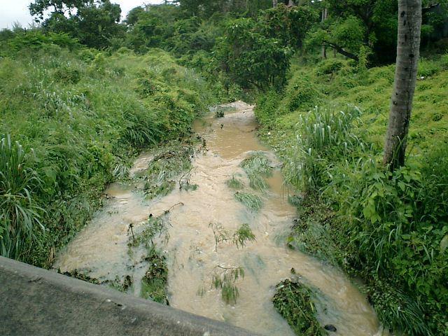


25 Flood Observations Channel Flows Inudations Nuisance flooding


26 Flood Surveys Registering flood levels, Recording level damages, and Losses


27 Flood Hazard Map Production From 1996 Barbados Drainage Study Legend contours 5yrFldLine Updated Roads 20yrFldProofArea yrFldLine 100yrFldLine Nov2004FldLine / Created by Pernel Brewster C:\Drainage Unit -Server\GIS Files\Drainage Features\FloodPlainMapping

28 100-years Rainfall/Storm Surge events Source: Coastal Hazard Project 2007
29 Thank-you Questions? Appreciation: to Drainage Unit s staff who braved flood conditions to provide flood data