Summary Report University of Wisconsin-Stevens Point and Waushara County Staff and Citizens
|
|
|
- Harvey Harrell
- 5 years ago
- Views:
Transcription


1 Summary Report 2013 University of Wisconsin-Stevens Point and Waushara County Staff and Citizens
2
 21 Johns 5 Long (Oasis) 22 Bughs 6 Huron 23 Irogami 7")
 32 Curtis 16 Fish 33 Pleasant 17 Marl Round")

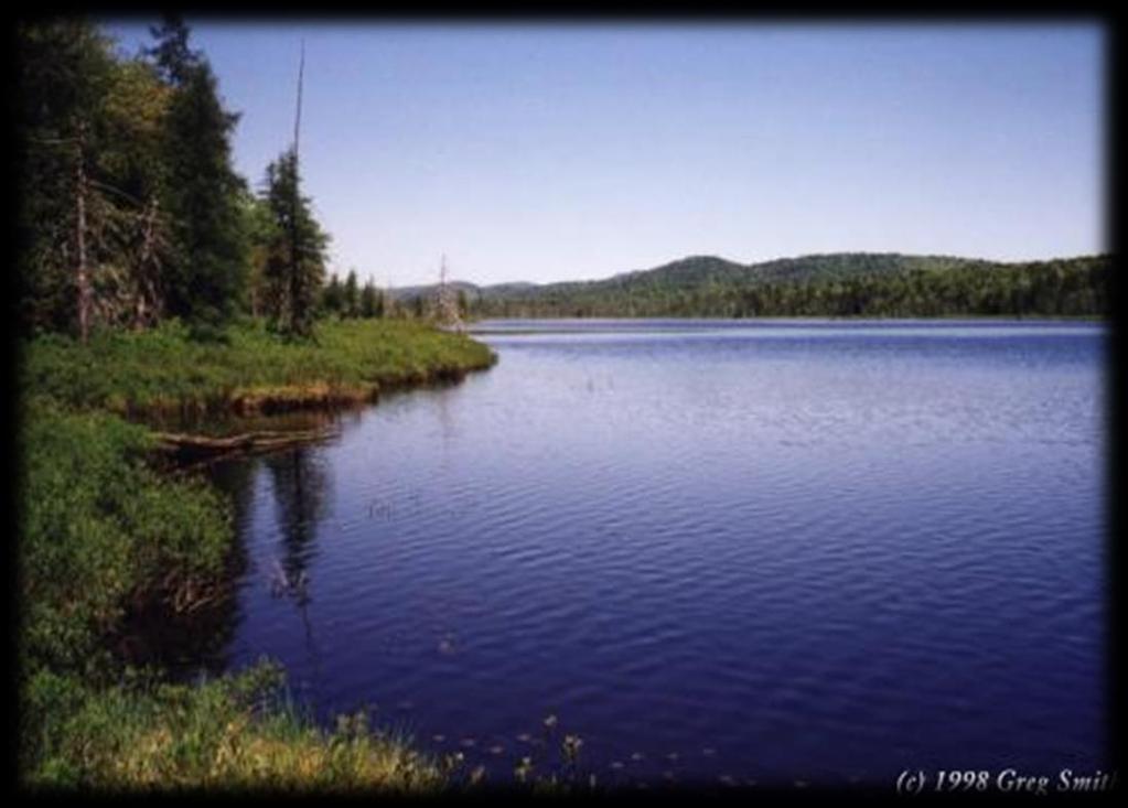
3 Round Lake Location WAUSHARA COUNTY LAKES STUDY 1 Pine (Springwater) 18 W. Branch Mill Pond 2 Twin 19 Porters 3 Gilbert 20 Pearl 4 Long (Saxeville) 21 Johns 5 Long (Oasis) 22 Bughs 6 Huron 23 Irogami 7 Wilson 24 Alpine 8 Kusel 25 Silver (Wautoma) 9 Silver (Springwater) 26 Deer 10 Round 27 Little Hills 11 Big Hills 28 White Riv. Flowage 12 Napowan 29 Witters 13 Beans 30 Lucerne 14 Morris 31 Spring 15 Pine (Hancock) 32 Curtis 16 Fish 33 Pleasant 17 Marl Round Lake East of Wild Rose South of County Highway A Township of Springwater Surface Area: 74 acres Maximum Depth: 19 feet Water Flow Round Lake is a seepage lake; most water enters via groundwater. Surface water runoff and direct precipitation also contribute water to lesser extents. Most water exits Round Lake via groundwater.


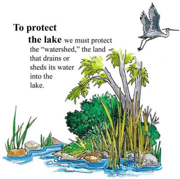
4 Round Lake Land Cover in the Surface Watershed Surface Watershed: The area where water runs off the surface of the land and drains toward the lake. Land uses and land management practices occurring in a watershed can affect the water quality in a lake. Land uses and land management also play major roles in how water moves across the landscape and how much water soaks into the ground (for long-term storage) or quickly runs off the land. The surface watershed of Round Lake is 296 acres. Forests and developed lands account for the primary land uses in the watershed. Development and forests surround Round Lake. Generally, the land closest to the lakes will have the greatest immediate impact on their water quality.


5 Round Lake Groundwater Flow Groundwater provides water to lakes in Waushara County throughout the entire year. Hard surfaces on the landscape prevent water from soaking into the ground and becoming groundwater. This results in less water flowing to the lake during the winter and between rains. Groundwater pumping can also reduce the amount of water entering lakes. The quality of groundwater reflects what is happening on the land surface. Precipitation falling on forested land produces clean groundwater, whereas precipitation falling on lands that have chemical use can leach contaminants to groundwater. Groundwater contamination in central Wisconsin may include nitrogen, pesticides, herbicides and other soluble chemicals originating from septic systems, crops, barnyards, road maintenance, etc. Once in the groundwater, these chemicals slowly move towards a lake or river. On the map below, arrows indicate the direction of groundwater flow to and from the lakes. Much of the groundwater flows to Round Lake from the west.


6 Round Lake Shoreland Vegetation Shoreland vegetation is critical to a healthy lake s ecosystem. It provides habitat for many aquatic and terrestrial animals including birds, frogs, turtles, and many small and large mammals. It also helps to improve the quality of the runoff that is flowing across the landscape towards the lake. Healthy shoreland vegetation includes a mix of tall grasses/flowers, shrubs and trees. A few stretches of the shoreland around Round Lake have healthy shoreland vegetation (displayed in green); however, most stretches could benefit the lake by being restored.


7 Round Lake Aquatic Plants Aquatic plants are the forest landscape within a lake. They provide food and habitat for terrestrial and aquatic creatures such as fish, ducks, turtles, invertebrates and other animals. They increase oxygen in the water and utilize nutrients that would otherwise be used by algae. A healthy lake typically has a variety of aquatic plants creating diversity that can help to prevent the establishment of aquatic invasive species. The aquatic plant community in Round Lake is characterized by above-average diversity of plant species when compared to other lakes in the Waushara County Lakes Study, with 23 aquatic species that are common to Wisconsin lakes. The greatest plant diversity is found in the southwestern shallows of the lake. Ninety-three percent of sites sampled had vegetative growth. The average depth of sampled sites was 13 feet, with a maximum depth of 21 feet.
, a non-native species, was identified in Round Lake for the first time during the 2012 survey.")


8 Round Lake Aquatic Plants The dominant plant species in the 2012 survey were flat-stem pondweed, white-stem pondweed and Chara spp. Eurasian water milfoil (EWM), a non-native species, was identified in Round Lake for the first time during the 2012 survey. It was found primarily in the southern portion of the lake. The EWM population was frequently found mixed with northern water milfoil, a native milfoil species. The EWM in Round Lake should be routinely monitored to determine if it is spreading. Species Richness is a count of the number of plant species found at a survey point. A greater number of species in a lake helps to make the aquatic plant community more resilient to year-to-year changes and aquatic invasive species. More plant species means more diverse habitat and food sources are available. The leaves of white-stem pondweed offer shade, shelter and foraging opportunities for fish. Its fruits are a valuable food for waterfowl. Eurasian watermilfoil (EWM) is an exotic species which forms dense colonies. EWM competes aggressively to displace and reduce the diversity of native aquatic plants. It also has a lower food value than the plants it replaces.


9 Round Lake Water Quality Lakes go through a natural aging process that results in increased aquatic plant growth, fish, and wildlife over time. Within a lake s watershed, human activity on the land, in a wetland, or in the lake can dramatically accelerate this process. Depending on land management practices, changes in a lake that may have normally taken centuries to occur may take place in decades or even years. The amounts of nutrients, algal growth, and water clarity measurements help to define the age of a lake. Based on these measures, lakes can be classified for comparison to one another. Oligotrophic Lakes Common uses: Swimming Skiing Boating Vegetation of oligotrophic lakes: Very little vegetation Mesotrophic Lakes Common uses: Boating Fishing Vegetation of mesotrophic lakes: Increased vegetation Occasional algal blooms Eutrophic Lakes Common uses: Fishing Wildlife watching Vegetation of eutrophic lakes: Lots of aquatic plants Frequent algal blooms Winter fish kills can occur in shallow lakes due to low oxygen levels.


.")
10 Round Lake Water Quality Phosphorus is a major nutrient that can lead to excessive algae and rooted aquatic plant growth in lakes. In fact, one pound of phosphorus entering a lake can result in 500 pounds of algal growth. All Waushara County lakes have either sufficient or excessive nutrients for aquatic plant growth, so these lakes will benefit from limiting the addition of more nutrients. Sources of phosphorus include septic systems, animal waste, storm water runoff, soil erosion, and fertilizers for lawns, gardens and agriculture. Total phosphorus levels measured when the lake was well-mixed during spring and fall are displayed in the graph to the left. During fall and spring , the average total phosphorus level remained similar to earlier measurements. Water clarity is a measure of how deep light can penetrate (Secchi depth). Clarity is affected by water color, turbidity (suspended sediment), and algae. Water clarity helps determine where rooted aquatic plants can grow. The graph to the left shows water clarity measurements taken between April and October. It is typical for water clarity to vary throughout the year. During the summers of 2011 and 2012, the poorest average water quality in Round Lake was 11.5 feet in June and the best was 13.4 feet in August. In comparison to measurements prior to 2011, water clarity has increased during the summer.


11 Round Lake Sediment Core Analysis Lake sediment can help to tell the history of a lake and changes that may have affected the lake related to water quality, the abundance of aquatic plants, and sedimentation or land disturbance in the watershed. These changes are assessed by evaluating the content of the upper layer of the sediment versus lower layers. This information can help to guide management decisions for a lake. Analysis of Pleasant Lake s sediment core suggests an increase of disturbance in the lake basin since the time of land clearing. These activities peaked in recent decades, but may have stabilized in recent years. Diatom species and communities as well as sediment properties reflect an increase in phosphorus. An increase in aquatic plants and filamentous algae found in the top of the sediment core. Pleasant Lake has experienced limited increased phosphorus concentrations, but large changes in habitat, during the last century. This sediment core was collected from Round Lake. The darker layers indicate organic-rich sediments that are often due to abundant aquatic plants and/or soil erosion from the landscape. Additional analysis of this layer can help to confirm the source(s). Diatoms are a type of algae commonly found in sediment. They are wellpreserved in sediments due to silica-based cell walls which resist degradation. Diatom species found in lake sediments in Waushara County. Different species of diatoms are sensitive to water quality; thus, changes in the diatom community from the bottom to the top of the sediment core can reveal how water quality in the lake has changed over time.


12 Round Lake What can you do to help? Lake Users: Land Owners: Home Owners: Run boat engines efficiently Observe no/low wake zones Refuel away from water Dispose of trash properly Remove all aquatic plants from boats and trailers Respect wildlife and other lake users Control soil erosion Keep livestock out of lakes and streams Control manure runoff Carefully manage nutrients and pesticides Leave natural shoreland vegetation in place or restore if it has been removed Learn to identify and look for invasive species Leave natural shoreland vegetation in place or restore if it has been removed Leave woody habitat for young fish, turtles and frogs Eliminate the use of fertilizer or use no phosphorus fertilizer Eliminate or minimize use of pesticides Control soil erosion Control runoff from rooftops and hard surfaces Clean up after pets Learn to identify and look for invasive species Stop the Spread of Aquatic Invasive Species! Wetlands and Shorelands: LEARN how to identify invasive plants and animals, and know who to contact if found. DO NOT PURCHASE prohibited and restricted species! Whenever possible purchase native plants. NEVER transplant water garden plants or aquarium plants into lakes, streams, wetlands, or storm water ponds. Properly dispose of unwanted plants and animals! REMOVE invasive exotic plants from your landscape and replace them with native plants or non-invasive exotic plants. Scout annually for new invasive plants. AVOID using garden plants from other regions whose invasive potential is poorly understood. Lakes and Rivers: LEARN what Wisconsin invasive plants and animals look like and who to contact if seen in a lake or river. INSPECT your boat, trailer and equipment when traveling to different water bodies and REMOVE any attached aquatic plants or animals (before launching, after loading, and before transporting on a public highway). DRAIN all water from boats, motors, and all equipment after use at a lake. NEVER release live fish, bait or pets into a wetland or water body. BUY minnows from a Wisconsin bait dealer. Only use leftover minnows at that same water body.
 Shoreland Assessments Ed Hernandez and Waushara County Land Conservation")


13 Round Lake Primary Authors Authors listed are from the UW-Stevens Point unless otherwise noted. Aquatic Plants Jen McNelly Sediment Core Samantha Kaplan Paul Garrison (Wisconsin Department of Natural Resources) Shoreland Assessments Ed Hernandez and Waushara County Land Conservation Department Staff Dan McFarlane Water Quality and Watersheds Nancy Turyk, Paul McGinley, Danielle Rupp and Ryan Haney Ed Hernandez and Waushara County Land Conservation Department Staff UW-Stevens Point Students: Melis Arik, Nicki Feiten, Sarah Hull, Chase Kasmerchak, Justin Nachtigal, Matt Pamperin, Scott Pero, Megan Radske, Anthony Recht, Cory Stoughtenger, Hayley Templar, Garret Thiltgen Acknowledgments We are grateful to many people for supporting this project by providing insight, enthusiasm, and funding. We would like to recognize our project partners: Waushara County Watershed Lakes Council Waushara County Staff and Citizens Wisconsin Department of Natural Resources Professionals, Mark Sessing and Ted Johnson Wisconsin Department of Natural Resources Lake Protection Grant Program Dr. Samantha Kaplan and Dr. Paul McGinley UW-Stevens Point Water and Environmental Analysis Lab