Tamilnadu Hydrology Project-II. DSS(Planning) for IWRD By SGSWRDC, TNWRD, Chennai
|
|
|
- Rudolf Jenkins
- 5 years ago
- Views:
Transcription
1 Tamilnadu Hydrology Project-II DSS(Planning) for IWRD By SGSWRDC, TNWRD, Chennai Chief Engineer, WRD State Ground & Surface Water Resources Data Centre, Chennai
2 About SG&SWRDC Custodian of Groundwater resources of Tamilnadu. Assess and categorize the GW potential of the State. Support the government in the policy matters and governance of groundwater. Repository of Hydrological, Hydro-meteorological, Hydrogeological and Water Quality data. Implemented the Hydrology Project-I and established the data collection system. Implements the Hydrology Project-II and develops DSS for 3 river basins and Hydrological Design Aids for balance basins of Tamilnadu.
3 Synopsis on Hydrology Project-I Implemented during at a cost of Rs crore. Objective is to establish a Hydrological Information System (HIS) in Tamilnadu among other States. S.No Assets created Nos 1 Rainfall Stations (daily) Rainfall Stations (Hourly) 57 3 Climatic Stations (manual) 45 4 Climatic Stations (automatic) 6 5 Stream flow stations Piezometers Water Quality (SW) 71 8 Water Quality (GW) Laboratories 1+3 The HIS is well institutionalized in SG&SWRDC.


4 DSS Overview Before DSS - Tank -Dry After DSS- Tank Water Plenty
5 Objective of DSS Dynamic Water budgeting at river basin scale. To assess the spatial and temporal distribution of Surfacewater and groundwater in the State. Use the Water Balance information for IWRM in the basin. Institutionalize and sustain the DSS in the State. Technological backing for the SWARMA.
6 Concept of DSS Integrated Water Resources Management (IWRM) covering the following modules in the DSS (Planning) of each Basin. Surface water Planning Drought Management Conjunctive use of Ground & Surface water Reservoir Operation Water Quality
7 Benefits of Decision Support System Spatial & Temporal Assessment of Surface Water and Groundwater in the river basin. Judicious planning and allotment of SW and GW for a predicted monsoon, year, decade. Scenario Analysis of adopting different Cropping pattern and their impact on the SW and GW resources. Identification of sites fit for Artificial Recharge Schemes and quantification of their impact on the Groundwater augmentation. Spatial & Temporal distribution of WQ across the basin. Collaborative Decision making by all stakeholders in a river basin.
8 Kind of DSS that the State requires Gives the spatial and temporal water balance (SW+GW) of a basin. Based on a distributed 3D Hydrological model of the basin. Take into account of the tank system on the hydrology of the basin. Dynamic and at daily time steps. Simulates the SW and GW and validate them against the observed catchment outflow and piezometric heads. Web-enabled. User-friendly and supports the SWARMA
9 Data Availability Readily Available Timeseries Rainfall (daily), Rainfall (hourly), Eto(daily), GWL (monthly), Water Quality(bi-annual) Static Lithology, Cartosat-1 stereo imageries. Basin Boundaries. Geology maps. Geomorphology maps. Soil maps.
10 Data Availability Secondary data to be collected Timeseries Cropping pattern under irrigation tanks and river/canal sluices (Fasli) Tank filling details Static DEM from Cartosat-1 stereo imageries. Location of TWAD and Industrial wells. Reservoir (inflow,storage,outflow) GW abstraction from TWAD and Industrial wells.
11 Data Availability Primary data to be collected Command Area maps under tanks and river/canal sluices. Ground Control Points to calibrate the DEMs. River/ canal Cross-sections. Tank FTLs and Sluice levels. Sill levels of River/Canal sluices. Drainage network of Supply channels from weirs and surplus courses of tanks.
12 Implementation Strategy Agreement on the Tamilnadu DSS Framework. Agreement on the modeling code and databases to be used for the future DSSs. Identification of basins among the agencies. Counterparts personnel for the identified basins between IWS + SG&SWRDC + Consultancy + PF + Regions. Training for the Counterpart Personnel on modelling.
13 Basins for DSS Integrated Water Resources Management (IWRM), covering SW, GW & WQ in 3 Basins. Agniar Basin Vaippar Tamiraparani Basin
14 Component Goal1 For a given Monsoon prediction, which part of the basin can go in for Wet/Dry crop? Goal2 How much for different sectors? How much from SW and how much from GW and when? Present Status of DSS Goals 1. Basin is divided into Subbasins. Status 2. Methodology has been evolved to populate subbasins in DSS Software with SW & GW availability obtained from MikeSHE and MikeBasin. 3. For a given Monsoon prediction, recommended subbasins for Wet/ Dry crop will be shown as a GIS Map. 1. MikeSHE model is being set up. 2. Methodology to assess available SW & GW as a time series has been evolved. 3. Upon calibration of the models, allocation for different sectors will be assessed. Goal3 Shall we invest in Artificial Recharge Structures in a particular location of the basin? What are the impacts on GW and SW? 1. MikeSHE model is being set up. 2. It has complete lithology and topsoil GIS Maps. 3. Upon calibration, the model will show the sites fit for ARS and impact on both the GW & SW. Goal4 Whether to grant a Groundwater abstraction permit? How much? 1. MikeSHE model is being set up. 2. All existing abstraction wells are there in the model. 3. Upon Calibration, the new abstraction well with its demand will be simulated in the model. 4. The output will show the feasibility of issuing the abstraction permits.
15 Architecture of Tamilnadu DSS Stakeholders Hired Web/Database Server Privileges Level 1 Administrator (1) SG&SWRDC (5) / SWaRMA (10) INPUT Control Administration Back-up Recovery Improvement Output Feedback Level 2 WRD (100) TWAD (50) Agri (50) Industries ( 50) Collectors (32) Tahsildars ( 215) WUA ( ) + RTDAS INPUT Add/Edit data to selected tables, Feedback OUTPUT View MikeSHE results, Run Mike Basin Simulations Level 3 CM (1) Ministers (30) Secretaries (30) Chief Engineers (30) + Public (no limit) INPUT Feedback OUTPUT View and download Data Text/Graphic/ Map Reports (PDF), for different users levels.

16 Operational Structure of DSS Policy makers Technocrats Public Farmers HDA Data Sharing DSS RDBMS Basin Info System in GIS Internet Server State Water Authority Output Reports Internet / WAN Input Data WRD Drinking Agri Industry Revenue Towards a Multi-criteria Collaborative Decision Making in Water Resources Management in a River basin
17 GW (Recharge/ Availability) SW (River Flow) SW (Tanks/ Detention Storage) Hydrological Models & DSS in Tamilnadu Mike Basin Database with all GIS, TS, Results DSS Solution Software MikeSHE Pre Defined Scenario Outputs

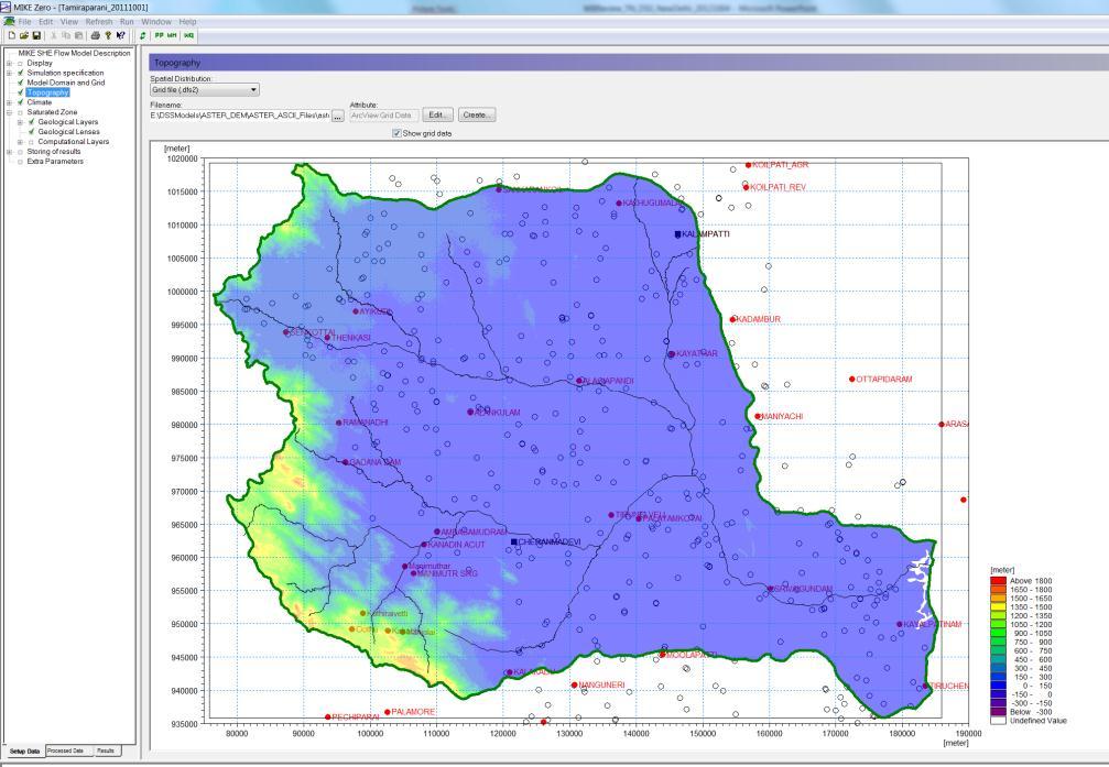
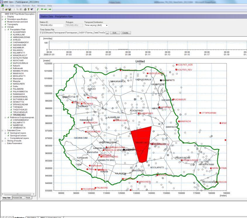
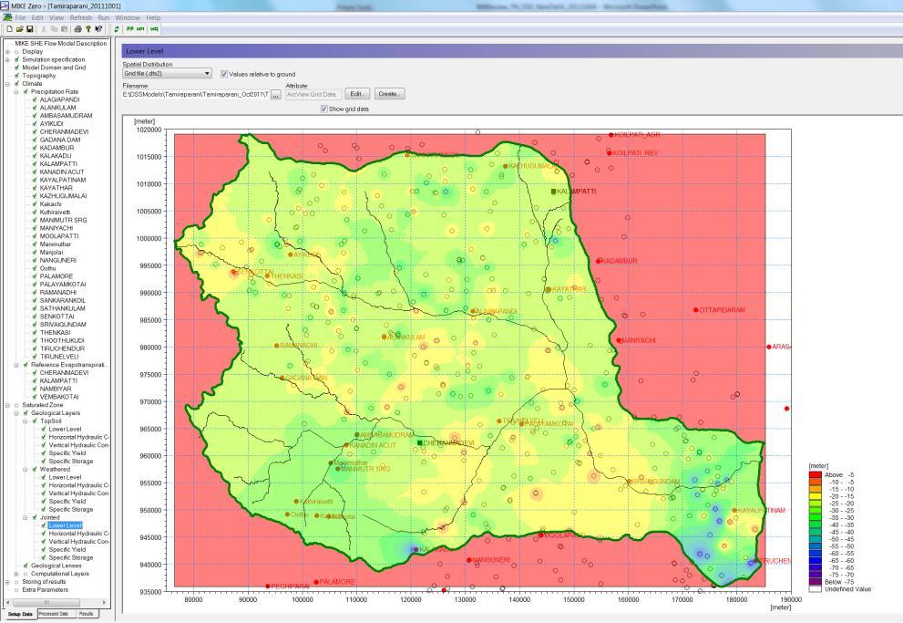
18 Technology developed by DHI, now under testing

19 Technology developed by DHI, now under testing

20 Technology developed by DHI, now under testing

21 Technology developed by DHI, now under testing

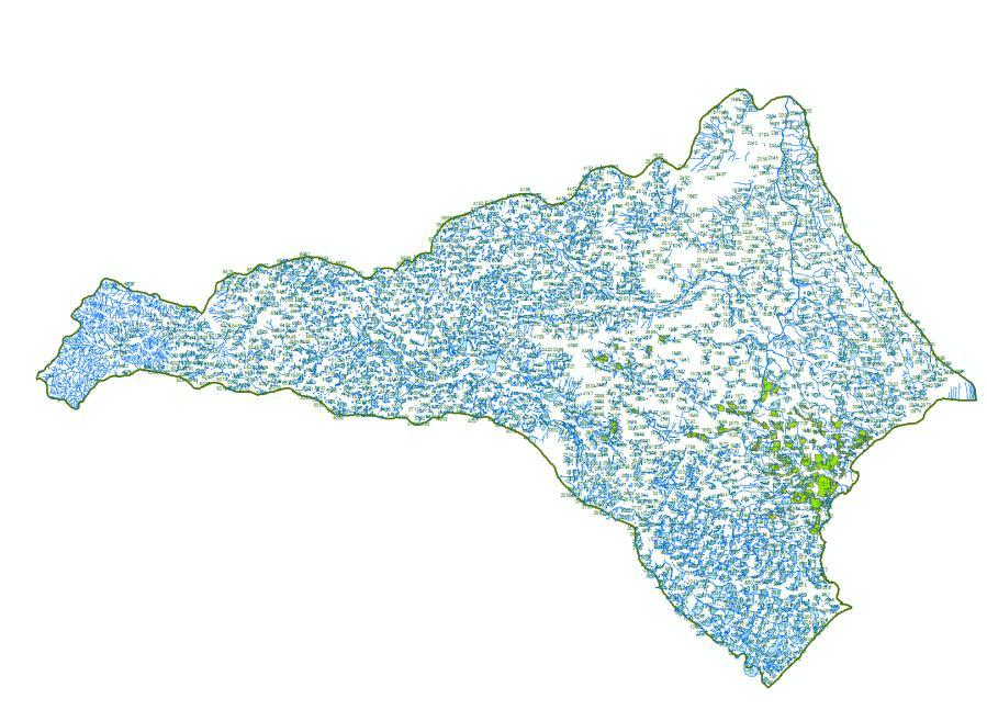
22 Non Command Area digitization

23 DSS Progress - Vaippar
24 Command Areas under each Tank

25 DSS Progress - Tamiraparani

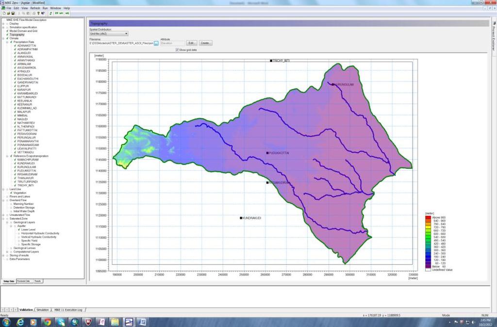
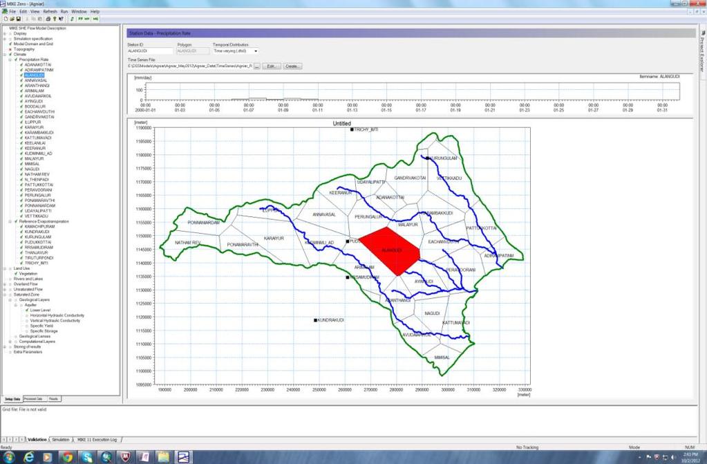
26 DSS Progress - Agniar


27 Why Decision Support System? IMD Predicts an Above or Below Normal North-East Monsoon! How DSS can help us?
28 Conclusion The Decision Support System, on its completion, will be the Technological backing for the State Water Resources Management Authority (SWaRMA). It will way for better water resources management at river basin framework.

29 THANK YOU Thokkalikadu Weir