Background - Parameter Scaling - Climate Change and Resolution - Conclusions
|
|
|
- Marilynn Diane Burns
- 5 years ago
- Views:
Transcription


1
2 Bulk of talk Brief summary of poster


3 CLIMATE CHANGE = é Temp, ê Snowpack Figure: IPCC Report, 2007
4 MOUNTAIN SNOWPACK CRITICAL FOR WATER SUPPLIES Snowmelt dominated regions Figure (Barnett et al 2005): More than 1/6 th population depends on surface water supplies from snowmeltdominated systems. Complex topography Accumulated annual snowfall Annual Runoff
: More than 85% of upper Colorado R.")
5 MOUNTAIN SNOWPACK CRITICAL FOR WATER SUPPLIES Snowmelt dominated regions Figure (Barnett et al 2005): More than 1/6 th population depends on surface water supplies from snowmeltdominated systems. Complex topography Accumulated annual snowfall Annual Runoff Figure (Ficklin et al 2013): More than 85% of upper Colorado R. Streamflow (main supply for Southwestern United States) generated from snowmelt in Rocky Mountain Headwaters.

6 Mountains to warm more quickly (NCC 2017)
7 Mountains are sensitive but process-based understanding is limited by complexity Range of elevations Steep Temperature Gradients Variable Precipitation m


8 Mountains are sensitive but process-based understanding is limited by complexity Range of elevations Steep Temperature Gradients Variable Precipitation Heterogeneous Geology & Landcover m

9 All methodologies simplify the real world Observations:

10 All methodologies simplify the real world Models Coarse resolution models to make decisions/predictions -> run quickly, missing feedbacks Fine resolution models are computationally expensive but when does it matter?


11 Using high resolution enabled by super computing to inform low resolution models bridge the gap 1. High resolution in both SPACE and TIME can bridge observational gaps 2. Insight into physical mechanisms driving changes 3. Inform predictive and decisionmaking models


; Kollet")
; Dai et al.")
 dz dx dl βx")

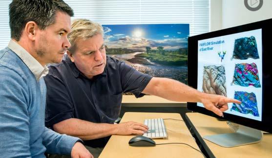
12 We use the integrated hydrologic model ParFlow, coupled to land surface model CLM Atmospheric forcings Water energy balance Root zone P2 H2 H1 Vegetation Overland flow Land surface Infiltration Vadose zone Saturated subsurface P1 Exfiltration z=0 z2 z1 Lateral Subsurface flow Maxwell (2013); Kollet and Maxwell (2008); Kollet and Maxwell (2006);Maxwell and Miller (2005); Dai et al. (2003); Jones and Woodward (2001); Ashby and Falgout (1996) dz dx dl βx No flow boundary Multi-physics PDE-based system Solving the nonlinear diffusion and wave equations Globally Implicitly In parallel
13 At 1km patterns of landcover, elevation, geology, and soils are decimated Small differences (<5%) in landcover and geology type
 in landcover and geology type Same parameters give very different streamflow")
14 At 1km patterns of landcover, elevation, geology, and soils are decimated Small differences (<5%) in landcover and geology type Same parameters give very different streamflow estimates


15 Hydraulic conductivity- critical parameter for estimating streamflow Electrical Conductivity: inherent property of substance explaining how conducive to FLOW Hydraulic Conductivity: inherent property of rock explaining how easily water flows through it. Sensitivity Experiment

16 Hydraulic conductivity acts as a moderator between streamflow and subsurface flow
17 So then what changes between resolutions to cause different flow? Simple Hydrology: Water flows downhill (GRAVITY) Resisted by friction (1/HYDRAULIC CONDUCTIVITY)
: 3.6E-11 < K < 1.")

18 Combine uncertainty in K with loss of gradient to make effective K Measured Crystalline K (m/hr): 3.6E-11 < K < 1.08 Topographic loss of 191m of elevation reduces gravity term in 1km model. Hydraulic Conductivity (K) is a highly variable (10 OM) measured parameter

19 Much larger difference between 1km and 100m effective K than K
20 Next step to parameter matching is minimizing the effective K ratios between resolutions BEFORE SCALING SCALING: Minimize K eff ratio White color means K eff ratio approaches 1

21 The improvement to matching streamflow between resolutions is dramatic

22 This method can help parameterize hyperresolution models where traditional calibration procedures are limited by computational demand Tune simple model parameters Parameter scaling method Accurate fine to hyper scale model Now we have matching fine and coarse-scale models to examine climate change impacts + =???
23 Global climate models and regional hydrologic models are known to perform poorly in the Rockies. Figure: simulated streamflow for different downscaling methods on PNW snowmelt driven rivers. (Wood et. al. 2003) Begs the question if our models are more uncertain than climate change are we able to predict climate impacts?


24 We compared climate variability with variation in model resolution 30 climate scenarios from Rocky Mountain projections
25 Results suggest that the coarseresolution models used today may underestimate climate impacts 100m model predicts a 18% decrease in headwater streamflow after 4 degrees of warming 1km model only predicts a 12%

26 To learn more


27 Why systems like BW? Computational Demand Parameter scaling study: 36 simulations 60,000 core hours Climate uncertainty study: 54 simulations 90,000 core hours Total: 150,000 hours (not counting mistakes or experiments that were not included in papers)
28 Conclusions Hyper-resolution models and HPCsystems can help us understand important, complex systems like mountains
29 Conclusions Hyper-resolution models and HPCsystems can help us understand important, complex systems like mountains Model interrogation and development are critical to getting the right answers for the right reasons i.e. model sensitivity and parameter estimation!


30 Conclusions Hyper-resolution models and HPCsystems can help us understand important, complex systems like mountains Model interrogation and development are critical to getting the right answers for the right reasons i.e. model sensitivity and parameter estimation! How we build and use our models is as important as the climate changes they are built to detect, so we must be thoughtful aboutour results and their implications.


31 Thank you!! Background - Parameter Scaling - Climate Change and Resolution - Conclusions

32 Climate [change]? Questions?