AERIAL PHOTO OF A FLOOD PLAIN Dr. Martin Falke
|
|
|
- Valerie Robinson
- 5 years ago
- Views:
Transcription
 MRC Flood Management and Mitigation Programme (FMMP) Land Management Component (C 5) Regional Flood Management & Mitigation Centre (RFMMC) Phnom Penh/")
1 FMMP-C 5 Flood Management and Mitigation Programme - Land Management Component - FMMP C 5 & FLOOD INFORMATION BASED LAND MANAGEMENT (FIBLM) by AERIAL PHOTO OF A FLOOD PLAIN Dr. Martin Falke Team Leader (GFA-Consulting Group) MRC Flood Management and Mitigation Programme (FMMP) Land Management Component (C 5) Regional Flood Management & Mitigation Centre (RFMMC) Phnom Penh/ Cambodia falke@mrcmekong.org 1
2 FMMP-C 5 Flood Management and Mitigation Programme - Land Management Component - 1. MRC-FMMP OVERVIEW 2. PROJECT OBJECTIVE 3. REVIEW OF FMMP C 5 (Phase 1 & 2)/ METHODOLOGY 4. FINAL STATUS OF FMMP C 5 (Phase 2), DATA COLLECTION & ANALYSIS 5. USE OF FLOOD PROBABILITY MAPS (FPM) IN LAND MANAGEMENT & LAND USE PLANNING (Examples from Cambodia) 6. CONCLUSIONS, RESULTS & RECOMMENDATIONS 2
3 FMMP-C 5 Flood Management and Mitigation Programme - Land Management Component - MRC-FMMP Overview The ultimate objective of the Flood Management and Mitigation Programme (FMMP) of the MRC, established in 2002, was to contribute to a reduction of civil and socioeconomic losses due to floods while preserving the environmental benefits of floods.
4 FMMP-C 5 Flood Management and Mitigation Programme - Land Management Component - The MRC-FMMP Programme covered 5 components: 1. Establishment of a Regional Flood Centre 2. Structural Measures and Flood Proofing 3. Mediation of Transboundary Flood Issues 4. Flood Emergency Management Strengthening 5. Land Management
5 FMMP-C 5 Flood Management and Mitigation Programme - Land Management Component - The immediate objective of component 4 and 5 (supported by GIZ) was: To improve the capacities of authorities and organisations at various levels of the riparian countries to apply more efficiently appropriate disaster preparedness, emergency management and land management policies and tools in the field of flood management.
6 FMMP-C 5 Flood Management and Mitigation Programme - Land Management Component - The Objective of FMMP- Component 5 (Land Management) was: Land Management in the Mekong floodplains is more effective, using reliable flood-related information. Relevant authorities and organisations at various levels of the four riparian countries use reliable flood-related information in land management. 6
7 FMMP-C 5 Flood Management and Mitigation Programme - Land Management Component - - Current land management practices are an important factor contributing to a situation where the regular floods of the Mekong cause substantial damage to agriculture and infrastructure - More effective decision making requires the provision of more relevant and accurate flood related information - FMMP C 5 produced flood probability maps (FPM) in a scale of 1: or larger. The project intended to supply the decision making authorities (particularly provincial and district offices) in the four participating countries with this urgently required planning tool of the right scale, which will contribute to avoid or at least minimize flood risks and damages for communities living along the Mekong River 7
8 FMMP-C 5 Flood Management and Mitigation Programme - Land Management Component - FMMP C 5 in the context of CLIMATE CHANGE - Global Warming induces rising temperature, changing in precipitation and wind - Resulting in flooding, drought and storm in terms of an increased frequency, intensity and duration, also within the Mekong River Basin - Causing disruption & damages to many development sectors such as land management, agriculture, infrastructure, ecology, hydrology, fisheries, tourism, etc. - The FMMP- C5 Approach and its Maps can serve as an ADAPTATION & MITIGATION TOOL for Planning Authorities and Communities as a response to Climate Change Effects (e.g. intensified flooding) 8
9 FMMP-C 5 Flood Management and Mitigation Programme - Land Management Component - REVIEW OF FMMP C 5 -Phase 1 & 2 (2004 to 2011)- - METHODOLOGY- 9
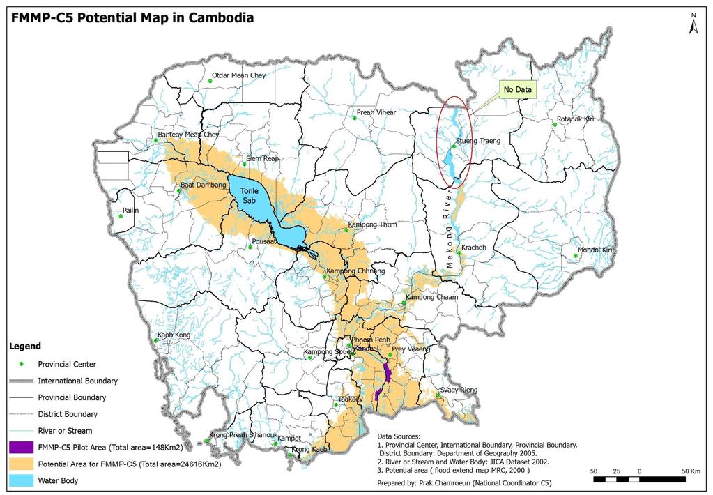
10 FMMP-C 5 Flood Management and Mitigation Programme - Land Management Component - The approach of FMMP C 5 (Phase1) was based on 3 Pilot Districts in Cambodia - the creation of reliable Flood Probability Maps for subsequent use in Land Management by the relevant authorities and organisations. 10
")
11 Location of River Stations and Flood Marks in the 3 Pilot Districts in Cambodia (Phase 1) 11


12 Data sources River station Village flood mark Daily records from flood marks during the flood season 2003 to 2010 and daily river levels since 1960

13 Flood Information Billboard Flood Information Billboard Village: Boeng Kandal People: 1892 persons Area: 1487 ha Alert 1 st: Alert 2 nd Alert 3rd Day Month Year Water level at Neak Loung Water level at village, m Inundation Area, m2 Station, m Yesterday Today Tomorrow After Tom 13

14 Flood Information Billboard 14
15 15

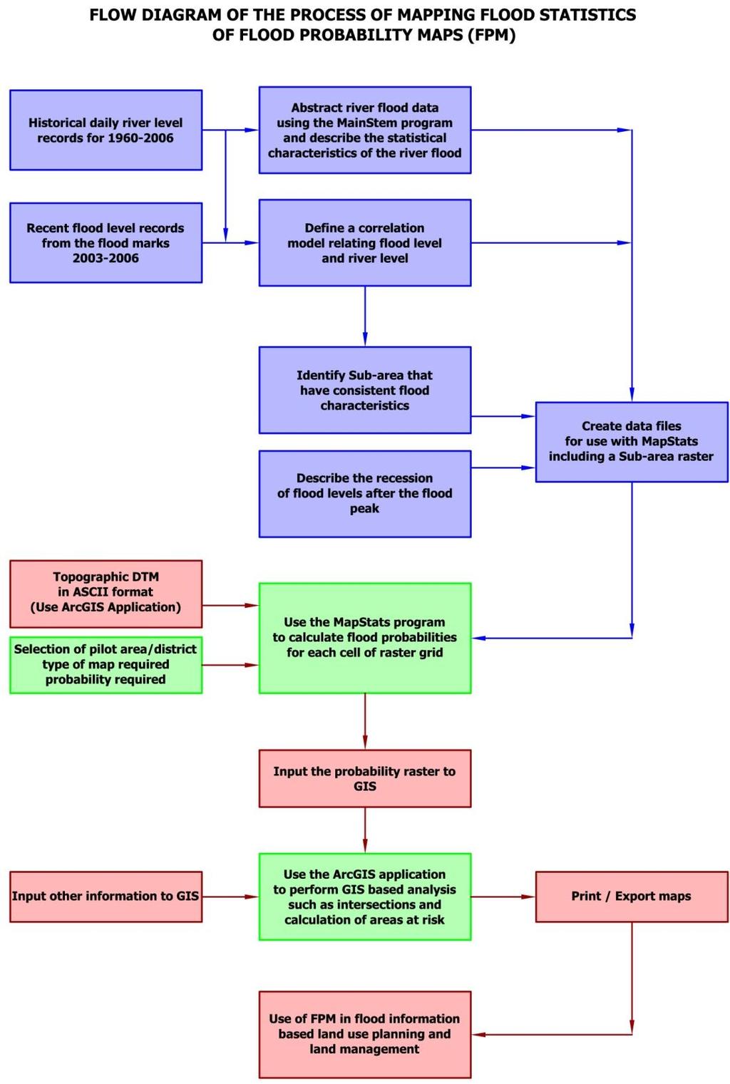
16 Displaying the Results: ASCII raster file In this example, each number represents the duration of flooding in days of a particular cell of the Peam Ro- DTM Each number represents the value of the statistic for each raster cell of the pilot area 16
 displayed as a map in MapWindow GIS. 17")
17 MapWindow GIS This is the raster file of the previous slide (Table) displayed as a map in MapWindow GIS. 17
18 FMMP-C 5 Flood Management and Mitigation Programme - Land Management Component - Creation of Flood Probability Maps The resulting raster files can then be displayed as maps in a GIS platform (ArcGIS/ MAP WINDOWS) showing any of the following statistics: Probability of flooding Start of Flooding Maximum depth of flooding for a range of probabilities Duration of flooding for a range of probabilities Completion of drainage for a range of probabilities 18
19 An Example for the Validation of Predictions The observed data fall within the range of the predicted results 19
20 FMMP-C 5 Flood Management and Mitigation Programme - Land Management Component - FINAL STATUS OF FMMP C 5 (Phase 2), DATA COLLECTION & ANALYSIS, RESULTS 20

21 FMMP-C 5 Flood Management and Mitigation Programme - Land Management Component - 21

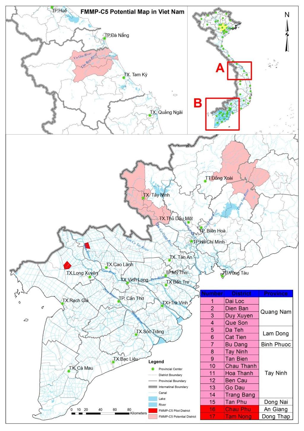
22 2 Pilot Districts in Vietnam Daily records from flood marks during the flood season for 2009 & 2010 in Tam Nong and Chau Phu pilot areas Daily river levels since 1979 from Tan Chau and Chau Doc

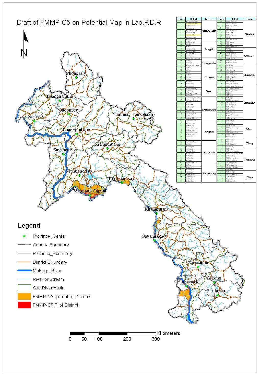
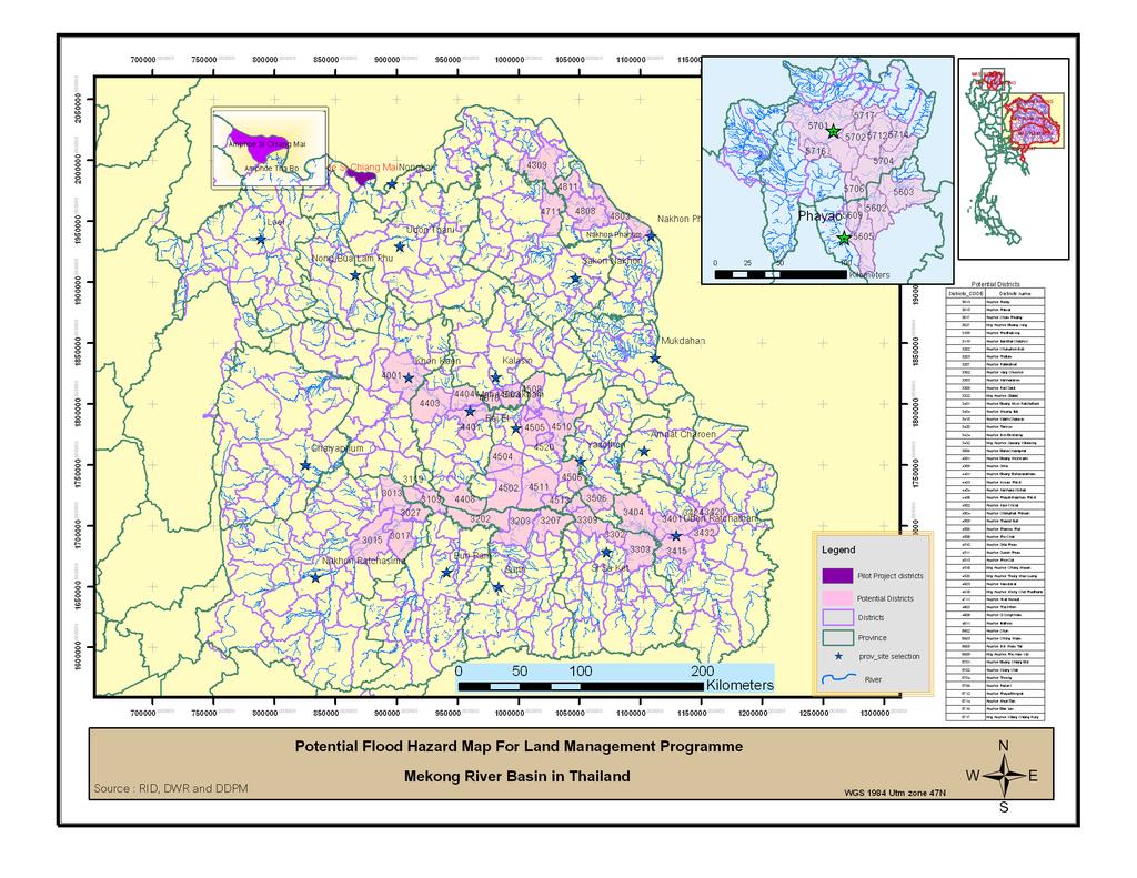
23 2 Pilot Districts in Lao PDR 1 Pilot District in Thailand 23
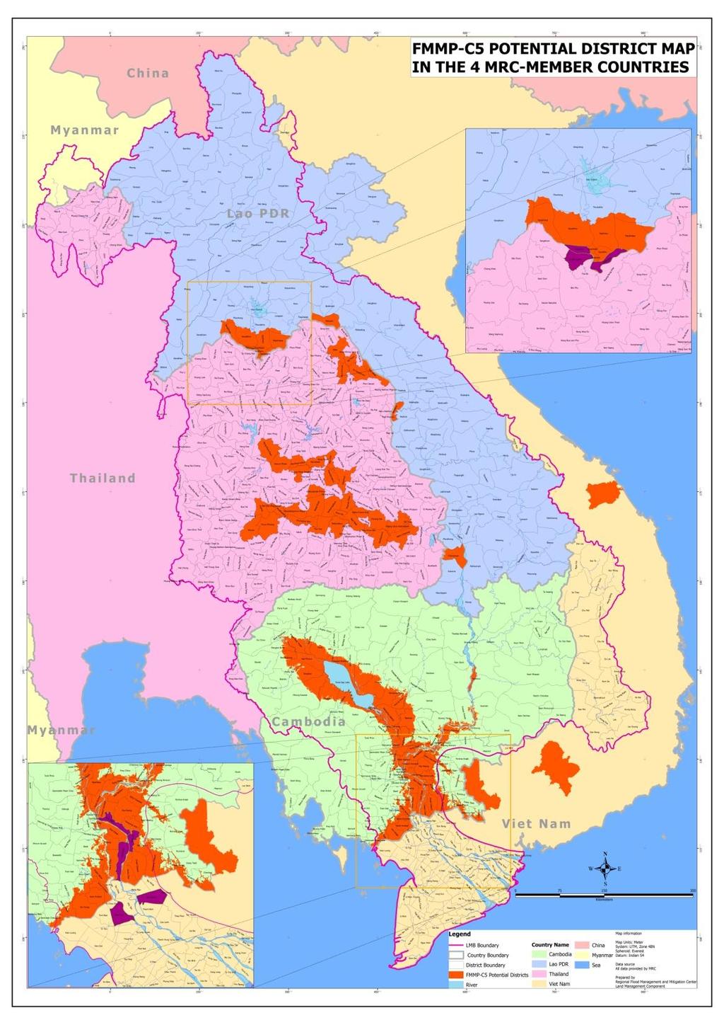
24 FMMP-C 5 Flood Management and Mitigation Programme - Land Management Component - PROJECT STATUS OF FMMP-C 5 (PHASE 2) in the 4 MRC-MEMBER COUNTRIES (February 2011) CAMBODIA (2 districts) LAO PDR (2 districts) THAILAND (1 district) National Workshop conducted 4 National Workshops completed in 10/ 2008 VIETNAM (2 districts) National Working Group established/ Meetings conducted Completed Completed Completed Completed Topographic Surveys conducted Completed Completed Completed Not required DEM/ DTM established/ provided Completed Completed Completed Completed Flood marks (FM) & Flood Billboards (BB) established Communities equipped & trained for data transmission Flood Mark Reading Data Base established Hydrographic Data collected (Main River Stations) Flood Probability Maps produced Flood Probability Maps used by Line Agencies Completed 30 FM & 14 BB Completed 19 FM & 4 BB Completed 20 FM & 6 BB Completed 38 FM & 4 BB Completed Completed Completed Completed Completed/ (Upgrading in process) Completed/ (Upgrading in process) Completed/ (Upgrading in process) In Process In Process (no flooding in 2009 & 2010) Completed/ (Upgrading in process) Not possible within C5-Phase 2 Not possible within C5-Phase 2 In Process (no flooding in 2009 & 2010) Completed/ (Upgrading in process) Not possible within C5-Phase 2 Not possible within C5-Phase 2 Completed (Upgrading in process) Completed/ (Upgrading in process) In Process since January In Process
25 FMMP-C 5 Flood Management and Mitigation Programme - Land Management Component - PROJECT STATUS OF FMMP-C 5 (PHASE 2) in the 4 MRC-MEMBER COUNTRIES (February 2011) CAMBODIA (2 districts) LAO PDR (2 districts) THAILAND (1 district) VIETNAM (2 districts) TOT-Trainings for Line Agencies (and at University) conducted Completed: 1. At RFMMC: Feb-March 2009/13 Participants 2. At National Level: Nov 2009/ 27 Participants 3. At Province & District Level: Nov 2009/ 50 Participants 4. At RUA: Nov 2009/ 22 Participants 5. At RUA: Feb 2010/ 30 Participants 6. At RFMMC: March 2010/10 Participants 7. At Province & District Level: June 2010/ 50 Participants 8. At RUA: July 2010/ 31 Participants 9. At DALRM: Oct 2010/ 14 Participants Completed: 1. At RFMMC: March 2010/ 5 Participants 2. At Udonthani: Sept. 2010/ 10 Participants Completed: 1. At RFMMC: March 2010/ 5 Participants 2. At Udonthani: Sept. 2010/ 10 Participants Completed in March 2010/ 15 participants Education Material produced & translated into the 4 riparian languages 3 Manuals, 2 DVDs & 1 Report completed 3 Manuals, 1 DVD & 1 Report completed 3 Manuals, 1 DVD & 1 Report completed 3 Manuals, 1 DVD & 1 Report completed Study Tour to Cambodia conducted M & E- System established Completed in February 2010 for 5 participants from Lao PDR, Thailand & Vietnam each (plus 36 participants from Cambodia) 4 National Workshops completed in 11/2008; 1 st & 2 nd Monitoring conducted in October 2009 & April 2010; 1 st & 2 nd M & E-Reports completed in December 2009 & May 2010 Impact Study on FIBLM- Achievements conducted Completed in 2 nd half of Regional Workshop conducted Completed in February 2011
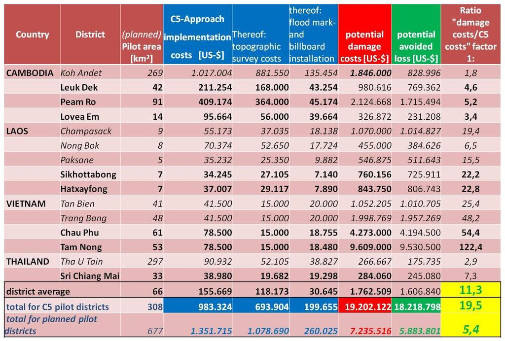
26 FMMP-C 5 Flood Management and Mitigation Programme - Land Management Component - Project Implementation-Status in the 4 MRC-MEMBER COUNTRIES (January to September 2009) CAMBODIA (2 districts) LAO PDR (2 districts) THAILAND (1 district) VIETNAM (2 districts) Districts Paem Ro Leuk Dek Sikhottabong Hatxayfong Si Chiang Mai Tam Nong Chau Phu Pilot Area (km 2 ) Flood Marks established Billboards established Total Nr. of Flood Marks Total Nr. of Billboards
27 FMMP-C 5 Flood Management and Mitigation Programme - Land Management Component - USE OF FLOOD PROBABILITY MAPS (FPM) IN LAND MANAGEMENT & LAND USE PLANNING - Examples from Cambodia - 27
28 FMMP-C 5 Flood Management and Mitigation Programme - Land Management Component - Land Use Planning can be considered as one of the most cost effective means of reducing the growth of future flood damage (= REDUCTION OF COSTS OF FLOODS). Therefore practical applications for the use of Flood Probability Maps & Flood Information in the most significant areas of Land Management & Land Use Planning in the Flood Plains are the following: 28
29 FMMP-C 5 Flood Management and Mitigation Programme - Land Management Component - Use of Flood Information & Flood Probability Maps in Land Management & Land Use Planning of Flood Plains Areas of Land Management & Land Use Planning Flood Conform Policy Formulation for Flood Plain Management Provincial Flood Disaster Preparedness & Early Warning Rural Infrastructure Planning & Design Most relevant Flood Information required Probability of flooding Maximum depth of flooding Duration of flooding Probability of flooding Maximum depth of flooding Duration of flooding Probability of flooding Maximum depth of flooding Resulting practical applications Land Use Zoning with exclusion of certain activities Design Characteristics for Buildings (Minimum height, water proofing measures) Defining conditions for Irrigation Modernization/ Rehabilitation & Expansion Identification & Delineation of vulnerable villages, safety areas, escape routes and emergency food stores Improved Flood Disaster Preparedness & Early Warning Systems with life saving effects for villages & communities Integrated into provincial & communal Development & District Strategic Plans Improved Planning for the Location & Design of Schools & Health Centers (e.g. Height of Stakes) Quantification & Assessment of anticipated flood impacts (= Risk Assessment) More focused Projections & Recommendations for flood preparedness according to the Risk Assessment Better flood adjusted planning concerning Design & Location of Rural Infrastructure Development like Roads Bridges Electricity Networks Waterways Water Supply 29 Sanitation Structures
30 FMMP-C 5 Flood Management and Mitigation Programme - Land Management Component - Use of Flood Information & Flood Probability Maps in Land Management & Land Use Planning of Flood Plains Areas of Land Management & Land Use Planning Irrigation & Flood Protection Master Planning Agricultural Planning & Programming (incl. Fisheries) Most relevant Resulting practical applications Flood Information required Flood Probability Maps are crucial for the Preparation of Irrigation Development Plans (District Master Plans) Probability of flooding Categorization & Prioritization of Irrigation Schemes and their Maximum depth of flooding Rehabilitation & potential Modernization Duration of flooding Design of Protection Facilities of the schemes Completion of draining More appropriate Irrigation System Design (e.g. for more diversified cropping systems) Probability of flooding Start of flooding Duration of flooding Completion of draining Flood Probability Maps facilitate the Elaboration of Communal- District- & Agricultural Development Plans Area- Delineation suitable for certain crops & varieties (e.g. Maize) becomes possible Development of a more diversified Cropping System becomes possible Better flood adjusted site selection for aquaculture locations (e.g. fish ponds) The Cropping & Variety Recommendations of Agricultural Extension Services become more flood-conform & precise (e.g. concerning costly short-duration lowland rice varieties) Better flood adjusted & more precise Cropping Schedules become possible (e.g. concerning short-duration lowland rice & recession rice) Improved Identification of suitable locations for Emergency Food Stores in case of Flooding The Integration of Flood Probability Information/ Maps into the Agricultural Extension Service will greatly improve the FOOD SAFETY of the Population living in the flood prone areas 30


31 FMMP-C 5 Flood Management and Mitigation Programme - Land Management Component - Technical Flow Chart for the Map Elaboration in a GIS-Application Aerial Photo Interpret and Field-check Current Land Use Land Use Zoning, Planning and Scheduling Flood Probability Information 31

 LAND")


32 MAXIMUM DEPTH OF FLOODING (20% PROBABILITY OF EXCEEDANCE) LAND MANAGEMENT ZONING DURATION OF FLOODING (20% PROBABILITY OF EXCEEDANCE) LAND MANAGEMENT POLICY FORMULATION FOR 4 ZONES 32

")


33 MAXIMUM DEPTH OF FLOODING (1% PROBABILITY OF EXCEEDANCE) DISASTER MANAGEMENT PLANNING DURATION OF FLOODING (1% PROBABILITY OF EXCEEDANCE) 33


34 PROBABILITY OF FLOODING INFRASTRUCTURE PLANNING MAXIMUM DEPTH OF FLOODING (1% PROBABILITY OF EXCEEDANCE) 34

")

35 MAXIMUM DEPTH OF FLOODING (80% PROBABILITY OF EXCEEDANCE) IRRIGATION PLANNING DURATION OF FLOODING (80% PROBABILITY OF EXCEEDANCE)
36 MAXIMUM DEPTH OF FLOODING (20% PROBABILITY OF EXCEEDANCE) AGRICULTURAL PLANNING DURATION OF FLOODING (20% PROBABILITY OF EXCEEDANCE) AGRICULTURAL LAND USE ZONING (5 ZONES) FOR RICE PRODUCTION 36

 AGRICULTURAL")


37 MAXIMUM DEPTH OF FLOODING (20% PROBABILITY OF EXCEEDANCE) AGRICULTURAL PLANNING DURATION OF FLOODING (20% PROBABILITY OF EXCEEDANCE) AGRICULTURAL LAND USE ZONING (5 ZONES) FOR RICE PRODUCTION 37
38 FMMP-C 5 Flood Management and Mitigation Programme - Land Management Component - CONCLUSIONS & RESULTS - So far the FMMP-C5 - methodology for mapping flood statistics has been shown to be reliable for three pilot areas in the Cambodian flood plains during FMMP-C5 - Phase 1 & 2. - Based on the produced FPM FMMP-C5 developed pilot examples in Cambodia concerning the potential use of FPM in Land Management and Land Use Planning in cooperation with Line Agencies (on National, Provincial and District/Commune Level) and the Faculty of Land Management of the Royal University of Agriculture. - The Faculty of Land Management of the Royal University of Agriculture (RUA)/ Phnom Penh has implemented the FMMP-C5 TOT-Curriculum (including all existing, readily available and translated FMMP-C5 education materials) into their university teaching plan. 38
39 FMMP-C 5 Flood Management and Mitigation Programme - Land Management Component - - University-students and -staff as well as Line Agencies (on National, Provincial- and District/ Commune Level) have been trained by FMMP-C5 on the FPM-Production & - Use in Land Management in Cambodia (up to now 247 participants). - Line Agency-Staff from Cambodia, Lao PDR, Thailand and Vietnam participated in a study tour to Cambodia (51 participants in total/ February 2010) and received FPM-production- trainings (23 participants from Cambodia, 5 participants each from Lao PDR & Thailand, 15 participants from Vietnam/ March 2009 & 2010), for Thailand and Lao PDR based on the Cambodian experiences and examples. - The Cambodian FMMP-C5-methodology designed to deal with regular annual flooding of several months duration has now been applied in Vietnam to produce similar maps of flood statistics. However, the influence of flood management measures, including accelerated drainage by pumping, needs to be identified 39 so that maps of quasi-natural conditions can be produced.
40 FMMP-C 5 Flood Management and Mitigation Programme - Land Management Component - - An alternative approach is needed for the districts in Laos and Thailand, apart from the lack of flood mark data, caused by the absence of flooding in 2009 & 2010, due to - ongoing flood protection works in the pilot districts causing instabilities of the statistical description of river hydrographs and - because the MapStat-procedure is not applicable where the floodwaters are not related to river levels throughout the flood season. - Therefore, the correlation model used in Cambodia & Vietnam could not be applied effectively and no FPM, meant to be used in Land Management, could be produced for Lao PDR and Thailand during Phase 2 of FMMP-C5. 40
41 FMMP-C 5 Flood Management and Mitigation Programme - Land Management Component - RECOMMENDATIONS - FMMP C 5 produces flood probability maps at a scale of 1: or larger. This should become a planning tool for line agencies in the four participating countries, which will help to avoid or at least minimize flood risks and damages along the Mekong River. - The Planning Authorities in the four participating countries as well as the MRC-CCAI (Climate Change and Adaptation Initiative of MRC) should use the FMMP- C5 Approach and its Maps for their strategy against Climate Change Effects (e.g. increase of flooding) as an ADAPTATION & MITIGATION TOOL. - Particularly for Cambodia, extension of the map coverage and the sustainability of map production are recommended after Phase 2 of Component 5 is completed (03/ 2011). 41
42
43
44
45
46
47
48 FMMP-C 5 Flood Management and Mitigation Programme - Land Management Component - - The establishment of an extensive DEM/ DTM by MRC (using LIDAR), covering the entire LMB (at least the flood prone areas adjacent to the Mekong River), is recommended, which would reduce the C5-Input Costs (for expensive topographic surveys) immensely. - In Cambodia, establishment of flood marks, collation and processing of the data, and production of the FPM should remain a major function of the DHRW (Department of Hydrology and River Works)/ Phnom Penh, which should provide the FPM as a service to other, data & map using agencies. - If a regular FPM-Production becomes possible in the other three Member Countries in the future, these should be the tasks of the DMH (Department of Meteorology & Hydrology) in Lao PDR (under WREA), the DWR (Department of Water Resources) in Thailand and the SIWRR (Southern Institute for Water Resources Research) in Vietnam. 48
49 FMMP-C 5 Flood Management and Mitigation Programme - Land Management Component - - Line Agencies, lacking capacities, could be supported by competent local consultants experienced in statistical analysis and GIS applications. - For Laos and Thailand an alternative solution for the production of Flood Event Maps - could be to use a hydraulic model such as ISIS applied to each flood event and based on observed data. - The area modelled would have to be expanded from the present pilot areas, including an extension of the DEM/ DTM and the number of flood marks, supported by high quality satellite based flood extent mapping. - Since FMMP-C5-Phase 2 finishes in 03/ 2011, such a new approach should be considered only for an overall 2nd Phase of FMMP. 49
50 Executive Summary of M & E by GIZ - Flood Probability Maps - Flood Probability Maps show the information, which stakeholders on all levels need. Maps have by now been received by almost all relevant agencies, but only been made available to parts of their staff. The level of understanding has been good on National level, moderate on District-level and low on Commune-level, despite of overall satisfaction with the trainings received. Some of the counterparts on National and District-levels doubt the accuracy of the maps, due to statistical reasons. Use of the maps on National- and Commune level has not started yet, but some line agencies on District-level have started usage. There are doubts about the sustainability of map-production in all 4 countries, especially because of lack of adequately qualified staff and facilities.
51 Executive Summary of M & E by GIZ - Bill-boards and Flood Marks - Bill-boards have been installed properly and are used by almost all villagers for getting information on floods as one of several sources of information. Villagers and Line Agencies are satisfied with the billboards. Understanding the information on the bill-boards is not a problem in Vietnam, but partly in Cambodia. When the project is finished, it is quite clear who could continue collecting flood-mark information, but in both countries it is not probable that budget for data-collection and maintenance will be available.
52 Executive Summary of M & E by GIZ Satisfaction with government s work & losses due to floods Satisfaction with government s work: Satisfaction by villagers and commune authorities with government s work is generally high, (except by villagers in Laos). Improvements as compared to 6 months ago can be seen in villager s knowledge on governments work in Laos and their level of satisfaction in Vietnam both of which can be attributed to Component 4 s work and the bill-boards (Component 5/ Vietnam). Losses due to Floods: Villagers and commune authorities (80-90 %) are generally optimistic, that they will lose less in future floods. In all countries except for Laos, awareness-raising and government actions (to which C4 and C5 have contributed) are named to have made significant contributions.
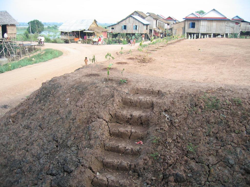
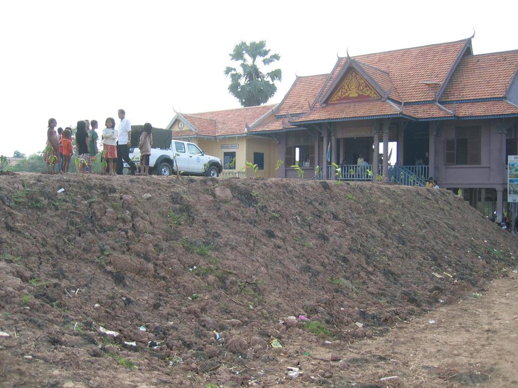
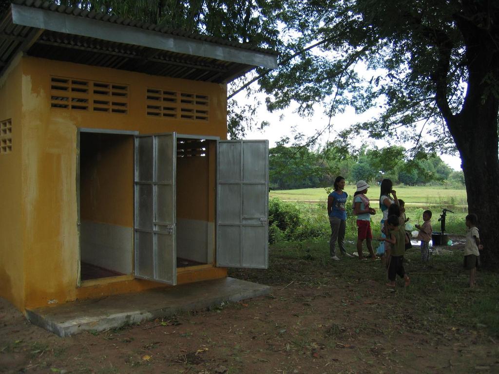
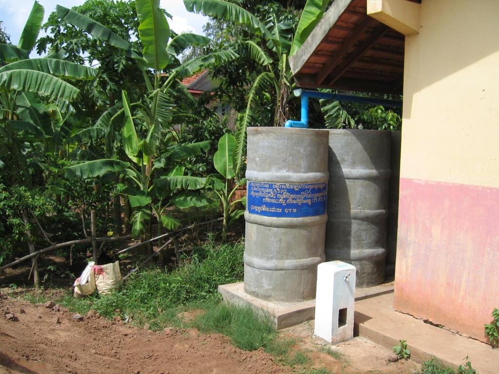
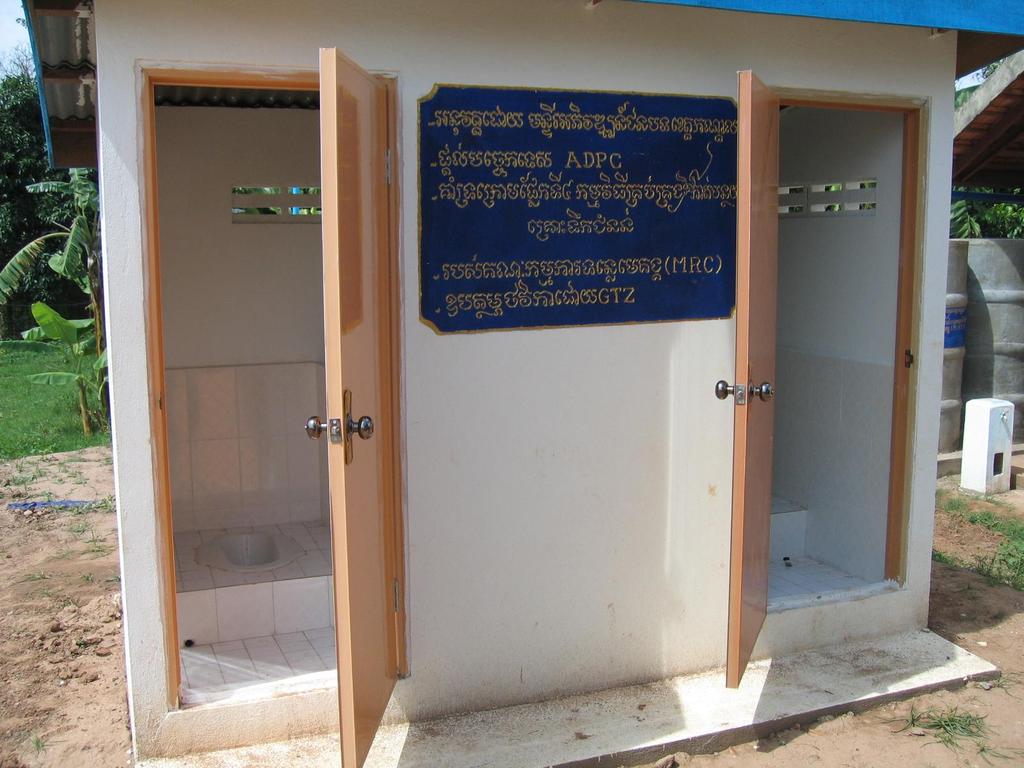
53 FMMP-C 5 Flood Management and Mitigation Programme - Land Management Component - Safety Area Establishment (as a FMMP C4 & C5- Cooperation) 53
54
55
56
57
58
59
60
61
62 FMMP-C 5 Flood Management and Mitigation Programme - Land Management Component - Thank you very much for your attention! Dr. Martin Falke Team Leader (GFA-Consulting Group) MRC Flood Management and Mitigation Programme (FMMP) Land Management Component (C 5) Regional Flood Management & Mitigation Centre (RFMMC) Phnom Penh/ Cambodia falke@mrcmekong.org 62