WALNUT AVENUE SPECIFIC PLAN
|
|
|
- Charlotte Davidson
- 5 years ago
- Views:
Transcription

1 DRAFT EIR WALNUT AVENUE SPECIFIC PLAN SCH No PREPARED FOR City of Greenfield January 13, 2014
2
3 DRAFT EIR WALNUT AVENUE SPECIFIC PLAN SCH No PREPARED FOR City of Greenfield Susan Stanton, City Manager 599 El Camino Real Greenfield, CA Tel PREPARED BY EMC Planning Group Inc. 301 Lighthouse Avenue, Suite C Monterey, CA Tel Fax sissem@emcplanning.com January 13, 2014 This document was produced on recycled paper.
4
5 TABLE OF CONTENTS SUMMARY... S-1 CEQA Requirements... S-1 Proposed Project... S-1 Summary of Impacts and Mitigation Measures... S-3 Areas of Controversy Known to the Lead Agency... S-22 Summary of Alternatives... S INTRODUCTION Report Authorization and Purpose EIR Preparation Standards and Methodology EIR Uses and Approvals EIR Organization Terminology Used in the EIR PROJECT DESCRIPTION Project Overview Project Location and Setting Project Description Relationship to Local and Regional Plans IMPACTS, ANALYSIS, AND MITIGATION MEASURES Aesthetics Agricultural and Forestry Resources Air Quality Biological Resources Climate Change Cultural Resources Geology and Soils Hazards and Hazardous Materials EMC PLANNING GROUP INC.
6 3.9 Hydrology and Water Quality Noise Public Services Transportation Utilities Urban Decay Environmental Effects Found to be Less than Significant CUMULATIVE IMPACTS CEQA Requirements Cumulative Development Scenario Cumulative Impacts and the Proposed Project s Contribution OTHER CEQA TOPICS Growth-Inducing Impacts Significant Unavoidable Impacts Significant Irreversible Environmental Changes ALTERNATIVES CEQA Requirements Summary of Project Impacts and Project Objectives Alternatives Considered Alternatives Considered But Not Further Analyzed Comparison of Alternatives REFERENCES AND REPORT PREPARATION Persons Contacted Documents Referenced Report Preparers EMC PLANNING GROUP INC.
7 Appendices (Included on a CD on the inside back cover of this EIR) Appendix A Notice of Preparation and Comments Appendix B Zoning Amendment Appendix C CalEEMod Results Appendix D AQMP Consistency Spreadsheet Appendix E Special-Status Species Lists Appendix F Noise Assessment Appendix G Traffic Impact Study Appendix H Economic Impact Analysis List of Figures Figure 1 Location Map Figure 2 Existing Project Site/Area Conditions Figure 3 Site Photographs Figure 4 Existing Land Use Designations and Zoning Districts Figure 5 Conceptual Land Use Plan Figure 6 Neighborhood Park Conceptual Plan Figure 7 Circulation Plan Figure 8 Habitat Map Figure 9 Site Soils Figure 10 Existing Utilities List of Tables Table S-1 Summary Table... S-4 Table S-2 Summary of Alternatives Impacts Relative to the Proposed Project... S-24 Table 1 Reviewing Agencies and Project Approvals Table 2 Project Site Size EMC PLANNING GROUP INC.
8 Table 3 Conceptual Development Capacity Table 4 Conceptual Land Use Summary Table 5 Common Air Pollutants Table 6 Federal and State Ambient Air Quality Standards Table 7 North Central Coast Air Basin Attainment Status Designations Table 8 Summary of Ambient Air Quality Data ( ) - Ozone and Particulate Matter Table 9 CalEEMod Operational Modeling Results Table 10 Special-Status Plants Potentially Occurring in the Project Vicinity Table 11 Special-Status Animals Potentially Occurring in the Project Vicinity Table 12 GHG Types and Their Contribution to Global Warming Table 13 Unmitigated Construction Phase GHG Emissions Table 14 Unmitigated Operational Phase GHG Emissions Table 15 Mitigated Operational Phase GHG Emissions Table 16 Existing Agricultural Water Use Table 17 Operational GHG Emissions per Service Population Table 18 Earthquake Faults Table 19 Modified Mercalli Intensity Scale for Earthquakes Table 20 Existing Baseline Agricultural Water Use Table 21 Projected Specific Plan Buildout Water Demand Table 22 Loading Dock Noise Levels Table 23 Trip Generation Summary Table 24 Baseline Plus Project Intersection Operation Impacts Table 25 Cumulative Baseline Plus Project Intersection Operations Impacts Table 26 Summary of Alternatives Effects Relative to the Proposed Project EMC PLANNING GROUP INC.
9 SUMMARY CEQA REQUIREMENTS CEQA Guidelines section requires an EIR to contain a brief summary of the proposed project and its consequences. The summary identifies each significant effect and the proposed mitigation measures and alternatives to reduce or avoid that effect; areas of controversy known to the lead agency; and issues to be resolved, including the choice among alternatives and whether or how to mitigate the significant effects. PROPOSED PROJECT Location and Setting The 62.6-acre project site is located in the City of Greenfield east of U.S. Highway 101. The project site is bound by 3rd Street on the east, Apple Avenue on the south, U.S. Highway 101 on the west, and agricultural uses on the north. Walnut Avenue bisects the site from west to east. Regional access is available from two freeway interchanges: U.S. Highway 101/Walnut Avenue and U.S. Highway 101/Oak Avenue. The project site is most directly accessible from the U.S. Highway 101/Walnut Avenue interchange and from Walnut Avenue, 3rd Street, and Apple Avenue. The project site is bordered by U.S. Highway 101 to the west, large-lot single-family residential development to the east, single-family residential development to the south, and agricultural fields to the north and northeast. The project site has historically been and is currently used for agricultural row crop production and is classified as Prime Farmland by the California Department of Conservation Farmland Mapping and Monitoring Program. Two single-family residences accompanied by various ancillary structures used for farming practices are located on the project site. EMC PLANNING GROUP INC. S-1
10 SUMMARY Project Overview The project site is within the city limits and designated in the general plan for development with Highway Commercial uses. The city has planned the project site for development with a local and regional-serving retail center. The city s primary purpose in preparing a specific plan is to reduce the time and cost associated with entitling the site for commercial development, thereby streamlining the development process. Project Description The specific plan would guide development of commercial, high-density residential, recreational and open space uses, and supporting infrastructure improvements. The specific plan includes land use guidance, development standards (including standards that modify the city s current zoning standards), design guidelines, a circulation plan, a public facilities and services plan, and a plan for development implementation. To promote the ability to respond to market demand for commercial and residential use, the specific plan is designed to be flexible in terms of the location of uses and conditions under which development would proceed. The specific plan defines land uses for the project site as Commercial, Residential, and Recreation and Open Space. Maximum development capacity of 445,000 square feet of commercial use, 220 high-density dwelling units, and useable recreation and open space of up to about two acres is assumed. A three-acre park site in the southeast portion of the specific plan area is owned by the city and will be developed as a neighborhood park by and with funding available through the city. It has been included in the specific plan boundary as a means to integrate the use with the remaining uses included in the specific plan. One possible organization of land uses and developed uses for the site is included in the specific plan. The Conceptual Land Use Plan shows commercial use concentrated within the northern and central portions of the project site and residential use concentrated adjacent to Apple Avenue at the sound end of the site. It is important to note that the organization of land uses shown in the specific plan is conceptual. The specific plan provides for flexibility in the location of commercial, residential and recreation and open space uses. The land use and policy direction provided in the specific plan could enable a range of different land use configurations, provided other configurations are consistent with the land use, development standards, development capacity, and policy guidance included in the specific plan. Development Phasing The commercial development capacity of 445,000 square feet is based on a market analysis conducted for the project, which considered both existing and future local and regional demand S-2 EMC PLANNING GROUP INC.
11 WALNUT AVENUE SPECIFIC PLAN EIR for retail commercial uses. Development is anticipated to occur over time, with full buildout of the specific plan area anticipated over the next 20 years or more as future local and regional demand for additional commercial uses grows. Due to the limited capacity of the U.S. Highway 101/Walnut interchange to accommodate the volume of traffic that would be generated at buildout of the specific plan area, full buildout would be constrained until such time as full interchange improvements are funded and constructed. Development of up to about 190,000 square feet of commercial development is possible with implementation of interim improvements to the interchange. The interim improvements are programmed and funded. The full interchange improvements are programmed and partially funded. Required Approvals To enable the specific plan to serve as the development guidance for the project site, the city will need to adopt the specific plan as a general plan amendment and amend the city zoning map to redesignate the project site as subject to development regulations contained in the specific plan. Future CEQA Requirements The land use types and development intensities included in the specific plan represent the development scenario used as the basis for analysis of project impacts in this EIR. Future development proposals that modify the location or intensity of uses described by the specific plan may require further CEQA review if found to be inconsistent with the objectives, policies, standards, and implementation measures of the adopted specific plan. SUMMARY OF IMPACTS AND MITIGATION MEASURES This EIR identifies significant or potentially significant environmental impacts in several areas as identified below. The impacts are presented in a summarized format in Table S-1, with the full text of the mitigation measure. The full text of the environmental setting, project analysis, and impacts and the mitigation measures can be found in Section 3.0 Environmental Setting, Impacts, and Mitigation Measures, and in Section 4.0, Cumulative Impacts. EMC PLANNING GROUP INC. S-3
12 SUMMARY Table S-1 Impact and Mitigation Measure Summary Description of Significant Impact Significance Mitigation Measure(s) Significance without after Mitigation Mitigation Aesthetics Substantial degradation of existing Significant No feasible mitigation is available to lessen the impact. Significant visual character and quality of the site and Implementation of specific plan policies and development and and its surroundings. Unavoidable standards to promote visual quality of future development would Unavoidable lessen but not avoid the impact. Proposed project contribution to Cumulatively This impact is identified in the general plan EIR as cumulatively Cumulatively substantial degradation of existing Significant significant and unavoidable. The proposed project contribution Significant visual character and quality of the site and to the cumulatively impact is considerable. Implementation of and and its surroundings. Unavoidable specific plan policies and development standards to promote Unavoidable visual quality of future development would lessen but not avoid the impact. Agriculture and Forest Resources Conversion of 62.6 acres of Prime Significant No feasible mitigation is available to lessen the impact. Significant Farmland to non-agricultural use. and and Unavoidable Unavoidable Proposed project contribution to Cumulatively This impact is identified in the general plan EIR as cumulatively Cumulatively conversion of Prime Farmland to Significant significant and unavoidable. The proposed project contribution Significant non-agricultural use. and to the cumulative impact is considerable. No feasible mitigation and Unavoidable is available to lessen the impact. Unavoidable S-4 EMC PLANNING GROUP INC.
13 WALNUT AVENUE SPECIFIC PLAN EIR Description of Significant Impact Significance Mitigation Measure(s) Significance without after Mitigation Mitigation Land use conflicts leading to Significant AG-1. To ensure consistency of agricultural buffer setbacks Less than potential conversion of agricultural proposed in specific plan policy LU-9.1, Implementation Significant land to non-agricultural use. Measure 2, with prior mitigation measures required by the city as part of the previous Yop annexation project, specific plan policy LU-9.1 shall be modified to read as follows: Policy LU-9.1, Implementation Measure 2. Development located north of Walnut Avenue shall maintain a 100-foot buffer between building surfaces and adjacent existing agricultural uses in unincorporated Monterey County if such development occurs prior to urban development of the adjacent unincorporated agricultural parcels to the north and east. A narrower buffer may be considered upon demonstration to the city of effective separation between uses. Air Quality Generation of volatile organic Significant AQ-1. The following measures shall be incorporated into new Significant compounds, suspended particulate and development by the master developer and/or individual project and matter, and carbon monoxide air Unavoidable developers to reduce operational volatile organic compounds Unavoidable emissions during operations that and suspended particulate matter emissions: contribute to regional air quality violations. Preferential employee parking spaces shall be provided for carpools, vanpools, and electric vehicles, with charging stations made available to electric vehicles; EMC PLANNING GROUP INC. S-5
14 SUMMARY Description of Significant Impact Significance Mitigation Measure(s) Significance without after Mitigation Mitigation Employee bicycle parking and shower facilities shall be provided within each of the four commercial areas; Drop-off spaces in lieu of full parking requirements for day care facilities shall be allowed if a day care is included within the specific plan area; and At least 10 parking spaces north of Walnut Avenue and 10 parking spaces south of Walnut Avenue shall be designated for carpool parking. In addition to the measures above, construction of a children s day care facility within the specific plan area should be encouraged, with funding from grants or the master developer and/or individual project developers. Public health hazards from airborne Potentially AQ-2. The master developer and/or future individual project Less than hazardous materials from demolition Significant developer shall have each existing structure located north of Significant of existing buildings. Walnut Avenue within the specific plan area proposed for demolition inspected by a qualified environmental specialist for the presence of asbestos containing material and lead based paints prior to obtaining a demolition permit from the city. If asbestos containing material and/or lead based paints are found during the investigations, the master developer and/or future individual project developer shall develop a remediation S-6 EMC PLANNING GROUP INC.
15 WALNUT AVENUE SPECIFIC PLAN EIR Description of Significant Impact Significance Mitigation Measure(s) Significance without after Mitigation Mitigation program to ensure that these materials are removed and disposed of by a licensed contractor in accordance with all federal, state and local laws and regulations, subject to approval by the air district. Hazardous materials that are removed from the structures shall be disposed of at an approved landfill facility in accordance with federal, state and local laws and regulations. Exposure of project residents to toxic Potentially CUM AQ-1. Specific plan policy LU-11.2 shall be amended to Less than air contaminants from cumulative Cumulatively include a requirement that high efficiency filtration (MERV Cumulatively traffic on U.S. Highway 101. Significant rating of 15 or greater) on ventilation systems be installed in all Significant residential units that would be located within 240 feet of the U.S. Highway 101 right-of-way. Alternatively, if the master developer and/or individual project developers maintain a minimum setback of 240 feet between residential units and the U.S. Highway 101 right-of-way, high efficiency filtration systems would not be required. Biological Resources Construction impacts to protected Potentially BIO-1. If noise generation, ground disturbance, vegetation Less than nesting birds if present on the site Significant removal, or other construction activities begin during the nesting Significant during construction activities. bird season (February 1 to August 31), or if construction activities are suspended for at least two weeks and recommence during the nesting bird season, then the master or project developer shall retain a qualified biologist to conduct a pre- EMC PLANNING GROUP INC. S-7
16 SUMMARY Description of Significant Impact Significance Mitigation Measure(s) Significance without after Mitigation Mitigation construction survey for nesting birds. The survey will be performed within suitable nesting habitat areas on and adjacent to the site to ensure that no active nests would be disturbed during project implementation. This survey will be conducted no more than two weeks prior to the initiation of disturbance and/or construction activities. A report documenting survey results and plan for active bird nest avoidance (if needed) will be completed by the qualified biologist and submitted to the city for review and approval prior to disturbance and/or construction activities. If no active bird nests are detected during the survey, then project activities can proceed as scheduled. However, if an active bird nest of a native species is detected during the survey, then a plan for active bird nest avoidance shall determine and clearly delineate an appropriately sized, temporary protective buffer area around each active nest, depending on the nesting bird species, existing site conditions, and type of proposed disturbance and/or construction activities. The protective buffer area around an active bird nest is typically feet, determined at the discretion of the qualified biologist and in compliance with applicable project permits. To ensure that no inadvertent impacts to an active bird nest will occur, no disturbance and/or construction activities will occur S-8 EMC PLANNING GROUP INC.
17 WALNUT AVENUE SPECIFIC PLAN EIR Description of Significant Impact Significance Mitigation Measure(s) Significance without after Mitigation Mitigation within the protective buffer area(s) until the juvenile birds have fledged (left the nest), and there is no evidence of a second attempt at nesting, as determined by the qualified biologist. Climate Change Proposed project contribution to Cumulatively GHG-1. The master developer and/or individual project Cumulatively cumulative climate change impacts Significant developers shall incorporate the following GHG reduction Significant from generation of a significant and measures into new commercial and/or residential development and volume of GHG emissions during Unavoidable projects within the specific plan area: Unavoidable project operations. Install energy efficient appliances in all commercial buildings (Energy); All commercial structures shall be constructed to exceed Title 24 energy efficiency requirements by a minimum of five percent; Commercial projects shall minimize exterior lighting requirements. Outdoor lighting should be LED or equivalent energy efficient technology and hours of outdoor lighting shall be minimized (Energy); Cool roof materials shall be utilized on commercial and residential structure roofs that are not covered by solar photovoltaic systems (Energy); EMC PLANNING GROUP INC. S-9
18 SUMMARY Description of Significant Impact Significance Mitigation Measure(s) Significance without after Mitigation Mitigation Provide bicycle parking in all commercial projects and within high-density residential development (Mobile Source); Provide bicycle parking near the on-site transit facility required per specific plan Policy CP 6.1 (Mobile Source); and Provide electrified loading docks at all commercial facilities with loading docks (Mobile Source). The city shall ensure that the above GHG reduction measures are included in all development plans and specifications for commercial and/or residential development prior to approval of a building permit for all commercial and residential development. Cultural Resources Change in the significance of a Potentially CR-1. Prior to any modification to the residential structure and Less than historical resource. Significant associated outbuildings located within Area 4 of the project site, Significant the master developer and/or future individual project developer proposing development of Area 4 shall retain a qualified cultural resources historian to conduct a historic evaluation of the structures to determine their potential significance as historical resources. If the structures are not found to be historically S-10 EMC PLANNING GROUP INC.
19 WALNUT AVENUE SPECIFIC PLAN EIR Description of Significant Impact Significance Mitigation Measure(s) Significance without after Mitigation Mitigation significant, the structures may be removed and development of the site on which the structures are located may proceed. If the structures are found to be historically significant, the master developer and/or future individual project developer shall consult with the city and cultural resource historian to determine an appropriate course of action that would mitigate potential impacts on the structures to less than significant. Actions needed for this purpose shall be included as conditions of approval of any discretionary permit for development of the site. If significant impacts cannot be mitigated to less than significant, additional CEQA documentation may be required for the subject development project. Substantial adverse change in the significance of an archaeological resource/disturbance of human remains. Potentially Significant CR-2. Due to the possibility that significant buried cultural resources could be found during construction, the master developer and/or future individual project developers shall include the following language in all construction documents Less than Significant subject to review and verification by the City Public Works Director: If archaeological resources or human remains are discovered during construction, work shall be halted at a minimum of 150 feet from the find and the area shall be staked off. The city shall notify a qualified professional archaeologist. If the find is EMC PLANNING GROUP INC. S-11
20 SUMMARY Description of Significant Impact Significance Mitigation Measure(s) Significance without after Mitigation Mitigation determined to be significant, appropriate mitigation measures shall be formulated and implemented. CR-3. In the event of an accidental discovery or recognition of any human remains during construction, the master developer and/or future individual project developers shall include the following language in all construction documents subject to review and verification by the City Public Works Director: If human remains are found during construction there shall be no further excavation or disturbance of the site or any nearby area reasonably suspected to overlie adjacent human remains until the coroner of Monterey County is contacted to determine that no investigation of the cause of death is required. If the coroner determines the remains to be Native American the coroner shall contact the Native American Heritage Commission within 24 hours. The Native American Heritage Commission shall identify the person or persons it believes to be the most likely descendent (MLD) from the deceased Native American. The MLD may then make recommendations to the city or the person responsible for the excavation work, for means of treating or disposing of, with appropriate dignity, the human remains and associated grave goods as provided in Public Resources Code Section The city or it s authorized representative shall rebury the Native American human remains and associated S-12 EMC PLANNING GROUP INC.
21 WALNUT AVENUE SPECIFIC PLAN EIR Description of Significant Impact Significance Mitigation Measure(s) Significance without after Mitigation Mitigation grave goods with appropriate dignity on the property in a location not subject to further disturbance if: a) the Native American Heritage Commission is unable to identify a MLD or the MLD failed to make a recommendation within 24 hours after being notified by the commission; b) the descendent identified fails to make a recommendation; or c) the city or it s authorized representative rejects the recommendation of the descendent, and the mediation by the Native American Heritage Commission fails to provide measures acceptable to the landowner. Hazards and Hazardous Materials Disturbance of potentially Potentially HAZ-1. Prior to the issuance of grading permits, the master Less than contaminated soil (from agricultural Significant developer and/or future individual project developers shall Significant chemicals) during construction contract with a qualified professional to prepare a site specific resulting in public health risk. Environmental Site Assessment, in compliance with all applicable local, state, and federal regulations. The master developer and/or future individual project developers shall be responsible for implementing all recommendations and requirements for remediation of hazardous materials conditions identified in the Environmental Site Assessment in accordance with all local, state, and federal regulation to the satisfaction of the city. EMC PLANNING GROUP INC. S-13
22 SUMMARY Description of Significant Impact Significance Mitigation Measure(s) Significance without after Mitigation Mitigation Potential public health safety risk Potentially See mitigation measure AQ-2 above. Less than from release of hazardous materials Significant Significant from structure demolition. Hydrology and Water Quality Change in drainage patterns that Potentially Compliance with existing local and state regulations and Less than results in erosion or flooding. Significant proposed specific plan policies would reduce the impact to less Significant than significant Noise Exposure of on-site residential uses Potentially N-1. Transportation noise impacts to proposed residential uses Less than and commercial outdoor activity Significant and outdoor seating uses within proposed commercial Significant areas to non-project traffic-generated developments resulting from project generated and noise levels that exceed standards. existing/cumulative traffic on specific plan area roadways shall be mitigated through implementation of one of the following options: a. Proposed residential uses and outdoor seating areas within commercial or other uses shall be located a minimum of 460 feet from the centerline of U.S. Highway 101, 42 feet from the centerline of 3rd Street between Cherry Avenue and Walnut Avenue, 47 feet from the centerline of 3rd Street between Walnut Avenue and Apple Avenue, and 75 feet from the centerline of Walnut Avenue, or S-14 EMC PLANNING GROUP INC.
23 WALNUT AVENUE SPECIFIC PLAN EIR Description of Significant Impact Significance Mitigation Measure(s) Significance without after Mitigation Mitigation b. Where residential or commercial projects are proposed that do not meet the noise setback requirements in item a above, the project developer shall prepare an acoustical analysis consistent with the content requirement specified in Table 9-2 of the noise element. The acoustical analysis must demonstrate site design, site location, building design, or other measures which will be implemented to reduce noise exposure to levels specified in the noise element. Implementation of this mitigation measure would reduce transportation noise source impacts to future project uses by ensuring that noise exposure is reduced to levels specified in the city s noise element. Exposure of off-site residential uses to Potentially N-2. Prior to issuance of a building permit for the final Less than substantial permanent noise increases Significant increment of development that constitutes build out of the Significant from project generated traffic that specific plan area, a noise assessment shall be prepared by a exceeds noise standards. qualified acoustics consultant to identify the incremental contribution of the proposed project to traffic noise impacts on the individual residences located at the southwestern and northwestern corners of Oak Street/3rd Street intersection. If the noise assessment concludes that the proposed project contribution to the impact is less than considerable based on the EMC PLANNING GROUP INC. S-15
24 SUMMARY Description of Significant Impact Significance Mitigation Measure(s) Significance without after Mitigation Mitigation City s noise exposure thresholds and standards, no further action is required. If the proposed project contribution is considerable, the impact shall be mitigated by providing a six-foot high acoustically effective barrier at the outdoor living areas of these residences as illustrated in Figure 3 on page 19 of the Final Noise Assessment Study for the Walnut Avenue Specific Plan Environmental Impact Report (Edward L. Pack Associates 2013). An alternative to the noise barrier as mitigation may be considered provided it achieves noise mitigation consistent with the City s noise exposure thresholds and standards. The developer of the final increment of development that constitutes build out of the specific plan area shall fund the noise assessment and fund and construct the noise barrier (or alternative noise impact mitigation). Exposure of on-site residential uses Potentially Refer to mitigation measure N-1 above. Less than and commercial outdoor activity Cumulatively Cumulatively areas to cumulative traffic-generated Significant Significant noise levels that exceed standards. Proposed project contribution to Potentially Refer to mitigation measure N-1 above. Less than cumulative transportation noise levels Cumulatively Cumulatively that exceed standards at proposed on- Significant Significant site residential uses. S-16 EMC PLANNING GROUP INC.
25 WALNUT AVENUE SPECIFIC PLAN EIR Description of Significant Impact Significance Mitigation Measure(s) Significance without after Mitigation Mitigation Proposed project contribution to Potentially Refer to mitigation measure N-2 above. Less than cumulative transportation noise levels Cumulatively Cumulatively that exceed standards at off-site Significant Significant residential uses. Traffic and Circulation Exceed LOS D performance Significant TRANS-1. Prior to the issuance of the first building permit for Less than standard on Caltrans facilities development within the specific plan area, the city shall install Significant (Walnut Avenue/U.S. Highway 101 interim all-way stop controls at the U.S. Highway 101/Walnut ramps) under background plus Avenue southbound and northbound ramps and the ramp interim specific plan development approaches shall be widened as described in the city s TIFP. The conditions and under background improvements will mitigate impacts of traffic volumes generated plus specific plan buildout conditions. by up to 190,000 square feet of commercial use within the Exceed LOS D performance standards on City facilities (Oak Avenue/4 th Street intersection) under background plus specific plan buildout conditions. specific plan area, or an equivalent traffic volume resulting from a combination of commercial and/or high-density residential use. Additional development within the specific plan area is prohibited until such time as the full programmed improvements to the interchange are complete or until such time as additional traffic analysis is provided which demonstrates to the satisfaction of the city that additional development can be accommodated without exceeding city and Caltrans traffic network performance standards for this facility. EMC PLANNING GROUP INC. S-17
26 SUMMARY Description of Significant Impact Significance Mitigation Measure(s) Significance without after Mitigation Mitigation TRANS-2. Prior to the issuance of a building permit for development over and above 190,000 square feet of commercial development or an equivalent traffic volume resulting from a combination of commercial and/or high-density residential use, the city shall install all way stop controls at the Oak Avenue/4 th Street intersection as described in the city s TIFP. Additional development within the specific plan area is prohibited until such time as the programmed improvements are complete or until such time as additional traffic analysis is provided which demonstrates to the satisfaction of the city that additional development can be accommodated without exceeding the city s traffic network performance standards for this facility. Proposed project contribution to Cumulatively No feasible mitigation measures are available to lessen or avoid Cumulatively cumulative traffic levels that exceed Significant the impact. The City s Traffic Impact Fee Program includes a Significant the LOS D performance standard on and project to improve conditions at this location, but the and Caltrans facilities (U.S. Highway Unavoidable improvements would not substantially lessen or avoid the Unavoidable 101/Oak Avenue ramps) impact. The project contribution to this impact is considerable. Proposed project contribution to Cumulatively CUM TRANS-1. Cumulative transportation impacts of the Less than cumulative traffic levels that Significant proposed project at the Walnut Avenue/El Camino Real Cumulatively exceedence the LOS D performance intersection, 3rd Street/Apple Avenue intersection, and 3rd Significant standard on City facilities (Walnut Street segment between Walnut Avenue and Apple Avenue shall Avenue/El Camino Real be mitigated through implementation of one of the following intersection, Apple Avenue/3 rd Street options: S-18 EMC PLANNING GROUP INC.
27 WALNUT AVENUE SPECIFIC PLAN EIR Description of Significant Impact Significance Mitigation Measure(s) Significance without after Mitigation Mitigation intersection, and segment of 3 rd Street between Walnut Avenue and Apple Avenue). Option 1: The city shall include the required cumulative improvements in the TIFP prior to issuance of the first building permit for development within the specific plan area. All developers of projects within the specific plan area shall pay the city s traffic impact fee prior to issuance of a building permit for their respective projects; Option 2: The city shall create a specific plan area traffic improvement fund prior to issuance of the first building permit for development within the specific plan area. All developers of projects within the specific plan area shall deposit their fair-share of the improvement costs into the improvement fund prior to issuance of a building permit for their respective projects; or Option 3: Individual developers shall fund and construct their proportional share of the cumulative improvements. The fair share to be funded and constructed shall be determined by the city. Improvements required by individual developers shall be constructed in a timeframe to be determined by the city to ensure improvement timing and cost efficiency, and that it is consistent with the timeframes for each improvement as listed below; or EMC PLANNING GROUP INC. S-19
28 SUMMARY Description of Significant Impact Significance Mitigation Measure(s) Significance without after Mitigation Mitigation Option 4: One or more individual project developers may construct and/or fund more than their fair share of the required cumulative improvements. In this case, the developer(s) shall be reimbursed for costs in excess of their fair share through a reimbursement agreement to be developed and approved by the city. The required improvements should be completed within the following timeframes: Walnut Avenue/El Camino Real Intersection Improvements prior to issuance of building permits for any new commercial use or for any combination of commercial and/or residential uses which generates a volume of traffic greater than that generated by 190,000 square feet of commercial use; 3rd Street/Apple Avenue Intersection Improvements - prior to issuance of building permits for any new commercial use or for any combination of commercial and/or residential uses which generate a volume of traffic greater than that generated by 190,000 square feet of commercial use; and S-20 EMC PLANNING GROUP INC.
29 WALNUT AVENUE SPECIFIC PLAN EIR Description of Significant Impact Significance Mitigation Measure(s) Significance without after Mitigation Mitigation 3rd Street from Walnut Avenue to Apple Avenue Widening Improvements prior to issuance of a building permit for the final development project within the specific plan area that constitutes full buildout of the specific plan area. Source: EMC Planning Group Inc EMC PLANNING GROUP INC. S-21
30 SUMMARY AREAS OF CONTROVERSY KNOWN TO THE LEAD AGENCY CEQA Guidelines section 15123, subdivision (b)(2) provides that the EIR shall identify areas of controversy known to the Lead Agency including issues raised by agencies and the public. As of the date this EIR was circulated for public review, no specific areas of controversy regarding the proposed project are known to the city. Based on the written comments received on the Notice of Preparation, several agencies raised issues to be considered in the EIR. The California Department of Transportation provided input on methodologies and assumptions to be used in evaluating the traffic and circulation effects of the proposed project and in planning the proposed project in light of potential effects on the existing and future operations of the U.S. Highway 101/Walnut Avenue interchange. The California Department of Toxic Substances Control identified the need to assess potential hazards associated with residual agricultural chemicals in site soils and potential presence of hazardous materials such as lead based paint in buildings to be demolished. The Monterey County Local Agency Formation Commission requested that the specific plan and EIR consider and be consistent with conditions of approval placed on prior annexations of land located within the specific plan area. SUMMARY OF ALTERNATIVES Section of the CEQA Guidelines states that an EIR must address a range of reasonable alternatives to the project, which would feasibly attain most of the basic objectives of the project but would avoid or substantially lessen any of the significant effects of the project, and evaluate the comparative merits of the alternatives. Project alternatives are presented, discussed, analyzed and compared in Section 6.0, Alternatives. The project objectives are included in Section 2.3, Project Description. The following project alternatives were analyzed: No Project Alternative; and Reduced Size Alternative. Each of these alternatives is summarized below and discussed in detail in Section 6.0, Alternatives. Additional alternatives were considered, but not selected for detailed evaluation. These included alternative project site location and alternative project design. These alternatives and reasons why they were not further considered are also discussed in Section 6.0. S-22 EMC PLANNING GROUP INC.
31 WALNUT AVENUE SPECIFIC PLAN EIR No Project Alternative CEQA Guidelines Section (d)(1) requires that the no project alternative be evaluated. The No Project alternative considered here assumes that the proposed project would not go forward and that the project site would be developed with Highway Commercial uses consistent with this general plan land use designation for the project site. Like the proposed project, the No Project alternative would result in substantial development at the project site. The primary difference in effects results from the fact that the proposed project includes 220 dwelling units in-lieu of about 10.5 acres of Highway Commercial use that would otherwise be developed under the No Project alternative. This alternative would result in a range of significant and significant and unavoidable impacts. Most No Project alternative impacts would be similar to those of the proposed project. However, increased air quality, climate change, noise, and transportation impacts are possible. The No Project alternative would meet the project objectives, but the feasibility of the No Project alternative is in question as it would result in commercial development in excess of the demand for such development as identified in the market analysis for the proposed project. Reduced Size Alternative The Reduced Size alternative is proposed to in order to avoid the significant and unavoidable climate change impacts of the proposed project and through so doing, also avoid significant and unavoidable air quality impacts, and possibly avoid a significant and unavoidable transportation impact. The Reduced Size alternative would also lessen a range of other significant impacts. This alternative avoids the significant and unavoidable climate change impacts of the proposed project by reducing the development capacity of the proposed project by 40 percent to a level at which the GHG emissions volume of the proposed project falls below the threshold for significant impact. Total commercial building development capacity would be reduced to approximately 267,000 square feet, a reduction of about 178,000 square feet. With a reduction of 40 percent of the proposed 220 high-density residential uses, this alternative would enable development of up to 132 high-density residential units. With reduced development capacity, it is assumed that the 62.6-acre size of the proposed project would also be significantly reduced. It is assumed that development could be accommodated entirely within the approximately 40-acre portion of the project site located south of Walnut Avenue. This alternative is designed only to address significant impacts of the proposed project. This alternative does not preclude future development of the approximately 22-acre area of the project site located north of Walnut Avenue under a different future development application with uses consistent with the current Highway Commercial land use designation. EMC PLANNING GROUP INC. S-23
32 SUMMARY The Reduced Size alternative would not fully attain the city s key objective for the proposed project to maximize employment generation and tax revenues from development of the 62.6-acre site with the maximum square footage of commercial uses that can be supported based on the market study for the proposed project. Comparison of Alternatives and Environmentally Superior Alternative Table S-2, Summary of Alternatives Impacts Relative to the Proposed Project, presents the general impacts of each alternative as compared to the proposed project. Table S-2 Summary of Alternatives Impacts Relative to the Proposed Project Environmental Topic No Project Reduced Size Aesthetics Similar Reduced Agricultural Resources Similar Similar Air Quality Increased Reduced Biological Resources Similar Reduced Cultural Resources Similar Reduced Geology and Soils Similar Reduced Greenhouse Gases Increased Avoided Hazards/Hazardous Materials Similar Reduced Hydrology/Water Quality Similar Reduced Noise Increased Reduced Population and Housing Reduced Reduced Public Services Similar Similar Transportation Increased Reduced Utilities/Service Systems Similar Reduced Urban Decay Increased Reduced An EIR is required to identify the environmentally superior alternative from among the range of reasonable alternatives that are evaluated. If the environmentally superior alternative is the No Project alternative, the EIR must also identify an environmentally superior alternative among the other alternatives. S-24 EMC PLANNING GROUP INC.
33 WALNUT AVENUE SPECIFIC PLAN EIR For reasons described above, the Reduced Size alternative is the environmentally superior alternative, as it would avoid significant and unavoidable impacts and substantially lessen a range of other significant impacts of the proposed project and of the No Project alternative. Development of the approximately 22-acre area north of Walnut Avenue, which is excluded from development as part of the Reduced Size alternative, would not be precluded and could proceed in the future as a separate project. EMC PLANNING GROUP INC. S-25
34 SUMMARY This side intentionally left blank. S-26 EMC PLANNING GROUP INC.
35 1.0 INTRODUCTION 1.1 REPORT AUTHORIZATION AND PURPOSE Determination to Prepare an Environmental Impact Report The City of Greenfield, acting as the lead agency, has determined that the proposed Walnut Avenue Specific Plan (hereinafter proposed project or specific plan ) may result in significant adverse environmental effects, as defined by the California Environmental Quality Act (CEQA) Guidelines section The specific plan can be found on CD on the inside back cover of this EIR. Therefore, the City of Greenfield (city) has had this environmental impact report (EIR) prepared to evaluate the potentially significant adverse environmental impacts of the proposed project. Based upon the decision to prepare an EIR, the city prepared and distributed a notice of preparation (NOP) for a 30-day review period from October 22, 2012 to November 20, 2012 in accordance with CEQA Guidelines section CEQA Guidelines section defines an NOP as: a brief notice sent by the lead agency to notify the responsible agencies, trustee agencies, and involved federal agencies that the lead agency plans to prepare an EIR for the project. The purpose of the notice is to solicit guidance from those agencies as to the scope and content of the environmental information to be included in the EIR. Written comments on the NOP were received from the following public agencies: California Department of Transportation (Caltrans), November 15, 2012; California Department of Toxic Substances Control (DTSC), November 19, 2012; and EMC PLANNING GROUP INC. 1-1
36 1.0 INTRODUCTION Local Agency Formation Commission of Monterey County (LAFCO) dated December 3, The initial study, NOP, and comments on the NOP received from responsible agencies are contained in Appendix A, which is included on CD on the inside back cover of this EIR. 1.2 EIR PREPARATION STANDARDS AND METHODOLOGY Standards EMC Planning Group has prepared this EIR under contract to the city in accordance with CEQA and its implementing guidelines. This EIR has been prepared using available information from private and public sources noted herein, as well as information generated through technical analysis and field investigation. This EIR will be used to inform public decision-makers, their constituents, and the public of the environmental impacts of the proposed project. This EIR is an objective public disclosure document that takes no position on the merits of the proposed project. Therefore, the findings of this EIR do not advocate a position "for" or "against" the proposed project. Instead, this EIR provides information on which decisions about the proposed project can be based. The EIR has been prepared according to the professional standards and practices of the EIR participants' individual disciplines and in conformance with the legal requirements and informational expectations of CEQA and its implementing guidelines. Methodology This EIR describes and evaluates the existing environmental setting of the project site and surrounding areas, discusses the characteristics of the proposed project, identifies environmental impacts associated with the proposed project, and provides feasible mitigation measures that can be implemented to reduce or avoid identified adverse environmental impacts. This EIR also evaluates reasonable alternatives to the proposed project. If an EIR identifies a significant adverse impact, the lead agency may approve the project only if it finds that mitigation measures have been incorporated into the project and will reduce the impact's significance, or that such mitigation is infeasible for specified social, economic, and/or other reasons (Public Resources Code section 21081). The lead agency may not omit from the project conditions a mitigation measure associated with a project impact identified in the EIR as significant, unless it makes specific findings regarding the omission. 1-2 EMC PLANNING GROUP INC.
37 WALNUT AVENUE SPECIFIC PLAN EIR Use of this EIR to Streamline Project Specific Environmental Review Once certified by the city, this EIR may be used, under specific circumstances, to streamline the environmental review of future individual projects that are proposed within the specific plan area. CEQA Guidelines sections 15182/15183 and section identify conditions under which such streamlining may occur. Portions of these sections are as follows; reference to the specific guideline sections should be made for more information: RESIDENTIAL PROJECTS PURSUANT TO A SPECIFIC PLAN (a) Exemption. Where a public agency has prepared an EIR on a specific plan after January 1, 1980, no EIR or negative declaration need be prepared for a residential project undertaken pursuant to and in conformity to that specific plan if the project meets the requirements of this section. (b) Scope. Residential projects covered by this section include but are not limited to land subdivisions, zoning changes, and residential planned unit developments PROJECTS CONSISTENT WITH A COMMUNITY PLAN OR ZONING (a) CEQA mandates that projects which are consistent with the development density established by existing zoning, community plan, or general plan policies for which an EIR was certified shall not require additional environmental review, except as might be necessary to examine whether there are project-specific significant effects which are peculiar to the project or its site. This streamlines the review of such projects and reduces the need to prepare repetitive environmental studies. (b) In approving a project meeting the requirements of this section, a public agency shall limit its examination of environmental effects to those which the agency determines, in an initial study or other analysis: (1) Are peculiar to the project or the parcel on which the project would be located, (2) Were not analyzed as significant effects in a prior EIR on the zoning action, general plan, or community plan, with which the project is consistent, EMC PLANNING GROUP INC. 1-3
38 1.0 INTRODUCTION (3) Are potentially significant off-site impacts and cumulative impacts which were not discussed in the prior EIR prepared for the general plan, community plan or zoning action, or (4) Are previously identified significant effects which, as a result of substantial new information which was not known at the time the EIR was certified, are determined to have a more severe adverse impact than discussed in the prior EIR. (c) If an impact is not peculiar to the parcel or to the project, has been addressed as a significant effect in the prior EIR, or can be substantially mitigated by the imposition of uniformly applied development policies or standards, as contemplated by subdivision (e) below, then an additional EIR need not be prepared for the project solely on the basis of that impact. (d) This section shall apply only to projects which meet the following conditions: (1) The project is consistent with: (A) A community plan adopted as part of a general plan, (B) A zoning action which zoned or designated the parcel on which the project would be located to accommodate a particular density of development, or (C) A general plan of a local agency, and (2) An EIR was certified by the lead agency for the zoning action, the community plan, or the general plan TIERING (a) Tiering refers to using the analysis of general matters contained in a broader EIR (such as one prepared for a general plan or policy statement) with later EIRs and negative declarations on narrower projects; incorporating by reference the general discussions from the broader EIR; and concentrating the later EIR or negative declaration solely on the issues specific to the later project. 1-4 EMC PLANNING GROUP INC.
39 WALNUT AVENUE SPECIFIC PLAN EIR (b) Agencies are encouraged to tier the environmental analyses which they prepare for separate but related projects including general plans, zoning changes, and development projects. This approach can eliminate repetitive discussions of the same issues and focus the later EIR or negative declaration on the actual issues ripe for decision at each level of environmental review. Tiering is appropriate when the sequence of analysis is from an EIR prepared for a general plan, policy, or program to an EIR or negative declaration for another plan, policy, or program of lesser scope, or to a site-specific EIR or negative declaration. Tiering does not excuse the lead agency from adequately analyzing reasonably foreseeable significant environmental effects of the project and does not justify deferring such analysis to a later tier EIR or negative declaration. However, the level of detail contained in a first tier EIR need not be greater than that of the program, plan, policy, or ordinance being analyzed. (d) Where an EIR has been prepared and certified for a program, plan, policy, or ordinance consistent with the requirements of this section, any lead agency for a later project pursuant to or consistent with the program, plan, policy, or ordinance should limit the EIR or negative declaration on the later project to effects which: (1) Were not examined as significant effects on the environment in the prior EIR; or (2) Are susceptible to substantial reduction or avoidance by the choice of specific revisions in the project, by the imposition of conditions, or other means. Use of General Plan and Specific Plan Policies as Mitigation The City of Greenfield General Plan and Environmental Impact Report (City of Greenfield 2005) (hereinafter general plan or general plan EIR ) contains a multitude of goals and policies that serve as the primary roadmap for guiding new development in the city, including the specific plan area. Proposed development within the city is evaluated through the CEQA process for its consistency with the general plan. All development projects must be substantially consistent with the general plan and its policies. Implementation of many general plan policies serves to avoid or lessen the environmental effects of new development, including impacts of development as proposed in the specific plan. Consequently, this EIR references applicable general plan policies where such polices would serve to avoid or reduce significant impacts of development as guided by the specific plan. EMC PLANNING GROUP INC. 1-5
40 1.0 INTRODUCTION As the general plan policies provide a roadmap for development in the city, the specific plan includes policies and implementation measures to guide development within the specific plan area. The specific plan must be consistent with the general plan. Future development within the specific plan area must be consistent with the specific plan polices. Consequently, this EIR also references applicable specific plan policies as mitigation measures where such polices would serve to avoid or reduce significant impacts. Where general plan and/or specific policies are not sufficient to adequately mitigate significant impacts to a less-than-significant level, additional mitigation measures are identified. Mitigation measures are designed to fill gaps that may exist between the level of impact avoidance or reduction provided by general plan and/or specific plan policies, and the level of impact avoidance or reduction needed to mitigate significant impacts to a less-than-significant level. Mitigation measures are crafted to be included as new or revised policies in the specific plan so that to the extent possible, the final specific plan can be self mitigating and the need to consider mitigation measures as separate conditions of approval for the proposed project is reduced or eliminated. 1.3 EIR USES AND APPROVALS As mandated by CEQA Guidelines section 15124(d), this section contains a list of agencies that are expected to use the EIR in their decision-making, and a list of the approvals for which the EIR will be used. These lists include information that is known to the lead agency. There are no specific developments proposed within the specific plan area at this time. As part of the development review and CEQA review processes for future individual projects, a range of project-specific entitlements may be required from the city, regional agencies, and/or state agencies. Entitlements that may be anticipated at this time are noted in Table 1, Reviewing Agencies and Project Approvals. 1.4 EIR ORGANIZATION This EIR is organized into several sections as listed and described as follows: Section 1.0, Introduction The Introduction includes information on the background for preparing the EIR and on the scope and content of the EIR. The Introduction is intended to set the context for describing and evaluating the proposed project as is done in subsequent sections of the EIR. 1-6 EMC PLANNING GROUP INC.
41 WALNUT AVENUE SPECIFIC PLAN EIR Table 1 Reviewing Agencies and Project Approvals Reviewing Agencies City of Greenfield California Regional Water Quality Control Board California Department of Transportation Project Specific Approvals Specific Plan Adoption General Plan Amendment Zoning Map Amendment Zoning Code Amendment Use Permits (future specific projects) Tentative/Final Maps (future specific projects) Grading Permits (future specific projects) Building Permits (future specific projects) National Pollutant Discharge Elimination System Construction Activity Permit (future specific projects) Approval of interim improvements at the U.S. Highway 101/Walnut Avenue Interchange Encroachment Permit (future specific projects) Source: EMC Planning Group 2014 Section 2.0, Project Description The Project Description includes information as required per CEQA Guidelines section It includes a discussion of the project location, the actions and improvements proposed as part of the project (technical and environmental characteristics); project objectives, agencies that may use the EIR in their review of the proposed project, and permits or other approvals required. Section 3.0, Setting, Analysis, and Mitigation Measures This section of the EIR contains information required per CEQA Guidelines sections regarding environmental setting, regarding consideration and discussion of environmental impacts including section concerning significant environmental effects, and section concerning discussion of mitigation measures proposed to minimize significant effects. Section 3.0 is divided into subsections, each of which includes analysis of an individual environmental topic such as Section 3.1, Aesthetics or Section 3.4, Biological Resources. The information and content within each subsection is as follows: EMC PLANNING GROUP INC. 1-7
42 1.0 INTRODUCTION NOP comments received that are related to the topic. Environmental Setting For each environmental topic, the general environmental setting addresses environmental conditions within the vicinity or project area within which all five of the project alternatives are located. The environmental setting for each of the five individual alternatives is then discussed with specific reference to the broader vicinity conditions that also pertain to each alternative. Regulatory Setting Contains a review of federal, state, and local laws and regulations that pertain to the topic and reference to how the laws and regulations may address the environmental effects of and/or mitigation requirements for the proposed project. Standards of Significance The standards of significance that are used by the Lead Agency for CEQA review purposes are listed. Lead Agencies often utilize the questions contained in Appendix G, Environmental Checklist, of the CEQA Guidelines as standards of significance. Where the lead agency has adopted standards or thresholds of significance that are specific to its CEQA review process, these are so noted. In some cases, Appendix G questions/lead agency standards may not be applicable to the proposed project. For those standards that are not applicable, a brief statement is provided which describes the rationale for this determination. Impacts, Analysis and Mitigation Measures For each standard of significance that is applicable to the project, a statement is made about whether the related project impact(s) has been found to be less than significant, less than significant with mitigation measures applied, or significant and unavoidable. A discussion follows that includes the analysis used as the basis for the impact determination. Mitigation Measures As noted in Section 1.2 above, where applicable, general plan and/or specific plan policies are referenced as mitigation for significant impacts of the project. Where general plan and/or specific policies are not sufficient to adequately mitigate significant impacts to a less-thansignificant level, additional feasible mitigation measures are identified to mitigate significant impacts to a less-than-significant level. 1-8 EMC PLANNING GROUP INC.
43 WALNUT AVENUE SPECIFIC PLAN EIR Section 4.0, Cumulative Impacts This section of the EIR includes evaluation of the cumulative effects of the proposed project as required pursuant to CEQA Guidelines section A cumulative impact scenario is described followed by an evaluation of topic-specific cumulative impacts. Section 5.0, Other CEQA Topics This section addresses several additional topics of review including growth inducing impacts per CEQA Guidelines section (d), significant unavoidable impacts per CEQA Guidelines section 15126(b), and significant irreversible impacts per CEQA Guidelines section (c). Section 6.0, Alternatives This section of the EIR includes analysis of project alternatives as mandated in CEQA Guidelines section Two alternatives are evaluated, a No Project Alternative and a Reduced Scale Alternative. Other alternatives considered, but not evaluated in detailed are also described. A comparison of the relative impacts of the alternatives as compared to the proposed project is provided and an environmentally superior alternative is defined. Section 7.0, Persons Contacted, References and EIR Preparers This section of the EIR contains a list of persons contacted and a list of references used in preparation of the EIR. This information is followed by a list of firms and their associated staff that contributed to preparation of the EIR. EIR Appendices This EIR includes references to appendices that contain technical analysis and other information. The appendices are found on the CD attached to the inside back cover of this EIR. 1.5 TERMINOLOGY USED IN THE EIR Characterization of Impacts This EIR uses the following terminology to denote the significance of environmental impacts: No impact means that no change from existing conditions is expected to occur; A less-than-significant impact would cause no substantial adverse change in the physical environment, and no mitigation is recommended; EMC PLANNING GROUP INC. 1-9
44 1.0 INTRODUCTION A significant impact or potentially significant impact would, or would potentially, cause a substantial adverse change in the physical environment, and mitigation is required; A less-than-significant impact with implementation of mitigation measures means that the impact would cause no substantial adverse change in the physical environment if identified mitigation measures are implemented; A significant and unavoidable impact would cause a substantial change in the physical environment and cannot be avoided if the project is implemented; mitigation may be recommended, but will not reduce the impact to less-than-significant levels; and A beneficial impact is an impact that would result in a decrease in existing adverse conditions in the physical environment if the project is implemented. Abbreviations and Acronyms AB AMBAG AADT AQMP BMP CalEEMod CALGreen CAPCOA CARB CCRWQCB CDFW CEQA CFC CH4 CNDDB Assembly Bill Association of Monterey Bay Area Governments Annual Average Daily Trips Air Quality Management Plan Best Management Practices California Emissions Estimator Model California Green Building Standards Code California Air Pollution Control Officers Association California Air Resources Board Central Coast Regional Water Quality Control Board California Department of Fish and Wildlife California Environmental Quality Act Chlorofluorcarbons Methane California Natural Diversity Database 1-10 EMC PLANNING GROUP INC.
45 WALNUT AVENUE SPECIFIC PLAN EIR CNPS CO CO 2 CO2e CWA DOF DTSC EIR EPA FAR FEIR GHG gpm kwh LAFCO LEED LGOP LID LOS MBUAPCD MCWRA MLD MWh NAAQS California Native Plant Society Carbon Monoxide Carbon Dioxide Carbon Dioxide Equivalent Clean Water Act California Department of Finance California Department of Toxic Substances Control Environmental Impact Report Environmental Protection Agency Floor to Area Ratio Final Environmental Impact Report Greenhouse Gas Gallons per Minute Kilowatt Hours Local Agency Formation Commission Leadership in Energy Efficient Design Local Government Operations Protocol Low Impact Development Level of Service Monterey Bay Unified Air Pollution Control District Monterey County Water Resources Agency Most Likely Descendent Megawatt Hours National Ambient Air Quality Standards EMC PLANNING GROUP INC. 1-11
46 1.0 INTRODUCTION NCCAB NOP NO 2 NOx NPDES O 3 PG&E PM IO PM 2.5 ppm ROG RWQCB SB SLO SLOAPCD SO 2 SOI SWPPP SWRCB TAMC TIFP TIS ug/m3 USACE North Central Coast Air Basin Notice of Preparation Nitrogen Dioxide Nitrous Oxides National Pollutant Discharge Elimination System Ozone Pacific Gas and Electric Company Particulate Matter 10 microns or less Particulate Matter 2.5 microns or less Parts per Million Reactive Organic Gases Central Coast Regional Water Quality Control Board Senate Bill San Luis Obispo San Luis Obispo Air Pollution Control District Sulfur Dioxide Sphere of Influence Storm Water Pollution Prevention Plan State Water Resources Control Board Transportation Agency for Monterey County Traffic Improvement Fee Program Traffic Impact Study Micrograms per Cubic Meter U.S. Army Corps of Engineers 1-12 EMC PLANNING GROUP INC.
47 WALNUT AVENUE SPECIFIC PLAN EIR USDA USFWS USGS VOC U.S. Department of Agriculture U.S. Fish and Wildlife Service U.S. Geologic Survey Volatile Organic Compound EMC PLANNING GROUP INC. 1-13
48 1.0 INTRODUCTION This side intentionally left blank EMC PLANNING GROUP INC.
49 2.0 PROJECT DESCRIPTION 2.1 PROJECT OVERVIEW Background In 2010, the city initiated a process to prepare a specific plan for development of approximately 62.6 acres of land near the Walnut Avenue/U.S. Highway 101 interchange. The project site is within the city limits and designated in the general plan for development with Highway Commercial uses. The city has envisioned and planned the project site for use as a major retail center that would substantially expand the diversity of commercial retail uses available to meet the needs of city residents, while also serving as a major regional retail center that would capture demand for commercial services generated by existing and future development in the Salinas Valley. The city s primary goal in initiating the specific plan process was to reduce the time and cost associated with entitling the site for commercial development. This approach is intended to help improve the marketability of the site to future developers by reducing their development transaction costs. A draft specific plan entitled Draft Walnut Avenue Specific Plan (EMC Planning Group 2013) (hereinafter proposed project or specific plan ) has been completed as a basis to enable the city to approve land use entitlements and zoning changes that, if adopted, would achieve this purpose. While the general plan land use designation for the site is Highway Commercial, High Density Residential use as classified in the general plan has also been included in the specific plan. A range of technical studies were completed as part of the specific plan process. These include a market evaluation and preliminary engineer s report that are included as appendices to the specific plan as appendices D and E, respectively. The specific plan is included on CD on the inside back cover of this EIR for reference. EMC PLANNING GROUP INC. 2-1
50 2.0 PROJECT DESCRIPTION Project Overview The specific plan would guide development of commercial, high-density residential, recreational and open space uses, and the infrastructure improvements needed to support those uses within the approximately 62.6-acre specific plan area. The specific plan includes land use guidance, development standards (including standards that modify the city s current zoning standards), design guidelines, a circulation plan, a public facilities and services plan, and a plan for development implementation. To promote the ability to respond to market demand for commercial and residential use, the specific plan is designed to be flexible in terms of the location of uses and conditions under which development would proceed. A more detailed description of the project components is presented in Section 2.3, Project Characteristics. To enable the specific plan to serve as the development guidance for the project site, the city will need to take several discretionary actions. Each of these is described below. General Plan Amendment The specific plan would amend the general plan and change the general plan land use designation from Highway Commercial with a Regional Commercial Design Overlay to Walnut Avenue Specific Plan. This would ensure consistency between the general plan and specific plan. The general plan amendment will identify the specific plan as establishing the guidance for development within the specific plan area. The specific plan includes several development standards that modify those contained in the City of Greenfield Municipal Code (City of Greenfield 2011) (hereinafter municipal code ). The city would adopt the specific plan by ordinance, which would codify the specific plan development standards as taking precedent over the broader municipal code standards only for development proposed within the specific plan area. Zoning Map Amendment To reflect the fact that the specific plan contains the applicable zoning for the specific plan area, the city would also amend its zoning map. The applicability of the specific plan as containing the zoning standards for the project site would be reflected by identifying the project site as Walnut Avenue Specific Plan or by similar nomenclature on the zoning map. Amendment to Zoning Ordinance At present, the city does not have standards for the development or adoption of specific plans. Prior to the city taking action on the specific plan, it must adopt such standards through an 2-2 EMC PLANNING GROUP INC.
51 WALNUT AVENUE SPECIFIC PLAN EIR amendment to its municipal code. The amendment would modify municipal code Title 17 - Zoning, Article III, Section 17.42, to codify the city-wide purpose and intent, authority and applicability, standards, allowed and conditionally allowed uses, and design review applicability for specific plans. The proposed amendment also includes revisions to ensure internal consistency within Section The complete text of Section with the proposed edits and amendments is included in Appendix B, found on CD on the inside back cover of this EIR. 2.2 PROJECT LOCATION AND SETTING Regional Location The project site is located in the City of Greenfield east of U.S. Highway 101. The project site is bound by 3rd Street on the east, Apple Avenue on the south, U.S. Highway 101 on the west, and land now in agricultural use on the north. Walnut Avenue bisects the site from west to east. Located at the heart of the Salinas Valley between the Gabilan Mountain Range to the east and the Santa Lucia Mountain Range to the west, the city is situated in south Monterey County along the U.S. Highway 101 corridor, 34 miles south of the City of Salinas and 10 miles north of King City. Figure 1, Location Map, presents the regional location of the city and project site. General Local and Regional Setting Greenfield s history and past development patterns have been closely tied to the city s location on U.S. Highway 101. U.S. Highway 101 serves as the principal inter-regional auto and truck travel route that connects Monterey County and other portions of the central California coast with the San Francisco Bay Area to the north and the Los Angeles basin to the south. Within Monterey County, U.S. Highway 101 serves as an important commuter route, truck route, and recreational route, connecting the areas in the southern part of Monterey County to the City of Salinas and areas in the northern part of Monterey County, and as an important transportation corridor between southern and northern California. Population and Housing According to the Association of Monterey Bay Area Governments (AMBAG) Monterey Bay Area 2008 Regional Forecast (AMBAG 2008), the population of Greenfield in 2010 was estimated to be 17,795 people; the projected population for 2015 is 19,090 people, and the projection for 2025 is 24,915 people. Relative to population growth, the AMBAG forecast also anticipates that by 2025, employment in the city should reach 1,210, with most jobs available in the public sector, followed by industrial (manufacturing) and service industries. EMC PLANNING GROUP INC. 2-3
52 2.0 PROJECT DESCRIPTION More recent population estimate information is available from the California Department of Finance (DOF), which maintains population records and general inventories of housing stock based upon U.S. Census data. DOF Table E-1 reports that the 2012 population of Greenfield was 16,510 persons (California Department of Finance 2012), approximately seven percent less than forecasted by AMBAG in According to the DOF Table E-5, as of January 1, 2012, the average number of persons per household in Greenfield was (California Department of Finance 2012). Access and Circulation System Regional access to and from the project site is available from two freeway interchanges: U.S. Highway 101/Walnut Avenue and U.S. Highway 101/Oak Avenue. The project site is most directly accessible from the U.S. Highway 101/Walnut Avenue interchange and from Walnut Avenue, 3rd Street, and Apple Avenue. In the vicinity of the project site, U.S. Highway 101 is a four-lane divided freeway. Figure 2, Existing Project Site/Area Conditions, shows the location of the project site relative to the U.S. Highway 101/Walnut Avenue interchange and also shows a range of other information about the site and adjacent areas, as well as existing features. Figure 3, Site Photographs, presents representative photographs of the project site. The U.S. Highway 101/Walnut Avenue interchange is not designed with sufficient capacity to accommodate the increase in traffic volumes that would be generated by buildout of the general plan, including the project site (Wood Rodgers 2013). As described in Section 2.12, Transportation, of this EIR and referenced in Article 3, Circulation Plan, of the specific plan, both interim and long-term improvements to the interchange are required for substantive development to proceed within the specific plan area. Walnut Avenue, between U.S. Highway 101 and 3rd Street, consists of a 100-foot right-of-way with four, 12-foot through lanes, a 12- to 16-foot dedicated left-turn lane, six-foot Class II bike lanes with two-foot curbs, and 10-foot sidewalks/landscaped space. A project to improve Walnut Avenue to this cross-section was completed by the city in In large part, the Walnut Avenue project was designed to facilitate future development of the specific plan area by reducing the cost of circulation improvements for potential future developers. 3rd Street is a north-south collector street that runs the length of the city and borders the east side of the project site. The 3rd Street public right-of-way between Cherry and Apple Streets is 68 feet wide. This segment of 3rd Street is envisioned in the general plan as a four-lane roadway as needed to accommodate traffic generated at general plan buildout. Apple Avenue is an east-west, two-way collector street that borders the project site on the south and is identified in the general plan as ultimately consisting of a 60-foot right-of-way. The existing Apple Avenue right-of-way is 50 feet for the roadway segment between U.S. Highway 101 and 2nd Street near the project site, with discontinuous sections of sidewalks along the south side of the street. 2-4 EMC PLANNING GROUP INC.


53 UV1 Santa Cruz 101 Gilroy UV152 5 Monterey Hudson Rd. UV1 Salinas k Greenfield Project Location King City 101 Regional Location Pine Ave. Thorne Rd. Cypress Ave. Pine Ave. El Camino Real 101 Specific Plan Area Cherry Ave. Walnut Ave. 3rd St. Apple Ave. Oak Ave. 2nd St. 1st St. Palm Ave. 8th St. 6th St. Elm Ave. 12th St. 9th St. 11th St. Apple Ave. 13th St. 14th St. Oak Ave. Espinosa Rd. Specific Plan Area Boundary City Limit Line Sphere of Influence miles Source: Monterey County GIS 2010 Figure 1 Location Map Walnut Avenue Specific Plan EIR
54 2.0 PROJECT DESCRIPTION This side intentionally left blank. 2-6 EMC PLANNING GROUP INC.

55 3rd St. Cherry Ave. Orchards/ Row Crops Orchards/ Row Crops City Limit Line Walnut Ave. Orchards/ Row Crops Storm Water Detention Basin Retail Center U.S. Highway 101 City Owned Neighborhood Park Site Apple Ave. Las Manzanitas Dr. School Eucalyptus Dr. Single Family Residential Apple Ave. 4th St. Pepper Dr. Mariposa Park Single Family Residential Palm Ave. Specific Plan Area Boundary City Limit Line Existing Structure Existing Trees 400 feet Source: Google Earth 2012, RJA 2012 Figure 2 Existing Project Site/Area Conditions Walnut Avenue Specific Plan EIR
56 2.0 PROJECT DESCRIPTION This side intentionally left blank. 2-8 EMC PLANNING GROUP INC.


57 3rd St. 1 1 View southwest from 3rd Street, north of Walnut Avenue Walnut Ave. 2 4 View southeast along 3rd Street of onsite storm water detention basin 3 4 U.S. Highway View southwest from 3rd Street and Walnut Avenue View west from 3rd Street and Apple Avenue Apple Ave. Pepper Dr. Eucalyptus Dr. 4th St. Apple Ave. Palm Ave. 3 View northwest along 3rd Street Specific Plan Area Boundary 6 View southwest along Apple Avenue Source: Google Earth 2012 Figure 3 Site Photographs Walnut Avenue Specific Plan EIR
58 2.0 PROJECT DESCRIPTION This side intentionally left blank EMC PLANNING GROUP INC.
59 WALNUT AVENUE SPECIFIC PLAN EIR Water and Wastewater The Monterey County Water Resources Agency (MCWRA) manages the groundwater basin that the city uses for water supply. The city receives all of its raw water supply from the Lower Aquifer sub-basin in the Salinas River Basin. Groundwater is extracted through seven wells and stored in tanks. The municipal water system is pressurized by variable frequency drive pumps that maintain pressures during demand fluctuations. The 12-inch main is located in Walnut Avenue. Wastewater treatment is provided by a city-owned and operated wastewater treatment plant, located at the eastern terminus of Walnut Avenue. The treatment plant currently receives about million gallons per day. The city has received approval from the Central Coast Regional Water Quality Control to increase the wastewater treatment plant capacity to 2.0 million gallons per day. The city also owns and maintains sanitary sewer system infrastructure, consisting of approximately 108,000 feet of gravity sewer pipes ranging from six to 24 inches in diameter. Existing sewer mains adjacent to the project site include a 24-inch sewer main under Walnut Avenue and a 21-inch and an eight-inch main sewer main under 3rd Street. Storm Drainage Storm drainage collection and disposal facilities are provided by the city and those proposed within the specific plan area would be dedicated to the city for maintenance once they are constructed. Storm water disposal is generally accomplished through the use of storm water percolation basins that are constructed by new development for the purpose of disposing of storm water that it generates. In the project area, storm water collection mains were constructed in Walnut Avenue and 3rd Street along the project site frontages as part of the Walnut Avenue widening project completed by the city in The existing storm water percolation facility located within the specific plan area was also constructed as part of the improvements and percolates storm water collected from Walnut Avenue and 3rd Street. Solid Waste Disposal and Gas and Electric Service The city is located within the service boundary of the Salinas Valley Solid Waste Authority, which operates the Johnson Canyon Landfill located near Gonzales, approximately 17 miles north of the project site. The landfill is estimated to have a remaining refuse disposal capacity through the year 2040 as described in Section 3.13, Utilities. Tri-Cities Disposal and Recycling, Inc. provides solid waste, recycling, and yard waste collection for residential and commercial uses in the city. EMC PLANNING GROUP INC. 2-11
60 2.0 PROJECT DESCRIPTION Pacific Gas and Electric (PG&E) supplies electricity and natural gas services to the city. PG&E has primary power service lines in proximity to the project site, including service lines along 3rd Street, Walnut Avenue, and Apple Avenue. Additionally, natural gas service lines are located along a portion of Apple Avenue and a portion of 3rd Street adjacent to the project site. A PG&E gas transmission pipeline serving the southern Salinas Valley follows 13th Street in the vicinity of the city, about 1.5 miles west of the project site. Project Site Existing Conditions The 62.6-acre project site consists of nine parcels with acreages as shown in Table 2, Project Site Size. Table 2 Project Site Size APN Acres Total Source: EMC Planning Group 2014 The project site is bordered by U.S. Highway 101 to the west, large-lot single-family residential development to the east, single-family residential development to the south, and agricultural fields to the north and northeast. The area to the west of U.S. Highway 101 is developed with residences, a shopping center, and a school, as shown in Figure 2. The project site has historically been and is currently used for agricultural row crop production, and is classified as Prime Farmland by the California Department of Conservation Farmland Mapping and Monitoring Program (California Department of Conservation 2010). Two single-family residences accompanied by various ancillary structures used for farming practices are located on the project site. One of the residences is located within a three-acre, city-owned neighborhood 2-12 EMC PLANNING GROUP INC.
61 WALNUT AVENUE SPECIFIC PLAN EIR park site located at the southeastern corner of the project site. Park improvements have not yet been constructed. Figure 2 shows the location of the structures, park site, roadways, and land uses that surround the site, as well as the location of a number of trees are present on and adjacent to the project site. The safety element of the general plan indicates that there are no geological or soils hazards of concern within the project site. The nearest earthquake faults are the Reliez/Rinconada fault, about five miles west of the city, and the San Andreas fault, about 14 miles northeast of the city (City of Greenfield 2005). The topography of the project site is relatively flat and there are no defined creeks or channels on or adjacent to the site. Rainfall currently either percolates into soils within the project site, or in the case of larger rain events, results in runoff. Surface drainage on the site generally consists of sheet flows toward Walnut Avenue and 3rd Street. Runoff is collected in 18 to 24-inch pipes beneath these streets, which is conveyed and discharged to an existing percolation/detention basin located in the southeast corner of the project site. The basin was designed to retain and percolate storm water from the segments of Walnut Avenue and 3rd Street that were recently improved by the city. Existing Project Site and Vicinity Planning Designations Figure 4, Existing Land Use Designations and Zoning Districts, presents the existing general plan land use designations and zoning districts for the project site and surrounding properties. It also illustrates the city limit line and Sphere of Influence (SOI) boundary. The general plan land use designation for the project site is Highway Commercial with a Regional Commercial Design Overlay. The land use designation allows for a broad range of commercial and service uses that require convenient vehicular access and adequate parking. Allowable uses include regional shopping centers, banquet facilities, gas stations, vehicular sales and services, building material supply, warehousing, and similar facilities. The purpose of the Regional Commercial Design Overlay is to require increased standards for parking spaces, additional landscaping, and greater attention to providing a buffer between the commercial uses and nearby residential and agricultural uses. To date, specific design standards for the Regional Commercial Design Overlay have not been developed by the city. The specific plan contains design standards that are intended to address the types of design issues the city envisioned as part of the Regional Commercial Design Overlay. The project site is zoned C-H Highway Commercial. Parcels to the north and northeast of the project site are within the city s SOI, but outside the existing city limits. The general plan designates lands immediately north of the project site for Highway Commercial use. Land within the city limits located east of 3rd Street adjacent to the project site is designated Medium Density Residential. Land to the south is designated for and EMC PLANNING GROUP INC. 2-13
62 2.0 PROJECT DESCRIPTION developed with Low Density Residential and Medium Density Residential uses. Land use compatibility with lands to the west is largely a non-issue as U.S. Highway 101 constitutes a major barrier between the site and uses to the west of the highway. 2.3 PROJECT DESCRIPTION Proposed Land Uses The specific plan defines land uses for the project site as Commercial, Residential, and Recreation and Open Space. For planning purposes, the specific plan area was divided into five subareas. Development capacity for the site is summarized in Table 3, Conceptual Development Capacity, and specified in more detail by subarea in Table 4, Conceptual Land Use Summary. One possible organization of land uses and developed uses for the site is shown in Figure 5, Conceptual Land Use Plan. Commercial use is concentrated within the northern and central portions of the project site and residential use is concentrated adjacent to Apple Avenue at the sound end of the site. It is important to note that the organization of land uses shown in Figure 5 is conceptual. The specific plan provides for flexibility in the location of commercial, residential and recreation and open space uses within the project site. Figure 5 shows one possible configuration of proposed land uses. The land use and policy direction provided in the specific plan could enable a range of different land use configurations, provided other configurations are consistent with the land use, development standards, development capacity, and policy guidance included in the specific plan. Table 4 provides an estimate of the land area necessary for development consistent with Figure 5, including public rights-of-way and commercial loading areas. The specific plan defines development capacity at a maximum floor area of 445,000 square feet for commercial uses and up to 220 dwelling units, as well as useable recreation and open space of up to about two acres. Note that the three-acre park site shown in the southeast portion of the specific plan area is owned by the city and will be developed as a neighborhood park by and with funding available through the city. It has been included in the specific plan boundary as a means to integrate the use with the remaining uses included in the specific plan. More information about each of the land use types is provided below. The land use types and development intensities represent the development scenario used as the basis for analysis of project impacts in this EIR. Future development proposals that modify the location or intensity of uses described by the specific plan, may require further CEQA review, if found to be inconsistent with the objectives, policies, standards, and implementation measures of the adopted specific plan EMC PLANNING GROUP INC.


")


63 3rd St. Cherry Ave. City Limit Line Walnut Ave. U.S. Highway 101 Apple Ave. Las Manzanitas Dr. Pepper Dr. Eucalyptus Dr. 4th St. Palm Ave. Specific Plan Area Boundary Land Use: Zoning: Land Use: Zoning: 400 feet Regional Commercial Center Design Overlay Low Density Residential R-L, Single Family Residential (1-7 du/ac) Medium Density Residential R-M, Multiple Family Residential (2-15 du/ac) Mixed Use Overlay Reserve Overlay Land Use: Public Quasi Public Zoning: PQP, Public Quasi Public Land Use: Highway Commercial Zoning: C-H, Highway Commercial Source: City of Greenfield 2003, RJA 2012 Figure 4 Existing Land Use Designations and Zoning Districts Walnut Avenue Specific Plan EIR
64 2.0 PROJECT DESCRIPTION This side intentionally left blank EMC PLANNING GROUP INC.


 e.")

")

 129,810 sf")

 15,000")


 et tre")

")


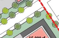
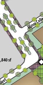
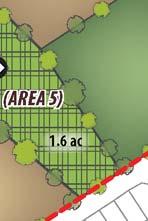
65 e. r er Ch v ya Future Right-of-Way Extension 40,000 sf 156,210 sf 15,000 sf St. (AREA 3) e. 3rd 15,000 sf v ta u aln W sf , 5,000 sf (typical) 45,000 sf 15,000 sf sf , 40,000 sf (AREA 4) 40,000 sf 129,810 sf 202,120 sf 15,000 sf (AREA 2) 5,000 sf (typical) Min (AREA 1) 15,000 sf et tre S tor lec l o or C 0.5 ac S. U. 15,000 sf gh Hi w 231,840 sf 3.0 ac ay 105,000 sf e (AREA 5) et tre or S ect ple 1.6 ac Av Ap oll or C Min 10.5 ac (220 du) Pe s tu r. lyp ca D er pp Eu 4th. Dr St. Plan Area Boundary Residential (High-Density) Neighborhood Park* Commercial (Highway) Landscaping Community Amenity/Open Space Parking Street Tree Plaza & Pedestrian Connections Service/Loading Storm Water Detention Plaza Opportunity Site 350 feet Source: RJA 2012 *Note: Neighborhood Park owned by the City and to be developed by the City with Proposition 84 Grant funds Figure 5 Conceptual Land Use Plan Walnut Avenue Specific Plan EIR
66 2.0 PROJECT DESCRIPTION This side intentionally left blank EMC PLANNING GROUP INC.
67 WALNUT AVENUE SPECIFIC PLAN EIR Table 3 Conceptual Development Capacity Area Land Use Acres (gross) 1 Typical Density (gross) 2 Development Capacity Total Area FAR 145,000 sf Area 2 Commercial FAR 80,000 sf Area FAR 90,000 sf Ac Area FAR 130,000 sf 445,000 sf Residential Right-of-Way Landscaping du/ac 220 du Ac Recreation and Open Space Area 5 City-owned Neighborhood Park site (Public) City-owned Storm Water Detention Area Ac Park Amenity/Open Space 1.62 Plaza Ac Source: EMC Planning Group, 2014 Note: 1 Includes Right-of-Way, Landscaping, Parking, Service/Loading, Setback-building (curb/walk), and Plaza areas within Areas Floor to Area Ratio (FAR) is calculated within each development area; however, if some areas are developed below the maximum FAR, other areas may be developed with a higher FAR. The total development capacity serves as the ultimate limit on density. EMC PLANNING GROUP INC. 2-19
68 2.0 PROJECT DESCRIPTION Table 4 Conceptual Land Use Summary (Square Feet or FAR) Area 1 687,930 Area 2 384,310 Area 3 403,480 Area 4 560,010 Area 5 691,300 Total Right-of-Way 155,230 61,555 42, ,635 80, ,275 Highway Commercial 145,000 80,000 90, ,000 n/a 445,000 High-Density 328, ,295 Residential 1 n/a n/a n/a n/a (220) (220) (units) Landscaping 62,540 48,000 36,880 45,075 47, ,735 (Net Percent) (12) (15) (10) (10) (10) (11) (average) Storm Water Detention n/a n/a n/a n/a 21,880 21,880 Neighborhood Park 2 n/a n/a n/a n/a 130, ,720 Park Amenity/ Open Space n/a n/a n/a n/a 70,660 70,660 Parking Spaces 231, , , , ,980 (number) (713) (399) (480) (622) n/a (2,214) Service/ Loading Building Setbacks (curb/walk) 46,960 29,045 30,425 28,845 n/a 135,275 27,600 19,200 26,200 27,085 n/a 100,085 Plaza 18,760 16,700 21,740 18,250 11,670 87,120 Gross FAR Net FAR n/a n/a 0.22 (average) 0.27 (average) Source: EMC Planning Group 2014 Notes: 1 Residential dwelling units are based on 21 dwelling units per gross area of 456,365 square feet (includes public right-ofway and landscaping) in Area 5. 2 City-owned public park site to be developed by the city with Proposition 84 grant funds, and subject to development standards and guidelines of the specific plan. 3 FAR is calculated within each sub-planning area; however, if some areas are developed below the maximum FAR, other areas may be developed with a higher FAR. The total development capacity serves as the ultimate limit on density EMC PLANNING GROUP INC.
69 WALNUT AVENUE SPECIFIC PLAN EIR Commercial Land Use The proposed project focuses primarily on commercial development. The proposed development capacity is based on a market analysis contained in the specific plan as Appendix D, which suggests that demand of up to 445,000 square feet of commercial use can be supported by existing and projected future demand from residents within the city as well as demand from residents within the broader southern portion of the Salinas Valley. Commercial uses allowed by the specific plan would be consistent with the types of uses currently allowed by the existing general plan Highway Commercial land use designation, and could include small- to large-scale retail development such as neighborhood grocery/drug/hardware store(s), service/gas station(s), restaurant(s), motel(s)/hotel(s), entertainment venue(s), and big box retail. As shown in Table 3, approximately acres of the project site are allocated for commercial use as conceptually planned. Figure 5, Conceptual Land Use Plan, shows a land use configuration where commercial development is focused primarily near the U.S. Highway 101/Walnut Avenue interchange in Areas 1-4. Big box retail is shown south of Walnut Avenue near the U.S. Highway 101 interchange, but could be located anywhere on the project site. The specific plan includes commercial zoning and development standards for minimum lot size, building placement, lot coverage, height, parking, landscaping, street and infrastructure standards, design, etc., to the extent that modification of existing city zoning standards for highway commercial uses are deemed necessary. Residential Land Use The proposed project would allow the development of high-density, multi-family residential uses consistent with the city s existing High Density Residential land use classification. The specific plan would allow a maximum of 220 high-density residential units based upon a maximum density of 21 units per acre. The development concept is based upon the development of maximum high-density residential units on an approximately 10.5 acres of land. However, the specific plan also would allow development of fewer residential units over a greater land area at a density as low as 10 dwelling units per acre. At 220 units, the specific plan could support an increased population of approximately 1,047 persons based upon the DOF persons per household. This is considered to be a conservative estimate, as the persons per household average for high-density residential uses is typically lower than average persons per household as averaged across all residential density types. Further, there is no certainty that the current anticipated general plan buildout population will ever be reached should the total number of projected housing units projected not be constructed. Consequently, it is possible that the proposed project would not result in a net increase in city population at general plan buildout. EMC PLANNING GROUP INC. 2-21
70 2.0 PROJECT DESCRIPTION A variety of housing product types is allowed to enable development to respond to market conditions. These product types could include condominiums, townhouses, apartments, mixed uses, and small-lot single-family residential uses. The specific plan defines a minimum residential density of 10 dwelling units per acre. The specific plan allows for development of mixed uses within the total allowable limits for commercial square footage and residential units. Mixed-use development standards included in Article 2 of the specific plan provide a means of calculating density for residential and commercial uses within mixed-use areas. Recreation, Open Space, and Infrastructure This land use includes both existing features and new proposed uses/features. As previously noted, the city purchased a three-acre park site in the southeast corner of the specific plan area for development as a neighborhood park. It has been included in the specific plan boundary to integrate its function with other uses proposed within the specific plan area. As of November 1, 2013, the city park had not been improved, but the city expects to initiate improvements in the next several years. A preliminary park design layout is illustrated in Figure 6, Neighborhood Park Conceptual Plan. The conceptual plan improvements include a tennis court, basketball court, play area, turf play area, gazebo, restroom, water play feature, landscaping, and other features. The city will develop the park regardless of whether or not the specific plan is approved. The specific plan includes requirements for the provision of a park amenity/open space feature and for public plazas. The goal is to facilitate the concept of the project site as destination that includes amenities for shoppers and for the community in general. Figure 5, Conceptual Land Use Plan, shows a 1.6-acre park amenity/open space feature in the southern portion of the specific plan area adjacent to the city s neighborhood park. This location was selected to leverage and expand on the open space and recreation benefit provided by the city park. The types of facilities to be provided within the park amenity area may vary based on whether or not it is developed adjacent to the city park. If so, the specific plan requires that the park amenity/open space area improvements are designed to complement those proposed by the city for the neighborhood park. The park amenity area could be developed with improvements that range from play structures, to a sports field, to picnic structures to a performance stage. Small public plazas would be integrated throughout the project site as site specific focal points for shoppers and employees to relax and congregate EMC PLANNING GROUP INC.

71 Bermed Earth with Vegetation Screen Wind Barrier Tree Picnic Area Turf Play Water Play Play Area 3rd Street Park Entry Boulder Garden Bench Gazebo Shade Tree Tennis Court Parking 1/2 Court Basketball Existing Structure with Restroom Existing Tree Apple Avenue 0 40 feet Source: Bellinger Foster Steinmetz 2011 *Note: Neighborhood Park owned by the City and to be developed by the City with Proposition 84 Grant funds Figure 6 Neighborhood Park Conceptual Plan Walnut Avenue Specific Plan EIR
72 2.0 PROJECT DESCRIPTION This side intentionally left blank EMC PLANNING GROUP INC.
73 WALNUT AVENUE SPECIFIC PLAN EIR A storm water retention/percolation pond was recently constructed by the city within the specific plan area along 3rd Street. Based on further analysis of soil conditions within the specific plan area, which indicated that soil percolation rates are higher than initially assumed when the facility was constructed, it has been determined that the size of the pond can be reduced to 0.5 acres as described in the Preliminary Engineer s Report for Walnut Avenue Specific Plan, Greenfield, California (Ruggeri-Jensen-Azar 2012) (hereinafter engineer s report ) contained in Appendix E of the specific plan. The facility will not function as usable open space, and will be fenced for safety reasons. Circulation Specific plan Article 3, Circulation Plan, includes goals and policies that guide the development of circulation improvements within the specific plan area. Figure 7, Circulation Plan, presents the conceptual circulation pattern on the project site and how it connects with the existing circulation system. Proposed new roadways would consist of two classes of public streets: a major collector street and minor collector streets. Primary access to the project site would be provided by Walnut Avenue, which also provides a direct connection to the major collector street that extends north-south through the middle of the site. The Walnut Avenue/major collector street intersection may operate as a traditional signalized intersection; however, the proposed project includes alternative design provisions for a roundabout at this location. The major collector street would have a 74-foot right-of-way that includes 12-foot travel lanes in each direction, a 14-foot dedicated left-turn lane/landscaped median, 6-foot bike lanes, 6-foot sidewalks, and 6-foot landscaped strips (with bioswales). Right-of-way for the future extension of the major collector to the north of the site is provided. Internal minor collector streets would connect to 3rd Street and Apple Avenue, providing two secondary access points. These intersections would operate as traditional stop sign controlled intersections. A minor collector would extend east-west from 3 rd Street through the southern portion of the project site to intersect with the major collector. A minor collector would extend north and east from Apple Street to connect with the major collector street. Minor collector streets would be public streets with a 60-foot right-of-way that includes 12-foot travel lanes in each direction, 6-foot bike lanes, 6-foot sidewalks, and 6-foot landscaped strips (with bioswales). The specific plan includes pedestrian and bicycle facilities intended to facilitate non-motorized access to and within the project site. The specific plan includes performance standards for the provision of traffic calming features such as raised crosswalks, textured pavement for intersections and vehicular entries, and intersection bulb-outs and roundabouts. The specific plan includes Class II bicycle lanes and sidewalks that connect to multiple destinations including existing surrounding streets, internal public spaces, and internal retail and residential uses. EMC PLANNING GROUP INC. 2-25
74 2.0 PROJECT DESCRIPTION Sidewalks and Class II bicycle lanes would be included along the internal major and minor collector streets to ensure safe and convenient non-motorized travel. Additionally, a bicycle lane would be provided on Apple Avenue. Policy is also included to encourage cooperation with Monterey-Salinas Transit to extend public transit services to the project site and install facilities such as bus stops and shelters. Utility Infrastructure The specific plan includes design criteria and preliminary plans for locating and sizing utility infrastructure. Preliminary utility master plans were prepared by the project engineer and are described and illustrated in detail in the engineer s report. The engineer s report identifies the backbone infrastructure required to connect the specific plan area to existing city infrastructure and identifies improvement types and sizing requirements based on the conceptual development capacity and land use organization. The water distribution system would consist of a looped series of eight-inch water lines that would connect to existing city infrastructure within Walnut Avenue and 3rd Street. Wastewater would be conveyed in a series of eight-inch gravity-fed sewer mains that would connect to the city s existing eight-inch main currently stubbed in Walnut Avenue, and to the existing 21-inch main in 3rd Street. Wastewater would then be conveyed through the city s 24-inch trunk main located in Walnut Avenue to the wastewater treatment plant. The preliminary storm water master plan focuses on maximizing storm drainage percolation to groundwater and managing storm water quality through use of Low Impact Development (LID) features and Best Management Practices (BMPs) throughout the specific plan area. Proposed drainage improvements would reduce runoff and enable groundwater recharge by incorporating functional design elements to detain, filter, infiltrate, store, and evaporate runoff close to its source. These design elements include streets and parking lots graded to direct runoff to storm water percolation areas such as swales, bioretention features, and other landscape features. No backbone storm drainage infrastructure is planned for the commercial areas within the project site, as the engineer s report notes that storm water can be percolated using subsurface percolation vaults placed on the site in locations planned for commercial development. Storm drainage from the residential portion of the site would be conveyed to the existing storm drainage retention/percolation facility. Once completed, the backbone utility infrastructure improvements would be conveyed to the city, who would own and maintain the facilities EMC PLANNING GROUP INC.

")


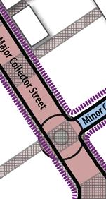
75 e. v ya 3rd Future Bike Access (recommended) rr St. e Ch Future Right-of-Way Extension e. v ta u aln W Primary Entrance Secondary Entrance Future Right-of-Way Ma jor le Col et cto tre t ree r St or S ect ll r Co o Min S. U. gh Hi ay w e. 10 ple et Ap tre 1 or S ect Av oll or C Min er pp Pe Eu. Dr s tu 4th lyp ca Secondary Entrance Dr. St. Plan Area Boundary Major Collector Street Class II Bicycle Lane Existing Street Minor Collector Street Sidewalk Existing Sidewalk Roundabout/ Traffic Circle Opportunity Plaza & Pedestrian Connections Existing Bicycle Route/Lane Entrance/ Access Point Source: RJA feet Figure 7 Circulation Plan Walnut Avenue Specific Plan EIR
76 2.0 PROJECT DESCRIPTION This side intentionally left blank EMC PLANNING GROUP INC.
77 WALNUT AVENUE SPECIFIC PLAN EIR Development Phasing Phasing of future development of the project site would be based largely upon the timing in which planned interim improvements and final improvements to the U.S. Highway 101/Walnut Avenue interchange are completed. As described in Section 2.12, Transportation, and in Section 4.0, Cumulative Impacts, the phasing of development is significantly influenced by the existing limited capacity of the Walnut Avenue/U.S. Highway 101 interchange to accommodate increased traffic from the project site. In short, no more than about 10,000 square feet of commercial development can be accommodated under existing conditions without improvements to the interchange. An interim set of low-cost improvements have been discussed with and validated with Caltrans that would enable up to approximately 190,000 square feet of commercial development or a combination of commercial/residential development with a traffic generation volume equivalent to 190,000 square feet of commercial development. The city s traffic engineer for Walnut Avenue interchange project anticipates that the interim improvements will be funded and completed by the end of 2014 (Telephone conversation with Ravi Narayanan, Wood Rodgers, June 11, 2013). Full interchange improvements are required to enable more than 190,000 square feet of commercial development or a combination of commercial/residential development with a traffic generation volume equivalent to 190,000 square feet of commercial development. Given the interchange capacity constraints, specific plan Article 5, Plan Implementation, includes a conceptual phasing plan. It assumes that the project site would be developed in at least four phases over an estimated period of approximately 20 years. This assumption could change based on market conditions that evolve over time. The conceptual development phases and their components are as follows: Phase 1: Includes development of a portion of the commercial use south of Walnut Avenue, near the U.S. Highway 101 interchange (Area 1). Phase 2: Includes additional highway commercial development south of Walnut Avenue and adjacent to 3rd Street (Area 2). Phase 3: Includes approximately 10.5 acres of High Density Residential development (Area 5) and modification of the existing storm water detention facility to accommodate storm water from the residential development. This phase would also include development of the public amenity/open space use. Phase 4: Includes the remaining approximately 22 acres of highway commercial use located north of Walnut Avenue near the U.S. Highway 101/Walnut Avenue interchange (Areas 3 and 4). The necessary on-site public infrastructure needed to develop each phase would be provided by the developer of each phase. EMC PLANNING GROUP INC. 2-29
78 2.0 PROJECT DESCRIPTION Project Objectives CEQA Guidelines section 15124(b) requires that a project description include a statement of objectives sought by the proposed project. The purpose is to help the lead agency develop a reasonable range of alternatives to evaluate in the EIR and aid decision makers in preparing findings or a statement of overriding considerations, if necessary. The following project objectives were developed by the city pursuant to this requirement: Implement the city s vision, as described in the general plan, for a regional commercial center that: creates new business opportunities to maximize job growth potential; provides residents and visitors with a more diverse offering of commercial uses; and maximizes tax revenues to support city services. Attract commercial and residential development by streamlining the entitlement process and related approval requirements, including zoning standards, design guidelines, implementation direction, and CEQA compliance; Pre-entitle land use for the project site in a flexible way that enables responsiveness to growth trends and retail commercial demand in the City of Greenfield and the Salinas Valley region; Enable development of high-density residential housing types to diversify the city s housing supply and provide mixed-use synergies within the site that support commercial development and reduce vehicle trips and associated air and greenhouse gas emissions; Allow for creativity and flexibility in the location of uses, density, development product type, and design, to help the end user(s) meet development and use objectives; Implement the city s vision, design guidelines, and standards within a specific plan to shape the development of the site; Create a pedestrian-oriented place of destination for shopping, entertainment, dining, and civic organization; and Reinforce the city s and community s commitment to efficient use of natural resources through the use of green building and sustainable site planning development practices EMC PLANNING GROUP INC.
79 WALNUT AVENUE SPECIFIC PLAN EIR 2.4 RELATIONSHIP TO LOCAL AND REGIONAL PLANS CEQA Guidelines section 15125(d), Environmental Setting, states that an EIR shall discuss any inconsistencies between the proposed project and applicable general plans, specific plans, and regional plans. This section includes a discussion of the proposed project s consistency or inconsistency with the following plans: General Plan and Zoning Ordinance The proposed project is consistent with general plan policy , which allows specific plans or planned unit development planning approaches for large-scale development projects that allow flexibility in development standards in return for creativity in design and other project amenities. Uses that undermine the overall intent of the General Plan policies and Land Use Diagram shall not be permitted. The proposed specific plan requires approval of an amendment to the general plan text and land use map for a change in the general plan land use designation on the site from Highway Commercial with a Regional Commercial Design Overlay to Walnut Avenue Specific Plan or a similar nomenclature. The development standards contained in the specific plan would modify zoning standards that now apply to the site except where no change is required. To reflect the modification of zoning standards for the project site, the city would also act to approve a modification of the city s zoning map to denote the specific plan area as subject to the new standards. The proposed project would be consistent with the general plan and zoning ordinance once the general plan amendment and zoning map amendment are approved. Air Quality Management Plan The city is located in the North Central Coast Air Basin (air basin). The Monterey Bay Unified Air Pollution Control District (hereinafter air district ) is the local agency responsible for air quality monitoring within the air basin and for preparation of an air quality management plan that outlines steps that will be taken to meet federal and state air quality standards. The 2008 Air Quality Management Plan for the Monterey Bay Region (AQMP) (Monterey Bay Unified Air Pollution Control District 2008) was adopted by the air district in August Projects related directly to population growth will generate population-related emissions (e.g., motor vehicles, residential heating and cooling emissions). Population-related emissions have been forecast in the AQMP using population forecasts adopted by the Association of Monterey Bay Area Governments. Population-related projects which are consistent with these forecasts are consistent with the AQMP. EMC PLANNING GROUP INC. 2-31
80 2.0 PROJECT DESCRIPTION The air district provides guidance to local jurisdictions for consistency determinations through its policy document Consistency Determination for Residential Development Projects (Monterey Bay Unified Air Pollution Control District 2013). The air district recommended procedure is suggested as an accounting resource; however, the air district defers to local agencies use of accounting methods appropriate to their jurisdictions in their roles as lead agency. The air district provides a consistency spreadsheet that includes projected housing data (as a proxy for population). The lead agency adds data on recently constructed housing, approved but un-built housing, and pending housing. The additional 220 high-density dwelling units proposed in the specific plan are added to this background data, and if the total resulting unit count is within projections, the proposed project is determined to be consistent with the AQMP. Refer to Section 3.3 Air Quality for a discussion of consistency of the proposed project with the AQMP; the proposed project has been found to be consistent with the AQMP. Regional Transportation Plan The Transportation Agency for Monterey County (TAMC) is the state-designated Regional Transportation Planning Agency, Congestion Management Agency, Local Transportation Commission, and the Service Authority for Monterey County. The 2010 Monterey County Regional Transportation Plan (hereinafter regional plan ) (Transportation Agency for Monterey County 2010a) provides policy guidelines regarding the planning and programming of transportation related needs, analyzes alternative transportation possibilities, and identifies available funding for transportation projects and programs in Monterey County needed to fulfill TAMC s regional transportation network goals. The regional plan financially constrained scenario includes new facilities and services that could be constructed and/or implemented based on projected levels of anticipated funds. The U.S. Highway 101/Walnut Avenue interchange project is included the list of new facilities planned for funding. As defined in Road and Highway Transportation Objective 1 on page of the regional plan, TAMC s intent is that facilities included in TAMC s expenditure plan program of regional transportation projects be designed to operate at level of service (LOS) C, achieve at least LOS D on the regional roadway network by 2020, and maintain at least LOS D on regional roadways thereafter. Per this objective, the U.S. Highway 101/Walnut Avenue interchange project must be designed to perform at LOS D. TAMC adopted a regional development impact fee in The TAMC fee program assesses most new development a fee to fund regional transportation improvements. The project site is within the South County benefit area. TAMC s South County projects include improvements to the Walnut Avenue/U.S. Highway 101 interchange. This project is included as a Tier 1 expenditure, meaning that it is a priority project for funding in the 2009 to 2015 timeframe if sufficient regional fees have been collected within that timeframe EMC PLANNING GROUP INC.
81 WALNUT AVENUE SPECIFIC PLAN EIR CEQA Guidelines section 15130(a)(3) allows developers to pay a fair share fee established by a program designed to mitigate cumulative impacts to reduce the contribution of individual projects to a significant cumulative impact to a less-than-significant level. TAMC s regional development impact fee program is designed to mitigate the cumulative impacts of individual projects on the regional transportation network. Future developers of projects within the specific plan area will be required to pay the TAMC regional development impact fee for this purpose. The proposed project would be inconsistent with the regional plan if it were determined to physically preclude development of facilities defined in the regional plan and/or would otherwise constrain the potential for implementing the regional plan. The proposed project would be consistent with the regional plan, as it would do neither. The specific plan includes Policy CP-2.1, Implementation Measure 1, which that requires future developers to pay a proportional share for improvements to the U.S. Highway 101/Walnut Avenue interchange improvements, the only improvements within the project area that are listed in the regional plan. EMC PLANNING GROUP INC. 2-33
82 2.0 PROJECT DESCRIPTION This side intentionally left blank EMC PLANNING GROUP INC.
83 3.0 IMPACTS, ANALYSIS, AND MITIGATION MEASURES 3.1 AESTHETICS This section assesses the existing visual quality of the project site and potential changes to the visual and aesthetic environment that would result from the proposed development. In assessing the visual quality of a site, it is important to consider that visual quality is not determined solely by the physical attributes of a project, but also by the relationship between the project and the total visual environment. The primary aesthetic concerns associated with the proposed project are potential changes in visual character of the project site and impacts from new sources of light and glare. Significant impacts are identified and mitigation measures are presented. The information presented in this section is based primarily on a field survey, review of aerial photographs, the general plan and general plan EIR, and the proposed specific plan, including design guidelines and development regulations. No comments on aesthetics issues were received by the city as part of the NOP process. Environmental Setting Regional Visual Character The primary character-defining visual resources in the Salinas Valley are widespread agricultural activities and mountains that border both sides of the valley along nearly its entire length. Views of these visual resources are not considered regionally unique as they are nearly unobstructed and available from U.S. Highway 101 and other locations throughout south Monterey County. According to the California Department of Transportation Scenic Highway Program, there are EMC PLANNING GROUP INC. 3-1
84 3.0 IMPACTS, ANALYSIS, AND MITIGATION MEASURES no officially designated, or candidate, State or county scenic routes within or in the immediate vicinity of the city (Caltrans 2013). Located on the valley floor and surrounded by productive farmlands, the city has generally retained a small-town ambience that is rooted in its historic agriculture-related character and economy. Agricultural fields and farms are present at the fringes of developed areas within the city limit, which contribute to the city s visual character as an agricultural community. Nearly unobstructed views of the Santa Lucia Mountains and Arroyo Seco to the west and the Gabilan Mountain range to the east are afforded from many locations within the city, including from the project site and vicinity. There are no designated scenic vistas within the city; however, views of mountains to the east and west of the city and valley floor are identified as scenic visual resources in the general plan. Project Site Visual Character Located at the northeastern edge of the city, the project site is contiguous urban uses along its southern and western border, but has historically and continues to be used for agricultural purposes. Foreground views are of the existing agricultural fields. Background views are of the mountain ranges located both to the east and to the west of the city. The project contains no unique visual resource features. The project site is not visible from surface streets and other public areas west of U.S. Highway 101, with the exception of the Walnut Street overpass, which is at a higher elevation than the project site. The project site is briefly visible from southbound and northbound lanes of U.S. Highway 101 in the vicinity of the Walnut Street interchange. Unobstructed views of the site are available from 3rd Street, Walnut Avenue, and Apple Avenue where they adjoin the project site. The project site is also visible from residential uses located along the south side of Apple Avenue and to the east of 3rd Street. Residents in these homes generally have an unobstructed view of the project site. Light and Glare A range of sources of daytime and nighttime glare are common in urbanized areas. Daytime sources of glare typically include reflection of the sun off of buildings, car windshields, and other highly reflective glass or metal surfaces. Nighttime lighting is the primary source of glare that adversely affects nighttime views and creates sky glow. Typical sources of nighttime glare include high intensity lighting at playfields, lighting of commercial and industrial facilities, parking lot lighting, street lighting, and vehicle headlights. 3-2 EMC PLANNING GROUP INC.
85 WALNUT AVENUE SPECIFIC PLAN EIR There are few sources of light and glare either on the project site or immediately adjacent to it. Street lighting and lighting of adjacent single-family residential areas are the notable light sources and these do not significantly affect day or nighttime views. Regulatory and Policy Setting General Plan The general plan contains a range of policies and implementation programs designed to directly and/or indirectly address protection of aesthetic qualities. These are as follows: Policy 2.1.1: New development shall be consistent with the scale, appearance, and rural community character of Greenfield s neighborhoods. Policy 2.1.7: Require agricultural buffers on developments adjacent to agricultural land consistent with the Local Agency Formation Commission s (LAFCO) requirements. Policy : Commercial development projects shall incorporate landscaping that enhances the character and quality of the project and its immediate vicinity and reduces visual impacts of the development on surrounding properties. Program 2.3.C: Within one (1) year, prepare and adopt design guidelines requiring design standards for different scales of commercial development including regional commercial centers, highway commercial, neighborhood commercial centers, professional office, and downtown commercial. The design standards shall provide for the inclusion of residential uses in areas with Mixed-Use overlays. Policy 2.8.5: Encourage the use of attractive signage and monumentation at the entrances to residential districts, commercial areas, and other appropriate locations. Policy 2.8.6: Encourage development of commercial and industrial uses that are consistent with the scale and character of surrounding land uses. Policy 7.8.1: Encourage development to include open space. EMC PLANNING GROUP INC. 3-3
86 3.0 IMPACTS, ANALYSIS, AND MITIGATION MEASURES Policy 7.8.2: Where feasible and desirable, major open space components shall be combined and linked to form a visual and physical system in the city. Policy 7.9.1: Encourage preservation and enhancement of views of the Gabilan Mountains, and the Santa Lucia Mountains, and Arroyo Saco to the extent possible. Policy 7.9.2: Design development and redevelopment in the city to take advantage of view opportunities and minimize visual impacts to the Gabilan and Santa Lucia Mountains. Policy 7.9.3: Recognize vineyards and agricultural landscapes as important visual resources. Program 7.9.A: Review development applications for discretionary actions to determine aesthetic impacts and visual compatibility with surrounding property. Municipal Code Chapter of the municipal code allows multi-family residential uses to a maximum height of 35 feet, and calls for medium-density use as transitional residential "Districts" between lower density residential neighborhoods and more intense uses such as high-density residential, office buildings, commercial uses, and industrial uses. The municipal code calls for the placement of high-density residential uses near other multi-family sites, office, commercial uses, or light industrial areas. Additionally, multi-family residential sites are recommended to be located along thoroughfare, arterial, or collector roads or near existing or planned public transit stops. Municipal code Chapter presents Highway Commercial uses and standards. Maximum height limits for commercial uses are 45 feet and building setbacks are 20 feet. Municipal code Chapter includes standards and criteria for new sources of light and/or glare to promote the preservation of the natural nighttime outdoor environment and to ensure adequate safety, night vision, and comfort. Thresholds of Significance CEQA Guidelines appendix G indicates that a project may have a significant effect on the environment if it would: substantially degrade the existing visual character or quality of the site and its surroundings; 3-4 EMC PLANNING GROUP INC.
87 WALNUT AVENUE SPECIFIC PLAN EIR have a substantial adverse effect on a scenic vista; create a new source of substantial light or glare, which would adversely affect day or nighttime views in the area; or substantially damage scenic resources including, but not limited to, trees, rock outcroppings, and historic buildings within a state scenic highway. Items Eliminated From Further Discussion According to the Caltrans Scenic Highway Program there are no designated or nominated State or county scenic routes within the city or in the vicinity. As such, the proposed project would not affect the character-defining visual features within a scenic highway. Therefore, no further discussion of impacts to scenic routes or their visual character is required. Impacts, Analysis, and Mitigation Measures Applicable Specific Plan Policies Article 2, Land Use, Development Standards, and Design Guidelines of the specific plan contains the following policies and development guidance that are applicable to the discussion of aesthetics impacts and mitigation measures: Policy LU-7.1: Buffer existing single-family uses south of Apple Avenue from commercial uses within the Plan Area. Implementation Measures: 1. Residential uses, as a transition, are encouraged adjacent to Apple Avenue within the Plan Area. 2. Adhere to larger set-backs established by the Specific Plan for residential and commercial development adjacent to Apple Avenue. 3. Design uses immediately adjacent to Apple Avenue to match the scale of development to the south. Policy LU-7.3: Design 3rd Street with enhanced aesthetic features to serve as an attractive connector to the Yanks Air Museum. Implementation Measures: 1. Provide landscaped frontage areas along 3rd Street. EMC PLANNING GROUP INC. 3-5
88 3.0 IMPACTS, ANALYSIS, AND MITIGATION MEASURES 2. Include Plan Area entry signage for southbound travelers on 3rd Street at the northeast corner of the Plan Area. 3. Ensure building placement at the northeast corner of the Plan Area provides for an attractive view into the Plan Area from southbound 3rd Street. Policy LU-8.1: Develop a project in the Plan Area with a mix of land uses that is visually attractive to the community and a focal point for residents and visitors. Implementation Measures: 1. The master developer and/or individual project developers shall adhere to the design guidelines in this Specific Plan to ensure that the development is visually attractive when viewed from within the community, as well as from off-site public view locations including U.S. Highway The master developer and/or individual project developers shall design all lighting, including street lighting, to minimize glare and casting of light to locations not intended for illumination. Lighting for residential and commercial areas, as well as for sidewalks and recreation areas, shall be consistent with development standards and design guidelines. Improvement plans shall be reviewed for consistency with this measure by the City Public Works Department prior to approval of any final map or commercial development plan. Design Guidelines. Specific plan Article 2.7, Design Guidelines, is fundamental to directing the visual characteristics of future development to promote design quality and visual harmony with the adjacent uses and the community in general. The design guidelines were prepared in consideration of the fact that the project site is within the Regional Commercial Design Overlay as described in Section 2.0, Project Description. To date, the city has not developed standards for this overlay. Hence, the design guidelines, along with other specific plan policies and development standards, are intended to serve the same intent to require increased standards for design sensitivity in light of adjacent residential and agricultural uses. The design guidelines provide specific direction for architectural style, commercial architecture, commercial/residential transitions and mixed use areas, residential architecture, streetscape and landscaping design, fencing, site planning (e.g. clustering buildings, providing useable open space, etc.), parking and loading areas, signage, lighting, and project gateways. The guidelines emphasize form and proportion, and logical relationships between buildings, site amenities, and 3-6 EMC PLANNING GROUP INC.
89 WALNUT AVENUE SPECIFIC PLAN EIR layout, and also address architectural details including building massing, scale, height, articulated wall facades, fenestration, lighting and architectural finishes. Design Review. Specific plan Article 2.6, Zoning and Development Standards, includes definition of the design review process through which future development would be scrutinized for its aesthetic compatibility and sensitivity. Residential and non-residential development, signage and lighting, landscaping, and parking and other site improvements, are subject to review and approval to ensure their siting and design are aesthetically compatible. Impact: Substantially Degrade Existing Visual Character and Quality of the Site and its Surroundings (Significant and Unavoidable) Discussion. Development as guided by the specific plan would permanently change the visual characteristics of the project site. The extent to which this change is considered significant is subjective based on the attitudes and perspectives of the viewer. The project site does contribute to the city s agricultural visual character. Agricultural character is defined in the general plan EIR as an attribute that substantially contributes to the city s aesthetic resources. Development of the project site was envisioned in the general plan, and the visual impacts of commercial development of the site associated with general plan buildout were studied in the general plan EIR. The general plan EIR identified agricultural and rural lands located along the urban fringe of the city as particularly valuable visual resources that contribute to the city s identity as an agricultural community. At the cumulative level, the conversion of these areas to urban uses was found to result in significant and unavoidable visual impacts, despite the implementation of general plan policies and programs. The City Council adopted a Statement of Overriding Considerations for this impact when it adopted the general plan. The scale (e.g. height and land coverage), density, and intensity of development proposed for the project site is such that the magnitude of change to urban use would be substantial relative to existing conditions. Further, the proposed project will convert a significant percentage of the remaining agricultural land located within the city limits to urban use, thereby significantly altering a key visual resource (agricultural land) that contributes to the city s overall rural community character. The change will be most noticeable from the roadways located adjacent to the site, the existing residential neighborhood to the south, the Walnut Avenue overpass over U.S. Highway 101, and for short-durations of time where the site is visible to motorists on U.S. Highway 101. As described above, Article 2 of the specific plan contains a range of policies and development standards intended to promote visual quality of future development. Implementation of future development consistent with the policies, development standards, and design guidelines would facilitate design quality and serve to partially mitigate the impact of the change in visual character, but would not reduce the scale of development such that the magnitude of visual EMC PLANNING GROUP INC. 3-7
90 3.0 IMPACTS, ANALYSIS, AND MITIGATION MEASURES change is substantially reduced. Consequently, the change in visual character is considered to be significant and unavoidable. Impact: Substantial Adverse Impact on a Scenic Vista (Less than Significant) Discussion. The general plan does not identify specific scenic vista points within or adjacent to the city, but instead notes the presence of broad scenic vistas comprised of views of the Santa Lucia and Gabilan Mountains that are available from throughout the city. Given the potential height and scale of development proposed for the project site, future development could impede scenic views of distant agricultural fields and the Santa Lucia and Gabilan Mountain ranges from the existing roadways that border the site. Views to the east towards the mountains may also be blocked from motorists traveling on U.S. Highway 101. Views east from the highway could be minimally to wholly impeded depending on the final arrangement and height of buildings constructed on the project site, on the location of the viewer (e.g. views over the site in the southbound direction are partially blocked by the northbound Walnut Avenue off-ramp), and on the duration of view over the site. Where views from the highway may be impeded, the duration of time over which they are impeded would be low given that vehicles on the highway travel at high speeds. Agricultural activities in the Salinas Valley are widespread and mountains border both sides of the valley for nearly its entire length. Such views are readily available from U.S. Highway 101 and other locations throughout the city and throughout south Monterey County, including form areas directly adjacent to the city. Due to the frequency and duration of available views along and adjacent to the U.S. Highway 101 corridor through the city, views of both resources are not unique. Therefore, the limited impedance of views to scenic agricultural fields and distant mountains that may occur with development of the project site is considered to be less than significant. Impact: Create a New Source of Substantial Light or Glare, Which Would Adversely Affect Day or Nighttime Views in the Area (Less than Significant) Discussion. New development would result in new sources of light and glare, the intensity, type, and locations of which would vary with the type of specific development and its location on the site. Both day and nighttime views in the immediate area could be affected by new sources of light and glare. The general plan EIR identified significant impacts from daytime glare and nighttime lighting resulting from buildout of the general plan. The general plan EIR concluded that the impacts would be reduced to a less-than-significant level by compliance with the general plan policies previously referenced that encourage development to be sensitive to community character and design. 3-8 EMC PLANNING GROUP INC.
91 WALNUT AVENUE SPECIFIC PLAN EIR The proposed specific plan includes a number of policies, which would reduce the light and glare impacts future development. The primary development standards and design criteria for lighting include consistency with municipal code Chapter 17.56, which specifies lighting standards for new development to minimize light and glare impacts, and standards for lighting intensity, light shielding, lighting intensity, light standard heights, and cut-off fixtures for the purpose of minimizing lighting impacts on existing and future adjacent residential uses in particular and for minimizing sky glow. Compliance with the provisions of municipal code Chapter 17.56, and with the specific plan design guidelines, would reduce day and nighttime glare and lighting effects from future development to less than significant. 3.2 AGRICULTURAL AND FORESTRY RESOURCES The following discussion is based on information obtained from the general plan, the general plan EIR, the U.S. Department of Agriculture (USDA) Soil Survey of Monterey County (1978), and the Monterey County Important Farmlands Map (California Department of Conservation 2010). LAFCO submitted a letter in response to the NOP. The letter requests that the EIR consider the impacts of the proposed project on adjacent agricultural land and that a buffer be considered, consistent with LAFCO conditions of approvals for previously approved annexations encompassing the project site. LAFCO comments on the NOP are included in Appendix A. Environmental Setting Important Farmlands Mapping Program The California Department of Conservation Division of Land Resource Protection publishes an important farmlands map and a list of soil types that qualify for determination as important farmlands through its Farmland Mapping and Monitoring Program. Important farmlands mapping provides an inventory of agricultural resources by county. The maps do not necessarily reflect general plan or zoning designations, city limit lines, changing economic or market conditions, or other land use policies. The Farmland Mapping and Monitoring Program defines several categories of important farmland for Monterey County: Prime Farmland. Land with the best combination of physical and chemical characteristics able to sustain long-term production of agricultural crops. The land must have been used for production of irrigated crops some time during the four years prior to the mapping date. EMC PLANNING GROUP INC. 3-9
92 3.0 IMPACTS, ANALYSIS, AND MITIGATION MEASURES Farmland of Statewide Importance. Land with a good combination of physical and chemical characteristics for agricultural production, having only minor shortcomings, such as less ability to store soil moisture, compared to prime farmland. Unique Farmland. Farmland of lesser quality soils but used for production of the state s leading agricultural crops. This land is usually irrigated, but can include some nonirrigated orchards or vineyards appropriate in certain climatic zones of California. Agricultural land in Monterey County was inventoried as part of the Farmland Mapping and Monitoring Program in 2010 to determine the extent of loss of important farmland due to land use conversion (California Department of Conservation 2010). According to the Important Farmlands Map for Monterey County, there were approximately 235,147 acres of Prime Farmland, Farmland of Statewide Importance, and Unique Farmland in the County, of which 165,251 acres is considered Prime Farmland. Agricultural Resources at the Project Site and in the Vicinity The project site has historically been and is currently utilized for agricultural row crop production. Land to the north and northeast of the project site that are outside the city limits, but within the SOI are also in agricultural production. These areas are within Monterey County, but within the city s SOI. A review of the 2010 Important Farmlands Map for Monterey reveals that the entire city is surrounded by important farmlands and the entire project site is classified as Prime Farmland. According to the California Department of Conservation, as of 2012, there are no Williamson Act contracted parcels within the project site ( Pages/Index.aspx). The project site does not contain forest or timber resources and is not zoned for such by the city. Policy and Regulatory Setting General Plan The general plan recognizes that urban growth beyond existing city limits would represent significant and unavoidable impacts to important farmland. The general plan also acknowledges that as development associated with buildout conditions occurs and expands into areas that have been traditionally used for agriculture, urban interface conflicts may occur. The land use element goals, policies and programs call for the preservation and protection of the viability of 3-10 EMC PLANNING GROUP INC.
93 WALNUT AVENUE SPECIFIC PLAN EIR agricultural areas surrounding Greenfield and outside the city limit, but within the city s SOI while promoting planned, sustainable growth. Applicable policies are as follows: Policy 2.6.1: Promote compact city growth and phased extension of urban services to discourage sprawl and encourage development that improves agriculture and vital public services. Policy 2.6.2: Preserve agricultural land and open space around the city to inhibit sprawl and maintain the rural community character of Greenfield. Policy 7.1.1: Promote the phased transition from agricultural operations to urban uses within the City s Planning Area. Policy 7.1.2: Minimize conflicts and negative impacts resulting from development that occurs in close proximity to agricultural uses. Policy 7.1.4: Incorporate parks, open space, and trails between urban and agricultural uses to provide buffering and transition between uses. Program 7.1.A: Implement the use of land use buffers such as passive parks, open space, and trails, between adjacent residential and agricultural uses. Seek LAFCO approval, where applicable, for passive recreational uses in agricultural buffers. Program 7.1.C: New development shall provide adequate setbacks for non-agricultural structures adjacent to cultivated agriculture. Right to Farm Ordinance. The city does not have an adopted city-wide right-to-farm ordinance. However, in the past the city has required individual projects near active agricultural lands have contained deed restrictions informing new residents of the presence and potential nuisances associated with nearby farming operations. Prior Annexation Conditions of Approval Agricultural Buffers Agricultural activities can generate noise and dust and utilize chemicals that are considered nuisances or health hazards to adjacent non-agriculture land uses. A common approach to mitigating conflicts between agricultural activities and surrounding uses is to establish a land buffer that separates the non-compatible uses. One buffer approach is to provide a strip of land between the conflicting activities where neither activity is permitted. Buffers can be improved with vegetation, used for trails or other passive recreation activity, roads, storm detention ponds, utility corridors or other such uses that don t attract a high volume of users. Typically, buffers are placed within the property lines of new development rather than on the agricultural land. EMC PLANNING GROUP INC. 3-11
94 3.0 IMPACTS, ANALYSIS, AND MITIGATION MEASURES LAFCO comments on the NOP note that three portions of the project site were annexed to the city over the period 1997 to As part of the annexation approval process, the city prepared environmental documents pursuant to CEQA, adopted mitigation measures and/or conditions of approval for these actions. Issues that are relevant to LAFCO s comments, with a focus on agricultural buffer issues, are summarized below Greenfield Reorganization Negative Declaration. In 1997, the city annexed the western one-half of the project site. No significant impacts to agricultural resources were identified and no mitigation measures were adopted by the city in its approval of the annexation Thorp Reorganization EIR. As part of a larger annexation between 2nd Street to the east, and Walnut Street on the north, a portion of the eastern one-half of the project site bounded by the Greenfield Reorganization boundary to the west, Walnut Street to the north, 3rd Street to the east, and Apple Avenue to the south was brought into the city. Mitigation measures included requirements for deed restrictions or similar covenants to provide protections for on-going farming operations, and the provision of a 200-foot buffer between development and active farming operations along the north side of Walnut Street and east of 2nd Street Yop Annexation Mitigated Negative Declaration. In 2007, the city annexed the northeastern portion of the project site located at the northwest corner of the intersection of Walnut Avenue and 3rd Street. Mitigation measures included a requirement for the placement of a 100-foot minimum land use buffer between the edge of active fields and the nearest building surface, with a shorter distance allowed upon demonstration to the city of effective separation between uses. A second mitigation required the city to provide recorded notifications of the Monterey County Right-to-Farm Ordinance and effects of agricultural activities to future owners at the time of transfer or sale of properties within 2,000 feet of agricultural land, operations, or processing facilities. LAFCO determined that the impacts to agricultural resources presented in the city's environmental initial study of the Yop annexation were reduced to less than significant with implementation of the mitigation measures contained therein. An additional LAFCO condition clarified the location and extent of the 100-foot buffer to apply along the "northern and eastern annexation boundaries if development on the Yop parcel occurs prior to urban development of the parcels to the north and east" (Monterey County Local Agency Formation Commission 2012). Thresholds of Significance CEQA Guidelines appendix G indicates that a project may have a significant effect on the environment if it would: 3-12 EMC PLANNING GROUP INC.
95 WALNUT AVENUE SPECIFIC PLAN EIR convert Prime Farmland, Unique Farmland, or Farmland of Statewide Importance (Farmland), as shown on the maps prepared pursuant to the Farmland Mapping and Monitoring Program of the California Resources Agency, to non-agricultural use; conflict with existing zoning for agricultural use, or a Williamson Act contract; conflict with existing zoning for, or cause rezoning of, forest land (as defined in Public Resources Code section 12220(g)), timberland (as defined by Public Resources Code section 4526), or timberland zoned Timberland Production (as defined by Government Code section 51104(g)); result in the loss of forest land or conversion of forest land to non-forest use; or involve other changes in the existing environment which, due to their location or nature, could result in conversion of Farmland, to non-agricultural use or conversion of forest land to non-forest use. Items Eliminated from Further Discussion The proposed project site is not zoned for agricultural use and none of the parcels within the project site are under Williamson Act contract. Therefore, the proposed project would not conflict with existing zoning for agricultural uses or with the provisions of any Williamson Act contract. Additionally, as noted in the environmental setting discussion of this section, the project site does not contain forest lands and also is not zoned for commercial timber production. Therefore, the proposed project would not result in the loss, or conversion, of forest land or timber resources to non-forest or non-timber-production uses. For these reasons no related impacts would occur and these issues are not discussed further. Impact, Analysis, and Mitigation Measures Applicable Specific Plan Policies Article 2, Land Use, Development Standards, and Design Guidelines of the specific plan contains the following policies and development guidance that are applicable to the discussion of agricultural resource impacts and mitigation measures: Policy LU-9.1: Minimize conflicts and negative impacts resulting from development that occurs in close proximity to agricultural uses by incorporating temporary buffers between urban and agricultural uses. EMC PLANNING GROUP INC. 3-13
96 3.0 IMPACTS, ANALYSIS, AND MITIGATION MEASURES Implementation Measures: 1. Create temporary buffers such as roadways, parking areas, passive parks, open space, and trails between development within the Plan Area and adjacent existing agricultural uses along the northern and eastern borders of the Plan Area. 2. Development shall provide a temporary buffer, where appropriate and feasible, of at least 50 feet from agricultural uses. 3. Buffers shall be retained until development applications for the adjacent lands are filed with the city. Impact: The Proposed Project Would Result in the Loss of Important Farmland by Converting Prime Farmland to Urban Uses (Significant and Unavoidable) Discussion. Future development of the project site will result in the conversion of 62.6 acres of Prime Farmland to a non-agricultural use. This is a significant and unavoidable impact of the proposed project. Impacts from converting Prime Farmland to non-agricultural use resulting from general plan buildout were studied in the general plan EIR. The general plan EIR determined that buildout of the general plan would result in a significant and unavoidable impact from conversion of important farmland, including Prime Farmland, to non-agricultural use. This loss of important farmland is partially mitigated by the city s commitment to compact and efficient development patterns identified in the land use element, and through implementation of Open Space policies and and programs 7.1A 7.1C. However, implementation of these general plan goals, policies and programs would not reduce the impact to less than significant. The city Council adopted a Statement of Overriding Considerations for this impact when it adopted the general plan. Although the city has already adopted findings and made a Statement of Overriding Considerations for the impact, a similar finding should be made for the proposed project to disclose its project-specific impact. This EIR discloses the impact. The Statement of Overriding considerations is a decision made by the City Council. Impact: Land Use Conflicts Leading to Potential Conversion of Agricultural Land to Non-agricultural Use (Less than Significant with Mitigation) Discussion. Future development of specific plan parcels to the north of Walnut Avenue could lead to land use conflicts with existing agricultural uses located on adjacent unincorporated parcels to the north and northeast. Impacts associated with urban interface conflicts were 3-14 EMC PLANNING GROUP INC.
97 WALNUT AVENUE SPECIFIC PLAN EIR identified in the general plan EIR, including inconveniences or discomforts associated with dust, smoke, noise, and odor from agricultural operations; restrictions on agricultural operations (such as pesticide application) along interfaces with urban uses; conflicts with farm equipment and vehicles using roadways; trespassing and vandalism on active farmlands; and pressure to convert land to urban uses as a result of an increase in conflicts and increases in property values. Future development of the project site consistent with the uses allowed by the specific plan would contribute to potential land use conflicts identified in the general plan EIR for urban uses. The general plan EIR concluded that implementation of general plan land use element policy 2.6, and Conservation, Recreation and Open Space policies 7.1.1, 7.1.2, and 7.1.4, in combination with Programs 7.1A and 7.1C, as previously referenced, would reduce the impacts to less than significant. Mitigation measures adopted in conjunction with previously approved annexations for land within the specific plan area, in particular, the Yop Annexation, are also relevant. The Yop project mitigation measures require: 1) recorded notifications of the Monterey County Right-to- Farm Ordinance and effects of agricultural activities to future owners at the time of transfer or sale of properties within 2,000 feet of agricultural land, operations, or processing facilities; and 2) the placement of 100-foot buffers between building surfaces of new development and active agricultural operations along the north and northeast portion of the project site, with narrower buffers allowed upon demonstration to the city of effective separation between uses. However, if development occurs on the adjoining agricultural parcels prior to development of the project site, no conflicts would occur and buffers would not be required. Specific plan policy LU-9.1 and its associated implementation measures call for the minimization of conflicts and negative impacts resulting from development that occurs in proximity to agricultural uses by incorporating temporary buffers between urban and agricultural uses. Future developers would be required to maintain 50-foot wide buffer from agricultural uses, until development applications for the adjacent agricultural lands are filed with the city. The 50-foot buffer specified in the specific plan is inconsistent with the 100-foot buffer required for the Yop annexation. Mitigation measure AG-1 below resolves this inconsistency by requiring modification of specific plan policy LU-9.1, Implementation Measure 2. Implementation of mitigation measure AG-1, in addition to compliance with general plan policies would reduce the potential for land use conflicts to a less-than-significant level. Mitigation Measure The following mitigation measure shall be implemented to modify the specific plan as described. EMC PLANNING GROUP INC. 3-15
98 3.0 IMPACTS, ANALYSIS, AND MITIGATION MEASURES AG-1. To ensure consistency of agricultural buffer setbacks proposed in specific plan policy LU-9.1, Implementation Measure 2, with prior mitigation measures required by the city as part of the previous Yop annexation project, policy LU-9.1 shall be modified to read as follows: Policy LU-9.1, Implementation Measure 2. Development located north of Walnut Avenue shall maintain a 100-foot buffer between building surfaces and adjacent existing agricultural uses in unincorporated Monterey County if such development occurs prior to urban development of the adjacent unincorporated agricultural parcels to the north and east. A narrower buffer may be considered upon demonstration to the city of effective separation between uses. 3.3 AIR QUALITY This section of the EIR addresses the potential effects to air quality that would result from implementing the proposed specific plan. CEQA Guidelines Section recommends that air quality analysis of an EIR for a specific plan should focus on cumulative effects and defer any unknown impacts to subsequent EIRs or negative declarations. When comparing a specific plan to an adopted plan or policy, the analysis should examine the existing physical conditions at the time the NOP is published as well as potential future conditions discussed in the existing plan (CEQA Guidelines 15125(e)). The discussion in this section is based primarily upon information contained in the proposed specific plan, the city s general plan and general plan EIR, the 2008 Air Quality Management Plan for the Monterey Bay Region (AQMP) (Monterey Bay Unified Air Pollution Control District 2008a) and CEQA Air Quality Guidelines (Air Quality Guidelines) (Monterey Bay Unified Air Pollution Control District 2008b), the results of emissions modeling using the California Emissions Estimator Model (CalEEMod) Version , and trip generation and traffic volumes contained in the Walnut Avenue Commercial Area Specific Plan Transportation Impact Study (Wood Rodgers 2013). Concerns regarding exposure to airborne hazards associated with excavation, grading, and potential demolition of buildings on the site were raised by the Department of Toxic Substances Control (DTSC) in response to the NOP. The concerns are addressed in this section and in Section 3.8, Hazards and Hazardous Materials. The responses are included in Appendix A. The CalEEMod results and the traffic impact study are included in Appendices C and G, respectively, found on CD on the inside back cover of this EIR EMC PLANNING GROUP INC.
99 WALNUT AVENUE SPECIFIC PLAN EIR Environmental Setting Regional Climate and Topography The City of Greenfield is located in the North Central Coast Air Basin (hereinafter air basin ), which lies along the central coast of California covering an area of approximately 5,159 square miles. The air basin is comprised of several interconnected valleys: a portion of the Santa Clara Valley, San Benito Valley, Salinas Valley, and Carmel Valley. A semi-permanent high-pressure cell in the eastern Pacific Ocean is the basic controlling factor in the climate of the air basin. In the summer, the high pressure cell is dominant and causes persistent west and northwest winds over the entire California coast. Air descends in the high-pressure cell forming a stable temperature inversion of hot air over a cool coastal layer of air. The onshore air currents pass over cool ocean waters to bring fog and relatively cool air into the coastal valleys. Warmer air aloft acts inhibits vertical air movement. The generally northwest-southeast orientation of mountain ranges restricts and channels summer on-shore air currents. Surface heating in the interior portion of the Salinas and San Benito valleys creates a weak low pressure, which intensifies on-shore airflows during the afternoon and evening. In the fall, the surface winds become weak, and the marine layer grows shallow, dissipating altogether on some days. Airflow is occasionally reversed in a weak offshore movement, and the relatively stationary air mass is held in place by the high-pressure cell, which allows pollutants to build up over a period of a few days. It is most often during this season that the north or east winds develop, which can transport pollutants from either the San Francisco Bay Area or the Central Valley into the air basin. During the winter, the high-pressure cell migrates southward and has less influence on the air basin. Air frequently flows in a southeasterly direction out of the Salinas and San Benito valleys, especially during night and morning hours. Northwest winds are nevertheless still dominant in winter, but easterly flow is more frequent. The general absence of deep, persistent inversions and the occasional storm systems usually result in good air quality for the basin as a whole in winter and early spring. Criteria Air Pollutants and their Effects on Human Health The six most common and widespread air pollutants of concern, or criteria pollutants, are ground level ozone, nitrogen oxides, particulate matter, carbon monoxide, sulfur dioxide, and lead. In addition, volatile organic compounds are a key contributor to the criteria pollutants because they react with other substances to form ground level ozone. The common properties, sources, and related health and environmental effects of these pollutants are summarized in Table 5, Common Air Pollutants. The primary pollutants of concern in Monterey County EMC PLANNING GROUP INC. 3-17
100 3.0 IMPACTS, ANALYSIS, AND MITIGATION MEASURES include ozone, carbon monoxide, and particulate matter 10 and 2.5 microns or less in size (Monterey Bay Unified Air Pollution Control District 2008b). Ozone. Ground level ozone is produced by chemical reactions, which are triggered by sunlight, involving nitrogen oxides and volatile organic compounds. Since ozone is not directly emitted to the atmosphere, but is formed because of photochemical reactions, it is considered a secondary pollutant. Ozone is a seasonal problem, occurring roughly from April through October. Ozone is a strong irritant that attacks the respiratory system, leading to the damage of lung tissue. Asthma, bronchitis, and other respiratory ailments, as well as cardiovascular diseases, are aggravated by exposure to ozone. A healthy person exposed to high concentrations may become nauseated or dizzy, may develop a headache or cough, or may experience a burning sensation in the chest. Research has shown that exposure to ozone damages the alveoli (the individual air sacs in the lung where the exchange of oxygen and carbon dioxide between the air and blood takes place). Research has shown that ozone also damages vegetation. Volatile Organic Compounds (Ozone Precursor). Volatile organic compounds are emitted from a variety of sources, including liquid and solid fuel combustion, evaporation of organic solvents, and waste disposal. Nitrogen Oxides (Ozone Precursor). Most nitrogen oxides are created during combustion of fuels. Nitrogen oxides are a major contributor to ozone formation. Nitrogen dioxide is a reddishbrown gas that can irritate the lungs and can cause breathing difficulties at high concentrations. Like ozone, nitrogen dioxide is not directly emitted, but is formed through a reaction between nitric oxides and atmospheric oxygen. Nitrogen dioxide also contributes to the formation of particulate matter (see discussion below). Nitrogen dioxide concentrations in the air basin have been well below ambient air quality standards; therefore, nitrogen dioxide concentrations from land use projects are not a concern. Table 5 Common Air Pollutants Pollutant Properties Major Sources Related Health & Environmental Effects Ozone (O 3 ) Created by the chemical Motor vehicle exhaust; Reduced lung reaction between nitrogen oxides and volatile organic compounds in the presence of heat and sunlight. Ground level ozone is the principal component of smog. Industrial emissions; Gasoline vapors; Chemical solvents. capacity; Irritation of lung airways and inflammation; Aggravated asthma; Increased susceptibility to respiratory illnesses (i.e. bronchitis) EMC PLANNING GROUP INC.
101 WALNUT AVENUE SPECIFIC PLAN EIR Pollutant Properties Major Sources Related Health & Environmental Effects Volatile Precursor of ground-level Petroleum transfer and Potential carcinogen Organic ozone. storage; (e.g. benzene); Compounds (VOC) Mobile sources; Organic solvents. Toxic to plants and animals. Nitrogen Group of highly organic Motor vehicles; Toxic to plants; Oxides (NO X ) gases containing nitrogen in varying amounts. Many nitrogen oxides are odorless and colorless. Electric utilities; Industrial, commercial, and residential sources that burn fuel. Reduced visibility; Respiratory irritant. Suspended Describes particles in the air, Motor vehicles; Aggravated asthma; and Fine Particulate Matter (PM 10 ) (PM 2.5 ) including dust, soot, smoke, and liquid droplets. Others are so small that they can only be detected with an electron microscope. Factories; Construction sites; Tilled farm fields; Unpaved roads; Wood burning. Increases in respiratory symptoms; Decreased lung function; Premature death; Reduced visibility. Carbon Colorless, odorless gas that Fuel combustion; Chest pain for those Monoxide (CO) is formed when carbon in fuel is not burned completely. Industrial processes; Highly congested traffic. with heart disease; Vision problems; Reduced mental alertness; Death (at high levels) Sulfur Sulfur oxide gases are Electric utilities Respiratory illness, Oxides (SO X ) formed when fuel containing (especially coal-burning); particularly in sulfur such as coal and oil is burned and when gasoline is extracted from oil, or metals are extracted from ore. Industrial facilities that derive their products from raw materials to produce process heat. children and the elderly; Aggravates existing heart and lung diseases. Lead Becomes airborne as a Combustion of leaded Organ, brain, nervous component of exhaust gasoline. system damage; following fuel combustion. Behavioral disorders, Anemia; Mental retardation and lowered IQ. Source: Monterey Bay Unified Air Pollution Control District 2008; U.S. Environmental Protection Agency 2013 EMC PLANNING GROUP INC. 3-19
102 3.0 IMPACTS, ANALYSIS, AND MITIGATION MEASURES Particulate Matter. Particulate matter is comprised of small, suspended particles, primarily composed of dust particles, nitrates, and sulfates. Particulate matter is classified as under 10 microns (suspended particulate matter or PM 10 ) and under 2.5 microns (fine particulate matter or PM 2.5 ). Suspended particulate matter is directly emitted to the atmosphere as a byproduct of fuel combustion, wind erosion of soil and unpaved roads, and from construction or agricultural operations. Small particles are also created in the atmosphere through chemical reactions. Approximately 64 percent of fugitive dust is suspended particulate matter. Minimal grading typically generates about 10 pounds per day per acre on average while excavation and earthmoving activities typically generate about 38 pounds per day per acre. Although particles greater than 10 microns in diameter can cause irritation in the nose, throat, and bronchial tubes, natural mechanisms remove much of these particles. Particles less than 10 microns in diameter are able to pass through the body's natural defenses and the mucous membranes of the upper respiratory tract and enter into the lungs. The particles can damage the alveoli. The particles may also carry carcinogens and other toxic compounds, which can adhere to the particle surfaces and enter the lungs. Carbon Monoxide. Carbon monoxide is a component of motor vehicle exhaust, which contributes about 56 percent of all carbon monoxide emissions nationwide. Other non-road engines and vehicles (such as construction equipment and boats) contribute about 22 percent of all carbon monoxide emissions nationwide. Carbon monoxide can cause harmful health effects by reducing oxygen delivery to the body's organs (like the heart and brain) and tissues. Carbon monoxide contributes to the formation of ground-level ozone. Higher levels of carbon monoxide generally occur in areas with heavy traffic congestion. In cities, 85 to 95 percent of all carbon monoxide emissions may come from motor vehicle exhaust. Concentration of carbon monoxide is a direct function of vehicle idling time and, thus, traffic flow conditions. Transport of carbon monoxide is extremely limited; it disperses rapidly from the source under normal meteorological conditions. Under certain meteorological conditions, however, carbon monoxide concentrations close to a congested roadway or intersection may reach unhealthy levels, affecting local sensitive receptors (residents, school children, hospital patients, the elderly, etc.). Emissions thresholds established for carbon monoxide apply to direct or stationary sources. Typically, high carbon monoxide concentrations are associated with roadways or intersections operating at unacceptable levels of service. Congested intersections with high volumes of traffic could cause carbon monoxide hot spots, where localized high concentrations of carbon monoxide occur Sulfur Oxides. Sulfur oxides are gases formed when fuel containing sulfur, such as coal and oil, is burned, when gasoline is extracted from oil, or metals are extracted from ore. Sulfur oxides 3-20 EMC PLANNING GROUP INC.
103 WALNUT AVENUE SPECIFIC PLAN EIR dissolve in water vapor to form acid, and interacts with other gases and particles in the air to form sulfates and other products that can be harmful to people and their environment. Lead. Lead was formerly a major air pollutant of concern. Levels of lead in the air decreased 94 percent between 1980 and 1999, following the initial reduction and ultimate removal of lead from gasoline. Today, the highest levels of lead in air are usually found near lead smelters and a few other industrial and utility plants. Toxic Air Contaminants and their Effects on Human Health Toxic air contaminants are pollutants that may be expected to result in an increase in mortality or serious illness or may pose a present or potential health hazard. Health effects include cancer, birth defects, neurological damage, damage to the body's natural defense system, and diseases that lead to death. Toxic air contaminants can be classified as either carcinogens or noncarcinogens. The air district considers an incremental risk of greater than 10 cases per million, over a 70-year exposure period for the Maximally Exposed Individual to be a significant impact. The 10 excess cases per million equates to the possibility of causing 10 additional cancer cases in a population of one million. This risk level also is used by the Air Toxics Hot Spots (AB 2588) program and California s Proposition 65 as the public notification level for air toxic emissions from existing sources. The EPA has established National Emission Standards for Hazardous Air Pollutants, which are applicable to asbestos, beryllium, mercury, vinyl chloride, benzene, arsenic, and radon/radionuclides. Diesel Emissions. Diesel exhaust is the predominant toxic air contaminant in urban air and is estimated to represent about two-thirds of the cancer risk from toxic air contaminants. Diesel engines emit a complex mix of pollutants including nitrogen oxides, particulate matter, and toxic air contaminants. The most visible constituents of diesel exhaust are very small carbon particles or soot, known as diesel particulate matter. Diesel exhaust also contains over 40 cancer-causing substances, most of which are readily adsorbed on the soot particles. Among the toxic air contaminants contained in diesel exhaust are dioxin, lead, polycyclic organic matter, and acrolein. Short-term exposure to diesel particulate matter is associated with variable irritation and inflammatory symptoms. Diesel engine emissions are responsible for a majority of California's estimated cancer risk attributable to air pollution. Diesel particulate matter is a significant fraction of California s particulate pollution (California Air Resources Board 2005; California Office of Environmental Health Hazard Assessment 2001a and 2001b). Diesel exhaust is especially common during the grading stage of construction (when most of the heavy equipment is used), and adjacent to heavily trafficked roadways where diesel trucks are common. The EPA regulates diesel engine design and fuel composition at the federal level, and has implemented a series of measures since 1994 to reduce nitrogen oxides and particulate EMC PLANNING GROUP INC. 3-21
104 3.0 IMPACTS, ANALYSIS, AND MITIGATION MEASURES emissions from off-road diesel equipment. EPA Tier 2 diesel engine standards were implemented from 2001 and 2006, Tier 3 standards from , and Tier 4 standards are being phased in through 2014 (United States Environmental Protection Agency 2004). Ultralow sulfur off-road diesel fuel, 15 parts per million (ppm) is now the standard in California, replacing the current 500 ppm fuel (Clean Diesel Fuel Alliance 2013). The Tier 4 engines and ultralow sulfur fuels will reduce emissions by up to 65 percent compared to older engines and fuel (United States Environmental Protection Agency 2004). California s Regulation for In-use Off-road Diesel Vehicles establishes a state program to reduce nitrogen oxides and particulate emissions from older construction equipment. Several provisions of the regulation are currently suspended (pertaining to fleet composition and vehicle retrofits), and some provisions are in force (idling restrictions and reporting). As the regulation is fully implemented, it will reduce construction equipment emissions over time (California Air Resources Board 2011). Asbestos. Asbestos handling and disposal is regulated by federal and state law. Asbestos is found in several kinds of building materials. Asbestos is generally not harmful when asbestoscontaining materials are left undisturbed, but when disturbed microscopic fibers can be dislodged and remain in the air for long periods. If asbestos fibers are inhaled they can become lodged in body tissues and pose a serious health threat, especially lung disease. Asbestos can also occur naturally in serpentine rocks and soils formed from those rocks (California Department of Conservation, Division of Mines and Geology 2000). The project site is composed of deep alluvial soils and does not contain serpentine rocks or soils formed from serpentine. Exposure to Mobile Source Toxic Emissions The California Air Resources Board identifies the location of sensitive land uses in proximity to freeways as contributing to total particulate matter exposure having the potential to increase the risks of cancer. According to the California Air Resources Board s Air Quality and Land Use Handbook (California Air Resources Board 2005), on-road diesel-fueled vehicles contribute about 26 percent of statewide diesel particulate matter emissions, and on a typical urban freeway (truck traffic of 10,000-20,000 per day), diesel particulate matter represents about 70 percent of the potential cancer risk from the vehicle traffic. In general, the California Air Resources Board recommends maintaining setbacks of 500 feet between new residences and freeways with 100,000 vehicles per day or rural roads with 50,000 vehicles per day to reduce the impact of exposing sensitive receptors to substantial concentrations of diesel particulate matter. The project site is located adjacent to U.S. Highway 101, which, as a major north-south transportation corridor through the county and state and is a potential source of diesel emissions that could negatively affect sensitive receptors, given its location relative to Salinas Valley topography. According to California Department of Transportation (Caltrans) traffic and vehicle data, U.S. Highway 101 in the vicinity of Greenfield in 2011 experienced peak hour annual 3-22 EMC PLANNING GROUP INC.
105 WALNUT AVENUE SPECIFIC PLAN EIR average daily traffic (AADT) volumes of approximately 24,500 to 31,400 vehicles (Caltrans 2011). According to the traffic impact study cumulative analysis discussed in Section 2.12, Transportation, average traffic volumes on U.S. Highway 101 have generally been steady (Wood Rodgers 2013, Table 23). The traffic impact study anticipates cumulative AADT on U.S. Highway 101 at project buildout in the year 2035, of approximately 57,200 AADT just south of the Walnut interchange, and approximately 62,800 AADT just north of the interchange (Wood Rodgers 2013, page 37). An additional source of mobile source hazardous emissions is associated with residues of pesticides and fertilizers in soils within the specific plan area. The project s potential to increase risks of exposure to such residues are discussed in Section 3.8, Hazards and Hazardous Materials. Construction Emissions Emissions generated during construction are short-term in the sense that they would be limited to the actual periods of site development and construction. Short-term construction emissions are typically generated by the use of heavy equipment, the transport of materials, and construction employee commute trips. Construction-related emissions consist primarily of reactive organic gasses, nitrogen oxides, suspended particulate matter, and carbon monoxide. Emissions of reactive organic gasses, nitrogen oxides, and carbon monoxide are generated primarily by the operation of gas and diesel-powered motor vehicles, asphalt paving activities, and the application of architectural coatings. Suspended particulate matter emissions are generated primarily by wind erosion of exposed graded surfaces. Diesel exhaust is especially common during the grading stage of construction (when most of the heavy equipment is used), and adjacent to heavily trafficked roadways where diesel trucks are common. The EPA regulates diesel engine design and fuel composition at the federal level, and has implemented a series of measures since 1994 to reduce nitrogen oxides and particulate emissions from off-road diesel equipment. EPA Tier 2 diesel engine standards were implemented from 2001 and 2006, Tier 3 standards from , and Tier 4 standards are being phased in through Ultralow sulfur off-road diesel fuel, 15 parts per million (ppm) became standard in 2010, replacing the current 500 ppm fuel. The Tier 4 engines and ultralow sulfur fuels will reduce emissions by up to 65 percent compared to older engines and fuel (United States Environmental Protection Agency 2004). The California Air Resources Board s Regulation for In-use Off-road Diesel Vehicles establishes a state program to reduce emissions from older construction equipment, which will reduce construction equipment emissions over time (California Air Resources Board 2000). EMC PLANNING GROUP INC. 3-23
106 3.0 IMPACTS, ANALYSIS, AND MITIGATION MEASURES Stationary Source Emissions There are no known stationary sources of hazardous emissions on the project site or within 1,000 feet of the perimeter of the project site. Sensitive Receptors Although air pollution can affect all segments of the population, certain groups are more susceptible to its adverse effects than others. Children, the elderly, and the chronically or acutely ill are the most sensitive population groups. These sensitive receptors are commonly associated with specific land uses such as residential areas, schools, parks, retirement homes, and hospitals. In addition, certain air pollutants, such as carbon monoxide, only have significant effects if they directly affect a sensitive population. The nearest sensitive receptors to the project site are the single-family residences located along Apple Avenue and 3rd Street adjacent to the project site. Other sensitive receptors within one quarter mile of the project site include residential uses to the south and southeast, and Cesar Chavez Elementary School located at 250 Apple Avenue approximately 0.15 miles east of the project site. The proposed residential uses within the project site would be future sensitive receptors. Policy and Regulatory Setting Federal and State Clean Air Acts Air quality is regulated on the state and federal level. The Clean Air Act, adopted in 1970 and amended in 1990, set federal standards for air quality. The California Clean Air Act was adopted by the state legislature in The federal Clean Air Act, adopted in 1970 and amended in 1990, provides the basis for federal air quality standards. The federal Clean Air Act required the EPA to set National Ambient Air Quality Standards for several air pollutants on the basis of human health and welfare criteria. The Clean Air Act also set deadlines for the attainment of these standards. Two types of national air standards: primary and secondary standards are established by the Clean Air Act. Primary standards set limits to protect public health, including the health of sensitive persons such as asthmatics, children, and the elderly. Secondary standards set limits to protect public welfare, including protection against decreased visibility, damage to animals, crops, vegetation, and buildings. Historically, air quality laws and regulations have divided air pollutants into two broad categories of airborne pollutants: criteria pollutants and toxic air contaminants. In general, the Clean Air Act creates a partnership between state and federal governments for implementation of the Clean Air Act provisions. The federal Clean Air Act requires states to 3-24 EMC PLANNING GROUP INC.
107 WALNUT AVENUE SPECIFIC PLAN EIR prepare an air quality control plan known as a State Implementation Plan. California s State Implementation Plan contains the strategies and control measures California will use to attain the National Ambient Air Quality Standards. If, when reviewing the State Implementation Plan for conformity with Clean Air Act Amendments mandates, the EPA determines a State Implementation Plan to be inadequate, it may prepare a Federal Implementation Plan for the non-attainment area and may impose additional control measures. The Lewis-Presley Air Quality Management Act, adopted in 1976 and amended in 1987, and the California Clean Air Act, adopted in 1988 and amended in 1992, provide the basis for air quality regulation in the state. The California Clean Air Act requires that all air districts in the state endeavor to achieve and maintain California Ambient Air Quality Standards for ozone, carbon monoxide, sulfur dioxide, nitrogen dioxide, and particulate matter. The California Clean Air Act specifies that air districts focus particular attention on reducing the emissions from transportation and area-wide emission sources, and the California Clean Air Act provides districts with authority to regulate indirect sources. Federal and State Standards for Air Pollutants Ambient air quality is described in terms of compliance with the state and national standards. In general, criteria pollutants are pervasive constituents, such as those emitted in vast quantities by the combustion of fossil fuels. Both the state and federal governments have developed ambient air quality standards for the most prevalent pollutants, which include ozone, carbon monoxide, nitrogen dioxide, sulfur dioxide, PM 10, and PM 2.5. Table 6, Federal and State Ambient Air Quality Standards, lists state and federal ambient air quality standards for common air pollutants. The state standards generally have lower thresholds than the federal standards, yet both are applicable to the proposed project. When thresholds are exceeded at regional monitoring stations, an attainment plan must be prepared that outlines how an air quality district will achieve compliance. Generally, these plans must provide for district-wide emission reductions of five percent per year averaged over consecutive three-year periods. National Emissions Standards for Hazardous Air Pollutants are emissions standards set by the EPA for an air pollutant not covered by National Ambient Air Quality Standards that may cause an increase in fatalities or in serious, irreversible, or incapacitating illness. The standards for a particular source category require the maximum degree of emission reduction that the EPA determines to be achievable, which is known as the Maximum Achievable Control Technology. EMC PLANNING GROUP INC. 3-25
108 3.0 IMPACTS, ANALYSIS, AND MITIGATION MEASURES Table 6 Federal and State Ambient Air Quality Standards Pollutant Averaging Time California Standards 1 Federal Standards 2 Concentration 3 Primary 3,4 Secondary 3,5 ppm μg/m 3 ppm μg/ m 3 ppm μg/ m 3 Ozone PM 10 PM 2.5 Carbon Monoxide (CO) Nitrogen Dioxide (NO 2 ) Sulfur Dioxide (SO 2 ) Lead 7 1 Hour Hour Hour Annual Hour Annual Hour 20 23, ,000 8 Hour 9 10, ,000 1 Hour Annual Mean Hour Hour , Hour Day Average Rolling 3 Month Calendar Quarter Visibility Reducing Particles 8 Hour Extinction coefficient of 0.23 per kilometer -visibility of ten miles or more due to particles when relative humidity is less than 70 percent. Method: Beta attenuation and transmittance through filter tape. Sulfates 24 Hour - 25 Hydrogen Sulfide 1 Hour Vinyl 24 Hour Chloride 7 Source: California Air Resources Board No Federal Standards 3-26 EMC PLANNING GROUP INC.
109 WALNUT AVENUE SPECIFIC PLAN EIR Notes: 1. California standards for ozone, carbon monoxide (except Lake Tahoe), sulfur dioxide (1 and 24 hour), nitrogen dioxide, suspended particulate matter PM 10, PM 2.5, and visibility reducing particles, are values that are not to be exceeded. All others are not to be equaled or exceeded. California ambient air quality standards are listed in the Table of Standards in Section of Title 17 of the California Code of Regulations. 2. National standards (other than ozone, particulate matter, and those based on annual averages or annual arithmetic mean) are not to be exceeded more than once a year. The ozone standard is attained when the fourth highest eight hour concentration in a year, averaged over three years, is equal to or less than the standard. For PM 10, the 24 hour standard is attained when the expected number of days per calendar year with a 24-hour average concentration above 150 μg/m3 is equal to or less than one. For PM 2.5, the 24 hour standard is attained when 98 percent of the daily concentrations, averaged over three years, are equal to or less than the standard. Contact U.S. EPA for further clarification and current federal policies. 3. Concentration expressed first in units in which it was promulgated. Equivalent units given in parentheses are based upon a reference temperature of 25 C and a reference pressure of 760 torr. Most measurements of air quality are to be corrected to a reference temperature of 25 C and a reference pressure of 760 torr; ppm in this table refers to ppm by volume, or micromoles of pollutant per mole of gas. 4. National Primary Standards: The levels of air quality necessary, with an adequate margin of safety to protect the public health. 5. National Secondary Standards: The levels of air quality necessary to protect the public welfare from any known or anticipated adverse effects of a pollutant. 6. To attain this standard, the 3-year average of the 98th percentile of the daily maximum 1-hour average at each monitor within an area must not exceed ppm. 7. The CARB has identified lead and vinyl chloride as 'toxic air contaminants' with no threshold level of exposure for adverse health effects determined. These actions allow for the implementation of control measures at levels below the ambient concentrations specified for these pollutants. United States Environmental Protection Agency The EPA was established in 1970, the same year the federal Clean Air Act was passed, and has primary responsibility for establishing the standards the states must enforce, conducting research, and providing financial and technical assistance to the states. When necessary, the EPA steps in to aid the states in implementation and enforcement of clean air regulations. California Air Resources Board The federal Clean Air Act give states primary responsibility for directly monitoring, controlling, and preventing air pollution. The California Air Resources Board is responsible for coordination and oversight of federal, state, and local air pollution control programs in California and for implementing the requirements of the federal Clean Air Act and California Clean Air Act. The duties of California Air Resources Board include coordinating air quality attainment efforts, setting standards, conducting research, and creating solutions to air pollution. The California Air Resources Board is composed of regional districts that are charged with developing attainment plans for their regions. The California Air Resources Board grants regional air districts explicit statutory authority to adopt indirect source regulations and transportation control measures, EMC PLANNING GROUP INC. 3-27
110 3.0 IMPACTS, ANALYSIS, AND MITIGATION MEASURES including measures to encourage the use of ridesharing, flexible work hours, or other measures that reduce the number or length of vehicle trips. Monterey Bay Unified Air Pollution Control District The air district is the regional agency with responsibility for monitoring air quality and achieving attainment of state and federal standards in the three Monterey Bay counties. The air district exercises its jurisdiction within the air basin, which includes Monterey, Santa Cruz, and San Benito counties. The air district is charged with regulatory authority over stationary sources of air emissions, monitoring air quality within the air basin, providing guidelines for analysis of air quality impacts pursuant to CEQA, and preparing an air quality management plan to maintain or improve air quality in the air basin. Air Basin Attainment Status In accordance with the Clean Air Act, the California Air Resources Board is required to designate areas of the state as attainment, non-attainment, or unclassified with regard to its compliance with state standards for criteria air pollutants. An attainment designation for an area signifies that pollutant concentrations do not violate the standard for that pollutant in that area. A non-attainment designation indicates that a pollutant concentration violated the standard at least once, excluding an unclassified designation signifies that available data does not support either an attainment or non-attainment status. The California Clean Air Act divides districts into moderate, serious, and severe air pollution attainment categories, with increasingly stringent control requirements mandated for each category. The air basin is in non attainment with state mandated thresholds for ozone and suspended particulate matter. Table 7, Ambient Air Quality Attainment Status, identifies the current status within the air basin for each criteria pollutant. The air district and California Air Resources Board operate a network of ambient air pollutant monitoring stations in the air basin. Local ambient air quality in Monterey County is monitored by the air district at three air quality monitoring stations located in Salinas, Monterey, and Mid- Carmel Valley. The air district monitoring station closest to the project site is in Salinas, approximately 35 miles north of Greenfield. The California Air Resources Board monitoring station closest to the project site is in King City, approximately 10 miles southeast of Greenfield. Air quality monitoring stations usually measure pollutant concentrations ten feet above-ground level; therefore, air quality is often referred to in terms of ground-level concentrations EMC PLANNING GROUP INC.
111 WALNUT AVENUE SPECIFIC PLAN EIR Table 7 North Central Coast Air Basin Attainment Status Designations Pollutant State Federal Ozone (O3) Non-attainment Attainment/Unclassified Suspended Particulates (PM10) Non-attainment Attainment Fine Particulates (PM2.5) Attainment Attainment/Unclassified Carbon Monoxide (CO) Monterey Co. Attainment Attainment/Unclassified Nitrogen Dioxide (NO2) Attainment Attainment/Unclassified Sulfur Dioxide (SO2) Attainment Attainment Lead Attainment Attainment/Unclassified Source: Monterey Bay Unified Air Pollution Control District, January 2013 As illustrated by the air basin attainment status in Table 7, the air district identifies ozone and particulate matter as the primary pollutants of concern in Monterey County. However, in the vicinity of the project site, air district ambient air quality measurements over the last three years indicate that air quality in south Monterey County is generally good with no exceedances of state or federal ozone standards and only one exceedance of the state standard for particulate matter during that time. Table 8, Summary of Ambient Air Quality Data ( ) Ozone and Particulate Matter, summarizes the most recent three years of published data ( ) from these monitoring stations. Air Quality Management Plan The air district is delegated with the responsibility at the local level to implement both federal and state mandates for improving air quality in the air basin through an air quality management plan. When thresholds are exceeded at regional monitoring stations on consecutive accounts, an attainment plan must be prepared that outlines how an air quality district will achieve compliance. Generally, these plans must provide for district-wide emission reductions of five percent per year averaged over consecutive three-year periods, or take all feasible measures to achieve emissions reductions. The air district s AQMP was adopted in According to the AQMP, the air basin achieved the 1-hour ozone standard in 2006; however, the current 8-hour standard was introduced the following year, and the air basin has not attained that standard. EMC PLANNING GROUP INC. 3-29
112 3.0 IMPACTS, ANALYSIS, AND MITIGATION MEASURES Table 8 Summary of Ambient Air Quality Data ( ) - Ozone and Particulate Matter Monitored Characteristics Ozone (O 3 ) 1 Maximum concentration, 1-hr/8-hr (ppm) 0.078/ / /0.065 # days state standard (1-hr/8-hr) exceeded 0/0 0/0 0/0 # days federal standard (1-hr/8-hr) exceeded NA NA NA Suspended Particulate Matter (PM 10 ) 2 Maximum 24-hour concentration (μg/m 3 ) Estimated number of days state standard exceeded Estimated number of days federal standard exceeded Fine Particulate Matter (PM 2.5 ) 1 Maximum 24-hour concentration (μg/m 3 ) Estimated number of days federal standard exceeded Source: California Air Resources Board. Aerometric Data Analysis and Measurement System, as found at Notes: 1 Ozone and particulate data obtained from the King City Pearl Street monitoring station 2 μg/m 3 = micrograms per cubic meter The AQMP outlines the steps that will be taken to come into attainment with the state and federal standards, and also requires measures to further reduce ozone levels in the air. The principal strategies for ozone reduction that are relevant to the proposed project are construction equipment emissions control measures, transportation control measures, and low-no X gas-fired water heater and furnace requirements. The AQMP transportation control measures reflect relevant projects included in Monterey Bay Metropolitan Transportation Improvement Program. Projects related directly to population growth will generate population-related emissions (e.g., motor vehicles, residential heating and cooling emissions). Population-related emissions have been forecast in the AQMP using population forecasts adopted by AMBAG. Thus, populationrelated projects which are consistent with these forecasts are consistent with the AQMP. For projects that contain residential uses, consistency is determined by comparing the project population at the year of project completion with the population forecast for the appropriate five year increment that most closely corresponds to the year of project completion (e.g., if project completion is 2014, the project would be compared with year 2015 forecasts) for the jurisdiction in which the project is located. A project is consistent with the AQMP if the population increase resulting from the project will not cause the estimated cumulative population (i.e., existing population plus population from locally-approved and unconstructed projects) to exceed forecasts for the next five year increment EMC PLANNING GROUP INC.
113 WALNUT AVENUE SPECIFIC PLAN EIR General Plan The general plan contains a range of policies and implementation programs designed to directly and/or indirectly address air quality. These are as follows: Policy 8.5.1: Support the reduction of air pollutants through land use, transportation, and energy use planning. Policy 8.5.2: Encourage transportation modes that minimize contaminant emissions from motor vehicle use. Policy 8.5.3: Implement the General Plan to be consistent with the pollution reduction goals of the Air Quality Management Plan (AQMP) for the Monterey Bay Region, as periodically updated. Policy 8.5.4: New development shall be located and designed to conserve air quality and minimize direct and indirect emissions of air contaminants, including diesel emissions. Program 8.5.A: Minimize impacts of new development by reviewing development proposals for potential impacts pursuant to CEQA and the Monterey Bay Unified Air Pollution Control District CEQA Guidelines. Apply land use and transportation planning techniques such as: Incorporation of public transit stops; Pedestrian and bicycle linkage to commercial centers, employment centers, schools, and parks; Preferential parking for car pools and van pools; Traffic flow improvements; and Employer trip reduction programs. Program 8.5.B: Control dust and particulate matter by implementing the Monterey Bay Unified Air Pollution Control District fugitive dust control measures, including: Restricting outdoor storage of fine particulate matter; Requiring liners for truck beds and covering of loads; Controlling construction activities and emissions from unpaved areas; and EMC PLANNING GROUP INC. 3-31
114 3.0 IMPACTS, ANALYSIS, AND MITIGATION MEASURES Paving areas used for vehicle maneuvering. In addition, the city shall address construction and operational diesel exhaust impacts in consultation with the Air District, and the need for risk assessments, when conditions warrant. Program 8.5.C: Work with the Monterey Bay Unified Air Pollution Control District, the Association of Monterey Bay Area Governments (AMBAG) and, to the extent feasible, meet federal and State air quality standards for all pollutants. To ensure that new measures can be practically enforced in the region, participate in future amendments and updates of the Air Quality Management Plan (AQMP) for the Monterey Bay Region. Thresholds of Significance Based on the Air Quality Guidelines and air district guidance on consistency with the AQMP (Monterey Bay Unified Air Pollution Control District 2011), the project would have a significant air quality impact if it would: conflict with or obstruct implementation of the AQMP: exceed Association of Monterey Bay Area Governments population forecasts for the jurisdiction. violate any air quality standard or contribute substantially to an existing or projected air quality violation: emit 137 pounds per day or more of an ozone precursor air pollutant (volatile organic compounds or nitrogen oxides). directly emit 550 pounds per day or more of carbon monoxide. generate traffic that significantly affects levels of service. emit 82 pounds per day or more of suspended particulate matter on-site, which is equivalent to general construction activity over an area of at least 8.1 acres per day, or grading/excavation over an area of at least 2.2 acres per day. emit 82 pounds per day or more of suspended particulate matter from vehicle travel on unpaved roads. directly emit 150 pounds per day or more of sulfur oxides EMC PLANNING GROUP INC.
115 WALNUT AVENUE SPECIFIC PLAN EIR result in a cumulatively considerable net increase of any criteria pollutant for which the air basin is non-attainment (ozone/ozone precursors and suspended particulate matter) under an applicable federal or state ambient air quality standard. expose existing or reasonably foreseeable sensitive receptors to substantial pollutant concentrations: cause or contribute to an exceedance of a carbon monoxide standard as measured by Level of Service (LOS) degradation at a project-affected intersection and confirmed by dispersion modeling. The Air Quality Guidelines require carbon monoxide hot spot analysis under the following project conditions: intersections degrading to below LOS D; volume to capacity ratio increases by 0.05 at LOS E or F intersections; the delay at LOS E or F intersections increases by 10 seconds or more; or reserve capacity at un-signalized LOS E or F intersections decreases by 50 or more. cause a violation of suspended particulate matter standard at a sensitive receptor. expose sensitive receptors or the general public to substantial levels of toxic air contaminants if the source of the contaminants results in a cancer risk of 10 in one million or greater. expose a substantial number of people to objectionable odors. Emissions Modeling and Modeling Methodology The air district recommends the use of the CalEEMod emissions estimator model for proposed projects that exceed screening thresholds contained in the Air Quality Guidelines. Emissions from future development of the project site consistent with the Conceptual Land Use Plan shown in Figure 5 were estimated using CalEEMod version The CalEEMod program estimates both project mobile-source and operational emissions, including vehicular, direct, and indirect emissions. The model also estimates greenhouse gas emissions from land development projects. The model contains default data for vehicular emissions (e.g., emission factors, trip lengths, meteorology, source inventory, etc.) provided by various California air districts to account for local requirements and conditions. Direct emissions include natural gas combustion associated with the heating of water and space, along with the emissions from use of gaspowered landscape equipment. Indirect emissions include off-site generation of electricity, and off-site processes associated with the land use, such as water treatment and delivery. Vehicular EMC PLANNING GROUP INC. 3-33
116 3.0 IMPACTS, ANALYSIS, AND MITIGATION MEASURES emission rates of volatile organic compounds and nitrogen oxides are sensitive to the year of analysis because emissions rates are decreasing as vehicles with more effective emission controls dominate the fleet mix. The operational year for the analysis is Specific to this discussion, the model inputs include air basin information from the air district, project-related inputs based upon the amount and type of land use and alteration outlined in the Table 3, Conceptual Development Capacity, and traffic impact study trip generation data. The model was not used to generate estimates of construction emissions as project-specific data needed for the model analysis is not available and typically would not be available until sitespecific development projects are proposed. The CalEEMod results for greenhouse gas emissions are summarized and discussed in Section 3.5, Climate Change. Model results for criteria pollutants, including ozone, nitrogen oxides, carbon monoxide, and suspended particulate matter, are summarized in the following discussion of impacts and mitigation measures. Impacts, Analysis, and Mitigation Measures Applicable Specific Plan Policies Article 2, Land Use, Development Standards, and Design Guidelines of the specific plan contains the following policies and development guidance that are applicable to the discussion of air quality impacts and mitigation measures: Policy LU-11.1: Reduce construction and operational air emissions consistent with Monterey Bay Unified Air Pollution Control District guidelines. Implementation Measures: 1. Developers shall comply with all applicable control measures adopted by the air district for achieving reduction in district-wide emissions. The measures shall be included in contractor work specifications and improvement plans for all individual project(s) proposed within the Plan Area. Improvement plans shall be subject to review of the City Public Works Department for this purpose prior to approval of the plans. 2. Prior to the start of construction, the project contractor shall prepare a construction dust mitigation plan. The plan shall specify the methods of dust control that will be utilized, demonstrate the availability of needed equipment and personnel, use reclaimed water for dust control, and identify a responsible individual who, if needed, can authorize implementation of additional measures. The plan requirements shall be 3-34 EMC PLANNING GROUP INC.
117 WALNUT AVENUE SPECIFIC PLAN EIR included on all construction documents and plans, where appropriate. The construction dust mitigation plan shall, at a minimum, include the following measures: Limit grading activity to a maximum of 2.2 acres daily. As more detailed construction information becomes available, emissions from grading activities could be reassessed to determine if the area of grading could be increased. Such an assessment would be completed using appropriate assumptions and mitigation measures. Water all active construction areas at least twice daily and more often during windy periods. Active construction areas adjacent to existing businesses should be kept damp at all times. If necessary, during windy periods, watering is to occur on all days of the week regardless of on-site activities. Cover soil or maintain at least two feet of freeboard on all hauling trucks. Pave, apply water three times daily, or apply (non-toxic) soil stabilizers on all unpaved access roads, parking areas, and staging areas at construction sites. Sweep daily all on-site paved access roads, parking areas, and staging areas at construction sites. Sweep adjacent off-site streets daily if visible soil material is deposited onto the roads. Hydroseed or apply (non-toxic) soil stabilizers to inactive construction areas (previously graded areas inactive for ten days or more). Enclose, cover, water twice daily or apply (non-toxic) soil binders to exposed stockpiles. Limit traffic speeds on unpaved roads to 15 miles per hour. Replant vegetation in disturbed areas as quickly as possible. Suspend excavation and grading activity if visible dust clouds cannot be contained within the construction site. 3. The developer shall reduce Nitrogen Oxide (NO X ) exhaust and particulate matter emissions by implementing one of the following measures prior to the start of construction: EMC PLANNING GROUP INC. 3-35
118 3.0 IMPACTS, ANALYSIS, AND MITIGATION MEASURES Provide a plan, acceptable by the Air District, demonstrating that the heavy-duty (> 50 horsepower) off-road vehicles and equipment to be used in the construction project, including owned, leased and subcontractor vehicles, will achieve a project wide fleet-average 20 percent NO X reduction and 45 percent particulate reduction compared to the most recent California Air Resources Board fleet average for the time of construction; or Provide a plan, acceptable by the Air District, that all off-road construction vehicles/equipment greater than 50 horsepower that will be used on site for more than one week shall: 1) be manufactured during or after 1996, 2) shall meet the NO X emissions standard of 6.9 grams per brake horsepower hour, and 3) shall be equipped with diesel particulate matter filters. 4. The developer shall reduce Nitrogen Oxide (NO X ) exhaust and particulate matter emissions by implementing the following measures prior to the start of construction: Contractors shall install temporary electrical service whenever possible to avoid the need for independently-powered equipment (e.g. compressors). Signs at the construction site shall be clearly visible to advise that that diesel equipment standing idle for more than five minutes shall be turned off. This would include trucks waiting to deliver or receive soil, aggregate, or other bulk materials. Rotating drum concrete trucks may keep their engines running continuously if on-site and staged away from residential areas. Properly tune and maintain equipment for low emissions. Stage large diesel powered equipment at least 200 feet from any active land uses (e.g., residences). Policy LU-11.2: Minimize impacts to indoor and outdoor air quality. Implementation Measures: 1. Require wood-burning stoves or fireplaces to exceed EPA emissions standards. 2. Minimize exposure of building occupants, indoor surfaces, and ventilation air distribution systems to tobacco smoke by prohibiting 3-36 EMC PLANNING GROUP INC.
119 WALNUT AVENUE SPECIFIC PLAN EIR smoking in buildings (non-residential uses only) and public spaces and parks. Locate designated exterior smoking areas at least 25 feet away from entries. 3. Residential uses placed within 150 feet of U.S. Highway 101 require the preparation of a health risk assessment, consistent with applicable guidelines. Impact: Conflict with or Obstruct Implementation of the AQMP (Less than Significant) Discussion. The proposed project would expand the distribution of residential uses allowed by the general plan, by changing the land use designation for 10.5 acres from commercial to highdensity residential use, with a capacity of 220 residential units. Projects related directly to population growth generate population-related emissions (e.g., motor vehicle trips, residential heating and cooling emissions). Population-related emissions have been estimated in the AQMP using population forecasts adopted by AMBAG. Population-related projects that are consistent with these forecasts are consistent with the AQMP. For cumulative impacts, the air district recommends that the project be assessed for consistency with the AQMP. In accordance with guidelines provided by the air district, a consistency determination was prepared by EMC Planning Group using the spreadsheet provided for that purpose by the air district. The spreadsheet uses housing units as a proxy for population. Greenfield s 2010 housing unit count, as provided in the air district spreadsheet, was 3,841 units. This baseline number was adjusted upward by 41 units to reflect housing units constructed since Approved but not yet built units were estimated by reviewing the City of Greenfield Housing Element: , which included a listing and description of all approved but un-built housing opportunities in the city as of May The city has 294 unbuilt approved units. For future year projections, two known proposed subdivision maps, with a total of 167 units were added to the total number of units within the city. The proposed project s 220 units were also added to the spreadsheet, and the resulting total unit number is below AMBAG projections for each of the five-year periods through Therefore, the project population (based on residential unit count) would be accommodated by city and regional growth projections and is consistent with air district air quality planning efforts. Therefore, no impacts would occur from inconsistencies with the AQMP. A copy of the consistency spreadsheet is included in Appendix D, found on CD on the inside back cover of this EIR. EMC PLANNING GROUP INC. 3-37
120 3.0 IMPACTS, ANALYSIS, AND MITIGATION MEASURES Impact: Future Development Would Generate Emissions that Contribute to Regional Air Quality Violations (Significant and Unavoidable) Discussion - Operational Emissions. The proposed project would lead to future development that would result in new sources of mobile (indirect) and operational (direct) emissions. The CalEEMod modeling results are summarized in Table 9, CalEEMod Operational Modeling Results (Pounds per Day). The complete results are presented in Appendix C, found on CD on the inside back cover of this EIR. Table 9 CalEEMod Operational Modeling Results (Pounds per Day) Volatile Organic Compounds Nitrogen Oxides Suspended Particulate Matter Carbon Monoxide Summer (unmitigated) Summer (mitigated) Winter (unmitigated) Winter (mitigated) Air District Thresholds Source: Monterey Bay Unified Air Pollution Control District June 2008; EMC Planning Group 2013 Based on CalEEMod modeling, the unmitigated proposed project emissions would exceed air district thresholds for all but nitrogen oxides. With the mitigation assumed in the CalEEMod modeling as described in Appendix C, only the summer scenario for carbon monoxide would be decreased to below the significance threshold. The specific plan includes several policies that are expected to reduce vehicle travel and the associated emissions. Policy LU-4.3, policy LU-4.4, policy LU-7.2, policy CP-3.1, policy CP- 5.1, and policy CP-5.2 all encourage development layouts and infrastructure improvements that facilitate walking between uses. Policy CP-6.1 facilitates transit service within the project site and to adjacent areas. The specific plan also includes policies that would reduce on-site energy and water use, which would reduce air pollutant emissions from on-site fuel consumption and/or off-site power generation and water treatment. These policies include policy LU-10.3, policy PF-1.3, and policy PF EMC PLANNING GROUP INC.
121 WALNUT AVENUE SPECIFIC PLAN EIR Despite these policies, CalEEMod modeling determined that air district thresholds would be exceeded, and additional mitigation would be required. Carbon monoxide emissions only exceed the threshold by a small amount, and might be feasibly reduced to below thresholds. However, operational emissions of suspended particulate matter and volatile organic compounds would each need to be reduced by about 40 percent, which is not likely to be feasible. Implementation of Mitigation Measure AQ-1 would reduce criteria air pollutants, but not to a less-than-significant level. Discussion - Temporary Construction Emissions. The project site is approximately 62.6 acres. Future development of uses consistent with the specific plan requires construction activities that may result in excavation exceeding 2.2 acres or grading or other light earth movement exceeding 8.1 acres in a day. The Air Quality Guidelines note that a project involving excavation or grading to that extent would likely generate sufficient dust to exceed state standards for suspended particulate matter. The general plan EIR identified temporary and short-term significant impacts from construction of uses necessary to implement the general plan and required compliance with general plan Program 8.5B (described previously in this section) to reduce impacts from construction dust and exhaust emissions to a less-than-significant level. Program 8.5B requires compliance with air district construction dust and exhaust control measures. Specific plan policy LU-11.1 requires implementation of the air district construction measures. Policy LU-11.1 and its implementation measures are derived from the air district s list of adopted feasible mitigation measures to reduce construction-phase suspended particulate matter emissions (Monterey Bay Unified Air Pollution Control District 2008, p. 8-2). Compliance with policy LU-11.1 as proposed would reduce the impacts of dust emissions. The proposed project would result in significant increases in traffic delays at several intersections. Refer to the discussion later in this section regarding carbon monoxide emissions at those intersections. The proposed project would not involve significant travel on unpaved roads, so would not result in significant particulate matter generation from that source. CalEEMod modeling indicates that sulfur dioxide emissions would be below the air district threshold. Mitigation Measure The following mitigation measure shall be incorporated into the specific plan as a new policy: AQ-1. The following measures shall be incorporated into new development by the master developer and/or individual project developers to reduce operational volatile organic compounds and suspended particulate matter emissions: EMC PLANNING GROUP INC. 3-39
122 3.0 IMPACTS, ANALYSIS, AND MITIGATION MEASURES Preferential employee parking spaces shall be provided for carpools, vanpools, and electric vehicles, with charging stations made available to electric vehicles; Employee bicycle parking and shower facilities shall be provided within each of the four commercial areas; Drop-off spaces in lieu of full parking requirements for day care facilities shall be allowed if a day care is included within the specific plan area; and At least 10 parking spaces north of Walnut Avenue and 10 parking spaces south of Walnut Avenue shall be designated for carpool parking. In addition to the measures above, construction of a children s day care facility within the specific plan area should be encouraged, with funding from grants or the master developer and/or individual project developers. Guidance provided in the specific plan shall not preclude city efforts to improve off-site bicycle and pedestrian connections to the specific plan area, including complete sidewalks within one-half mile of the specific plan area; bike lanes within one mile of the specific plan area consistent with the city s bicycle plan; and addition of an enhanced U.S. Highway 101 bicycle/pedestrian crossing (i.e. pathway on existing freeway crossing or dedicated non-motorized bridge adjacent to the specific plan area) to the city s bicycle/pedestrian plan. Impact: Future Development Would Generate Local Emissions that Would Contribute to Localized Hot Spots (Less than Significant) Discussion - Local Carbon Monoxide Concentrations. Future development of the project site would increase local mobile source emissions on and in the vicinity of the project site. According to the traffic impact study, traffic generated by the proposed project would result in three intersections operating at LOS F during the weekday afternoon peak period: the Walnut Avenue intersections with the U.S. Highway 101 southbound and northbound ramps, and the intersection of Oak Avenue and 4th Street. All three intersections are two-way stop sign controlled. Therefore, carbon monoxide concentrations could become locally elevated. The traffic impact study determined that mitigation of the U.S. Highway 101 ramp intersection impacts can be accomplished through interim and long-term improvements that are programmed by the city and/or TAMC. A fire station and market are adjacent to the intersection of Oak Avenue and 4 th Street; the nearest sensitive receptors are at a mobile home park, about 300 feet to the south. Traffic congestion at this intersection could result in exposure of residents at the mobile home park or pedestrians near the intersection to high levels of carbon monoxide. A 3-40 EMC PLANNING GROUP INC.
123 WALNUT AVENUE SPECIFIC PLAN EIR mitigation measure presented in Section 3.12, Transportation, would improve conditions at this intersection to LOS C, and reduce the potential impact from carbon monoxide concentrations to a less-than-significant level. Additional intersections would operate at LOS F under cumulative conditions. Refer to Section 4.0, Cumulative Impacts for further discussion. Discussion - Construction Diesel Exhaust. Diesel exhaust includes air contaminants that can cause adverse health effects. Development of the project site would utilize diesel-fueled heavy equipment, which would increase exposures of existing residences located along Apple Avenue. Diesel-powered trucks and equipment would emit nitrogen oxides, acrolein, and diesel particulate matter during the construction phase. Construction equipment can emit substantial amounts of nitrogen oxides that could have a small, but cumulative effect on ozone concentrations. The Air Quality Guidelines do not have thresholds that apply to these emissions. Calculating reactive organic gases and nitrogen oxides emissions from typical construction equipment is not necessary because temporary emissions of these ozone precursors have been accommodated in State- and federally-required air plans (Monterey Bay Unified Air Pollution Control District 2008b, page 7-1). Therefore, the impact of construction-phase nitrogen oxides emissions would be considered less than significant. Construction activities associated with future development of the project site would likely involve use of the heavy-duty off-road equipment and large trucks that use diesel fuel resulting in a cumulative contribution to emissions of diesel particulate matter. The California Air Resources Board s Regulation for In-use Off-road Diesel Vehicles establishes a state program to reduce emissions from older construction equipment (California Air Resources Board 2000 and 2011; United States Environmental Protection Agency 2004). Equipment built to EPA Tier 4 diesel engine standards and utilizing ultralow sulfur fuel would result in diesel emissions that are substantially lower than older equipment. However, older equipment not meeting the Tier 4 standards would result in greater emissions and a cumulatively considerable air quality impact. Specific plan policy LU-11.1 and its implementation measures 3 and 4 as referenced above include measures to reduce nitrogen oxides and particulate matter exhaust emissions consistent with air district guidelines for off road equipment emissions. These specific plan implementation measures are consistent with the measures recommended in the Air Quality Guidelines (Monterey Bay Unified Air Pollution Control District 2008, Table 8-3) that limit the number of vehicles, type of fuel used, hours of daily operation and duration of use. Compliance with specific plan policy LU-11.1; therefore, would reduce and subsequently limit exposure to construction exhaust and ensure that construction emissions, and exposure to them resulting from future development of the project site would be reduced to a less-than-significant level. Discussion - Diesel Particulate Matter and other Airborne Pollutants from High Traffic Volume Roads. Vehicular traffic along U.S. Highway 101, particularly heavy-duty trucks, emits EMC PLANNING GROUP INC. 3-41
124 3.0 IMPACTS, ANALYSIS, AND MITIGATION MEASURES diesel particulate matter and other pollutants that would drift into the project site. Diesel particulate matter is identified as a carcinogen by the California Air Resources Board. Exposures that would have a cancer risk greater than 10 in one million for residential exposures would be a significant impact. In April 2005, the California Air Resources Board released the final version of the Air Quality and Land Use Handbook, which is intended to encourage local land use agencies to consider the risks from air pollution prior to making decisions that approve the siting of new sensitive receptors (e.g., schools, homes or daycare centers) near sources of air pollution. Unlike industrial or stationary sources of air pollution, siting of new sensitive receptors does not require air quality permits or approval by air districts, but could create air quality problems. The primary purpose of the handbook is to highlight the potential health impacts associated with proximity to common air pollution sources, so that those issues are considered in the planning process. Studies cited in the Air Quality and Land Use Handbook indicate that pollutant concentrations drop in a logarithmic curve, most steeply nearest the freeway and more gradually farther from the freeway. A study in Los Angeles showed pollutant levels had dropped to near background levels within 300 feet of the nearest freeway lanes. The California Air Resources Board makes advisory recommendations for setbacks of 500 feet between new residences and freeways or roadways with greater than 50,000 AADT in rural areas. The California Air Resources Board acknowledges that land use agencies have to balance other siting considerations such as housing and transportation needs, economic development priorities, and other quality of life issues. Siting of new sensitive land uses on the project site within the distances recommended by the California Air Resources Board may not result in unacceptable exposures to diesel particulate matter, but this can only be determined if site-specific studies are conducted to identify the actual health risks. These studies should consider local conditions such as source strength meteorological conditions, and actual setbacks. The current AADT on U.S Highway 101 in the vicinity of the project site is between 28,400 and 31,400 trips. Because current AADT volumes on U.S. Highway 101 are less than 50,000 trips, the proposed project would have a less-than-significant impact under current traffic conditions. However, traffic volumes are projected to rise in the future. Refer to the discussion of air quality impacts in Section 4.0, Cumulative Impacts, for discussion of cumulative impacts on on-site sensitive receptors. Impact: Public Health Hazards from Airborne Hazardous Materials (Less than Significant with Mitigation) Discussion. Future development of the project site may include demolition of existing buildings located north of Walnut Avenue in Area 4 of the project site as shown on Figure 2, Existing Project Site/Area Conditions. These buildings were constructed prior to 1978 USGS quadrangle maps and may have been constructed when use of hazardous materials such as asbestos and lead 3-42 EMC PLANNING GROUP INC.
125 WALNUT AVENUE SPECIFIC PLAN EIR based paint as construction materials was common. During demolition of structures containing these materials, the materials can become airborne and result in exposure of construction workers and sensitive receptors the materials. Implementation of mitigation measure AQ-2 would reduce this impact to a less-than-significant level. Mitigation Measure The following mitigation measure shall be incorporated into the specific plan as a new policy: AQ-2. The master developer and/or future individual project developer shall have each existing structure located north of Walnut Avenue within the specific plan area proposed for demolition inspected by a qualified environmental specialist for the presence of asbestos containing material and lead based paints prior to obtaining a demolition permit from the city. If asbestos containing material and/or lead based paints are found during the investigations, the master developer and/or future individual project developer shall develop a remediation program to ensure that these materials are removed and disposed of by a licensed contractor in accordance with all federal, state and local laws and regulations, subject to approval by the air district. Hazardous materials that are removed from the structures shall be disposed of at an approved landfill facility in accordance with federal, state and local laws and regulations. 3.4 BIOLOGICAL RESOURCES This section addresses the existing biological resources conditions in the project vicinity and on the project site; the federal, state, and local regulatory framework pertaining to biological resources; and an evaluation of anticipated biological resources impacts due to the proposed project. The following discussion is based on a biological reconnaissance field survey conducted by EMC Planning Group; a review of existing scientific literature, aerial photographs, and technical background information including relevant biological database searches; and information obtained from the general plan and the general plan EIR. No comments on biological resources issues were received in response to the NOP. Environmental Setting Existing Conditions on the Project Site EMC Planning Group biologist Andrea Edwards conducted a reconnaissance-level biological survey on April 19, 2012 to document existing habitats and evaluate the potential for specialstatus species to occur on the project site. The field survey included access to the edges of EMC PLANNING GROUP INC. 3-43
126 3.0 IMPACTS, ANALYSIS, AND MITIGATION MEASURES existing agricultural areas; private residences were only observed from publicly accessible roads. The project site is situated on the Greenfield U.S. Geological Survey (USGS) quadrangle map. Elevation on the relatively flat site ranges from about feet. The approximately 62.6-acre project site located in the Salinas Valley is primarily utilized for active agriculture, with row crops mapped as agricultural areas comprising most of the acreage. Disturbed areas comprised of agricultural access roads that generally lack vegetation are located in the central and southeastern portions of the site. The site includes two rural residences with associated landscaping/trees and sheds/barns that are mapped as ornamental/developed areas, and a fenced detention basin in the southeast corner of the site that is regularly maintained (cleared of vegetation) for storm water management purposes that is mapped as a disturbed/developed area. No natural plant communities exist on the site, although patches of weedy ruderal vegetation are present along the road edges, especially adjacent to Apple Avenue. Non-native plant species present in these ruderal patches include ripgut grass (Bromus diandrus), hare barley (Hordeum murinum), wild oat (Avena fatua), bull mallow (Malva nicaeensis), cheeseweed (Malva parviflora), white sweetclover (Melilotus alba), sourclover (Melilotus indica), common knotweed (Polygonum aviculare ssp. depressum), radish (Raphanus sativus), London rocket (Sisymbrium irio), common sow thistle (Sonchus oleraceus), lamb's quarters (Chenopodium album), shepherd's purse (Capsella bursapastoris), red-stemmed filaree (Erodium cicutarium), and white-stemmed filaree (Erodium moschatum). Mature landscaped trees including non-native gum (Eucalyptus sp.), pine (Pinus sp.), and pepper tree (Schinus molle) are present on the project site on the two rural residential properties, and adjacent to the site to the west along U.S. Highway 101, to the north and east on rural residential properties, and to the south on smaller residential properties. The project site contains shallow irrigation drainage ditches on the edges of the row crop fields that do not appear to extend off of the project site, and utility lines with wooden support poles along Walnut Avenue, 3rd Street, and Apple Avenue. Figure 8, Habitat Map, shows existing habitats and land cover types on the project site. Refer to Figure 3, Site Photographs, presented in Section 2.0, Project Description, for photographs of the project site. The active agricultural fields on the site provide limited habitat value for wildlife, but may support some tolerant and opportunistic species. Animals observed during the field survey include common native American crow (Corvus brachyrhynchos), barn swallow (Hirundo rustica), house finch (Carpodacus mexicanus), non-native European starling (Sturnus vulgaris), and rock pigeon (Columba livia). The following wildlife description for agricultural lands is an excerpt from the general plan with scientific names updated: 3-44 EMC PLANNING GROUP INC.


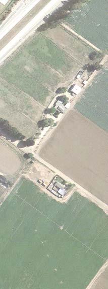
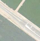


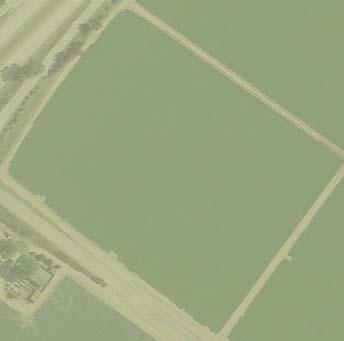
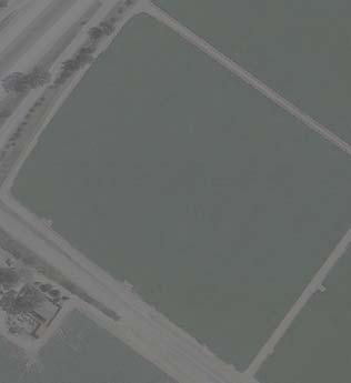

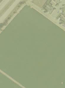
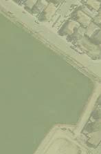


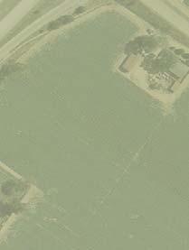


127 3rd Street Cherry Ave. City Limit Walnut Ave. Apple Ave. Las Manzanitas Dr. Pepper Dr. Apple Ave. U.S. Highway 101 4th Street Eucalyptus Dr. Palm Ave. Plan Area Boundary Habitat Types City Limits Agricultural Disturbed Developed/ Ornamental Developed/ Disturbed 400 feet Source: Google Earth 2012 Figure 8 Habitat Map Walnut Avenue Specific Plan EIR
128 3.0 IMPACTS, ANALYSIS, AND MITIGATION MEASURES This side intentionally left blank EMC PLANNING GROUP INC.
129 WALNUT AVENUE SPECIFIC PLAN EIR Reptiles typically found in agricultural lands of the Salinas River Valley include western fence lizard (Sceloporus occidentalis) and gopher snake (Pituophis catenifer). A variety of birds and mammals utilize agricultural fields as foraging areas, including red-tailed hawk (Buteo jamaicensis), American kestrel (Falco sparverius), American crow, American pipit (Anthus rubescens), coyote (Canis latrans), and house mouse (Mus musculus). Insectivorous species of birds and mammals, including Say s phoebe (Sayornis saya), western kingbird (Tyrannus verticalis), cliff swallow (Petrochelidon pyrrhonota), barn swallow (Hirundo rustica), and Brazilian free-tailed bat (Tadarida brasiliensis), forage in the air column over agricultural areas. Several species nest within, or adjacent to, agricultural fields, including ring-necked pheasant (Phasianus colchicus), killdeer (Charadrius vociferus), mourning dove (Zenaida macroura), savannah sparrow (Passerculus sandwichensis), red-winged blackbird (Agelaius phoeniceus), western meadowlark (Sturnella neglecta), Brewer s blackbird (Euphagus cyanocephalus), house finch, and lesser goldfinch (Spinus [Carduelis] psaltria). Special-Status Species A search of the California Department of Fish and Wildlife (CDFW) California Natural Diversity Database (CNDDB) for the Soledad, North Chalone Peak, Topo Valley, Paraiso Springs, Greenfield, Pinalito Canyon, Reliz Canyon, Thompson Canyon, and San Lucas USGS quadrangles was conducted in order to generate a list of potentially occurring special-status species within the project vicinity (California Department of Fish and Wildlife 2012) A compilation of federally listed species was obtained for Monterey County from the U.S. Fish and Wildlife Service (USFWS) website (USFWS 2012). Additionally, records of occurrence for special-status plants were reviewed for the quadrangles listed above in the California Native Plant Society (CNPS) Inventory of Rare and Endangered Plants (California Native Plan Society 2012). These lists are included in Appendix E, which is included on CD on the inside back cover of this EIR. Special-status species potentially occurring within the project vicinity are listed in Table 10, Special-Status Plants Potentially Occurring in the Project Vicinity, and Table 11, Special-Status Animal Potentially Occurring in the Project Vicinity, along with their listing status, habitat suitability requirements, and potential to occur on the project site. EMC PLANNING GROUP INC. 3-47
130 3.0 IMPACTS, ANALYSIS, AND MITIGATION MEASURES Table 10 Special-Status Plants Potentially Occurring in the Project Vicinity Status Species (Federal/ Habitat Description Potential to Occur on the Project Site State/Other) Butterworth's buckwheat (Eriogonum butterworthianum) Congdon s tarplant (Centromadia parryi spp. congdonii) Davidson's bush mallow (Malacothamnus davidsonii) Hickman's checkerbloom (Sidalcea hickmanii ssp. hickmanii) Hooked popcorn-flower (Plagiobothrys uncinatus) Indian Valley bush-mallow (Malacothamnus aboriginum) Jolon clarkia (Clarkia jolonensis) Lemmon's jewel-flower (Caulanthus lemmonii) Monterey spineflower (Chorizanthe pungens var. pungens) Norris' beard moss (Didymodon norrisii) Pale-yellow layia (Layia heterotricha) --/SR/1B.3 --/--/1B.2 --/--/1B.2 Sandy areas; chaparral with sandstone substrate and valley and foothill grassland; elevation m. Alkaline areas in valley and foothill grassland; elevation 1-230m. Coastal scrub, riparian woodland, chaparral, and sandy washes; elevation m. Not expected to occur. No suitable habitat present on the site. Not expected to occur. No suitable habitat present on the site. Not expected to occur. No suitable habitat present on the site. --/--/1B.3 Chaparral; elevation m. Not expected to occur. No suitable habitat present on the site. --/--/1B.2 --/--/1B.2 --/--/1B.2 --/--/1B.2 FT/--/1B.2 Chaparral (sandy), cismontane woodland, and valley and foothill grassland; elevation m. Chaparral and cismontane woodland; rocky, often burned areas; elevation m. Cismontane woodland, chaparral, and coastal scrub; elevation m. Pinyon-juniper woodland and valley and foothill grassland; elevation m. Sandy areas in chaparral (maritime), cismontane woodland, coastal dunes, coastal scrub, and valley and foothill grassland; elevation 3-450m. --/--/2.2 Cismontane woodland and lower montane coniferous forest. Found on rocks at intermittently mesic sites; elevation m. --/--/1B.1 Cismontane woodland, pinyon and juniper woodland, and valley and foothill grassland; alkaline or clay areas; elevation m. Not expected to occur. No suitable habitat present on the site. Not expected to occur. No suitable habitat present on the site. Not expected to occur. No suitable habitat present on the site. Not expected to occur. No suitable habitat present on the site. Not expected to occur. No suitable habitat present on the site. Not expected to occur. No suitable habitat present on the site. Not expected to occur. No suitable habitat present on the site EMC PLANNING GROUP INC.
131 WALNUT AVENUE PROJECT EIR Status (Federal/ State/Other) Species Habitat Description Potential to Occur on the Project Site Pinnacles buckwheat (Eriogonum nortonii) Recurved larkspur (Delphinium recurvatum) Robust spineflower (Chorizanthe robusta var. robusta) Round-leaved filaree (California macrophylla) San Francisco collinsia (Collinsia multicolor) Umbrella larkspur (Delphinium umbraculorum) --/--/1B.3 --/--/1B.2 FE/--/1B.1 --/--/1B.1 --/--/1B.2 Chaparral and valley and foothill grassland; sandy areas, often on recent burns; elevation m. Chenopod scrub, cismontane woodland, and valley and foothill grassland; alkaline areas; elevation 3-750m. Cismontane woodland (openings), coastal dunes, coastal scrub; sandy or gravelly areas; elevation 3-300m. Cismontane woodland and valley and foothill grassland; clay areas; elevation m. Closed cone coniferous forest, and coastal scrub on decomposed shale (mudstone) mixed with humus; elevation m. --/--/1B.3 Cismontane woodland; mesic sites; elevation m. Not expected to occur. No suitable habitat present on the site. Not expected to occur. No suitable habitat present on the site. Not expected to occur. No suitable habitat present on the site. Not expected to occur. No suitable habitat present on the site. Not expected to occur. No suitable habitat present on the site. Not expected to occur. No suitable habitat present on the site. Listing Status Codes: Federal (USFWS) FE - Listed as Endangered under the Federal Endangered Species Act. FT - Listed as Threatened under the Federal Endangered Species Act. State (CDFG) SE - Listed as Endangered under the California Endangered Species Act. ST - Listed as Threatened under the California Endangered Species Act. SR - Listed as Rare under the California Endangered Species Act. Other (CNPS Rare Plant Ranks and Threat Code Extensions) 1A: Plants that are considered extinct in California. 1B: Plants that are considered Rare, Threatened, or Endangered in California and elsewhere. 2: Plants that are considered Rare, Threatened, or Endangered in California, but more common elsewhere..1: Seriously endangered in California (over 80% of occurrences threatened/high degree and immediacy of threat)..2: Fairly endangered in California (20-80% occurrences threatened)..3: Not very endangered in California (<20% of occurrences threatened or no current threats known). Sources: CDFG 2012, CNPS 2012 EMC PLANNING GROUP INC. 3-49
132 3.0 IMPACTS, ANALYSIS, AND MITIGATION MEASURES Table 11 Special-Status Animals Potentially Occurring in the Project Vicinity Status Species (Federal/ State) Habitat Description Potential to Occur on the Project Site American badger (Taxidea taxus) American peregrine falcon (Falco peregrinus anatum) Bank swallow (Riparia riparia) Big-eared kangaroo rat (Dipodomys venustus elephantinus) Burrowing owl (Athene cunicularia) California condor (Gymnogyps californianus) California red-legged frog (Rana draytonii) California tiger salamander (Ambystoma californiense) Coast horned lizard (Phrynosoma blainvillii) --/SSC FD/SD and SFP --/ST --/SSC --/SSC FE/SE FT/SSC FT/ ST --/SSC Drier open stages of most shrub, forest, and herbaceous habitats, with friable soils. Need sufficient food, friable soils, and open, uncultivated ground. Prey on burrowing rodents and dig burrows. Near wetlands, lakes, rivers, or other waters. On cliffs, banks, dunes, mounds, and human-made structures. Nest consists of a scrape on a depression or ledge in an open site. Colonial nester; nests primarily in riparian and other lowland habitats west of the desert; requires vertical banks/cliffs with fine-textured sandy soils near streams, rivers, lakes, or ocean to dig nesting hole. Chaparral-covered slopes of the southern part of the Gabilan Range, in the vicinity of the Pinnacles. Forages under shrubs and in the open. Burrows for cover and for nesting. Open, dry, annual or perennial grasslands, desert or scrubland, with available burrows. Requires vast expanses of open savannah, grasslands, and foothill chaparral in mountain ranges of moderate altitude. Deep canyons containing clefts in the rocky walls provide nesting sites. Forages up to 100 miles from roost/nest. Rivers, creeks, and stock ponds with pools and overhanging vegetation. Grasslands, open oak woodlands, and seasonal pools or stock ponds in central California. Frequents a wide variety of habitats, most common in lowlands along sandy washes with scattered low bushes. Requires open areas for sunning, bushes for cover, patches of loose soil for burial, and abundant supply of ants and other insects. Not expected to occur. No suitable habitat present on the site. Not expected to occur. No suitable habitat present on the site. Not expected to occur. No suitable habitat present on the site. Not expected to occur. No suitable habitat present on the site. Not expected to occur. No suitable habitat present on the site. Not expected to occur. No suitable habitat present on the site. Not expected to occur. No suitable habitat present on the site. Not expected to occur. No suitable habitat present on the site. Not expected to occur. No suitable habitat present on the site EMC PLANNING GROUP INC.
133 WALNUT AVENUE SPECIFIC PLAN EIR Species Coast Range newt (Taricha torosa) Golden eagle (Aquila chrysaetos) Long-eared owl (Asio otus) Pallid bat (Antrozous pallidus) Salinas pocket mouse (Perognathus inornatus psammophilus) San Joaquin kit fox (Vulpes macrotis mutica) San Joaquin whipsnake (Masticophis flagellum ruddocki) Silvery legless lizard (Anniella pulchra pulchra) Steelhead south/central California coast Distinct Population Segment (DPS) (Oncorhynchus mykiss irideus) Townsend's big-eared bat (Corynorhinus townsendii) Status (Federal/ State) --/SSC --/SFP --/SSC --/SSC --/SSC FE/ST --/SSC Habitat Description Coastal drainages from Mendocino County to San Diego County. Lives in terrestrial habitats and will migrate over 1 km to breed in ponds, reservoirs, and slow-moving streams. Rolling foothill mountain areas, sage-juniper flats, and desert. Cliff-walled canyons provide nesting habitat; also uses large trees in open areas. Riparian bottomlands with tall willows and cottonwoods. Also prefers belts of live oak paralleling stream courses. Requires adjacent open land with mice and the presence of old nests of crows, hawks, or magpies for breeding. Deserts, grasslands, shrublands, woodlands and forests. Most common in open, dry habitats with rocky areas for roosting. Roosts must protect bats from high temperatures. Very sensitive to disturbance of roosting sites. Annual grassland and desert shrub communities in the Salinas Valley. Prefers fine-textured, sandy, friable soils. Burrows for cover and nesting. Annual grasslands or grassy open stages with scattered shrubby vegetation. Needs loose-textured sandy soils for burrowing, and suitable prey base. Open, dry habitats with little or no tree cover. Found in valley grassland and saltbush scrub in the San Joaquin Valley. Requires mammal burrows for refuge and egg-laying sites. Potential to Occur on the Project Site Not expected to occur. No suitable habitat present on the site. Not expected to occur. No suitable habitat present on the site. Not expected to occur. No suitable habitat present on the site. Not expected to occur. No suitable habitat present on the site. Not expected to occur. No suitable habitat present on the site. Not expected to occur. No suitable habitat present on the site. Not expected to occur. No suitable habitat present on the site. --/SSC Sandy or loose loamy soils under sparse vegetation, moist soils. Not expected to occur. No suitable habitat present on the site. FT/SSC Coastal stream with spawning gravel. Not expected to occur. No suitable habitat present on the site. --/SSC Wide variety of habitats. Most common in mesic sites. Roosts in the open, hanging from walls and ceilings. Roosting sites limiting. Extremely sensitive to human disturbance. Not expected to occur. No suitable habitat present on the site. EMC PLANNING GROUP INC. 3-51
134 3.0 IMPACTS, ANALYSIS, AND MITIGATION MEASURES Species Vernal pool fairy shrimp (Branchinecta lynchi) Western mastiff bat (Eumops perotis californicus) Western pond turtle (Actinemys [=Emys] marmorata) Western red bat (Lasiurus blossevillii) Western spadefoot (Spea hammondii) White-tailed kite (Elanus leucurus) Status (Federal/ State) FT/-- --/SSC --/SSC --/SSC --/SSC --/CFP Habitat Description Endemic to the grasslands of the Central Valley, Central Coast Mtns., and South Coast Mtns. in rain-filled pools. Inhabit small, clear-water sandstone depression pools and grassed swale, earth slump, or basalt-flow depression pools. Many open, semi-arid natural habitats, including conifer and deciduous woodlands, coastal scrub, grasslands, chaparral, etc. Roosts in crevices in cliff faces, high buildings, trees, and tunnels. Ponds, marshes, rivers, streams, and irrigation ditches with aquatic vegetation. Need basking sites and suitable upland habitat for egg-laying (sandy banks or grassy open fields). Roosts primarily in trees, 2-40 feet above the ground, in natural habitats from sea level up through mixed conifer forests. Prefers habitat edges and mosaics with trees that are protected from above and open below with open areas for foraging. Occurs primarily in grassland habitats, but can be found in valley-foothill hardwood woodlands; breeds in winter and spring (January - May) in quiet streams and temporary pools. Rolling foothills/valley margins with scattered oaks, and river bottomlands or marshes next to deciduous woodland. Open grasslands, meadows, or marshes for foraging close to isolated, dense-topped trees for nesting and perching. Potential to Occur on the Project Site Not expected to occur. No suitable habitat present on the site. Not expected to occur. No suitable habitat present on the site. Not expected to occur. No suitable habitat present on the site. Not expected to occur. No suitable habitat present on the site. Not expected to occur. No suitable habitat present on the site. Not expected to occur. No suitable habitat present on the site. Listing Status Codes: Federal (USFWS) FE - Listed as Endangered under the Federal Endangered Species Act. FT - Listed as Threatened under the Federal Endangered Species Act. FD: Delisted under the Federal Endangered Species Act. State (CDFG) SE - Listed as Endangered under the California Endangered Species Act. ST - Listed as Threatened under the California Endangered Species Act. SD: Delisted under the California Endangered Species Act. SSC: Species of Special Concern. SFP: Fully Protected species may not be taken or possessed at any time, except for permitted collection for necessary scientific research or relocation of bird species for protection of livestock. Source: CDFG EMC PLANNING GROUP INC.
135 WALNUT AVENUE SPECIFIC PLAN EIR Policy and Regulatory Setting Federal Regulations Endangered Species Act. The Endangered Species Act of 1973 protects species that the USFWS has listed as Endangered or Threatened. Permits may be required from USFWS if activities associated with a proposed project would result in the take of a federally listed species or its habitat. Under the Act, the definition of take is to harass, harm, pursue, hunt, shoot, wound, kill, trap, capture, or collect, or to attempt to engage in any such conduct. USFWS has also interpreted the definition of harm to include significant habitat modification that could result in take. Take of a listed species is prohibited unless (1) a Section 10(a) permit has been issued by the USFWS or (2) an Incidental Take Statement has been obtained through formal consultation between a federal agency and the USFWS pursuant to Section 7 of the Act. Migratory Bird Treaty Act. Migratory Bird Treaty Act of 1918, last amended in 1989, prohibits killing, possessing, or trading in migratory birds, and protects the nesting activities of native birds including common species, except in accordance with certain regulations prescribed by the Secretary of the Interior. Over 800 native nesting bird species are currently protected under the federal law. Whole birds, parts of birds, bird nests, and eggs are protected. Clean Water Act. Section 404 of the Clean Water Act (CWA) of 1972 regulates the discharge of dredge and fill material into Waters of the U.S. including wetlands. Natural drainage channels and wetlands are considered jurisdictional Waters of the U.S. The U.S. Army Corps of Engineers (USACE) is responsible for administering the 404 permit program and determines the extent of jurisdiction within drainage channels as defined by ordinary high water marks on channel banks. Wetlands are habitats with soils that are intermittently or permanently saturated, or inundated. The resulting anaerobic conditions select for plant species known as hydrophytes that show a high degree of fidelity to such soils. Wetlands are identified by the presence of hydrophytic vegetation, hydric soils (soils intermittently or permanently saturated by water), and wetland hydrology according to methodologies outlined in the 1987 Corps of Engineers Wetlands Delineation Manual and 2006 Arid West Regional Supplement. Activities that involve the discharge of fill into jurisdictional waters are subject to the permit requirements of the USACE. Discharge permits are typically issued on the condition that the project proponent agrees to provide mitigation resulting in no net loss of wetland function or value. In addition to individual discharge permits, the USACE issues nationwide permits applicable to certain activities. Under the nationwide permits, discharge of fill must be minimized to the extent practicable. EMC PLANNING GROUP INC. 3-53
136 3.0 IMPACTS, ANALYSIS, AND MITIGATION MEASURES Under Section 401 of the CWA, any activity requiring a USACE Section 404 permit must also obtain a state Water Quality Certification (or waiver thereof) to ensure that the proposed activity will meet state water quality standards. The applicable Regional Water Quality Control Board (RWQCB) is responsible for administering the water quality certification program. The RWCQB is also responsible for enforcing National Pollutant Discharge Elimination System (NPDES) permits, including the General Construction Storm Water Permit. State Regulations California Endangered Species Act. Pursuant to the California Endangered Species Act and Section 2081 of the California Fish and Game Code, an incidental take permit from the CDFW is required for projects that could result in the take of a state-listed Threatened or Endangered species. Take is defined as an activity that would directly or indirectly kill an individual of a species; take is defined in Section 86 of the California Fish and Game Code as "hunt, pursue, catch, capture, or kill, or attempt to hunt, pursue, catch, capture, or kill." If a proposed project would result in the take of a state-listed species, then a CDFW Incidental Take Permit, including the preparation of a conservation plan, would be required. Nesting Birds and Birds of Prey/Raptors. Sections 3505, , and 3800 of the California Fish and Game Code prohibit the take, possession, or destruction of birds, including their nests or eggs. Birds of prey/raptors are specifically protected in California under provisions of the California Fish and Game Code, Section This section states that it is unlawful to take, possess, or destroy any birds of prey/raptors or to take, possess, or destroy the nest or eggs of any such bird except as otherwise provided by this code. Disturbance that causes nest abandonment and/or loss of reproductive effort, such as construction during the breeding season, is considered take by the CDFW. Streambed Alterations. The CDFW has jurisdiction over the bed and bank of natural drainages according to provisions of Sections 1601 through 1603 of the California Fish and Game Code. Diversions, obstructions, or changes to the natural flow or bed, channel, or bank of any river, stream, or lake in California that support wildlife resources and/or riparian vegetation are subject to CDFW regulations. Activities that would disturb these drainages are regulated by the CDFW; authorization is required in the form of a Streambed Alteration Agreement. Such an agreement typically stipulates certain measures that will protect the habitat values of the drainage in question. California Porter-Cologne Water Quality Control Act. Under the California Porter-Cologne Water Quality Control Act, the applicable RWQCB may necessitate Waste Discharge Requirements for the fill or alteration of Waters of the State, which according to California Water Code Section includes any surface water or groundwater, including saline waters, within the boundaries of the state. The RWQCB may therefore necessitate Waste Discharge Requirements even if the affected waters are not under USACE jurisdiction EMC PLANNING GROUP INC.
137 WALNUT AVENUE SPECIFIC PLAN EIR General Plan The general plan contains biological resources Goal 7.5 to encourage preservation of important ecological and biological resources, including wildlife habitat. In support of this goal, the following general plan policies are relevant to the mitigation of potential impacts on biological resources from development projects: Policy 7.5.1: Use land use planning to reduce the impact of development on important ecological and biological resources identified during application review and analysis. Policy 7.5.2: Encourage preservation of portions of important wildlife habitats that would be disturbed by major development. Policy 7.5.3: Develop open space uses in an ecologically sensitive manner. Policy 7.5.4: Development in sensitive habitat areas should be avoided or mitigated to the maximum extent possible. Thresholds of Significance CEQA Guidelines Appendix G indicates that a project may have a significant effect on biological resources if it would: have a substantial adverse effect, either directly or through habitat modifications, on any species identified as a candidate, sensitive, or special-status species in local or regional plans, policies, or regulations, or by the California Department of Fish and Wildlife or U.S. Fish and Wildlife Service; have a substantial adverse effect on any riparian habitat or other sensitive natural community identified in local or regional plans, policies, regulations or by the California Department of Fish and Wildlife or U.S. Fish and Wildlife Service; have a substantial adverse effect on federally protected wetlands as defined by Section 404 of the Clean Water Act (including, but not limited to, marsh, vernal pool, coastal, etc.) through direct removal, filling, hydrological interruption, or other means; interfere substantially with the movement of any native resident or migratory fish or wildlife species or with established native resident or migratory wildlife corridors, or impede the use of native wildlife nursery sites; EMC PLANNING GROUP INC. 3-55
138 3.0 IMPACTS, ANALYSIS, AND MITIGATION MEASURES conflict with any local policies or ordinances protecting biological resources, such as a tree preservation policy or ordinance; or conflict with the provisions of an adopted Habitat Conservation Plan, Natural Community Conservation Plan, or other approved local, regional or state habitat conservation plan. Items Eliminated from Further Discussion Given the lack of natural plant communities and wildlife habitats at the project site and the habitat requirements of the special-status species with potential to occur in the project vicinity, no special-status species are expected to occur on the project site due to lack of suitable habitat. Also, because none are present, the proposed project would not have a substantial adverse effect on any riparian habitats or other sensitive natural communities, wetlands or waterways, or wildlife movement corridors/native wildlife nursery sites. Finally, the proposed project would not conflict with any local policies or ordinances protecting biological resources, or with the provisions of an adopted habitat conservation plan. For these reasons, no related impacts would occur and these issues are not discussed further. Impacts, Analysis, and Mitigation Measures Impact: The Proposed Project Could Result in Impacts to Protected Nesting Birds, if Present on the Site During Construction (Less than Significant with Mitigation) Discussion. Mature trees (and possibly wooden utility poles) existing on and adjacent to the project site provide suitable habitat for a variety of protected nesting birds during the nesting bird season. Therefore, construction noise and possible tree/pole removal associated with the proposed project have potential to impact nesting birds protected under the federal Migratory Bird Treaty Act and/or California Fish and Game Code. If any active nest(s) of protected bird species should occur on or adjacent to the site, then construction activities or vegetation removal, if conducted during the bird nesting season (February 1 to August 31), could result in the direct loss of nests, including eggs and young, or the abandonment of an active nest. This would be a significant impact. Implementation of mitigation measure BIO-1 would reduce this impact to a less-than-significant level. Mitigation Measure The following mitigation measure shall be incorporated into the specific plan as a new policy: 3-56 EMC PLANNING GROUP INC.
139 WALNUT AVENUE SPECIFIC PLAN EIR BIO-1. If noise generation, ground disturbance, vegetation removal, or other construction activities begin during the nesting bird season (February 1 to August 31), or if construction activities are suspended for at least two weeks and recommence during the nesting bird season, then the master or project developer shall retain a qualified biologist to conduct a pre-construction survey for nesting birds. The survey will be performed within suitable nesting habitat areas on and adjacent to the site to ensure that no active nests would be disturbed during project implementation. This survey will be conducted no more than two weeks prior to the initiation of disturbance and/or construction activities. A report documenting survey results and plan for active bird nest avoidance (if needed) will be completed by the qualified biologist and submitted to the city for review and approval prior to disturbance and/or construction activities. If no active bird nests are detected during the survey, then project activities can proceed as scheduled. However, if an active bird nest of a native species is detected during the survey, then a plan for active bird nest avoidance shall determine and clearly delineate an appropriately sized, temporary protective buffer area around each active nest, depending on the nesting bird species, existing site conditions, and type of proposed disturbance and/or construction activities. The protective buffer area around an active bird nest is typically feet, determined at the discretion of the qualified biologist and in compliance with applicable project permits. To ensure that no inadvertent impacts to an active bird nest will occur, no disturbance and/or construction activities will occur within the protective buffer area(s) until the juvenile birds have fledged (left the nest), and there is no evidence of a second attempt at nesting, as determined by the qualified biologist. The master developer and/or future individual project developers will be responsible for the implementation of this mitigation measure, subject to monitoring by the city. 3.5 CLIMATE CHANGE This section of the EIR summarizes the relevant environmental setting in terms of greenhouse gas (GHG) emissions; identifies potential climate change impacts from project implementation; and evaluates the significance of those potential impacts. This analysis is based on the results of air quality modeling using the CalEEMod emissions estimator model. The CalEEMod results are included in Appendix C along with a memo describing the data and assumptions used in the model. Additional information regarding related regulations and legislation was utilized, most notably from the California Air Resources Board (CARB) and information in the CEQA Air Quality Handbook, a Guide for Assessing the Air Quality Impacts for Projects Subject to CEQA Review (hereinafter Air Quality Guide ) (San Luis Obispo Air Pollution Control District 2012). EMC PLANNING GROUP INC. 3-57
140 3.0 IMPACTS, ANALYSIS, AND MITIGATION MEASURES No comments pertaining to climate change were received in response to the NOP. Global, National, State, and Local Environmental Setting Climate Change Science The international scientific community has concluded with a high degree of confidence that human activities are causing an accelerated warming of the atmosphere. The resulting change in climate has serious global implications and consequently, human activities that contribute to climate change may have a potentially significant effect on the environment. In recent years, concern about climate change and its potential impacts has risen dramatically. That concern has translated into a range of international treaties and national and regional agreements aimed at diminishing the rate at global warming is occurring. The federal government has begun to tackle concerns about climate change through a range of initiatives and regulatory actions. Many states and local agencies, private sector interests, and other public and private interests have also taken initiative to combat climate change. At the state level, California has taken a leadership role in tackling climate change, as evidenced by the programs outlined in the Regulatory Setting section below. Causes and Effects of Climate Change Temperatures at the Earth's surface increased by an estimated 1.4 F (0.8 C) between 1900 and The past decade was the warmest of the past 150 years and perhaps the past millennium. The warmest 23 years on record have occurred since The years of 2005 and 2010 were the warmest on record for the United States (National Oceanic and Atmospheric Administration 2011). Scientific consensus is that this warming is largely the result of emissions of carbon dioxide and other greenhouse gases from human activities including industrial processes, fossil fuel combustion, and changes in land use, such as deforestation. Unaddressed, climate change will have significant impacts across the United States and around the world. The generalized potential effects of climate change in California have been summarized by the California Environmental Protection Agency in its April 2006 report entitled, Climate Action Team Report to the Governor and the Legislature. Among the key effects are: substantially reduced availability of water supply; temperature increases projected at 8.0 to 10.4 degrees Fahrenheit under more severe emissions scenarios; exacerbation and acceleration of coastal erosion; impacts on surface water quality from seawater intrusion into the Sacramento Delta; general decline in agricultural production resulting from increased scarcity of water supply; increased vulnerability of natural areas and agricultural production from rising temperatures and increases in potential pest infestation; increased growth rates and expanded 3-58 EMC PLANNING GROUP INC.
141 WALNUT AVENUE SPECIFIC PLAN EIR ranges of weeds, insect pests, and pathogens with elevated temperatures; increased energy demand especially during hot summer months; and economic impacts resulting from reduced winter recreation. Numerous climate change models have been developed since the Climate Action Team report noted above was released in Over time, modelers have been refining the models themselves as well as the inputs to the models in an effort to more precisely project climate change impacts. For example, refined modeling of conditions in the San Francisco Bay Area conducted by Scripps Institute for Oceanography for the California Energy Commission suggests that by the end of the twenty-first century, the range of warming ranges from about 2 C to 6 C (about 3.5 F to 11 F) under one model scenario, with temperatures averaging 1.5 C greater under a second scenario (Cayan, Tyree, and Iacobellis 2012). The California Energy Commission has funded the Cal-Adapt program, which has developed on-line compendium of climate change information for California that, among other things, identifies a range of future global warming scenarios that can be accessed interactively. This information can be found at: Climate change may result in a range of consequences including the following: Unpredictable weather: The years of had the warmest global temperature ever recorded in human history, measured since Combined with longer summer seasons, increased temperatures over prolonged periods can reduce soil moisture levels, which increases the need for many emissions-producing activities such as irrigation and air conditioning, and in turn, increases demands for electrical infrastructure. Increased rate of wildfires: Wildfire risk is based on a combination of factors including precipitation, winds, temperature, and vegetation, all of which are susceptible to the impacts of increased warming. Wildfires are expected to grow in number and size throughout the state as a result of increased temperatures induced by climate change. Deteriorating public health: Heat waves are expected to have a major impact on public health as well as decreasing air quality and increasing mosquito-breeding and mosquitoborne diseases. In particular, the elderly, young, and poor, are vulnerable populations that do not have the resources to deal with the costs of health care or adapt to the changes that are expected to impact the community, and will need assistance. Decreasing supply and quality of fresh water: Warmer average global temperatures cause more rainfall than snowfall, making the winter snowfall season shorter and accelerating the rate at which the snow packs melt in the spring. A change to a liquid-precipitation system has the potential to reduce storage capacity (snowpack), water quality, and the accessibility of water for emergencies. With rain and snow events becoming less EMC PLANNING GROUP INC. 3-59
142 3.0 IMPACTS, ANALYSIS, AND MITIGATION MEASURES predictable and more variable, this could increase the rate of flooding and decrease the ability to maintain fresh water for consumption. Increased residential electricity demands for cooling: Warming temperatures are predicted to cause significant increases in residential electricity demand for cooling in summer months, especially for residential developments built in warm, inland areas. Coupled with the negative impacts of increased temperatures on electrical infrastructure and of earlier spring snowmelt on hydropower production, climate change could have significant impacts on energy supply in California. Reductions in the quality and quantity of certain agricultural products: Crops and food products that are likely to be affected include wine grapes, fruits, nuts, and milk. A rise in sea levels resulting in the displacement of coastal businesses and residences: During the past century, sea levels along California s coast have risen about 7 inches. If temperatures rise into the higher warming range, sea level is expected to rise an additional 16 to 55 inches by the end of the century. Elevations of this magnitude would inundate coastal areas with salt water, accelerate coastal erosion, threaten vital levees and inland water systems, and disrupt wetlands and natural habitats. Damage to marine ecosystems and the natural environment. A decrease in the health and productivity of California s forests. Although certain environmental effects are widely accepted to be potential hazards to certain locations, such as rising sea level for low-lying coastal areas, it is currently infeasible to predict all environmental effects of climate change on any one location, and thus would be speculative to do so. Greenhouse Gas Types Gases that trap heat in the atmosphere are called greenhouse gases. GHGs are emitted by natural processes and human activities. The human-produced GHGs most responsible for global warming and their relative contribution it are carbon dioxide, methane, nitrous oxide and chlorofluorocarbons. The contribution of these GHGs to global warming is summarized in Table 12, GHG Types and Their Contribution to Global Warming EMC PLANNING GROUP INC.
143 WALNUT AVENUE SPECIFIC PLAN EIR Table 12 GHG Types and Their Contribution to Global Warming Greenhouse Gas Percent of all GHG Typical Sources Carbon dioxide (CO2) 83.0 percent Combustion of fuels, solid waste, wood Methane (CH 4 ) 10.3 percent Fuel production/combustion; livestock, decay of organic materials Nitrous Oxide (N 2 O) 4.5 percent Combustion of fuels, solid waste; agricultural and industrial processes Chlorofluorocarbons (CFCs) 2.2 percent Industrial processes Note: Percentages reflect weighting for global warming potential. Source: United States Environmental Protection Agency 2011 Greenhouse Gas Global Warming Potentials Each type of GHG has a different capacity to trap heat in the atmosphere and each type remains in the atmosphere for a particular length of time. The ability of a GHG to trap heat is measured by an index called the global warming potential expressed as carbon dioxide equivalent. Carbon dioxide is considered the baseline GHG in this index and has a global warming potential of one. Methane has a global warming potential of 21 times that of carbon dioxide and nitrous oxide has a global warming potential of 310 times that of CO2. The families of chlorofluorocarbons, hydrofluorocarbons and perfluorocarbons have a substantially greater global warming potential than other GHGs, generally ranging from approximately 1,300 to over 10,000 times that of CO2. While CO2 represents the vast majority of the total volume of GHGs released into the atmosphere, the release of even small quantities of other types of GHGs can be significant for their contribution to climate change. The GHG volume produced by a particular source is often express in terms of carbon dioxide equivalent (CO2e). Carbon dioxide equivalent describes how much global warming a given type of GHG will cause, with the global warming potential of CO2 as the base reference. It is useful because it allows comparisons of the impact from many different GHGs, such as methane, perfluorocarbons or nitrous oxide. If a project is a source of several types of GHGs, their individual global warming potentials can be standardized and expressed in terms of CO2e. Inventories of Greenhouse Gases World/U.S. Estimates of GHG Emissions. In 2004, total worldwide GHG emissions were estimated to be 49,000 teragrams carbon dioxide equivalent (Intergovernmental Panel on Climate Change 2007). A teragram equals one million metric tons. In 2009, U.S. GHG EMC PLANNING GROUP INC. 3-61
144 3.0 IMPACTS, ANALYSIS, AND MITIGATION MEASURES emissions were 6,633.2 teragrams carbon dioxide equivalent (CO2e). GHG emissions vary annually due to factors such as weather, economic conditions, and cost of various energy sources. The highest GHG emissions year in the United States was 2007, with total emissions of 7,263 teragrams CO2e. In 1990, the year frequently used as a baseline for emissions, GHG emissions in the United States were 6,182 teragrams CO2e (United States Environmental Protection Agency 2011). California GHG Emissions Inventory. California is a substantial contributor of global greenhouse gases. Based on CARB s most recent state GHG inventory, a net of about million tons of CO2e were generated in 2010 (California Air Resources Board 2013). In 2010, about 38 percent of all GHG gases emitted in the state came from the transportation sector. Electric power generation (in state generation and out of state generation for imported electricity) and industrial uses were the second and third largest categories at about 21 percent and 19 percent, respectively. The commercial and residential use sectors combined to generate about 10 percent of the 2010 emissions, while the agricultural sector contributed about seven percent. Other sources include high global warming potential gases at about three percent and landfill waste emissions at about two percent of the total state inventory. Monterey County GHG Emissions Inventory. Greenhouse gas emissions generated in Monterey County represent a small fraction of the statewide emissions inventory. In 2006, the County conducted a GHG emissions inventory as part of its general plan update. Table in the Monterey County Draft Environmental Impact Report, Monterey County 2007 includes the results of the inventory (Jones and Stokes 2008). At that time, about 1,394,404 metric tons of CO2e was estimated to have been generated in the County. This compares to approximately 484 million metric tones of CO2e emitted in California in As with most cities and counties in the state, the primary source of GHG emissions is the transportation (cars and trucks). On-road sources of emissions accounted for about 46 percent of all emissions generated in the County. Approximately 15 percent of total emissions were created by electricity generation, 14 percent by industrial processes, 13.6 percent from combustion of natural gas, 8 percent from agricultural equipment fuel use, and 2 percent from landfill emissions. Policy and Regulatory Setting For projects being undertaken in California, the CEQA process is used as a primary tool in the analysis of climate change impacts. Federal, state, and regional policy and regulations pertaining to climate change is summarized below EMC PLANNING GROUP INC.
145 WALNUT AVENUE SPECIFIC PLAN EIR International and Federal In 1988, the United Nations and the World Meteorological Organization established the Intergovernmental Panel on Climate Change to assess the scientific, technical and socioeconomic information relevant to understanding the scientific basis of risk of humaninduced climate change, its potential impacts, and options for adaptation and mitigation. In March 1994, the United States joined a number of countries around the world in signing the United Nations Framework Convention on Climate Change. Under the Convention, governments gather and share information on GHG emissions, national policies, and best practices; launch national strategies for addressing GHG emissions and adapting to expected impacts, including the provision of financial and technological support to developing countries; and cooperate in preparing for adaptation to the impacts of climate change. The Kyoto Protocol, which went into effect in February 2005, was an outcome of the United Nations Framework Convention on Climate Change. Countries that have signed the Protocol are required to demonstrate their commitment to reduce their emissions of GHGs or engage in emissions trading. About 170 countries had, at one point, signed the Protocol. Industrialized countries are required to reduce their GHG emissions by an average of five percent below their 1990 levels by The U.S. Senate approved a non-binding Sense of the Senate resolution in July 1997 by a margin of 95-0 that expressed opposition to the treaty s provisions, most notably the disparity in GHG emissions reduction obligations between industrialized nations and developing nations. In 2001, the President indicated that he would not submit the treaty to the U.S. Senate for ratification, which effectively ended American involvement in the Kyoto Protocol. International leaders have since met periodically to address the future of international climate change commitments post-kyoto. Coinciding with the opening of the Copenhagen Climate Conference, in December 2009, the EPA issued an Endangerment Finding under Section 202(a) of the Clean Air Act, opening the door to federal regulation of GHGs. The Endangerment Finding notes that GHGs threaten public health and welfare and are subject to regulation under the Clean Air Act. The final findings were published in the Federal Register on December 15, 2009 and became effective on January 14, Federal regulation of GHGs can occur through other means, such as fuel efficiency standards. A new national policy to increase fuel economy for all new cars and trucks sold in the United States has been put into place. The new standards would cover model years 2012 through 2016, and would require an average fuel economy standard of 35.5 miles per gallon in The U.S. EPA and the National Highway Traffic Safety Administration, on behalf of the U.S. Department of Transportation, released a notice of intent to conduct joint rulemaking to establish vehicle GHG emissions and fuel economy standards in May The final standards were adopted by the U.S. EPA and the Department of Transportation on April 1, EMC PLANNING GROUP INC. 3-63
146 3.0 IMPACTS, ANALYSIS, AND MITIGATION MEASURES State of California State policy and regulatory guidance has grown out of its effort to meet goals under the landmark Global Warming Solutions Act, which was passed in Several other legislative acts, executive orders, and opinions from the California State Attorney General have provided further GHG emissions reduction guidance and reinforced CEQA as the appropriate evaluation tool for assessing climate change impacts of new development. California Assembly Bill 32. Assembly Bill 32 (AB 32), the California Global Warming Solutions Act of 2006, requires CARB to adopt rules and regulations that would achieve GHG emissions equivalent to statewide levels in 1990 by Among its key components are: Identify a list of discrete early action GHG emission reduction measures that can be implemented prior to the adoption of the statewide GHG limit and the measures required to achieve compliance with the statewide limit; Adopt a statewide GHG emissions limit that is equivalent to the 1990 level (an approximate 25 percent reduction in existing statewide GHG emissions); Adopt regulations to implement the early action GHG emission reduction measures; Adopt quantifiable, verifiable and enforceable emission reduction measures by regulation that will achieve the statewide GHG emissions limit by 2020, to become operative on January 1, 2012 at the latest; and Monitor compliance with and enforce adopted emission reduction measures. The state is continuing to work to meet the milestones for implementing AB 32. Scoping Plan. CARB s AB 32 Scoping Plan, which was adopted by CARB in December 2008, contains the main strategies California will pursue to reduce greenhouse gas by approximately 169 million metric tons by the year 2020, or a reduction of approximately 30 percent from the 2020 projected emissions level of 596 million metric tons under a business-as-usual scenario. The strategies address reduced emissions for light-duty vehicles, the Low-Carbon Fuel Standard, a range of energy efficiency measures includes building and appliance energy efficiency, increasing the percentage of electricity generated by renewable sources, and implementation of a cap-andtrade program. With regard to land use planning, the Scoping Plan expects approximately 5.0 million metric tons CO2e will be achieved associated with implementation of Senate Bill 375 (SB 375), discussed further below. AB 32 does not mandate action at the local level. However, the Scoping Plan identifies that local agencies should strive to reduce GHG emissions within their boundaries by 15 percent from 2008 levels by 2020 to help achieve emissions reductions needed to meet AB 32 goals EMC PLANNING GROUP INC.
147 WALNUT AVENUE SPECIFIC PLAN EIR Since the Scoping Plan was adopted, many of the measures included in it have been implemented or are in the process of being implemented. Among the most notable are implementation of the Low Carbon Fuel Standard and a GHG emissions cap-and-trade program. Under cap-and-trade, an overall limit on GHG emissions from capped sectors has been established and facilities subject to the cap will be able to trade permits (allowances) to emit GHGs. The program started on January 1, Enforceable compliance obligations started in The program applies to facilities that comprise 85 percent of the states GHG emissions. In August 2011, CARB released a Final Supplement to the AB 32 Scoping Plan Functional Equivalent Document (California Air Resources Board 2011). The Supplement was prepared to provide a more in-depth analysis of the five alternatives to the Scoping Plan that were originally included in that document. The supplemental analysis was conducted in response to litigation brought against CARB which challenged the adequacy of the alternatives analysis contained in the Scoping Plan. The Final Supplement includes an update of the business as usual GHG emissions projections that were contained in the Scoping Plan. The update is based on current economic conditions (including the economic downturn) and on reduction measures from the Scoping Plan that are already in place. The updated 2020 business as usual emissions forecast of 507 million metric tones CO2e is lower than that contained in the 2008 Scoping Plan. With this forecast, only a 16 percent reduction below business as usual levels would be needed to return to 1990 levels (e.g. 427 million metric tons CO2e) by California Senate Bill 97. Senate Bill 97 (SB 97), signed in August 2007, directed the California Office of Planning and Research to prepare, develop, and transmit to the Natural Resources Agency guidelines for the feasible mitigation of GHG emissions adopted those guidelines in January SB 97 also describes the CEQA process as an appropriate tool for addressing and mitigating global warming impacts from new development projects that are subject to CEQA. In 2009, the California Office of Planning and Research adopted amendments to the CEQA Guidelines as directed by SB 97. The amendments provide guidance about analysis and mitigation approaches to incorporate into environmental documents. In June 2008, the California Office of Planning and Research released a Technical Advisory entitled CEQA and Climate Change: Addressing Climate Change through California Environmental Quality Act (CEQA) Review. The California Office of Planning and Research recommended an analysis methodology that includes: 1) identifying sources of GHG emissions; 2) making a goodfaith effort to calculate, model, or estimate the amount of GHG emissions from a project, including the emissions associated with vehicular traffic, energy consumption, water usage and construction activities; 3) determining the significance of the project GHG emissions; and 4) identifying and adopting feasible mitigation measures to reduce the identified impact if it is determined to be significant. EMC PLANNING GROUP INC. 3-65
148 3.0 IMPACTS, ANALYSIS, AND MITIGATION MEASURES California Senate Bill 375. This 2008 bill sets forth a mechanism for coordinating land use and transportation on a regional level for the purpose of reducing GHGs. The focus is to reduce miles traveled by passenger vehicles and light trucks. CARB is required to set GHG reduction targets for each metropolitan region for the years 2020 and Regional organizations for each metropolitan area are responsible for working with CARB to set the reduction targets and to implement programs. SB 375 aligns the following: 1) regional transportation plans and policies; 2) housing policies and housing allocations; and 3) GHG emissions reductions for the transportation sector (passenger vehicles and light trucks). Title 24 Standards/Energy Conservation. California s Energy Efficiency Standards for Residential and Nonresidential Buildings (California Code of Regulations, Title 24, Part 6) were first established in 1978 to reduce California's energy consumption. The standards were most recently updated in January Energy efficient buildings require less electricity, natural gas, and other fuels, the use of which creates GHG emissions. California Assembly Bill No AB 1493, enacted on July 22, 2002, required the CARB to develop and adopt regulations that reduce GHGs emitted by passenger vehicles and light-duty trucks. CARB estimates that the regulation will reduce GHG emissions from the lightduty/passenger vehicle fleet by 18 percent in 2020 and by 27 percent in 2030, compared to today. Renewable Energy Legislation/Orders. The California Renewable Portfolio Standard Program, which requires electric utilities and other entities under the jurisdiction of the California Public Utilities Commission to meet 20 percent of their retail sales with renewable power by 2017, was established by SB 1078 in The renewable portfolio standard was accelerated to 20 percent by 2010 by SB 107 in The program was subsequently expanded by the renewable electricity standard approved by CARB in September 2010, requiring all utilities to meet a 33 percent target by The renewable electricity standard is projected to reduce greenhouse gas emissions from the electricity sector by at least 12 million metric tons of carbon dioxide equivalent in Executive Order S The Governor announced on June 1, 2005, through Executive Order S- 3-05, GHG emission reduction targets as follows: by 2010, reduce GHG emissions to 2000 levels; by 2020, reduce GHG emissions to 1990 levels; by 2050, reduce GHG emissions to 80 percent below 1990 levels. Some literature equates these reductions to 11 percent by 2010 and 25 percent by Executive Order S Issued on January 18, 2007, this order mandates that a statewide goal be established to reduce the carbon intensity of California s transportation fuels by at least 10 percent by 2020 and that a Low Carbon Fuel Standard for transportation fuels also be established EMC PLANNING GROUP INC.
149 WALNUT AVENUE SPECIFIC PLAN EIR Executive Order S This Executive Order enhances the state's management of climate impacts from sea level rise, increased temperatures, shifting precipitation and extreme weather events. In December 2009, the California Natural Resources Agency released the 2009 California Climate Adaptation Strategy Discussion Draft. The document provides interim guidance to state and local agencies on planning for the impacts and risks of climate change. California Green Building Standards Code. The Green Building Standards Code (CALGreen), which requires all new buildings in the state to be more energy efficient and environmentally responsible, took effect on January 1, These comprehensive regulations will achieve major reductions in greenhouse gas emissions, energy consumption and water use to create a greener California. Monterey Bay Unified Air Pollution Control District The Monterey Bay Unified Air Pollution Control District ( air district ) has been in the process of developing guidance for evaluation of GHG emissions impacts for several years. In June 2011, the air district proposed interim thresholds of significance for use in the CEQA analysis process. After release of the interim guidance, the air district consulted with various stakeholders regarding the proposed thresholds. To date, the air district has not formally adopted thresholds of significant or other district-specific guidance regarding analysis of GHG impacts as part of the CEQA process. However, air district has been informally recommending that local lead agencies consider using thresholds of significance adopted by the San Luis Obispo Air Pollution Control Districts ( SLO air district ) as described in its Air Quality Guidelines (San Luis Obispo County Air Pollution Control District 2012), until such time as the air district formally adopts its own thresholds of significance. Information about the SLO district guidelines is provided in the Thresholds of Significance section below. General Plan/City GHG Reduction Planning To date, the city has not adopted regulations or standards of significance pertaining to GHGs. Because the general plan was adopted and the general plan EIR certified before AB 32 was signed into law, neither document contains policies or impact analyses pertaining to climate change or GHGs. However the general plan does contain direction that would directly or indirectly result in reduction of mobile source GHGs from motor vehicles, which generally are the primary source of GHGs from new development projects. The city s key land use design principles include concepts for fostering compact growth, encouraging infill and development intensification, encouraging mixed-use development, ensuring access to and encouraging infrastructure for alternative transportation, and promoting a jobs-to-housing balance would reduce vehicle trip numbers and vehicle trip distances relative to past development practices in the city. EMC PLANNING GROUP INC. 3-67
150 3.0 IMPACTS, ANALYSIS, AND MITIGATION MEASURES Thresholds of Significance CEQA Guidelines Appendix G indicates that a project may have a significant effect on the environment if it would: generate a significant amount of greenhouse gas emissions, either directly or indirectly, that may have a significant impact on the environment; or conflict with an applicable plan, policy or regulation adopted for the purpose of reducing the emissions of greenhouse gases. Climate Change as a Cumulative Effect Global climate change is, as the name implies, a global phenomenon. Greenhouse gas emissions released to the atmosphere from a variety of human activities and natural processes that occur across the globe are contributing to global warming. While the U.S. emits the largest per capita volume of GHGs of any country in the world, other major countries contribute substantial volumes of emissions that continue to grow on a per capita basis. Because climate change is a global phenomenon, it is highly unlikely that any one development project located anywhere in the world would have a significant individual impact on climate change. It is the sum total of contributions of development around the world that contribute to the problem. Hence, global climate change is inherently a cumulative effect. The individual contribution of a project to GHGs in the atmosphere can generally be quantified in terms of volume of greenhouse gas emissions that it generates. However, the precise indirect effects of that contribution are difficult if not impossible to identify due to the complexity of local, regional, and global atmospheric dynamics and to the broad scale at which global warming impacts such as sea level rise, increase in weather intensity, decrease in snowpack, etc. are known to occur. Quantified Thresholds of Significance Significant Amount of GHG Emissions Though climate change is a cumulative, global issue, impacts of individual projects on climate change as assessed in the CEQA process are generally considered relative to the climate change context at the state, regional, and/or local jurisdiction boundary scale. CEQA thresholds of significance for GHG emissions address whether the incremental cumulative contribution of a specific project to GHG emissions is significant at the state, regional, and/or local scale. At the state scale, consistency with AB 32 is typically the appropriate threshold, since AB 32 is intended to reduce GHG emissions generated within the state. Where regional or local plans for reducing GHG emissions have been adopted, the thresholds contained in those plans generally serve as the appropriate threshold of significance. However, quantified thresholds of significance for 3-68 EMC PLANNING GROUP INC.
151 WALNUT AVENUE SPECIFIC PLAN EIR GHG emissions have not yet been adopted by CARB at the state level, the air district at the regional level, or the city at the local level. Despite the fact that no state, regional, or local quantified thresholds of significance have been adopted, the SLO air district has developed and adopted quantified GHG emissions thresholds of significance that can serve as de facto guidance for assessment of GHG impacts for projects in Monterey County. As noted previously, the air district has informally recommended that until it develops thresholds for projects in Monterey County, use of the SLO air district thresholds is appropriate for evaluating GHG impacts of projects within the air district boundary. The thresholds are based on an analysis methodology contained in the SLO air district s SLOAPCD Greenhouse Gas Thresholds and Supporting Evidence (San Luis Obispo Air Pollution Control District 2012). That document presents the methodology and substantial evidence used to determine the thresholds. The city has not adopted the SLO air district thresholds. They are described for informational purposes. Because of their relevance, the thresholds are used as guide for evaluating the significant of project impacts. The SLO air district s Air Quality Guide contains its GHG thresholds. One of three thresholds can be used to assess the significance of a project s GHG impacts: 1) consistency with a qualified GHG reduction plan, 2) generation of 1,150 metric tons CO2e per year or less, or 3) generation of 4.9 metric tons CO2e per service population per year. Regarding the third threshold, the service population is defined as the sum of the new resident population and new employees generated by a land use development project. A development's total GHG emissions volume is divided by the service population to yield a GHG efficiency metric that is presented in terms of metric tons of CO2e per service population per year. In the broadest context, the thresholds were established to guide development within the boundaries of the SLO air district to reduce GHG emissions consistent with the targets identified in AB 32. These thresholds provide an understanding of GHG emissions volumes above which the SLO air district has concluded, based on substantial evidence, that the contribution of GHG emissions from individual projects should be deemed significant. Applicable GHG Reduction Plan Regarding conflict with an applicable GHG reduction plan, because neither the air district nor city have yet developed a qualified plan for the purpose of reducing GHG emissions, AB 32 serves as the GHG reduction plan that has relevance to the proposed project. In the case of the SLO air district, since its thresholds were developed based on a goal to reduce emissions within its district consistent with AB 32, if a project s GHG emissions are below either of the quantified thresholds described above, the project would be considered consistent with AB 32. EMC PLANNING GROUP INC. 3-69
152 3.0 IMPACTS, ANALYSIS, AND MITIGATION MEASURES Impacts, Analysis, and Mitigation Measures Applicable Specific Plan Policies Article 2, Land Use, Development Standards, and Design Guidelines, and Article 3, Circulation Plan, of the specific plan contains the following policies and development guidance that are applicable to the discussion of climate change impacts and mitigation measures: Policy LU-6.2: Provide for a mix of land uses as prescribed within the Specific Plan and ensure that development does not exceed design capacities for residential and commercial development. Implementation Measures: 1. Ensure that land within the Plan Area is reserved for a mix of commercial, residential, and recreational/park/community amenity spaces. Policy LU-7.2: Include pedestrian linkages to existing neighborhoods. Implementation Measures: 1. Arrange land uses to provide a visual connection and a direct pathway northward from Apple Avenue to the commercial areas, both north and south of Walnut Avenue through the Plan Area. 2. Provide convenient pedestrian connections to the Plan Area from the east. 3. Design improvements to Walnut Avenue and 3rd Street to assist pedestrian crossings. Policy LU-10.1: Encourage developers to design development consistent with LEED or enhanced CALGreen standards or incorporate other sustainable features. Implementation Measures: 1. Encourage sustainability practices to be included in development plans. 2. Encourage developers and end users to establish a green image and emphasize sustainability as a part of advertising programs EMC PLANNING GROUP INC.
153 WALNUT AVENUE SPECIFIC PLAN EIR 3. Divert a minimum of 25 percent of total waste materials taken off the construction site from landfills or incinerators. Policy LU-10.2: Promote water conservation and water quality in project design. Implementation Measures: 1. Implement design guidelines relating to water conservation and water quality. 2. Design storm drainage to incorporate low impact development approaches. 3. Encourage rainwater catchment and other approaches to water conservation. Policy LU-10.3: Facilitate alternative energy sources and reduce energy use in buildings and landscapes. Implementation Measures: 1. Encourage net-zero and low energy building designs. 2. Specify the use of natural lighting within buildings. Design facilities to minimize the need for artificial lighting. Provide ample windows; light towers; light wells; dormers; skylights; or other features to enhance natural lighting. 3. Use high-efficacy lighting technologies for buildings and landscapes. 4. Utilize solar photovoltaic electric, solar water heating, ground source space heating, passive solar, and other renewable energy approaches in project designs. 5. Design structures to facilitate passive solar heating during the winter, and use cool roofs and thermal window coverings to reduce solar heat gain during the summer. 6. The developer should make photovoltaic electrical systems and solar hot water available, or facilitate future use of these technologies. Applicable to residential units and commercial facilities, the master developer and/or individual project developer(s) shall pre-plumb/prewire at least one-third of facilities for solar power and shall offer solar power as an option on all facilities. EMC PLANNING GROUP INC. 3-71
154 3.0 IMPACTS, ANALYSIS, AND MITIGATION MEASURES 7. Equip facilities with energy efficient water heaters and heat recovery drain systems. 8. Provide programmable thermostats for all space heating systems. 9. Use space heating systems with an Annual Fuel Use Efficiency (AFUE) of 95 percent or greater, seal all ducts, and insulate ducts in unconditioned spaces. 10. Design lots and structures to maximize rooftop solar energy output potential. Where feasible, roof pitches and roof orientation should be designed to maximize solar exposure to rooftop energy panels (minimum 300 square feet of unobstructed roof area facing within 30 degrees of south. 11. For residential development, covered porches more than four feet deep shall be placed only on the east, south, or west side of houses to provide shading in the summer, and to maximize northern light exposure to the interior of houses. 12. South and west-facing elevations shall be designed with roof overhangs that block summer sun from windows and allow penetration of winter sun. 13. For residential development, equip all garages/carports with a circuit suitable for electric vehicle charging. Commercial parking lots shall include electrical vehicle charging stations for a minimum of three (3) percent of the total vehicle parking capacity of the site. 14. Encourage use of non-motorized modes for transportation and transport to and within the Plan Area by providing appropriate facilities. 15. Provide communications wiring within all dwelling units to facilitate telecommuting. 16. For multi-family housing or commercial uses, the parking lot shall be shaded by either high albedo (reflective roofs), roofs with solar panels, or trees that provide a minimum of 50 percent shade within 10 years of planting. 17. Landscaping should include deciduous trees to shade south and westfacing walls in the summer and allow sunlight penetration in the winter EMC PLANNING GROUP INC.
155 WALNUT AVENUE SPECIFIC PLAN EIR 18. Promote the reduced operating costs of energy-efficient buildings to potential tenants. Policy CP-3.1: Provide street, pathway, and emergency vehicle connections to adjacent areas. Implementation Measures: 1. Integrate circulation within the Plan Area to adjacent land uses and circulation networks. Lots and streets shall be arranged to facilitate convenient pedestrian circulation within the Plan Area and adjacent locations. Policy CP-4.1: Promote a pleasant and conducive travel environment through implementation of traffic calming techniques. Policy CP-5.1: Design the circulation system to provide appropriate bicycle facilities. Policy CP-5.2: Facilitate pedestrian circulation by providing clearly identifiable pedestrian circulation routes that connect neighborhoods, parks, commercial areas, and transit stops. Policy CP-6.1: Facilitate future transit service at or adjacent to the Plan Area. GHG Analysis Methodology The determination of whether the proposed project generates a significant volume of GHG emissions that could have a significant impact on the environment is based on the project GHG emissions volumes, as calculated using CalEEMod and a comparison of the emissions volumes to the SLO air district s 4.9 metric tons CO2e/service population/year threshold of significance. The SLO air district s service population threshold is applicable to the proposed project because the project will generate new population due to the residential component, as well as new employment due to the commercial development. As noted previously, the city has not adopted a quantified threshold of significance, but use of the SLO air district service population threshold enables a useful assessment of the potential GHG impacts of the proposed project. The threshold is deemed to be an appropriate comparative threshold. To utilize the service population threshold, the projected resident population and employment generation for the proposed project must be determined. The new resident population is projected to be approximately 1,047 people. This is equivalent to the product of 220 residential EMC PLANNING GROUP INC. 3-73
156 3.0 IMPACTS, ANALYSIS, AND MITIGATION MEASURES units and the city s average of 4.76 persons per household in 2012 per the California Department of Finance (California Department of Finance 2012). It is estimated that the proposed project will generate approximately 890 new employees. While employment generation varies for different types of commercial development, it is assumed that the 445,000 square feet of commercial use will generate one job per 500 square feet of floor area. Therefore, the 1,047 residents plus 890 employees would generate a service population of 1,937. Impact: Generation of a Significant Volume of GHG Emissions (Significant and Unavoidable) Discussion. Implementation of the proposed project would generate GHG emissions both during its construction phases and operations phases. These emissions are evaluated based on CalEEMod results. Existing annual baseline GHG emissions from existing agricultural operations are then evaluated and subtracted from annual project operational emissions to arrive at a total projected project emissions volume. Construction Emissions Estimate. Table 13, Unmitigated Construction Phase GHG Emissions, shows the one-time GHG emissions from constructing both the commercial and residential portions of the project. Construction emissions total approximately 13, metric tons CO2e spread over the approximately 20-year anticipated project buildout period or about 668 metric tons CO2e per year. This value is taken from section 2.1, Overall Construction, of the CalEEMod model included in Appendix C, found on CD on the inside back cover of this EIR. CalEEMod defaults have been used for the number and type of construction equipment to be utilized during the construction process and for other construction emissions because more project specific data is not available at the current specific plan level of analysis. No construction mitigation measures were utilized to calculate a mitigated construction emissions volume. Table 13 Unmitigated Construction Phase GHG Emissions (metric tons) Bio CO2 NBio CO2 CH4 N2O CO2e Total Construction Emissions , , Source: CalEEMod, EMC Planning Group 2013 Notes: Abbreviations: CH4 methane, CO2 - carbon dioxide, N2O - nitrogen dioxide, CO2e - carbon dioxide equivalents, Annual Unmitigated Operational Emissions Estimate. Table 14, Unmitigated Operational Phase GHG Emissions, shows the annual operational emissions volume of 16, metric tons CO2e at buildout. This value is taken from section 2.2, Overall Operational, of the CalEEMod model results included in Appendix C EMC PLANNING GROUP INC.
157 WALNUT AVENUE SPECIFIC PLAN EIR Table 14 Unmitigated Operational Phase GHG Emissions (metric tons/year) Emissions Source Bio CO2 NBio CO2 CH4 N2O CO2e Area Source Energy , , Mobile Source , , Waste Water Subtotal , , Total Unmitigated Operational Emissions 16, Source: CalEEMod, EMC Planning Group 2013 Notes: Abbreviations: CH4 methane, CO2 - carbon dioxide, N2O - nitrogen dioxide, CO2e - carbon dioxide equivalents. GHG Reduction Features of the Proposed Project. GHG emissions reductions under operational conditions will be incrementally reduced by virtue of the project location and design, and due to several policies in the specific plan. A second CalEEMod run was completed to identify, at least in part, the GHG emissions volume reduction that would accrue from the project design and from incorporation of specific plan policies and implementation actions that have emission reduction benefits. The net difference between the volume of unmitigated emissions and mitigated emissions would constitute the net GHG emissions volume generated by the project. CalEEMod allows a user to activate a range of GHG reduction measures that are included in the model. If the project being modeled includes sufficient detail about the specific measures and the measures are applicable to the project type, the measures can be activated in CalEEMod and the resulting emissions reductions calculated. CalEEMod includes only those reduction measures that have to date been shown to result in reliable, quantifiable emissions reductions in the context (e.g. urban, suburban, or rural location) of a proposed project. The measures are referenced from an August 2010 publication from the California Air Pollution Control Officers Association (CAPCOA) entitled Quantifying Greenhouse Gas Mitigation Measures in which a multitude of potential GHG reduction measures and methodologies to quantify emissions reductions from each measure are identified (California Air Pollution Control Officers Association 2010). CalEEMod includes GHG reduction measures related to traffic, area source emissions, energy, water supply and conservation, and solid waste recycling. A number of the CalEEMod emission reduction measure options are valid for the proposed project. These include the following: Increased density (high-density residential development reduces emissions from vehicle trips relative to lower density development); EMC PLANNING GROUP INC. 3-75
158 3.0 IMPACTS, ANALYSIS, AND MITIGATION MEASURES Increased diversity (mix of commercial, residential, and open space/park land uses reduces vehicle trip number and vehicle miles traveled); Improved pedestrian network (incorporation of extensive pedestrian facilities, traffic calming measures, etc., facilitates walking and reduces vehicle trips and miles traveled; and Incorporation of on-site renewable (solar) energy reduces demand for electricity produced by fossil fuels. Based on specific plan policy LU-10.3, 33 percent of residential units and 33 percent of commercial square footage must be wired for solar panel installation. As a conservative approach, it is assumed, for purposes of GHG reduction calculations, that only one-third of the 33 percent of residential and commercial solar applications are actually installed. Typically, increased burning of fossil fuels in motor vehicles is the primary source of GHG emissions from new land development projects that arises from increased vehicle trips. GHG emissions reduction features/measures of a proposed project that reduce vehicle trips and/or vehicle trip lengths are often the most effective at reducing the greatest volume of emissions from such projects. For this reason, the mixed land use character of the proposed project is perhaps its most significant GHG emissions reduction feature. As described in Section 3.12, Transportation, the calculation of total vehicle trips that would be generated by the proposed project includes a significant reduction due to the mix of uses included in the specific plan. New land development projects also typically create demand for electricity from the regional electricity grid that is generated at least in part in fossil-fueled power plants. Energy consumption is typically a much lower percentage of a proposed project s overall GHG emissions inventory, but project features/measures which result in reduced electricity demand are also effective in reducing overall GHG emissions. GHG emissions reductions would also likely accrue to other development guidance identified in a number of specific plan policies and implementation measures. Most of the guidance is found in Policies LU-10.1 through LU-10.3, which promote sustainable building and site development. Examples include development to LEED and CALGreen standards, promotion of water conservation, and facilitation of alternative energy use and energy conservation. Potential GHG emission reductions from most of these measures have not been quantified for one of or more of the following reasons: 1) sufficient information about the extent to which the measures may be implemented cannot be know at the current plan versus specific project level; 2) many of the measures are recommended rather than required and their implementation is; therefore, not assured; and/or 3) the reliability of the measures for reducing GHG emissions remains insufficient to credit/quantify emissions reductions EMC PLANNING GROUP INC.
159 WALNUT AVENUE SPECIFIC PLAN EIR Table 15, Mitigated Operational Phase GHG Emissions, shows the results of the mitigated operational phase of the project as determined using CalEEMod. Table 15 Mitigated Operational Phase GHG Emissions (metric tons/year) Emissions Source Bio CO2 NBio CO2 CH4 N2O CO2e Area Source Energy , , Mobile Source , , Solid Waste Water Subtotal , , Total Mitigated Operational Emissions 12, Source: CalEEMod, EMC Planning Group 2013 Notes: Abbreviations: CH4 methane, CO2 - carbon dioxide, N2O - nitrogen dioxide, CO2e - carbon dioxide equivalents. Though not a specific feature of the specific plan, placement of a regional shopping center in Greenfield will also have benefits by making commercial uses more accessible to existing and future residents in south Monterey County. For example, to access diverse commercial retail and service opportunities, residents in Greenfield and Soledad currently often drive to Salinas, which is approximately 35 miles from Greenfield and 25 miles from Soledad. It is possible that a substantial reduction in vehicle miles traveled would result by diverting a percentage of these trips to a much closer location. It would be considered speculative to project to what degree vehicle miles would be reduced. Consequently, emissions reductions are not calculated for this aspect of the proposed project. Baseline GHG Emissions. The historical use of the project site for agricultural production has and continues to result in generation of GHG emissions. The primary source of GHG emissions is production of electrical energy needed to supply irrigation water to row crops. To estimate GHG emissions volume from this source, total annual water demand, electrical energy demand per unit volume of water demand, and a GHG emissions factor per unit of electrical energy demanded for water pumping are needed. Irrigation water demand is based on the assumption that lettuce has been grown on the site half of the time and that cauliflower and broccoli have been grown the other half of the time and that two crops per year are planted and harvested. Lettuce demands approximately 2.1 acre-feet per crop per acre and cauliflower/broccoli demand approximately 4.0 acre-feet per crop per acre. If it assumed that half of the site is used for lettuce production and half is used for cauliflower and EMC PLANNING GROUP INC. 3-77
160 3.0 IMPACTS, ANALYSIS, AND MITIGATION MEASURES broccoli production, at two crops per year each, total agricultural water demand would be approximately acre feet or 61,616,344 gallons per year. Table 16, Existing Agricultural Water Use, presents the existing water use on the project site. Table 16 Existing Agricultural Water Use Crop Acres Water Use (Acre Feet Per Crop per Acre) 1 Crops per Acre per Year Total Water Use (Acre Feet Per Year) Lettuce Broccoli/Cauliflower Total Source: EMC Planning Group Notes: 1 Water demand factors from UC Vegetable Research & Information Center. The typical energy intensity for electricity used to supply, treat, and distribute water in northern California as referenced in CAPCOA s Quantifying Greenhouse Gas Mitigation Measures (page 342) is 3,500 kwh per 1,000,000 gallons of water. Since irrigation water used at the project site is locally sourced from wells, this typically energy intensity value is likely much lower and is assumed to be 2,000 kwh per 1,000,000. Information obtained from utility providers, in this case, Pacific Gas and Electric, can be used to estimate electrical demand per unit of water demand and GHG emissions volumes per unit of energy consumed. At the estimated volume of agricultural water demand at the site, agricultural water pumping generates demand for approximately 143 megawatt hours (MWh) of electricity per year. Per Pacific Gas and Electric s Greenhouse Gas Emission Factors: Guidance for PG&E Customers, April 2013, metric tons of CO2e are produced for each MWh of electricity produced within its service area ( _factor_info_sheet.pdf). Applying this factor to the existing agricultural water pumping electricity demand yields a GHG emissions baseline of approximately 23 metric tons CO2e per year. An additional incremental volume of GHG emissions is generated from combustion of fuel in agricultural machinery used on the site. However, the emissions volume from this source is considered to be negligible. The project site is used to cultivate row crops. Row crop agriculture generally does not provide substantial potential carbon sequestration value because crops are turned over in a relatively short time period, which results in the re-release of sequestered carbon back into the soil and atmosphere. The site does not provide opportunities for significant massing of vegetation such as trees that do provide carbon sequestration value. Consequently, conversion of the project site from row crop agriculture to the proposed uses would not result in a substantial loss of carbon sequestration value EMC PLANNING GROUP INC.
161 WALNUT AVENUE SPECIFIC PLAN EIR Total Project GHG Emissions and Comparison to Operational Impact Threshold. Table 17, GHG Emissions per Service Population, summarizes total annual GHG emissions and identifies the consistency of the emissions volume with the service population threshold of significance. Table 17 Operational GHG Emissions per Service Population Emissions Source/Standard CO2e (metric tons/year) Mitigated Operational Project Emissions 12, Annual Construction Emissions (amortized over 20 years) 1 Less Existing Ag Baseline GHG Emissions Total Annual Operational GHG Emissions 13, Service Population (1,047 residents employees) = 1,937 Annual Emissions/Service Population (13,524.23/1,937) 7.00 Comparative SLO District Service Population Threshold 4.90 Emissions Exceed Threshold by 4, metric tons CO2e per year/service population Source: EMC Planning Group 2013 Notes: 1 Per SLO air district guidelines, amortized construction emissions are to be included in the total project emission volume. The actual mitigated annual operational GHG emissions would likely be incrementally lower than determined in this analysis. As part of the project design, future developers must comply with existing state regulations such as CALGreen and with city regulations such as Chapter 13.09, Mandatory Water Conservation Regulations, of the city s municipal code. Implementation of the proposed project consistent with existing standards and regulations would result in incremental GHG reductions that are not captured in the CalEEMod results. However, the reduction would be relatively minimal and would not notably reduce the mitigated emissions volume of 7.0 metric tons/service population/year shown in Table 17. Impact Conclusion. As described in the Methodology section above, evaluation of annual GHG impacts is based on comparison to the SLO air district service population threshold of significance of 4.9 metric tons CO2e/service population/year. The mitigated project s generation of 7.0 metric tons CO2e/service population/year exceeds the impact threshold by 2.1 metric tons CO2e/service population/year, or approximately 43 percent. Therefore, the proposed project contribution to the cumulative impact is considerable. EMC PLANNING GROUP INC. 3-79
162 3.0 IMPACTS, ANALYSIS, AND MITIGATION MEASURES Implementation of general plan policies and specific plan policies referenced earlier in this section that were not included as GHG reduction measures in the mitigated project CalEEMod results would further reduce the volume of GHGs generated from new development. A quantitative evaluation of the GHG emissions reductions that would accrue to these measures has not been conducted. It is unlikely that the additional measures would further substantially reduce mobile source emissions, which constitute about 79 percent of the mitigated project emissions. The additional measures primarily address energy related GHG emissions, which constitute only about 14 percent of the mitigated project emissions. Mitigation measures GHG-1 below identifies additional feasible GHG reduction measures for incorporation into the specific plan to further incrementally reduce GHG emissions. The measures would not substantially further reduce emissions volumes. It is unlikely that the annual GHG emissions volume would be reduced to below the SLO threshold of 4.9 metric tons CO2e/service population. Therefore, the project impact would be significant and unavoidable. Mitigation Measures The following mitigation measure shall be incorporated into the specific plan as a new policy: GHG-1. The master developer and/or individual project developers shall incorporate the following GHG reduction measures into new commercial and/or residential development projects within the specific plan area: Install energy efficient appliances in all commercial buildings (Energy); All commercial structures shall be constructed to exceed Title 24 energy efficiency requirements by a minimum of five percent; Commercial projects shall minimize exterior lighting requirements. Outdoor lighting should be LED or equivalent energy efficient technology and hours of outdoor lighting shall be minimized (Energy); Cool roof materials shall be utilized on commercial and residential structure roofs that are not covered by solar photovoltaic systems (Energy); Provide bicycle parking in all commercial projects and within high-density residential development (Mobile Source); Provide bicycle parking near the on-site transit facility required per specific plan Policy CP 6.1 (Mobile Source); and Provide electrified loading docks at all commercial facilities with loading docks (Mobile Source) EMC PLANNING GROUP INC.
163 WALNUT AVENUE SPECIFIC PLAN EIR The city shall ensure that the above GHG reduction measures are included in all development plans and specifications for commercial and/or residential development prior to approval of a building permit for all commercial and residential development. 3.6 CULTURAL RESOURCES The information contained within this section is based on data from the 2005 general plan and general plan EIR, and the Cultural Resource Evaluation for the Greenfield Community Park Project (Archaeological Resource Management 2012) (hereinafter cultural resources evaluation ). The cultural resource evaluation was conducted as part of the CEQA process for the city s acquisition of three-acre public park located at the southeastern corner of the specific plan project site. Environmental Setting Archaeological Resources The first settlements in the vicinity of Greenfield were small bands of nomadic Native Americans who left little or no physical traces of inhabitation in the area. According to the general plan, human occupation of the area has occurred as early as 10,000 B.C; however, recent studies conducted for specific projects in Greenfield have yielded few significant resources. Native American archaeological sites in the Greenfield area tend to be situated at the base of hills and on the valley floor near sources of water. The Salinas River and Arroyo Seco River are historically the only perennial sources of surface water in the vicinity of the city. Therefore, lands within the general plan area are considered to have a low sensitivity for presence of archaeological resources. Ethnography As reported in the general plan EIR, at the time of Euroamerican contact (ca. 1769), Native Americans identified as Salinian occupied the area from Soledad in the north to near San Luis Obispo in the south and extending from the coast to the eastern edge of the Salinas River Valley (Hester 1978). Salinian peoples spoke a Hokan language, but there is scant information concerning their culture. The major sociopolitical unit of Salinian was the village. Each village was an autonomous unit that was ruled by a chief (Hester 1978). The position of chief appears to have been patrilineal (i.e., passed from father to son). EMC PLANNING GROUP INC. 3-81
164 3.0 IMPACTS, ANALYSIS, AND MITIGATION MEASURES Salinian technology primarily highlights exploitation of terrestrial resources, although both coastal and inland groups engaged in fishing (Hester 1978). Hunting weaponry and facilities included: sinew-backed and self-bows; wooden arrow shafts; projectile points and other flaked stone tools; and nets. Salinian utilitarian tools and facilities included: baskets, both coiled and twined, for food and water collection, food storage, and food preparation; bowl mortars; pestles; metates; stone bowls; and bone awls. Clothing included tule aprons, rabbitskin or otterskin cloaks, and basket hats. Salinian generally experienced friendly relations with neighboring cultural groups such as the Yokuts to the east and Chumash to the south, but were hostile toward the Costanoans to the north. Interaction between Salinian, Yokuts, and Chumash involved trade and use of each other s territory to acquire resources. On the other hand, it appears that Salinian and Costanoans were in competition with each other regarding access to trade routes, and their interactions were generally unfriendly (Hester 1978). Cultural Resource Inventory As part of the general plan EIR analysis process, a series of records searches that had been conducted at the Northwest Regional Information Center of the California Archaeological Inventory at Sonoma State University for recent projects within the general plan planning area were reviewed. These searches were augmented by an examination of files and maps for a series of individual project sites. The records and literature searches were used to determine the presence of any previously recorded archaeological resources within the vicinity. In addition, a search of the California Inventory of Historical Resources, California Historical Landmarks, and the National Register of Historic Places was conducted, but did not reveal the presence of historic resources in the project area. The general plan EIR states that due to major land disturbance from intensive agricultural activity and distance to major water courses, the archaeological sensitivity of the area is generally low. However, subsurface archaeological resources or artifacts, including Native American artifacts, could be present in any given location due to the history and prehistory of the area. The cultural resources evaluation for the three-acre city park site found no evidence of archaeological resources on that site. As part of the evaluation, a review of records at the Northwest Information Center was conducted to determine if any known archaeological resources were reported within that site or within one-half mile of that site, which would encompass the entire specific plan area. One historic site was reported as the modern alignment of U.S. Highway 101. Another cultural resources evaluation was identified as having been conducted as part of the Thorp Annexation, which brought a portion of the specific plan area into the city limits. No cultural materials were noted within the boundaries of that project area (Archaeological Resource Management 2012) EMC PLANNING GROUP INC.
165 WALNUT AVENUE SPECIFIC PLAN EIR Historic Resources According to the general plan EIR, there are no officially designated historic structures in Greenfield, although there are numerous buildings, primarily in the old town area, eligible for such designation or listing. As part of the general plan EIR analysis, a search of the California Inventory of Historical Resources, California Historical Landmarks, and the National Register of Historic Places did not reveal the presence of recorded historic resources within the general plan planning area boundary. The project site includes two residential structures, once of which is located on the three-acre city park site and which has been evaluated in a separate CEQA process for that project to determine its status as a potentially historic resource. The structure was built in 1905 and determined to be potentially eligible for the California Register of Historical Resources. The city s preliminary plan for development of the park site would retain the structure as is for integration into the functions of the park. Hence, no impact to the structure would occur. The second residence and its associated outbuildings are located along the north side of Walnut Avenue. A determination of the potential historical significance of these structures has not been conducted to date. From visual assessment, the structures do not appear to be of significant age or unique historic character. Paleontological Resources Significant paleontological resources are fossils or assemblages of fossils that are unique, unusual, rare, and uncommon. Most of the fossils found in Monterey County are of marine life forms. Fossils are found throughout the County because of the widespread distribution of marine deposits. Twelve fossil sites have been identified as having outstanding scientific value. The general locations of these sites are illustrated on Exhibit , Paleontological Resources, of the Monterey County General Plan Draft Environmental Impact Report (Jones and Stokes 2007). None of these sites are located in the vicinity of the specific plan area. A search of the University of California Museum of Paleontology Paleontological Collections Database for Monterey County ( revealed that most of the known fossil localities are within one of several types of geologic formations, none of which are found in the specific plan area. The agricultural soils in the Salinas Valley are generally formed on deep alluvium that is relatively young in geologic time, having likely been deposited in the last 10,000 years. To be considered a fossil, an object must be more than 10,000 years old. Consequently, it is unlikely that fossils would be found during subsurface excavation activities associated with the proposed project. EMC PLANNING GROUP INC. 3-83
166 3.0 IMPACTS, ANALYSIS, AND MITIGATION MEASURES Policy and Regulatory Setting Federal Plans and Regulations National Historic Criteria. Federal regulations for cultural resources are primarily governed by section 106 of the National Historic Preservation Act of 1966, which applies to actions taken by federal agencies, such as approval of section 404 permits for fill of wetlands. The National Register of Historic Places (NRHP) was established to recognize resources associated with the accomplishments of all peoples who have contributed to the country's history and heritage. Guidelines were designed for federal and state agencies in nominating cultural resources to the national register. These guidelines are based upon integrity and significance of the resource. Integrity applies to specific items such as location, design, setting, materials, workmanship, feeling, and association. Integrity is defined in Bulletin 15: How to Apply the National Register Criteria for Evaluation, (U.S. Department of the Interior, National Park Service 1982) as: The authenticity of a property's historic identity, evidenced by the survival of physical characteristics that existed during the property s historic or prehistoric period. If a property retains the physical characteristics it possessed in the past then it has the capacity to convey association with historical patterns or persons, architectural or engineering design and technology, or information about a culture or peoples. Quality of significance in American history, architecture, archaeology, engineering and culture is present in resources that possess integrity of location, design, setting, materials, workmanship, feeling, and association, and the resources meet at least one of the following criteria: a. are associated with events that have made a significant contribution to broad patterns of our history; b. are associated with the lives of persons significant in our past; c. embody distinctive characteristics of type, period, or method of construction, or that represent the work of master, or that possess high artistic values, or that represent a significant and distinguishable entity whose components may lack individual distinction; and d. have yielded, or are likely to yield, information important in prehistory or history EMC PLANNING GROUP INC.
167 WALNUT AVENUE SPECIFIC PLAN EIR State Plans and Regulations CEQA Guidelines Section Under CEQA, public agencies must consider the effects of their actions on both historical resources and unique archeological resources. CEQA Guidelines section (a)(i) defines a historical resource as, among other things, a resource listed or eligible for listing on the California Register of Historical Resources. In addition, a resource is presumed to constitute an historical resource if it is included in a local register of historical resources unless the preponderance of evidence demonstrates that it is not historically or culturally significant (CEQA Guidelines, section (a)(2)). CEQA Guidelines section (b)(2) describes a historic resource as being materially impaired when a project demolishes or materially alters in an adverse manner those physical characteristics of an historical resource that convey its historical significance and that justify its inclusion in, or eligibility for inclusion in either, the California Register of Historic Resources, a local register of historic resources, or a historical resources survey. Under CEQA, a unique archaeological resource is defined as an archaeological artifact, object, or site about which it can be clearly demonstrated that, without merely adding to the current body of knowledge, there is a high probability that it meets any of the following criteria: 1) contains information needed to answer important scientific research questions and that there is a demonstrable public interest in that information; 2) has a special and particular quality such as being the oldest of its type or the best available example of its type; or 3) is directly associated with a scientifically recognized important prehistoric or historic event or person (Public Resources Code, section (h)). If an archaeological site does not meet the criteria for inclusion on the California Register of Historical Resources but does meet the definition of a unique archeological resource as outlined in the Public Resource Code section , it is entitled to special protection or attention under CEQA. Treatment options under section include activities that preserve such resources in place in an undisturbed state. Other acceptable methods of mitigation under section include excavation and curation or study in place without excavation and curation. CEQA Guidelines section (e) and section of the California Health and Safety Code require that construction or excavation be stopped in the vicinity of discovered human remains until the county coroner has been informed and has determined that: 1) no investigation of the cause of death is required; and 2) whether the remains are of Native American origin. CEQA Guidelines section also specifies procedures to be followed in case of the discovery of human remains on non-federal land. These procedures include appropriate and dignified treatment of human remains and associated grave goods, and may include reburial on the site in an area free from disturbance. The disposition of Native American burials falls within the jurisdiction of the Native American Heritage Commission. EMC PLANNING GROUP INC. 3-85
168 3.0 IMPACTS, ANALYSIS, AND MITIGATION MEASURES State Historic Criteria. A cultural resource is considered significant if it qualifies as eligible for listing in the California Register of Historical Resources. Properties that are eligible for listing in the California Register of Historical Resources must meet one or more of the following criteria: a. Associated with events that have made a significant contribution to the broad patterns of local or regional history or the cultural heritage of California or the United States; b. Associated with the lives of persons important to local, California or national history; c. Embodies the distinctive characteristics of a type, period, region or method of construction or represents the work of a master or possesses high artistic values; and/or d. Has yielded, or has the potential to yield, information important to the prehistory or history of the local area, California or the nation. A property may be automatically listed in the California Register of Historical Resources if it is formally determined eligible for the National Register of Historic Places. Properties that are formally determined eligible for the National Register of Historic Places are those that are designated as such through one of the federal preservation programs administered by the California Office of Historic Preservation. The California Register of Historical Resources interprets the integrity of a cultural resource based upon its physical authenticity. A historic cultural resource must retain its historic character or appearance and thus be recognizable as a historic resource. Integrity is evaluated by examining the subject s location, design, setting, materials, workmanship, feeling, and association. If the subject has retained these qualities, it may be said to have integrity. It is possible that a cultural resource may not retain sufficient integrity to be listed in the National Register of Historic Places yet still be eligible for listing in the California Register of Historical Resources. If a cultural resource retains the potential to convey significant historical/scientific data, it may be said to retain sufficient integrity for potential listing in the California Register of Historical Resources. General Plan The general plan contains a series of goals, policies and programs for encouraging the preservation of cultural resources within the city. These policies are as follows: Policy 7.6.1: Preserve areas that have identifiable and important archaeological or paleontological significance EMC PLANNING GROUP INC.
169 WALNUT AVENUE SPECIFIC PLAN EIR Program 7.6.A: Adopt the following conditions on all discretionary projects regarding the discovery of archaeological or paleontological resources: i. The Planning Department shall be notified immediately if any prehistoric, archaeological, or paleontology artifact is uncovered during construction. All construction must stop and an archaeologist that meets the Secretary of the Interior s Professional Qualifications Standards in prehistoric or historical archaeology shall be retained to evaluate the finds and recommend appropriate action. ii. All construction must stop and the authorities notified if any human remains are uncovered. The County Coroner must be notified according to Section of California s Health and Safety Code. If the remains are determined to be Native American, the procedures outlined in CEQA Section (d) and (e) shall be followed. Policy 7.7.1: Promote the compatibility of new development located adjacent to existing structures of historic significance with the architecture and site development of the historic structure. Policy 7.7.2: Respect the character of the building and it s setting during the remodeling and renovation of facades of historic buildings. Policy 7.7.3: Encourage the use of the State Historic Building Code for historic buildings and other structures that contribute to the City s historic character. Policy 7.7.4: Recognize the value of Greenfield s historic resources as an economic development tool. Policy 7.7.5: Preserve the integrity of historic structures and the parcels on which they are located by properly implementing applicable design, building, and fire codes. Policy 7.7.6: Work with property owners to preserve historic features within the community. Policy 7.7.7: Encourage owners of eligible historic properties to apply for State and Federal registration of these sites and to participate in tax incentive programs for historic restoration. EMC PLANNING GROUP INC. 3-87
170 3.0 IMPACTS, ANALYSIS, AND MITIGATION MEASURES Program 7.7.A: Identify funding mechanisms, including funding from the City to the extent possible, to support programs to preserve, restore, and enhance unique historic sites. Program 7.7.B: For structures that potentially have historic significance, a study conducted by a professional historian shall be prepared to determine the actual significance of the structure and potential impacts of the proposed development. Thresholds of Significance CEQA Guidelines appendix G indicates that a project may have a significant effect on the environment if it would: cause a substantial adverse change in the significance of a historical resource as defined in CEQA Guidelines Section ; cause a substantial adverse change in the significance of an archaeological resource pursuant to CEQA Guidelines Section ; directly or indirectly destroy a unique paleontological resource or site or unique geologic feature; and/or disturb any human remains, including those interred outside of formal cemeteries. Items Eliminated from Further Discussion The proposed project site is not expected to contain paleontological resources. Therefore, the proposed project would not have an adverse impact on such resources and this issue is not discussed further. Impacts, Analysis, and Mitigation Measures Impact: Substantial Adverse Change in the Significance of a Historical Resource (Less than Significant with Mitigation) Discussion. With one possible exception, the portion of the specific plan area to be developed per the specific plan does not appear to contain historic resources. The potential exception is the residential structure and associated outbuildings that are located northern of Walnut Avenue. It is assumed that these structures would be removed in order to develop Area 4 of the specific plan area as shown on Figure 5, Conceptual Land Use Plan. To avoid significant impacts to a 3-88 EMC PLANNING GROUP INC.
171 WALNUT AVENUE SPECIFIC PLAN EIR potential historic resource, a historic resources evaluation of these structures must be conducted prior to development of Area 4. Implementation of mitigation measure CR-1 below would reduce this potential impact to a less-than-significant level. The mitigation measure is consistent with the intent of general plan policies and regarding protection of cultural resources. Impact: Substantial Adverse Change in the Significance of an Archaeological Resource/Disturbance of Human Remains (Less than Significant with Mitigation) Discussion. Based on information contained in the general plan EIR, visual survey of the specific plan area, and information contained in the Cultural Resource Evaluation for the Greenfield Community Park Project, there is a low potential for the specific plan area to contain archeological resources or human remains. However, earth disturbing activities conducted as part of the development of the specific plan area could uncover and damage previously undiscovered subsurface resources/remains should they be present. Implementation of mitigation measures CR-2 and CR-3 would ensure that resources, if uncovered, are appropriately identified and treated such that potential impacts are reduced to less than significant. These mitigation measures are consistent with the intent of general plan policies and regarding protection of cultural resources. Mitigation Measures The following mitigation measures shall be incorporated into the specific plan as new policies: CR-1. Prior to any modification to the residential structure and associated outbuildings located within Area 4 of the project site, the master developer and/or future individual project developer proposing development of Area 4 shall retain a qualified cultural resources historian to conduct a historic evaluation of the structures to determine their potential significance as historical resources. If the structures are not found to be historically significant, the structures may be removed and development of the site on which the structures are located may proceed. If the structures are found to be historically significant, the master developer and/or future individual project developer shall consult with the city and cultural resource historian to determine an appropriate course of action that would mitigate potential impacts on the structures to less than significant. Actions needed for this purpose shall be included as conditions of approval of any discretionary permit for development of the site. If significant impacts cannot be mitigated to less than significant, additional CEQA documentation may be required for the subject development project. CR-2. Due to the possibility that significant buried cultural resources could be found during construction, the master developer and/or future individual project developers shall include the following language in all construction documents subject to review and verification by the City Public Works Director: EMC PLANNING GROUP INC. 3-89
172 3.0 IMPACTS, ANALYSIS, AND MITIGATION MEASURES If archaeological resources or human remains are discovered during construction, work shall be halted at a minimum of 150 feet from the find and the area shall be staked off. The city shall notify a qualified professional archaeologist. If the find is determined to be significant, appropriate mitigation measures shall be formulated and implemented. CR-3. In the event of an accidental discovery or recognition of any human remains during construction, the master developer and/or future individual project developers shall include the following language in all construction documents subject to review and verification by the City Public Works Director: If human remains are found during construction there shall be no further excavation or disturbance of the site or any nearby area reasonably suspected to overlie adjacent human remains until the coroner of Monterey County is contacted to determine that no investigation of the cause of death is required. If the coroner determines the remains to be Native American the coroner shall contact the Native American Heritage Commission within 24 hours. The Native American Heritage Commission shall identify the person or persons it believes to be the most likely descendent (MLD) from the deceased Native American. The MLD may then make recommendations to the city or the person responsible for the excavation work, for means of treating or disposing of, with appropriate dignity, the human remains and associated grave goods as provided in Public Resources Code Section The city or it s authorized representative shall rebury the Native American human remains and associated grave goods with appropriate dignity on the property in a location not subject to further disturbance if: a) the Native American Heritage Commission is unable to identify a MLD or the MLD failed to make a recommendation within 24 hours after being notified by the commission; b) the descendent identified fails to make a recommendation; or c) the city or it s authorized representative rejects the recommendation of the descendent, and the mediation by the Native American Heritage Commission fails to provide measures acceptable to the landowner. 3.7 GEOLOGY AND SOILS This section assesses the existing geology and soils conditions of the project site and potential changes that would result from reasonably foreseeable future development of the project site consistent with the proposed specific plan. The information presented in this section is based primarily the general plan and general plan EIR, the Soil Survey of Monterey County (United States Department of Agriculture 1978), the engineer s report contained in Appendix E of the specific plan, field observations, and policies in the proposed specific plan. No comments on geologic issues were received by the city as part of the NOP process EMC PLANNING GROUP INC.
173 WALNUT AVENUE SPECIFIC PLAN EIR Environmental Setting Regional Geology, Earthquake Faults, and Seismicity Geology in the project region is dominated by a complex system of strike-slip faults associated with transform motion between the Pacific and North American crustal plates. The San Andreas Fault is the most important among the strike-slip faults. It forms a boundary between the North American and Pacific crustal plates and separates major basement assemblages, with granitic and metamorphic basement rocks of the Salinian Block to the southwest and Franciscan Formation to the northeast of the fault, respectively. The region is highly active tectonically and includes other active strike-slip faults, as well as active folding and thrust faulting associated with convergence of the North American and Pacific tectonic plates at the continental margin. Located in the Coast Ranges Geomorphic Province of California, the broad and primarily flat Salinas Valley is bounded by the Santa Lucia Range on the southwest and the Gabilan Range on the northeast. The orientation of these topographic features parallels the region s northwest trending structural grain. The majority of the Greenfield general plan planning area is comprised of Quaternary alluvial deposits. The sediments, which consist of sands, gravels and clays, are fluvial deposits derived from the Salinas River and Arroyo Seco Creek and alluvial fan deposits emanating from the Santa Lucia Range (City of Greenfield 2005). Central coastal California's system of faults has a complex history of movement over the past 15 to 20 million years. The most important fault in the region is the San Andreas Fault that has moved repeatedly during Holocene time, approximately the last 11,000 years, and is therefore, considered active. Historic earthquakes along the San Andreas Fault and its eastern branches have caused significant seismic shaking in the region. There were large earthquakes along the San Andreas Fault in 1838, 1865, 1890, 1906, and The most intense earthquake to have affected this area was the 1906 San Francisco Earthquake. This temblor, with a Richter magnitude of greater than 8, was centered in Marin County and caused severe seismic shaking and structural damage to many buildings throughout northern California, including Santa Cruz and Monterey counties. The 1989 Richter magnitude 7.1 Loma Prieta Earthquake caused seismic shaking as intense as that of 1906 in parts of the Santa Cruz Mountains, although its regional effects were not nearly as extensive as the 1906 San Francisco Earthquake. The epicenter was in Santa Cruz County. The rupture surface was approximately 26 miles long, and ranged in depth from about three to 11.5 miles. The Central Salinas Valley is bordered on the east by the San Andreas Fault. Because of the likelihood of an earthquake along its length, the San Andreas has been classified as an active fault as per the Alquist-Priolo Special Studies Zones Act of Many faults not classified as EMC PLANNING GROUP INC. 3-91
174 3.0 IMPACTS, ANALYSIS, AND MITIGATION MEASURES active by the Alquist-Priolo Act are still considered by geologists to be active and capable of inflicting severe loss of life and property (City of Greenfield 2005). The closest potentially active fault to the City is the Reliz/Rinconada Fault. No known historical earthquakes have occurred on this fault; however, according to the general plan, evidence exists of late Quaternary activity. A maximum expected magnitude earthquake of 7.3 on the Richter scale has been attributed to this fault (see page 8-19 of the general plan). Historical data regarding seismically induced ground failures in northern California shows no recorded ground failures within the City of Greenfield. Table 18, Earthquake Faults, summarizes active and potentially active faults near the city. Table 18 Earthquake Faults Fault Distance From Greenfield (Miles) Fault Length (Miles) Maximum Magnitude Rinconada Reliez/Rinconada San Andreas (Creeping) Monterey Bay-Tularcitos Calaveras (Southern) Hosgri Quien Sabe Palo Colorado-Sur Ortigalita Zayante-Vergeles Source: City of Greenfield General Plan 2005 Faults in the vicinity of Greenfield also are shown in general plan Figure 8-1, Regional Fault Map. Although Greenfield is located in a region that is seismically active, there are no known active faults within the city, nor does the city fall within the area mapped as a result of the Alquist-Priolo Special Studies Earthquake Fault Zone Act of Intensity Criteria for Earthquakes Earthquake magnitude is a measure of the total amount of energy released in an earthquake. With increasing magnitude (i.e., larger earthquakes), ground motions are stronger, last longer, and are felt over larger areas. Earthquake intensity is a measure of the effects of earthquake ground motions on people and buildings. Earthquake intensity is often more useful than magnitude when discussing the damaging effects of earthquakes. The most common intensity scale is the Modified Mercalli Intensity Scale, which ranges from I to XII. Table 19, Modified 3-92 EMC PLANNING GROUP INC.
175 WALNUT AVENUE SPECIFIC PLAN EIR Mercalli Intensity Scale for Earthquakes, describes the effects of earthquakes and compares the Richter Scale (magnitude) to the Modified Mercalli Scale (intensity). Table 19 Modified Mercalli Intensity Scale for Earthquakes Richter Magnitude Scale Modified Mercalli Scale Effects of Intensity I Earthquake shaking not felt II Shaking felt by those at rest III Felt by most people indoors; some can estimate duration of shaking IV Felt by most people indoors. Hanging objects rattle, wooden walls, frames creak V Felt by everyone indoors; many estimate duration of shaking. Standing autos rock. Crockery clashes, dishes and glasses rattle. Doors open, close and swing VI Felt by all; many frightened and run outdoors. Some heavy furniture moved; a few instances of fallen plaster or damaged chimneys. Damage slight. 6.0 VII People frightened and walls unsteady. Pictures and books thrown, dishes/glass is broken. Weak chimneys break. Plaster, loose bricks and parapets fall VIII Difficult to stand, waves on ponds, cohesionless soils slump. Stucco and masonry walls fall. Chimneys, stacks, towers, elevated tanks twist and fall. 7.0 IX General fright as people are thrown down. Hard to drive, trees broken, damage to foundations and frames. Reservoirs damaged, underground pipelines break X General panic, ground cracks, masonry and frame buildings destroyed. Bridges destroyed, dams, dikes and embankments damaged. Railroads bent. 8.0 XI Large landslides, water thrown, general destruction of buildings; pipelines destroyed; railroads bent XII Total nearby damage, rock masses displaced. Lines of sight/level distorted. Objects thrown into air. Source: USGS 2013 Risks of Seismic Effects As noted previously, there are no known active faults within the city; risks of fault rupture on the project site are extremely low. The risks of injury or damage from other seismic hazards were reviewed in the general plan EIR. The EIR determined that future development associated with general plan buildout conditions could result in increased exposure to seismic effects such as ground shaking, ground failure and liquefaction. A brief description of these seismic effects is provided below. Ground Shaking. Ground shaking is the most obvious and widespread evidence of earthquakes, and has potential to occur on the site due to a possible future earthquake. The duration of strong shaking is dependent on magnitude. Due to its location in an alluvium-filled valley, the ground around the city would be expected to respond strongly to seismic waves generated by an EMC PLANNING GROUP INC. 3-93
176 3.0 IMPACTS, ANALYSIS, AND MITIGATION MEASURES earthquake. The size of the earthquake, distance to the fault that generated the earthquake, and the geology of the site determine the severity of ground shaking. Thick, loose materials tend to amplify and prolong the ground shaking during an event whereas dense materials such as bedrock tend to minimize the effects of ground shaking. Areas underlain by firm, dry alluvium are considered to possess moderate damage susceptibility (City of Greenfield 2005). According to the general plan EIR, the city can expect to experience moderate to severe ground shaking in the event of a major earthquake exposure to severe seismic ground shaking is identified as a potentially significant impact of future development. The EIR concluded that implementation of general plan health and safety element policies and programs would reduce the potential impacts of seismic ground shaking to a less-than-significant level. The general plan policies are presented in the Regulatory and Policy Setting discussion later in this section. Seismic Ground Failure. Seismic ground failure induced by seismic shaking includes ground cracking, settlement, and landsliding. Seismically induced landslides would not occur on the project site given its flat topography. The general plan EIR identified settlement as a potentially significant ground failure hazard within the city. Seismically induced settlement can occur due to consolidation of loose, granular soils above the water table during strong seismic shaking. Liquefaction. Liquefaction can occur when generally loose, saturated, cohesionless soils (i.e., poorly graded sands or sandy layers within fine-grained floodplain or slough deposits) consolidate under the effects of seismic shaking and lose shear strength, causing them to behave like a liquid. Ground deformation accompanying liquefaction may occur as differential settlement, lurch cracking, or lateral spreading. Differential settlement occurs because of compaction and/or flowage of liquefied materials at depth. Due to natural variations in the liquefied sediments, the soil may settle more in certain areas than in others, which can tip buildings out of level and crack foundations. Lurch cracking is caused by liquefaction and differential settlement of the earth materials underlying a relatively rigid, un-liquefied surface layer. The lurch cracks form where the surface layer breaks up into large blocks that tip and rotate due to flowage of the underlying liquefied soils. Lateral spreading occurs when relatively flat-lying liquefiable materials are permitted to flow laterally by a "free face" bounding the materials on one side. A "free face" is a cliff or embankment that permits the liquefied soils to flow out of slope. The general plan EIR identified liquefaction-related ground failure hazards within the city as potentially significant depending on conditions within individual development locations EMC PLANNING GROUP INC.
177 WALNUT AVENUE SPECIFIC PLAN EIR Project Site Topography and Soils Topographical conditions within the specific plan area are described in the engineer s report included in Appendix E of the specific plan. Existing site topography is relatively flat, with a slope of less than one percent from west to east towards 3rd Street. The lowest elevation occurs near the intersection of 3rd Street and Apple Avenue. The topography of adjacent properties is similar. According to the U.S. Department of Agriculture (United States Department of Agriculture) online websoil survey, the project site contains two soil types, Arroyo Seco gravelly loam and Elder sandy loam (United States Department of Agriculture 2013). The soil types are illustrated in Figure 9, Site Soils. The Soil Survey of Monterey County, California (United States Department of Agriculture 1978) describes these two soil types as follows: Arroyo Seco gravelly loam. This soil type is found on nearly level slopes (zero to two percent) slopes) and was formed from granitic alluvium on alluvial fans. Soil permeability is moderately rapid, and the available water holding capacity is five to seven inches. Runoff is slow. Arroyo Seco gravelly loam soils are primarily used for irrigated row and field crops, dryland pasture, and dryfarmed grain. This soil type occurs in a very small area at the southeast corner of the specific plan area within the boundary of the city s three-acre neighborhood park site. Any constraints for construction on this soil type would not be an issue for development of commercial, residential, or other open space uses proposed in the specific plan. Elder sandy loam. The remainder of the project site consists primarily of Elder sandy loam soil. Soils of this series are found on nearly level slopes (0 to 2 percent slopes) and are generally located on alluvial fans and plains. Soil permeability is considered moderate, and the available water holding capacity is six to nine inches. Runoff is slow. Elder sandy loam soils are primarily used for irrigated field and row crops. Erosion Potential/Expansive Soils Based on the moderate to moderately rapid soil permeability and site topography, the erosion potential for the Elder sandy loam soil is limited. On flat terrain, soil erosion is most likely to occur during the construction process when soils exposed by grading, excavation, trenching, etc. are exposed to the erosive effects of wind and storm water. Construction on soils with high shrink-swell potential can result in damage to buildings, pavements and utilities due to differential settlement. The Elder sandy loam soil type contains very little clay. The higher the soil clay content, the higher the potential for a soil to expand and contract. EMC PLANNING GROUP INC. 3-95
178 3.0 IMPACTS, ANALYSIS, AND MITIGATION MEASURES Regulatory and Policy Setting California and Uniform Building Codes The California Building Code (Title 24 of the California Code of Regulations) and the Uniform Building Code provide standards for testing and building construction as well as safety measures for development within earthquake prone areas. The project site is located within Seismic Zone 4, which is expected to experience the greatest effects from earthquakes, and which requires the most stringent standards for seismic design. Alquist-Priolo Earthquake Fault Zoning Act The Alquist-Priolo Earthquake Fault Zoning Act (Pub. Res. Code Division 2, Chapter 7.5, commencing with Section 2621) was passed in 1972 to mitigate the hazard of surface faulting to structures for human occupancy. The Alquist-Priolo Act s main purpose is to prevent the construction of buildings used for human occupancy on the surface trace of active faults. The Act only addresses the hazard of surface fault rupture and is not directed toward other earthquake hazards. General Plan The general plan contains a series of goals, policies and programs for reducing risks from seismic and geologic hazards within the city. These policies are as follows: Policy 8.1.1: Existing and new buildings, structures, and walls within the City shall meet minimum seismic safety standards. Policy 8.1.2: Projects within areas of potential significant seismic activity shall provide detailed geologic, geologic-seismic and soils studies by a Registered Geologist (RG), Certified Engineering Geologist (CEG), and/or Geotechnical Engineer to evaluate geologic-seismic and soils conditions, as well as ground shaking and liquefaction potential. Policy 8.1.3: The development of structures in areas of high liquefaction potential shall be contingent on geologic and engineering studies which: 1) define and delineate potentially hazardous geologic and/or soils conditions, 2) recommend means of mitigating these adverse conditions; and 3) provide implementation of the mitigation measures EMC PLANNING GROUP INC.


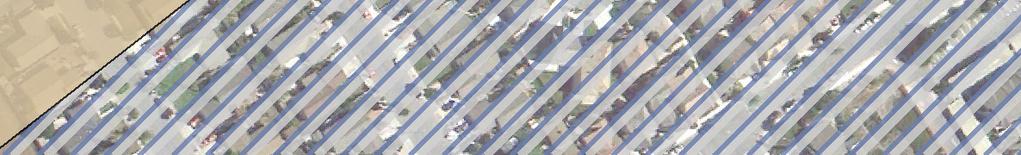


179 Ch err. ve A y 3 rd St. W ut aln e Av g Hi S. U. hw ay 1 10 pl Ap. ve A e 4th St. Plan Area Boundary Soils Arroyo Seco Gravelly Sandy Loam, 0 to 2 percent slopes Elder Loam, Gravelly Substratum, 0 to 2 percent slopes Elder Sandy Loam, 0 to 2 Percent Slopes feet Source: Natural Resources Conservation Service 2013, Google Earth 2012 Figure 9 Site Soils Walnut Avenue Specific Plan EIR