Pierce County Islands and the Head of Lake Pepin
|
|
|
- Jayson Collins
- 5 years ago
- Views:
Transcription


1 Pierce County Islands and the Head of Lake Pepin CAP Section Beneficial Use of Dredged Material Public Meeting and Open House St. James Hotel April 4, 2018 US Army Corps of Engineers 1
2 What this is and what it isn t Upper Pool 4 Section 204 Beneficial Use of Dredge material - sand Lower Pool 4 DMMP 40 year plan to place sand

3 Present Section 204 Upper Pool 4 Study Alternatives Meeting Purpose Solicit public input Address questions & concerns
4 Participating Entities Wisconsin Minnesota Lake Pepin Legacy Alliance Audubon Ducks Unlimited US Fish and Wildlife Service Public Industry NGO s City of Red Wing Stakeholders


5 Study Authority Authorized under Section 204 of the Water Resources Development Act of 1992 Restore, protect, and create aquatic and wetland habitats in connection with maintenance dredge of an authorized project
6 Section 204 Beneficial use of Dredged Material Benefits must exceed the project costs incurred Project must be environmentally acceptable and complete $10M max Federal contribution per project. Cost share for feasibility is 100% Federal then 65% Fed/ 35% Sponsor for Design and Construction.


7 Location: River Mile 780 and 792 in the backwater complexes adjacent to the main channel. PROJECT LOCATION 7

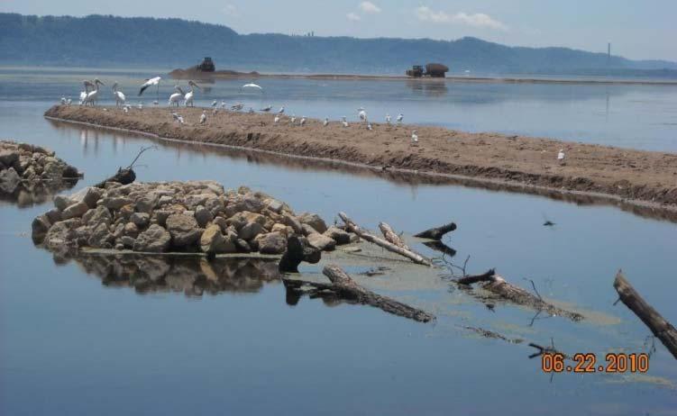
8 Project Area History The lake covers 26,000 acres. An average of 1.7 miles wide, it is the widest natural reach of the entire Mississippi River. Upper Lake Pepin consists of channel border islands and backwater lakes grading into an expansive, shallow open water area with little physical structure. Valuable cultural, aesthetic, recreational and economic asset to local communities. Designated as a globally significant bird area.

9 Upper Pool 4 Goals Improve habitat for native/ desirable plant, animal & fish species Beneficial use of dredged material
10 Problems Continued sedimentation and sediment resuspension. The lack of emergent and submerged aquatic vegetation. Lack of protected wetlands and aquatic areas. Limited habitat for migrating waterfowl and other species. Limited aquatic plant coverage and bathymetric diversity.

11 Objectives Increase aquatic vegetation Improve bird habitat Improve shoreline habitat Increase and improve floodplain forest Improve fish habitat

12 Institutional Navigation, flood stages Engineering Feasibility, construction materials Environmental NEPA, avoid contaminated material Constraints

13 Restoration Measures Island restoration/creation Bank protection Floodplain forest Dredging Emergent wetlands
14 Project Area 14


15 1938 Image of Project Area 15

16 Bathymetry 16
17 Alternative 1a 17
18 Alternative 1b 18
19 Alternative 2 19
20 Alternative 3 20
21 Alternative 4 21
22 Shoreline Assessment 22


23 Potential Access Dredging 23
 Screening/Refining Alternatives 2) Habitat Benefits Analysis 3) Cost Effectiveness/ Incremental Cost")
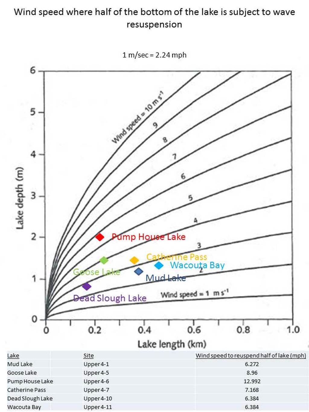
24 What s Next During the Study? 1) Screening/Refining Alternatives 2) Habitat Benefits Analysis 3) Cost Effectiveness/ Incremental Cost Analysis 4) Tentatively Select a Plan 5) Develop Draft Report 6) Public Review (Fall 2018)

25 Pierce County Islands WA Ryan Haffele Wildlife Biologist WDNR
26 Pierce County Islands WA Master Plan Update Determines how the property is managed into the future for wildlife, fisheries, and recreation Key Points Improve wetland habitat Improve floodplain forest habitat Identifies restoration needs to compliment 204 Project Maintain and enhance opportunities for hunting, fishing, trapping, and other nature based outdoor recreation
27 Pierce County Islands WA Public Input Opportunity Provide comments regarding the master plan by Friday April 6 th to Laurie Ross Laurie.Ross@Wisconsin.gov Item 2 B 3 on April NRB Agenda

28 Pierce County Islands Kurt A. Rasmussen Mississippi River Planner Office of Great Waters Mississippi River, Lake Superior & Lake Michigan Environmental Management Division Wisconsin Department of Natural Resources 3550 Mormon Coulee Road La Crosse, WI Phone: (608) Fax: (608)

29

30 Upper Pepin Lake Water Quality Assessment Water Depth Secchi Depth (water transparency) Water Velocity Total Nitrogen Total Phosphorus Dissolved Oxygen Water Temperature Chlorophyll a Total Suspended Solids
31 Ryan Haffele Wildlife Biologist WDNR Water quality factors Introducing the most variance to the system: Water Depth Water Velocity


32 Upper Pepin Lake Water Quality Assessment Water quality factors Introducing the most variance to the system: Water Depth (possibly explained wind resuspension of fine sediment) Water Velocity (possibly explained by turbid inflows and higher connectivity to the main channel)
33

34 Ryan Haffele Wildlife Biologist WDNR Design project features that: Reduce connectivity with turbid inflows Reduce wind fetch Increase backwater depth

35 Ryan Haffele Wildlife Biologist WDNR

36


37 Questions?