INTEGRATED MANAGEMENT PLAN Jointly Developed by the Central Platte Natural Resources District and the Nebraska Department of Natural Resources
|
|
|
- Chastity Cummings
- 5 years ago
- Views:
Transcription
1 INTEGRATED MANAGEMENT PLAN Jointly Developed by the Central Platte Natural Resources District and the Nebraska Department of Natural Resources CHAPTER 1: EFFECTIVE DATE I. This Integrated Management Plan (IMP) was adopted by the Central Platte Natural Resources District (the District) on July 23, 2009, and by the Nebraska Department of Natural Resources (Department) on August 13, The original IMP became effective on September 15, The revised IMP was adopted on March 22, 2012, and became effective on May 21, CHAPTER 2: AUTHORITY I. This IMP was prepared by the Board of Directors of the District and the Department in consultation and collaboration with the District Stakeholders Group in accordance with Neb. Rev. Stat , , , and CHAPTER 3: BACKGROUND I. This document presents the IMP developed by the District and the Department for Integrated Groundwater and Surface Water Management within the District. II. III. IV. Key components of the Integrated Management Plan are a description of the groundwater reservoir(s) within the NRD and a description of the surface water systems and supplies within the District. The groundwater aquifer characteristics of the Central Platte Valley of Nebraska may be the most studied in the State, if not in the high-plains region. Considerable information is available and has recently been expanded and improved through the efforts of COHYST- -a cooperative hydrology study carried out by a coalition of natural resources districts, two public power districts, and two state agencies, with the assistance of numerous other federal and state agencies, and several statewide and local organizations (Attachment A). The best means of describing the physical aquifer system, surface water systems and existing uses is through maps, charts, tables and graphs showing the different characteristics (e.g. hydraulic conductivity, transmissivity, certified acres, surface water rights) that are important to resource assessment and management planning. These items are referenced in Attachment B, which contains current state-of-knowledge information on the aquifer system and irrigation across the District. Page 1 of 39
2 V. The District lies almost entirely within the Central Platte River Basin with the Platte River being not only the largest surface water feature, but also the major source of water for the seven surface water irrigation projects located in Dawson and western Buffalo counties. Annual flows in the Platte River average approximately 1.1 million-acre feet per year. VI. VII. VIII. IX. Water rights for irrigation, instream flows, storage, and storage use are held by numerous individuals and organizations on both the Platte River and on the Platte River tributaries across the Natural Resources District. The District has an instream flow water right that represents the largest quantity of surface water within the District. Additionally, numerous surface water rights outside the District may be impacted by the District s IMP. In addition to providing irrigation water to approximately 81,000 acres of cropland in Dawson and Buffalo counties, Nebraska Public Power District (NPPD) also has a water right to produce electricity at their hydro plant on their Kearney Canal located near the UNK Campus in Kearney, Nebraska. The Gothenburg, Dawson County, and Kearney Canals are all owned and operated by NPPD while the four other Canals (Cozad, Six- Mile, Thirty-Mile, and Orchard Alfalfa) are privately owned and each are operated by their own boards of directors. The primary source of irrigation water is groundwater, with 17,462 registered irrigation wells irrigating 999,402 certified acres. Total certified and inventoried acres are 1,014,066 and are supplied by surface water, groundwater, or both. Additionally, all municipalities, cities, towns and both suburban and rural downstream water users, get their water supply from groundwater; as do the vast majority of commercial and industrial users not on a municipal supply. In developing this plan the District and the Department consulted and collaborated with stakeholders who rely upon water from within the designated area that, after being notified of the commencement of the plan development process, indicated in writing or in person, their desire to participate in the process. Participating stakeholders include representatives from surface water users, municipalities, wildlife and environmental interests, economic development, banks and financial organizations, county boards, agricultural organizations, and well drillers (See Attachment C). X. This collaboration and consultation with stakeholders took place during monthly stakeholders meetings held in Kearney, Nebraska between December 7, 2005 June 13, 2006, with follow up review meetings on September 11, October 10, November 14, December 13, 2006, and February 24, XI. It is the intent of this IMP that the goals, objectives and action items described in the fully appropriated portion of this IMP (Chapter 5) apply to the entirety of the Natural Resources District (Map 1); whereas, the goals, objectives and action items described in the over-appropriated portion of this IMP (Chapter 6) apply only to the over-appropriated area of the District (Map 2). Page 2 of 39
3 XII. On July 1, 1997, the State of Nebraska entered into the Cooperative Agreement for Platte River Research and other Efforts relating to Endangered Species Habitats along the Central Platte River, Nebraska. In 2006, all parties to the 1997 agreement, revised the cooperative agreement with the signing of the Platte River Recovery Implementation Program (PRRIP) Agreement which, among other things, provides Endangered Species Act compliance for existing and new water related activities 1 including surface water irrigation, hydropower projects, and groundwater uses. In 2004, the Nebraska Legislature adopted LB962 which required the integrated management of hydrologically connected waters to achieve state compliance with interstate agreements such as the PRRIP Agreement. 1 For purposes of this Program Document and its attachments, the term water related activities means activities and aspects of activities which (1) occur in the Platte River basin upstream of the confluence of the Loup River with the Platte River; and (2) may affect Platte River flow quantity or timing, including, but not limited to, water diversion, storage and use activities, and land use activities. Changes in temperature and sediment transport will be considered impacts of a water related activity to the extent that such changes are caused by activities affecting flow quantity or timing. Impacts of water related activities do not include those components of land use activities or discharges of pollutants that do not affect flow quantity or timing. Existing water related activities include surface water or hydrologically connected groundwater activities implemented on or before July 1, New water related activities include new surface water or hydrologically connected groundwater activities including both new projects and expansion of existing projects, both those subject to and not subject to section 7(2) of the ESA, which may affect the quantity or timing of water reaching the associated habitats and which are implemented after July 1, Page 3 of 39

4 CHAPTER 4: MAP AND MANAGEMENT AREA BOUNDARIES I. Fully Appropriated Area: The area subject to the fully appropriated portion of this IMP is the entire geographic area of the District (Map 1, below). Page 4 of 39
. A map of the OAIMS is included as Map 2, below. III.")
5 II. Overappropriated Area: The area subject to the overappropriated portion of this IMP is the geographic area of the District designated by the Department as over-appropriated on September 15, This area is referred to as the overappropriated integrated management subarea (OAIMS). A map of the OAIMS is included as Map 2, below. III. Stratigraphic Boundaries of Plan: The stratigraphic boundaries subject to this IMP include all sediments from ground level downward through all aquifer units. Page 5 of 39
6 CHAPTER 5: FULLY APPROPRIATED PORTIONS OF THE IMP I. GOALS AND OBJECTIVES A. Vision Statement 1. The Central Platte Natural Resources District, in cooperation with the Nebraska Department of Natural Resources, will implement this IMP to achieve and/or maintain a balance between water uses and water supplies so that the economic viability, social and environmental health, safety, and welfare can be achieved and maintained for both the near term and long term, considering the effects on existing surface water appropriators and groundwater users. B. Goals 1. To secure any future water supply projects that are shown to be feasible, beneficial and desirable. 2. To provide for a total consumption of water that does not exceed a fully appropriated status. 3. To maintain for present and future generations the District s water resources while promoting programs that allow economic growth. 4. To provide, for present and future generations, an adequate supply of quality water for feasible and beneficial uses. 5. To minimize and/or resolve conflicts between water users. 6. To ensure that the plan complies with the law and with interstate agreements, and to meet basin-wide goals. C. Objectives 1. Develop adequate regulations to protect the rights of all legal existing users, ensuring that mandatory requirements will treat parties equitably in both the fully and the overappropriated areas of the District. 2. Develop rules, regulations, and programs that will strive for a balance between water use and availability. 3. Promote water use efficiency when hydrologically and economically beneficial to domestic, agricultural, and industrial water users. 4. Promote and support wherever economically feasible, programs that reduce water consumption by invasive species. Page 6 of 39
7 5. Identify and implement potential incentive programs, educational programs, and funding sources (state, federal, other) that help encourage water conservation, reduce consumptive use, meet other management goals and objectives, and develop a plan to maximize funding from available sources. 6. Allow for groundwater banking and transfers. D. Means. 1. It is the intent of the District to utilize qualified projects described in Neb. Rev. Stat to provide river-flow enhancement to achieve the goals and objectives of the District and to achieve the goals and objectives of the State under the Platte River Recovery Implementation Program and the requirements of the Ground Water Management and Protection Act. The District may pay for such projects by using the occupation tax provided in Neb. Rev. Statutes , funds granted to the District by the State or Federal government, or the levy authority authorized by Neb. Rev. Stat II. PLAN COMPONENTS AND ACTION ITEMS FOR THE FULLY APPROPRIATED AREA INFLUENCING THE PLATTE RIVER UPSTREAM OF CHAPMAN, NEBRASKA A. The action items described in this section are intended to be consistent with the requirements of Neb. Rev. Stat (3). B. Non-regulatory Action Items 1. Information and Education Programs (b) The District and the Department will provide educational materials to the public and/or carry out educational activities that may include, but not be limited to, the following: the fully appropriated determination, the overappropriated designation, the IMP, the Nebraska New Depletion Plan (NNDP), the Platte River Recovery and Implementation Program (PRRIP), hydrologically connected groundwater and surface water, invasive species management, conversion of irrigated acres to dryland agriculture or wildlife habitat, limited irrigation cropping systems, soil residue and tillage management, alternative crops, and funding sources for programs that enhance water supply. These educational materials and/or activities may include, but not be limited to, public meetings held jointly at least once a year, pamphlets, and website information. 2. Incentive Programs Page 7 of 39
8 Where possible, encourage surface water irrigation districts to implement a program to improve measurements and data collection for farm turnouts. (1) Work with the Department, U.S. Bureau of Reclamation, USDA-Natural Resources Conservation Service and others to seek cost-share for installation of measuring devices on surface water irrigation district farm turnouts. (b) Promote water use efficiency through the use of technology, lower consumptive water use crops and improved management. (1) Develop conservation programs that place groundwater-irrigated, marginal cropland into grazing land. (c) Promote and support, wherever economically feasible, programs that reduce water consumption by invasive species. 3. Water Banking (1) Support and coordinate research, training, and incentive programs concerning invasive plant species in the Platte River system, and assist with information and education efforts to distribute research results. The District will establish a water bank for the purposes of encouraging and facilitating the transfer of water between users. The District will purchase or otherwise acquire transfers of the depletion impact of certified groundwater acres (i.e. the right to use water under land that has been certified by the District as irrigated acres) or other groundwater uses or surface water use appropriations. The District will hold the transferred water uses in its water bank for the purposes of: (1) offsetting new or expanded uses; (2) saving to meet statutory requirements or interstate agreement obligations; (3) saving to meet future incremental targets toward achieving a fully appropriated condition; or (4) future sales to individuals as offsets for development of new consumptive uses of groundwater within the District. (i) In determining the amount of accretions to the stream that will be placed into the water bank, due to the transfer of groundwater or surface water uses, the District and the Department will agree on the best available tools to utilize Page 8 of 39
9 for calculating streamflow accretions (i.e. the bankable volumes of water). The calculations used to determine the accretions to be put into the water bank will consider the impact to streamflows through at least a fifty (50) year period and will be consistent with the methods used to evaluate transfers as described in subsection II.C.4.d (2) of Chapter 5 of this IMP. Additionally, these calculations will determine the timing and location of streamflow changes due to the transfer to the water bank and any impacts to existing groundwater or surface water users. (b) (c) (d) (e) (f) If the District intends to purchase or otherwise acquire surface water appropriations for deposit in the water bank, the District will contact the Department prior to such purchase or acquisition. The Department will conduct a field investigation of the surface water appropriation and notify the District of the results as soon as possible. The District will work collaboratively with the Department in performing the analysis to evaluate the bankable volume of water resulting from the retirement of the surface water appropriation. If the water is to be transferred to another use the District will follow the appropriate statutes, rules and regulations of the Department for approval of the transfer. The District will obtain and maintain permanent easements on all property from which surface water or groundwater uses have been retired for purposes of the water bank. All deposits, withdrawals and other activities related to the water banking will be reported annually according to the specifications described in subsection II.A.1 of Chapter 7 of this IMP. Any water banking activity carried out by the District must follow the procedures for any groundwater regulatory action (e.g. transfers, certification or municipal and non-municipal industrial accounting) applicable to such activity. Any surface water related water banking activity carried out by the District must follow the appropriate state statute and Department rules and regulations. Any person desiring to utilize the services of the water bank should contact the District. C. Groundwater Regulatory Action Items (Controls) 1. The District will, by order, adopt controls in the fully appropriated areas to achieve the goals and meet the objectives of this plan. The District will put into place the following controls: (1) controls to limit or prevent an increase in the amount of irrigated land in the management area or otherwise limit or prevent increases in consumptive use of water for any purpose, (2) requiring approval of transfer permits and placing conditions on such transfers), (3) closing of the management area to the issuance of additional groundwater Page 9 of 39
10 well construction permits unless the permit is conditioned to meet the purposes for which the management area was designated, (4) adapting different controls for different categories of groundwater uses, and (5) establishing different requirements for water wells constructed before the designation of a management area and those drilled afterward. 2. The District will periodically review the controls being implemented to carry out the goals and objectives of this IMP. Any changes to the controls must not be in conflict with the goals and objectives of this IMP. The District may adjust or modify the controls or expand to include additional controls as deemed necessary and appropriate by the Board of Directors to achieve the goals and meet the objectives outlined in this IMP. However, if the Board decides to remove any of the controls for 4, 4(b), 4(c), or 4(d) (listed below), the District and the Department shall amend this IMP prior to removal of these controls. Changes to these controls may be the result of the annual review of progress being made toward achieving the goals of this IMP, according to (4)(d)(i).The District s Rules and Regulations will contain procedural details for the controls listed in this IMP. Persons desiring to apply for a new ground water use or to alter an existing use should contact the District. 3. The District and the Department will coordinate with the other Platte Basin NRDs (Tri- Basin NRD, Twin Platte NRD, South Platte NRD and North Platte NRD) to develop a consistent method of calculation that will be applied when calculation of depletions or accretions to the stream are necessary to implement groundwater controls. 4. Authorized Groundwater Controls to be utilized: Moratorium (1) The District and the Department have closed the management area to the issuance of new well permits and the expansion of irrigated acres and limited increases in the consumptive use of groundwater withdrawals from water wells used for irrigation or other beneficial purposes. The District may issue a water well construction permit provided that the permit conditions require an offset for any new or expanded use or if as a result of issuing the permit, there will not be an increase in consumptive use due to any new or expanded use of groundwater. New or expanded groundwater uses may occur if an offset is provided. In granting a variance the District will consider timing, location and amount of the depletion and offset so that there is not an adverse impact on existing water users. Only lands that have been certified by the District as irrigated acres may be irrigated. (b) Certification of Groundwater Uses (1) The purpose of certifying groundwater uses as of the dates below is to identify the current groundwater uses in the District. Different types of irrigated land will be determined as part of the certification process, such as irrigated cropland, Page 10 of 39
11 irrigated hay land, irrigated pasture, and sub-irrigated uses. In certifying the irrigated acres, the District used 2004 as the base year for those areas within the fully appropriated area that was under the original state stay on new wells and new irrigated acres was used as the base year for the remainder of the area designated as fully appropriated. All groundwater uses, with the exception of domestic uses and range livestock uses have been certified by the District. If modifications to certified irrigated acres are necessary, the District will consider timing, location and amount of any depletion associated with the modification and any associated offset so that there is not an adverse impact on existing users. The certification rules include the identification of other sources of water serving the acres to be certified. (2) The District also inventoried acres irrigated by surface water and acres irrigated by both surface water and groundwater sources. This process provides an inventory of irrigated acres in the District, as well as an inventory of the source or sources of the water. By virtue of the remainder of acres within the District, it also provides an inventory of all acres not irrigated in order to enforce the Department and District s stay on new irrigated acres. (c) Variances (1) The purpose of variances is to allow an exception to the stay on new irrigated acres and new consumptive uses while providing for adequate offsets or transfers to assure no increase in depletions to the river or impacts to existing surface water or groundwater users. (2) Any variance granted by the District must consider the timing, location and amount of any depletion associated with the variance and any associated offset to ensure that there will not be an adverse impact to existing groundwater or surface water users or on the state s ability to comply with PRRIP. (d) Transfers (1) The purpose of a groundwater transfer is to be able to allow for the consumptive use of water to be changed either in location or purpose without causing an increase in depletions to the river or an impact to existing surface water or groundwater users. (2) The District will utilize the methodology for calculating depletions and accretions consistent with the other Platte Basin NRDs when evaluating proposed transfers to ensure that the criteria for compliance with PRRIP, which includes the timing, location and amount of the depletion and corresponding offset, are met. Any actions taken by the District related to the approval of transfer permits will be documented and shared with the Department pursuant to Subsection II.A.1.(b) of Chapter 7 of this IMP. Page 11 of 39
12 (3) Transfers from outside to inside the District and from inside to outside the District- (1) a permit from the District is required; (2) the transfer must be in conformance with the rules and regulations of the NRD from which the transfer is coming from or going to; (3) an agreement must be reached between the District and the other NRD involved in the transfer that the use being retired in one district will remain retired for the duration of the transfer. (4) The District and the Department will coordinate transfer permits to assure compliance with each of their statutory responsibilities. (5) In order to provide for flexibility and efficiency, the District will allow a person to transfer groundwater that had been used for irrigation off of the overlying land after applying for and obtaining approval from the District. The land from which the groundwater is transferred shall remain in dryland agriculture or, with written District approval, a use with the same or lower consumption. 5. Within the fully appropriated area of the District, CPNRD will be implementing the following regulatory action items through their Rules and Regulations within one year of the effective date of this IMP, and will continue to do so in the future. Municipal Use and Accounting (1) The District will calculate baseline consumptive use for each municipality in the District based on historic consumptive use data for the interval August 1, 2001, through July 31, Consumptive use will be determined from groundwater pumping volumes, wastewater discharge volumes (when available), and/or computer modeling, and converted to a per capita volume. The baseline per capita volume, plus the annual population growth estimated by the Nebraska Department of Economic Development and/or U.S. Census Bureau will be used to determine annual changes in consumptive uses. Changes in consumptive use will be tracked annually for each municipality through a reporting and database system administered by the District. (2) Once each five (5) years, and more often if requested by the Department or as determined by the District, the District will re-calculate the per capita consumptive use based upon similar, but updated, data described in section 5 above, and make any necessary adjustments to the per capita offset requirements. (3) Each year, the District will be responsible for offsetting all increases from the baseline consumptive use as estimated by population growth, except any new or expanded single commercial/industrial consumptive use, served by the municipal water system, of more than twenty-five (25) million gallons per year. (4) Each year the municipality shall be responsible for reporting to the District and offsetting to the river, any new or expanded single commercial/industrial Page 12 of 39
13 consumptive use served by the municipal water system, if that new or expanded consumptive use is greater than twenty five (25) million gallon per year. 6. Non-Municipal Industrial Use and Accounting (b) (c) (d) The District will calculate baseline consumptive use for each non-municipal commercial/ industrial user in the District based on historic consumptive use data for the interval August 1, 2001, through July 31, Consumptive use will be determined from groundwater pumping volumes, wastewater discharge volumes (when available) and/or computer modeling. The baseline will be used to determine changes in consumptive use annually. These changes in consumptive use will be tracked for each non-municipal commercial/ industrial user annually through a reporting and database system administered by the District. If the new or expanded single commercial/industrial use is less than or equal to twenty-five (25) million gallons per year, the District will be responsible for offsetting the entire new or expanded use below the amount granted in the industrial transfer permit, if applicable. If the new or expanded non-municipal commercial/industrial use exceeds twentyfive (25) million gallons per year and they do not have a transfer permit, the user will be responsible for offsetting all new or expanded consumptive uses. If the new or expanded non-municipal commercial/industrial use has a transfer permit, the user is responsible for offsetting all new or expanded uses above the amount granted in the industrial transfer permit. D. Surface Water Regulatory Action Items The surface water controls listed below, as authorized by Neb. Rev. Stat , will be implemented or will continue to be implemented by the Department. The Department s Rules and Regulations contain procedural details for these controls. Persons desiring to develop a new surface water project or to alter an existing project should contact the Department to determine which controls, rules and regulations may apply to their project. 1. The Department will continue the moratorium on new surface water appropriations in the portion of the Platte Basin within the boundaries of the District. Variances may be granted by the Department in accordance with Department rules and regulations. 2. Transfers of surface water appropriations will be in accordance with statute and Department rules and regulations. 3. Surface water appropriations will continue to be administered according to statute and Department rules and regulations. Page 13 of 39
14 4. The use of surface water will continue to be monitored to make sure that unauthorized use is not occurring. 5. The Department may require surface water appropriators to apply or use conservation measures. If, in the future, the Department requires surface water appropriators to apply or use such conservation measures, in accordance with (2), the surface water appropriators will be allowed a reasonable amount of time, not to exceed one hundred eighty (180) days unless extended by the Department, to identify conservation measures to be applied or used and to develop a schedule for such application and utilization. 6. The Department may require any other reasonable restrictions on surface water use, as authorized in Nebraska statues if the Department feels it is necessary in order to comply with this IMP, the Basin-Wide IMP or any state program, decree, compact or agreement. If, in the future, the Department requires other restrictions on surface water use, such restrictions must be consistent with the intent of and the requirements of If, in the future, the Department requires other restrictions on surface water use, in accordance with (2), the surface water appropriators will be allowed a reasonable amount of time, not to exceed one hundred eighty (180) days unless extended by the Department, to comment on the proposed restrictions. III. PLAN COMPONENTS AND ACTION ITEMS FOR THE FULLY APPROPRIATED AREA INFLUENCING THE PLATTE RIVERDOWNSTREAM OF CHAPMAN A. The action items described in this section are intended to be consistent with the requirements of Neb. Rev. Stat (3). B. Non-regulatory Action Items 1. Information and Education Programs The District and the Department will provide educational materials to the public and/or carry out educational activities that may include, but not be limited to, the following: the fully appropriated determination, the overappropriated designation, the IMP, the Nebraska New Depletion Plan (NNDP), the Platte River Recovery and Implementation Program (PRRIP), hydrologically connected groundwater and surface water, invasive species management, conversion of irrigated acres to dryland agriculture or wildlife habitat, limited irrigation cropping systems, soil residue and tillage management, alternative crops, and funding sources for programs that enhance water supply. Page 14 of 39
15 (b) These educational materials and/or activities may include, but not be limited to, public meetings held jointly at least once a year, pamphlets, and website information. 2. Incentive Programs Promote water use efficiency through the use of technology, lower consumptive water use crops and improved management. (1) Develop conservation programs that place groundwater-irrigated, marginal cropland into grazing land. (b) Promote and support, wherever economically feasible, programs that reduce water consumption by invasive species. (1) Support and coordinate research, training, and incentive programs concerning invasive plant species in the Platte River system, and assist with information and education efforts to distribute research results. 3. Water Banking The District will establish a water bank for the purposes of encouraging and facilitating the transfer of water to and between users. The District will purchase or otherwise acquire the depletion impact of certified groundwater acres (i.e. the right to use water under land that has been certified by the District as irrigated acres) or other groundwater uses or surface water use appropriations. The District will hold the water use rights in its water bank for the purposes of: (1) offsetting new or expanded municipal uses and non-municipal commercial and industrial uses; (2) saving to meet future incremental targets toward maintaining achieving a fully appropriated condition; or (3) future sales to individuals as offsets for development of new consumptive uses of groundwater within the District. (b) In determining the amount of accretions to the stream that will be placed into the water bank, due to the transfer of groundwater or surface water uses, the District and the Department will agree on the best available tools to utilize for calculating streamflow accretions (i.e. the bankable volumes of water). The calculations used to determine the accretions to be put into the water bank will consider the impact to streamflows through at least a fifty (50) year period and will be consistent with the methods used to evaluate transfers as described in subsection II.C.4.d (2) of Chapter 5 of this IMP. Additionally, these calculations will determine the timing and Page 15 of 39
16 location of streamflow changes due to the transfer to the water bank and any impacts to existing groundwater or surface water users. (c) (d) (e) (f) If the District intends to purchase or otherwise acquire surface water appropriations for deposit in the water bank, the District will contact the Department prior to such purchase or acquisition. The Department will conduct a field investigation of the surface water appropriation and notify the District of the results as soon as possible. The District will work collaboratively with the Department in performing the analysis to evaluate the bankable volume of water resulting from the retirement of the surface water appropriation. If the water is to be transferred to another use the District will follow the appropriate statutes, rules and regulations of the Department for approval of the transfer. The District will obtain and maintain permanent easements on all property from which surface water or groundwater uses have been retired for purposes of the water bank. All deposits, withdrawals and other activities related to the water banking will be reported annually according to the specifications described in subsection II.A.1 of Chapter 7 of this IMP. Any water banking activity carried out by the District must follow the procedures for any groundwater regulatory action (e.g. transfers, certification or municipal and non-municipal industrial accounting) applicable to such activity. Any surface water related water banking activity carried out by the District must follow the appropriate state statute and Department rules and regulations. C. Groundwater Regulatory Action Items (Controls) 1. The District will, by order, adopt controls in the fully appropriated areas to achieve the goals and meet the objectives of this plan. The District will put into place the following controls: (1) controls to limit an increase in the amount of irrigated land in the management area or otherwise limit increases in consumptive use of water for any purpose, (2) requiring approval of transfer permits and placing conditions on such transfers), (3) closing of the management area to the issuance of additional groundwater well construction permits unless the permit is conditioned to meet the purposes for which the management area was designated, (4) adapting different controls for different categories of groundwater uses, and (5) establishing different requirements for water wells constructed before the designation of a management area and those drilled afterward. 2. The District will periodically review the controls being implemented to carry out the goals and objectives of this IMP. Any changes to the controls must not be in conflict with the goals and objectives of this IMP. The District may adjust or modify the controls or expand to include additional controls as deemed necessary and appropriate by the Board of Directors to achieve the goals and meet the objectives outlined in this IMP. However, Page 16 of 39
17 if the Board decides to remove any of the controls (for 4, 4(b), 4(c), or 4(d) listed below), the District and the Department shall amend this IMP prior to removal of these controls. Changes to these controls may be the result of the annual review of progress being made toward achieving the goals of this IMP, according to (4)(d)(i). 3. The District and the Department will coordinate with the other Platte Basin NRDs (Tri- Basin NRD, Twin Platte NRD, South Platte NRD and North Platte NRD) to develop a consistent method of calculation that will be applied when calculation of depletions or accretions to the stream are necessary to implement groundwater controls. 4. Authorized Groundwater Controls to be Utilized: Moratorium (1) The District and the Department have closed the management area to the issuance of new well permits and the expansion of irrigated acres and limited increases in the consumptive use of groundwater withdrawals from water wells used for irrigation or other beneficial purposes. The District may issue a water well construction permit or a variance to expand irrigated acres provided that the permit or variance conditions require an offset for any new or expanded use if at any later date the District and the Department determine the use is resulting in a depletion to the river that is contributing to the reduction in the short term or long term beneficial use of existing surface water appropriations or groundwater uses. Pursuant to (6) (b), if such a determination is made, offsets for the new or expanded uses may be required by the Board based upon the date of the permit or variance. Only lands that have been certified by the District as irrigated acres may be irrigated. (b) Certification of Groundwater Uses (1) The purpose of certifying groundwater uses as of the dates below is to identify the current groundwater uses in the District. Different types of irrigated land will be determined as part of the certification process, such as irrigated cropland, irrigated hay land, irrigated pasture, and sub-irrigated uses. In certifying the irrigated acres, the District used 2004 as the base year for those areas within the fully appropriated area that were under the original State stay on new wells and new irrigated acres was used as the base year for the remainder of the area designated as fully appropriated. All groundwater uses, with the exception of domestic uses and range livestock uses, have been certified by the District. If modifications to certified irrigated acres are necessary, the District will consider timing, location and amount of any depletion associated with the modification and any associated offset so that there is not an adverse impact on existing users. The certification rules include the identification of other sources of water serving the acres to be certified. Page 17 of 39
18 (2) The District also inventoried acres irrigated by surface water and acres irrigated by both surface water and groundwater sources. This process provides an inventory of irrigated acres in the District, as well as an inventory of the source or sources of the water. By virtue of the remainder of acres within the District, it also provides an inventory of all acres not irrigated in order to enforce the Department and District s stay on new irrigated acres. (c) Variances (1) The purpose of variances is to allow an exception to the stay on new irrigated acres and new consumptive uses while providing a process for adequate offsets to ensure no reduction in the long term beneficial use of existing surface water appropriators or groundwater users. (2) The District will issue variances on the stay on new irrigated acres based upon a ranking system approved by the Board of Directors. The ranking system may consider number of acres to be developed, location of acres and such other items as may be determined by the Board. (3) The ranking system may also consider the timing, location and amount of any potential depletion associated with the variance and any associated offset that may be required if a determination is made that there will be a reduction in the long term beneficial use of existing surface water appropriators or groundwater users. (4) The District will limit variances on new irrigated acres up to 2,500 acres per calendar year or up to 500 acre feet impact to the river, whichever is met first. (When measuring the 500 acre-feet it is meant to be the average annual depletion occurring 50 years from the time the irrigation begins). (5) After the first five years, and each five years after that, the District and the Department will determine what limit, if any, should be placed on new irrigated acres during the next five year increment. (6) The District may grant variances on or before April 30 th in 2012 and on or before February 1 st of each year thereafter. (7) At least once each five years the District and the Department will conduct studies to determine if the new uses are causing depletions to the river that would impact the long term beneficial use of existing surface water appropriations or groundwater users. If the District and the Department determine the new uses are causing an impact to existing surface water appropriators and/or groundwater users, sufficient numbers of the new uses will be required to provide offsets to the river to mitigate Page 18 of 39
19 the impacts to the long term beneficial uses. The Board of Directors will determine those variances required to make offsets. (d) Transfers (1) The purpose of a groundwater transfer is to be able to allow for the consumptive use of water to be changed either in location or purpose without causing an increase in depletions to the river or an impact to existing surface water or groundwater users. (2) The District will utilize the methodology for calculating depletions and accretions consistent with the other Platte Basin NRDs when evaluating proposed transfers to ensure that the criteria for compliance with PRRIP, which includes the timing, location and amount of the depletion and corresponding offset, are met. Any actions taken by the District related to the approval of transfer permits will be documented and shared with the Department pursuant to Subsection II.A.1.(b) of Chapter 7 of this IMP. (3) Transfers from outside to inside the District and from inside to outside the District- (1) a permit from the District is required; (2) the transfer must be in conformance with the rules and regulations of the NRD from which the transfer is coming from or going to; (3) an agreement must be reached between the District and the other NRD involved in the transfer that the use being retired in one district will remain retired for the duration of the transfer. (4) The District and the Department will coordinate transfer permits to assure compliance with each of their statutory responsibilities. (5) In order to provide for flexibility and efficiency, the District will allow a person to transfer groundwater that had been used for irrigation off of the overlying land after applying for and obtaining approval from the District. The land from which the groundwater is transferred shall remain in dryland agriculture or, with written District approval, a use with the same or lower consumption. 5. Within the fully appropriated area of the District below Chapman Nebraska, CPNRD will be implementing the following regulatory action items through their Rules and Regulations within one year of the effective date of this IMP, and will continue to do so in the future. (b) Municipal Use and Accounting Page 19 of 39
20 (1) The District will calculate baseline consumptive use for each municipality in the District based on historic consumptive use data for the interval August 1, 2001, through July 31, Consumptive use will be determined from groundwater pumping volumes, wastewater discharge volumes (when available), and/or computer modeling, and converted to a per capita volume. The baseline per capita volume, plus the annual population growth estimated by the Nebraska Department of Economic Development and/or U.S. Census Bureau will be used to determine annual changes in consumptive uses. Changes in consumptive use will be tracked annually for each municipality through a reporting and database system administered by the District. (2) Once each five (5) years, and more often if requested by the Department or as determined by the District, the District will re-calculate the per capita consumptive use based upon similar, but updated, data described in section 5 above, and make any necessary adjustments to the per capita offset requirements. (3) Each year, the District will be responsible for offsetting all increases from the baseline consumptive use as estimated by population growth, except any new or expanded single commercial/industrial consumptive use, served by the municipal water system, of more than twenty-five (25) million gallons per year. (4) Each year the municipality shall be responsible for reporting to the District and offsetting to the river, any new or expanded single commercial/industrial consumptive use served by the municipal water system, if that new or expanded consumptive use is greater than twenty five (25) million gallon per year. 6. Non-Municipal Industrial Use and Accounting (b) (c) (d) The District will calculate baseline consumptive use for each non-municipal commercial/ industrial user in the District based on historic consumptive use data for the interval August 1, 2001, through July 31, Consumptive use will be determined from groundwater pumping volumes, wastewater discharge volumes (when available) and/or computer modeling. The baseline will be used to determine changes in consumptive use annually. These changes in consumptive use will be tracked for each non-municipal commercial/ industrial user annually through a reporting and database system administered by the District. If the new or expanded single commercial/industrial use is less than or equal to twenty-five (25) million gallons per year, the District will be responsible for offsetting the entire new or expanded use below the amount granted in the industrial transfer permit, if applicable. If the new or expanded non-municipal commercial/industrial use exceeds twentyfive (25) million gallons per year and they do not have a transfer permit, the user Page 20 of 39
21 will be responsible for offsetting all new or expanded consumptive uses. If the new or expanded non-municipal commercial/industrial use has a transfer permit, the user is responsible for offsetting all new or expanded uses above the amount granted in the industrial transfer permit. D. Surface Water Regulatory Action Items The following surface water controls as authorized by Neb. Rev. Stat will be implemented or will continue to be implemented by the Department: 1. The Department will continue the moratorium on new surface water appropriations in the portion of the Platte Basin within the boundaries of the District. Variances may be granted by the Department in accordance with Department rules and regulations. 2. Transfers of surface water appropriations will be in accordance with statute and Department rules and regulations. 3. Surface water appropriations will continue to be administered according to statute and Department rules and regulations. 4. The use of surface water will continue to be monitored to make sure that unauthorized use is not occurring. 5. The Department may require surface water appropriators to apply or use conservation measures. If, in the future, the Department requires surface water appropriators to apply or use such conservation measures, in accordance with (2), the surface water appropriators will be allowed a reasonable amount of time, not to exceed one hundred eighty (180) days unless extended by the Department, to identify conservation measures to be applied or used and to develop a schedule for such application and utilization. 6. The Department may require any other reasonable restrictions on surface water use, as authorized in Nebraska statues if the Department feels it is necessary in order to comply with this IMP, the Basin-Wide IMP or any state program, decree, compact or agreement. If, in the future, the Department requires other restrictions on surface water use, such restrictions must be consistent with the intent of and the requirements of If, in the future, the Department requires other restrictions on surface water use, in accordance with (2), the surface water appropriators will be allowed a reasonable amount of time, not to exceed one hundred eighty (180) days unless extended by the Department, to comment on the proposed restrictions. Page 21 of 39
22 CHAPTER 6: OVERAPPROPRIATED AREA & NEBRASKA NEW DEPLETION PLAN I. GOALS AND OBJECTIVES A. Goals 1. Incrementally achieve and sustain a fully appropriated condition. (b) (c) Within the first ten (10) year increment, address impacts of streamflow depletions to surface water appropriations and water wells constructed in aquifers dependent upon recharge from streamflow to the extent those depletions are due to water use initiated after July 1, Impacts of streamflow depletions to surface water appropriations and water wells constructed in aquifers dependent upon recharge from streamflow to the extent those depletions are due to water use initiated prior to July 1, 1997, may be addressed prior to a subsequent increment with the intent of achieving a fully appropriated condition. Once a fully appropriated condition is achieved, maintain such condition through the continued implementation of the IMP. 2. Ensure no act or omission of the District will cause the state to be in noncompliance with any interstate compact or decree or other formal state contract or agreement. Ensure no act or omission of the District will cause the state to be in noncompliance with the Nebraska New Depletions Plan (NNDP) included within PRRIP, for as long as PRRIP exists. 3. Maintain consistency with the Basin-Wide Plan. B. Objectives 1. Goal I.A.1. Objectives Implement measures within the first ten (10) year increment to offset an annual depletion rate of one thousand nine hundred (1,900) acre-feet to the river in the year This rate is the current best estimate and is subject to change based upon new data and information. (b) Conduct a technical analysis as described in Neb. Rev. Stat (4)(d)(iii) for this IMP after it has been in effect for six (6) years, to Page 22 of 39
23 determine whether the measures adopted in this IMP are sufficient to offset depletions due to post-july 1, 1997, water uses. 2. Goals I.A.1. and I.A.1.(b) Objectives (b) Continue to refine the estimation methodology used to calculate the difference between the current and fully appropriated levels of development. Use available funds to offset depletions that are identified as part of the overall difference between current and fully appropriated levels of development. 3. Goals I.A.1., I.A.1.(b), and I.A.1.(c) Objectives (b) (c) Develop and maintain data and analytical tools, such as the Cooperative Hydrology Study (COHYST) and other programs and projects needed to implement this integrated management plan (IMP). Review the provisions of this IMP to insure that they are adequate to sustain progress toward a fully appropriated condition. Review the provisions of this IMP to insure that they are adequate to maintain a fully appropriated condition. 4. Goal I.A2. Objectives To the extent required in order to maintain compliance with the NNDP, provide accretions to the Platte River equal to or exceeding the annual depletion amount, taking into account appropriate timing and location, for the first ten (10) year increment, as shown in table 1. The data shown in table 1 represents the current best estimate of stream depletions due to changes in groundwater irrigated acres between 1997 and 2005 and is subject to change based upon new data and information. Table 1: Current best estimate of post-1997 depletions to the Platte River due to changes in groundwater irrigated acres within the entire District between 1997 and 2005 based upon the June 10, 2008, COHYST Report on stream depletion Year Annual Stream Depletion (AF) 1,974 2,049 2,161 2,232 2,303 2,347 Year Annual Stream Depletion (AF) 2,348 2,350 2,409 2,456 2,503 Page 23 of 39
24 (b) As required by the NNDP, submit reports to the Department as necessary to assist Nebraska in maintaining compliance with PRRIP. 5. Goal I.A.3. Objectives: (b) (c) Amend this IMP as needed to remain consistent with the Basin-Wide Plan. Participate in basin-wide planning activities. If appropriate, follow the dispute process in the Basin-Wide Plan. C. Means. It is the intent of the District to utilize qualified projects described in Neb. Rev. Stat to provide river-flow enhancement to achieve the goals and objectives of the District and to achieve the goals and objectives of the State under the Platte River Recovery Program and the requirements of the Ground Water Management and Protection Act. The District may pay for such projects by using the occupation tax provided in Neb. Rev. Statutes , funds granted to the District by the State or Federal government, or the levy authority authorized by Neb. Rev. Stat II. PLAN COMPONENTS AND ACTION ITEMS The action items described in this section are intended to be consistent with the requirements of (3). A. Non-regulatory Action Items 1. Information and Education Programs These programs are discussed in the fully appropriated portion of this IMP. 1. Incentive Programs The Department and/or the District intend to establish, implement, and/or continue financial or other incentive programs to reduce consumptive use of water within the District to meet the goals and objectives of this IMP. Incentive programs may include, but not be limited to, retiring irrigated acres and/or any program authorized by state law and/or federal programs such as CREP (Conservation Reserve Enhancement Program), EQIP (Environmental Quality Incentive Program) or AWREP (Agricultural Water Resources Enhancement Program). Page 24 of 39
25 (b) At this time, the Platte Basin NRDs and the Department have identified PBHEP (Platte Basin Habitat Enhancement Program) as an incentive program that they intend to pursue to reduce consumptive use within the overappropriated portion of the Platte River Basin. 2. Other Programs The District and the Department may investigate opportunities to reduce the consumptive use of water in order to enhance water supply as well as other water supply improvement projects. The District and the Department may develop an incentive-based program if any such opportunity exists. When developing any water-based programs, the Department and the District intend to follow these principles: (1) Use the best science readily available (2) Work with irrigation districts, not just individual appropriators, when potential projects affect the irrigation district s operation. (3) Enhance groundwater quantity, groundwater quality and recognize the value of return flows. (4) Remain in compliance with any state or federal laws, contracts, interstate compacts or decrees that govern the water use of the irrigation districts or canal companies. (b) These other programs may include, but are not limited to the following: (1) transfer existing surface water appropriations within the District to instream flow appropriations; (2) transfer existing surface water appropriations or apply for new appropriations for intentional recharge, and recovery when applicable, in existing canals during the irrigation or non-irrigation season; and (3) develop new infrastructure (e.g. dams or canals) that may include intentional recharge projects, and recovery when applicable; (4) groundwater projects for the purpose of providing net accretions to the river; and (5) contractual agreements between water users. (c) If any of these programs were to be pursued, the Department and the District would develop a schedule to complete the project(s) within the first ten (10) year increment. (d) Process for Implementing Other Programs (1) Determine the available groundwater and surface water supplies. Page 25 of 39
26 (i) Unappropriated Surface Water (i.a.) (i.b.) Perform an analysis within the first year of the first ten (10) year increment to determine if there is unappropriated surface water. Determine if unappropriated surface water is available at the necessary time, in the right location, and in the correct amount, or determine if it can be appropriately relocated or retimed. (i) Appropriated Surface Water (ii.a.) Compile a list of existing surface water appropriations within the District within the first year of the first ten (10) year increment. (ii.b.) Determine if the appropriated water is available at the necessary time, in the right location and in the correct amount, or determine if it can be appropriately relocated or retimed. (iii) Groundwater (iii.a.) Compile a list of certified groundwater uses within the district within the first year of the first ten (10) year increment. (iii.b.) Determine if the certified groundwater uses can be converted to another use or otherwise retimed or relocated to provide net accretions to the river at the necessary time and in the right location. (2) Develop a list of criteria to evaluate the potential to utilize available surface water and/or groundwater supplies. The criteria may take into consideration the following: (i) (ii) (iii) Any permitting requirements or regulatory constraints related to the utilization of the available water supplies. Potential benefits and the estimated cost of operation The cyclical water supply conditions (3) Evaluate available surface water supplies and/or groundwater based on the criteria developed in Subsection II.A.3.(d)(2) above. (4) Sections (d)(2) and (d)(3) would be an iterative process until the preferred projects are identified. (5) For existing surface water appropriations, contact appropriators to determine willingness to cooperate, lease, and/or sell those appropriations. If willing, develop and execute contract(s) with appropriator(s). Page 26 of 39
27 (6) For existing groundwater uses, contact the landowner(s) to determine willingness to cooperate with the proposed project(s). If willing, develop and execute contract(s) with such landowner(s). (7) Submit any required permit application(s). (8) Implement approved projects. Identification of Specific Other Programs (1) At this time, the specific other programs that have been identified are: (1) potential purchase or lease of surface water appropriations for irrigation from individuals or irrigation districts in order to transfer those appropriations, (2) Exploration of water supply opportunities in the Platte, (3) Conjunctive management with surface water projects, (4) Elm Creek Re-Regulating Reservoir, and(5) B-1 Reservoir. A. Groundwater Regulatory Actions (Controls) 1. In order to determine whether additional groundwater regulatory actions are needed in the overappropriated area, the annual stream depletion amounts shown in table 2 will be compared to the stream accretions resulting from the actions taken by the District. As long as the annual net sum of the accretions resulting from the actions taken by the District and the annual depletions (shown in table 2) are less than or equal to zero, additional regulatory actions will not be required. The depletion amounts shown in table 2 are subject to change based upon the best scientific data and information available. Table 2: Current best estimate of depletions to the Platte River due to changes in groundwater irrigated acres within the overappropriated area of the District between 1997 and 2005 based upon the June 10, 2008, COHYST Report on stream depletions Year Annual Stream Depletion (AF) 1,044 1,070 1,141 1,167 1,183 1,202 Year Annual Stream Depletion (AF) 1,219 1,232 1,261 1,257 1, Based on an analysis of the water banking actions taken by the District, the accretions to and depletions from streamflow do not yet result in a net sum of less than or equal to zero.therefore, further action must be taken to offset the currently identified post-1997 depletions. 3. The Department and the District recognize the potential for the implementation of voluntary programs, incentive measures or other projects to provide stream accretions that will help bring the annual depletions and accretions to a net sum of less than or equal to zero, Page 27 of 39
28 and will work diligently to implement measures to provide stream accretions in a timely manner. Regular progress toward meeting the goal of an annual net sum of accretions and depletions that is less than or equal to zero must be demonstrated. Regular progress will be determined by the following triggers. If, by the end of 2012, an accretion to the Platte River equal to or exceeding a rate of one thousand-one hundred and sixty-seven (1,167) acre-feet annually and every year thereafter throughout the first ten (10) year increment accretions to the Platte River equal or exceed the depletions shown in table 2 has not been met, the Department and District will jointly determine what steps need to be taken to ensure that any necessary, agreed-upon regulatory actions will be in place by the beginning of the 2014 irrigation season. If the above trigger has not been met, the following triggers will be used to determine progress toward meeting the goals and objectives of this IMP. (b) (c) If, by the end of 2015, an accretion to the Platte River equal to or exceeding a rate of one thousand-two hundred and nineteen (1,219) acre-feet annually, and every year throughout the ten-year (10) increment, has not been met, the Department and the District will jointly determine what steps need to be taken to ensure that the agreed-upon regulatory actions will be in place by the beginning of the 2016 irrigation season. By the end of 2015, measures will be in place to achieve an accretion to the Platte River equal to or exceeding a rate of one thousand-three hundred and thirty (1,330) acre-feet annually (70% of the 1,900 acre-feet for the period ).If this trigger has not been met, the Department and the District will jointly determine what steps need to be taken to ensure that the agreed-upon regulatory actions will be in place by the beginning of the 2016 irrigation season. 4. Section II.A.2 in the Monitoring and Studies portion of this IMP (Chapter 7) describes how progress toward achieving these triggers will be measured. 5. At this time, the Department and the District have identified the following groundwater controls as regulatory actions that would be required if the above triggers cannot be achieved through voluntary programs, incentive measures or other projects: Groundwater Controls (1) Crop Rotation (i) Crop rotation would mean planting a mix of crops that would have an upper limit on the consumptive use within the amount determined by the District and the Department over a specified period of years for the certified irrigated acres within the overappropriated area (OIMA). The consumptive use limit would be determined prior to the implementation of Page 28 of 39
29 this control. Considerations for using this control would include, but not be limited to, monitoring, enforcement, and administrative actions Examples of monitoring methods would be the use of thermal sensor data or infrared aerial photography and spot checks on an individual basis. Enforcement will be done through the provisions and procedures established by the NRD through their district-wide rules and regulations. Administrative actions would include determination of the consumptive use of different crops and the submission of a cropping plan by the producer. As an example, listed below are the Crop Factors from the District s Groundwater Quantity Plan: Crop Type Conversion Factor Corn 1.0 Soybeans 0.9 Sorghum 0.80 Wheat 0.67 Alfalfa 1.30 (2) Reduction of irrigated acres A reduction of irrigated acres would mean a set percentage reduction in certified irrigated acres within the overappropriated area. The percentage of the reduction would be determined prior to the implementation of the control. The purpose of this control is to reduce consumptive use. Considerations for using this control would include, but not be limited to, monitoring and enforcement. Monitoring methods would be the use of aerial photography or spot checks on an individual basis. Enforcement will be done through the provisions and procedures established by the District for issuing cease and desist orders and filing with District Court on noncompliance. B. Surface Water Regulatory Actions The surface controls that will be used in the overappropriated area are the same as those described in the fully appropriated section of this plan. Page 29 of 39
30 CHAPTER 7: MONITORING AND STUDIES I. The overarching purpose of the monitoring and studies section is to ensure that the overappropriated and fully appropriated areas within the District reach and/or maintain a fully appropriated condition. The objective of the monitoring and studies section of this IMP is to gather and evaluate data, information, and methodologies that could be used to increase understanding of the surface water and hydrologically connected groundwater system, to test the validity of the conclusions and information upon which this IMP is based, and to assist decision makers in properly managing the water resources within the District. II. MONITORING A. Various methods will be employed to monitor the progress of the implementation of this IMP. Part one of the monitoring section describes the tracking and reporting of water use activities within the fully appropriated and overappropriated areas of the NRD by the District and the Department. Part Two of the monitoring section describes the analyses that will evaluate the progress that has been made toward (1) addressing streamflow depletions due to new uses begun subsequent to July 1, 1997; (2) reaching a fully appropriated condition; and (3) sustaining a fully appropriated condition. Part Three of the monitoring section describes the procedure for evaluating whether a subsequent increment is necessary to meet the goals and objectives of this IMP. Part Four concerns the areas of the District downstream of Chapman, Nebraska. 1. Part One: Tracking and Reporting of Water Use Activities Tracking (1) The District will be responsible for tracking the following activities within the District on an annual basis: (1) certification of groundwater uses and any changes to these certifications; (2) approved transfers, including all of the information provided with the application and used in the approval of the transfer; (3) any water well construction permits issued; (4) any other permits issued by the District; (5) any conditions associated with any permits issued; (6) information gathered through the municipal and non-municipal industrial accounting process; (7) any variances issued, including the purpose, the location, any required offset, the length of time for which the variance is applicable, and the reasoning behind approval of the variance; (8) any retirements of irrigated acres or other activities by the District for the purpose of returning to a fully appropriated condition; and (9) offsets provided for depletions resulting from increased consumptive use related to the above listed items. (2) The Department will be responsible for tracking the following activities within the District on an annual basis: (1) any surface water permits issued; (2) any dam safety permits issued; (3) any groundwater permits issued; and (4) the associated Page 30 of 39
31 offsets for any new permits issued. The Department will be responsible for tracking the following activities within the District on a five (5) year basis: (1) National Agricultural Statistics Service livestock data; (2) US Census Bureau population data; (3) inventory of sandpits; (4) inventory of reservoirs of less than fifteen (15) acrefeet; (5) any retirements of irrigated acres or other activities by the Department for the purpose of returning to a fully appropriated condition; and (6) offsets provided for depletions resulting from increased consumptive use related to the above listed items. (b) Reporting (1) An annual review of the progress being made toward achieving the goals and objectives of the first ten (10) year increment will include annual reporting by the Department and the District of the information being tracked as described above. This information will be shared between the District and the Department, presented at the basin-wide annual meeting, and will be used for PRRIP compliance. (2) The reports from the District and the Department should include information on the location, amount and timing of the depletions caused by each permitted new or expanded water use, as well as the associated offset and the location, amount and timing of the offset s accretions to the river. The depletions and/or the accretions should be reported for each year throughout the first ten (10) year increment. (3) These reports should be made available at least four (4) weeks prior to each annual basin-wide meeting. The format of the reports will be standardized as agreed to by the Department and the Platte Basin NRDs. (4) The reported information will be utilized as appropriate in the evaluation process as described below. 2. Part Two: Measuring the Success of this IMP in Meeting the Goals and Objectives of this IMP Measuring the success of this IMP in addressing streamflow depletions due to new uses begun after July 1, 1997, (Goal I.A.1. and I.A.2. of Chapter 6 of this IMP). (1) In order to meet the requirements of Neb. Rev. Stat (4)(d)(ii), the data contained in the annual reports submitted by the District and the Department will be reviewed and analyzed annually to assess the progress being made toward achieving the goals and objectives of the Overappropriated Area and NNDP portion of this IMP for the first ten (10) year increment. The analysis will include a forecasting of the balance of the depletions and offsets from the current year through the year Page 31 of 39
32 (2) In addition to the annual review, a more robust review of the progress being made toward achieving the goals and objectives of the Overappropriated Area and NNDP portion of this IMP for the first ten (10) year increment will be carried out periodically. The process for this review is described below. (i) The groundwater models utilized for this process will be calibrated to baseflows and groundwater levels in the area with sufficient temporal variability to assess the changes in baseflow on a monthly basis. The groundwater models will be updated periodically to simulate the management practices that have been implemented to date. The evaluation period of this model will be 1998 through (ii) The following groundwater model runs will be conducted to measure the success toward reaching the objectives of Goal I.A.1.a and Goal I.A.2.a of Chapter 6 of this IMP: (ii.a) The 1997 Development Level Run - A model run that simulates the 1997 number of irrigated acres in 1997 and the associated crop mix. It will run and incorporate the pumpage made to meet full crop irrigation requirement for the 1997 crop mix. This model run will serve as the baseline to which the evaluation run will be compared. The run will be conducted using data through the current date and will include an update from the current year through the year (ii.b) The Evaluation Run - A model run that simulates the annual changes between the irrigated acres throughout the evaluation period and the irrigated acres in 1997.The model will utilize the certified and inventoried acre data that the District collects and the CALMIT 2001 and 2005 remote sensing irrigated acres and any additional relevant data to determine the pumpage made to meet crop consumptive use, assuming the full crop irrigation requirement is met. The run will be conducted using data through the current date and will include an update from the current year through the year (ii.c) Difference between the Evaluation Run and the 1997 Run - The simulated baseflow output from each model run will be compared to determine the difference. (ii.d) Surface Water Accretions and Other Uses not Covered by the Model- If the District chooses to retire surface water acres to offset streamflow depletions due to new uses begun subsequent to July 1, 1997, accretions resulting from those retirements will be determined using agreedupon methodologies. (ii.e) Evaluation Results - For the first ten (10) year increment to be considered achieved, the results of combining the difference between the Page 32 of 39
33 evaluation run and the 1997 development level run with the addition of surface water accretions and other uses not covered by the model will be less than or equal to zero. See the following equation. (Depletions from the Evaluation Run) - (Depletions from the 1997 Development Run) + (Surface Water Accretions) = Net Depletions (b) Measure the success of reaching a fully appropriated condition (1) Because a fully appropriated condition is not currently determined, the Department and the District will work on outlining the process that will measure the success of reaching the fully appropriated condition once that condition has been determined. (c) Measure the success of maintaining a fully appropriated condition (1) Current Fully Appropriated Area - Monitor and analyze uses in the fully appropriated areas to determine the change in stream depletions due to such uses. (2) Current Overappropriated Area - Because a fully appropriated condition is not currently determined, the Department and the District will work on outlining the process that will measure the success of maintaining a fully appropriated condition once that condition has been determined. (3) In performing these analyses, the Department and the District will use the best data and science that is readily available. The Department and the District will work with other agencies and/or interested parties, if necessary, to identify data gaps in their analyses and determine whether studies should be undertaken to address these gaps. 3. Part 3: Evaluating the Need for a Subsequent Increment (b) The Department and the District will carry out the studies and the technical analysis as specified in Neb. Rev. Stat (4)(d)(iii) to determine whether or not a subsequent ten (10) year increment is necessary. This will include a process to test the validity of the conclusions and information upon which this IMP is based, as required by section (2)(e). Determining the difference between the current and fully appropriated levels of development. (1) In accordance with (4)(c), and at the request of the Overappropriated Basin Stakeholders, staff members from the Department, the District, Central Nebraska Public Power &Irrigation District (CNPPID) and NPPD performed an analysis to determine changes in stream reach gains and surface water demands affected by such reach gain changes entitled Preliminary Estimate of Historical Page 33 of 39
34 Stream Flow Reductions in the Overappropriated Portion of the Platte River in Nebraska. (2) This analysis of streamflow changes in the Platte River Basin is a preliminary estimate of the overall difference between the current and fully appropriated levels of development. This initial estimate is considered the highest potential difference between current and fully appropriated levels of development. The values from this report for dry, normal and wet conditions ranged from 0 AF to 17,400 AF, based on analysis of data through the year (3) The depletions estimated by COHYST, under average climatic conditions, of 1,900 AF in the period , for the changes in groundwater irrigated acres between 1997 and 2005 is currently considered the lowest potential difference between current and fully appropriated levels of development. (4) Therefore, based on the best data and science that is readily available, the range of values for the difference between current and fully appropriated levels of development for the District is 1,900 to 17,400AF. (c) Within the first ten (10) year increment, the Department and the District will continue to develop and/or refine the estimation methodology used to calculate the difference between the current and fully appropriated levels of development. Fully appropriated levels of development will be determined through the following process: (1) Determine the changes in recharge from surface water diversions and the impacts of those changes on streamflow using readily available data. (2) Determine the changes in groundwater uses within the District including irrigation, industry, municipal, domestic and livestock; and the streamflow depletions caused by those changes using readily available data. (3) Determine the effects of conservation measures within the District on streamflows. (4) Determine the timing and location of the net changes within the District in streamflow. (5) Determine when streamflow changes impact existing users, taking into account the effects of cyclical supply (e.g. drought). (6) If significant changes in either the timing or location of streamflow have impacted existing users, the District and the Department will work collaboratively with affected parties to determine subsequent ten (10) year increment goals. These goals will Page 34 of 39
35 include consideration of the cause of the impact as well as the socioeconomic benefits derived from the various uses impacted by such changes in streamflow. (7) The Department and the District will review other data relevant or significant to the process. (d) (e) The process described above in subsection II.A.3.(c) of Chapter 7 will focus on uses (initiated prior to July 1, 1997) and their impacts on hydrologically connected streamflows. All uses initiated subsequent to July 1, 1997, will be evaluated utilizing the process described in subsection II.A.2 of Chapter 7 of this IMP. In performing the analyses, the Department and the District will use the best data and science that is readily available. The Department and the District will work with other agencies and/or interested parties, if necessary, to identify data gaps in their analyses and determine whether studies should be undertaken to address these gaps. 4. Part 4: Evaluating the impacts of new waters uses downstream of Chapman, Nebraska The Department and the District will conduct analysis consistent with the methodologies utilized by the Department to carry out the technical analysis specified in Neb. Rev. Stat to determine if uses are resulting in a depletion to the river that is contributing to a reduction in the short term or long term beneficial use of existing surface water appropriations or groundwater uses. III. STUDIES A. The Department and the District will jointly pursue and/or evaluate studies, contingent upon budget and staff resources, to evaluate their potential effectiveness in achieving the goals and objectives of this IMP. B. The following potential studies have been identified by the Department and the District: (1) crop rotation; (2) vegetation management; (3) irrigation scheduling; (4) a survey of the type and location of irrigation systems throughout the District; (5) tillage practices; (6) other best management practices; and (7) conjunctive management. Page 35 of 39
36 CHAPTER 8: REVIEW OF AND MODIFICATIONS TO THE IMP I. FULLY APPROPRIATED PORTION OF THE IMP A. The District and the Department will jointly determine whether amendments need to be made to this IMP as necessary. B. Modifications to this IMP require an agreement by both the District and the Department as to the proposed changes. If amendments are proposed, the person(s) or organization(s) requesting the proposed changes will be required to state the section(s) to be modified. The section(s) would then be open for the proposed modifications. After the proposed changes have been agreed to, a joint hearing on those changes will be required. Following the joint hearing, the District and the Department will, by order, adopt amendments to that/those sections of the IMP. C. If the published results of COHYST or other model(s) or tool(s) are developed as part of the monitoring effort and indicate annual depletion values different than those in table 1, the Department and the District shall meet and discuss how or whether this IMP may need to be revised. II. OVERAPPROPRIATED AREA AND NEBRASKA NEW DEPLETION PLAN PORTION OF THE IMP A. First Ten (10) Year Increment 1. The District and the Department may amend the Overappropriated Area and NNDP portion of this IMP after an annual review of progress being made toward achieving the overappropriated IMP goals and objectives, of the Overappropriated Area and NNDP portion of this IMP, or at more frequent intervals as more data and information become available. If the published results of COHYST or other model(s) or tool(s) are developed as part of the monitoring effort and indicate annual depletion values different than those in table 2, the Department and the District shall meet and discuss how or whether this IMP may need to be revised. 2. If the Basin-Wide Plan is revised and results in the need for this IMP to be revised to be consistent with the Basin-Wide Plan, this IMP will be revised accordingly. 3. Basin-Wide Disputes If a dispute is presented at the annual meeting as described in the Basin-Wide IMP, the Platte Basin NRDs and the Department will Page 36 of 39
37 make a determination of whether or not the dispute has hydrologic impact. If it is determined that the dispute does have hydrologic impact, then the Platte Basin NRDs and the Department will determine whether the dispute pertains to all of the Platte Basin NRDs or just individual NRD(s). (b) (c) If the dispute pertains to all of the Platte Basin NRDs, an investigation will be conducted by the Platte Basin NRDs and the Department to determine what management actions will address the dispute(s) in the Basin-Wide Plan and/or the IMPs. If the management action pertains to this IMP, then this IMP will be revised accordingly. If the dispute is not a basin-wide issue, but pertains to the District, the Department, the District, and any other affected Platte River Basin NRD(s), working with the affected water user(s), shall develop management solutions as appropriate to address the issue(s). 4. Modifications to the Overappropriated Area and NNDP portion of this IMP will require an agreement by both the District and the Department as to the proposed changes. After the proposed changes have been agreed to, a joint hearing on those changes will be required. This IMP will be provided to all of the other Platte Basin NRDs for comment before the revisions are approved by the District and the Department. B. Second Ten (10) Year Increment 1. A technical analysis as described in Neb. Rev. Stat (4) (d) (iii) will be completed after this IMP has been in effect for six (6) years. This technical analysis will determine whether the measures adopted in this IMP are sufficient to offset depletions due to post-july 1, 1997, water uses. The technical analysis will also determine whether the adopted measures have returned the District to a fully appropriated condition. 2. If it is determined from this technical analysis that a subsequent ten (10) year increment is needed to meet the goals and objectives of this IMP, then, pursuant to Neb. Rev. Stat (4) (d) (iv), the goals and objectives for the subsequent ten (10) year increment will be developed using the consultative and collaborative process described in Neb. Rev. Stat (4) (b). The changes to this IMP needed to implement a subsequent ten (10) year increment shall be completed, adopted and put into effect not more than ten (10) years after adoption of this IMP. Page 37 of 39
38 CHAPTER 9: INFORMATION CONSIDERED IN DEVELOPING THIS IMP Information used in the preparation of this IMP and to be used in the subsequent implementation of this IMP can be found in: 1) the Order of Final Determination of River Basins, Sub-basins, or Reaches as Fully Appropriated, and Describing Hydrologically Connected Geographic Area in the Matter of the Portion of the Platte River Basin Upstream of the Loup River Confluence, the North Platte River Basin, and the South Platte River Basin within the South Platte Natural Resources District, the Twin Platte Natural Resources District and the Central Platte Natural Resources District; 2) the Order Designating Overappropriated River Basins, Sub-basins, or Reaches, and Describing Hydrologically Connected Geographic Area in the Matter of the Platte River Basin upstream of the Kearney Canal Diversion, the North Platte River Basin, and the South Platte River Basin; 3) the CPNRD Groundwater Management Plan; and 4) additional data on file with the District and the Department of Natural Resources. Additional data in item #4 above includes but is not limited to: 1. Historical data on streamflows within the proposed integrated management plan area. 2. Past, present and potential future surface water use within the proposed integrated management plan area. 3. Hydrogeologic parameters within the proposed integrated management plan area including hydraulic conductivity, saturated thickness, and other groundwater reservoir information. All groundwater models will be considered, and the best science and data that is readily available will be used. 4. Recharge characteristics and rates. 5. Precipitation and the variations including trends within the proposed integrated management plan area. 6. Past, present and anticipated future crop water needs within the proposed integrated management plan area. 7. Water data collection programs. 8. Past, present and potential groundwater uses within the proposed integrated management plan area. 9. Proposed water conservation and supply augmentation programs within the proposed integrated management plan area. 10. The availability of supplemental water supplies, including the opportunity for groundwater recharge within the proposed integrated management plan area. Page 38 of 39
39 11. Surface and groundwater quality concerns within the proposed integrated management plan area. 12. Opportunities to integrate and coordinate the use of water from different sources of supply within the proposed integrated management plan area. 13. Existing and potential sub-irrigation uses within the proposed integrated management plan area. 14. The relative economic value of different uses of surface and groundwater proposed or existing within the proposed integrated management plan area. 15. Rules and regulations for groundwater management developed by the Natural Resources District(s) affected by the integrated management plan. Page 39 of 39
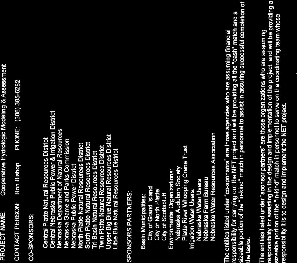

40