Interim: Developing a local water management strategy
|
|
|
- Carmella Burns
- 5 years ago
- Views:
Transcription
1 Interim: Developing a local water management strategy Department of Water December 2008
2 Department of Water 168 St Georges Terrace Perth Western Australia 6000 Telephone Facsimile Government of Western Australia 2008 December 2008 This work is copyright. You may download, display, print and reproduce this material in unaltered form only (retaining this notice) for your personal, noncommercial use or use within your organisation. Apart from any use as permitted under the Copyright Act 1968, all other rights are reserved. Requests and inquiries concerning reproduction and rights should be addressed to the Department of Water. ISBN (print) ISBN (online) Acknowledgements This document was prepared for the Department of Water by Essential Environmental Services. Figures were contributed by Thompson, McRobert and Edgeloe (TME), EPCAD and Emerson Stewart. The Department of Water would like to thank the following organisations for their contribution to this publication: Urban Development Institute of Australia (WA) Institute of Public Works Engineering Australia JDA Consultant Hydrologists Emerson Stewart TME. For more information about this report, contact the Drainage and Waterways branch of the Department of Water. Cover photos: A water-sensitive urban development in Mandurah, courtesy of Essential Environmental Services.
3 Contents Contents...i Figures... i Tables... i 1 Aim of this document Urban water management Local structure planning Design objectives Drainage and water management plans Developing a local water management strategy When to prepare a local water management strategy What should be addressed in a local water management strategy How to develop a local water management strategy Issues that may require special consideration District-level information Monitoring...21 Pre-development...21 Post-development Fragmentation of land ownership Staging of development In summary...25 Appendix...26 Appendix 1 Design objectives for water sensitive urban design Water conservation potable and wastewater...26 Water quantity management...26 Water quality management...27 Disease vector and nuisance insect management...27 Appendix 2 Local water management strategy checklist Appendix 3 Example figures Glossary...45 Bibliography...47 Figures Figure 1 Figure 2 Planning framework that integrates water planning with land planning processes...3 Recommended design process for development of a local water management strategy...15 Tables Figure 1 Figure 2 Planning framework that integrates water planning with land planning processes...3 Recommended design process for development of a local water management strategy...15 Department of Water i
4
5 1 Aim of this document This document provides guidance on urban water management issues to be addressed at the local planning stage of the land development process to support the rezoning of local schemes and/or local structure planning. It guides the preparation of documentation to support decisions about urban structure and landscape for new residential, rural-residential, commercial or industrial development (including redevelopment) areas. This document is targeted at engineers and designers but also provides information useful to planners. This document aids the implementation of State planning policy no. 2.9: Water resources (Government of Western Australia, 2006), Liveable neighbourhoods: a Western Australian government sustainable cities initiative (WAPC, 2007) and provides more detailed guidance on delivering Better urban water management (WAPC, 2008). Local structure planning is a critical stage in supporting better urban water management outcomes. An integral part of the design process is the consideration of how the urban structure responds to the water resources onsite drinking water, stormwater, surface water, groundwater and wastewater. A local water management strategy is required to support rezoning to residential, ruralresidential, commercial or industrial developments at the local scheme amendment stage. Alternatively, where the provisions of the zone require a local structure plan, a local water management strategy may be provided to support that structure plan, consistent with Better urban water management (2008). Under both these scenarios, the local water management strategy will be approved by the Western Australian Planning Commission on the Department of Water s advice, as part of the scheme amendment s gazettal or structure plan s endorsement. A local water management strategy should be prepared for the entire amendment/structure plan area, even if subdivision is planned to occur in stages. 1 Water management for small-scale 2 or infill developments with no significant waterresource management issues 3 can be addressed at the subdivision stage through an urban water management plan, which would need to be submitted with the application for subdivision. Proponents should seek advice from the Department of Water about the requirements for water information to support local planning for infill or where smallscale development is proposed. Guidance for addressing water management during subdivision is contained in Urban water management plans: Guidelines for preparing plans and for complying with subdivision conditions (DoW, 2008). 1 As a general guide, a local water management strategy will be required for development of greater than 100 to 150 lots (8 10 ha) or any area with significant water-resource issues; however, this should not be used as a cut-off criteria for the preparation of the strategy. 2 Small-scale development may be considered to be less than 100 to 150 lots (8 10 ha); however, this is only a guide and the Department of Water may request a local water management strategy for a smaller area or number of lots depending on circumstances. 3 In general terms this includes areas containing or adjacent to wetlands, significant vegetation, water-source protection areas and waterways, and areas with high or medium risk of acid sulfate soils, high groundwater table, existing or potential for soil or groundwater contamination or high levels of nutrients. The presence of soils with low permeability or high gradients may also require special consideration. Department of Water 1
6 2 Urban water management Better urban water management (2008) provides a framework for integrating land and water planning and decision-making processes. It has been prepared in partnership with all levels of government so that the State planning policy no. 2.9: Water resources (2006) can be more effectively implemented. Both these documents promote management of the urban water cycle as a single system in which all urban water flows are recognised as a potential resource and where the interconnectedness of water supply, stormwater, wastewater, flooding, water quality, wetlands, watercourses, estuaries and coastal waters is recognised. They also require development to consider total water-cycle management and water-sensitive urban design principles and ensure that development is consistent with current best management practices and best planning practices for the sustainable use of water resources. The decision-making framework identified in Better urban water management (2008) outlines how a planning proposal should demonstrate compliance with the policies and principles of State planning policy no. 2.9: Water resources (2006) using relevant urban water management information at each stage of the planning process (see Figure 1). At the local structure plan or local scheme amendment stage, the relevant urban water management information is outlined in a local water management strategy. 2 Department of Water
7 This guideline applies here Figure 1 Planning framework that integrates water planning with land planning processes 2.1 Local structure planning A site s water characteristics (both pre- and post-development) including groundwater, wetlands, waterways, drinking-water-source areas, stormwater and wastewater are an important consideration when determining its final urban form and community design. These factors are largely determined as part of a local structure plan, which is a critical stage for achieving better urban water management outcomes in new developments. New urban developments should aim to achieve the best water management outcomes possible. Many areas proposed for development are constrained by water issues such as wetlands, shallow groundwater or nutrient-rich groundwater. Water supply and wateruse efficiency are also crucial issues given the current and future pressures on the state s limited water resources. Proponents must consider how the development will address these issues and achieve the agreed design objectives. 2.2 Design objectives For greenfield, redevelopment/brownfield and infill developments 4, the design objectives to be met will be set out in any applicable Department of Water drainage and water management plan or any endorsed district water management strategy. Where no drainage and water management plan or district water management strategy is available, the design objectives outlined in Better urban water management (2008) shall apply. These are replicated in Appendix 1. 4 See Glossary for definition of terms. Department of Water 3
8 2.3 Drainage and water management plans The Department of Water may prepare a drainage and water management plan for an area with development pressures. The drainage and water management plan will provide district-level information about pre-development conditions and outline design objectives for the area. It should be used to inform the preparation of a district water management strategy, which identifies post-development strategies for water management in a development area. Refer to Better urban water management (2008) for more information about district-level requirements. Any local water management strategy will need to address the design objectives and site conditions outlined in any relevant drainage and water management plan and/or district water management strategy. Where a district water management strategy is not available, the local water management strategy should address the objectives and issues outlined in the drainage and water management plan. In areas where a drainage and water management plan is significantly progressed, the Department of Water may choose to defer consideration of a local water management strategy until the drainage and water management plan has been finalised. If a local water management strategy appears to be in accordance with a draft drainage and water management plan, the Department of Water is unlikely to object to the advertising of the planning proposal for public comment provided it is not approved prior to and is made consistent with the final drainage and water management plan. 4 Department of Water
9 3 Developing a local water management strategy A local water management strategy is a water management document prepared by a proponent to support a land-use planning proposal at the local level (local planning scheme amendment or local structure plan). It is informed by a district water management strategy (if prepared) and demonstrates how the proposed urban structure addresses water use and management to guide all stages of subdivision. The local water management strategy should be summarised in a chapter of the planning document and attached as a technical appendix. 3.1 When to prepare a local water management strategy State planning policy no. 2.9: Water resources (2006) and Liveable neighbourhoods (2007) note the importance of integrating water resources into structure planning and the need for preparation of an integrated land-use and water management strategy or urban water management strategy. Better urban water management (2008) recommends preparation of a local water management strategy to support a local scheme amendment or local structure plan. Determining the design response at the subdivision stage is too late in the process to achieve optimal water management outcomes. Thus proponents are required to submit a local water management strategy at the local planning stage to show how they propose to manage all forms of water within the urban structure. The Department of Water recognises that there are many variations in terms of planning process and development circumstances that may occur and, in response to this, will allow some variation in the timing of submissions. In general terms, the Department of Water recommends preparation of a local water management strategy in the circumstances outlined in Table 1. The Department of Water reserves the right to request preparation of a local water management strategy to support local structure planning or rezoning in other circumstances. If a concurrent region scheme and local scheme rezoning is proposed, it should be supported by a district water management strategy (prepared by the proponent), followed by a local water management strategy in support of the structure plan. If a structure plan is not required by the local planning scheme before subdivision can be applied for, then the concurrent region and local scheme rezoning should be supported by a combined district and local water management strategy. If a local water management strategy is prepared to support a local scheme amendment, its requirements must be incorporated into a local structure plan. Where a local water management strategy is endorsed by the Department of Water as part of the scheme amendment process, it will not require further assessment or approval unless modifications are proposed. Department of Water 5
10 Table 1 Circumstances that require preparation of a local water management strategy Land type Planning tool Action Greenfield areas Brownfield/ redevelopment areas Infill and smallscale development of >30 lots with no significant water resource management issues Region scheme Previously rezoned and supported by district water management strategy Previously rezoned and not supported by district water management strategy Previously rezoned No region scheme N/A Local planning scheme Rezoning proposed Rezoning proposed Previously rezoned Rezoning proposed Previously rezoned Rezoning proposed Previously rezoned Local structure plan Not yet prepared Not yet prepared Proposed Not yet prepared Proposed Not yet prepared Proposed Provided the provisions of the zone require preparation of a structure plan, the preparation of the local water management strategy consistent with the district water management strategy can be deferred to support the structure plan. Rezoning should be supported by a district water management strategy. A local water management strategy will be required to support the local structure plan; however, these documents can be combined if the amendment and structure plan are concurrent. Refer to Better urban water management (2008). Local structure plan to be supported by local water management strategy. Rezoning should be supported by a district water management strategy. A local water management strategy will be required to support the local structure plan. Refer to Better urban water management (2008). Local structure plan to be supported by local water management strategy. Provided the provisions of the zone require preparation of a structure plan, the preparation of the local water management strategy can be deferred to support the structure plan. Local structure plan to be supported by local water management strategy. N/A N/A N/A Issues to be addressed through an urban water management plan to be lodged with the application for subdivision. Where <30 lots are proposed in an area with no significant water management issues, an urban water management plan may not be required and development should be consistent with the Stormwater management manual for Western Australia (DoW ). In areas where a drainage and water management plan has been significantly progressed by the Department of Water, the local water management strategy should be prepared consistent with this plan. No decision to finalise the local scheme amendment should occur until the district water management plan and local water management strategy has been finalised and approved by the Department of Water. The Department of Water is unlikely to object to the advertising of the planning proposal 6 Department of Water
11 for public comment provided it is not approved prior to and is made consistent with the final drainage and water management plan. 3.2 What should be addressed in a local water management strategy The purpose of a local water management strategy is to inform the decision-making process. It does not need to be a lengthy document; however, all issues relevant to the site must be addressed. A local water management strategy should address all elements of the total water cycle that are relevant to the development area and associated catchment. Broadly, the strategy should provide a proof of concept 5 for how water will be managed and address: principles, objectives and design criteria for total water-cycle management the proposed development existing site characteristics, site constraints and opportunities including the capacity of the land to sustain the proposed land uses based on onsite investigations as appropriate conceptual urban water management system, providing proof of concept which includes: fit-for-purpose water-use strategy and water sustainability initiatives quantification of land required for flood conveyance and storage identification of land required for water quality treatment existing groundwater levels and any proposed controlled groundwater level maintenance of any water-dependent ecosystems best management practices for water quantity and quality management documentation of alternative water supply, stormwater conveyance and stormwater treatment infrastructure including proposed locations and management requirements wastewater re-use management plan where required landscape concept for public open spaces including the purpose and design of any constructed waterbody 6 issues to be addressed at subdivision stage monitoring and maintenance proposed implementation of strategy. Guidance on what should be included in a local water management strategy is provided in Table 2. 5 Proof of concept is a short synopsis of a certain method or idea(s) to demonstrate its feasibility. 6 Refer to the Department of Water s Interim position statement: Constructed lakes (2007) for further information. Department of Water 7
12 Table 2 What to include in a local water management strategy, by section Requirement Executive summary Provide a summary of the development s design strategy, outlining how the design objectives are proposed to be met. This should include critical elements of the design, particularly at control points (e.g. peak flows, invert levels) and highlight key management practices to be employed. Comment Where possible, provide quantitative measurements for critical elements of the design that need to be met and translated into the subdivision design. Note where further work is required to confirm design/strategy elements. 1. Introduction The objective of the local strategy is to achieve better urban water management outcomes, providing references to key state and/or local policies, guidelines and requirements, including local catchment strategies. This section should also provide a summary of the planning background, including dates of rezoning (and amendment numbers) and refer to previous studies in the area. 2. Proposed development This section should outline the key elements of the structure plan, particularly those that reflect the vision of the proposed development. Site context should also be provided so that waterrelated issues between neighbouring lots are outlined and assessed and any potential offsite or onsite impacts can be identified (e.g. what groundwater levels have been set in the adjacent development?). It should provide the landscape concept for any area of public open space and if using Liveable Neighbourhoods (2007) criteria (Element 4), show how credits for public open space have been determined, consistent with the local structure plan. 3. Design criteria Clearly state the design criteria that apply to the development area and identify the source of the criteria. The remainder of the document should provide the strategy for achieving the design criteria. 4. Pre-development environment Clearly outline the pre-development environment. This should be based on existing information and local site investigations. Information to be presented (preferably with supporting data) includes: Current land use, topography and soils including porosity and Phosphorus Retention Index (PRI) and acid sulfate soils (see Planning Bulletin 64: Acid sulfate soils (WAPC 2007)). Environmental assets and water-dependent ecosystems including wetland types and classification, public drinking-water-source areas, Bush Forever (WAPC 2000), and regionally and locally significant flora and fauna. Floodways, floodplains, catchments and capacity of surface-water flows and existing drainage There is no need to include definitions of water sensitive urban design or similar. References to appropriate literature should demonstrate that the consultant is aware of key state and/or local policies, guidelines and requirements. Accurate referencing is important. A current map of the proposed structure plan must be included. This should also provide some context regarding neighbouring properties. Generic design criteria are contained in Appendix 1 on page 28. Specific criteria may be provided in any preceding district water management strategy or Department of Water drainage and water management plan. It is important that preliminary site investigations are conducted to establish local conditions to which the water management strategy can respond. Be clear about the information obtained from existing sources and that obtained from recent site investigations. Identify any areas where further investigation is required before the detailed design is finalised. Sampling regimes should be consistent with the requirements of any endorsed district water management strategy. For infill development areas without a district water management strategy, the surface-water and groundwater monitoring program should be agreed with the 8 Department of Water
13 Requirement infrastructure including analysis of 1-year, 5/10- year and 100-year Average Recurrence Interval (ARI) pre-development flows. Adopted runoff rates should be identified. Surface-water quality sampling including locations representative of the site as well as environmental assets. Groundwater levels, depth, direction and quality, confirmed at the local scale using a network of bores representative of the site, the variation in hydrogeology and including environmental assets. Identification and mapping of all monitoring sites. Existing infrastructure and any constraints to design. Where a non-potable water source is proposed, the sustainable supply from the proposed source(s) should be validated. Where previous land use has the potential to affect the design (i.e. potential for soil or groundwater contamination or high levels of nutrients), this should be noted and appropriate action taken. 5. Water sustainability initiatives Identify the water sustainability strategy proposed to meet the design criteria. The strategy should address waterwise landscaping and irrigation requirements for both public and private spaces, as well as water sustainability initiatives within the development, having consideration of imported drinking water, rainwater, groundwater and wastewater. Arrangements for implementation of the strategy, including the approvals required and mechanisms for adoption of best management practices, should be clear and have the prior agreement of key stakeholders. 6. Stormwater management strategy Clearly outline the stormwater management strategy to be used across the site that meets the design criteria outlined in the report. This should include: quantification of upstream surface-water flows rates and volumes (including invert levels) to be received by the development area and allowable discharges into waterways, constructed drains and wetlands from each subcatchment of the development area for critical events 100-year flowpath, flow velocity and top water level as well as required storage areas and depiction of these areas on the structure plan area required for attenuation of post-development 5- year ARI event (local government serviceability criteria) or 10-year ARI event in industrial/ commercial areas post-development critical 1-year ARI peak flows, volumes and area required for retention proposed connection strategy for lots the proportion of constructed impervious surfaces including approximate impervious area for each catchment area required for treatment of stormwater and Comment Department of Water. Where a non-drinking water source is proposed, it will need to be substantiated with a site water balance. Refer to Developing alternative water supplies in the Perth metropolitan area series (Water Corporation, 2007) for further information. Additional information on water re-use and efficiency options can be found on the Department of Water and Water Corporation websites. This section should make recommendations based on appropriate measurement and modelling. Clearly state the types of models used and the assumptions used in the modelling. Where it is necessary or desirable to modify the current hydrological regime of significant water-dependent ecosystems, the ecological water requirement of the water-dependent ecosystem should be established consistent with the Department of Water s guideline for determining ecological water requirements in urban developments (in preparation). Subsoil drains shall have open outlets and discharge into bio-filtration areas, which, where appropriate, may be incorporated into the floodplain of waterways and/or immediately outside vegetated buffer areas of wetlands. Where restoration or revegetation of buffers is required, biofiltration areas may be incorporated into the restored buffer area where appropriate to Department of Water 9
14 Requirement subsoil drainage flows post-development hydrology of water-dependent ecosystems including frequency, extent and duration of inundation for critical events and management of water quality discharge points (peak flows, invert levels) from the structure plan area modelling parameters and assumptions (catchment roughness and loss model, catchment slopes, hydraulic roughness). Considerations for design include: Floodways to be left undeveloped and unobstructed. Final surface level should allow finished floor levels to be 0.5 m above the 100-year flood level (check with your local government and consider climate change). Maintain or improve the existing cross-sectional area of waterways and restore drains in a manner reflective of natural systems where possible. Detention of the 1-year 1-hour ARI event as close to source as possible (within the street network if possible). Any storage in open space areas to be vegetated (more than grass) and not part of active public open space. Peak flows from developed areas to be attenuated to pre-development peak flows (unless otherwise agreed) for critical events at critical points. Quantification of the land storage and retention required for the 100-year ARI, 5-year ARI and 1- year ARI storm events. Identify major arterial roads to provide emergency access routes in the 100-year ARI event. Refer to Liveable Neighbourhoods (2007), Element 5, Figure 60 and consult your local government. The hydrological buffer required for any wetland may be different than the ecological buffer required. Confirm wetland buffer requirements before the design stage. 7. Groundwater management strategy Outline the strategy for the management of groundwater across the development area. This should include information, presented where possible with supporting data, which clearly shows: Post-development groundwater levels (showing any change from pre-development a controlled groundwater level). Any change to groundwater levels in the location of groundwater-dependent ecosystems. Finished surface level relative to final groundwater level. Soil permeability and soil compaction criteria of any imported fill. Comment enhance ecological functions. The size of the bio-retention (rain garden) treatment areas shall be at least 2 per cent of the constructed impervious surfaces. Water quality treatment systems and water sensitive urban design structures should be designed in accordance with the Stormwater management manual for Western Australia (DoW, 2007) and Australian runoff quality: a guide to water sensitive urban design (Engineers Australia, 2006). Contact your local government to ensure its support for the future maintenance requirements of the recommended treatment measures. Where there is significant interaction between groundwater and surface water, these two sections may be combined. Consideration must be given to the presence of actual or potential acid sulfate soils and any areas of high nutrients or contamination. The hydrological regime of significant water-dependent ecosystems should be maintained (unless otherwise agreed). If the maximum groundwater level is at or near the surface level 7, appropriate action to address inundation and/or rising damp is 7 Further guidance will be provided by Department of Water position statement: Groundwater management in urban development (In prep). 10 Department of Water
15 Requirement Comment If and where subsoils are to be used and the level at required. This response can either be which they are to be set. Where groundwater is rich installation of subsoil drainage or in nutrients, all water discharging from the subsoil importation of clean fill. The depth at which network must be treated before discharge to the subsoil drains are installed will be the receiving environment. Outlets from the subsoil controlled groundwater level. This should network should be free draining. be determined having consideration of the need to protect significant water-dependent ecosystems. In areas where there are no significant water-dependent ecosystems, average annual maximum groundwater level can be used to determine the drainage (controlled groundwater) level. Impacts of groundwater abstraction and local drawdown should also be considered. Where it is necessary or desirable to modify the current hydrological regime of significant water-dependent ecosystems, the ecological water requirement of the water-dependent ecosystem should be established consistent with the Department of Water s guideline for determining ecological water requirements in urban developments (in preparation). Clean fill imported onto the site should have the capacity to reduce phosphorus export through soil leaching, while also meeting soil permeability and soil compaction criteria specified by your local government. Where the phosphorous retention index is insufficient, the fill should be amended. 8. The next stage subdivision and urban water management plans Provide clear instructions on the content and coverage of future urban water management plans to be completed at subdivision. This should include areas where further investigations are required before detailed design. Construction staging should also be addressed. 9. Monitoring Identify the recommended program for monitoring to support development of urban water management plans (locations, methods, frequency, duration and parameters) as well as the likely monitoring program post-development. Identify contingency action plan and trigger values. 10. Implementation Clearly state the developer s commitments to deliver the local water management strategy including timing for actions and requirements to implement the strategy immediately and into the future, including contingency measures. Provide a statement on the need for review of the local water management strategy, particularly in response to changes in the local structure plan or future subdivision design. Guidance is contained within Better urban water management (2008) and Urban water management plans: Guidelines for preparing plans and for complying with subdivision conditions (2008). Refer to the Australian guidelines for water quality monitoring and reporting (ANZECC, 2000) or contact the Department of Water and your local government to obtain advice on an appropriate program. See also Section 4.2 on page 23. Consultation with your local government and any other service provider should occur before you begin and then before you finalise your local water management strategy to ensure support for its recommendations and requirements. The Department of Water recognises the possibility of many different responses to a list of requirements. Although this document aims to provide detailed guidance on the preparation of a local water management strategy, it is difficult to accurately describe Department of Water 11
16 what is required in all circumstances as each local water management strategy will be a direct response to the site and the planned development. There is no one-size-fits-all approach. The degree to which site investigations are undertaken and the level of information provided in the local water management strategy should reflect the significance of the ecological assets or the likely level of risk to the water resources on and adjacent to the site. In general, a development proposed on a site with significant water-resource issues should be supported by a greater level of investigation and information than a development on an unconstrained site. A local water management strategy should only contain information to support a conclusion or decision about the management of water within the proposed development. It should not contain information for information s sake. Proponents should obtain advice on how to address the requirements in a site-specific context from their local government and the Department of Water at an early stage in the project. It is likely that other studies relevant to the local water management strategy will be required to support the structure plan. These may include a wetland management plan, acid sulfate soils management plan, contaminated sites review or field surveys for flora and fauna. While the Department of Water does not require these studies as part of the local water management strategy, proponents should refer to any commitments to other agencies in the strategy. Proponents should consult with regulatory agencies, their local government and any other service provider (e.g. Water Corporation, Department of Environment and Conservation, Department of Health) in formulating their local water management strategy to ensure all requirements for additional studies are completed or scheduled to be completed as part of the planning and development process, as necessary. A checklist outlining the issues to be addressed in the local water management strategy is provided in Better urban water management (2008) and Appendix Department of Water
17 3.3 How to develop a local water management strategy An integrated urban form and water-resource design process is a critical factor in meeting the agreed design objectives for a site. A multidisciplinary project team led by a suitably qualified person (i.e. engineer) should undertake this process. This team should contain a member of the urban design team (or liaise closely with it), as the water management strategy will have a direct impact on the final urban form. An iterative process of design is recommended. It is also recommended that the team liaise with the Department of Water, the relevant local government and the Water Corporation (if necessary) at an early stage in the process to identify critical issues to be addressed. The local government should be consulted to identify any local policies that influence water management, public open space and/or landscaping. Water sensitive urban design requires consideration of all forms of water including drinking water, wastewater, stormwater, groundwater and water for the environment. To determine appropriate strategies to manage these forms of water, proponents should consider the specific conditions of the site. They should carry out site investigations to ensure local conditions are described adequately. The design outcome will therefore be a response to these conditions, within the overall planning vision for the proposed development. For new developments of greenfield sites, it is anticipated that appropriate district-level monitoring will have been undertaken before the local water management strategy is approved. This could be in the form of a Department of Water drainage and water management plan or a district water management strategy. Further guidance on monitoring requirements is in Section 4.2. Where this information has not been provided, site investigations will be required to identify the following district-level information, which is necessary to guide informed development of the local water management strategy: design objectives major flowpaths major flow rates, levels and quality flood design levels district groundwater contours district water balance environmental water requirements for significant water-dependent ecosystems wetland buffers groundwater availability. The principles and strategies of water sensitive urban design are outlined in detail in several key references listed in the references section. To meet these principles and design objectives, a seven-step design process is recommended (see Figure 2). Department of Water 13
18 Each step requires particular information that is used to produce an output and/or outcome which is used in the next step. The recommended process is described in more detail in Table 3. Additional guidance on how to address urban water management in local structure plans is contained within Liveable Neighbourhoods (2007), the Stormwater management manual for Western Australia ( ), Australian runoff quality guidelines: A guide to water sensitive urban design (2006) and Australian rainfall and runoff: A guide to flood estimation (2001). Catchment-specific guidance such as the Peel-Harvey WSUD local planning policy (PDC, 2006) and Peel-Harvey WSUD technical guidelines (PDC, 2006) have also been published to assist with preparation of documents in the Peel-Harvey catchment. Other catchment-specific information may also be available. 14 Department of Water


19 Figure 2 Recommended design process for development of a local water management strategy Department of Water 15
20 Table 3 How to prepare a local water management strategy Required action Inputs and Information Tools Outputs Outcome Likely timing Report chapter Step 1: Gather information and map site characteristics Talk to your local government, Department of Department of Water database. Desktop survey. Water and Water Landgate GIS Corporation. system. Locate appropriate sites for groundwater bores and Previous studies. surface-water measurement. Existing drainage features and external surface-water and groundwater catchment characteristics and issues. Water-dependent ecosystems, acid sulfate soils, past land use, soils, vegetation coverage. Identification of critical issues for drainage and water management design. At least 18 months before intended submission date. 4. Predevelopment environment Step 2: Undertake site sampling at local level (confirm district-level information) Map surface runoff catchment/topographic divides. Locate existing infrastructure. Characterise relationship of hydrological features. Sampling of groundwater bores levels and quality. Sampling of surface-water flows and quality (where applicable). Site feature survey including existing drainage infrastructure. Site survey and monitoring. Local groundwater levels and quality. Pre-development floodpaths and levels identified and mapped. Map of surface runoff catchment(s) (including any public drinking-water-source areas). Existing infrastructure including constraints to design. Surface-water quality (if relevant). Local-level site characteristics described and mapped. At least 18 months before intended submission date. 4. Predevelopment environment
21 Required action Inputs and Information Tools Outputs Outcome Likely timing Report chapter Step 3: Refine pre-development characteristics Develop pre-development hydrologic and hydraulic drainage model (1, 5/10 and 100-year flows). Determine pre-development nutrient inputs. Where a non-potable source is proposed, predevelopment water balance. Consider significant wetlands. From steps 1 and 2. Department of Water district water management plan if available. Use hydrologic and hydraulic models as appropriate (refer to Engineers Australia publications). Document assumptions. Refine pre-development groundwater levels, including maximum and average annual maximum groundwater level Confirm allowable surfacewater and groundwater discharges (drains, wetlands) Pre-development water and nutrient balance. Baseline for system design. Six months before intended submission date Before determination of lot layout and location of public open space. 4. Predevelopment environment. Step 4: Drainage and water management system design Objective: Protect from flooding Development should not occur within a floodway. Floor levels to be at least 0.5 metres above the 100- year flood level. Check requirements with Department of Water, your local government and Water Corporation where necessary and consider climate change using a sensitivity analysis. Design objectives. Allowable discharges. Requirements of any waterdependent ecosystems. Department of Water district water management plan if available. Use hydrologic and hydraulic models as appropriate (refer to Engineers Australia publications). Document assumptions. 100-year flowpaths, levels and storages quantified and mapped. Requirements for fill identified and mapped. Requirements for subsurface drainage identified critical control points and locations mapped. Meets objectives. Accommodate major floods in road reserves and public parkland. Should be undertaken in parallel with determination of block layouts and location of public open space areas. 6. Stormwater management strategy 7. Groundwater management strategy
22 Required action Inputs and Information Tools Outputs Outcome Likely timing Report chapter Objective: Manage serviceability Contact local government to determine requirements. Design objectives. Outputs of steps 1, 2 and 3. Department of Water district water management plan if available. Use hydrologic and hydraulic models as appropriate (refer to Engineers Australia publications). Document assumptions. Stormwater Management Manual 5-year flowpaths and storages mapped and quantified including postdevelopment discharges. Water conveyance best management practices to be put in place are identified. Meets objectives. This event should not be contained within active playing fields. 6. Stormwater management strategy Objective: Protect ecology Retain or detain the runoff from constructed impervious surfaces generated up to the 1yr 1hr ARI event. Provide treatment measures for this runoff and for subsoil drainage flows. Design objectives Outputs of steps 1, 2 & 3 Identify controlled groundwater level. 1-year flowpaths, storages and treatment areas quantified and mapped. Water quality best management practices and treatment trains to be put in place are identified. Meets objectives. Bio-retention areas to be at least 2% of additional/ constructed impervious areas. Other systems should be sized in accordance with Stormwater management manual (2007). 6. Stormwater management strategy 7. Groundwater management strategy
23 Required action Inputs and Information Tools Outputs Outcome Likely timing Report chapter Objective: Sustainable water use Identify alternative water source where possible including service provider. Minimise water use in public open space. Minimise use at lot scale. Step 5: Test design Test the effectiveness of the design in meeting the design objectives while ensuring value for money. Ensure the water management strategy requirements feed into the structure plan design. Design objectives. Pre-development water balance. Design objectives. Info from steps 1, 2, 3 and 4, Water balance. Sensitivity analysis or risk assessment that considers: ongoing maintenance costs, responsibilities and risks if not undertaken climate change scenarios and risks potential infrastructure failure monitoring/ contingency actions for best management practices. Landscape use including available groundwater allocation. Non-potable source (water re-use). Water efficiency options. Implementation methods. Structure plan layout that sets aside sufficient land to meet water quantity and quality objectives, including flood protection of the proposed development area. Identification of critical elements that must be implemented and incorporated into the future urban water management plan (non-negotiable) to ensure achievement of design objectives. Demonstration that the strategy is feasible and able to be implemented. Meets objectives. Structure plan that meets objectives and is able to be implemented. If an alternative source is proposed, negotiations should start before initiation of local water management strategy. 5. Water sustainability initiatives.
24 Required action Inputs and Information Tools Outputs Outcome Likely timing Report chapter Step 6: Identify further work required (urban water management plans) Identify needs to ensure implementation including more detailed site investigations and monitoring. Step 7: Write up local water management strategy Confirm support from local government and other service providers for proposed strategy. From steps above. Funding and responsibilities. Maintenance schedules. Monitoring program. Copies of correspondence within an appendix as appropriate. Note: The information provided in this table is indicative only. Inputs, information and tools should be applicable and appropriate to the specific circumstances of the site and the proposed development. 8. Subdivision and urban water management plans.
25 4 Issues that may require special consideration Depending on the particular development circumstances and site conditions, the following issues may require special consideration. 4.1 District-level information This document assumes that a district water management strategy has been prepared to accompany a preceding planning proposal (such as a region scheme amendment or the lifting of urban deferred zoning) or the Department of Water has released a drainage and water management plan that covers the subject area or both a drainage and water management plan and a district water management strategy are available. Where only limited district-level information is available, additional information is likely to be necessary to demonstrate how the site characteristics are influenced by and will impact on the surrounding area and catchments. Existing available data and/or onsite sampling and monitoring will need to describe the site adequately to inform the local water management strategy design. In this situation a combined district water management strategy and local water management strategy may be required. If land is currently zoned urban deferred, it is recommended that appropriate information, in the form of a district water management strategy, is prepared to support the lifting of the urban deferred zoning. Where planning is significantly progressed, the Department of Water may give this requirement special consideration. Further guidance on information required at the district level will be provided in the Department of Water position statement: Implementing better urban water management (DoW, in press). 4.2 Monitoring Pre-development Proponents will need an agreed level of pre-development monitoring up to the time of subdivision and commencement of site works. This should be reflective of the constraints of the site and the presence of or potential impact on significant water dependant ecosystems. In greenfield and development situations, where rezoning and structure planning is required, the Department of Water recommends a pre-development data period of three years at the time of lodgement of the structure plan. Although the standard 3 year pre-development monitoring requirement should be achievable within the usual planning timeframes, it may not be necessary in brownfield or redevelopment Department of Water 21
26 situations where the catchment is already highly modified and there are no significant ecosystems. It will be necessary in these circumstances to demonstrate sufficient knowledge of the system requirements and control points. Where the Department of Water has produced a drainage and water management plan, a reduction to the standard three year pre-development data period may be accepted. In addition, where there is no surface water flow paths (channels) within the development area this data period may be reduced to 18 months (two winters) provided accurate baselines can be established and recommendations can be supported, particularly for groundwater levels and quality. Where a reduction to the standard three years pre-development monitoring requirement is proposed, it is the responsibility of the proponent to demonstrate to the Department of water that sufficient data is already available to support the planning decision being requested. Any proposed reduction to the standard monitoring requirement should be discussed and approved by the Department of Water as part of early preparation for water management planning and before the Local water management strategy has been finalised. Considerations for a reduction to the monitoring requirements will be based on any risks that the data provides (for example, whether the data is consistent with results from surrounding areas). Requirements for the quantum of data may be varied depending on site specifics and may be reduced over time depending on the results of the data. If the site is outside a Drainage and water management plan area, generic monitoring program requirements may be applied in the absence of more site specific guidance. Post-development The format and frequency of post-development reporting should be proposed within the local water management strategy and approved by your local government and the Department of Water. Where a trigger for contingency action (as specified in the local water management strategy) is reached, it will be necessary to report on the action taken. The post-development monitoring program should be outlined and tailored to the development, quantifying the development s impact on surface-water quality, surface-water flows, and groundwater-level seasonal fluctuations and quality. The monitoring results can then provide: pre-development baseline data post-development comparisons to target design objectives and criteria a trigger for contingency action, as per the contingency plan an interim internal assessment tool of the monitoring program. About the monitoring program: All monitoring results should be provided to the Department of Water in an agreed format. A short report on these results should be submitted with the monitoring data. If a trigger value for contingency action has been reached, it 22 Department of Water
27 will be necessary to provide a more detailed report on the proposed action to be taken. Monitoring sampling should follow the Australian Standard AS/NZ 5667 series of water-quality-sampling guidance notes. A National Association of Testing Authorities accredited laboratory is required to perform the water quality testing. The groundwater-monitoring bore network s extent and density should spatially represent the hydrogeology of the local area, to the satisfaction of the local government and Department of Water. Monitoring of groundwater levels should be initially on a monthly basis to establish water-level fluctuations. Surface-water monitoring should determine the pre-development flows from the subject site, all detention or retention storages, and any water-dependent ecosystems. Surface-water monitoring requirements are site-specific and must meet the regulatory bodies recommendations. Samples should be analysed for at least the following water quality parameters: in-situ ph, electrical conductivity total suspended solids total nitrogen and total kjeldahl nitrogen ammonia nitrate and nitrite total phosphorus filterable reactive phosphorus. Additional parameters are recommended in locations where acid sulfate soils and contaminated sites may be an issue. Additional monitoring should be conducted in accordance with Department of Environment and Conservation guidelines. 4.3 Fragmentation of land ownership Work required to identify local conditions should be undertaken by the land owner/developer. Where an area has fragmented ownership, the cost of paying for these studies and the coordination required may cause some difficulty in meeting the requirements. Options for facilitating preparation of a local water management strategy in these circumstances include: a coordinated approach by several land owners coordination by the local government, with an agreed mechanism or arrangement between landowners for funding of the study such as through a development contribution scheme imposition of a special control area that requires certain information before support for rezoning, structure planning or development. Department of Water 23
28 4.4 Staging of development Implementation (construction) of the water management infrastructure should be an important consideration when scheduling the staging (subdivision) of development. Temporary storages may be required where the necessary infrastructure is scheduled to be constructed at a later stage. Critical elements of the water management system should be identified in the local water management strategy to aid appropriate scheduling of development. 24 Department of Water
29 5 In summary The integration of water into the urban design process has been shown to achieve multiple benefits in terms of better management and use of our water resources, as well as creating more liveable and vibrant spaces. Local structure planning is one of the most important steps in achieving better urban water management outcomes, particularly in terms of water re-use and efficiency, water quality treatment and ecological protection and restoration. This document provides guidance on the content and development of local water management strategies, which should be prepared to support the design of urban areas through local structure planning. Although the requirements of each local water management strategy are important, the process that is followed in developing the strategy the design process is critical. It is an iterative process that needs to be integrated with the urban design process to deliver the best outcome. Department of Water 25
30 Appendix Appendix 1 urban design Design objectives for water sensitive The following design criteria are to be used as a guide for development of the urban water management system for strategic planning, subdivision and development (unless other specific objectives have been defined in other approved water management plans/strategies). Demonstration of compliance with these design objectives may be through appropriate computer modelling or other assessment methods acceptable to the Department of Water. Water conservation potable and wastewater Objective No potable water should be used outside of homes and buildings and achieve efficient use of scheme water, where alternative water sources are available. Design criteria Consumption target for water of 100 kl/person/yr as outlined in the State Water Plan (2007) with an aspirational target of not more than kl/person/yr scheme water, as provided in Better urban water management (2008). Water quantity management Objective Post-development annual discharge volume and peak flow be maintained relative to pre-development conditions, unless otherwise established through determination of ecological water requirements for sensitive environments. Design criteria Ecological protection For the critical 1-year ARI event, the post-development discharge volume and peak flow rates shall be maintained relative to predevelopment conditions in all parts of the catchment. Where there are identified impacts on significant ecosystems, maintain or restore desirable environmental flows and/or hydrological cycles as specified by the Department of Water. Flood management Manage the catchment runoff for up to the 1-in-100-year ARI event within the development area to pre-development peak flows unless otherwise indicated in an approved water management strategy or as negotiated with the relevant drainage service provider. 26 Department of Water
31 Water quality management Objective Maintain surface-water and ground water quality at pre-development levels (winter concentrations) and, if possible, improve the quality of water leaving the development area to maintain and restore ecological systems in the (sub)catchment in which the development is located. Design criteria Contaminated sites To be managed in accordance with the Contaminated Sites Act 2003 (WA). All other land If the pollutant outputs of the development (measured or modelled concentrations) exceed catchment ambient conditions, the proponent shall achieve water quality improvements within the development area or, alternatively, arrange equivalent water quality improvement offsets within the catchment. If catchment ambient conditions have not been determined, the development should meet relevant water quality guidelines stipulated in the National water quality management strategy (AWWA, ANZECC & ARMCANZ, 1994). Drainage Ensure that all runoff contained within the drainage infrastructure network receives treatment prior to discharge to a receiving environment consistent with the Stormwater management manual for Western Australia ( ). Swales/vegetated bio-retention systems (also referred to as rain gardens) are to be sized at 2 per cent of the constructed impervious area from which they receive runoff. In addition, all outflows from subsoils should receive treatment prior to discharge to the stormwater system. Stormwater modelling criteria If it is proposed to use a computer stormwater modelling tool to demonstrate compliance with design objectives, the following design modelling parameters are recommended. As compared with a development that does not actively manage stormwater quality: at least 80 per cent reduction of total suspended solids at least 60 per cent reduction of total phosphorus at least 45 per cent reduction of total nitrogen at least 70 per cent reduction of gross pollutants. Disease vector and nuisance insect management To reduce the health risk from mosquitoes, retention and detention treatments should be designed to ensure that between the months of November and May, detained immobile stormwater is fully infiltrated within a time period not exceeding 96 hours. Department of Water 27
32 Permanent water bodies are discouraged, but may be accepted by the Department of Water, where issues outlined in the Interim position statement: Constructed Lakes (2007) are adequately addressed. Any water body must be designed to maximise predation of mosquito larvae by native fauna to the satisfaction of the local government, on the advice of the Department of Water and the Department of Health. 28 Department of Water
33 Appendix 2 checklist Local water management strategy Local water management strategy item Executive summary Summary of the development design strategy, outlining how the design objectives are proposed to be met Introduction Total water-cycle management principles and objectives Planning background Previous studies Proposed development Structure plan, zoning and land use Key landscape features Previous land use Deliverable Table 1: Design elements and requirements for best management practices and critical control points Site context plan Structure plan Notes Landscape proposed public open space areas, public open space credits, water source, bore(s), lake details, irrigation areas (if applicable) Design criteria Agreed design objectives and source of objectives Pre-development environment Existing information and more detailed assessments (monitoring). How do the site characteristics affect the design? Site conditions existing topography/contours, aerial photo underlay, major physical features Geotechnical topography, soils including acid sulfate soils and infiltration capacity, test pit locations Environmental areas of significant flora and fauna, wetlands and buffers, waterways and buffers, contaminated sites Surface water topography, 100- year floodways and flood fringe areas, water quality of flows entering and leaving (if applicable) Groundwater topography, predevelopment groundwater levels and water quality, test bore locations Landscape plan Site condition plan Geotechnical plan Environmental plan plus supporting data where appropriate Surface-water plan Groundwater plan plus site investigations Department of Water 29
34 Local water management strategy item Water sustainability initiatives Water efficiency measures private and public open spaces including method of enforcement Water supply (fit-for-purpose) strategy, agreed actions and implementation Wastewater management Stormwater management strategy Flood protection peak flow rates, volumes and top water levels at control points, 100-year flowpaths and100-year detention storage areas Manage serviceability storage and retention required for the critical 5- year ARI storm events Minor roads should be passable in the 5-year ARI event Protect ecology detention areas for the 1-year 1-hour ARI event, areas for water quality treatment and types of agreed structural and non-structural best management practices and treatment trains (including indicative locations). Protection of waterways, wetlands (and their buffers), remnant vegetation and ecological linkages Groundwater management strategy Post-development groundwater levels, existing and likely final surface levels, outlet controls, and subsoil drain areas/exclusion zones Actions to address acid sulfate soils or contamination Deliverable 100-year-event plan Long section of critical points 5-year-event plan 1-year-event plan Typical cross sections Groundwater/subsoil plan The next stage subdivision and urban water management plans Content and coverage of future urban water management plans to be completed at subdivision. Include areas where further investigations are required before detailed design. Monitoring Recommended future monitoring plan including timing, frequency, locations and parameters, together with arrangements for ongoing actions Implementation Developer commitments Roles, responsibilities, funding for Notes 30 Department of Water
35 Local water management strategy item implementation Review Deliverable Notes Department of Water 31


36 Appendix 3 Example figures Figure A3 1: Site context plan

37 Figure A3 2: Landscape plan
38 Figure A3 3: Site condition plan


39 Figure A3 4: Geotechnical plan Department of Water 35

40 Figure A3 5: Environmental plan

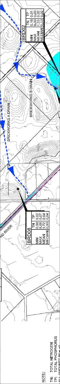
41 Figure A3 6: Surface-water plan

42 Figure A3 7: Groundwater plan

43 Figure A3 8: 100-year-event plan

44 Figure A3 9: 5-year-event plan

45 Figure A3 10: 1-year-event plan