Interstate 66 Tier 1 Environmental Impact Statement Public Hearing
|
|
|
- Tobias Oliver
- 5 years ago
- Views:
Transcription


1 Interstate 66 Tier 1 Environmental Impact Statement Public Hearing

2 1 Project Corridor

3 Study Process / Tiering Approach Tier 1 EIS focuses on broad issues - Purpose and need - Mode / Technology choice - General location and relative impacts Tier 2 analysis will focus on site-specific details - Project-level footprint and impacts - Costs - Mitigation 2

4 Purpose and Need Improve multimodal mobility along the I-66 corridor by providing diverse travel choices in a cost-effective manner. Enhance transportation safety and travel reliability for the public along the I-66 corridor. 3


5 Overview of Corridor Conditions Steady population growth Employment growth in activity centers Congestion and mobility demands Safety concerns 4
6 5 Overview of Corridor Conditions: Population
7 6 Overview of Corridor Conditions: Employment

8 7 Overview of Corridor Conditions: Daily Volume Estimates
 10,000 8,000 Hourly Volume 6,000 4,000 2,000 0")
9 Overview of Corridor Conditions: Total Volumes 12,000 I-66 between VA 234 Business and US 29 (Smoothed) 10,000 8,000 Hourly Volume 6,000 4,000 2,
 7,000 6,000 Hourly Volume 5,000 4,000 3,000 2,000 1,000 0 2011 2040")
10 Overview of Corridor Conditions: Eastbound Volumes 8,000 I-66 EB between VA 234 Business and US 29 (Smoothed) 7,000 6,000 Hourly Volume 5,000 4,000 3,000 2,000 1,
 7,000 6,000 Hourly Volume 5,000 4,000 3,000 2,000 1,000 0 2011 2040")
11 Overview of Corridor Conditions: Westbound Volumes 8,000 I-66 WB between VA 234 Business and US 29 (Smoothed) 7,000 6,000 Hourly Volume 5,000 4,000 3,000 2,000 1,
 4,990 crashes (average of 4.")
12 Overview of Corridor Conditions: Safety Three-Year Crash Information (2006 to 2010) 4,990 crashes (average of 4.5 per day) 2,477 injuries 10 fatalities 11


13 Build Improvement Concepts General Purpose Lanes Managed Lanes Metrorail Extension Light Rail Transit Bus Rapid Transit VRE Extension Improve Spot Locations/Chokepoints Intermodal Connectivity Safety Improvements Transportation Communication and Technology 12

14 13 Build Improvement Concepts: Evaluation of Purpose and Need
15 Build Improvement Concepts: Key Findings Based on the concept analysis, it was determined that: - Fully meeting demand may not be possible given the constraints within the corridor. - A major factor in the decision is space efficiency the ability to carry large numbers of persons within limited spaces. - The No-Build concept does not satisfy the purpose and need. - None of the Build Improvement Concepts, as stand-alone concepts, fully satisfy the purpose and need. - Multimodal solutions would be most effective in addressing transportation needs in the corridor. Therefore, all 10 Build Improvement Concepts, as well as the No-Build, are evaluated in the Tier 1 Draft EIS. 14


16 Affected Environment Resources in the Human (Built) and Natural Environments 15
17 Environmental Consequences: Approach Impact analysis is at a level of detail appropriate for a Tier 1 EIS and decisions. It has the following characteristics: - Uses information at a level of detail that is available at this stage of the project development process. - Focuses on the individual improvement concepts rather than combinations of improvements. - Supports Tier 1 decision-making by focusing on the comparative impacts of various multimodal capacity, operational, and safety improvements. 16
18 Environmental Consequences: Process The 10 Build Improvement Concepts were grouped into four categories ( templates ) based on space requirements for implementation: TEMPLATE FOOTPRINT WIDTH DESCRIPTION Median Outside Interchange VRE Add one lane in each direction (either general purpose or managed lane) 1 Add two lanes in each direction (either general purpose or managed lanes) 2 Add 5 lanes in each direction (general purpose lanes) feet 270 feet 295 feet 355 feet Existing footprint plus 100 feet 100 feet Space within the median would be used by Metrorail Extension, Light Rail Transit, or Bus Rapid Transit. Space to the outside of existing highway would be used for either General Purpose Lanes or Managed Lanes. Widths for three possibilities of Outside widening are considered as part of the impact analysis. Improvements at Spot Locations/Chokepoints would require space within or immediately adjacent to the existing interchange. Requirements for rights-of-way for the VRE Extension would be located off of I-66. Shown as separate VRE Extension Corridor. Note: The estimated widths shown are planning-level; Tier 2 analysis would refine these widths based on more detailed analyses. The Outside templates are indicated as: 1 Outside (Minimum); 2 Outside (Medium); 3 Outside (Maximum) in following tables. The Safety Improvements, Intermodal Connectivity, and Transportation Communication and Technology improvement concepts would take place within existing rights-of-way and therefore are anticipated to have limited need for increased rights-of-way. 17
19 Environmental Consequences: Potential Impacts Quantitative OUTSIDE OUTSIDE OUTSIDE RESOURCE MEDIAN MINIMUM MEDIUM MAXIMUM INTERCHANGE VRE Social and Economic: Approximate template width: 235 feet 270 feet 295 feet 355 feet Existing plus 100 feet 100 feet Residential Relocations Community Facility Relocations Business Relocations Relocations in Minority Census Tracts Relocations in Low-Income Census Tracts Relocations in Limited English Proficiency Census Tracts Farmlands (acres) Public Parks, Recreation Areas, Open Space Easements 2 (acres) Notes: 1: Includes single family and multi-family structures. 2: There are no open space easements located within the study area. Acreage includes potential impacts to one federal, state, and regional park, and five local public parks and recreation areas. Given the nature of Manassas National Battlefield Park as a federally owned national park, it is highly likely that direct potential impacts to the Park will be avoided 18
20 Environmental Consequences: Potential Impacts Qualitative RESOURCE Land Use Air Quality Noise Visual Quality The Build Improvement Concepts are generally consistent with local comprehensive plan objectives which identify the need to improve transportation facilities along the I-66 corridor to reduce congestion and air pollution. The transit improvement concepts (i.e., Metrorail Extension, Light Rail Transit, Bus Rapid Transit, and VRE Extension), and Managed Lanes improvement concepts within the I-66 corridor are compatible with transportation policies of local jurisdictions located along the corridor, because these policies cite the need to move large numbers of people within relatively confined spaces. The VRE Extension concept is consistent with the City of Manassas Comprehensive Plan, which seeks to expand the service and promote infill and transit-oriented development. The Safety Improvements and Transportation Communication and Technology improvement concepts would further contribute to local transportation objectives of reducing congestion by lowering crash rates and providing tools to inform drivers of traffic flow problems. The additional highway lanes associated with the General Purpose Lanes and Managed Lanes improvement concepts would improve traffic flow and increase vehicle speeds, thereby reducing vehicle idling and stop-and-start driving conditions that are associated with higher levels of air emissions. However, an increase in vehicles speeds may have different effects for different pollutants, depending on the rate of speed. The Metrorail Extension, Light Rail Transit, Bus Rapid Transit, and VRE Extension improvement concepts all would reduce the number of vehicles on the roadway resulting in lower air emissions. Improvements to chokepoints to allow traffic to flow more efficiently would also generally result in lower air emissions compared to the existing conditions. Demonstration of conformity with the State Implementation Plan in accordance with the Clean Air Act will occur during Tier 2 when individual projects are analyzed. An initial inventory of noise-sensitive and vibration-sensitive buildings and activity areas adjacent to the study area was completed. Detailed noise modeling, quantification of potential impacts from individual projects, and identification of appropriate abatement measures will be conducted during Tier 2. The noise analyses for the I-66 corridor would be performed in accordance with FHWA 23 CFR 772 and VDOT noise policy. For the VRE Extension corridor, rail sources are the dominant component to the noise and vibration environment and therefore the noise and vibration analyses for the VRE corridor would be conducted according to FTA criteria. The transit improvement concepts (i.e., Metrorail Extension, Light Rail Transit, or Bus Rapid Transit) would introduce a new visual element that suggests a more urban environment. Widening of the roadway as part of the capacity improvement concepts (i.e., General Purpose Lanes and Managed Lanes) as well as Improve Spot Location/Chokepoint would potentially impact views of parkland and farmland through the conversion of open space to a more expansive transportation facility. The intensity of potential impacts would be greatest for the Outside Maximum template. Water Quality The I-66 corridor crosses four impaired water bodies. The Build Improvement Concepts have the potential to increase stormwater runoff velocities and roadway contaminants received by these impaired water bodies, and other water resources in the study area. 19
21 20 Agency Coordination and Public Involvement

22 Agency Coordination 17 Cooperating and Participating Agencies 42 Agencies Participated in Project Scoping Process 21
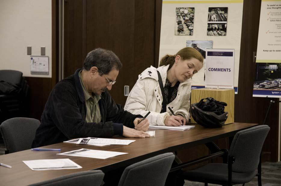
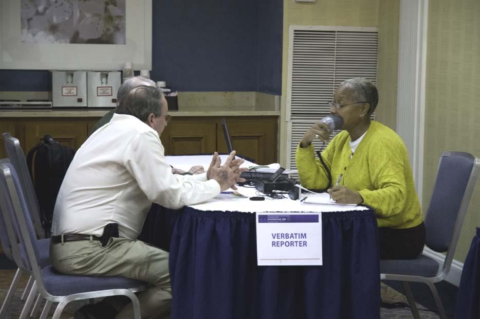
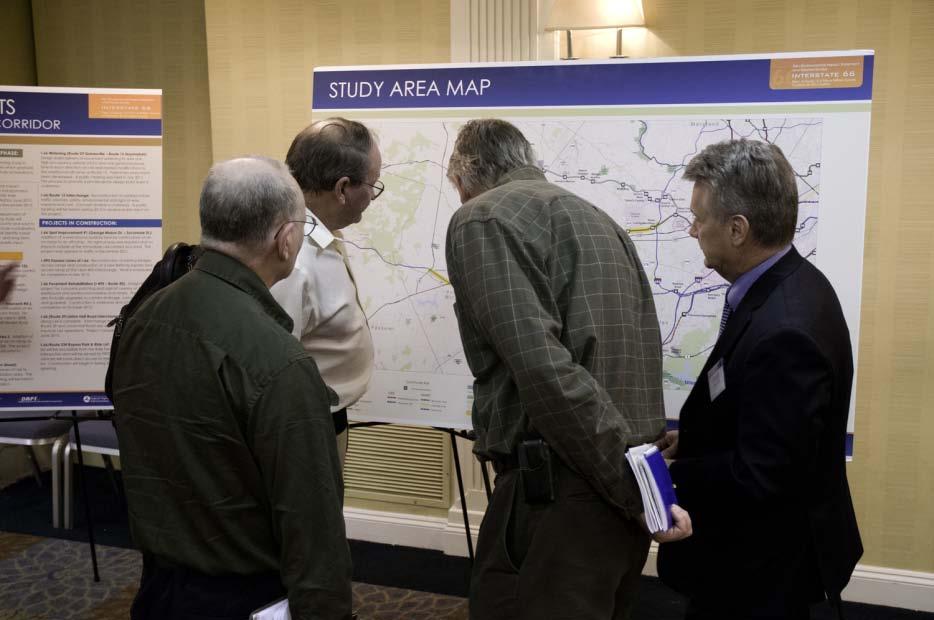
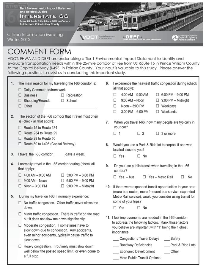
23 22 Public Involvement


24 Provide Us With Your Comments Comment Form Court Reporter Website 23

25 24 Study Schedule / Next Steps

26 25 THANK YOU