Regional flood information system and Cryosphere Monitoring in the Hindu Kush Himalaya
|
|
|
- Gordon Harmon
- 5 years ago
- Views:
Transcription


1 Regional flood information system and Cryosphere Monitoring in the Hindu Kush Himalaya South Asia Hydromet Forum, September 2018 Geneva Mandira Singh Shrestha ICIMOD
2 Outline of presentation The Hindu Kush Himalayas floods and the key issues Good practices in flood risk reduction in the HKH region Achievements of HKH HYCOS -supporting modernization of hydromet networks and establishment of regional flood information system Use of hydromet data Cryosphere monitoring in the HKH region Lessons learnt Opportunities for cooperation


3 8 countries of which 6-7 with substantial cryosphere resources 240 million people in the HKH 1.9 billion people living in the mountains and downstream Himalayan glaciers are sources of freshwater reserves which provide headwaters for major river systems in Asia
; 2007 floods in India and Bangladesh killed more than 3,000 people and left millions")
4 Floods in the HKH region Extreme flood events in the HKH region has increased 2013 floods in Uttarakhand, India killed more than 5000 people 2010 floods in Pakistan killed 2,000 people and left 20 million homeless, with a financial loss of USD 10 billion (FFC, 2010); 2007 floods in India and Bangladesh killed more than 3,000 people and left millions homeless.


5 South Asia Floods 2017


6 Key issues in the HKH region There is a diversity of technical, scientific, and institutional capacity There is limited exchange of realtime data especially across national boundaries increase lead time The integration of risk information into EWS is still weak Investment in FEWS is low and of less priority Opportunities for sharing knowledge, experiences and knowhow


7 The Hindu Kush Himalayan Hydrological Cycle Observing System (HKH HYCOS) Making information travel faster than flood waters Establishment of a Regional Flood Information System in the HKH-Region - Timely exchange of flood data and information through an accessible and user friendly platform HYCOS is a vehicle for technology transfer, training and capacity building

8 Innovation in technologies for end to end flood early warning system Advancement in technology : real-time data through sensors Data transmission through CDMA, GPRS/GSM, and satellite iridium ICT for risk communication Space based technology using earth observations are increasing the lead time, filling data gaps in flood modeling


9 Modernization of observation network 38 hydrometeorological stations upgraded in four countries (Bangladesh, Bhutan, Nepal, Pakistan) Access to > 300 Global Telecommunication Stations of WMO Real time data acquisition


10 The Hindu Kush Himalayan Hydrological Cycle Observing System (HKH HYCOS) Regional flood outlook and information system

11 Enhancing user interface Assessment of the communication of flood early warning: formal and informal mechanisms and gaps technical, institutional and sociocultural Regional case studies on best practices in communicating flood early warning Development of communication products Capacity building and training Components of the early warning system (EWS)

12 CRYOSPHERE in the HKH Largest reserves of snow and ice outside the polar region 50,000 glaciers Seasonal snow up to 10% of total area Permafrost area exceeding glacier are


13 Glacier extent in the HKH

14 IMPORTANCE OF CRYOSPHERE CLIMATIC INDICATOR ALBEDO FEEDBACK WATER STORAGE CRYOSPHERE SERVICES HABITAT RELIGIOUS BELIEFS CARBON STORAGE MOUNTAIN TOURISM HAZARDS AGRICULTURE FRESH WATER ENERGY


15 Impact Capacity Development Knowledge Management Cryosphere monitoring approach by Global Terrestial Network for Glaciers GTN-G In-situ measurements Cryosphere Monitoring Remote sensing Modelling Policy influence


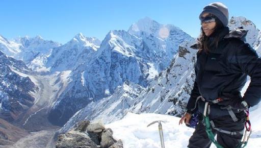
16 Field based long term monitoring empower women in the field of cryospheric sciences in the HKH region
17 Glacier monitoring in Nepal In collaboration with partners in Nepal (DHM, KU) and France Name Rikha Samba Catchment / location Hidden Valley/Dhaulagiri Type Clean/valley 2011 Yala Langtang Valley Clean/plateau 2011 Lirung Langtang Valley Debris/valley 2012 Langtang Langtang Valley Debris/valley 2012 Mera Dudh Koshi/Everest Clean/valley 2007 Pokalde Khumbu/Everest Clean/valley 2009 Changri Nup Khumbu/Everest Clean / valley 2010 Rikha Samba Glacier Since Yala Glacier Lirung Glacier Langtang Glacier Kathmandu Understand the high mountain processes and address the data gaps Mera Glacier Pokalde Glacier Changri Nup Glacier

18 Annual glacier mass balances in Khumbu, Nepal Sherpa et al. 2017

19 Remote sensing based glacier mapping and monitoring Bajracharya et al.,

20 Modelling Shea et al., 2015


21 Lessons Learnt Technology: flood information system at basin scale Limited networks in the region: high altitude need further strengthening and sharing Utility of data and information for developing flood outlook demonstrated the value of real-time data: development of customized products Capacity building and training enhanced cooperation and partnerships: support to Glaciology program Flood forecasting and warning needs to be integrated with the disaster risk management activities for an effective end to end flood early warning system Efforts needed for risk communication, awareness, better preparedness and strengthen institutional mechanisms

22 Lessons Learnt Concerted efforts required for mainstreaming gender into programmes: by end of female glaciologist would have graduated and 5 doing PhD Collaboration between projects and various funding agencies multiply the success: in terms of building on, continuity Regional cooperation is a long term effort and requires building trust
23 Opportunities for regional collaboration Capacity building Standardized methods Impact based flood forecasting and strengthening capacities Early warning and communication products Knowledge, Information and data sharing Cryosphere services Transboundary issues
24 THANK YOU