Maskinonge River Subwatershed Plan
|
|
|
- Erica Greene
- 5 years ago
- Views:
Transcription

1 Maskinonge River Subwatershed Plan 2010
 falling on the")
2 Executive Summary The Maskinonge River occupies 63.5 km 2 of lands to the east of the tip of Lake Simcoe s Cook s Bay. There are three main branches to the subwatershed, with the southern branch extending past the community of Queensville, and a small portion in the southeast of the subwatershed (2%) falling on the Oak Ridges Moraine. The majority of the subwatershed flows through mainly agricultural areas with some pockets of wetland and forest, before reaching the community of Keswick and its outlet into Lake Simcoe. The subwatershed falls entirely within York Region, and includes portions of the municipalities of East Gwillimbury and Georgina. The land within the Maskinonge River subwatershed provides a number of benefits to the river, to Lake Simcoe, and to its residents and visitors. Although they occupy a relatively low percentage of the subwatershed area (21%), the Maskinonge s natural areas help to absorb rain and snow melt, aiding in preventing flooding and erosion, as well as helping to improve water quality. These areas also provide habitat for a wide variety of plant and animal species. The river also supports recreation opportunities, such as boating, snowmobiling, and fishing. In addition, some of the Maskinonge s agricultural areas, which occupy 70% of the subwatershed, provide a Land use within the Maskinonge subwatershed close-to-market supply of fresh vegetables, as well as opportunities for infiltration. In a study undertaken to estimate the value of the services provided by the subwatershed s ecosystem, it was found that it would cost over $12.5 million to replace these natural services with man-made solutions. Given the intrinsic and monetary value of the subwatershed s features, the development of this subwatershed plan is an important step in ensuring that these services continue to be performed economically, while balancing the other demands on the subwatershed such as urban growth, agriculture, industrial, and recreational uses in a truly integrated fashion. In spite of the benefits provided by its natural areas, the Maskinonge River is showing signs of stress from anthropogenic land uses. For example, in both the 2008 Watershed Report Card, the Maskinonge subwatershed received the lowest grades in the Lake Simcoe basin for both forest cover and forest interior, and in both the 2008 Report Card and 2009 Report Card Update, the subwatershed displayed low levels of riparian vegetation as well as low grades for both the fish and benthic invertebrate communities. Much of this state can be attributed to the very large extent of agricultural land use in the subwatershed. Impacts from the agricultural Cows in the Maskinonge River areas include the removal of riparian vegetation, the input of sediment-laden sediment which impacts both water quality and the habitat of fish and benthic invertebrates, the use of large volumes of water for irrigation, channelization, and i
3 the rapid conveyance of stormwater directly to area watercourses by tile drainage. Some of these impacts, such as low water levels, are more acutely felt in the Maskinonge subwatershed because it lacks the groundwater influence of the Oak Ridges Moraine in its headwater areas, given the very small portion of the subwatershed that falls on the moraine. Although located mainly in the community of Keswick near the mouth of the subwatershed, the urban areas are likely impacting conditions in the subwatershed as well. Impervious surfaces cause decreased infiltration of rain and melt water, which can result in low groundwater levels and reduced baseflow in area watercourses; impacts to water quality as contaminants are carried with stormwater runoff; instability and erosion of streambanks; effects on stream habitat such as sediment deposition or disruption of natural riffle-pool sequences, resulting in changes to the composition of aquatic communities; and impacts on biodiversity. These impacts can be particularly detrimental in those areas of the subwatershed that lack stormwater controls. Additional issues in this subwatershed include habitat alteration, and the introduction of invasive species. The cumulative effects of these activities have caused considerable stress in the Maskinonge River subwatershed. There have been numerous successes in improving the conditions in the Maskinonge River subwatershed. Initiatives such as the completion of streambank erosion control projects, tree plantings, establishment of riparian vegetation, and other best management practices (BMPs) will help to improve conditions with respect to bank stability, water quality and quantity, and aquatic and terrestrial natural heritage in the subwatershed. The recently introduced Maskinonge River Recovery Program is a Tree planting in the Maskinonge River subwatershed community stewardship program designed to undertake on the ground environmental improvement projects within the subwatershed. This is being accomplished through education and outreach, the development of communication materials, and the implementation of BMP projects. The Maskinonge subwatershed is scheduled to experience some growth in the coming years. The Provincial Places to Grow Plan identifies that population and employment growth will occur in the Lake Simcoe watershed. Provincial growth forecasts have been allocated to all municipalities in the Region. In the Maskinonge River subwatershed, this growth is mainly focused around the community of Keswick. The population of Keswick is estimated to grow from approximately 20,000 residents to close to 40,000 by Along with the housing that will have to be built to accommodate these new subwatershed residents, new employment lands, shopping centres, and schools will also be required to meet their needs. In addition to the above, in order to services these increases in population and employment, critical municipal infrastructure projects, including roads, municipal sewers and treatment facilities and water supply systems will also need to be built, maintained and expanded in the subwatershed. This will result in increased levels of impervious surfaces and its associated impacts, combined with a reduction in the natural features that help to mitigate these impacts. These changes, as well as the unknown impacts that climate change may bring to the subwatershed, could have a significant effect on the health of the subwatershed if measures are not taken to mitigate them. To build on the successes of the projects initiated so far, and to mitigate impacts of the changes that are to come, a comprehensive, integrated subwatershed plan is needed for the Maskinonge ii


4 River subwatershed. The plan that follows is intended to provide the blueprint for the conservation authority, the municipalities, and subwatershed stakeholders to move forward and continue the important work that has been completed in order to mitigate the impacts of land use changes and improve conditions in the subwatershed. It includes chapters dedicated to each of five subwatershed parameters, these being water quality, water quantity, aquatic habitat, fluvial geomorphology and terrestrial natural heritage, although it is acknowledged that all of these parameters are related and certainly interact with each other. Each chapter is loosely structured around a state-pressure- response framework, in that each chapter firstly describes the current condition (state), secondly describes the stressors likely leading to the current condition(pressure), and finally recommends management responses in the context of the current management framework (response) (See text box below). Plan section: 1) Subwatershed Condition: Describes and analyzes the current state or condition of the subwatershed feature based on the best available data and information. This assessment is based on monitoring data, model output, surveys etc. 2) Subwatershed Stressors: Uses the best available information to identify and quantify the factors affecting the current condition of the watershed. For example, describing phosphorus loads from different land use activities. 3) Current Management: Establishes the relationship of the subwatershed plan to other legislation and planning documents; 4) Management needs: Identifies areas within the current management framework where improvements within this plan may be able to have greatest impact i.e. gaps or opportunities for the subwatershed plan to act upon. 5) Management recommendations: outlines resource management goals and objectives; as well as options for protection, rehabilitation, and enhancement of conditions in the subwatershed. iii
5 The management responses (high level recommendations) fall into eight broad categories, these being: A. Planning and Policy B. Use of Better Management Practices C. Changing the Way Things Are Done On the Ground D. Applied Research and Science E. Monitoring (Surveillance, Compliance, and Reporting) F. Management, Rehabilitation, and Restoration G. Adaptive Response (Climate, Social, Political) H. Communications From these recommendations fall a number of detailed recommendations, the implementation of which will help to meet the plan s goals and objectives. These detailed recommendations will form the implementation plan, a document which will assign responsibilities, develop timelines, estimate costs, and set priorities for undertaking the actions that will need to be taken in the Maskinonge subwatershed. Input from the subwatershed municipalities, conservation authority staff, stakeholders and members of the public will be incorporated through the process of developing the implementation plan. Implementing the recommended actions of this plan is a huge undertaking with respect to both the funding and human resources that will be needed, and will require assistance from all of these subwatershed partners. Undertaking the actions outlined in the implementation plan will help to protect the existing natural resources, facilitate informed planning decisions, and improve the efficiency of the development review process. An over-arching concept to keep in mind throughout the subwatershed planning process is that it is far more beneficial, both financially and ecologically, to protect resources from degradation than to rehabilitate them once they have been damaged. These plans support this concept, and provide alternatives for instances where it may not be possible to maintain the Maskinonge s remaining resources in their natural state. The implementation plan will identify actions to be undertaken in both the short and the long term. However, the subwatershed plan will be reviewed on a regular basis as part of the adaptive management framework to ensure the effectiveness of the actions being undertaken. Depending on the state of the subwatershed the subwatershed and implementation plan may be updated at that point in order to incorporate the most up to date information on the subwatershed state and to incorporate any new tools and practices that may be used. By undertaking these regular evaluations and updates, the partners can ensure that all of the necessary steps are being taken in order to achieve the goal of a healthy Maskinonge River subwatershed. iv
6 Table of Contents 1 Approach and Management Setting Introduction Maskinonge River Subwatershed Planning Process Oak Ridges Moraine Conservation Plan Subwatershed Planning Context Subwatershed Planning Process Current Management Framework Oak Ridges Moraine Conservation Plan Greenbelt Plan Lake Simcoe Protection Plan Provincial Policy Statement Nutrient Management Act Environmental Protection Act Ontario Water Resources Act Growth Plan for the Greater Golden Horseshoe Clean Water Act Endangered Species Act Fisheries Act Conservation Authorities Act and the Role of the LSRCA York Region Official Plan Durham Region Official Plan Recommended Actions for the Maskinonge River Subwatershed Plan How this plan is organized Study Area and Physical Setting Location Drainage Topography and Physiography Topography Physiography Geology Bedrock Geology Bedrock Topography Quaternary Geology Stratigraphy Best Management Practices for the Maskinonge River Subwatershed Introduction Urban Environments Stormwater BMPs Background Stormwater Control Urban Environments Employing Other Urban Best Management Practices and Stormwater Control Measures Rural/Agricultural Best Management Practices and Controls Phosphorus Reduction Opportunities Streambank Erosion Control Cropland Erosion Control Structures Cover Cropping v
7 3.3.4 Conservation Tillage Livestock Access Restriction Clean Water Diversion Milkhouse Waste Management Manure Storage and Management Private Septic Systems Wellhead Protection and Well Decommissioning Bypass Channels and Bottom Draw Structures for Online Ponds Opportunities for BMPs in the Maskinonge River subwatershed Urban BMP opportunities Stream Corridor BMP Opportunities Water Quality Surface and Groundwater Introduction and background Current Status Measuring Groundwater Quality Measuring Surface Water Quality and Water Quality Standards Groundwater Quality Status Surface Water Surface Water Quality Status Factors impacting status stressors Groundwater Surface Water Current management framework Oak Ridges Moraine Conservation Plan (2002) The Greenbelt Plan (2005) Lake Simcoe Protection Plan (2009) Places to Grow Act Growth Plan for the Greater Golden Horseshoe (2006) Provincial Policy Statement (2005) Nutrient Management Act (2002) Ontario Water Resources Act (1990) Environmental Protection Act (1990) Clean Water Act (2006) Source Water Protection LSRCA Watershed Development Policies York Region Official Plan (2009) Local municipal bylaws Management gaps and limitations Growth, Development and Site Alteration Road Salt Stormwater Impervious Surfaces Discharge of Material Agriculture Restoration Septic Systems Climate Change Atmospheric deposition Recommended Actions to Improve Water Quality Planning and Policy Use of Better Management Practices vi
8 4.6.3 Changing the Way things are done on the ground Applied Research and Science Monitoring Management, Rehabilitation and Restoration Adaptive Response Water Quantity (Surface and Groundwater) Introduction and Background Understanding the Factors that Affect Water Quantity Previous Studies Current Conditions Hydrogeologic Setting Hydraulic Properties Groundwater Flow Streamflow Baseflow Groundwater Discharge Areas Groundwater Recharge Areas Water Budget Local Water Budget Initiatives Precipitation and Evapotranspiration Infiltration Discharge Water Takings Ground and Surface Water Consumption Factors Impacting Status Stressors Water Demand Land Use Climate Water Budget Estimates Current Management Framework Oak Ridges Moraine Conservation Plan Greenbelt Act and Plan (2005) Lake Simcoe Protection Plan Growth Plan for the Greater Golden Horseshoe (2006) Provincial Policy Statement (2005) Clean Water Act (2007) Ontario Water Resources Act (1990) LSRCA Watershed Development Policies (2008) York Region Official Plan (2009) Durham Region Official Plan (2008) Management Gaps and Limitations Water Demand Land Use Climate Water Budget Estimates Recommended Actions to Improve Water Quantity Planning and Policy Use of Better Management Practices Changing the way things are done on the ground vii
9 5.7.4 Applied Research and Science Monitoring Management, Rehabilitation and Restoration Adaptive Response Aquatic Habitat Introduction and background Current Status Fish Community Benthic Invertebrates Factors impacting status stressors Changes to Instream Habitat and Habitat Fragmentation Invasive Species Impacts to the hydrologic regime Water quality and thermal degradation Recreation Current Management Framework Oak Ridges Moraine Conservation Plan (2002) Greenbelt Plan (2005) Lake Simcoe Protection Plan (2009) Places to Grow Act Growth Plan for the Greater Golden Horseshoe (2006) Provincial Policy Statement (2005) Ontario Water Resources Act (OWRA) Permit to Take Water Fisheries Act (1985) LSRCA Watershed Development Policies York Region Official Plan (2009) Timing Restrictions for In Water Works Additional legislation and policies that address aquatic habitat issues Management gaps and limitations Growth, Development and Site Alteration Introduction of Invasive Species Loss of Natural Heritage Features Loss of Riparian Areas Stream Alteration, Instream Barriers, and Bank Hardening Changing Hydrologic Conditions Degradation of Water Quality Restoration Climate Change Recommended Actions to Improve Aquatic Habitat Planning and Policy Use of Better Management Practices Changing the way things are done on the ground Applied Research and Science Monitoring Management, Rehabilitation and Restoration Adaptive Response Fluvial Geomorphology Introduction Geomorphic Processes viii
10 7.2 Current Status Planform Stream Order Valley Segments Reach Break Determination Meander Belt Width Field Reconnaissance Factors impacting status stressors Recreation Mitigating Issues Associated with Land Use Changes Current management framework Oak Ridges Moraine Conservation Plan (2002) The Greenbelt Plan (2005) Lake Simcoe Protection Plan (2009) Places to Grow Growth Plan for the Greater Golden Horseshoe (2006) Provincial Policy Statement (2005) Ontario Water Resources Act (1990) Fisheries Act LSRCA Watershed Development Policies York Region Official Plan (2009) Durham Region Official Plan (2008) Management gaps and limitations Growth, Development and Site Alteration Impervious Surfaces Removal of Riparian Vegetation Stormwater Controls Channelization/Stream Alteration/Bank Hardening Restoration Climate Change Recommended Actions to Improve Fluvial Geomorphology Planning and Policy Use of Better Management Practices Changing the way things are done on the ground Monitoring Management, Rehabilitation and Restoration Adaptive Response Terrestrial Natural Heritage System Introduction Current Status Species at Risk Wetlands Woodlands Valleylands Wildlife Habitat Areas of Natural and Scientific Interest Landscape Connectivity Factors impacting status stressors Land use changes and habitat fragmentation ix
11 8.3.2 Changes to hydrologic regime Invasive species Recreation Current Management Framework Oak Ridges Moraine Conservation Plan (ORMCP) Greenbelt Act (2005) Lake Simcoe Protection Plan Places to Grow Act Growth Plan for the Greater Golden Horseshoe (2006) Provincial Policy Statement (PPS) Endangered Species Act The Role of the LSRCA York Region Official Plan (2009) Management gaps and limitations Growth, Development and Site Alteration Habitat Fragmentation Connectivity Impervious Areas Introduction of Invasive Species Restoration Climate Change Recommended Actions to Improve Terrestrial Natural Heritage Planning and Policy Use of Better Management Practices Applied Research and Science Monitoring Management, Rehabilitation and Restoration Adaptive Response Maskinonge River Subwatershed s Natural Capital: The Value of the Subwatershed s Ecosystem Services Introduction What is Natural Capital? Valuing Ecosystems Conclusions Detailed Recommendations for the Maskinonge River Subwatershed Plan Detailed recommendations for the Maskinonge River subwatershed plan References x
12 Figures Figure 1 1 Subwatershed planning context... 3 Figure 1 2 The Hydrologic Cycle (image courtesy of Conservation Ontario)... 4 Figure 1 3 Areas regulated under O. Reg. 179/ Figure 1 4 Sample product depicting vulnerable features Figure 2 1 The location of the Maskinonge River subwatershed within the Lake Simcoe basin Figure 2 2 Land uses in the Maskinonge River subwatershed Figure 2 3 Ground surface topography (Earthfx and Gerber Geosciences, 2008) Figure 2 4 Physiographic regions within the Maskinonge River subwatershed (Earthfx and Gerber Geosciences, 2008) Figure 2 5 Bedrock geology within the study area (Earthfx and Gerber Geosciences, 2008) Figure 2 6 Interpreted bedrock surface topography (Earthfx and Gerber Geosciences, 2008) Figure 2 7 Quaternary sediment thickness (Earthfx and Gerber Geosciences, 2008) Figure 2 8 Quaternary deposits found within the Toronto area (Figure from Eyles, 2002) Figure 2 9 GSC stratigraphic framework of the ORM region (Sharpe et al., 1999) Figure 2 10 Interpreted erosional and depositional process in the tunnel channels (GSC) Figure 2 11 Interpreted subsurface erosional channel or tunnel channel locations where Newmarket Till and older deposits are either partially or completely eroded (Earthfx & Gerber, 2008) Figure 2 12 Surficial geology (from Sharpe et al., 1997). North south cross section line shown in Figure Figure 2 13 West east cross section (Earthfx & Gerber, 2008) Figure 2 14 North south cross section (Earthfx & Gerber, 2008) Figure 3 1 Pathways by which impervious surfaces may impact aquatic biological communities (ORM Technical Paper #13) Figure 3 2 Stormwater retrofit opportunities in the Maskinonge River subwatershed Figure 3 3 Location of best management practice (BMP) opportunities along the Maskinonge River stream corridor Figure 3 4 Types and relative proportion of stream corridor BMP opportunities identified during the LSRCA survey (LSRCA 2009) Figure 4 1 Provincial Water Quality Monitoring Network sites in the Maskinonge River subwatershed62 Figure 4 2 Maskinonge River phosphorus concentrations , (mg/l) Figure 4 3 Area of stormwater control in urban regions of the Maskinonge River subwatershed Figure 4 4 Phosphorus load estimates for all subwatersheds in the Lake Simcoe basin, with relative contributions from various sources Figure 5 1 Hydrologic cycle (USGS, 2008) Figure 5 2 Observed potential within the shallow groundwater flow system. Water levels in wells are referred to as potentials (Earthfx & Gerber, 2008) Figure 5 3 Observed potential within the Thorncliffe aquifer complex (Earthfx & Gerber, 2008) Figure 5 4 Observed potential within the Scarborough aquifer complex (Earthfx & Gerber, 2008) Figure 5 5 MODFLOW calculated vertical groundwater flow between the shallow and deep groundwater flow system through the Newmarket Till (N t ) and Channel Silt deposits (White zones = no leakage) (Earthfx & Gerber, 2008) Figure 5 6 Maskinonge River profile (Earthfx & Gerber, 2008) Figure 5 7 Low flow streamflow survey locations in the Maskinonge River subwatershed and surrounding area (Earthfx & Gerber, 2008) Figure 5 8 Low flow streamflow survey results for Figure provided by LSRCA xi
13 Figure 5 9 Shallow groundwater flow system potentials minus ground surface elevation illustration possible groundwater discharge zones. Discharge verified by location of flowing wells from MOE database (Earthfx & Gerber, 2008) Figure 5 10 Applied recharge in the Core Model (from Earthfx, 2004) Figure 5 11 Water budget components (Earthfx and Gerber Geosciences, 2008) Figure 5 12 Regional ORM Model and Core Model boundaries (figure from Earthfx, 2006) Figure 5 13 The Maskinonge River subwatershed location within the Core Model area (Figure from Earthfx & Gerber, 2008) Figure 5 14 Average annual precipitation over a 20 year period ( ) in mm/annum (Earthfx & Gerber, 2008) Figure 5 15 Simulated (VL WABAS) annual average evapotranspiration in mm/annum with 2002 land use (Earthfx & Gerber, 2008) Figure 5 16 Detailed water budget for the Maskinonge subwatershed 2002 conditions (Earthfx & Gerber, 2008) Figure 5 17 Simulated (VL WABAS) annual average groundwater infiltration (GWI) in mm/a with 2002 land use (Earthfx & Gerber, 2008) Figure 5 18: Potential discharge to streams in the Maskinonge River subwatershed (LSRCA, 2009) Figure 5 19 Municipal well locations in the Maskinonge subwatershed (LSRCA, 2009) Figure 6 1 Coldwater fish presence and habitat suitability in the Maskinonge River subwatershed ( ) Figure 6 2 The mottled sculpin, a coldwater indicator fish native to the headwaters of the Maskinonge River Figure 6 3 Benthic invertebrate sites in the Maskinonge River subwatershed ( ) Figure 6 4 Locations of known barriers in the Maskinonge River subwatershed Figure 6 5 Areas of bank hardening and channelization in the Maskinonge River subwatershed (LSRCA, Figure ) Sites identified in the Maskinonge River subwatershed as having insufficient riparian vegetation Figure 6 7 Timing restrictions for in water works in the Maskinonge River subwatershed Figure 7 1 Maskinonge River reach break and meander belt width Figure 7 2 Summary of field survey results Figure 7 3 Boat slips near the mouth of the Maskinonge River Figure 7 4 Channelized portion of the Maskinonge River Figure 8 1 Natural features of the Maskinonge subwatershed Figure 8 2 Woodland patch size analysis for the Maskinonge River subwatershed Figure 8 3 Land use distribution in the Maskinonge River subwatershed Figure 8 4 LSRCA Natural Heritage System in the Maskinonge River subwatershed xii
14 Tables Table 2 1 Land use distribution within the Maskinonge River subwatershed (MRS)... Error! Bookmark not defined. Table 3 1 Stormwater retrofit opportunities in the Maskinonge River subwatershed Table 4 1 A summary of surface water quality variables and their potential effects and sources Table 4 2 A comparison of the Maskinonge River surface water quality to other tributaries within the Lake Simcoe watershed Table 4 3 Controlled vs. uncontrolled stormwater catchments in the Maskinonge River subwatershed Table 4 4 Phosphorus loads by source in the Maskinonge River subwatershed Table 4 5 Summary of current regulatory framework as it relates to the protection and restoration of water quality Table 5 1 Hydrostratigraphic framework Table 5 2 Summary of hydraulic conductivity (K) estimates used in the Core Model, (Earthfx & Gerber, 2008) Table 5 3 Water budget estimates for different scenarios. Note: All estimates were calculated under steady state conditions Earthfx & Gerber, 2008) Table 5 4 Estimates of annual current & future consumptive groundwater use (Earthfx, 2009) Table 5 5 Comparison of impervious land cover within the Lake Simcoe watershed and Maskinonge subwatershed Table 6 1 Aquatic habitat features of the Maskinonge River subwatershed Table 6 2 Fish species captured in the Maskinonge River subwatershed ( ) Table 7 1 A summary of geomorphologic features investigated Table 7 2 Summary of stream orders and bifurcation ratio for the Maskinonge River Table 7 3 RGA scores and their definitions Table 7 4 RSAT scores and their definitions Table 7 5 Table 7 6 Fluvial geomorphology assessment: field observations in the Maskinonge River subwatershed Summary of the current management framework as it relates to the protection and restoration of stream geomorphology Table 8 1 Wetlands in the Maskinonge River subwatershed (MRS) Table 8 2 Wetland type distribution in the Maskinonge River subwatershed Table 8 3 Woodland cover by type Table 8 4 Seasonal concentrations of animals in the Maskinonge River subwatershed (MRS) Table 8 5 Specialized habitats for wildlife: grasslands Table 8 6 Summary of current the current management framework as it relates to the protection and restoration of terrestrial natural heritage Table 8 7 Policy guidelines of the LSRCA Natural Heritage System Phase Table 8 8 LSRCA Natural Heritage System policy levels in the Maskinonge subwatershed Table 9 1 Summary of non market ecosystem service values by land cover type xiii
15 1 Approach and Management Setting 1.1 Introduction The Maskinonge River subwatershed is 63.5 km 2 in area, encompassing lands immediately east of the southern tip of Lake Simcoe s Cook s Bay. There are three main branches to the Maskinonge River, with the southern branch extending past the town of Queensville and with a very small percentage originating in the Oak Ridges Moraine (ORM). The river flows into Lake Simcoe at the Town of Keswick, approximately halfway along the eastern shore of Cook s Bay. The subwatershed is entirely within the Regional Municipality of York, with portions of the two lower tier municipalities of East Gwillimbury and Georgina falling within its boundaries. The Maskinonge River subwatershed is one of the most agricultural subwatersheds in the Lake Simcoe basin, with 71% of the area classified as intensive and non-intensive agriculture. The second largest area of land is occupied by natural heritage features at approximately 21%. While there are a number of small towns in the subwatershed, the largest urban area is Keswick, located at the confluence with Lake Simcoe. The land uses in the subwatershed have had considerable impacts to the natural heritage features, the river and Lake Simcoe. Water quality and quantity have deteriorated due to the inputs of harmful substances from both urban and rural areas.the Maskinonge River has been known to dry up in some years, with presumed consequences for associated flora and fauna. The Maskinonge River subwatershed has one of the lowest levels of wetland and woodland cover in the Lake Simcoe basin and consequently an overall low percentage of natural heritage features. In addition, impervious surfaces are approaching a critical threshold. Other current and future issues that have been identified in the Maskinonge River subwatershed include the planned extension of Highway 404, potential water quality issues associated with the vacant Thane smelter site, water quality and quantity issues arising from sod farming and other agricultural activities, and planned urban expansion in the subwatershed. Aside from participating in committees to resolve some of the subwatershed s issues (e.g. sitting on a committee regarding the Thane smelter issue and participating in studies as appropriate), many of these issues are beyond the scope of the LSRCA s jurisdiction, and some may not be addressed in this plan. In order to mitigate the impacts of land use changes in a subwatershed, and to prevent future impacts, subwatershed plans are developed. These plans provide a framework for the implementation of remedial activities and a focus for community action. More importantly, they prevent further serious degradation to the existing environment and can reduce the need for expensive rehabilitation efforts. Subwatershed plans provide a framework within which sustainable development can occur. As part of the requirements through the Oak Ridges Moraine Conservation Act and Conservation Plan Regulation (ORMCP, O.Reg. 140/02), all municipalities with subwatersheds originating on the Oak Ridges Moraine (ORM) are required to develop a subwatershed plan for each. York Region has commissioned the Lake Simcoe Region Conservation Authority to complete these plans for their subwatersheds. The four York Region subwatersheds that originate on the ORM are the West and East Holland Rivers, Maskinonge River, and the Black River. The watershed planning requirements of the Act and Conservation Plan Regulation represent an opportunity to strengthen a long established watershed management partnership between the Regional Municipality of York and its two conservation authorities. York Region has gone beyond their requirements under the ORMCP with the development of these subwatershed plans for the entire subwatershed area, not just the portion that lies on the Oak Ridges Moraine. 1
16 1.2 Maskinonge River Subwatershed Planning Process Oak Ridges Moraine Conservation Plan The Oak Ridges Moraine Conservation Plan was developed in 2001, and is an ecologically based plan that provides land use and resource management direction for the 190,000 hectares of land and water that fall on the Oak Ridges Moraine (ORM), 51 ha of which falls within the Maskinonge River subwatershed. The ORM is one of Ontario s most significant landforms. It stretches from the Trent River in the east to the Niagara Escarpment in the west and divides the subwatersheds draining south into Lake Ontario from the subwatersheds draining north to Lake Simcoe. It has a unique concentration of environmental, geological, and hydrological features that make its ecosystem vital to south-central Ontario, including: Clean and abundant water sources Healthy and diverse plant and animal habitat An attractive and distinct landscape Prime agricultural areas Sand and gravel resources close to market (MAH, 2002). Because of its location across the Greater Toronto Area, the ORM is under increasing pressure for new residential, commercial, industrial, and recreational uses which compete with the present natural environment. The Oak Ridges Moraine Conservation Plan provides land use and resource management planning direction to provincial ministers, ministries, and agencies, municipalities, municipal planning authorities, landowners and other stakeholders on how to protect the Moraine's ecological and hydrological features and functions Subwatershed Planning Context This subwatershed plan has been written firstly to comply with the requirements under the ORMCP. However there are other documents that have influenced and fed into the development of this plan and its recommendations. The LSRCA s Integrated Watershed Management Plan (2008) and the Province s Lake Simcoe Protection Plan (2009) are the two main documents aside from the ORMCP that have guided this plan s development. The Integrated Watershed Management Plan, released by the Lake Simcoe Region Conservation Authority in 2008, was intended to be a roadmap to provide future direction for the protection and rehabilitation of the Lake Simcoe watershed ecosystem. Its broad-scale recommendations for the Lake Simcoe watershed provided the basis for a number of this plan s recommended actions for the smaller scale Maskinonge River subwatershed; these two reports are meant to complement each other. The Lake Simcoe Protection Plan, released by the Province in 2009, aims to be a comprehensive plan to protect and restore the ecological health of the lake and its subwatershed. Its priorities include restoring the health of aquatic life, improving water quality, maintaining water quantity, improving ecosystem health by protecting and rehabilitating important areas, and addressing the impacts of invasive species, climate change, and recreational activities. This subwatershed plan aims to be consistent with the themes and policies of the Lake Simcoe Protection Plan to ensure a consistent approach is being taken by all of the partners toward improving watershed health. This subwatershed plan also aims to complement and be supportive of the policies of the applicable upper tier municipal official plans and the related municipal programs that strive to achieve similar outcomes related to subwatershed health. 2
17 Figure 1-1 depicts the relationship between this subwatershed plan and the documents that have guided and contributed to its development. It also depicts the implementation plan, which will provide details of a plan to undertake the recommended actions. Integrated Watershed Management Plan (2008) ORMCP (2002) Lake Simcoe Protection Plan (2009) York Region Official Plan (Draft, 2009) Subwatershed Plans (East Holland, West Holland, Black, Maskinonge) Local Official Plans Water for Tomorrow Greenlands Strategy Implementation Plan (2010 forward) Figure 1-1 Subwatershed planning context Subwatershed Planning Process The Lake Simcoe Region Conservation Authority (LSRCA) has adopted a holistic approach to completing subwatershed plans to ensure compliance with ORMCP instead of managing one subwatershed at a time. This method ensures the completion of a comprehensive and consistent ORMCP watershed plan while maximizing efficiencies and funding. It also provides a one window approach for broader public consultation and the future development or policies and land use designations. The initial focus of the subwatershed planning exercise has involved the completion and summarization of subwatershed characterization work. It also involved the development of water quality, quantity, aquatic, and terrestrial habitat models to assess the environmental impacts associated with potential changes in the landscape. This important information is then incorporated into the process of formulating management options and recommendations for the subwatershed plans. The ecosystem approach to environmental management takes into consideration all of the components of the environment. These components include the movement of water through the system, the land use, climate, geology, and all of the species that comprise the community living in the system. These ecosystem components are all intricately related, and changes in any can have significant effects on the others. To manage natural resource using an ecosystem approach it is essential to establish biophysical boundaries. In the Lake Simcoe watershed, the subwatersheds or river systems that 3
 is")
18 drain into the lake have been identified as the best fit for the implementation of an ecosystem study because they are virtually self-contained water-based ecosystems (OMOE and OMNR, 1993c). Watersheds are defined as the area of land drained by a watercourse and, subsequently, the land draining to a tributary of the main watercourse (Lake Simcoe is the main watercourse in this case) is called a subwatershed. Watershed processes are controlled by the hydrologic cycle (Figure 1-2). The movement of water influences topography, climate, and life cycles. It is due to this connectivity that any change within the watershed will impact other parts of the subwatershed. Figure 1-2 The Hydrologic Cycle (image courtesy of Conservation Ontario) 1.3 Current Management Framework In addition to meeting the requirements of the ORMCP, the goals and management recommendations offered in this plan have been developed in context of the other existing legislation and their associated plans and policies. There are many regulations related to the protection and restoration of Lake Simcoe and its subwatersheds, and obviously each of these acts and associated plans differ, although in some cases policies do overlap. The manner in which regulations differ include: (1) the number and types of watershed activity they have authority over. For example some regulations have a very broad mandate, regulating many activities (e.g. the Greenbelt Plan) while others are very specific (e.g. The Endangered Species Act); (2) the legal effect of policies they contain policies fall into two broad categories, those legally requiring conformity, and those with no legal requirement but stating the need to have regard for ; (3) the geographic area they represent most cover the entire Lake Simcoe basin, however the Greenbelt Act and the ORMCP have defined geographic boundaries which do not follow subwatershed boundaries; and (4) the degree of implementation many aspects of more recent legislation such as the Lake Simcoe Protection Plan still need to be acted upon. Each 4
19 chapter of this subwatershed plan provides a more detailed assessment of the legislation and associated polices related to that particular subwatershed feature (e.g. water quantity or aquatic habitat). The key pieces of legislation, regulations and plans that form the planning framework in the subwatershed are described below. This is not a comprehensive list of all of the pieces that apply in the subwatershed, but rather those that are most influential of environmental conditions in the area Oak Ridges Moraine Conservation Plan The province of Ontario developed the Oak Ridges Moraine Conservation Plan (ORMCP) in 2002, after recognizing the vital importance of this feature to southern Ontario and the intense pressure that was being placed on it. The authority to establish the ORMCP comes from the Oak Ridges Moraine Conservation Act (2001), which established objectives for the plan. The ORMCP is an ecologically-based plan that was established to provide land use and resource management direction for the land and water within the Moraine. The government s vision for the Oak Ridges Moraine is that of a continuous band of green, rolling hills that provides form and structure to south-central Ontario, while protecting the ecological and hydrological features and functions that support the health and well-being of the region s residents and ecosystems. To achieve this vision, the ORMCP sets out a number of objectives: a) protecting the ecological and hydrological integrity of the Oak Ridges Moraine Area; b) ensuring that only land and resource uses that maintain, improve or restore the ecological and hydrological functions of the Oak Ridges Moraine Area are permitted; c) maintaining, improving or restoring all the elements that contribute to the ecological and hydrological functions of the Oak Ridges Moraine Area, including the quality and quantity of its water and its other resources; d) ensuring that the Oak Ridges Moraine Area is maintained as a continuous natural landform and environment for the benefit of present and future generations; e) providing for land and resource uses and development that are compatible with the other objectives of the plan; f) providing for continued development within existing urban settlement areas and recognizing existing rural settlements; g) providing for a continuous recreational trail through the Oak Ridges Moraine Area that is accessible to all including persons with disabilities; h) providing for other public recreational access to the Oak Ridges Moraine Area; and i) any other prescribed objectives. The ORMCP contains four land use designations: Natural Core Areas, Natural Linkage Areas, Countryside Areas, and Settlement Areas. Natural Core Areas the protection of these lands, which contain the greatest concentrations of key natural heritage features, is vital to maintaining the integrity of the Moraine. Aside from existing uses, the only uses that will be permitted in these areas are resource management, agriculture, low intensity recreation, home businesses, transportation and utilities. Natural Linkage Areas these protect natural and open space linkages between the Natural Core Areas and along rivers and streams. The uses permitted in the Natural Core Areas are also permitted in Natural Linkage Areas, as are some aggregate resource operations. 5
20 Countryside Areas these areas are intended to provide an agricultural and rural transition and buffer between the Natural Core and Linkage Areas and Settlement Areas. Prime agricultural areas and natural features are protected. Settlement Areas these include existing communities; urban uses and development as set out in municipal official plans are allowed. The policies of the ORMCP provide protection for key natural heritage features and hydrologically sensitive features throughout the plan area The Oak Ridges Moraine Conservation Act, 2001 directs municipalities to bring their Official Plans into conformity with the ORMCP and to ensure that the planning decisions they make conform to the Plan. The policies include: Strict limitations on the activities that can be undertaken in Natural Core and Natural Linkage Areas Protecting key natural heritage features and hydrologically sensitive features by setting out minimum vegetation protection zones and minimum areas of influence around the features. Most activities are not permitted in minimum vegetation protection zones, and applicants are required to demonstrate that activities within the minimum area of influence will have no negative impact on the feature Requiring planning, design and construction practices that will maintain, improve, or restore the health, diversity, size, and connectivity of features on the moraine for developments adjacent to these features Municipalities are required to develop subwatershed plans (i.e. this plan) for river systems originating on the Moraine, including a water budget and conservation plan, land and water use and management strategies The protection of water quality and quantity Protection for landform conservation areas (such as steep slopes, kames, kettles, ravines, and ridges) This subwatershed plan will satisfy the requirements of the ORMCP for both watershed planning (Section 24) and water budgets and conservation plans (Section 25) Greenbelt Plan Faced with intense growth pressures on the Greater Golden Horseshoe and its potential impacts to this area s rural and environmental resources, the Province created the Greenbelt Act in This Act authorizes the Lieutenant Governor in Council, by Regulation, to designate an area of land as the Greenbelt Area, and to establish a Greenbelt Plan for all or part of the Greenbelt Area. The Plan describes the Greenbelt as a broad band of permanently protected land which: Protects against the loss and fragmentation of the agricultural land base and supports agriculture as the predominant land use Gives permanent protection to the natural heritage and water resource systems that sustain ecological and human health and that form the environmental framework around which major urbanization in south-central Ontario will be organized; and Provides for a diverse range of economic and social activities associated with rural communities, agriculture, tourism, recreation and resource uses. 6
21 The Greenbelt includes lands within, and builds upon the ecological protection provided by, the Oak Ridges Moraine Conservation Plan. In the Maskinonge River subwatershed, approximately 91% of the land falls within the boundaries of the Greenbelt, with almost all of this area (90% of the subwatershed) falling within the Greenbelt s Protected Countryside area. The Plan identifies goals for the Protected Countryside area of the Greenbelt around Agricultural Protection; Environmental Protection; Culture, Recreation and Tourism; Settlement Areas; and Infrastructure and Natural Resources. The Environmental Protection goals are the most applicable to this subwatershed plan, and include: Protection, maintenance and enhancement of natural heritage, hydrologic and landform features and functions, including protection of habitat for flora and fauna and particularly species at risk; Protection and restoration of natural and open space connections between the Oak Ridges Moraine, the Niagara Escarpment, Lake Ontario, Lake Simcoe and the major river valley lands, while also maintaining connections to the broader natural systems of southern Ontario beyond the Greater Golden Horseshoe; Protection, improvement or restoration of the quality and quantity of groundwater and surface water and the hydrological integrity of watersheds; and Provision of long-term guidance for the management of natural heritage and water resources when contemplating matters including development and private or public stewardship programs The Greenbelt Plan delineates a number of policy areas within the Protected Countryside, these are an agricultural system, which is comprised of specialty crop areas, prime agricultural areas, and rural areas; the Natural System, which contains the Natural Heritage System, Water Resource System, and key natural heritage features and key hydrologic features; and Settlement Areas, which are comprised of Towns/Villages and Hamlets. Policies for the Natural System protect areas of natural heritage, hydrologic and/or landform features, which are often functionally inter-related and which collectively support biodiversity and overall ecological integrity of the system. These policies: Restrict the land uses that can be undertaken within key natural heritage and hydrologic features Protect important features from the impacts of development and site alteration and encourage improvement or restoration of features wherever possible Promote connectivity between features Protect, improve or restore the quality and quantity of water Lake Simcoe Protection Plan As part of the Ontario government s overall strategy to protect and restore the ecological health of the Lake Simcoe watershed, the Lake Simcoe Protection Act was introduced and passed by the legislature in 2008, receiving Royal Assent in December of that year. This Act provides authority for the establishment of and amendments to a Lake Simcoe Protection Plan. The Lake Simcoe Protection Plan, which was released in June 2009, contains a wide variety of objectives to achieve their vision of a healthy lake with healthy communities and people as well as a healthy economy. These objectives, as set out in the Lake Simcoe Protection Act, include: 7
22 protecting, improving or restore the elements that contribute to the ecological health of the watershed, including water quality, hydrology, key natural heritage features and their functions, and key hydrologic features and their functions; restoring a self-sustaining coldwater community in the lake; reducing loads of phosphorus and other nutrients of concern and reducing the discharge of pollutants; responding to the effects of invasive species and, wherever possible, preventing their introduction into the watershed; providing for ongoing research and monitoring in the watershed; improving conditions for environmentally sustainable recreation activities, and promoting these activities; and building on the protections offered by existing legislation in the watershed. The Plan contains policies related to a number of critical issues: restoring the health of aquatic life in the watershed; improving water quality, maintaining water quantity; improving the health of the ecosystem by protecting and rehabilitating important areas such as shorelines and natural heritage; and addressing the impacts of invasive species, climate change, and recreational activities. The Plan takes a subwatershed approach to the activities that will need to be undertaken to improve conditions in the watershed. This approach will help to determine priorities in different areas of the watershed, depending on the conditions and issues in each subwatershed. In addition to prescribing the development of the Lake Simcoe Protection Plan, the Lake Simcoe Protection Act established two advisory committees, the Lake Simcoe Science Committee and the Lake Simcoe Coordinating Committee, to facilitate the development and implementation of the Lake Simcoe Protection Plan. The Lake Simcoe Science Committee, which is composed of scientific experts in watershed protection issues, is responsible for reviewing the environmental conditions of the watershed and to advise on the ecological health of the Lake Simcoe watershed and the current and potential threats to the ecological health, as well as to identify the scientific research that should be undertaken to support the implementation of the Plan. This committee may also be asked to advise on the design and implementation of monitoring programs to track whether the Plan is meeting its objects; proposed amendments to the Plan; and proposed regulations made under the Lake Simcoe Protection Act. The functions of the Lake Simcoe Coordinating Committee will include: Providing advice to the Minister on Plan implementation and any issues or problems related to Plan implementation Providing advice to the Minister on the types of measures that could be taken to deal with threats to the ecological health of the watershed Assisting in monitoring progress on Plan implementation. This committee will be comprised of representatives from across the watershed, including representatives from municipalities, Aboriginal communities, the LSRCA, the Province, the agricultural, commercial and industrial sectors, interest groups, environmental organizations, and the public. 8
23 1.3.4 Provincial Policy Statement The Provincial Policy Statement (PPS), issued under the authority of Section 3 of the Planning Act (1990), provides direction on matters of provincial interest related to land use planning and development, and promotes the provincial policy-led planning system. The PPS recognizes the complex inter-relationships among economic, environmental and social factors in planning and embodies good planning principles. It includes policies on key issues including the efficient use and management of land and infrastructure; protection of the environment and resources; and ensuring appropriate opportunities for employment and residential development, including support for a mix of uses. The PPS was updated in 2005, with the intent of providing strong, clear policy direction on landuse planning to promote strong communities, a clean and healthy environment, and a strong economy Nutrient Management Act The Nutrient Management Act, approved by the Ontario legislature in 2002, was developed by the Ministries of the Environment and Agriculture and Food and Rural Affairs as part of the provincial government s Clean Water Program. Its intent is to provide for the management of materials containing nutrients in ways that will enhance the protection of the natural environment and provide a sustainable future for agricultural operations and rural development. The NMA specifies requirements for the development of Nutrient Management Plans or Strategies for farms that generate and/or store over 300 nutrient units of manure. These plans include information on how and where the manure is stored, how it is applied, as well as contingency plans for issues that may arise, such as inclement weather preventing the spreading of manure on fields. The implementation of these plans will help to protect water quality from contamination from nutrients, particularly phosphorus, as well as bacteria such as E. coli Environmental Protection Act The purpose of the Environmental Protection Act (EPA), approved by the Ontario legislature in 1990, is to provide for the protection and conservation of the natural environment. The EPA contains policies and restrictions around the discharge of contaminants and pollution, and the management of waste and litter. It gives the Ministry of the Environment a number of powers, such as requiring an operation to have in place equipment and/or controls in order to prevent the release of contaminants or minimize the impacts from such a release, and issuing control orders in the case of a release of a contaminant in levels above that specified by the regulations Ontario Water Resources Act The purpose of this Act is to provide for the conservation, protection and management of Ontario s waters and for their efficient and sustainable use, in order to promote Ontario s longterm environmental, social and economic well-being. This is accomplished through policies around activities including the construction of wells, stormwater and sewage works, preventing the impairment of water quality, water takings, and water transfers. It is through this Act that the Ministry of the Environment issues Permits to Take Water for non-domestic water takings over 50,000 L/day and Certificates of Approval for stormwater management facilities and sewage treatment plants. 9
24 1.3.8 Growth Plan for the Greater Golden Horseshoe The Growth Plan for the Greater Golden Horseshoe was prepared under the Places to Grow Act (2005). The Growth Plan provides a framework for implementing the government of Ontario s vision for building stronger, prosperous communities by better managing growth in the Greater Golden Horseshoe to The Growth Plan is aimed at avoiding the negative aspects of growth, such as deteriorating air and water quality and the disappearance of agricultural lands and natural resources. The plan provides improvements in the ways in which our urban areas will grow over the long term, and guides decisions on a wide range of issues such as transportation and infrastructure planning, land-use planning, urban form, and natural heritage and resource protection, all in the interest of promoting economic prosperity. The Growth Plan builds on the Greenbelt Plan, Planning Act reform and the PPS. It works within the existing planning framework to provide growth management policy direction for the area. This plan seeks to address the challenges of urban sprawl through policy directions that: direct growth to built-up areas; promote transit supportive densities and community infrastructure to support growth; ensuring sustainable water and wastewater services are available to support future growth; identify natural systems and prime agricultural areas, and enhance the conservation of these resources; and supports the protection and conservation of water, energy, air, and cultural heritage, as well as integrated approaches to waste management. The Guiding Principles of the Growth Plan are to: Build compact, vibrant and complete communities Plan and manage growth to support a strong and competitive economy Protect, conserve, enhance and wisely use the valuable natural resources of land, air and water for current and future generations Optimize the use of existing and new infrastructure to support growth in a compact, efficient form Provide for different approaches to managing growth that recognize the diversity of communities in the GGH Promote collaboration among all sectors government, private and non-profit and residents to achieve the vision Clean Water Act The Clean Water Act (CWA), approved by the Ontario legislature in 2006, was developed to protect drinking water at its source, as part of the Province s overall commitment to safeguard human health and the environment. It was established to implement the recommendations of the Walkerton Inquiry, in which Justice Dennis O Connor set out the concept of a multi-barrier approach to safe drinking water. The protection of sources of drinking water in the lakes, rivers and underground aquifers of Ontario comprises the first barrier. Source protection complements the other components of the multi-barrier approach, which include effective water treatment, secure distribution systems, monitoring programs, and responses to adverse test results, by reducing the risk that water is contaminated in the first place. 10
25 This Act is being implemented on a watershed scale, with most areas using existing conservation authority boundaries. The LSRCA is leading the initiative for the South Georgian Bay Lake Simcoe Source Protection planning region. The Source Protection process involves four stages: Stage 1: establishing source protection authorities and committees, and negotiating a terms of reference Stage 2: conducting an identification and assessment of the threats to drinking water in the source protection region and preparing an assessment report Stage 3: the preparation of a source protection plan, which will include policies to address significant threats to drinking water Stage 4: implementation of the source protection plans, including inspection and enforcement of the plan s policies, monitoring and reporting on progress, and reviewing the plan It is expected that the process will be completed in Endangered Species Act The Endangered Species Act was approved by the Ontario legislature in 2007 and came into effect in This Act provides protection to Ontario s species at risk those identified on the Species at Risk in Ontario list as extirpated, endangered, threatened or special concern. The Act recognizes the ecological, social, economic, cultural and intrinsic value of biodiversity, and that it is often human activities that put these species at risk. The Act provides protection to the species and their habitats, and also requires the development of recovery strategies once a species has been identified as being at risk. The implementation of these recovery strategies will help to protect the important habitats of these species, and enhance biodiversity in the subwatershed Fisheries Act The Fisheries Act is a piece of federal legislation that dates back to confederation; it was established to manage and protect Canada s fisheries resources. The Act applies to all inland waters, and supersedes any provincial legislation. The Fisheries Act contains a number of policies related to the protection and preservation of fish habitat, the most important of these being Section 35, a general prohibition of the harmful alteration, disruption or destruction of fish habitat, unless an authorization is issued. Under a Level III agreement between the LSRCA and Fisheries and Oceans Canada, LSRCA is responsible for reviewing applications and administering authorizations within the Lake Simcoe basin. Under the Act, fish habitat includes spawning grounds and nursery, rearing, food supply, and migration areas on which fish depend directly or indirectly to carry out their life processes. In order to protect fish habitat there is a hierarchy of management options including (in order of preference) relocation of the project, redesign, mitigation of the impact, and finally habitat compensation. Applicants must pursue location and design options which will avoid impacts to fish habitat before authorizations will be considered. 11
26 Conservation Authorities Act and the Role of the LSRCA Delegated Responsibility to Represent Provincial Interest in Natural Hazards Conservation Authorities (CAs) have delegated responsibilities to represent provincial interests regarding natural hazards encompassed by Section 3.1 of the Provincial Policy Statement, 2005 (PPS, 2005). These delegated responsibilities require CAs to review and provide comments on policy documents (Official Plans and comprehensive zoning by-laws) and applications submitted pursuant to the Planning Act as part of the Provincial One-Window Plan Review Service. In 2001, Conservation Ontario, the organization representing Ontario s 36 Conservation Authorities, signed a Memorandum of Understanding with the Ministry of Natural Resources and the Ministry of Municipal Affairs and Housing that defined the roles of and responsibilities of each agency with respect to delegated responsibilities for natural hazards. Watershed Based Resource Management Agency Conservation Authorities, as public bodies pursuant to the Planning Act, are to be notified of policy documents and planning and development applications as prescribed under the Act. CAs may comment as per their mandate to the municipality/planning approval authority on these documents and applications. In this role, the CA is responsible to represent its program and policy interests as a watershed based resource management agency. In this regard, CAs operating under the authority of the CA Act, and in conjunction with municipalities, develop business plans, watershed plans and natural resource management plans within their jurisdictions (watersheds). These plans may recommend specific approaches to land use and resource planning and management that should be incorporated into municipal planning documents and related development applications in order to be implemented. Planning Advisory Service to Municipalities CAs may perform a technical advisory role to municipalities, as determined under the terms of a service agreement with participating municipalities which may include, but is not limited to, matters related to the assessment or analysis of environmental impacts associated with activities near or in the vicinity of sensitive natural features such as wetlands, river and stream valleys, fish habitat or significant woodlands; hydrogeology and storm water studies; and, in some cases, septic system reviews. By providing planning advisory services for the review of Planning Act applications, Conservation Authorities and municipalities can ensure the implementation of a comprehensive resource management program on a watershed basis. The planning advisory service agreements allow the Conservation Authority the opportunity to provide advice to the municipality on the interpretation of the Provincial Policy Statement (PPS). With the exception of natural hazards for which Conservation Authorities have delegated responsibility to represent the provincial interest, this advice is not represented as a provincial position. Regulatory Responsibilities CA Act Regulations: In participating in the review of development applications under the Planning Act, Conservation Authorities will (i) ensure that the applicant and municipal planning authority are aware of the Section 28 regulations and requirements under the CA Act, and, (ii) assist in the coordination of applications under the Planning Act and the CA Act to eliminate unnecessary delay or duplication in the process. 12
27 LSRCA Watershed Development Policies In order to protect the environmental integrity of the Lake Simcoe watershed to the extent of its jurisdictional capabilities, which are granted through the provincial Conservation Authorities Act, the LSRCA applies a number of Watershed Development Policies in reviewing applications for development and site alteration. These policies include directing development away from areas such as floodplains, wetlands, significant forests and valleylands, fish habitat, and a number of other sensitive or hazardous features; requirements for reports/studies including environmental impact studies, servicing plans, erosion and sediment control plans; buffer requirements for fish habitat; requiring Enhanced Level 1 stormwater treatment for all new developments; as well as a number of others. The consistent application of these policies will ensure that important environmental features are protected, and enable the conservation authority to strive for minimal disturbance to the environment from development. Watershed Regulations In May of 2006, the Province of Ontario approved Ontario Regulation 179/06 which was entitled Lake Simcoe Region Conservation Authority: Regulation of Development, Interference with Wetlands and Alterations to Shorelines and Watercourses. The format of this regulation was established by the Province in the Generic Regulation which was approved in May of All Conservation Authorities in Ontario were given two years (May 2004 to May 2006) to produce regulations and associated mapping which would conform to the Generic Regulation. This process involved extensive remapping of the entire Lake Simcoe watershed using 2002 air photos and digital elevation models, development of a Draft Regulation and a series of five public open houses throughout the watershed. The regulated areas for the Maskinonge River subwatershed can be seen in Figure 1-2. The intent of this regulation is twofold. Firstly, it is to protect features in the natural environment such as wetlands (and associated buffer areas), watercourses and valley systems. Secondly, to steer development away from hazard lands such as unstable slopes, flood plain, dynamic beaches, meander belts and erosion prone areas. The preservation or enhancement of natural features such as wetlands and watercourses is important for the overall health of the watershed and significantly affects the quantity and quality of storm water runoff. Wetlands act as giant sponges, absorbing precipitation and releasing it over long periods of time, which helps to preserve base flow in creeks during periods of drought. The natural water storage in wetlands also serves to reduce peak creek flows in downstream areas. Natural watercourses with their vegetated flood plains and meandering channels help to slow the rate of water flow and provide storage and thus dampening water flows and velocities in the creek. Hazardous lands such as unstable slopes, flood plain, dynamic beaches, meander belts, and erosion prone areas are not suitable areas for new development. Many slopes in the watershed are relatively unstable and triggers such as vegetation removal, concentrated surface drainage or the construction of a house near the top of the slope is enough to cause slope failure. Flood plains can be dangerous areas. A number of significant flood events occur in our watershed on a yearly basis and the Regulation serves to tightly control the location and type of development in or around flood plains. Dynamic beaches are currently not a large issue in the Lake Simcoe watershed but if any are discovered in the future the Regulation serves to restrict development in these areas. Meander belts and erosion prone areas are naturally hazardous areas adjacent to watercourses and lakes that can also impact on land and structures. The Regulation controls development within these areas and the Authority, through its Development Policies, ensures that the necessary studies are completed to ensure that the development occurs in a safe location. 13
28 Figure 1-3 Areas regulated under O. Reg. 179/ 06 14
29 Flood Forecasting and Warning The Flood Warning and Forecasting Program is a key component of the Authority s Watershed Management program. It works in concert with the Authority s regulations/planning program to achieve the Provincial goal of reducing the loss of life and property damage caused through flooding. The program is made up of two components; forecasting and warning. Conservation authority staff utilize a number of parameters, including weather forecasts, stream flow gauges, weather stations, surveys of snow conditions, and computer models to predict whether a flood is likely to occur. The warning component of the program follows the forecasting of stream flows and denotes the procedures required to ensure that a forecast of potential flooding or expected flooding is properly passed on to our flood clients to allow for appropriate response. The flood client base for the Authority consists of the Municipalities and School Boards within our jurisdiction as well as the media and police. There are three types of bulletins that a conservation authority will issue: Flood Safety Bulletin/Advisory - Informs the public and municipalities that the conservation authority is assessing the flood potential. Flood Advisory/Alert - Indicates the potential for flooding within specific watercourses or municipalities. Flood Warning - Warns that flooding is imminent or is occurring in specific watercourses or municipalities. LSRCA staff have developed a Vulnerable Feature in Floodplain database to aid the flood warning component of the Authority s program. With a pilot project now completed for the municipalities within York Region, including the Town of Georgina within the Maskinonge River subwatershed, the database has increased the Authority s ability to: Provide increased detail of location and type of flood vulnerable structures, Provide increased detail of flood vulnerable road/rail segments, Provide a more accurate prediction of the scale of impact on vulnerable features, Increase the speed and clarity of communication to our flood clients The database s purpose is twofold; Emergency Management Service (EMS) planning and operation. Map and tabular output from the database are excellent tools in alerting flood clients to potential infrastructure and EMS issues at a planning stage. The data provide answers to where the most vulnerable features are located, the type of vulnerable features impacted, the velocities and water depths affecting those features at various storm levels. Clients then have a clearer understanding of the risks inherent in a flood situation and are in a better position to mitigate the risk or plan for a flood prior to an event. Figure 1-3 displays an example of one of the map products that can be produced to depict the flooding risk in an urban area. Once a flood event is imminent, communication of accurate information to clients is critical. The database houses a flood warning communication tool which enables the Authority to communicate the flood bulletin. Concurrently, the database is able to produce an address list of affected structures specific to a municipality or a subwatershed. The database s relation to GIS ensures maps and tabular data are produced quickly; an asset in any Emergency Operations Centre. 15


30 Figure 1-4 Sample product depicting vulnerable features York Region Official Plan The York Region Official Plan is a document intended to provide guidance on growth and development for the region as a whole, with high level policies pertaining to building a sustainable region, under the broad headings of A Sustainable Natural Environment, Healthy Communities, and Economic Vitality; and also around growth management, with policies pertaining to Building Cities and Complete Communities, Agriculture and Rural Areas, and Servicing [York Region s] Population. The plan s policies are meant to guide decisions related to these areas and manage growth within the region. They help to co-ordinate and set the stage for more detailed planning by local municipalities. With respect to the policies around a sustainable natural environment, the plan provides direction on enhancing a linked Regional Greenlands System and the treatment of the components that comprise the system, including key natural heritage features and key hydrologic features, Oak Ridges Moraine and Greenbelt features, habitat of endangered, threatened and special concern species, wetlands, significant woodlands, and landform conservation features. The plan also provides policy direction on maintaining and enhancing water system health in order to ensure water quality and quantity, and to maintain the natural hydrologic function of water systems Durham Region Official Plan Similar to York Region s Official Plan, Durham Region s Official Plan provides guidance, in the form of text and maps, on growth and development within the Region, as per the intent of Regional Council. The Plan s stated purposes include: Providing policies to ensure an improved quality of life and secure the health, safety, convenience and well-being of the present and future residents of the Region; Establishing the Region s future development pattern and articulates goals, policies, and implementation mechanisms to achieve such a pattern; and 16
31 Providing guidelines for Regional Council and Councils of the area municipalities in the preparation of future amendments to this Plan, area municipal official plans, zoning bylaws and other municipal actions and programs. Guiding growth and development in this fashion will help to protect the region s environmental resources, which will benefit the region s residents as well as its natural environment now and into the future. 1.4 Recommended Actions for the Maskinonge River Subwatershed Plan The following recommended actions were developed through the subwatershed planning process, and are based on the analysis of subwatershed conditions, stressors, and management gaps that were identified through the process. These recommendations are supported by a number of other, more detailed, recommended actions, which can be found in Chapter 10 of this document. These detailed recommendations will form the basis of the implementation plan, which will be developed following the completion of this plan. The recommendations have been grouped into a number of categories in order to facilitate clarity and consistency. These categories are: A. Planning and Policy B. Use of Better Management Practices C. Changing the Way Things Are Done On the Ground D. Applied Research and Science E. Monitoring (Surveillance, Compliance, and Reporting) F. Management, Rehabilitation, and Restoration G. Adaptive Response (Climate, Social, Political) H. Communications Planning & Policy 1) That the municipal partners and the LSRCA strive to reduce the impacts of stormwater through a number of methods including the implementation of policies and guidelines and enabling the use of new and innovative technologies, retrofitting of existing urban developments. 2) That the partner municipalities act to improve water quality by implementing measures to prevent and/or mitigate impacts from septic systems, development, and other activities that may cause impairment. 3) That the Province develop binding criteria for specific contaminants within the Lake Simcoe watershed, as well as criteria for addressing emerging substances of concern 4) That the municipal partners and the LSRCA strive to maintain natural hydrologic conditions on development sites 5) That the federal, provincial, and municipal governments, as well as the LSRCA, continue to evaluate and implement planning initiatives and practices aimed at reducing the impact of development on the condition of the Maskinonge subwatershed 6) That the value of the ecological goods and services (EGS) provided by ecological features be considered in decision making around growth and development 17
32 7) That the rural/agricultural community be engaged in developing solutions for minimizing the impacts of practices on their lands 8) That the municipal partners, the LSRCA, and the Province support a common framework and develop and endorse policies and programs for the protection and enhancement of the Maskinonge subwatershed s natural heritage system and its functions 9) That the partners, including the municipalities, LSRCA, and the Province, seek to gain an improved understanding of the natural heritage features of the Maskinonge subwatershed 10) That the Province, the municipal partners, and the LSRCA seek to gain an improved understanding of the impacts of climate change in the Maskinonge River subwatershed, incorporating this information into decision making scenarios and developing strategies to mitigate and adapt to its impacts. Use of Better Management Practices 11) That the LSRCA and its municipal partners continue working to mitigate the impacts of stormwater to water quality and quantity through tracking its sources, completing stormwater retrofits, promoting methods of minimizing stormwater volume, and continuing to research new and innovative solutions to stormwater control and implementing these solutions where appropriate. 12) That support for programs offered to assist rural landowners in implementing BMPs on their properties, such as LSRCA s LEAP program, be continued and/or expanded as resources permit 13) That sectors that have the potential to have significant impacts on conditions in the Maskinonge River subwatershed be expected to undertake BMPs and other activities to mitigate their impacts, as required under the LSPP 14) That the LSRCA and the partner municipalities encourage the use of natural channel designs and soft solutions wherever possible for preventing or mitigating streambank erosion and accommodating channel realignments; and that technical and financial resources be made available for retrofitting where appropriate to undertake these activities. 15) That the LSRCA assist partner municipalities in reducing the risk of flooding in the Maskinonge subwatershed 16) That the LSRCA work with large users of water (e.g. sod farms, market gardens) to develop solutions for decreasing water consumption, such as the installation of retention ponds. Changing the way things are done on the ground 17) That the LSRCA and its partner municipalities strive to maximize the infiltration of stormwater where appropriate through development approvals and the use of practices and technologies 18) That the partner municipalities, the LSRCA, and the related stakeholders work to reduce the impacts of construction practices on the Maskinonge subwatershed s water quality 19) That the partner municipalities continue to work to prevent the pollution of local watercourses due to road maintenance activities (e.g. chloride levels, sediment, phosphorus) 18
33 Applied Research and Science 20) That the Province, LSRCA and the municipal partners continue to work to identify sources of phosphorus within the subwatershed in order to set targets and develop strategies and solutions for reducing loads within the Maskinonge subwatershed 21) That all partners study the requirements for environmental flows within the Maskinonge subwatershed, explore innovative solutions, and undertake works and practices where possible in order to ensure adequate baseflow to support ecological function 22) That all partners continue to research techniques that may be undertaken in the subwatershed for improving water quality 23) That the partners explore the subwatershed to determine where reductions in groundwater discharge, excessive water takings and other impacts to aquatic habitat have occurred and undertake activities to mitigate these impacts 24) That measures be taken at site level to reduce demands on water resources 25) That the partners (LSRCA, MNR, NRCAN, etc) undertake studies to enhance understanding of natural heritage resources within the Maskinonge subwatershed in support of management strategies related to unique and/or significant features 26) That LSRCA and its partner municipalities assess the feasibility of increasing and/or enhancing natural cover, and develop strategies to prioritize these undertakings in order to achieve the greatest benefit to the subwatershed 27) That all partners cooperate to determine the presence and extent of invasive species in the subwatershed, and work to prevent their establishment and spread Monitoring 28) That the water quality monitoring program undertaken by the LSRCA be continued into the future, with regular reviews to ensure that program goals are being met, and expanded as resources permit to undertake special projects or enhance the understanding of conditions in the subwatershed; with results to be reported on annually. 29) That the LSRCA continue to undertake the aquatic monitoring program, with expansions to the program in order to further understand conditions in the subwatershed; and cooperate with partner agencies on additional initiatives as required 30) That the LSRCA, partner municipalities, and developers undertake efforts to minimize the impacts of construction through the use of on-site practices aimed at protecting water quality; and by conducting monitoring to ensure the effectiveness of these practices. 31) That the LSRCA assess the impacts of land use change on fluvial geomorphology in the subwatershed. 32) That the amount of impervious area in the subwatershed be assessed on a regular basis by the LSRCA and its partner municipalities. 33) That the LSRCA undertake regular updates to its Natural Heritage and Land Use mapping to ensure the most up-to-date information is being used. Management, Rehabilitation and Restoration 34) That the MNR, with the support of LSRCA and the partner municipalities, undertake initiatives aimed at maintaining the health of the subwatershed s fish community. These may include the development of fish community goals and objectives, fisheries management 19
34 plans, or other plans aimed at protecting the habitat of species at risk in applicable catchments. 35) That the LSRCA and its partners continue monitoring the aquatic community and habitat in the Maskinonge subwatershed, assessing the monitoring program on a regular basis and undertaking targeted monitoring where appropriate to fill data gaps. 36) That that LSRCA, in cooperation with its partner municipalities, prioritize and undertake activities to improve and restore aquatic ecological functions within the subwatershed, including barrier removal, natural channel design, restoring floodplain functions, and wetland creation. This could include undertaking pilot/demonstration projects to assess the feasibility of such works. 37) That the LSRCA continue to utilize buffer requirements and timing guidelines as tools to protect aquatic resources, and that other activities such as stormwater retrofits, tree planting, and habitat enhancement be undertaken to enhance aquatic habitat 38) That the LSRCA and the partner municipalities assess the feasibility of increasing natural cover (e.g. woodland, streambank vegetation, interior forest, grassland) in the subwatershed and set priorities and develop plans to undertake this enhancement, based on overall benefit to the subwatershed. 39) That the LSRCA identify opportunities for land securement of priority sites. 40) That the partner municipalities, in cooperation with the LSRCA, look to enhance existing woodland areas through replacing plantation species with appropriate native species through succession in order to provide higher quality habitat while maintaining the functions that plantation areas perform. These include maintaining water quality, providing shelter, encouraging infiltration and stabilizing soils. 41) That the LSRCA support the work of MNR and OFAH with respect to invasive species and encourage the distribution of promotional materials. 42) That the partner municipalities adopt policies to encourage the use of native species, particularly those drought tolerant species, through development approvals and property management programs. 43) That the LSRCA continue to undertake stewardship initiatives, priority areas for which may be identified through Phase II of LSRCA s Natural Heritage System. 44) That the LSRCA request the Ministry of Natural Resources to undertake the development of watershed rare lists and protection policies for species at risk in the subwatershed. 45) That LSRCA and its municipal partners investigate initiatives to improve the long term benefit and environmental sustainability of public properties and facilities. 46) That the LSRCA, the partner municipalities, and developers work to identify opportunities for undertaking restoration works on development sites, and incorporate these into proposals where appropriate (e.g. the re-establishment of riparian buffers on the Keswick Business Park site) Adaptive Response 47) That the LSRCA and partner municipalities work to reduce their carbon footprint and to increase ecological resilience in the watershed 48) That the LSRCA and the partner municipalities support water conservation initiatives, such as York Region s Water for Tomorrow program. 20
35 49) That the LSRCA in conjunction with the MNR and MOE undertake initiatives to understand the environmental flow needs within the Maskinonge subwatershed, and undertake studies and develop programs and policies to ensure that these needs are met, including the continuation of the Low Water Response Program, setting environmental flow targets, water reuse, and ensuring that water taking activities do not exceed the available supply. 50) That the LSRCA and its partners work to ensure that flood mapping is up to date; that the data needed for assessing flood risk is sufficient and that new monitoring equipment is added to the monitoring network as required; and that there be available programs to assist landowners in flood proofing their homes. Communications 51) That the LSRCA use its website and other internet tools (e.g. Facebook groups) to communicate information about the subwatershed and the implementation of subwatershed plan recommendations 52) That outreach activities be conducted that: provide information to stakeholders about subwatershed plans and issues, encourage participation in the development of implementation plans and other subwatershed activities, and facilitate the undertaking of BMPs to improve subwatershed health 53) That the LSRCA promote enhanced relationships between sectors to work towards the goal of more sustainable development 54) That the LSRCA promote its programs (such as the LEAP), workshops, and seminars by a variety of methods in order to reach a broader audience and inform and educate subwatershed stakeholders about key issues and how they can be resolved 1.5 How this plan is organized This plan includes a chapter dedicated to each of the five subwatershed features identified above, these being water quality, water quantity, aquatic habitat, fluvial geomorphology and terrestrial natural heritage. Each of these chapters follows an identical format, loosely structured around a pressure-state-response framework, in that each chapter firstly describes the current condition (state), secondly describes the stressors likely leading to the current condition (pressure), and finally recommends management responses in the context of the current management framework (response) (See text box below). 21
36 Plan section: 1) Subwatershed Condition: Describes and analyzes the current state or condition of the subwatershed feature based on the best available data and information. This assessment is based on monitoring data, model output, surveys etc. 2) Subwatershed Stressors: Uses the best available information to identify and quantify the factors affecting the current condition of the watershed. For example, describing phosphorus loads from different land use activities. 3) Current Management: Establishes the relationship of the subwatershed plan to other legislation and planning documents; 4) Management needs: Identifies areas within the current management framework where improvements within this plan may be able to have greatest impact i.e. gaps or opportunities for the subwatershed plan to act upon. 5) Management recommendations: outlines resource management goals and objectives; as well as options for protection, rehabilitation, and enhancement of conditions in the subwatershed. The resulting plan will protect the existing natural resources, facilitate informed planning decisions, and improve the efficiency of the development review process. An over-arching concept to keep in mind throughout the subwatershed planning process is that it is far more beneficial, both financially and ecologically, to protect resources from degradation than to rehabilitate them once they have been damaged. 22
37 2 Study Area and Physical Setting 2.1 Location The Maskinonge River subwatershed drains an area of 63.5km 2, and lies just to the east of the southern tip of Lake Simcoe s Cook s Bay (Figure 2-1). The subwatershed lies entirely within York Region, and includes portions of the Towns of Georgina and East Gwillimbury, including the community of Keswick. Neighbouring subwatersheds draining into Lake Simcoe include the Black River to the east, the East Holland River to the southwest, and the series of small watersheds known as the Georgina Creeks to the north (Figure 2-2). Land use in the subwatershed is primarily agricultural, occupying 70.6% of the subwatershed area. Natural areas occupy approximately 20%, and close to 6% is occupied by built-up areas (this number includes rural development and urban), though this is expanding. Agricultural areas are found throughout the subwatershed, with natural areas interspersed throughout the upper and middle reaches. The area nearest the mouth of the river at the lake is mostly urban, occupied the community of Keswick. The remainder of the breakdown of the land use of the watershed is outlined in Figure 2-1 and Figure 2-2. The distribution of various land uses can be seen in Figure 2-3. Figure 2-1 Land use distribution in the Maskinonge River subwatershed 23

38 Figure 2-2 The location of the Maskinonge River subwatershed within the Lake Simcoe basin 24
39 Figure 2-3 Land uses in the Maskinonge River subwatershed 25
40 2.2 Drainage All of the lands within the Lake Simcoe watershed ultimately drain into Lake Simcoe, via one of the tributary rivers. The Maskinonge River subwatershed is one of 18 subwatersheds that drain into Lake Simcoe. The Maskinonge River is the only named stream in the subwatershed. Tributaries of the Maskinonge River begin in agricultural areas in the eastern half of the subwatershed and flow westward towards Lake Simcoe passing through Keswick. 2.3 Topography and Physiography Topography The topographic features of the Maskinonge subwatershed are related to its geological history, including significant glacial events. The ground surface topography within the Maskinonge subwatershed ranges from 291 metres above mean sea level (masl) to 218 masl (Figure 2-4). There are two topographic areas that have been identified within the subwatershed; a small portion of the ORM, and a rolling clay plain. The ORM is located in a small portion of the south eastern reaches of the subwatershed. It is characterized by hummocky terrain that ranges from approximately 275 to 390 masl. The area that has elevations ranging between 275 to 225 masl represents the rolling clay plain that is characterized by numerous valleys, which make its relief very uneven (Chapman and Putnam, 1984). 26


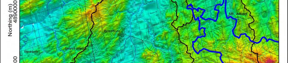
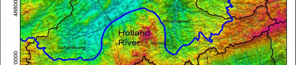
41 Figure 2-4 Ground surface topography (Earthfx and Gerber Geosciences, 2008) 27
42 2.3.2 Physiography The physiographic regions within the Maskinonge River subwatershed are a direct result of the deposition and erosion during glacial and post-glacial events, and closely correspond to the topography discussed above. According to Chapman and Putnam (1984), three physiographic regions are found within the subwatershed: the Oak Ridges Moraine (ORM), the Simcoe Lowlands, and the Schomberg Clay Plain (Figure 2-5). The ORM generally makes up the topographic highs, while the Simcoe Lowlands and the Schomberg Clay Plain make up the low areas within the subwatershed. Oak Ridges Moraine The headwaters of the streams flowing into Lake Simcoe from the south are located on the most widely recognized feature in the subwatershed, the Oak Ridges Moraine. The Oak Ridges Moraine is a significant physiographic feature that lies between the Trent River and the Niagara Escarpment. It is a total length of approximately 160 km, and has topographic elevations ranging from 305 to 395 masl (Davies et al, 2008). The peak of the moraine forms the surface water divide separating flow towards Lake Simcoe from flow towards Lake Ontario (ORMCP, 2002). The Oak Ridges Moraine is comprised of rolling sandy hills, hummocky topography and closed depressions that form the source of the headwaters to major streams that drain off the moraine. The moraine within the subwatershed consists primarily of surficial sand and gravel deposits, which can have a thickness of as much as 90 m along the topographic divide within the moraine these deposits are covered with silt to clay silt till (Halton Till). Also, a sand to sandy silt till (Newmarket Till) abuts the northern edge of the moraine in the Aurora area, and is believed to extend under the sand and gravel cap of the moraine. A unique feature of the Oak Ridges moraine is the lack of surface drainage. Precipitation in this area either infiltrates to replenish the groundwater system or returns back to the atmosphere via evapotranspiration. It is at the northern and southern flanks of the moraine where the groundwater emerges as springs or seepages, creating the headwaters of the subwatersheds originating on the moraine, including a small part of the Maskinonge River. The high infiltration capacity of the moraine makes it one of the most important recharge zones in southern Ontario, and within the Maskinonge River subwatershed. Schomberg Clay Plain The Schomberg Clay Plain is not a continuous feature like the Oak Ridges Moraine outlined above. It occurs in several low lying regions around the Schomberg, Newmarket, and Lake Scugog areas. Within this subwatershed, the clay plain is found near the communities of Queensville and Ravenshoe, and has an approximate elevation range of 225 to 275 masl. The Schomberg Clay Plain is characterized as having rolling relief that reflects the underlying till plain. The Schomberg Clay Plain areas are characterized by thick deposits of fine-grained sediments that are draped over an irregular till plain and are typically 15 m in thickness (Chapman & Putnam, 1984). Simcoe Lowlands The Simcoe Lowlands is the physiographic region that comprises the majority of the Maskinonge River subwatershed. The region extends from the ORM northward to Lake Simcoe, and is described as having lower elevations, with flat-floored valley features that generally correspond to current river systems (Sharpe et al., 1999). The lowlands were flooded by glacial Lake Algonquin and as a result are floored by sand, silt and clay (Chapman and Putnam, 1984). 28
43 One valley occurs immediately south of Lake Simcoe. The floor of this valley is now a swampy sandy plain, covered by organic deposits. The continuity of this plain is disrupted by drumlinized till composed of glaciolacustrine deposits. 29
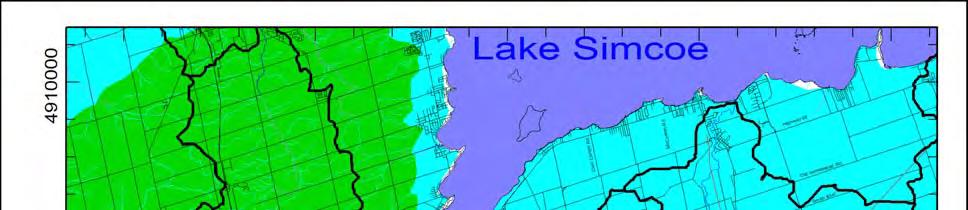
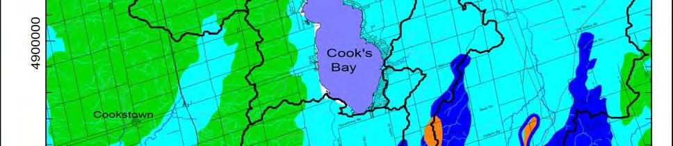
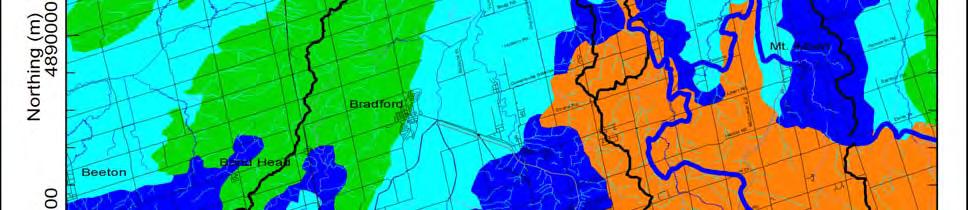
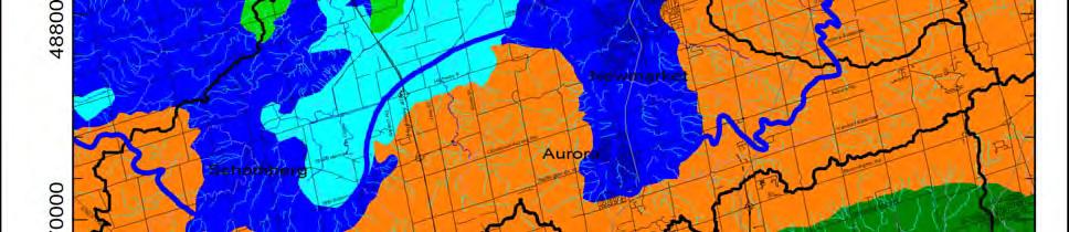
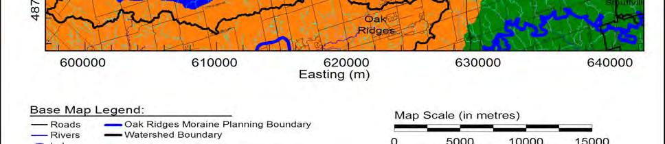
44 Figure 2-5 Physiographic regions within the Maskinonge River subwatershed (Earthfx and Gerber Geosciences, 2008) 30
45 2.4 Geology There have been a number of studies that have lead to the geologic understanding in the area. A generalized description of the bedrock geology, Quaternary geology, and conceptual stratigraphic units within the Maskinonge subwatershed is provided below. For more detailed information the reader is referred to Liberty (1969), Karrow (1989), Johnson et al. (1992) and Barnett (1992). The geology of the Maskinonge subwatershed is complex and has been influenced by a number of glacial events. Bedrock topography, which has a significant influence on the nature and extent of deeper aquifer units, has been mapped using data obtained from the MOE s digital water well records. Overburden thickness has also been estimated as the difference between bedrock and ground surface elevation. Areas of thicker overburden generally correspond to moraine or hummocky topography features Bedrock Geology The bedrock can be characterized as being from the Paleozoic Era, consisting primarily of limestone of the Middle Ordovician Simcoe Group in the north, and shale of the Upper Ordovician Blue Mountain in the south (Johnson et al., 1992). The bedrock has been overlain by a sequence of sediments that have been deposited over the last 135,000 years by glacial, fluvial and lacustrine environments (Error! Reference source not found.). The Middle Ordovician deposits make up the Simcoe Group, which consists of five formations. However, only the Lindsay Formation is found within the subwatershed. The younger, Upper Ordovician deposits found within the subwatershed consist of the Georgian Bay-Blue Mountain Formation. Lindsay Formation The Lindsay Formation overlays the Verulam Formation and extends from the northeastern boundaries of the subwatershed toward its southern and southwestern boundaries. The formation is also of Middle Ordovician age and is a member of the Simcoe Group (which is represented as (5) on Error! Reference source not found.. Within the subwatershed the Lindsay Formation has a thickness of 67 m and is richly fossiliferous, which indicates that the depositional environment was a shallow to deep marine environment (Thurston et al., 1992). Blue Mountain Formation The Blue Mountain Formation (formerly the Whitby Formation) overlies the Lindsay Formation. This formation is represented as part of the Georgian Bay formation (6) on Error! Reference source not found.. The formation is Upper Ordovician in age (approximately 420 million years ago) and is present as a band running southeast to northwest in the southern portion of the subwatershed. The formation consists of blue-grey, poorly fossiliferous, non-calcareous shale up to 60 m thick (Thurston et al., 1992). 31


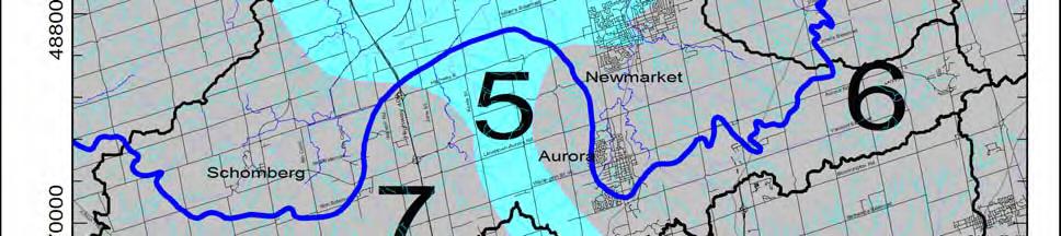
46 Figure 2-6 Bedrock geology within the study area (Earthfx and Gerber Geosciences, 2008). 32
47 2.4.2 Bedrock Topography The bedrock surface of the Maskinonge River subwatershed has a general elevation range of 120 to 160 masl, Error! Reference source not found.. The bedrock surface is thought to have been the result of a long period of non-deposition and/or erosion activity that occurred between the deposition of the sedimentary bedrock and the overlying sediments. The topographic lows are associated with significant valleys that have been eroded into the bedrock surface. These valleys are believed to be a result of fluvial activity prior to glaciation, approximately 440 to 2 million years ago with additional modification by glacial processes over the last 2 million years (Gerber and Earthfx, 2008). A major bedrock valley known as the Laurentian bedrock channel traverses through the southwestern portion of the Lake Simcoe watershed. Recent interest has been generated over the Laurentian Channel (also referred to as the Laurentian Valley), a proposed Tertiary-aged river network that extended from Georgian Bay to Lake Ontario (Brennand et al., 1998; Sharpe et al., 2004). This interest has been driven primarily through the attempt to locate additional sources of potable water as increasing population continues to place additional stress on existing groundwater supplies. This valley identifies an ancient drainage system that extended from Georgian Bay to Toronto. Tributary valleys to the main Laurentian valley are interpreted to occur beneath the subwatershed extending from Mount Albert through Newmarket and Aurora to join the main valley south of the study area (Gerber and Earthfx, 2008). 33


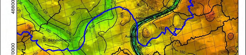
48 Figure 2-7 Interpreted bedrock surface topography (Earthfx and Gerber Geosciences, 2008). 34
49 2.4.3 Quaternary Geology Glacial History The bedrock within the Maskinonge subwatershed is overlain by unconsolidated sediment, known as the overburden, which was deposited during the Quaternary Period. The Quaternary Period can be further divided into the Pleistocene (Great Ice Age) and the Holocene (Recent) Epochs. During the Pleistocene, at least four major continental-scale glaciations occurred, which include, from youngest to oldest, the Wisconsinan, Illinoian, Kansan and Nebraskan Stages (Dreimanis and Karrow, 1972). All of the surficial deposits within the subwatershed, and within most of southern Ontario are interpreted to have been deposited by the Laurentide Ice Sheet during the Wisconsinan glaciation. The Laurentide Ice Sheet is the glacier that occupied most of Canada during the Late Wisconsinan period, approximately 20,000 years ago (Barnett, 1992). Sediments deposited during the Late Wisconsinan substage are extensive in southern Ontario, and are thought to represent all of the surficial deposits in the Maskinonge subwatershed. All of the deposits which outcrop at surface within the subwatershed were likely laid down within the last 15,000 years during and after the Port Bruce Stade. Deep boreholes indicated that older Wiconsinan deposits do occur at depth; however, it is not always possible to date them (Dreimanis and Karrow, 1972). The stratigraphy of the surficial deposits within the subwatershed is extremely complex, particularly in the ORM area where the deposits are very thick and are a direct result of the complex glacial history over the last 115,000 years. Quaternary Sediment Thickness Within the subwatershed the Quaternary sediment thickness is the difference between the ground surface and the interpolated bedrock surface. The thickness of quaternary sediments has been determined from borehole and water well information. Figure 2-8 shows that the thickness ranges from approximately 31m to 134m. The paleozoic bedrock topography appears to strongly influence the overlying Quaternary sediment thickness and distribution. The thicker Quaternary sediments occur in bedrock topographical lows (ie. within bedrock valleys and beneath the ORM), while the thinnest areas of Quaternary deposits occur at the north end of the subwatershed. 35


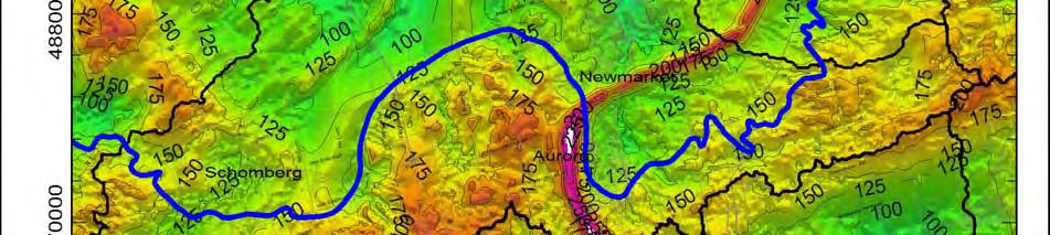
50 Figure 2-8 Quaternary sediment thickness (Earthfx and Gerber Geosciences, 2008) 36
51 2.4.4 Stratigraphy The stratigraphy of the surficial deposits within the Maskinonge River subwatershed is complex as a result of the glacial history. There are a number of ongoing initiatives to understand the local stratigraphy. The following subsections provide a brief overview of relevant and previously completed stratigraphic studies. The statigraphic framework of Quaternary glacial and non-glacial sediments, as shown in Figure 2-9, was determined using exposed sediment along the Lake Ontario bluffs and in the Don Valley brickyard (Eyles, 2002). In addition, a conceptual understanding of the stratigraphic framework was completed for the ORM area by the Geological Survey of Canada (GSC) and later refined by the Conservation Authorities Moraine Coalition York-Peel-Durham-Toronto Groundwater Study (CAMC-YPDT). The GSC constructed a five-layer geologic model of the moraine based in part on the stratigraphy of the Scarborough Bluffs. The CAMC-YPDT group combined the two stratigraphic models presented above to produce an eight-layer geologic model, shown in Figure Further information can be obtained from Earthfx et al. (2006). The eight conceptual model layers (from youngest to oldest) are: 1. Surficial deposits and/or weathered Halton Till 2. Halton Till or Kettleby Till 3. Oak Ridges Aquifer complex and/or Mackinaw Interstadial deposits 4. Newmarket Till 5. Thorncliffe Formation deposits 6. Sunny Brook Drift 7. Scarborough Formation deposits 8. Weathered bedrock Don Formation and York Till The Don Formation and underlying York Till have not been mapped within the subwatershed due to lack of deep borehole information that would be necessary to delineate these deposits since they are only within lows on the bedrock surface. 37


52 Figure 2-9 Quaternary deposits found within the Toronto area (Figure from Eyles, 2002). Figure 2-10 GSC stratigraphic framework of the ORM region (Sharpe et al., 1999) 38
53 Scarborough Formation The oldest Quaternary deposit of significant (mappable) thickness present within the subwatershed is the Scarborough Formation or equivalent to the Scarborough Formation as mapped in outcrop in areas to the south. The Scarborough Formation marks the start of the Wisconsinan glaciation, approximately 100,000 years ago. The Scarborough Formation (or equivalent) was formed by fluvio-deltaic processes leading to deposition of a lower clay layer overlain by sands showing varieties of cross-beddings. However, within the Maskinonge River subwatershed these deposits are mostly sand. This unit is mainly found within bedrock valleys and thins laterally away from the valleys (Earthfx & Gerber, 2008). Sunnybrook Drift The Sunnybrook Drift (or equivalent) overlies the Scarborough Formation and consists of clastpoor silt and clay deposited by glacial and lacustrine processes. This formation was deposited in close proximity to an ice sheet as it finally reached the subwatershed about 45,000 years ago (Gerber and Earthfx, 2008). Thorncliffe Formation The Thorncliffe Formation (or equivalent) represents glaciofluvial deposition of sand and silty sand generally within lows in the underlying stratigraphy. South of the study area, this unit largely consists of glaciolacustrine deposits of sand, silt and clay. The Thorncliffe Formation was deposited approximatedly 45,000 years ago and consists of sedimentary deposits of silt-clay rythmites and cross-laminated and cross-bedded sands (Earthfx & Gerber, 2008). Newmarket Till The Newmarket Till overlies the lower sedimentary sequences described above. The Newmarket Till is a dense diamict unit deposited when the Laurentide ice sheet was at its maximum extent, approximately 18-20,000 years ago. This unit can be up to 100 m thick but is generally m thick. The Newmarket Till is an important formation as it hydraulically separates the upper and lower aquifers and serves as a protective barrier to the deeper groundwater resources in the area (Earthfx & Gerber, 2008). Channel Sediments Following its deposition, the Newmarket Till was subject to erosional processes by glacial meltwater that modified the upper surface of the till. In some locations, the processes fully or partially eroded entirely through the till (Figure 2-11). These features have been termed tunnel channels by the GSC, who believe these erosional events occurred beneath glacial ice (Sharpe et al., 2004). The location of the major Newmarket Till tunnel channel erosion features as interpreted in the CAMC-YPDT study are shown on Figure These channels cover much of the study area, as major erosional channels occur beneath the Holland Marsh extending from Lake Simcoe through Schomberg, and within the northern reaches of the subwatershed. These erosional channels were largely infilled with sand and silt deposits as meltwater energy waned. Extensive work was carried out to identify these channels and map the upper silt layer that frequently occurs within them. The nature of the infill material is important for understanding the groundwater flow system as it determines the degree of hydraulic communication between the shallow and deeper aquifer systems. 39


54 Figure 2-11 Interpreted erosional and depositional process in the tunnel channels (GSC) 40


55 Figure 2-12 Interpreted subsurface erosional channel or tunnel channel locations where Newmarket Till and older deposits are either partially or completely eroded (Earthfx & Gerber, 2008). 41
56 Oak Ridges Aquifer complex and/or Mackinaw Interstadial deposits Oak Ridges aquifer complex occurs above the Newmarket Till and is a small geologic feature in the subwatershed. The Oak Ridges aquifer complex is an interlobate glacial deposit that largely consists of sand and gravel layers that can be up to 150 m thick. To the north and south of the ORM, sand units overlying the Newmarket Till have been categorized as belonging to the Mackinaw Interstadial deposits. Mackinaw Interstadial sediments generally only occur locally within areas of low topography upon the surface of the underlying Newmarket Till (Earthfx & Gerber, 2008). Surficial deposits and/or weathered Halton Till The last glacial advance in the area, approximately 13,000 years ago, led to deposition of the Halton and Kettleby Tills which generally have a silt to clayey-silt matrix. These till deposits overlie the ORM and Mackinaw Interstadial units. The uppermost units, which form an intermittent surficial veneer over the underlying till deposits consist of glaciolacustrine sand, silt, and clay associated with local ponding of glacial meltwater, and with Glacial Lake Schomberg and subsequently Glacial Lake Algonquin (Earthfx & Gerber, 2008). Figure 2-14 and Figure 2-15 show typical cross sections through the study area depicting the key features of the geologic and hydrogeologic system. Figure 2-13 shows the area the cross section depicts. Figure 2-14 shows a west-east cross section along Aurora Road, whereas Figure 2-15 shows a north-south cross section along Yonge Street. Key components of the geologic system include (1) thick deposits associated with the ORM; (2) erosional breaches (tunnel channels) through the Newmarket Till; and (3) thickening of the Scarborough Formation sand deposits within the bedrock valleys. The geologic formation names used in this study are from the Scarborough bluffs area situated along the shore of Lake Ontario (Karrow, 1967) and are also used by subsequent researchers (see, for example, Barnett et al., 1998). The term or equivalent is used to denote similar deposits situated to the north of the moraine that are interpreted to represent the approximate time or position in the sequence, as determined to the south of the Moraine. 42


57 Figure 2-13 Surficial geology (from Sharpe et al., 1997). North-south cross section line shown in Figure
58 Figure 2-14 West-east cross section (Earthfx & Gerber, 2008) Figure 2-15 North-south cross section (Earthfx & Gerber, 2008) 44
59 3 Best Management Practices for the Maskinonge River Subwatershed 3.1 Introduction The remaining chapters of this plan characterize the current condition of the five main parameters that comprise subwatershed health (water quality, water quantity, stream geomorphology, aquatic habitat and terrestrial natural heritage), and identifies some of the stressors leading to their current condition. For each of these parameters, a series of recommended actions has been developed to maintain or improve conditions. While these actions may include prohibition or restriction of specific activities, especially in environmentally sensitive areas, it will also require expanded use of best management practices (BMPs). Best management practices can be defined as those measures intended to provide an on-the-ground practical solution to pollution and other environmental impacts from all sources and sectors. BMP refers to operational activities, physical controls, or educational measures that are applied to reduce the discharge of pollutants or impacts (US EPA, 2004). In this chapter we provide an overview of current urban and rural/agricultural BMPs, and since the urban area of the Maskinonge River subwatershed is slated to expand in the coming years, there is particular emphasis on stormwater BMPs. The chapter concludes by highlighting BMP opportunities within the Maskinonge subwatershed, resulting from two recent studies by the LSRCA Lake Simcoe Basin Best Management Practice Inventory (2009) and the Lake Simcoe Basin Stormwater Management and Retrofit Opportunities (2008). 3.2 Urban Environments Stormwater BMPs Background Urban stormwater runoff occurs as rain or melting snow washes streets, parking lots, and rooftops of dirt and debris, minor spills, and landscaping chemicals and fertilizers. In the past it was common practice to route stormwater directly to streams, rivers, or lakes in the most efficient manner possible. This practice typically has negative impacts on the receiving watercourse. Over the last two decades this has changed and efforts are made to intercept and treat stormwater prior to its entering watercourses or water bodies. However, in many older urban areas stormwater typically still reaches watercourses untreated. Urban stormwater runoff is also greatly affected by land use type. Commercial and industrial areas usually have more impervious area (e.g. paved parking lots, sidewalks, roof tops) than any other type of land use and consequently generate more urban runoff and pollution. In sharp contrast are open areas that have little, if any, paved surface area. In these areas, the natural hydrologic cycle occurs whereby water can infiltrate down into the ground to be filtered by the soil before entering local streams and watercourses or continue deeper to recharge the ground water aquifer. The impact of stormwater runoff on stream ecosystems has been well documented and in almost every instance is detrimental to the health of local rivers and streams. Impacts to watercourses have been categorized as follows (Scheuler, 1992): changes to stream hydrology (flow), changes to stream form (channel morphology), degraded water quality, and aquatic habitat, 45
60 As the amount of impervious area increases, the natural water balance is disrupted. Evapotranspiration is decreased as there is little vegetation and the permeable soil surfaces are paved over; infiltration to groundwater is significantly reduced; and thus the runoff characteristics change. This change results in increases in the frequency and magnitude of runoff events, a decrease in baseflow, and an increase in flow velocities and energy. These changes further affect the form or morphology of the stream, including channel widening, downcutting, sedimentation, and channel braiding. These changes occur due to the increase in the erosive force associated with the increase in stream flow. As the velocity of a stream increases, the erosive force is transferred to the streambanks, and they may begin to erode. If the banks are well vegetated or armoured, the erosive force can be transferred to the stream bottom and down cutting of the streambed can occur. The results of this erosion will be the introduction of additional sediment and bedload to the stream system causing a further imbalance. When deposited along the inside bend of a river, this additional sediment may transfer even more force along the outside bend. Further deposition can occur where the river gradient flattens out and results in the creation of a braided channel. All of these changes can have significant impacts on the biological community in the watercourses (Figure 3-1). Subwatersheds with less than 10% imperviousness should maintain surface water quality and quantity and preserve aquatic species density and biodiversity, as recommended in the Environment Canada s Areas of Concern (AOC) Guidelines (2005). The AOC Guidelines further recommend an upper limit of 30% as a threshold for degraded systems that have already exceeded the 10% impervious guideline. In the Maskinonge River subwatershed, approximately 670 ha (10.5%) is impervious which is approaching the primary guideline to protect surface water quality and aquatic biodiversity. Figure 3-1 Pathways by which impervious surfaces may impact aquatic biological communities (ORM Technical Paper #13) 46
61 One of the most significant environmental impacts of stormwater runoff is to water quality. Problems with degraded water quality directly affect the aquatic ecosystem, recreational opportunities and aesthetics. This occurs as pollutants are washed off of streets, parking lots, rooftops, and roadways into storm drains or ditches which discharge to rivers, streams and lakes. Generally, concentrations of pollutants such as bacteria (e.g. Escherichia coli, faecal coliform, Pseudomonas aeruginosa and faecal streptococci), nutrients (e.g. phosphorus, nitrogen), phenolics, metals and organic compounds are higher in urban stormwater runoff than the acceptable limits established in the PWQO (MOE, 1994). Other harmful impacts include increased water temperature and the collection of trash and debris. It is a combination of all the previously mentioned changes (hydrology, channel morphology, and water quality) that influence stream ecology and health. Impacts on the aquatic community range from the outright destruction of habitat to reductions in stream productivity and species diversity. The destruction of habitat can occur as spawning beds, nursery areas and structure are covered with sediment. Another way in which habitat can be destroyed is through thermal degradation. Coldwater streams are defined as having stable water temperatures that generally do not exceed 20 C, even in the warm summer months. Stormwater runoff can reach temperatures exceeding 30 C because it is draining off of warm pavement. These inputs of warm water can significantly impact the temperature regime within coldwater systems. The reduced infiltration of precipitation due to the impervious surfaces can also result in lower groundwater levels, and a potential reduction in the amount available to be discharged as baseflow. Streams that once flowed permanently may become intermittent, and flow can disappear altogether Stormwater Control There are various methods of controlling stormwater runoff, from small-scale single lot controls to larger scale end-of-pipe stormwater management facilities (SWMF). The most common types of SWMF include wet ponds, dry ponds, and artificial wetlands. Based on the Stormwater Practices Manual (MOE, 1994, 2003), there are various levels of stormwater control established to ensure the protection of receiving waters (e.g. watercourse, ditch, lake). These guidelines were produced by the Ministry of Environment taking into consideration concerns from the Ministry of Natural Resources (MNR) (Fish Habitat Protection Guidelines for Developing Areas, 1994). Four levels of protection were established focusing on the ability of SWM pond to control and remove suspended solids. Level 1 is the most stringent level of protection designed to protect habitat which is essential to fisheries productivity (e.g. spawning, rearing and feeding areas) and requires 80% removal of suspended solids. Level 2 protection calls for a 70% removal of suspended solids. In this instance the receiving water can sustain the increased loading without a decrease in fisheries productivity. Level 3 controls are relaxed further requiring a 60% sediment removal rate again reflecting the lower quality of the receiving water for fish production. Level 4 controls exclusively address retrofit situations where, due to site constraints the other levels of control cannot be achieved. Level 4 protection is not to be considered for any new development, only for instances where uncontrolled urban areas can implement some SWMF to improve environmental health. It is important to realize that, while these guidelines are specific to suspended solids, other pollutants such as bacteria, metals, and nutrients (e.g. phosphorus) are reduced by the same controls. Due to severe water quality problems in Lake Simcoe, and the potential destruction of 47
62 the coldwater fishery (e.g. lake trout Salvelinus namaycush), the entire watershed has been deemed a special policy area. As a result, all new development in the watershed since 1996 has been required to construct SWMF that meet the most stringent criteria or Level 1 protection. This special policy designation was a result of a recommendation contained in the Lake Simcoe Environmental Management Strategy (LSEMS) Our Waters, Our Heritage, 1995 report, which deals exclusively with efforts to reduce phosphorus inputs to Lake Simcoe. The newly introduced Lake Simcoe Protection Plan also contains a number of policies around the control of stormwater. Dry ponds, also referred to as quantity control facilities, provide negligible water quality improvement benefits, instead acting to control and slowly release stormwater runoff to receiving water bodies. These facilities reduce the risk of flooding and mitigate hydrologic and channel morphology impacts associated with stormwater runoff, and should be considered in areas where it is not possible to construct quality control facilities Urban Environments Employing Other Urban Best Management Practices and Stormwater Control Measures There are some sections of existing urban areas where stormwater pond retrofits are not possible. These are largely the old sections of towns including the downtown core, and commercial and industrial areas developed long before current stormwater management practices were developed. To ensure that these areas are addressed, existing control measures should be undertaken and newer, innovative, and unconventional BMPs are being recommended. Street Sweeping Street sweeping is practiced in most municipalities within the subwatershed. Street sweeping involves mechanically removing dirt and debris from streets and parking lot surfaces, thereby reducing the amount of pollutant available to be washed into area watercourses during rain or snow melt events. While the effectiveness of street sweeping for pollutant removal is thought to be relatively low compared to other accepted stormwater BMPs (the estimated removal rate from a recent Environment Canada study is grams per curb kilometre [Rochfort et al., 2007]), this method does have the benefit from a water quality perspective in that it can be undertaken in areas where structural stormwater controls do not exist. Therefore, efforts to target additional street sweeping programs specifically within these uncontrolled areas will result in more effective water quality control. Targeted street sweeping in the uncontrolled areas in the Town of Georgina (of which Keswick is a part) would result in an estimated phosphorus reduction of 17 to 50 kilograms, depending on the removal rate. Rainwater Harvesting Canadians could be considered one of the more wasteful societies in the world with regard to water. For example, the use of potable water for flushing toilets and irrigating lawns and cropland is a waste of a valuable resource. One method of reducing this wasteful use of water is rainwater harvesting, which involves the collection and storage of rainwater, usually from rooftops and other hard impermeable surfaces. The water can then be stored in tanks and used for non-potable uses such as washing cars, irrigating lawns, and flushing toilets. The storage tanks can range from a barrel at the bottom of a home s downspout to a large industrial-size facility with multiple tanks, pipes, pumps, and controls. In addition to the conservation of potable water, the benefits of rainwater harvesting include reducing pollution from stormwater runoff and flood control. Collecting and storing stormwater 48
63 decreases the volume and rate of runoff, which reduces the potential for the runoff to pick up pollution, as well as reducing the risk of flooding and erosion. Under their Water for Tomorrow program, designed to promote water conservation, York Region offers rain barrels at a reduced price. While the widespread use of this practice, combined with downspout disconnection and other water conservation measures, will reduce the demand for water at peak times and reduce the potential for stormwater related issues, a more aggressive and targeted approach is recommended to achieve significant improvements for the purpose of stormwater management. For example, in the City of Portland, Oregon, water harvesting for the purpose of stormwater management is encouraged through reduced development fees if the stormwater runoff is retained on site. This has led many commercial, industrial, and institutional landowners to undertake water harvesting projects based on the reduced fee and savings associated with a decrease in water use. There are some concerns with large scale water harvesting, particularly with cost, maintenance, and public acceptance. Another concern is the potential harmful impact of these large-scale takings on baseflow and maintaining environmental flows to surface waters. These concerns can be mitigated by conducting a proper water balance for the affected site to ensure that there is adequate water to support baseflow. Ditches/Grassed Swales In the past, subdivisions were not built with curb and gutters which connected to storm sewers, but simple ditches to convey water away from roads and homes. Ditches have a number of benefits over curb and gutter systems. They are much less expensive to construct, reduce the size required for stormwater management facilities, allow water to infiltrate into the ground, and provide some snow storage during the winter months. The main drawbacks of ditches are that they use more space and are not as easy to maintain as curb and gutters. The use of ditches and grassed swales is now making a comeback as resource managers and planners have realized the environmental benefits. Ditches and grassed swales have been estimated to remove 30% of the phosphorus, 70% of the suspended solids, and greater than 50% of certain metals and hydrocarbons contained in urban runoff (Low Impact Development Center, When grassed swales and ditches are combined with bioretention facilities or infiltration galleries, there can be a greater benefit to water quality and quantity. These areas require more routine maintenance than do curb and gutter systems, and are therefore more costly, but the planting of native grasses, shrubs, and trees can also be undertaken to add aesthetic value and can significantly improve the public s acceptance of these features. Roof Top Storage/Green Roofs Providing roof top storage to retain rainfall is a common practice currently employed within the GTA and the Lake Simcoe watershed. The concept is to reduce the amount of runoff and subsequent pollution resulting from a building/structure. Roof top runoff is also controlled using a combination of other BMPs such as infiltration galleries, soakaway pits, and bioretention facilities. Infiltration galleries and soakaway pits can be constructed underneath existing infrastructure such as parking lots and boulevards and therefore don t constrain the developable area. Treating the runoff in a bioretention facility is probably the most effective method, but it requires land to construct and is therefore less attractive. Green roofs were developed as an alternative to the above mentioned practices for treating roof top runoff. Green roofs have been described as the creation of a contained green space on a roof for the purpose of improving water quantity and quality control. Green roofs are constructed 49
64 by first placing an impermeable membrane on the roof top followed by a drainage medium and soil. The roofs are then planted with a variety of ground covers. Research conducted into green roofs has documented that there are additional benefits associated with their construction. These include reduced energy consumption and cost, improved air quality, and a reduction in the urban heat island effect. Soakaway Pits, Infiltration Galleries, Bioretention, and Permeable Pavement These BMPs, while different, have a common objective to reduce surface water runoff by infiltrating water back into the ground. They are more useful for quantity control, reducing peak runoff and flooding, and maintaining the water balance. There is also a benefit to water quality, by reducing the volume of runoff, they minimize water contamination. Soakaway Pits Soakaway pits are the smallest and least expensive of these BMPs. They are designed to control roof top runoff from smaller buildings. They should be located well away from building foundation drains, and require well-drained soils. They are sized according to the amount of roof runoff they will receive a typical soakaway pit is 4-5 ft square, 3-4 ft deep, and can be covered in grass or stone. This is one of the few BMPs that a homeowner can install, with instructions for their construction easily accessible on the internet. Infiltration Galleries These can include trenches, chambers, and large basins. They are generally designed to control larger volumes of runoff and are often twinned with some form of sediment control when involved with treating parking lot runoff. This ensures that they do not become plugged and increases their operational lifetime. Bioretention Bioretention is a BMP that is designed to control water quantity and improve water quantity using the chemical, biological, and physical properties of plants, microbes, and soils to removal pollutants from stormwater runoff and facilitate its infiltration. They are generally used in parking lots, road medians, and in conjunction with grassed swales, and can be significantly less expensive than traditional stormwater BMPs. While the design may vary, they generally consist of a grass buffer strip, sand bed, ponding area, organic layer or mulch layer, planting soil, and plants. They are designed such that runoff (usually as sheet flow from a parking area, though they can be adapted to receive flow from a curb and gutter system) first reaches the grass buffer, where the flow of water is slowed and some particulates are filtered out. It then flows into a sand bed, which further slows the flow, and spreads the runoff along the length of the ponding area. The ponding area is designed for the water to pond to a depth of approximately 15 cm, where it is stored and may undergo a number of natural processes; it then infiltrates into the soil within approximately four days (US EPA, 1999). The processes that can take place in a bioretention facility include (Prince George s County, 2007): Sedimentation Adsorption of pollutants to soil particles Filtration Volatilization of hydrocarbons and other pollutants Plant uptake Cooling of runoff water Decomposition Phytoremediation Bioremediation Storage capacity 50
65 These facilities are not appropriate for some areas, such as those where the water table is within 1.8 m of the ground surface. There have been some concerns with their use in cold climates as the soil may freeze, preventing runoff from infiltrating into the soil during the winter months, though a recent study by the Toronto and Region Conservation Authority s Sustainable Technologies Evaluation Program (TRCA, 2008) found that the bioretention area was an effective means for draining melt water, so long as it is designed to prevent freezing at the inlet of the area. Temperatures generally remained above freezing in the bioretention area due to microbial activity in the soil and an insulating layer of snow. Other considerations include the salt tolerance of the plants used in the area, the phosphorus content of the soil (if this is high, the bioretention area may actually contribute to phosphorus loading), and the annual inspection and maintenance requirements. Permeable Pavement Permeable or porous pavement is another option for reducing runoff through infiltration, particularly from parking lots, which can generate large volumes of runoff. Forms of permeable pavement include porous pavement, cement pavers, and other turf grass pavers. While there are obvious benefits to reduce runoff and prevent flooding and erosion problems, there can be concern over potential groundwater contamination from the oils, metals, and other contaminants that accumulate on pavement. Oil Grit/Hydrodynamic Separators A typical oil/grit separator (OGS) operates by settling sediments and large debris out of stormwater runoff, and ultimately separating oils from the water. The units generally consist of 3-4 chambers, each designed for a specific function. The first chamber, referred to as the Grit Chamber, settles coarse sediment and large debris by slowing the flow of the water and screening larger debris with a trash rack. From there, the stormwater moves to the second chamber, the oil chamber, which traps and separates surface oils and grease from the stormwater runoff. This separation occurs because oil is lighter than water and floats on the surface. The discharge pipe is located near the bottom of the chamber, allowing the oil to pool on the surface and be contained. The third chamber houses the stormwater outlet pipe that discharges the overflow to the storm drain system. These systems are effective at removing oil and sediment, but their capacity for phosphorus removal is low. Therefore, they should be used in combination with other stormwater practices. Another important consideration is maintenance their efficiency is dependent upon regular maintenance. This involves cleaning them out at least twice per year and as necessary after major storm events. The maintenance costs can be high because they can contain hazardous materials which need to be safely disposed of. Some manufacturers have tried to increase the effectiveness of OGS for removing particulate and oil as well as additional contaminants such as phosphorus. An example of this is Imbrium Systems Incorporated s Jellyfish System. Systems such as this should be explored through pilot projects in the urban and industrial areas of the subwatershed. Road Salt Road salt has become an increasingly important issue as the urban areas of the Lake Simcoe watershed expand. The Canadian Environmental Protection Act defined road salt containing chloride salts as toxic under the Act (Environment Canada, 2001). Analysis of surface water quality throughout the Lake Simcoe watershed shows an increasing trend in chloride concentrations (see water quality section). The use, storage and application of road salt as well as disposal of snow should be conducted in accordance with the Code of Practice for the 51
66 Environmental Management of Road Salts (Environment Canada, 2004). York Region does have a Salt Management Plan, aimed at ensuring the proper timing and amount of road salt in order to reduce the amount needed and the impacts to the environment from its use. Local municipalities should adopt similar plans and/or the Code of Practice. To reduce the area of roads requiring salt during the winter, and also to limit the amount of impervious area, municipalities should also explore the feasibility of varying road widths narrower streets could be used on less travelled routes to reduce impervious area, rather than simply using a standard width. Alternatives to the use of road salt should also be explored. 3.3 Rural/Agricultural Best Management Practices and Controls - Phosphorus Reduction Opportunities There are a number of Best Management practices that can be implemented in a rural setting to help improve water quality and quantity. These include manure storage and management, private septic system repair or replacement, construction of bypass channels or bottom draws for online ponds, streambank erosion control, cover cropping, tree and shrub planting, installation of cropland erosion control structures, clean water diversion, livestock access restriction, and the completion of nutrient management plans. Funding and professional assistance is available through the LSRCA s Landowner Environmental Assistance Program (LEAP) for a number of these activities. Each of these BMPs is discussed below and more detail can be found at Streambank Erosion Control Vegetation is often removed from streambanks in order to accommodate various activities (e.g. farming, urban development, etc.). This leaves the streambank vulnerable to erosion, which can affect the aquatic ecosystem and can be a source of phosphorus. Depending on the soil type, stormwater runoff and high flows in the watercourse can result in bank slumping and the loss of valuable land. The planting of trees and shrubs in the riparian area will stabilize the stream bank by helping to bind the soil in place and slowing the flow of storm water Cropland Erosion Control Structures These BMP projects are undertaken to reduce soil erosion, and to protect watercourses and waterbodies. Not only will they reduce the loss of valuable topsoil, but will reduce the deposition of soil particles containing phosphorus and other contaminants onto the lake and watershed. They can include grass waterways to slow the flow of water and cause sediment to settle; water and sediment control basins; terraces, which are built on a steep slope to enhance water retention and reduce erosion; and drop structures Cover Cropping Cover cropping is a practice whereby plants are grown on agricultural lands where the fields would normally be left bare in between crops. Cover cropping can be used as a tool to manage soil fertility, soil quality, weeds, pests, and diseases. Soil fertility can be improved through cover cropping the cover crop takes up nutrients in the soil and maintains them in an inorganic form which is less likely to wash away during snow melt or precipitation events. These nutrients are then re-incorporated into the soil as the cover crop is decomposed, and made available to the newly planted crop, which is seeded over the residue of the cover crop. When used for cover crops, certain species (e.g. legumes) can be a significant source of nitrogen to the soil, as they have the capability to fix nitrogen. This can reduce, or in some cases negate, the need for chemical fertilization. 52
67 Soil quality is also improved through the use of cover crops as there are increases in organic matter; water holding capacity, as it reduces the rate and quantity of water that drains off the field; and nutrient holding and buffering capacity. As an added benefit it can also lead to increased soil carbon sequestration. Soil erosion is also reduced, as the roots help to create large soil aggregates and also hold the soil in place, and the plant material covers the soil surface when the cover crop dies off. Again, this helps to reduce the amount of soil and its associated contaminants reaching surface water through wind and water erosion Conservation Tillage The traditional tillage method for agricultural operations generally involves tilling the soil in the fall after the completion of the harvest, and again in the spring to prepare for planting. This can result in high levels of soil erosion and nutrient loss, as large soil aggregations are broken up and left vulnerable to erosion, and the plant material which would normally aid in holding the soil in place is ploughed under during tillage. Conservation tillage is a practice whereby where less or no tillage is undertaken, and a higher percentage of the plant residue is left on the field. This has several benefits: it requires less work and fuel, the stubble of the previous year s crop helps to hold the soil in place, increases moisture retention and infiltration, and increases the organic matter content of the soil. There are some challenges associated with conservation tillage. These include soil compaction, increased need for pesticides to reduce the amount of weeds (which would normally be tilled under), carryover of diseases, and a possible increase in saturated or flooded soils, which can delay planting Livestock Access Restriction Livestock that have access to watercourses can impact the water quality and affect the riparian area. The input of urine and manure directly into the water and onto low lying areas in the riparian area where it can be washed into the watercourse affect water quality. The livestock can trample streambanks, which contributes to instability, erosion, and sedimentation in the stream; while livestock in the stream can destroy spawning habitat. These issues can be avoided with the installation of fencing along watercourses to exclude livestock; cattle crossings; and alternate water sources, such as nose pumps Clean Water Diversion These systems direct clean melt water and/or precipitation away from potential sources of contamination including manure storage and exercise yards. These consist of systems such as eavestroughs, ditches, or trenches; rainwater collection systems; or any other permanent technique for preventing rain and snow from becoming contaminated Milkhouse Waste Management Milkhouse waste water includes excess milk, the soap and acids used to clean equipment and kill bacteria, manure, and, dirt. This waste water, when released to surface waters, can have significant impacts to water quality. There are methods, such as adding the washwater into manure storage, and installing treatment trenches and milkhouse wastewater treatment systems, in combination with management practices. A common management practice is to save the first flush of milk washwater and use it as a diluted feed back to calves. These methods will prevent waste water from being discharged to surface waters. 53
68 3.3.8 Manure Storage and Management Manure from beef and dairy operations is very high in nutrients, such as phosphorus, and bacteria. If left on the field, it can easily seep into ground and surface water sources with snow melt and/or precipitation. This can have considerable environmental and health impacts. Manure is stored in order to allow its application at the most beneficial time for crops, and to apply the manure at an appropriate time to minimize potential environmental impacts. The type of manure storage facility depends on what is being stored. Storage facilities can consist of open storage structures with runoff containment or roofed structures for solid manure; concrete or steel storage tanks for liquid manure; earthen manure storage and runoff storage; and the containment of runoff from exercise yards Private Septic Systems Waste from the majority of residences in rural areas is treated by private septic systems. As they age, these systems can malfunction and fail, and can be a considerable source of nutrient and bacteria contamination to surface and groundwater. Malfunctions and failures of septic systems will be identified through regular inspections if a problem is detected it should be resolved in a timely manner to minimize environmental impacts. LEAP provides funding for septic system repair or replacement for those systems within 100 metres of the lake or a watercourse in the watershed, as this is the zone where malfunctions can have the greatest impact Wellhead Protection and Well Decommissioning Wellhead protection is undertaken in order to reduce the risk of contamination of well water by implementing proper construction and maintenance practices and safeguards for existing wells. Wellhead projects that can be undertaken include grading and permanently seeding the soil surface around the well, sealing the space around the well, upgrading or replacing a dilapidated well casing and/or extending a well casing 16 inches above the finished ground level, installing proper well caps, and earth moving to ensure that water is directed away from the well head. Wells left unused or abandoned without being properly decommissioned leave the groundwater supply vulnerable to contamination. Wellhead decommissioning is undertaken in order to prevent groundwater contamination via improperly abandoned or unused wells. This is completed by properly plugging unused wells by a licensed well contractor Bypass Channels and Bottom Draw Structures for Online Ponds Online ponds, created by damming a watercourse, can cause a host of issues on the watercourse. They can increase water temperatures, raise bacteria levels, and disrupt the natural movement of fish, invertebrates, sediment, and nutrients. The natural movement of each is imperative for a healthy aquatic system. It is possible to reduce or negate the environmental impacts caused by an online pond, without the complete removal of the pond (which is important if the pond is used for irrigation). This can be accomplished either through the construction of a bypass channel around the pond or a bottom draw structure in the pond. A bypass channel is essentially a redirection of the watercourse around the pond, where the majority of the flow is diverted away from the pond, but enough flow if left going into the pond to maintain it. A bottom draw structure can be constructed where it would not be possible to put a bypass channel. These structures draw water from the cooler bottom waters of the pond, and this is discharged downstream to the watercourse, rather than the warm top waters from the pond flowing over the dam. While this does not negate the issues caused by the pond, it does improve conditions in the waters downstream of the pond. 54
69 3.4 Opportunities for BMPs in the Maskinonge River subwatershed Urban BMP opportunities The Lake Simcoe Basin Stormwater Management and Retrofit Opportunities report (LSRCA, 2008) identified and evaluated opportunities to control phosphorus from existing urban areas. In these urban areas, stormwater runoff should be addressed through stormwater pond retrofits. These include creating facilities in uncontrolled catchments or upgrading existing facilities or quantity only facilities to a higher level of control (i.e. Level 1). The report identified one retrofit opportunity in the only urban area in the Maskinonge River subwatershed, in Keswick (Figure 3-2). This has the potential to reduce over 113 kg/year of phosphorus entering the river, and ultimately the lake (Table 3-1). Table 3-1 Stormwater retrofit opportunities in the Maskinonge River subwatershed Location Number of Retrofits Area (ha) Affected Estimated Cost ($150/m 3 excavated) Phosphorus Loading (kg/yr) With Existing Stormwater Treatment Phosphorus Loading (kg/yr) With Retrofits Difference in Phosphorus Loading (kg/yr) Percent (%) Difference in Phosphorus Loading (kg/yr) Keswick $2,411,
70 Figure 3-2 Stormwater retrofit opportunities in the Maskinonge River subwatershed 56
71 3.4.2 Stream Corridor BMP Opportunities The Lake Simcoe Region Conservation Authority (LSRCA) conducted a Best Management Practices (BMP) Inventory, spanning 12 sections of the 18 subwatersheds within the Lake Simcoe basin in 2008 (LSRCA, 2009). The purpose of the BMP Inventory was to identify opportunities for the reduction of nutrients or improvements to fish habitat within the Lake Simcoe basin. Three priority areas were identified to focus the scope of the Inventory. These three areas are agriculture, tributary, and urban. Agriculture areas include any farming and agricultural operations; tributary areas include tributaries of all orders with a variety of land uses, excluding urban and agriculture; and urban areas include any section of watercourse within an urban environment, including drains, stormwater outfalls, and any other sources of nutrients that could require the implementation of BMPs to improve conditions. The BMP Inventory identified 2,420 waypoints containing 8,656 BMP opportunities throughout the entire Lake Simcoe watershed. Ninety-nine percent of the Maskinonge River subwatershed was surveyed through this inventory (Figure 3-3). A total of 187 BMP opportunities were located in the survey area, with the largest proportion of BMP opportunities being related to impervious surface runoff (17%), riparian cover (20%) and destabilizing land use (12%) see Figure

72 Figure 3-3 Location of best management practice (BMP) opportunities along the Maskinonge River stream corridor. 58

73 Maskinonge River Recovery Project The Maskinonge River Recovery Project (MRRP) is a community stewardship program designed to undertake on-the-ground environmental improvement projects within the Maskinonge River subwatershed area. It strives to address the problems found in the Maskinonge River, such as declining water quality and loss of fish habitat, with the help and involvement of the nearby communities. Formed in 2009, the MRRP has a 12 member committee with representatives from the Lake Simcoe Region Conservation Authority, Save the Maskinonge, York Environmental Stewardship, the Town of Georgina, the Town of East Gwillimbury and seven private citizens of varying backgrounds. The main goal of the MRRP is to work with the watershed-wide community and landowners in particular, to expand their interest in taking on a stewardship role in their own backyards. Already there have been a number of projects initiated including: Creating and managing a baseline monitoring program Participation in LSRCA s Maskinonge River Subwatershed Plan Developing a baseline database that will be needed/used to monitor future success Continuing to develop and implement a landowner outreach program A landowner letter and brochure have been completed and are ready for mail-out and will be accompanied by a MRRP brochure and a brochure for LSRCA s funding program, the Landowner Environmental Assistance Program (LEAP) Held two separate television interviews to highlight the project Figure 3-4 Establishing Types improved and relative education, proportion cooperation, of stream and corridor positive relationship BMP opportunities building identified during the LSRCA survey (LSRCA 2009) 24 MRRP logo fishing hats were made to promote the program Developing of new communication material 2000 MRRP brochures printed and ready for mail out and distribution at public events A subwatershed wide photo-contest in the Fall/Winter of 2009/10 Seven public education projects planned or underway (such as the Pond Management Workshop spring 2010) On-the-Ground projects for 2009/10 (just to name a few!) 23 site visits in 2009 Removal of tires and debris from river and riparian area Riverbank naturalization and erosion control Large scale cattle fencing project underway Commissioning of a large hydrogeological study for the wetland at Ravenshoe Roadd Coordinating and implementing a Yellow Fish Road program in Keswick with local schools These, along with other project activities, have been carried out by the various partners involved in this worthwhile endeavour. The success of this project depends heavily on community involvement and dedication toward the restoration of natural areas in and around the Maskinonge River. By encouraging landowners to take the initiative in protecting these areas in their own backyards, this recovery project is a team effort and in turn is something the communities of the Maskinonge River can be proud to be a part of. 59
74 4 Water Quality - Surface and Groundwater 4.1 Introduction and background The chemical, physical and microbiological characteristics of natural water make up an integrated index we define as water quality. Water quality is a function of both natural processes and anthropogenic impacts. For example, natural processes such as weathering of minerals and various kinds of erosion are two actions that can affect the quality of groundwater and surface water. There are also several types of anthropogenic influences, including point source and non-point sources of pollution. Point sources of pollution are direct inputs of contaminants to the surface water or groundwater system and include municipal and industrial wastewater discharges, ruptured underground storage tanks, and landfills. Non-point sources include, but are not exclusive to, agricultural drainage, urban runoff, land clearing, construction activities and land application of waste that typically travel to waterways through surface runoff and infiltration. Contaminants delivered by point and non-point sources can travel in suspension and/or solution and are characterized by routine sampling of surface waters in the Lake Simcoe watershed. Surface water quality results are compared to guidelines relating to the protection of the aquatic ecosystem. 4.2 Current Status Measuring Groundwater Quality There are no provincial groundwater quality monitoring sites in the Maskinonge River subwatershed. However, there is one site that, while it is technically within the East Holland River subwatershed, lies close to the border of the two subwatersheds and therefore is likely to provide a good indication of water quality Maskinonge River subwatershed groundwater quality Measuring Surface Water Quality and Water Quality Standards Within the Lake Simcoe watershed there are 12 PWQMN stations, one of which is located in the Maskinonge River subwatershed. Samples are collected eight times a year on a monthly basis during the ice-free period. Each sample, analyzed for 32 chemical parameters in the Laboratory Services Branch of the Ministry of Environment, is assessed using the Provincial Water Quality Objectives (PWQO) (Ministry of Environment, 1994). As stated by the Ministry of Environment, the goal of the PWQO is to protect and preserve aquatic life and to protect the recreational potential of surface waters within the province of Ontario. Meeting the PWQO is generally a minimum requirement, as one has to take into account the effects of multiple guideline exceedances, overall ecosystem health, and the protection of site-specific uses. In instances where a chemical parameter is not included in the PWQO, the Canadian Water Quality Guidelines for the Protection of Aquatic Life (CWQG) is applied (Environment Canada, 2003). The CWQG were developed by the Environmental Quality Branch of Environment Canada to protect aquatic species by establishing acceptable levels for substances that affect water quality and are based on toxicity data for the most sensitive species found in streams and lakes of Canada. 60
75 Table 4-1 A summary of surface water quality variables and their potential effects and sources Variable Effects Sources Objective/Guideline Chloride Control of excess chloride levels is important to protect the aesthetics and taste of drinking water. High levels may also have an impact on aquatic life. Background concentrations in natural surface waters are typically below 10 mg/l. The largest source of chloride is from road salt applications during the winter months. Other sources include waste water treatment, industry, potash used Env. Canada (2001): approx 210 mg/l for the protection of aquatic life. Total Phosphorus Total Suspended Solids (TSS) Metals Phosphorus promotes eutrophication of surface waters by stimulating nuisance algal and aquatic plant growth, which deplete oxygen levels as they decompose resulting in adverse impacts to aquatic fauna and restrictions on recreational use of waterways. Elevated concentrations reduce water clarity that can inhibit the ability of aquatic organisms to find food. Suspended particles may cause abrasion on fish gills and influence the frequency and method of dredging activities in harbours and reservoirs. As solids settle, coarse rock and gravel spawning and nursery areas become coated with fine particles, limiting the ecological function of these important areas. Many pollutants are readily adsorbed by suspended solids, and may become available to benthic fauna. Heavy metals generally have a strong affinity to sediments and can accumulate in benthic organisms, phytoplankton, and fish. Several heavy metals are toxic to human health, fish and other aquatic organisms at low concentrations. for fertilizers Sources include fertilizers, animal wastes, eroded soil particles and sanitary sewage. TSS originates from areas of soil disturbance, including construction sites and farm fields, lawns, gardens, eroding stream channels, and grit accumulated on roads Most metals in surface runoff are associated with automobile use, windblown dusts, roof runoff and road surface materials Interim PWQO: 0.03 mg/l to prevent excessive plant growth in rivers and streams. CWQG: 30 mg/l) for short term (<25 hr) exposures. EPA (1973( and EIFAC (1965): no harmful effects on fisheries below 25 mg/l PWQOs: Copper: 5 g/l Zinc: 20 g/l Lead: 5 g/l Iron: 300 g/l Cadmium: 0.5 g/l Chromium: 8.9 g/l Aluminium: 75 g/l for clay free soils; 100 g/l (CWQG) 61

76 Figure 4-1 Provincial Water Quality Monitoring Network sites in the Maskinonge River subwatershed 62
77 4.2.3 Groundwater Quality Status Few issues have been found in these samples, which are compared with drinking water guidelines. There have been some samples that have exceeded the sodium guidelines for restricted diets; however this station is a shallow well in a road right-of-way, which would not be a well from which drinking water would be extracted. However, this monitoring has only been undertaken for a short period of time, therefore there is not yet enough data from this site to see any trends Surface Water Surface Water Quality Status Examination of the water quality data collected between 2002 and 2008 highlights phosphorus and iron as the main parameters impacting water quality in the Maskinonge River. Table 4-2 details the number of samples from this data set meeting the guideline from this sampling period for Maskinonge station, as well as other stations around the Lake Simcoe watershed. Other parameters that are worth noting are the aluminum and cadmium concentrations with only approximately 60% meeting the objectives. It should also be mentioned that while nitrogen has no Provincial Water Quality Objective (PWQO), it was identified in the 1998 report due to its role in promoting the growth of duckweed, which is a continuing issue around the mouth of the Maskinonge. In addition, TSS levels have also been increasing over the years. It should be noted that the water quality monitoring station is located upstream of Keswick, the only urban area in this subwatershed, and the effects of this urban area are therefore not captured. The water quality issues identified are therefore mainly from agriculture activities, though there will certainly be impacts from Keswick in the subwatershed. 63
78 Table 4-2 A comparison of the Maskinonge River surface water quality to other tributaries within the Lake Simcoe watershed Monitoring Station Current Conditions ( ) Percentage of samples meet objectives Orange = median Concentration >objective Green = median Concentration < objective Trends Analysis ( ) Orange = Increasing/ Blank = no significant trend/ Green = Decreasing Chloride Phosphorus Nitrate TSS Iron Zinc Cadmium Copper Chloride Phosphorus Nitrate TSS Iron Zinc Aluminium Cadmium Copper West Holland River Tannery Creek * Mt. Albert Creek Beaver River Pefferlaw Lovers Creek Historical data n/a Historical data n/a Historical data n/a Schomberg n/a Maskinonge River East Holland Black River Hawkestone Creek Uxbridge Brook Historical data n/a Historical data n/a Historical data n/a Historical data n/a Objective 210 mg/ L 0.03 mg/ L 2.9 mg/ L 30 mg/ L 300 μg/l 20 μg/l 0.5 μg/l 5 μg/l 64
79 Chloride The Canadian Environmental Protection Act has defined road salts containing chloride as toxic under the Act (2001). This was based on research that found that the large amount of road salts being used can negatively impact ground and surface water, vegetation, and wildlife. While elevated chloride levels are primarily found around urban centres, chloride levels have been found to be steadily increasing across the Lake Simcoe watershed (LSRCA, 2007) (Table 4-2, above) as well as in Lake Simcoe itself (Eimers and Winter, 2006). Chloride concentrations in the Maskinonge River seem to have remained relatively constant over the period of record as well as being well below the Canadian Water Quality Guideline (CWQG) of 210 mg/l. Planned development in the headwaters of the river may impact chloride concentrations and therefore chloride concentrations will continue to be monitored. Aluminum and Iron The PWQO Guideline for aluminum requires that a sample be filtered so that it is clay free. This removes natural background aluminum associated with clay or bound up with suspended solids in the water column. The aluminum left after filtering is the portion that is bioavailable and therefore the portion that could affect the aquatic ecosystem. Samples analyzed under the PWQMN are not filtered, necessitating the use of guidelines less applicable to the Lake Simcoe watershed. Analysis of total aluminum and iron with Total Suspended Solids (TSS) at a number of Lake Simcoe stations showed good correlation with each other (LSRCA, 2006) indicating that the majority of aluminum is associated with clay or suspended solids. However, Maskinonge samples returned the lowest correlation suggesting that other factors are causing these elevated aluminum concentrations. To properly assess and comment on aluminum in the Maskinonge River, filtered samples need to be taken to examine dissolved aluminum. Cadmium Exceedances of the PWQO for cadmium occur more frequently at the Maskinonge than at any other station in the Lake Simcoe watershed for the current data set. Historic cadmium sampling ( ) only recorded trace concentrations. As with aluminum, it appears that a local factor unique to the Maskinonge River subwatershed is responsible for the concentrations being sampled in the river. Chloride contamination was also reported as one of the most abundant contaminants on the site (MOE, 2002). Chloride, being highly soluble, is also one of the most mobile contaminants which, as discussed above, is not being sampled at high concentrations downstream. None of the three parameters (chloride, aluminum, or cadmium) correlate with each other suggesting different sources and/or different transport mechanisms. Nitrite and Nitrate Nitrite is typically an indicator of organic waste or sewage effluent. As it is a very short lived parameter, exceedances of the PWQO typically indicate a nearby source (PWQO for nitrite is 60 ug/l). Historic data shows only two exceedances from 1985 to 1995, while the current data set has five recorded exceedances, all occurring in late summer. The only station in the Lake Simcoe watershed that has nitrite exceedances similar to the Maskinonge is the Uxbridge Brook station, which lies downstream of the Uxbridge Water Pollution Control Plant. In contrast, no current samples exceeded the PWQO for nitrate. 65
80 Phosphorus Total phosphorus is a measure of all forms of phosphorus (dissolved and particulate) in a water sample, including phosphates which are the most reactive (biologically accessible) form. Phosphorus is a nutrient essential to plant and animal life and is part of the natural cycle of decomposition and photosynthesis. Phosphorus binds to soil and is easily transported to streams with eroding soil where it can be utilized by aquatic plants and algae. Excessive levels of phosphorus cause an over abundance of plants and algae which can impair the aesthetic and recreational opportunities of the lake. As the plant material dies off the resulting decomposition can lead to oxygen depletion (eutrophication) in surface waters. Eutrophication is one of the leading concerns regarding the health of Lake Simcoe (Scott et al., 2006). Reading & Interpreting Box Plots A box plot presents a data set in graphical form. The shaded portion of the box represents the middle 50% of the data set showing where the majority of the values fall and the spread of the data. The line in the box is the median (50 th percentile) of the data set. The whiskers show the lower and upper quartiles of the data set. The points above and below the whiskers represent outliers in the data set at the 5th and 95th percentile. A red line has also been included to highlight the applicable guideline for the parameter. Phosphorus concentrations exceeded the PWQO in all Maskinonge samples in the current data set, up from 77% exceedances in the historic data. The East and West Holland are the only other rivers in Lake Simcoe that exceeded the PWQO in all current samples. The lower volume of water typically flowing in the Maskinonge means that the phosphorus loading to Lake Simcoe from this subwatershed is not as significant as what is coming from these larger rivers. That said, phosphorus is the most problematic parameter in the Maskinonge River and is impairing water quality. Compared to historic data sets phosphorus concentrations have increased slightly in the current data (Figure 4-2). This is uncommon for Lake Simcoe where most systems are seeing a decreasing trend in phosphorus concentrations. However, as the increase is slight it is possible that it is due to climatic conditions or due to recent changes to made to sampling methodologies. Sampling was formerly conducted on a set interval (e.g. every second Wednesday), but storm events are now being targeted. This methodology is preferred as it better characterizes the range of flows and concentrations that can occur within the subwatershed, but it has the potential to cause a bias in the data when compared with data collected under the former methodology. This is because there are more high flow samples in the data set under the new methodology. This may appear to be an increasing trend in the data, but is simply more accurate data. Further monitoring will clarify this trend. 66
81 PWQO = 0.03mg/L Median mg/l Figure 4-2 Maskinonge River phosphorus concentrations , (mg/l) Water Temperature Although it is not a substance that can be measured through water quality sampling, water temperature is another important water quality parameter. Increasing water temperatures, due mainly to impervious surfaces and ponds, can cause a number of issues. These include decreased dissolved oxygen concentrations, stress to sensitive fish and benthic invertebrate species, and the increased growth of algae. Water temperatures in the Maskinonge River are monitored using in-stream data loggers, which record the temperature at regular intervals throughout the summer. The LSRCA has been collecting temperature data for approximately five years. While this has been sufficient for increasing our understanding of where coldwater systems are found in the subwatershed (see Chapter 6, Aquatic Habitat for more detail), it is difficult at this point to see any trends or patterns in the data. There are factors influencing water temperature in addition to upstream and surrounding land use, including air temperature and the amount of precipitation, which can make it difficult to analyze trends in water temperature. 67
82 Key points - Current Water Quality Status: Few issues have been found in the groundwater samples. Some samples have exceeded the sodium guidelines for restricted diets; however this station is a shallow well in a road right-of-way, which would not be a well from which drinking water would be extracted. Some surface water quality parameters within Maskinonge River have failed to meet the established objectives or guidelines. Phosphorus is the main parameter of concern. Phosphorus is the most problematic parameter in the Maskinonge, exceeding the PWQO in 100% of samples collected between 2002 and During this timeframe, phosphorus concentrations have also increased slightly which is uncommon for Lake Simcoe where most systems are seeing a decreasing trend. Further monitoring is needed to clarify this trend. Chloride levels have remained relatively constant and are well below the Canadian Water Quality Guideline. However, planned development in the headwaters of the river may impact chloride concentrations. It should be noted that the monitoring station is due south of Keswick, the urban portion of the subwatershed. Between 2002 and 2008, there were five recorded exceedances of nitrite, all occurring in late summer. The only station in the Lake Simcoe watershed that has nitrite exceedances similar to the Maskinonge is Uxbridge Brook. Non-filtered aluminum concentration frequently failed to meet the PWQO. Maskinonge samples showed low correlation between aluminum and iron and TSS, suggesting that other factors are causing the elevated aluminum concentrations. Exceedances of the PWQO for cadmium occur more frequently at the Maskinonge River than at any other station in the Lake Simcoe watershed. It appears that a local factor unique to the Maskinonge subwatershed is responsible for the elevated concentrations. Whether or not it is responsible, the Thane Smelter brownfield site (which has had both aluminum and cadmium found at the site) is located directly upstream of the sampling station and should be remediated before the contaminants on site do impact the surrounding environments. 4.3 Factors impacting status stressors Groundwater Because groundwater moves more slowly and is subject to natural filtering as it moves through the soil, the quality of groundwater is most often better than that of surface water. As the water moves through the soil, contaminants are subject to the processes of adsorption, where they are bound to soil particles; precipitation; and degradation over time. These processes serve to improve the quality of the water. There are some substances that can easily move through the groundwater system without attenuation by any of the aforementioned processes. The most notable of these is chloride from road salt. Further, if a contaminant source is located near a discharge area, there may not be 68
83 sufficient time and distance for natural filtering to occur. There are also some parameters, including iron and chloride, which are naturally found within some groundwater aquifers. Groundwater quality can also be impacted by anthropogenic factors. In rural areas, levels of contaminants including bacteria, phosphorus, nitrates, and road salt can become elevated where the groundwater is beyond the capacity of the natural filtration capability of the soils. Sources of contaminants in these areas are fertilizers, improperly functioning septic systems, manure storage facilities, and road salt application. In urban areas, groundwater can be subject to contamination by road salt, hydrocarbons, metals, phosphorus, and other nutrients. Groundwater contamination becomes an issue where it is discharged to the surface and is used by animals or humans. Source Water Protection Authorities are currently determining the vulnerability of aquifers in the region to water quality stressors and identifying potential threats drinking water supply Surface Water Natural Influences Natural features in the environment generally serve to maintain water quality conditions. Naturally vegetated areas including grasslands, meadows, and woodland areas tend to improve water quality as it flows over land. The stems and roots of the vegetation slow the flow of water, enabling soil particles and other contaminants to be deposited, and increasing the amount of runoff that is infiltrated into the soil. Soil filters water as it flows through to the groundwater. Wetlands slow the flow of water, provide storage, and can absorb some contaminants, including nutrients such as phosphorus; and thus have a natural filtering ability. The inputs of clean cool groundwater into lakes and streams also serve to improve water quality, by diluting the concentration of any pollutants in the portion of the flow coming from surface water. Rural and Urban Influences A high percentage of the land within the Maskinonge River subwatershed, 67%, is agricultural. There are a number of water quality issues that are associated with agriculture. Runoff from pasture and cropland can contain high levels of nutrients, sediment, and bacteria; and wind can erode topsoil with its associated contaminants. All of these substances can end up in local watercourses if the appropriate BMPs are not implemented. These BMPs can include conservation tillage, cover cropping, maintaining vegetated riparian buffers, cattle fencing, and the appropriate use of fertilizers and pesticides. Of note in the Maskinonge River subwatershed is the large area occupied by sod farms, approximately 800 ha. These are intensively farmed areas which require a significant input of fertilizer and irrigation to be viable. These activities can have a considerable impact on the quality of the waterbodies receiving runoff from these fields. The partners of the Maskinonge River Recovery Project (described in Chapter 3) are working with sod farm operators in an attempt to reduce the environmental impacts of this activity. Runoff in urban areas, particularly those built prior to the requirement for stormwater management, can carry a host of pollutants to local watercourses. These pollutants build up on roads, driveways and parking lots, and even lawns, and are washed to watercourses during precipitation events. The pollutants that can be carried by urban stormwater runoff include nutrients and pesticides from lawns, parks, and golf courses; road salts; tire residue; oil and gas; sediment; and nutrients and bacteria from pet and wild animal faeces. Paved surfaces increase the volume and velocity of surface runoff, which causes streambank erosion, contributing further more sediment to watercourses. The requirement for stormwater management facilities in all new developments will help to mitigate these issues in urban areas, 69

84 however, the ongoing maintenance of these facilities is crucial to ensuring that they continue to reduce sediment and nutrient loads as designed, otherwise these new developments would be contributing additional phosphorus to the system. Additional best management practices should also be implemented in conjunction with stormwater management wherever possible to reduce the amount of these pollutants, as even a stormwater facility with the highest level of control does not achieve 100 % removal. A further input of sediment and nutrients from urban areas is the wind erosion of soils stripped bare for development. These areas can be without vegetation for prolonged periods of time, and can be a significant source of windborne pollution. Keswick is the only significant urban area in the Maskinonge River subwatershed. Approximately a quarter of the urban area of Keswick drains into the Maskinonge River (26% or ha), the remainder drains to Glenwoods Creek or directly to Lake Simcoe. This urban area represents approximately 3.5% of the subwatershed. Of the area of Keswick draining to the Maskinonge River 45% has no stormwater control, 21.5% has only quantity control, and the remaining 33.5% is controlled by a Level 1 or 4 stormwater facility (Figure 4-3, Figure 4-4, and Table 4-3). This represents a modelled phosphorus load of approximately kg/yr to the Maskinonge River, which has been reduced by 49.12kg/yr due to existing controls (LSRCA, 2007). Figure 4-3 Area of stormwater control in urban regions of the Maskinonge River subwatershed 70
85 Table 4-3 Controlled vs. uncontrolled stormwater catchments in the Maskinonge River subwatershed Total Number of Catchments Total Urban Area (ha) Used Uncontrolled Quantity Level 1 Level 2 Level 3 Level 4 Controlled (Total of Levels 1 to 4) Location # Area (ha) % (area) # Area (ha) % (area) # Area (ha) % (area) # Area (ha) % (area) # Area (ha) % (area) # Area (ha) % (area) # Area (ha) % (area) Keswick

86 Figure 4-4 Stormwater controls in the Maskinonge River subwatershed 72
87 Phosphorus Phosphorus load estimates are those calculated during the Assimilative Capacity Study (see text box for more information). The assimilative capacity study used a watershed model (CANWET) that estimates nutrient loads based inputs such as land use, precipitation and soil type. The following table (Table 4-4) presents the average yearly phosphorus load derived from each source in the subwatershed under current conditions, the approved growth scenario, and the approved growth scenario with implementation of BMPs. The primary source of phosphorus in the Maskinonge subwatershed under existing conditions is derived from cropland (56%) and other sources (16%). Under the approved growth scenario, there is a projected decrease in total phosphorus load of less than 1% without the implementation of BMPs. The projected phosphorus load under the approved growth scenario can be further reduced by approximately 44% through the implementation of BMPs. Thus, assuming the implementation of BMPs, the total phosphorus load under the approved growth scenario will decrease from the current estimated load by 44% for this subwatershed. Based on the modelled phosphorus loads, the Maskinonge River is a fairly significant contributor of phosphorus to Lake Simcoe, despite its smaller size (Figure 4-4). The majority of this load is from agricultural sources within the subwatershed. However, the phosphorus load from the Maskinonge River was far less than that of the East and West Holland Rivers, Uxbridge Brook/Pefferlaw River (which were treated as one system for the Assimilative Capacity Study) and Beaver River, likely due to the low flow levels during the summer months in this subwatershed. This is discussed in further detail in Chapter 5, Water Quantity. Table 4-4 Source Phosphorus loads by source in the Maskinonge River subwatershed Existing (kg/year) Committed Growth Scenario (kg/yr) Change (Existing Condition to Committed Growth) Committed Growth (with BMPs) BMP Reduction Potential Difference between Existing and Committed Growth w/bmps Phosphorus Load Allocation (kg/year) Hay/Pasture % Crop Land % Other % Low Intensity Development % 0 1 High Intensity % Development Stream Bank Erosion % -1 2 Groundwater % Point Source % 0 Septic System % -8 8 TOTAL 1,609 1, %

88 Figure 4-4 Phosphorus load estimates for all subwatersheds in the Lake Simcoe basin, with relative contributions from various sources Chloride The main source of chloride, in its various compounds, in the environment is from road salt. It enters the environment through runoff from roadways as well as through losses from salt storage and snow disposal sites. Due to its high solubility, chloride very easily contaminates both surface and groundwater. High levels of chloride, such as those found in runoff water draining from roads and salt storage yards, can damage the roots and leaves of aquatic and terrestrial plants, and can also have behavioural and toxicological impacts to animals. Continued exposure to high chloride levels can cause a shift from sensitive communities to those more tolerant of degraded conditions (including a number of invasive species that are able to thrive).given that the urban area of the Maskinonge River subwatershed is anticipated to expand in the coming years, it can be expected that these loads will also increase, although the continuation or expansion of the salt 74
89 management plans already initiated by York Region to reduce the use of road salt may reduce the amount used in any given area. Sediment While a certain amount of sediment input is normal in a natural system, in larger amounts it begins to cause a number of problems. Many contaminants, including phosphorus, bind themselves to soil particles, and eroding soil acts as a vector for introducing these particles to an aquatic system. There are also impacts to aquatic biota, which are discussed in greater detail in Chapter 6, Aquatic Habitat. There are a number of sources of sediment in the Maskinonge River subwatershed: Development sites: these sites are often stripped of vegetation well in advance of development in an effort to reduce costs as the development is built in phases. These bare soils are then subject to erosion by both wind and water. The proper installation of erosion controls can prevent some of the soil from reaching watercourses, but need to be inspected and maintained regularly. Agricultural areas: fields are particularly vulnerable to erosion whenever they are bare (e.g. after tilling and in the spring prior to the establishment of crops). The flow of melt waters and precipitation over the fields during these periods can result in a huge influx of sediment. In addition, many farmers also remove treed windbreaks and much of the riparian vegetation along watercourses flowing through their properties in order to maximize the cultivable land, both of which help to prevent soil erosion. Practices such as conservation tillage and the use of cover crops, as well as the implementation of appropriate BMPs will help to reduce soil loss and its associated impacts on watercourses. Urban areas: The use of sand as well as salt for maintaining safe road conditions during the winter is commonplace. However, large quantities of sand remain on the roadsides after all of the snow has melted in the spring, and if it is not removed (e.g. by street sweeping) in a timely manner, much of it will be washed away by surface runoff during rain events. This is of particular concern in areas without stormwater controls, as the sand will be transported directly to local watercourses. Water temperature thermal degradation The warming of surface water can generally be attributed to one of two factors: flow over impervious surfaces, and/or the detention of water in a pond. During the summer, impervious surfaces such as parking lots and rooftops can become extremely warm. As water flows over these surfaces before discharging to a watercourse, its temperature increases as well. The detention of water in a pond increases the surface area of the water that is exposed to sunlight, and keeps it there for a prolonged period of time, leading to warming. Although online ponds are the greatest concern due to their direct impact on the watercourse, offline ponds (including stormwater ponds and detention ponds for irrigation) that discharge to watercourses are also a concern. While the planting of vegetation around a pond and along its outflow and the installation of structures such as bottom-draws to ensure that the coolest water is being discharged from the pond can help to reduce the heating effect, ponds may still have an impact on the thermal regime of a watercourse. This issue will likely worsen as the amount of impervious area in the subwatershed increases in the coming years. Recreation Natural areas such as streams and rivers are a popular location for recreational activities such as hiking, boating and snowmobiling. These activities if not managed correctly and undertaken 75
90 in a responsible manner, can reduce ecological condition of the surface water quality in the area. Impacts from recreational activities can include increased bank erosion and instability, loss of riparian area resulting in an increase in input of total suspended solids (TSS) and pollution. Stresses on these sensitive areas are increasing as a result of increasing population and diminishing natural heritage lands. Pesticides Given the large proportion of the subwatershed with agricultural and urban land uses, pesticide use is a concern in the subwatershed. While pesticide for cosmetic purposes has been banned by the Province of Ontario, which is a very positive step, there are a number of exceptions to this law that allows for the use of pesticides for public health or safety (including the protection of public works structures), golf courses, specialty turf, specified sports fields, arboriculture and to protect natural resources, if certain conditions are met. There are also exceptions for agriculture, forestry, research and scientific purposes, and uses of pesticides for structural exterminations (e.g., in and around homes to control insects) and uses of pesticides required by other legislation. Due to the number of uses still allowed for pesticides, there is still the potential for these substances to end up in the subwatershed s surface waters. There can be a number of impacts to both terrestrial and aquatic systems due to pesticide contamination, including: Cancers, tumours and/or lesions on fish and animals; Reproductive inhibition/failure reduced egg suppression and hatching, sterility; Nest and brood abandonment; Immune system suppression; Endocrine disruption; Weight loss; Loss of attention; and Loss of predator avoidance (Ongley, E., 1996, Helfrich et al., 2009). The use of best management practices for the storage and use of pesticides can limit the amount of pesticide required in a given area, and will also reduce the movement of the pesticides from target areas. These practices should be promoted throughout the subwatershed. The LSRCA initiated sampling for pesticides in the Maskinonge River subwatershed in 2004 with the Toxic Pollutant Screening Program; the current program which was initiated in 2007 involves taking three samples each year in the subwatershed. As this is a relatively new program, there are few samples from which to draw information; it is therefore difficult to determine the state of this subwatershed with respect to pesticide levels. Continuation and enhancement of this program will enhance our understanding of the extent and fate of pesticides in this subwatershed, and may lead to the development of programs to prevent pesticides from reaching area watercourses. 76
91 Key points Factors Impacting Water Quality - Stressors: The primary source of total phosphorus in the Maskinonge subwatershed is cropland (56%) and other sources (16%). Under the approved growth scenario, modelled through Assimilative Capacity Study, there is a projected decrease in total phosphorus loads of less than 1% without the implementation of BMPs. Sod farms are thought to be a significant contributor of nutrients and sediment in the subwatershed. Most of the chloride in the subwatershed comes from the use of road salt, with the estimated annual loads increasing in recent years with the growing urban area in the subwatershed. It is expected that this load will increase into the future as the urban area is scheduled to expand, as well as the extension of Highway 404 into the subwatershed. Sediment sources include sites stripped for development, agricultural areas, and sand used on roads in the winter. Increasing surface water temperatures can be attributed to overland flow across impervious surfaces and discharge from ponds. This is a trend that can be expected to increase in the coming years as the amount of impervious area increases. 77
92 Tools to Improve Water Quality: The Assimilative Capacity Study The purpose behind the Assimilative Capacity Study (ACS) was to help the Lake Simcoe Environment Management Strategy (LSEMS) partners to determine how much development can be accommodated in the Lake Simcoe watershed and the management practices necessary to minimize future phosphorus loading from the watershed or to reduce current loadings, to meet the LSEMS remedial target for Lake Simcoe. Study components The estimation of the assimilative capacity of the Lake Simcoe watershed required the completion of several steps. These included: Estimating the current contribution of phosphorus entering Lake Simcoe from all existing point and non-point sources Evaluating the potential reduction in phosphorus loading resulting from the implementation of BMPs throughout the watershed on the current load Estimating the impact of the future Official Plan designated population and urban area growth on phosphorus loading within the watershed with and without the implementation of BMPs Establishing phosphorus targets in the form of Total Maximum Monthly Loads (TMMLs) for individual subwatersheds within the basin which are in turn linked to the LSEMS lake phosphorus target load of 75 T/y Assessing whether the TMMLs can be achieved and maintained under the future growth scenario Recommending options for future growth based on the results. These tasks were completed through the development of two water quality models, CANWET, a watershed water quality model; and MIKE3\ECO Lab, a hydrodynamic lake water quality model. These are discussed in further detail in the ACS reports, which can be found on the LSRCA website. Phosphorus Targets: Developing Total Maximum Monthly Loads (TMMLs) The practice of developing total maximum loads was first initiated by the United States Environmental Protection Agency (USEPA) to regulate and protect degraded water resources. Once a water quality indicator is identified, in this case total phosphorus, a target value for that indicator is determined that will allow for the attainment of water quality objectives. This target condition is established to provide measurable environmental management goals and a clear linkage to attaining water quality objectives (i.e. PWQOs). The development of TMMLs in the Lake Simcoe watershed represents the first time this method has been proposed for use in protecting water resources in Canada. Two water quality objectives were necessary in the development of a Lake Simcoe TMML phosphorus target setting strategy. The first objective considered was the existing LSEMS lake target of 75 (T/y). The second was the PWQO for total phosphorus concentration guideline for the streams and rivers flowing into the lake (0.03 mg/l). It is important to understand that PWQO are not standards that must be met but rather objectives that are recommended to ensure healthy aquatic ecosystems 78
93 Summary of the Assimilative Capacity Study Results Current Conditions Sixteen out of 23 subwatersheds in the Lake Simcoe watershed, including the Maskinonge River, exceed a PWQO-based load target. The Maskinonge River subwatershed s modelled phosphorus loads exceeded the PWQO based target in all months except for August to October, during baseflow conditions. The loads in this subwatershed are highest in March during the spring freshet, and again later in June. The concentration of total phosphorus is generally highest during the months of lowest flow, from June to October. The primary source of phosphorus in the Maskinonge River subwatershed was found to be cropland. The measured annual phosphorus load for the period was found to be 1,118 kg. The overall target load for the Maskinonge River is 903 kg/year. Committed Growth without Implementation of BMPs Committed growth is the scenario involving population and urban expansion based on the municipal Official Plan designations into the future. It does not include implementation of enhanced BMPs to offset the impact of growth and is therefore the worst-case scenario option. There is actually a projected decrease in the Maskinonge River subwatershed under the committed growth scenario without the implementation of BMPs. Committed Growth with Full Implementation of BMPs The last scenario modelled involves the population and urban expansion along with a full implementation of BMPs to offset the impacts associated with development. The results of this scenario indicate that an estimated total reduction of up to 28% (from 41.5 to 37.2 T/y) could be achieved for the Lake Simcoe watershed. This result suggests that the continued growth within the watershed could occur without impacting negatively on water quality. Modelling results suggest that with BMP implementation, the Maskinonge River subwatershed would observe a 44% decrease from its current phosphorus load. The estimated cost of implementation of the BMPs in the Maskinonge River is $6.4 million. Approximately 95% of this cost is derived from the implementation of urban BMPs, such as the installation or upgrades of stormwater management facilities. Approximately 4% would be derived from agricultural BMPs, such as nutrient management, cover cropping, and contour farming. Very little of this cost (<1%) would be associated with stream protection BMPs, which include fencing, buffer protection, and streambank stabilization. 79
94 4.4 Current management framework There are numerous acts, regulations, policies and plans aimed at maintaining or improving water quality. These include the Provincial Policy Statement, the Ontario Water Resources Act, the Greenbelt Plan, Growth Plan for the Greater Golden Horseshoe, the Oak Ridges Moraine Conservation Plan, the Lake Simcoe Protection Plan, and the Nutrient Management Act. This management framework relates to many different stressors that can potentially affect water quality, ranging from the discharge of material to urban development. In Table 4-5 we categorize 12 such stressors, recognizing that many of these activities overlap and that the list is by no means inclusive of all activities. The legal effects of this management framework broadly fall into one of two categories. The first broad category we define as those having little or no legal standing and are referred to as General or Have Regard to Statements in Table 4-5and are shown in blue. The second category includes those that have legal standing and must be conformed to; these are referred to as Regulated / Existing Targets in Table 4-5 and are shown in green. In many cases an act, regulation, policy, or plan does not relate to the activity specified, these are shown in red. Table 4-5 Summary of current regulatory framework as it relates to the protection and restoration of water quality Stressor affecting water quality Oak Ridges Moraine Conservation Plan (2002) Greenbelt Plan (2005) Lake Simcoe Protection Plan (2008) Growth Plan for the Greater Golden Horseshoe (2006) Provincial Policy Statement (2005) Nutrient management Act (2002) Ontario Water Resources Act (1990) Environmental Protection Act (1990) Clean Water Act (2006) Source Water Protection 8 LSRCA Watershed Development Policies (2008) York Region Official Plan (2008) Growth, development and site alteration Application of road salt 3 Loss of natural heritage features Stormwater Impervious surface Discharge of material Agriculture Restoration Septic systems Climate change General/Have regard to statement Regulated/Existing targets No applicable policies 1 Gives specifics of what stormwater management plans are to include, but these are very general (e.g. protect water quality ) 2 PPS only specifies where private septic systems would be allowed, but doesn t give details around inspections/restrictions 80
95 3 Just general policy (not specific to road salt): Every person that discharges or causes or permits the discharge of any material of any kind into or in any waters or on any shore or bank thereof or into or in any place that may impair the quality of the water of any waters is guilty of an offence 4 Septic systems >10,000 L/day are regulated under OWRA (smaller systems under building code) 8 It is possible that many of these activities may be the addressed through policies developed under Source Protection Plans, but this is dependent on the threats and stressors identified through the Threats Assessment 5 One policy regarding replacement of septic systems that are in wetlands 6 Specific policies within ORM planning area, otherwise this is a have regard to 7 Within ORM planning area In this section we provide a summary the various acts, regulations, policies and plans as they pertain to activities affecting water quality. This summary is to give context to future management considerations and the opportunities and recommendations to improve water quality. This summary is not intended to be comprehensive in terms of all the legislative pieces that relate to water quality, or of the acts, regulations, policies and plans that are discussed below the reader is directed to each act, regulation, policy, or plan for a full assessment of how it relates to water quality Oak Ridges Moraine Conservation Plan (2002) Among the objectives of the Oak Ridges Moraine Conservation Plan is to maintain, improve, or restore all of the elements that contribute to the ecological and hydrological functions of the ORM area, including the quality and quantity of its water and its other resources. With respect to water quality this plan: Requires a natural heritage evaluation to demonstrate that the development or site alteration will have no adverse effects on key natural heritage features or their ecological functions, and to specify a minimum vegetation protection zone to ensure that the features are protected. Prohibits development and site alteration in hydrologically sensitive features such as streams, wetlands, kettle lakes, and seepage areas, and associated vegetative protection zone. Prohibits development and site alteration outside of Settlement Areas if it would cause the total percentage of the area of the subwatershed with impervious cover to exceed 10 per cent. Approval authorities should strive to maintain at least 30 per cent of the area outside of Settlement Areas in self-sustaining vegetation. Requires applications for major development include a sewage and water system plan that demonstrates that the quantity and quality of ground and surface water will be maintained, and that the project will comply with the applicable watershed plan. The plan also includes specific requirements for stormwater management such as: Applications for development are required to demonstrate that planning, design and construction practices that protect water resources will be used, including; minimizing the removal of vegetation, grading, and soil compaction; keeping all sediment that is eroded during construction within the site. Stormwater Management Plans are to provide for an integrated treatment train approach that uses a planned sequence of methods of controlling stormwater and minimizing its impact by techniques that include lot level controls, conveyance controls, and end-ofpipe controls. 81
96 Municipal development standards shall incorporate planning, design and construction practices that will reduce the portions of lots and sites that have impervious surfaces; and provide the flexibility to use alternative stormwater management techniques such as directing roof discharge to rear yard ponding areas and using grassed swales. The minimum standard for water quality is that 80 per cent of suspended solids shall be removed from stormwater runoff as a long-term average. Disposal of stormwater into a kettle lake is prohibited and new stormwater management ponds are prohibited within key natural heritage features and hydrologically sensitive features The Greenbelt Plan (2005) One of the stated goals of the Greenbelt Plan is the protection, improvement or restoration of the quality and quantity of ground and surface water and the hydrological integrity of watersheds. This goal is supported by a number of policies in the plan that relates to the Protected Country side areas of the Greenbelt. The Water Resource System Policies requires: Planning authorities to provide for a comprehensive, integrated and long-term approach for the protection, improvement or restoration of the quality and quantity of water, Municipalities are required to protect vulnerable surface and ground water areas, such as wellhead protection areas, from development that may adversely affect the quality and quantity of ground and surface waters. Policies specifically related to Stormwater Management Infrastructure include: Stormwater management ponds are prohibited in key natural heritage features or key hydrologic features or their vegetation protection zones. Applications for development and site alteration shall be accompanied by a stormwater management plan which demonstrates that: - Planning, design and construction practices will minimize vegetation removal, grading and soil compaction, sediment erosion and impervious surfaces - Where appropriate, and integrated treatment approach shall be used to minimize stormwater management flows and structures through such measures as lot level controls and conveyance techniques such as grass swales - The objectives of a stormwater management plan are to avoid, minimize and/or mitigate stormwater volume, contaminant loads and impacts to receiving water courses in order to protect water quality, minimize the disruption of pre-existing (natural) drainage patterns and prevent increases in stream channel erosion. The plan also contains policies specifically related to natural heritage features which would also have an influence on water quality. See Chapters 6 and 8 for more information Lake Simcoe Protection Plan (2009) The Lake Simcoe Protection Plan (LSPP) sets out very ambitious targets for improving water quality in the lake and its tributary rivers and streams, and a number of policies for achieving these targets. The water quality targets in the Lake Simcoe Protection Plan are: 82
97 To achieve 7 mg/l dissolved oxygen in Lake Simcoe (which equates to a phosphorus load to the lake from all sources of approximately 44 tonnes/year). Reduce pathogen loading to eliminate beach closures Reduce contaminants to levels that achieve Provincial Water Quality Objectives or better The policies to achieve these targets include those around stormwater, septic systems, construction and aggregate extraction activities, and the development of a phosphorus reduction strategy. These are outlined in further detail below. In regards to Stormwater the LSPP requires: Preparation and implement comprehensive stormwater management master plans for each settlement area in the Lake Simcoe watershed. Municipalities are to incorporate policies related to reducing stormwater runoff volume and pollutant loadings from major development and existing settlement areas into their official plans. Applications for major development must be accompanied by a stormwater management plan that demonstrates, among other requirements: - That an integrated treatment train approach will be used - How changes between the pre- and post-development water balance will be minimized - How phosphorus loadings will be minimized Every owner and operator of a new stormwater management works to inspect and maintain the works on a periodic basis. In regards to Septic Systems, the LSPP requires development of a proposal for a regulation under the Ontario Building Code act to: Designate the lands within 100 metres of the Lake Simcoe shoreline, other lakes and any permanent stream of the watershed, as a prescribed area for required septic system maintenance and re-inspections. Investigate new standards for septic systems. Place limitations on when and where new septic systems can be built within this 100 metre buffer around the lake and its streams and rivers. The LSPP contains policies to minimize the impacts from exposed soils at construction and mineral aggregate sites. These policies requires municipalities to ensure that the following measures are incorporated into subdivision and site plan agreements: the removal of vegetation, grading, and soil compaction; and stipulating that the removal of vegetation is not to occur more than 30 days prior to grading or construction structures to control and convey runoff are in place and exposed soils are seeded once construction is complete sediment and erosion controls are implemented effectively Phosphorus Reduction Strategy The LSPP has set ambitious targets for reducing the phosphorus load to the lake which will require a reduction from all sources in the watershed. To help accomplish this goal, the LSPP 83
98 contains policies for the development of a phosphorus reduction strategy, which will support a phased, coordinated and adaptive management approach to reducing excess phosphorus loadings. The policies also consider the need for innovative solutions to reducing phosphorus. The phosphorus reduction strategy will include the development of subwatershed phosphorus loading targets, an assessment of the sources of phosphorus loadings in the watershed (including tributary sources and stormwater runoff) and an identification of practical and effective actions that should be taken to address each source. Additional Policies The LSPP also contains a number of other policies which, while not directly related to water quality but, will help to protect and enhance water quality in the Maskinonge River subwatershed when they are implemented. These include: Water conservation and efficiency initiatives, which will reduce surface runoff and improve the efficiency of sewage treatment plants and septic systems, wherever possible (although significant upgrades have already been undertaken at the Keswick treatment facility) Natural heritage targets around shorelines, the amount of high quality vegetative cover and riparian cover, the protection of wetlands and other important features, restoration of natural areas or features, and overall ecological health Consideration of climate change and its potential effects throughout the Lake Simcoe watershed The coordination of stewardship efforts throughout the watershed in order to capitalize on the strengths of the various partners; increase effectiveness in cost-sharing, communication and co-marketing; enhance stewardship opportunities; and champion key new initiatives, technologies, and BMPs Places to Grow Act Growth Plan for the Greater Golden Horseshoe (2006) Policies within this plan will help to maintain and/or improve water quality by directing development to built-up areas and those areas that already have municipal water and wastewater systems. Perhaps most important with regard to surface water quality are the Growth Plan s policies around Water and Wastewater. These include the following: The construction of new, or expansion of existing, municipal or private communal water and waste water systems should only be considered where the following conditions are met: - Strategies for water conservation and other water demand management initiatives are being implemented in the existing area - Plans for expansion or for new services are to serve growth in a manner that supports achievement of the intensification target and density target Municipalities that share an inland water source and/or receiving water body, should coordinate their planning for potable water, stormwater, and wastewater systems to ensure that water quality and quantity is maintained or improved Municipalities are encouraged to implement and support innovative stormwater management actions as part of redevelopment and intensification 84
99 The Growth Plan also supports and builds on the protection offered to natural features in plans such as the Greenbelt and ORMCP. Municipalities are encouraged to identify and develop policies to protect natural features, the linkages between, and areas that complement them Provincial Policy Statement (2005) Policies that are directly related to maintaining and/or improving water quality in the Provincial Policy Statement (PPS) include: Planning authorities shall protect, improve, or restore the quality of water by implementing necessary restrictions on development and site alteration to: - Protect municipal drinking water supplies - Protect, improve or restore vulnerable surface water and groundwater, sensitive surface water features and sensitive groundwater features, and their hydrologic functions, including: Promoting the efficient and sustainable use of water resources Ensuring stormwater management practices minimize stormwater volumes and contaminant loads, and maintain or increase the extent of vegetative and pervious sites Growth should be directed to promote the use of existing sewage and water services, ensuring that these services can be provided in a manner that can be sustained by the water resources on which they rely, and that protects human health and the natural environment. Growth is to be focused in settlement areas which, if implemented, should limit the amount of natural area removed, thus maintaining their functions. Development and site alteration are not permitted in features such as significant wetlands, woodlands and ANSIs, or the lands adjacent to them, unless it can be demonstrated that there will be no negative impacts on the natural features or their functions Nutrient Management Act (2002) The goal of the Act is to set standards for nutrient management on farms that create nutrients (such as manure, biosolids, and fertilizers) and for farms that use these materials. The Act and its regulations are currently limited to farms that create over 300 nutrient units (one nutrient unit is equivalent to the amount of nutrient that is created by approximately one cow), or those smaller farms that are expanding and will be generating over 300 nutrient units. Farms that generate manure are required to complete a Nutrient Management Strategy a document that shows how much manure and/or other materials prescribed by the regulation are produced, how they will be stored, and where they will be used. Farms that use or store manure or other prescribed substances on their land, but do not generate manure for removal are required to complete a Nutrient Management Plan. These plans include many similar components to the Nutrient Management Strategies, but must also include contingency plans for situations such as weather preventing the application of the material on the field or if storage becomes too full. This Act gives current best management practices the force of law, and creating comprehensive, enforceable, province-wide standards to regulate the management of all landapplied materials containing nutrients. Specific regulations of this Act include: Restrictions on how and where farmers can apply nutrients to their land. 85
100 Setbacks from sensitive features such as wells and streams are required for new barns that will be storing manure Ontario Water Resources Act (1990) With respect to water quality, the Ontario Water Resource Act (OWRA): Requires that construction of new water works (including sewage treatment works and stormwater management facilities) or alterations to existing works may proceed only after a Certificate of Approval under Section 53 of the Act has been issued by the MOE. This enables MOE to track the amount of pollutant being discharged into the water, and ensures that project designs meet the proper specifications. Prohibits the discharge of material of any kind into waters (or on the shore or bank of a water body) that may impair the quality of water States that every person that discharges or causes or permits the discharge of any material of any kind into or in any waters or on any shore or bank thereof or into or in any place that may impair the quality of the water of any waters is guilty of an offence. The OWRA also enabled the development of water quality of objectives to provide the basis upon which the limits of the uses of water resources can be established in order to protect water quality. The Provincial Water Quality Objectives (PWQO) established under this directive, provide a series of goals, policies and guidelines are intended to assist those making decisions under or related to the OWRA and the Environmental Protection Act (See EPA below). For example, they give directions that assist in defining site specific effluent limits, which may then be incorporated into Certificates of Approval or control orders. The policies and guidelines do not have any formal legal status. The PWQOs are numerical and narrative criteria which serve as chemical and physical indicators representing a satisfactory level for surface waters and groundwater (where it discharges to the surface). PWQOs are set at a level of water quality which is protective of all forms of aquatic life and all aspects of the aquatic life cycle during indefinite exposure to the water. PWQOs are intended to provide guidance in making water quality management decision such as the designation of surface waters which should not be further degraded. They are used to assess ambient water conditions, infer use impairment, assist in assessing spills, and in monitoring the effectiveness of remedial actions. The publication states that meeting the PWQO is a minimum requirement, and that considerations such as ecosystem health, the additive effects of more than one chemical, or the protection of other uses may lead to more stringent requirements Environmental Protection Act (1990) The main policy of the Environmental Protection Act (EPA) that will help to protect water quality is that a person shall not discharge a contaminant or cause or permit the discharge of a contaminant into the natural environment, if the discharge causes or may cause an adverse effect. This does not apply to discharges that are authorized under this Act or the OWRA if the discharge does not cause and is not likely to cause an adverse effect. It also does not apply to a discharge of a contaminant that arises when animal wastes are disposed of in accordance with normal farming practices, when the only adverse effect that is caused or may be caused is the impairment of the quality of the natural environment for any use that can be made of it. The EPA enables a Director of the MOE to: order someone who causes or allows the discharge of a contaminant that results in injury, damage, or endangerment to land, water, property, animal or plant life, or human 86
101 health or safety to prevent or repair the injury or damage or (if water supplies are threatened) provide temporary or permanent water supplies. require a person who owns a property or has management of an undertaking to put in place equipment and/or precautionary measures to be in place to prevent the discharge of a contaminant or to minimize its impact if it is released into the environment. issues stop orders or control orders where a contaminant has been released in a concentration or level that exceeds that prescribed by the regulations Clean Water Act (2006) Source Water Protection While its aim is to protect sources of drinking water, a number of the initiatives included the Clean Water Act will help to improve water quality throughout the subwatershed. The goals of the Act are to identify threats to drinking water, and then implement changes to reduce or remove those threats. A Source Protection Plan will be prepared for each Source Protection Area. This plan may set out significant threat policies to which planning decisions must conform they will affect future activities and land use planning around wellheads and water intakes. The plan may also provide for the prohibition of certain activities and the use of risk management plans to impose conditions on certain activities, and may include policies for which municipalities must have regard in other vulnerable source water areas such as moraines, aquifers, headwaters and recharge areas. Implementation of Source Protection Plans will include the incorporation of the Plan s policies into municipal Official Plans, changes to zoning by-laws, and inspections and enforcement LSRCA Watershed Development Policies Although not extensive, the LSRCA Watershed Development Policies do address the protection of water quality. Policies include: Requiring Enhanced Level 1 stormwater quality protection for all new developments in the watershed Requiring erosion and sediment control plans for plans of subdivision Protecting environmentally significant areas, wetlands and floodplains (as permitted under its mandate) and their functions, which will maintain water quality York Region Official Plan (2009) York Region s Official Plan (OP) includes a number of policies related to the protection of the quality of both ground and surface water. The policies within the OP related to water quality include: The preparation of a comprehensive regional water strategy for both piped services and surface and groundwater sources that will include long-term protection strategies, enhancement guidelines and monitoring requirements; That the natural quality and hydrological characteristics of watercourses and lakes (including water quality and temperature) will be maintained, and that development be designed with the goal of maintaining water balance Directing development away from sensitive surface water and groundwater features Continuing to partner with other regions and conservation authorities to study, analyze, and monitor ground and surface water resources to ensure a unified approach to protecting and enhancing water quality and quantity 87
102 Monitoring the quantity and quality of surface and ground water systems in York Region, in co-operation with local municipalities and conservation authorities) by: - Assessing the sustainability of current activities and land uses - Identifying areas that are susceptible to, or currently experiencing, water quality and quantity problems Requiring local municipalities to establish policies and programs to protect, enhance, and monitor water systems Encouraging agricultural land management practices that minimize the application of pesticides and nutrients Working with partners in the implementation of stormwater management initiatives Requiring the preparation of comprehensive stormwater management plans as a component of secondary plans Requiring that development have an integrated and innovative approach to water management, be water efficient, and maximize stormwater quality, quantity, and infiltration through an integrated treatment approach Encouraging innovative approaches to stormwater within secondary plans Requiring owners and operators of stormwater management works to inspect, maintain, and monitor effluent quality on a periodic basis Working with local municipalities and LSRCA in the preparation and implementation of comprehensive stormwater master plans for each settlement area within the Lake Simcoe watershed by 2014 Working in partnership with local municipalities, conservation authorities, adjacent municipalities and other agencies to co-ordinate watershed planning initiatives and implement watershed plan objectives; and supporting the goals and objectives of watershed plans In addition to these policies, York Region s protection of the regional Greenlands System will help to ensure that the functions of the Region s natural features, such as the filtering effect of wetlands, will continue to protect and enhance water quality Local municipal bylaws Each local municipality within the subwatershed will have bylaws and requirements regarding site alteration and requirements for erosion and sediment control during and after construction. The reader should consult the individual municipality for information related to these requirements. 4.5 Management gaps and limitations Clearly there are already numerous legislations, regulations and municipal requirements aimed at protecting Maskinonge River water quality. Despite this strong foundation, there are a number of gaps and limitations in the management framework that need to be considered, including a number of emerging issues such as the effects of climate change and the potential for new water quality contaminants such as pharmaceuticals. This section provides an overview of factors that need to be considered in the future management of the subwatershed. 88
103 4.5.1 Growth, Development and Site Alteration These activities are strongly regulated in areas such as key natural heritage features (See Figure 8-1), key hydrologic features, and shorelines through the ORMCP, Greenbelt Plan, Lake Simcoe Protection Plan, York Region s Official Plan, and LSRCA Watershed Development Policies. The protection of these features and functions serves to prevent further deterioration of the Maskinonge River water quality. There are, however, limitations with these policies: For many natural heritage features it is only those considered significant that are protected, and in general only those considered provincially significant are protected. Although they are not considered to be significant, these features still perform important functions in the watershed, and the development of these areas and loss of these functions will have impacts to watershed health. Wetlands are now well protected through the Generic Regulation (179/06); The policies that apply to hydrologic features are not consistent across the subwatershed the definition of a key hydrologic feature is different for the ORMCP area, the Greenbelt Plan area, and the LSPP area which covers the remainder of the subwatershed. Features such as seepage areas, springs, aquifers and recharge areas are protected in the ORMCP area, but not the LSPP area, and the Greenbelt Plan includes seepage areas and springs but not aquifers and recharge areas. These discrepancies can leave some of these features unprotected. Some plans specify a minimum vegetation protection zone (e.g. the ORMCP and Greenbelt Plan), and also identify a further area of influence (as it is referred to in the ORMCP) outside of the minimum vegetation protection zone. Within this area of influence, a proposal for development or site alteration triggers the requirement for a natural heritage and/or hydrologic evaluation. This evaluation is meant to describe the existing conditions, assess the potential impacts from proposed development/site alteration and determine if the minimum vegetation protection zone provides sufficient protection. If the minimum vegetation protection zone is not found to be sufficient, the evaluation should specify the dimensions of the required minimum vegetation protection zone. While the goal of these policies is undoubtedly to protect the features, in reality the required evaluations rarely specify anything greater than the minimum; in essence the minimum becomes the maximum distance. There is therefore little further protection gained through this process for these features and their functions by way of a buffer distance Road Salt There is no legislation that specifically regulates the application of road salt. The ORMCP, Greenbelt Plan, Growth Plan for the GGH, and the OWRA address it either through broad have regard for policies, or general water quality statements. These are very general policies that in no way require the management of road salt and its impacts to water quality and aquatic biota. Urban areas have been expanding in the subwatershed, and thus the increasing chloride concentrations are not unexpected. However, while safety must obviously continue to be the priority for road salt use, municipalities should continue to explore the most environmentally friendly options for maintaining safe roads in order to protect the subwatershed s water quality and the aquatic communities residing within its watercourses. These options include ensuring the proper timing and amount of road salt application, as well as exploring the use of alternative de-icing substances. Municipalities within the subwatershed should adopt the Code of Practice for the Environmental Management of Road Salts (Environment Canada, 2004). 89
104 4.5.3 Stormwater The ORMCP, PPS, Greenbelt Plan, Growth Plan, LSPP, Official Plans, and LSRCA Development Policies all contain some form of policy recommendation around requirements for stormwater management. Although some of these are have regard for statements, there is policy support to require that all applications for development within the Lake Simcoe watershed are required to have Enhanced Level 1 stormwater control or better. The LSPP has gone a step further and contains several policies around reducing the impacts of stormwater. These are highlighted in the above section. While these policies are an important step in reducing the impacts of stormwater, there are some limitations: There are no required timelines for the implementation of the recommendations of stormwater master plans required through the LSPP There is no mention of funding support for the implementation of such activities as stormwater retrofits in the LSPP While municipalities are required to incorporate policies around stormwater including encouraging a hierarchy of treatment, the implementation of innovative stormwater management measures, allowing for flexibility in development standards around alternative community design and stormwater techniques, this does not necessarily mean that developers will adopt these standards. Municipalities should require some or all of these practices rather than encouraging their use in order to create a level playing field for all developers undertaking works in the watershed, otherwise there is little incentive to change standard practices Impervious Surfaces The ORMCP, Greenbelt Plan and Regional Official Plans contain policies around that aim to limit impervious area to a certain level, while the PPS, LSPP and LSRCA Watershed Development Policies contain more general statements about striving to limit impervious area. These policies are limited in scope, and there are gaps in the geographic area covered. The issues with these policies include: The ORMCP and Greenbelt Plan do set a limit of 10 per cent, but these limits apply only outside of Settlement Areas in the ORMCP, and only in the Natural Heritage System of the Greenbelt. Thus there are no defined impervious surface limits within the ORMCP and the Greenbelt Plan areas not covered by these policies, as well as areas outside of the ORMCP and Greenbelt boundaries. York Region s policies around impervious surfaces only apply in the ORMCP area There is no agency ensuring that subwatershed impervious areas do not exceed the defined limit. Approval agencies should be striving for either a reduction in impervious areas on development sites or the mandatory use of practices that increase infiltration in order to reduce the impacts of impervious area within the subwatershed Discharge of Material The OWRA, EPA, Nutrient Management Act, Clean Water Act, and Official Plans all contain policies related to the discharge of materials that would impact water quality. Some are related to specific activities and/or contaminants; for example the Nutrient Management Act is mainly related to the phosphorus and bacterial contaminants from agricultural activities, whereas the Clean Water Act is concerned with the protection of drinking water. Others regulate the 90
105 discharge of substances that have the potential to impair water quality. The limitations with these policies include: Much of the regulation is related to point sources of pollutant (e.g. WWTPs, industrial activities, stormwater ponds) and do not generally address non-point sources of pollutant Cumulative impacts are generally not considered the Province has developed Provincial Water Quality Objectives under the EPA and OWRA, but the objectives and their related policies have no legal standing, and are generally seen as merely guidelines, not as limits to be strictly adhered to. There is no enforcement related to exceedances of these objectives. This has led to ever deteriorating water quality conditions in the subwatershed which will require a significant investment to rehabilitate The LSPP identifies a target of achieving the PWQO or better in its watersheds, but while it does include a number of policies aimed at improving water quality, there are none that specifically identify how the PWQO target will be reached The Nutrient Management Act only applies to farms of a certain size or that store and/or utilize a minimum amount of manure Limited regulation related to the discharge of Endocrine Disrupting Chemicals Pharmaceuticals and Personal Care Products from sources such as wastewater treatment plants (See text box below) Agriculture The Nutrient Management Act contains the most stringent of the policies related to agriculture, as it requires plans for the management of contaminants created and/or stored on farms. Other policies relate to the protection of agricultural resources, but few relate to the management of contaminants from agricultural areas, with only have regard to statements encouraging the use of agricultural BMPs. There are no policies that regulate or require the use of BMPs such as cover crops, conservation tillage/no tillage, wind breaks or other practices that would protect water quality Also lacking are policies requiring livestock to be fenced and kept out of watercourses, an activity that causes numerous water quality issues as well as causing bank instability There is nothing that requires farmers to test soils to ensure that the use of fertilizer is actually required many farmers simply fertilize at certain times every year, without testing the soil to ensure that it is actually necessary, which may be resulting in unnecessary inputs of nutrients into the subwatershed. Although there are currently no requirements for farmers to undertake BMPs such as cover crops, conservation tillage, the planting of wind rows, and leaving riparian buffers intact, there are a number of available programs to assist farmers to implement these programs. In particular, the LSRCA s Landowner Environmental Assistance Program (LEAP) provides guidance and funding for a number of types of projects; and there are a number of policies in the Lake Simcoe Protection Plan related to agricultural stewardship Restoration Most of the policies related to restoration are quite general in nature, and do not contain specific requirements. Some require applications for development in site alteration in key hydrologic 91
106 features and key natural heritage features to be accompanied a natural heritage or hydrologic evaluation, which in some cases requires the applicant to include planning, design, or construction practices that will maintain and, where feasible, improve or restore the health, size and diversity of the feature Septic Systems Policies relating to septic systems are included in the PPS, ORMCP, OWRA, LSPP, and the York Region Official Plan. These policies range from outlining the types of developments where septic systems may be constructed (as is the case in the PPS) to those policies in the ORMCP and LSPP which do not allow for the construction of any new septic systems, on the ORM and within 100 metres of Lake Simcoe or any of its permanent streams, respectively. The issues around the policy framework include: The ORM policy is the only one that will help to protect the quality of groundwater from malfunctioning septic systems, policies such as those in the Lake Simcoe Protection Plan will mainly serve to protect surface water These policies do not require the regular inspection of existing systems, leaving both surface and groundwater vulnerable to contamination. The LSPP s proposed regulation under the Ontario Building Code for required septic system maintenance re-inspections for systems within 100 metres of Lake Simcoe or any of the watershed s permanent streams is a good step. However the appropriate agency should ensure that funding is available to residents within these areas to undertake required system maintenance and/or repairs identified through this program Climate Change Climate change is generally not well addressed in the current management framework. The LSPP contains the most comprehensive policies related to this issue which, although it is still difficult to predict its impacts, may exacerbate water quality issues in this subwatershed. The adaptation strategy that will be developed through the LSPP is a significant first step in addressing this issue, and some of the Official Plan policies are beginning to consider climate change as well. While it may not be appropriate for some of the existing legislation to address climate change issues, it will be important to incorporate climate change considerations wherever possible in making management decisions for the subwatershed, and implement policies requiring, at the very least, the implementation of so called no regrets options should be incorporated into development and site alteration wherever possible Atmospheric deposition The municipalities have requirements for sediment and erosion control from ongoing developments; and the LSPP is also proposing the use of best practices to minimize the amount of dust erosion from sites. There are few, if any, policies around preventing erosion from agricultural lands, although there are a number of funding programs for the implementation of BMPs. Although there are some policies and/or by-laws in place, it will be important to ensure that there are sufficient resources for their enforcement in order to prevent inputs from this source. 92
107 Emerging Contaminants As anthropogenic activities increasingly impact our natural areas, the potential for introduction of harmful substances becomes more of a concern. It is for this reason that a Toxic Pollutant Screening Program was initiated by the Lake Simcoe Region Conservation Authority in The goal of this project was to develop a better understanding of the location and prevalence of certain elements, chemicals, and chemical compounds that have the potential to negatively impact either human or aquatic life in the watershed. Sampling through this program revealed that there are currently some substances whose levels exceed regulatory guidelines in some Lake Simcoe tributaries. In addition, there were some substances, such as pharmaceutical products, that were not included in this monitoring work. Many of these substances have the potential to impact humans and affect aquatic life. Endocrine Disrupting Chemicals Endocrine disrupting chemicals (EDCs) are chemicals which adversely affect the endocrine system, which is a set of glands and the hormones they produce which guide development, growth, reproduction, and behaviour. Harmful effects have been observed on wildlife and humans including reproductive disorders, impacts on growth and development, as well as the incidence of some cancers. EDCs can come from both natural and man-made sources including pesticides; hormones, including both natural and synthetic which are used in oral contraceptives and in livestock farming; and can be the product of industrial processes such as incineration. In nature, EDCs including PCBs and other man-made chemicals have caused, among other issues, severe reproductive problems in fish and birds, swelling of the thyroid glands in numerous animal species, reduction in frog populations, and, in birds, the thinning of eggshells. The Lake Simcoe Region Conservation Authority s Toxic Pollutant Screening Program included monitoring for organochlorine pesticides, which are EDCs. These substances were not detected in any of the samples taken in the Maskinonge subwatershed. Pharmaceuticals and Personal Care Products The presence of pharmaceuticals and personal care products (PPCPs) in the natural environment has been a growing concern over the past two decades, and will become more prevalent with the growing population and increasing use of these products. While the effects of pharmaceuticals on humans during the course of treatment are very well studied; the impacts of their by-products after use is not. Although some of the products and their by-products can be broken down incidentally at Waste Pollution Control Plants, the plants are generally not equipped to remove PPCPs from waste water. Studies have shown hormones, antibiotics, antiinflammatory drugs, fragrances, antiseptics, sunscreen agents and a host of other PPCPs in varying amounts in the environment, though they are mostly seen within 100 metres of a waste water treatment plant discharge. In general, the levels in the environment are quite low; however, the effects of prolonged exposure to low levels are not well known. Some studies have shown that PPCPs have the potential to alter physiology, behaviour, and reproductive capacity. Concerns in the environment related to PPCPs include endocrine disruption in aquatic life and antibiotic resistance. Further understanding of these and other concerns is required in order to determine potential steps. Polybrominated Diphenyl Ethers Polybrominated Diphenyl Ethers (PBDEs) are emerging as a chemical of concern to both human and environmental health due to their persistence and ability to bioaccumulate in the environment. PBDEs are a group of chemicals used as flame retardants in a number of manufactured products, particularly in plastics. They are found in most homes and businesses in products such as electronics, TVs, textiles, cars, aircrafts, construction products, adhesives, sealants, and rubber products. They have become an increasingly common pollutant and have been found in samples taken in air, water, and land. PBDEs have been also been detected in a number of species (including humans) worldwide and studies are finding that levels of PBDEs have been increasing steadily and substantially over time. In the Canadian environment the greatest potential risk from PBDEs is secondary contamination in wildlife from the consumption of prey with elevated PBDE levels as well as effects on benthic organisms through exposure to PBDEs in sediments. Due to the environmental persistence and bioaccumulation of PBDEs they are defined as toxic to the environment as defined under the Canadian Environmental Protection Act (CEPA. Currently Canada is proposing a ban on the import and manufacture of a number of forms of PBDEs. This ban however does not include the decabde form, the most commonly used form. Efforts to control the release of decabde would involve working with industry and stakeholders to minimize the impact of PBDEs in the environment. Through the federal government, environmental objectives are also being proposed for virtual elimination of a number of forms of PBDEs detectable in the environment. 93
108 4.6 Recommended Actions to Improve Water Quality The following recommended actions were developed to improve water quality in the Maskinonge River subwatershed. The main parameter of concern identified through the development of the subwatershed plan was phosphorus, which has exceeded the Provincial Water Quality Objective in every water quality sample over the past number of years. Much of the impact on water quality can be attributed to the high percentage of the subwatershed with agricultural land uses, and likely also due to the urban area of Keswick, though these impacts would only be seen near the mouth of the river. This subwatershed is under some pressure from urban development, with the communities of Keswick and Queensville both slated for significant expansions in the coming years. The implementation of these actions will help to mitigate the impacts of this growth, as well as that of the land uses, on the water quality in this subwatershed. These recommendations, which are grouped and numbered as described in Section 1.4, were developed to address the water quality issues and stressors that were identified throughout this chapter. In addition, they consider, and are consistent with applicable policies and recommendations in the province s Lake Simcoe Protection Plan, and the LSRCA s Integrated Watershed Management Plan. Each recommendation below also identifies the applicable detailed recommendations as outlined in Chapter 10. These detailed actions will form the basis of the Implementation Plan for York Region s ORM subwatersheds, to be developed following the completion of this plan Planning and Policy 1) That the municipal partners and the LSRCA strive to reduce the impacts of stormwater through a number of methods including the implementation of policies and guidelines and enabling the use of new and innovative technologies, retrofitting of existing developments. Detailed recommendations: A.1.1 A.1.3 2) That the partner municipalities act to improve water quality by implementing measures to prevent and/or mitigate impacts from septic systems, development, and other activities that may cause impairment. Detailed recommendations: A.2.1 A.2.4 3) That the Province develop binding criteria for specific contaminants within the Lake Simcoe watershed, as well as criteria for addressing emerging substances of concern Detailed recommendations: A.2.5 A.2.8 4) That the municipal partners and the LSRCA strive to maintain natural hydrologic conditions on development sites Detailed recommendations: A.3.1 A.3.2 5) That the federal, provincial, and municipal governments, as well as the LSRCA, continue to evaluate and implement planning initiatives and practices aimed at reducing the impact of development on the condition of the Maskinonge subwatershed Detailed recommendations: A.3.3 A.3.5, A.3.7 6) That the value of the ecological goods and services provided by ecological features be considered in decision making around growth and development Detailed recommendation: A
109 7) That the rural/agricultural community be engaged in developing solutions for minimizing the impacts of practices on their lands Detailed recommendation: A ) That the Province, the municipal partners, and the LSRCA seek to gain an improved understanding of the impacts of climate change in the Maskinonge subwatershed, incorporating this information into decision making scenarios and developing strategies to mitigate its impacts. Detailed recommendations: A.6.1 A.6.2, G.1.1 G Use of Better Management Practices 11) That the LSRCA and its municipal partners continue working to mitigate the impacts of stormwater to water quality and quantity through tracking its sources, completing stormwater retrofits, promoting methods of minimizing stormwater volume, and continuing to research new and innovative solutions to stormwater control and implementing these solutions where appropriate. Detailed recommendations: B.1.1 B ) That support for programs offered to assist rural landowners in implementing BMPs on their properties, such as LSRCA s LEAP program, be continued and/or expanded as resources permit Detailed recommendations: B.2.1 B ) That sectors that have the potential to have significant impacts on conditions in the Maskinonge subwatershed be expected to undertake BMPs and other activities to mitigate their impacts, as required under the LSPP Detailed recommendations: B.2.4 B Changing the Way things are done on the ground 17) That the LSRCA and its partner municipalities strive to maximize the infiltration of stormwater where appropriate through development approvals and the use of practices and technologies Detailed recommendations: C.1.1, C.2.1 C ) That the partner municipalities, the LSRCA, and the related stakeholders work to reduce the impacts of construction practices on the Maskinonge subwatershed s water quality Detailed recommendations: C.3.1 C ) That the partner municipalities continue to work to minimize the environmental impacts of road maintenance activities (e.g. chloride levels, sediment, phosphorus) on local watercourses Detailed recommendations: C.4.1 C Applied Research and Science 20) That the Province, LSRCA and the municipal partners continue to work to identify sources of phosphorus within the subwatershed in order to set targets and develop strategies and solutions for reducing loads within the Maskinonge subwatershed Detailed recommendations: D.1.1 D.1.4, D.1.8 D
110 22) That all partners continue to research techniques that may be undertaken in the subwatershed for improving water quality Detailed recommendations: D.1.6 D Monitoring 28) That the water quality monitoring program undertaken by the LSRCA be continued into the future, with regular reviews to ensure that program goals are being met, and expanded as resources permit to undertake special projects or enhance the understanding of conditions in the subwatershed; with results to be reported on annually Detailed recommendation: E ) That the LSRCA, partner municipalities, and developers undertake efforts to minimize the impacts of construction through the use of on-site practices aimed at protecting water quality; and by conducting monitoring to ensure the effectiveness of these practices. Detailed recommendations E.3.1 E Management, Rehabilitation and Restoration 37) That the LSRCA continue to utilize buffer requirements and timing guidelines as tools to protect aquatic resources, and that other activities such as stormwater retrofits, tree planting, and habitat enhancement be undertaken to enhance aquatic habitat Detailed recommendation: F ) That the LSRCA and the partner municipalities assess the feasibility of increasing natural cover (e.g. woodland, streambank vegetation, interior forest, grassland) in the subwatershed and set priorities and develop plans to undertake this enhancement, based on overall benefit to the subwatershed. Detailed recommendations: A.5.3, F.2.2 F.2.4, F ) That the LSRCA, the partner municipalities, and developers work to identify opportunities for undertaking restoration works on development sites, and incorporate these into proposals where appropriate (e.g. the re-establishment of riparian buffers on the Keswick Business Park site) Detailed recommendation: F Adaptive Response 47) That the LSRCA and partner municipalities work to reduce their carbon footprint and to increase ecological resilience in the watershed Detailed recommendations: G.1.1 G

111 5 Water Quantity (Surface and Groundwater) 5.1 Introduction and Background The effective management of water resources requires the accounting of the total quantity of water and its distribution within a watershed, known as a water budget. The input into the budget is the total amount of precipitation within a watershed and the outputs include evaporation, transpiration, infiltration (movement of water into the subsurface), and runoff (or overland flow) into rivers and streams, which all make up components of the hydrologic cycle. Surface water quantity deals with components of the hydrologic cycle that move overland and are within lakes, streams and wetlands. Surface flow is comprised of groundwater discharge into rivers and streams, overland flow from rain, snow melt, and precipitation that falls directly into lakes, rivers, streams and wetlands. Groundwater quantity deals with components of the hydrologic cycle that are present below the earth s surface, in the spaces between rocks and soil particles. The discharge of groundwater to lakes and streams remains relatively constant from season to season; it therefore forms an important part of the surface water flow system, and is particularly important when surface runoff is at its lowest levels, and it can be the only source of water. Many natural systems rely on a consistent supply of groundwater. Fish species that depend on coldwater conditions for their survival require a very high ratio of cold, clean groundwater to total stream flow. Many ponds and wetlands are maintained by groundwater flow during the dry summer months. In many areas throughout the subwatershed, humans are extremely dependent on a reliable supply of groundwater for many purposes including irrigation of fields, potable water, industry, and recreation. The physical properties within a watershed such as drainage area, slope, geology and land use can influence the distribution of the water and the processes that function within a watershed. This chapter quantifies the surface and groundwater components within the hydrologic cycle for the watershed and also identifies how the rural and urban land uses in the Maskinonge subwatershed have altered the hydrologic cycle, including changes to the surface flow volumes, annual flow patterns and the risk of flooding (Figure 5-1). Figure 5-1 Hydrologic cycle (USGS, 2008) 97
112 5.1.1 Understanding the Factors that Affect Water Quantity There are three main factors influencing the quantity of surface and groundwater available within a subwatershed. They are climate, geology, and land use. Climate Both surface and groundwater quantity can be influenced by a number of climatic factors, including precipitation, evaporation, and evapotranspiration. Precipitation is the main climate variable that has a direct influence on the quantity of water available, since it is the main input into the system. The amount of precipitation that falls, particularly in one event, will have a significant influence on how much infiltrates into the soil, and how much will runoff. In Southern Ontario, relatively little precipitation runs over the land to area watercourses, as a high percentage of the precipitation is either cycled back into the atmosphere through evapotranspiration or infiltrates into the soil. An intense storm event, where a large quantity of precipitation falls over a short time, will direct most of the precipitation overland, as will a significant snowmelt event. This type of event is observed in March or April when the snow melts, and with the onset of the spring rains in April or May. The subwatershed lies within the Simcoe and Kawartha Lakes Climatic Region (Brown et al., 1980). It is characterized by having relatively predictable precipitation patterns, with the mean annual precipitation for the watershed being approximately 815mm/year (Earthfx & Gerber, 2008). However, it should be noted that precipitation patterns have become less predicable in recent years, possibly due to climate change. For example, there have been three 100 year storm events in the last four years within the Lake Simcoe basin. There are other variables associated with climate that will influence water quantity. In particular, evapotranspiration is strongly influenced by climate and unlike precipitation it is considered an output or loss to the system. Evapotranspiration is the water lost to the atmosphere by two processes, evaporation and transpiration. Evaporation is the loss from open bodies of water, such as lakes and reservoirs, wetlands, bare soil, and snow cover; transpiration is the loss from living-plant surfaces. Several factors other than the physical characteristics of water, soil, snow and plant surfaces also affect the evapotranspiration process. The important factors include net solar radiation, surface area of open bodies of water, wind speed, density and type of vegetative cover, availability of soil moisture, root depth, reflective land-surface characteristics, and season. Geology Geology also has a significant influence on groundwater quantity. The underlying geology and the type of soil present at the surface will determine how much water will be infiltrated during a precipitation event. For example, coarse-grained and loosely packed soils such as sands and gravels will promote groundwater recharge, whereas fine-grained or hard packed soils such as clay will allow less water to infiltrate to recharge the groundwater system. The surficial geology is an important factor in determining the amount of water that flows to and within a watercourse. Land Use and Land Cover Land cover is an important factor that can strongly influence both surface and groundwater quantity because it will affect several aspects of the water budget including surface water runoff, evaporation and infiltration. Developed land will generally have a higher proportion of impervious surface such as roadways, parking lots, and buildings roofs. Increased runoff rates result in erosion and reduced infiltration to recharge groundwater reserves. In addition, groundwater pathways may also be affected because of development, which can result in decreased discharge to wetlands and streams. 98
113 The surface water in this subwatershed flows from the topographic highs in the southern tip of the subwatershed northwest to Lake Simcoe, and a small portion flows from a topographic high in the north towards Cook s Bay. The land types present in a subwatershed will influence how much water remains at the surface and how fast it will be flowing. The land types present in this subwatershed include the Oak Ridges Moraine, wetlands, woodlands, and a small amount of valley lands. The wetlands are found in areas of topographic lows; the groundwater often intersects the surface in these areas. The intersection of the surface with the ground water table allows for a constant flow of surface water throughout these areas. Since the wetlands are in areas of topographic lows, water flow in the areas will be relatively slow compared to the slopes of the Oak Ridges Moraine. Part of the subwatershed, near the mouth of the river, is urbanized, which has resulted in large areas of impervious surfaces. These impervious surfaces can lead to a decrease in the time to peak flow following a rain event, as the ability to store and slowly release water has been eliminated. Watercourses in the undeveloped areas of the subwatershed exist under more natural conditions making them less vulnerable to extreme changes in climatic events; for example, the time to peak flow will not occur as rapidly. As impervious surfaces increase in area, peak flow can also increase as water cannot infiltrate into the ground, and therefore runs off into surface water bodies, which can increase the risk of flooding, particularly during the spring freshet. However, due to the location of the Keswick near the mouth of the river, impacts on water quantity to subwatershed health due to the presence of urban areas will not be as great as impacts from other stresses further upstream in the subwatershed. Water Use In the Maskinonge subwatershed both surface and groundwater is used for a variety of purposes, including municipal water supply, agricultural irrigation, industrial use, golf course irrigation and private water supplies. Many of these users withdraw large amounts of water and could potentially be putting stress on the system. Therefore, it is important to be able to identify the large water users by location, source water (surface or groundwater), type of water use, and volume of water takings to ensure the water within the subwatershed is managed in a sustainable manner. An effort to quantify these required water withdrawals has been undertaken as part of the Source Water Protection initiatives required under the Clean Water Act (discussed in Section 5.5.6) Previous Studies Information from several groundwater and water budget studies was used to assess the hydrogeology of the Maskinonge River subwatershed. To data no studies have been conducted to assess the surface hydrology of the Maskinonge River subwatershed. The following are a list of key studies and reports that have influenced the information provided in this chapter: York Peel Durham Toronto/Conservation Authorities Moraine Coalition (YPDT/CAMC) Groundwater Study In 2000, the nine conservation authorities with jurisdiction on the ORM (Credit Valley, Nottawasaga Valley, Toronto and Region, Lake Simcoe Region, Central Lake Ontario, Kawartha, Ganaraska Region, Otonabee and Lower Trent) formed a coalition to investigate common issues pertaining to the groundwater flow systems associated with the ORM. The coalition is referred to as the Conservation Authorities Moraine Coalition (CAMC). Around the same time, the Regional municipalities of York, Peel, Durham and the City of Toronto (YPDT), through a planning led process, were also looking at the common issues they faced with respect to development issues on the ORM. The need for more environmental 99
114 protection on the moraine and greater access to groundwater related information was highlighted. In 2001, the two groups came together to look at groundwater issues in a broad regional context. The project is referred to as the YPDT/CAMC Groundwater Management Program. The overall goal of this study is to provide a hydrogeological analysis of the system that will support water resource management of the subwatersheds that drain off the ORM. The three main technical components that form the foundation of analysis system are: 1. A database of all water related information; 2. A geologic and hydrogeologic interpretation of the subsurface stratigraphy including development and refinement of a conceptual model; and 3. A numerical groundwater flow model. To date, four numerical models have been created. These four models, termed: i) the Core Model; ii) the Regional Model, iii) the Durham Model, and iv) the West Extension Model, have different geographical extents and different resolutions (additional details regarding the numerical models are provided in Appendix A). Three of the models cover the south and east parts of the Lake Simcoe watershed. This modelling work is documented in the report completed by Earthfx (2006) and was used extensively throughout this report and forms the basis for much of the water budget work that was completed for the Maskinonge River subwatershed plan and Source Water Protection Studies. Holland River, Maskinonge River, and Black River Watershed and Water Budget Study This study was completed to address the water budget component required under the Oak Ridges Moraine Conservation Plan and is based on the previous modelling work by the YPDT- CAMC groundwater study (described above). The study details the movement of water through the East Holland, West Holland, Maskinonge and Black River subwatersheds under five different groundwater and land use scenarios (Earthfx & Gerber, 2008). Source Water Protection Studies Much of the information presented throughout this chapter has been extracted from and is consistent with preliminary information, data and modeling results developed and reported through several Source Water Protection (SWP) water budget studies: Draft Preliminary Conceptual water budget (SGBLS, 2007) Draft Tier 1 Water Budget and Water Quantity Risk Assessment (LSRCA, 2009) Draft Tier 2 Water Budget Assessment of the Holland and Maskinonge River Watersheds (Earthfx, 2009) These draft reports were developed in accordance with provincial direction provided by the Ministry of the Environment (MOE) in the Technical Rules (MOE, 2009) prepared for the provincial SWP program under the Clean Water Act. Due to the overlapping information, every effort has been made to maintain a consistent interpretation of information reported in this chapter with that reported under the draft documents (above). 100
115 5.2 Current Conditions Hydrogeologic Setting The hydrogeology of the Maskinonge River subwatershed is shaped by the stratigraphic framework discussed in Chapter 2. In order to characterize the hydrogeological conditions across the ORM the CAMC-YPDT (Conservation Authorities Moraine Coalition- York, Peel, Durham, Toronto) study group constructed a database, containing streamflow, climate, borehole, and water well information. The database was used in the development of a hydrostratigraphic framework used in the numerical model development mentioned above. For numerical modeling purposes, the hydrostratigraphy of the ORM complex was divided into the following eight layers: (1) surficial deposits and/or weathered Halton Till; (2) Halton Till or Kettleby Till; (3) Oak Ridges Aquifer Complex; (4) Newmarket Till; (5) Thorncliffe Aquifer Complex; (6) Sunnybrook Drift; (7) Scarborough Aquifer Complex; and (8) Weathered Bedrock. The regional stratigraphic framework and the local hydrostratigraphic units are summarized in Table 5-1. Table 5-1 Hydrostratigraphic framework Layer Name Function Description 1 Recent glaciolacustrine deposits Aquitard Thin deposits of sands, silts and clays; generally of low permeability and only used locally for minor water supply to private homes 2 Halton Till or Kettleby Till 3 Oak Ridges Aquifer Complex Aquitard Aquifer Sandy silt to clayey silt till, typically 3 to 6 m thick but can range up to 30 m, low permeability Mainly granular sediments interlayed with finer materials, up to 100 m thick, generally medium to high permeability, forms important local and regional aquifers 4 Newmarket Till Aquitard Dense, sandy silt to clayey silt till, up to 50 m thick, of low permeability. In lateral tunnel areas the infill material is primarily low permeability silts. 5 Thorncliffe Aquifer Complex Aquifer Sands and silt, up to 60 m thick in some areas, generally high permeability, forms important regional aquifers 6 Sunnybrook Drift Aquitard Silts and clays, generally less than 20 m thick, low 7 Scarborough Aquifer Complex Aquifer permeability Sands, silts and clays, up to 60 m thick, variable permeability, forms important aquifers in localized areas 8 Weathered Bedrock Aquifer Limestone and shale; limestone in northern part of Region acts as an aquifer for private supplies The groundwater system within the watershed consists of three principal aquifers: 1) the upper aquifer system or Oak Ridges aquifer complex occurs within deposits of the ORM and 2) the Mackinaw Interstadial Unit, 3) the intermediate aquifer or Thorncliffe aquifer complex occurs within the Thorncliffe formation; and the deep aquifer system or Scarborough aquifer complex occurs within the deposits of the Scarborough formation (Figure 2-8 and Figure 2-9). The Thorncliffe and Scarborough aquifers are separated from the Oak Ridges aquifer by the Newmarket till. The Newmarket till effectively forms a protective barrier for the deeper aquifers. 101
116 However, within this subwatershed this aquitard has been breached by erosive processes, resulting in Channel Aquifers, also referred to as tunnel channels. These tunnel channels were infilled with sand and silt deposits as melt water energy waned. The nature of the infill material is important for understanding the groundwater flow system as it determines the amount of transfer between the shallow and deeper aquifer systems. It has been estimated that the rate at which water can move through these channels is an order of magnitude greater than that of the Newmarket Till aquitard. Refer to Figure 2-9 and Figure 2-10 for a hydrogeologic profile of the Maskinonge River. From the diagram the location of the three aquifer complexes can be observed. The interpreted location of the tunnel channels within the subwatershed are shown in Figure The conceptual model of groundwater flow within the subwatershed was presented above in Figure 2-8 and 2-9. Through this model the cross sectional profile of the Maskinonge River was created (Figure 5-6). The profile demonstrates how the thickness and depth of the aquifer complexes vary throughout the subwatershed Hydraulic Properties Hydraulic properties such as hydraulic conductivity, specific storage (S s ), specific yield (S y ) hydraulic gradients, and porosity characterize the amount, rate, and direction of groundwater flow through soil and rock. This numerical value is referred to below as hydraulic conductivity. Both the vertical and horizontal hydraulic conductivities for the Maskinonge River subwatershed have been calculated in metres per second (m/s). Ansiotropy is a ratio of the vertical conductivity to the horizontal conductivity. It is useful in characterizing the properties of (k), of a unit layer which vary according to the direction of flow. Table 5-2 is a summary of the hydraulic conductivity estimates through all of the hydrogeologic layers derived from the CORE model, described in the water budget section below (i.e. Section 5.3) Table 5-2 Summary of hydraulic conductivity (K) estimates used in the Core Model, (Earthfx & Gerber, 2008) Unit Model Layer Horizontal K h (m/s) Vertical K v (m/s) Anisotropy (K v /K h ) Recent Deposits Weathered Halton Till x x Halton Till x x Oak Ridges Moraine 3 5 x 10⁻⁷ to 2.4 x 10⁻⁴ variable 0.5 Weathered Newmarket Till x x Newmarket Till x x Newmarket Till under ORM x x Tunnel Channel Silt x x Tunnel Channel Sand 5 1 x x Thorncliffe Fm. 5 1 x 10⁻⁵ to 1 x 10⁻³ variable 0.5 Sunnybrook Drift x x Scarborough Fm. 7 1 x 10⁻⁵ to 3 x 10⁻⁴ variable 1.0 Weathered bedrock x x Groundwater Flow Groundwater flows from areas of high to low hydraulic head. The direction of movement at any point within the system is dependent on the distribution of hydraulic potential (Funk, 1977). Groundwater moves continuously but at different rates based on the hydraulic properties of the 102
117 formations mentioned above. Within each formation, groundwater can move in both the horizontal and vertical directions. Since the water table commonly follows the ground surface topography, horizontal flow can be topographically mapped using water table data obtained from shallow wells. Groundwater flow within the three major aquifer systems is generally from the topographic highs associated with the ORM toward the topographic lows associated with the major stream channels and Lake Simcoe (Figure 5-2). In the shallow groundwater flow system, groundwater flow patterns are influenced by ground surface topography, but are more significantly influenced by the stream network. Local deflections in flow direction toward tributary streams and their associated valleys occur in all three aquifers (Earthfx & Gerber, 2008) A geologic profile in the general north-south direction from the Oak Ridges Moraine to Lake Simcoe (Figure 5-6) shows the various components of the hydrogeologic system in this subwatershed. This is a simplified graphical presentation showing groundwater recharge, movement and discharge in the different lithologic layers underlying the subwatershed. Groundwater flow within the deep groundwater flow system comprised of the Thorncliffe (Figure 5-3 and Scarborough (Figure 5-4) aquifer complexes exhibit a similar, but more subdued, pattern to the shallow flow system with flow converging on the lower reaches of the major streams. The southern boundary of the study area (Holland River subwatershed divide) along the ORM appears to approximate a groundwater flow divide for all three aquifers. This divide is less pronounced between Schomberg and Oak Ridges perhaps because of the influence of the bedrock valley system and the presence of tunnel channel in this area (Figure 5-4). It should be noted that the potentiometric surface (water level) for the Scarborough aquifer complex is the least certain as it is based on fewer data points than the two overlying aquifers, which may explain the lack of clear channel flow dominated system in the observed data. Note that in the report water levels in wells are herein referred to as potentials. Observed potential will refer to measured water levels in wells and simulated potential will refer to Core Model (discussed in Section 5.3) estimated water levels (Earthfx & Gerber, 2008). The relative rates of vertical groundwater flow between the shallow and deep aquifer systems, as simulated by the numerical groundwater flow model, is displayed on Figure 5-5. This flow (referred to as vertical leakage) occurs through the Newmarket Till aquitard, or the aquitard material formed by the silt infill following tunnel channel erosion through the Newmarket Till. Vertical hydraulic gradients are mainly downward between the shallow and deep aquifers under the ORM and till highlands and upward in the vicinity of river valleys associated with topographic lows. The vertical gradients in all aquifers are also locally enhanced by municipal groundwater pumping. The major area within the subwatershed that has upward groundwater flow from the deep aquifer complexes to the shallow groundwater flow system occurs along the Holland Marsh area (Earthfx & Gerber, 2008). 103


118 Figure 5-2 Observed potential within the shallow groundwater flow system. Water levels in wells are referred to as potentials (Earthfx & Gerber, 2008) 104


119 Figure 5-3 Observed potential within the Thorncliffe aquifer complex (Earthfx & Gerber, 2008) 105


120 Figure 5-4 Observed potential within the Scarborough aquifer complex (Earthfx & Gerber, 2008) 106


 (Earthfx &")
121 Figure 5-5 MODFLOW calculated vertical groundwater flow between the shallow and deep groundwater flow system through the Newmarket Till (N t ) and Channel Silt deposits (White zones = no leakage) (Earthfx & Gerber, 2008) 107
122 Figure 5-6 Maskinonge River profile (Earthfx & Gerber, 2008) Streamflow There are no streamflow gauging stations with long term continuous streamflow measurements within the Maskinonge subwatershed. However, in 2006 LSRCA began operating a gauge along the Maskinonge River. While this short period of record does not allow for trends in seasonal flow volumes to be examined, several notable occurrences have been observed within the data set. Most obvious is that the river dried up through much of the summers of 2006 and Coupled with this was evidence of downstream damming and daily water taking from the river. While these factors alone do not necessarily account for the system drying up, at a gross scale multiple dams and water takings are placing significant stress on an already stressed system. While historic stream flow data does not exist, accounts given by long time residents suggest that the tendency for the river to dry up is a relatively new occurrence. Climatic data over the last 40 years shows no significant trend in precipitation suggesting that the Maskinonge is being affected by anthropogenic activities. Runoff/ Impervious Surfaces A change in the amount of impervious surface in a catchment may show up as a change in the seasonal flow volumes through a river system. Frozen ground during the winter acts as an impervious surface limiting infiltration. Evapotranspiration effects will be minimal due to dormant 108
123 or absent vegetative cover. In a watershed with minimal impervious surfaces streamflow through winter will make up the majority of the yearly flow volume, while summer will contribute the least volume due to the effect of infiltration and evapotranspiration. As a watershed becomes more urbanized it can therefore be expected that this seasonal variation will lessen as more of the area becomes impervious. Land use and Stream Flow Changes in land use and water taking (both surface and groundwater takings) can dramatically alter flow characteristics and morphology of a stream. The land use changes associated with urbanization can have a significant impact on surface flows. This is due in large part to the increase in impervious surfaces, which include roads, parking lots, and rooftops. The increase in impervious surfaces leads to a significant reduction in evapotranspiration and infiltration of water into the soil, as there is little vegetation and the paved surfaces do not provide opportunities for the water to reach the soil, thereby disrupting the natural hydrologic balance. This disruption creates conditions for a higher volume of precipitation to be converted to surface water runoff, which flows at a faster velocity to receiving watercourses than it naturally would. The reduced infiltration of precipitation due to impervious surfaces can also result in lower groundwater levels and a reduction in the volume of water that is discharged as baseflow. Streams that once flowed permanently may become intermittent, or flow can disappear altogether for periods of time. According to Ontario Ministry of Agriculture and Rural Affairs 10% of the Maskinonge River subwatershed is known to be tile drained. In the Lake Simcoe watershed the Maskinonge is second only to the West Holland in terms of greatest proportion of total watershed area that is tile drained. Tile drains have their greatest hydrologic impact at the small scale (field or individual stream reach); however, due to the small size of the Maskinonge subwatershed, coupled with the proportion that is tile drained, these impacts are likely being seen throughout the subwatershed. The main hydrologic impact of tile drained fields is on peak flows and time to peak flows but not the total quantity of storm flow (Maidment, 1992). This can mean higher peak storm flows and shorter response time to storm events which can lead to issues similar to those discussed under previous discussions regarding impervious surfaces. However, a variety of factors will affect the runoff generated from tile drained fields including antecedent soil moisture conditions, soil type, season, and precipitation quantity and intensity (Mansell, 2003; Davie, 2003; Maidment, 1992). Due to this variety of factors, tile drains do not have a consistent effect on hydrology and it is therefore difficult to identify their influence on the hydrology of a whole subwatershed. As they can also provide preferential pathways to nutrients, bacteria, pesticides and herbicides (Maidment, 1992) it is a good practice to intercept tile drain runoff for reuse as irrigation water. This would mitigate the negative impacts to both water quality and quantity Baseflow Baseflow is the portion of stream flow that is derived from groundwater discharge, from sources such as springs and seepages that release the cool groundwater. The baseflow component within streams is vital for fish populations that require a cold water habitat. This habitat can be affected by localized pumping as the aquifers are drawn down and less baseflow is released. Baseflow measuremen ts were conducted on the Maskinonge River in August of 2004 and July of 2005 (Figure 5-8). With the exception of a section of the southern reach and a small headwater portion of the central reach, there was no flow in the system. The stream crossings surveyed were either dry, had unmeasurable standing pools of water or were too low to measure. Where flow did exist in the southern reach, the volume was very low and it is not uncommon for this section of the river to go dry in late summer as well. The site locations of the 2004 survey conducted by the LSRCA are illustrated in Figure 5-7 and the results are depicted in Figure
124 The lack of baseflow in the Maskinonge River indicates that either the groundwater contribution to flow is very little, that water use and water taking is exceeding the capacity of the system, that land use changes have reduced the system s capacity to store and slowly release water (i.e. wetland alteration or destruction), or a combination of all three. Modeling work conducted by Earthfx & Gerber, 2005 for the purposes of water budget analysis indicated that a large impact on groundwater discharge to streams within the study area (East & West Holland, Maskinonge and Black River subwatershed) occurs from the pumping of municipal supply wells. These wells supply water to the serviced areas of York Region, pulling water from aquifers that directly or indirectly discharge into the streams as baseflow. However, the municipal pumping within the Maskinonge is reasonably low compared to the East Holland, with only one rural groundwater supply system and two wells. Any impact to baseflow from municipal pumping will be somewhat minor and localized. The reduction of baseflow in the subwatershed is more likely a combination of a number of factors including reduction of groundwater input to the system caused by the increase in impervious surfaces, landuse changes and water use (municipal and non-municipal). Increasing demands for water and reduction in recharge will ultimately have the effect of reducing baseflow contribution to total stream flow in the system, cause lower summer flow volumes and impact the quality of cold water habitat. 110


125 Figure 5-7 Low flow streamflow survey locations in the Maskinonge River subwatershed and surrounding area (Earthfx & Gerber, 2008). 111


126 Figure 5-8 Low flow streamflow survey results for Figure provided by LSRCA Groundwater Discharge Areas In areas where the static water table intersects the ground surface there is potential for discharge to occur. Groundwater discharge areas are often in low topographic areas and can be observed in and around watercourses in the form of springs and seeps, or as baseflow to streams. These areas are characterized by upward vertical hydraulic gradients. The portion of water that is contributed from groundwater is referred to as baseflow and provides clean cool water to streams and wetlands. Groundwater discharge rates vary throughout the year due to seasonal and longer-term changes in recharge and groundwater potentials. Hydrograph separation techniques applied to long term surface water flow records are the best methods for quantifying the portion of streamflow derived from groundwater discharge to streams. However, there are few long-term gauges within the study area and not all significant stream tributaries are monitored. A discharge map (Figure 5-12) was created using the potentiometric surface produced from shallow wells in the MOE water well database in conjunction with the topographic mapping. Potential discharge zones are where the water levels are within two metres of the surface (topographic mapping). Groundwater discharge zones are associated with the northern flank of the ORM along the break in slope and further downstream along the southern shores of Lake Simcoe. Numerical 112
127 models have been used to predict the location and rates of groundwater discharge throughout the subwatershed Groundwater Recharge Areas Groundwater is replenished as precipitation or snowmelt infiltrates into the ground surface. The rate and direction of groundwater movement is dependent upon several factors, such as soil permeability, surface topography, land use, and vegetation cover. For example, water will move more readily through coarse loose material and bedrock fractures than through material such as clay or unfractured rock. The mapping of these recharge zones and the policies that protect them are necessary to ensure the sustainability of groundwater supplies and a healthy subwatershed. In the version of the Core Model described in Earthfx (2004), groundwater recharge to the Core Model was initially estimated considering land use, climate and soil properties, and published values from previous modelling studies. These estimates were adjusted during model calibration. The spatial distribution of applied recharge within the study area is provided in Figure 5-10 (Earthfx & Gerber, 2008). This map was based on preliminary efforts to characterize recharge across the subwatershed. The most significant area for groundwater recharge within the Maskinonge River subwatershed is the Oak Ridges Moraine. As demonstrated on Figure 5-10, the southern end of the subwatershed on the Oak Ridges Moraine, specifically the northern flank, provides the highest recharge rates and is capable of infiltrating approximately 360 millimetres of water per year due to the sandy soils and hummocky topography (Earthfx, 2006). Areas of significant groundwater recharge can be described as areas that can effectively move water from the surface through the unsaturated soil zone to replenish available groundwater resources. The mapping of these recharge zones is necessary to ensure the sustainability of groundwater supplies. In turn, land development plans should consider the protection of these areas in order to maintain the quantity and quality of groundwater required by a healthy subwatershed. Methods to determine significant recharge areas have been developed based on geology and topography, and continue to be refined to better understand and protect groundwater. Groundwater Monitoring The static water levels measured in monitoring wells characterize the amount of water stored in an aquifer, aquifer complex, or saturated portion of the subsurface system. Groundwater levels can fluctuate due to precipitation, barometric pressure, temperature, and water withdrawal. Monitoring these ambient groundwater levels can help understand baseline conditions and assess how groundwater is affected by climate change, seasonal fluctuation, and land and water use. Monitoring helps to identify trends and emerging issues, and provides a basis for making informed resource management decisions. The data can also be used to measure the effectiveness of the programs and policies that are designed to manage and protect groundwater resources. 113


128 Figure 5-9 Shallow groundwater flow system potentials minus ground surface elevation illustration possible groundwater discharge zones. Discharge verified by location of flowing wells from MOE database (Earthfx & Gerber, 2008). 114


 115")
129 Figure 5-10 Applied recharge in the Core Model (from Earthfx, 2004) 115
130 Key points Current Hydrogeologic Conditions: The low levels of baseflow in the Maskinonge River indicates that either the groundwater contribution to flow is very little, that water use and water taking is exceeding the capacity of the system, that land use changes have reduced the system s capacity to store and slowly release water, or a combination of all three. The water table map for the Maskinonge River shows that on a regional scale groundwater flow within the major aquifer systems is generally from the topographic highs associated with the ORM towards the topographic lows associated with the major stream channels and Lake Simcoe. Groundwater recharge can be described as areas that can effectively move water from the surface through the unsaturated soil zone to replenish available groundwater resources. The mapping of these recharge zones show that the most significant recharge within the subwatershed occurs on the ORM. Monitoring groundwater levels can characterize baseline conditions, and assess how groundwater is affected by climate change, seasonal fluctuation, land and water use. Monitoring groundwater levels can help identify trends and emerging issues, and can provide a basis for making informed resource management decisions, measure the effectiveness of the programs and policies that are designed to protect these groundwater resources. A refined understanding of the aquifer systems and groundwater flow as part of the subwatershed components and processes is vital in maintaining the ecological balance and sustainability of resources within a watershed. 116
131 5.3 Water Budget A water budget characterizes the hydrologic conditions within a subwatershed by quantifying the various elements of the hydrologic cycle, including precipitation, interception, and evapotranspiration. Therefore, the water budget can be used to identify areas where a water supply could be under stress, now or in the future, and help protect the ecological and hydrological integrity of an area by establishing water supply sustainability targets and strategies. The following section provides information regarding the water budget study that was completed for the Maskinonge subwatershed. York Region enlisted the assistance from LSRCA to complete the water budget studies for the subwatersheds that originate in the ORM. Earthfx & Gerber (2008) completed the water budget study on behalf of the LSRCA, which included the East and West Holland River, Maskinonge River and Black River subwatersheds. The water budget addresses the requirements set out in the Oak Ridges Moraine Conservation Plan. The general water budget may be expressed as an equation with water Inputs = Outputs + Change in Storage; or The project objectives were to provide estimates of each component of the hydrologic cycle for the subwatershed based on various land and water use scenarios. Estimates were completed using a water budget analysis program (VL-WABAS) and a three-dimensional numerical groundwater flow model (MODFLOW). The five groundwater and land use scenarios analysed within this study include: P + SW in + GW in + ANTH in = ET + GW out + SW out + ANTH out + S Where: P = Precipitation SWin = surface water flow into the watershed GWin = groundwater flow into the watershed ANTHin = anthropogenic or human inputs such as waste discharges ET = evapotranspiration SWout = surface water flow out (includes runoff) GWout = groundwater flow out ANTHout = discharge to wells (i.e. drinking water supplies) S = change in storage (surface water, soil moisture) Source: (OMOE, 2005b) 2002 land use and groundwater use (current conditions); estimated 1950 land use and groundwater use conditions; estimated 2002 drought conditions; estimated 2026 land use and groundwater use conditions; and, estimated 2026 drought conditions (with future pumping levels). 117


132 Figure 5-11 Water budget components (Earthfx and Gerber Geosciences, 2008) Local Water Budget Initiatives The water budget methodology presented in this chapter includes an assessment of existing hydrologic conditions within the subwatershed using both a conceptual model and numerical modelling information developed through the Source Water Protection program and the CAMC- YPDT Groundwater study (discussed in Section 5.1.2). Water budgets are generally developed using an approach that estimates the amount and location of water conceptually; however they can be refined by using surface and groundwater models. These models are referred to as numerical models, and use mathematical equations to approximate existing hydrogeologic conditions. While models can quantify the various components of the hydrologic cycle they can also be used to estimate the direction of groundwater or surface water flow within a subwatershed and therefore aid in the identification of potentially stressed areas. Numerical model outputs are intended to provide estimates of possible conditions that may exist within the subwatershed; these estimates or predictions may point to possible areas of concern and may also be considered when providing solutions to identified problems. The numerical model used to assess the Maskinonge River subwatershed was developed through the CAMC-YPDT study group. A major part of this investigation included the construction of two three-dimensional numerical groundwater flow models (Figure 5-15) (Kassenaar and Wexler, 2006). The initial five-layer Regional Model covers the entire ORM, while the more recent model has been expanded to an eight-layer Core Model that covers much of the western portion of the ORM. Both the Regional and Core Models include portions of the Lake Simcoe Region Conservation Authority (LSRCA) subwatersheds situated within York Region (Figure 5-13). The Core Model was the tool used in the study completed by Earthfx & Gerber (2008) to quantify the water budget components within the Maskinonge River subwatershed. The Core Model was created using the United States Geological Survey (USGS) MODFLOW code to solve the equations for groundwater flow (McDonald and Harbaugh, 1988; Harbaugh and McDonald, 1996). The model was created using geologic data supplied by the Ontario Geologic Survey and the Geologic 118
133 Survey of Canada. Because the Core Model is unable to predict the surface water components necessary to complete a detailed water budget analysis, a WABAS surface water model was used. The WABAS model was used to quantify the surface water components necessary to complete the water budget. A VL-WABAS model was used to estimate the following parameters (Earthfx & Gerber, 2008). actual evapotranspiration (ET); snowmelt surface runoff (RO); infiltration (GWI); and storage within each water reservoir (pervious and impervious interception storage, surficial soil storage, and snowpack storage). Further information about the model and its limitations can be obtained from Earthfx and Gerber, (2008) and Earthfx, (2006). Figure 5-12 Regional ORM Model and Core Model boundaries (figure from Earthfx, 2006) 119


134 Figure 5-13 The Maskinonge River subwatershed location within the Core Model area (Figure from Earthfx & Gerber, 2008) 120
135 5.3.2 Precipitation and Evapotranspiration Precipitation in the form of rain or snow is the source of all water within a subwatershed. Typically, precipitation will vary seasonally and from year to year due to climatic factors. Precipitation is often measured at one or more meteorological stations within a subwatershed using precipitation gauges. There are nine active Environment Canada climate stations situated near the Maskinonge River subwatershed. However, only six of these stations have a period of record greater than 20 years. The total annual precipitation for these six stations ranges from 785 to 837 mm/year. Two stations situated near the Maskinonge subwatershed, Sharon and King Smoke Tree, have average total precipitation of 814 and 826 mm/year, respectively. Data from inactive stations within or near the subwatershed were used to supplement the active station data in the detailed water budget analyses (Earthfx & Gerber, 2008). The average annual precipitation and evapotranspiration is shown in and Figure 5-17, and Figure 5-18 respectively. Table 5-3 displays water budget estimates for different scenarios. Note that all estimates were calculated under steady state conditions (Earthfx & Gerber, 2008). The table also shows the annual precipitation and evapotranspiration for the Maskinonge River subwatershed. A comparison of the current 2002 average conditions to the estimated 2002 drought conditions reveals an 8.9% decrease in total precipitation, an 11.5% decrease in evapotranspiration (ET), an increase in runoff of 3.6% and decrease in recharge of approximately 10.0%. The reduction in recharge and increase in pumping again leads to a reduction in groundwater discharge to streams (Earthfx & Gerber, 2008). Table 5-3 Water budget estimates for different scenarios. Note: All estimates were calculated under steady state conditions Earthfx & Gerber, 2008) Condition Precipitation ET RO GWI Current Drought Predicted current 2026 Predicted drought All units in mm/annum ET= Evapotranspiration RO=Runoff GWI= Groundwater infiltration 121


136 Figure 5-14 Average annual precipitation over a 20- year period ( ) in mm/annum (Earthfx & Gerber, 2008) 122

")

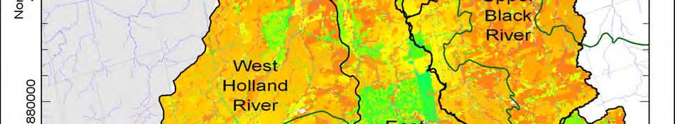
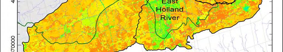
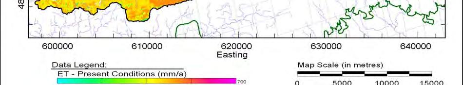
137 Figure 5-15 Simulated (VL-WABAS) annual average evapotranspiration in mm/annum with 2002 land use (Earthfx & Gerber, 2008). 123
138 5.3.3 Infiltration Groundwater infiltration (GWI) is influenced by the distribution and thickness of surficial deposits and associated soil properties, topography, and land cover and use. In areas where there is imperviousness, such as within urban areas, the amount of infiltration is reduced, while infiltration rates are increased in areas of sands and sandy loams, particularly within the ORM. The groundwater recharge input file for the Core Model was modified by replacing the original recharge estimates with the GWI rates (Table 5-3) calculated by VL-WABAS within the study area. The groundwater model was then run with the modified recharge file to simulate groundwater flow under 2002 land use conditions (Earthfx & Gerber, 2008). The groundwater flow model is a steady-state model and uses estimates of annual average net recharge (GWI) as input to the model (Figure 5-17).The recharge is initially applied to model Layer 1, which represents the weathered Halton/Kettleby Till and surficial sands. If this layer is missing in a particular area, or if the model cells go dry in that layer during the simulation (i.e. the simulated water-table drops below the base of the layer), the recharge is passed on to the next layer down. This allocation of recharge to the different layers is shown in Figure 5-16 and was determined from the final distribution of recharge in the Core Model/VL-WABAS results (Earthfx & Gerber, 2008). 124
139 Figure 5-16 Detailed water budget for the Maskinonge subwatershed conditions (Earthfx & Gerber, 2008) 125


140 Figure 5-17 Simulated (VL-WABAS) annual average groundwater infiltration (GWI) in mm/a with 2002 land use (Earthfx & Gerber, 2008). 126
 and discharge to rivers (larger tributaries) where the creek may be either gaining groundwater discharge or losing streamflow to the")
141 5.3.4 Discharge Simulated discharge to streams (Figure 5-18) was generated from the groundwater model in cubic metres per second (m 3 /s). Discharge to streams includes discharge to drains (smaller creeks) and discharge to rivers (larger tributaries) where the creek may be either gaining groundwater discharge or losing streamflow to the groundwater system depending on the depth to groundwater. Groundwater discharge to drain segments (which were used to represent the smaller, but more numerous, tributaries) was about 42% of the total discharge. The remaining 58% was to river segments which represented the larger tributaries and main stream reaches. Recharge from the river to the aquifer was negligible at less than 2% of the total stream/aquifer water exchange 1. A qualitative comparison of model results to LSRCA baseflow estimates indicates that there is a good correlation between model-predicted discharge locations and field measured discharge, particularly in the upper reaches of the watersheds. In particular, the model matches the very high discharge along the northern flank of the ORM within the Maskinonge subwatershed, which make up the headwaters to the Maskinonge River (Earthfx & Gerber, 2008). Figure 5-12 shows the potential discharge zones within the Maskinonge subwatershed overlain with flowing wells. These zones are areas where the water table is at or near the ground surface. Figure 5-18: Potential discharge to streams in the Maskinonge River subwatershed (LSRCA, 2009) 1 Model simulated conditions over the entire East and West Holland River, Maskinonge River, Black River study area. 127
142 5.3.5 Water Takings Ground and Surface Water Consumption Municipal water supply services are typically not available within rural areas and therefore residents and businesses rely solely on private water wells or surface water to meet their water needs. Any person/business taking more than 50,000 litres of water per day (L/day) are required by law to obtain a permit to take water (PTTW) from the Ministry of the Environment (MOE). Municipal and other water supplies are obtained from both surface water (lakes and rivers) and groundwater. Section 34 of the Ontario Water Resources Act (OWRA) requires that any person or business taking more than 50,000 litres of surface or groundwater per day (L/day) are required to be permitted by the Ministry of the Environment (MOE) by obtaining a Permit to Take Water (PTTW). Permits are not required to take water for domestic purposes, livestock watering, or firefighting. Significant efforts have been made to quantify the amount of water takings within the subwatershed and York Region through studies such as Marshall Macklin Monaghan and Golder Associates (2003), SGBLS (2009), and Earthfx and Gerber (2008). Along with municipal supply groundwater is extracted from aquifers and surface water within the study area for a number of uses including agricultural use, industrial/commercial use, golf course irrigation, and private domestic supply. The groundwater model simulated only the large water users such as municipal, golf courses, industrial and agricultural irrigation. Domestic wells and other small users were not represented (Earthfx & Gerber, 2008.) Municipal Water Supply There are two municipal water supply wells and one surface water intake that service the communities within the study area. Data on average daily water takings from most of the municipal wells within the subwatershed were obtained and used to estimate actual annual average pumping rates. Actual pumping rates are often less than the permitted rates. The numerical groundwater flow model, discussed previously, incorporated average pumping rates where the data were available (Earthfx & Gerber, 2008). Permit To Take Water (PTTW) There are a number of large groundwater and surface water takings within the subwatershed that require a Permit to Take Water for uses such as industry and golf course irrigation. Some of the water pumped for these uses is lost to evapotranspiration while some may infiltrate back to the subsurface as irrigation return flow (actual consumption, i.e. water removed from the watershed, will differ by the specific application). The rates used in the model for simulating consumptive use from these wells were obtained from Marshall Macklin Monaghan and Golder Associates (2003) (Earthfx & Gerber, 2008). 128
143 Key points Current Water Quantity Status: In the Lake Simcoe watershed the Maskinonge is second only to the West Holland in terms of greatest proportion of total watershed area that is tile drained. Tile drains have their greatest hydrologic impact at the small scale (field or individual stream reach); however, due to the small size of the Maskinonge subwatershed, coupled with the proportion that is tile drained, these impacts are likely being seen throughout the subwatershed. The Maskinonge River is known to dry up. In 2006 and 2007 little or no flow was observed in sections of the river. Water budget scenarios indicated that increased groundwater takings had the most significant, but localized impact on simulated aquifer potentials and groundwater discharge to streams. Within the model severe drought conditions affected simulated groundwater potentials and groundwater discharge to streams over a broad area but mostly along the crest of the Oak Ridges Moraine. The estimated future land use changes (modelled scenario) indicated a decrease in evaporation, an increase in runoff and a slight decrease in recharge. Therefore having a minor impact on the regional groundwater balance. 5.4 Factors Impacting Status- Stressors Land use change, increased water use, short-term summer droughts and long-term climate change can all result in stress on the quantity of water within a watershed. Potential impacts of these stressors include reduced groundwater recharge or discharge, increased surface water runoff, well interferences and changes to groundwater flow patterns and groundwater-surface water interaction. The purpose of completing a water budget and water quantity risk assessment is to determine if the watershed can support current or future water takings without exhibiting a continued longterm decline in groundwater levels or surface water flow. The most basic definition of stress is whether a watershed can support the current levels of pumping without exhibiting a continued long term decline in water levels Water Demand Potential water quantity stress is being estimated on a subwatershed scale through the Source Protection Planning process. Several water budget initiatives have been undertaken to identify potential water quantity stress within the subwatershed. The indicators of stress presented in this report are based on these studies and more information can be obtained from the following reports: SGBLS (2009), Earthfx Inc. (2009), and Earthfx and Gerber (2008). The water demand component of the water budget refers to water taken as a result of an anthropogenic activity (e.g., municipal drinking water takings, private water well takings, as well as other permitted takers). Water demand can be estimated from a number of information sources including the Permit to Take Water applications, municipal pumping records, water well records, population estimates, and agricultural censuses. 129
144 The percentage of quantity demand can be expressed as in the following equation: % WaterDemand Q SUPPLY Q Q DEMAND RESERVE where: Q Demand = amount of water consumed (pumped); Q Supply = recharge plus lateral groundwater inflow into the subwatershed (Qr + Qin); and Q Reserve = the portion of available surface water or groundwater reserved for other needs such as navigation, assimilative capacity, and ecosystem health. This is estimated as 10% of the model predicted baseflow discharge to the streams in the subwatershed Considerable effort was made in the Tier 1 (SGBLS, 2009) and Tier 2 (Earthfx, 2009) water budgets indicated above to document the various sources of water demand. Marshall Macklin Monaghan and Golder Associates (2003) analyzed the PTTW data to estimate water use in York Region. The following table (Table 5-4) summarizes the groundwater takings in the Maskinonge River subwatershed. Surface and groundwater takings within the Maskinonge River subwatershed include the following: Municipal supply; Agricultural use; Private domestic supply; and Other permitted takings (e.g. industrial use, golf course irrigation). Table 5-4 Estimates of annual current & future consumptive groundwater use (Earthfx, 2009) Scenario Current Consumptive Use Future Consumptive Use Municipal Water Supplies Municipal Domestic Permits Agriculture Total Total (m 3 /a) (m 3 /a) (m 3 /a) (m 3 /a) (m 3 /a) (m 3 /s) 1,821,000 30,000 23, ,000 2,170, ,821,000 42,000 23, ,000 2,182, There are two municipal water supply wells within the Maskinonge River subwatershed; these service the community of Queensville. The municipal water takings account for approximately three-quarters of the estimated total groundwater withdrawal in the East and West Holland River, Maskinonge River and Black River study area. Municipal well locations are shown on (Figure 5-19). Some of the wells listed are used primarily as backup wells. For example, York Region often installs two wells in close proximity such that if one is off-line for repairs, the other well can be used. The data presented in this report were analyzed to estimate actual annual 130
145 average pumping rates which are often less than the permitted rates. The numerical groundwater flow model, discussed in Section 5.3, incorporated average pumping rates where the data were available. Agricultural Agriculture is the most prominent land use feature in the subwatershed. The grasslands and wetlands present in the subwatershed have provided for excellent agricultural conditions. Water extracted for agricultural purposes is used for irrigation and in some cases livestock watering. The agricultural water supply is derived from both ground and surface water resources. Under the Clean Water Act, farms are exempt from the Permit to Take Water program for livestock watering or for irrigation purposes if they use less than 50,000L/day. Sod farming, which comprises 18% of the agricultural industry, is among the most intensive agricultural uses in the subwatershed. There are four large scale sod farming operations that take enough water to require a permit under the Clean Water Act, taking an average of (1,900,000 L/day) throughout the growing season, placing a huge demand on the water supply. However, sod farming places an even greater on demand on the water supply when the smaller farms taking less than (50,000L/day) are factored in. Some of the water used for irrigation will return back to the groundwater system as an irrigation return flow, and some will be lost to the atmosphere due to evapotranspiration. Water extracted for irrigation generally leads to an overall water loss in a water budget. The cumulative impact of agricultural water users, combined with the other takers in the subwatershed, is likely one of the major factors causing the river to dry up during the summer months. The study results suggest that current water taking rates are broadly sustainable. Lateral inflows and a significant decrease in discharge to streams have developed to balance the high rates of groundwater extraction in the subwatershed, which would indicate that a new equilibrium has been reached. However, the new equilibrium may be impacting the surface water quantity. Groundwater takings reduce baseflow volumes by extracting water that would otherwise find its way to the stream through groundwater discharge. Both surface and groundwater taking can cause stress on the baseflow, limiting the stream s ability to withstand periods of low water or drought thereby affecting the ecological health and sustainability of the stream. 131

146 Figure 5-19 Municipal well locations in the Maskinonge subwatershed (LSRCA, 2009) Land Use It is important to consider land cover within a water budget study because it affects several aspects of the water budget including surface water runoff, evaporation, and infiltration. 132
147 Developed land will generally have a higher proportion of impervious surfaces, such as roadways, parking lots, and building roofs. Increased runoff rates result in erosion and reduced infiltration to recharge groundwater reserves. The potential for the introduction of contaminants to both groundwater and surface water must be a consideration when a new land use is being proposed. Each type of land use can affect the quantity of both ground and surface water in the subwatershed. Impervious Land Cover Impervious areas were estimated based on the land use data for the Lake Simcoe basin as well as for the Maskinonge River subwatershed. Table 5-5 below which illustrates the percentage of impervious land cover within the basin (the surface of the lake was not included for the purpose of this analysis) and within the Maskinonge subwatershed. It should be noted that although the most accurate available land use information was used, these numbers will continue to change as development occurs. Table 5-5 Comparison of impervious land cover within the Lake Simcoe watershed and Maskinonge subwatershed Lake Simcoe watershed Maskinonge River subwatershed Area (km 2 ) Impervious (km 2 ) Impervious (%) 2,601* * Area does not include the surface of Lake Simcoe The following sections describe urban and agricultural land uses within the Maskinonge subwatershed. Details concerning the location and extent of impervious and pervious land cover in the subwatershed and how specific land cover effects surface water runoff is also provided. Urban Development Urban development represents approximately 6% of the land use within the subwatershed. Portions of the Town of Georgina (including the community of Keswick) and East Gwillimbury comprise the majority of the development within the subwatershed. Impervious surfaces such as roads, parking lots, sidewalks, rooftops and hardened channels are a characteristic feature of urban areas. Impervious surfaces affect the quantity of both ground and surface water in the subwatershed. When a precipitation event occurs impervious surfaces do not allow water to penetrate the ground, causing the water to remain at the surface. The elimination of water penetrating the soils in these urban areas has a ripple effect on the distribution of water within the subwatershed. Groundwater recharge has been significantly reduced in the urban centres. The absence of groundwater recharge in the urban areas can have an impact on the baseflow of the Maskinonge River and its tributaries. Baseflow in the river can be particularly important in drought years. Impervious surfaces also decrease the time to peak surface flow following a precipitation or snow melt event. Since the water is unable to infiltrate the ground it must remain at the surface, increasing the overall quantity of water at the surface. The water from the precipitation travels to the streams and river quickly through overland runoff and through a series of storm drains. The rapid increase in surface water can lead to localized flooding if the system becomes overburdened. As the water moves downstream the wetlands in the lower reaches of the subwatershed will exhibit flooding. 133
148 Urban centres have placed demand on the available water within the upper subwatershed for domestic purposes. The water supply for these centres mainly comes from a series of municipal wells, and waste water is sent to sewage treatment plants. After treatment the water is released back into the surface water system. At 6.7%, the impervious area of the Maskinonge River subwatershed is still below the level at which impacts to aquatic biota are seen. This area within the community of Keswick, the subwatershed s only major urban area, is much higher, with a level of 57.8%. At this level, impervious surfaces are likely impacting the aquatic communities in the area, and may be affecting hydrology. Agricultural Areas Like urban development, agriculture activities can influence the quantity of both surface and groundwater within a watershed. Because there is little paved area, agricultural land use leaves the ground in a more natural state allowing for groundwater infiltration to occur. Because groundwater infiltration is occurring in rural areas the ground can become supersaturated following a prolonged precipitation event leading to the ponding of water at the surface. In the pre and post growing season the land is left open allowing for increased erosion and runoff following a precipitation event. During the growing season a large volume of water will be lost to the atmosphere through evapotranspiration. The water lost through evapotranspiration is removed from the ground as the plants draw the water up through their root system. As mentioned in section agricultural practices including livestock watering and irrigation also place a huge demand on the water supply Climate The climate of the Maskinonge River subwatershed directly determines the quantity of surface and ground water present in the system. When the spring melt occurs, a large volume of water is freed up. This water will first infiltrate the ground. When the soil becomes supersaturated the remaining water will flow overland until it reaches the tributaries and main branch of the river. The temperature in the subwatershed can directly affect the quantity of water present in the system. In the cold winter months the water is frozen at the surface so the quantity of available water is reduced, while in the hot summer months the water is flowing but an overall loss is occurring due to the high rates of evaporation Water Budget Estimates The Holland River, Maskinonge River and Black River Watersheds Water Budget Study 2008 conducted a comparison analysis of past, current average, drought, and future average and drought conditions. The completion of the analysis helps to determine whether stress on the groundwater resources can be anticipated under various scenarios. The simulated VL-WABAS estimates for the Maskinonge water budget under different conditions is summarized in Table 5-3 (Earthfx & Gerber, 2008). In general, the modelled scenarios analyzed indicated that increased groundwater takings had the most significant, but localized impact on aquifer potentials (levels). Modelled simulations of severe drought conditions showed an increase in runoff, a decrease in infiltration and evapotranspiration. The estimated future land use changes (modelled scenario) indicated a decrease in evaporation, an increase in runoff and no change in recharge, which indicates a minor impact to the regional groundwater balance (Earthfx & Gerber, 2008). However, this could have implications to stream flow. Increased runoff can lead to a decrease in time to peak flow, increasing the risk for flooding. 134
149 The results of the model simulation can be compared to any available historical observations (e.g. fisheries and stream headwater mapping) to assess the accuracy of the simulations and the suitability of the existing monitoring network, particularly streamflow measurements, to detect change in the flow system. This analysis conducted over time will allow more confidence to be placed in estimates of future change to the hydrologic cycle (Earthfx & Gerber, 2008). Key points Factors Impacting Water Quantity status - stressors: With the increasing urban growth and impervious surfaces the amount of water available for infiltration to the groundwater system decreases, while the increase of flow in streams during storm events increases. The Tier 1 water budget estimated the current GW use within the Maskinonge River is 2,170,000m 3 /annum, which represents 20 % of the total available GW supply. Future GW use is projected to be 2,182,000m 3 /annum which represents 20% of the available GW supply. The Tier 1 water budget estimated the current surface water use within the Maskinonge River is 1,062,000m 3 /annum, which represents 4% of the total available SW supply. Future SW use is projected to be 1,066,990m 3 /annum, which represents 13% of the available SW supply. Numerous surface and groundwater takings have a significant cumulative impact on surface water conditions in the subwatershed. Many of these users do not require a permit, it is therefore difficult to track the volume of water takings in the subwatershed. 5.5 Current Management Framework There are numerous acts, regulations, policies and plans aimed at maintaining or improving water quantity. These include the Provincial Policy Statement, the Ontario Water Resources Act, the Greenbelt Plan, Growth Plan for the Greater Golden Horseshoe, the Oak Ridges Moraine Conservation Plan, the Lake Simcoe Protection Plan, and the Clean Water Act. This management framework relates to many different stressors that can potentially affect water quantity, ranging from the urban development to the demand for water resources. In Table 5-6 we categorize six such stressors, recognizing that many of these activities overlap and that the list is by no means inclusive of all activities. The legal effects of this management framework broadly fall into one of two categories. The first broad category we define as those having little or no legal standing and are referred to as General or Have Regard to Statements in Table 5-6 and are shown in blue. The second category includes those that have legal standing and must be conformed to; these are referred to as Regulated / Existing Targets in Table 5-6 and are shown in green. In many cases an act, regulation, policy, or plan does not relate to the activity specified, these are shown in red. 135
150 Table 5-6 Summary of current regulatory framework as it relates to the protection and restoration of water quantity Stressor affecting water quantity Oak Ridges Moraine Conservation Plan (2002) Greenbelt Plan (2005) Lake Simcoe Protection Plan (2009) Growth Plan for the Greater Golden Horseshoe (2006) Provincial Policy Statement (2005) Ontario Water Resources Act (1990) Clean Water Act (2006) Source Water Protection 2 LSRCA Watershed Development Policies (2008) York Region Official Plan (2008) Growth, development and site alteration Loss of natural heritage features Impervious surface Agricultural use Water demand Climate change General/Have regard to statement Regulated/Existing targets No applicable policies 1 Applies within ORM planning area 2 May be addressed through the development of Source Protection Plans In this section we provide a summary the various acts, regulations, policies and plans as they pertain to activities affecting water quantity. This summary is to give context to future management considerations and the opportunities and recommendations to maintain and improve water quantity. This summary is not intended to be comprehensive in terms of all the legislative pieces that relate to water quantity, or of the acts, regulations, policies and plans that are discussed below the reader is directed to each act, regulation, policy, or plan for a full assessment of how it relates to water quantity Oak Ridges Moraine Conservation Plan The objectives of the Oak Ridges Moraine Conservation Plan include maintaining, improving or restoring all of the elements that contribute to the ecological and hydrological functions of the ORM area, including the quality and quantity of its water and other resources. The policies of this Plan that will protect the quantity of water resources include: Municipalities are required to complete water budgets and conservation plans which include: - Quantification of components of the water balance equation - Characterization of the groundwater and surface water flow systems - Identification of targets to meet the water needs of the affected ecosystems; the availability, quantity and quality of water sources; and goals for public education and for water conservation 2 136
151 - Development of a water-use profile and forecast - Identification and evaluation of various water conservation measures - Requirement for the use of specified water conservation measures and incentives - Plans for implementation and monitoring Development and site alteration is prohibited in hydrologically sensitive features and their related minimum vegetation protection zones, including streams, wetlands, kettle lakes, and seepage areas and springs, with exceptions for activities such as fish and wildlife management, conservation projects, transportation and infrastructure, and low-intensity recreational uses. Except with respect to land in Settlement Areas, development and site alteration with respect to land in a subwatershed are prohibited if they would cause the total percentage of impervious area in the subwatershed to exceed 10 per cent. Planning authorities are also to consider the desirability of having at least 30 per cent of the area of a subwatershed in natural self sustaining vegetation. Within Settlement areas, planning authorities should consider the importance of ensuring that natural vegetation is maintained, and improved or restored wherever possible, and should attempt to keep impervious surfaces to a minimum. The ORMCP also contains policies for the protection of key natural heritage features and their functions, similar to those for hydrologically sensitive features. By protecting the ecosystem holistically, the implementation of the ORMCP will help to conserve water resources and ensure that there is enough available to sustain the needs of the ecosystem as well as those who reside within it Greenbelt Act and Plan (2005) One of the Greenbelt Plan s Environmental goals is the protection, improvement or restoration of the quality and quantity of ground and surface water and the hydrological integrity of watersheds. This goal is supported by a number of policies that relate to the Protected Countryside areas of the Greenbelt. The following policies related to water quantity apply for lands within the Natural Heritage System of the Protected Countryside: New development or site alteration shall demonstrate that: - There will be no negative effects on key hydrologic features - The removal of other natural features should be avoided - The disturbed area of any site does not exceed 25%, and impervious surfaces do not exceed 10% of the developable area Where non-agricultural uses are contemplated, applicants shall demonstrate that: - At least 30% of the total developable area will remain or be returned to natural selfsustaining vegetation (this will encourage infiltration and slow runoff), and that buildings and structures are to occupy less than 25% of the total developable area of the site Policies of the Water Resources system (within the Protected Countryside) that relate to water quantity include: Planning authorities shall provide for a comprehensive, integrated and long-term approach for the protection, improvement or restoration of the quality and quantity of water 137
152 Cross-jurisdictional and/or cross-watershed impacts should be considered, and should be integrated with ORM subwatershed plans Municipalities shall protect vulnerable surface and groundwater areas The Greenbelt Plan also limits development in Key Natural Heritage Features and Key Hydrologic Features, which will protect the important watershed functions that they perform: Development and site alteration are not permitted within these features, including any associated vegetation protection zone (with some exceptions, such as conservation and flood control works) Lake Simcoe Protection Plan The Water Quantity policies of the Lake Simcoe Protection Plan (LSPP) focus on ensuring sufficient water supply to maintain healthy aquatic ecosystems and promoting the conservation and efficient use of water. They include: The MOE and MNR will be developing in-stream flow targets for water quantity stressed watersheds in the Lake Simcoe basin, which includes the Maskinonge River. This includes the development of targets for in-stream flow regimes and water extraction limits, and will build on watershed information and assessments developed through the Drinking Water Source Protection Program. The MAFRA, in cooperation with key stakeholders, will assist and encourage water conservation and efficiency efforts in the agricultural community through stewardship programs aimed at promoting the adoption of BMPs The MOE will work with other water use sectors (including recreational, commercial, and industrial users) to encourage the development and implementation of water conservation and efficient use practices. LSPP policies around stormwater management will also help to protect water quantity. Applications for major development will be required to include a stormwater management plan, which demonstrates, among other things, consistency with water budgets; an integrated treatment train approach to minimize stormwater management flows and reliance on end-ofpipe controls through measures such as source and lot-level controls and conveyance techniques; and how anticipated changes in water balance will be minimized. The LSPP also provides protection to key natural heritage and hydrologic features which will, in turn, protect their functions related to water quantity Growth Plan for the Greater Golden Horseshoe (2006) Under its policies for managing growth, the Growth Plan specifies that population and employment growth will be accommodated by directing growth to built-up areas through intensification this may help to limit the spread of impervious area, reducing its impacts on stream flow and infiltration to groundwater. Specific policies within this plan related to water quantity include: That the construction of new, or the expansion of existing, municipal or private communal water and wastewater systems should only be considered where the following conditions are met: - Strategies for water conservation and other water demand management initiatives are being implemented in the existing area 138
153 - Plans for the expansion or for new services are to serve growth in a manner that support the achievement of the intensification target and density target Municipalities that share an inland water source and/or receiving water body should coordinate their planning for potable water, stormwater and wastewater systems to ensure that water quality and quantity is maintained or improved. Municipalities are encouraged to implement and support innovative stormwater management actions as part of redevelopment and intensification Municipalities will develop and implement official plan policies and other strategies in support of the following conservation objectives: - Water conservation, including water demand management for the efficient use of water; and water recycling, to maximize the reuse and recycling of water Provincial Policy Statement (2005) Policies that are directly related to the management of water quantity in the PPS include: Implementing necessary restrictions on development and site alteration to - Protect municipal drinking water supplies (i.e. quantity) - Protect, improve or restore vulnerable surface and groundwater, sensitive surface water features and sensitive groundwater features and their hydrologic functions - Maintaining linkages and related functions among surface water features, groundwater features, hydrologic functions and natural heritage features and areas - Promoting efficient and sustainable use of water resources, including practices for water conservation and sustaining water quality Directing growth to promote the use of existing sewage and water services, ensuring that these services can be provided in a manner that can be sustained by the water resources on which they rely, and that protects human health and the natural environment Focusing growth in settlement areas, a policy which, if implemented, should limit the amount of natural area removed, thus maintaining the natural functions of these areas. Development and site alteration are not permitted in features such as significant woodlands and ANSIs, or the lands adjacent to them, unless it can be demonstrated that there will be no negative impacts on the natural features or their functions Ensuring stormwater management practices minimize stormwater volumes and contaminant loads, and maintain or improve the extent of vegetative and pervious surfaces Clean Water Act (2007) The recently enacted Clean Water Act (CWA) ensures the safety of drinking water by identifying potential risks to local water sources. A key focus of the CWA is to identify where long-term municipal water supplies could be threatened, identify the causes of concern and possible management strategies that will ultimately aid in the development of the source protection plans. The Ministry of Environment (2009) indicates that this legislation is designed to promote voluntary initiatives but does require mandatory action where needed. The legislation sets out a basic framework for communities to follow in developing an approach to protecting their water supplies that works for them: 139
154 Identify and assess risks to the quality and quantity of drinking water sources and decide which risks are significant and need immediate action, which need monitoring to ensure they do not become significant, or which pose a low or negligible risk. Develop a source protection plan that sets out how the risks will be addressed. Broad consultation will involve municipalities, conservation authorities, property owners, farmers, industry, businesses, community groups, public health officials, First Nations and the public in coming up with workable, effective solutions. Carry out the plan through existing land use planning and regulatory requirements or approvals, or voluntary initiatives. Activities that pose a significant risk to drinking water sources may be prohibited or may require a site specific risk management plan. This plan will set out the measures that a property owner will take to ensure the activity is no longer a threat. Stay vigilant through ongoing monitoring and reporting to measure the effectiveness of the actions taken to protect drinking water sources and ensure they are protected in the future Ontario Water Resources Act (1990) Section 34 of the Ontario Water Resources Act (OWRA) deals with the issue of water taking. The OWRA stipulates that a person shall not take more than 50,000 litres of water on any day by any means except in accordance with a permit issued by the Director (the permit is issued under Section 34 (1) of the OWRA. This policy applies to all uses except for domestic or farm purposes, which includes ordinary household purposes or the watering of livestock, poultry, home gardens, or lawns; or to use for firefighting. The irrigation of crops grown for sale is not included under domestic and farm purposes. A permit is however required for takings for domestic and farm purposes if the amount of water taken exceeds 379,000 litres per day. A Director has discretion to issue, refuse to issue, or cancel a permit, and can impose a number of terms and conditions in issuing a permit as he or she considers proper, and can also alter the terms and conditions of a permit after it has been issued. The following are some of the terms and conditions that a Director may include in a permit: Limiting the amount and rate of water taking Governing the manner in which water may be taken Governing the return, after use, of water taken under the permit Governing the monitoring and reporting of the amount, rate, use, and effects of water taking (including effects on water quantity and quality) Governing the use and conservation of water taken, including requiring the implementation of specified measures to promote the efficient use of water or reduce the loss of water through consumptive use or to prepare a water conservation plan - Requiring the holder to implement specified measures to prevent the water taking from causing interference with other water takings and/or to remedy any interference with other water takings that is caused by the water taking under the permit Section 34 (4) of the OWRA states that where the taking of water for any purpose, other than for domestic or farm use or for firefighting, interferes, in the opinion of a Director, with any public or private interest in any water, the Director may prohibit the person from so taking water without a permit issued by the Director. 140
155 5.5.8 LSRCA Watershed Development Policies (2008) LSRCA s Watershed Development Policies address issues of water quantity in a number of ways: Requiring Enhanced Level 1 stormwater controls of all new developments Noting that stormwater management plans accompanying development proposals must make all feasible efforts to maintain pre-development infiltration and evapotranspiration rates to the receiving watershed Stipulating that peak discharges are to be controlled to a minimum of pre-development levels Requiring a minimum 24-hour detention of runoff from a 25 mm storm for erosion protection and baseflow maintenance Protecting natural features, thus promoting infiltration for the slow release of water after storm events and the maintenance of aquifer levels York Region Official Plan (2009) York Region s Official Plan (OP) includes a number of policies related to the protection of the quality of both ground and surface water. The policies within the OP related to water quality include: The preparation of a comprehensive regional water strategy for both piped services and surface and groundwater sources that will include long-term protection strategies, enhancement guidelines and monitoring requirements; That the natural quality and hydrological characteristics of watercourses and lakes (including water quality and temperature) will be maintained, and that development be designed with the goal of maintaining water balance To direct development away from sensitive surface water and groundwater features To continue to partner with other regions and conservation authorities to study, analyze, and monitor ground and surface water resources to ensure a unified approach to protecting and enhancing water quality and quantity To monitor the quantity and quality of surface and ground water systems in York Region, in co-operation with local municipalities and conservation authorities) by: - Assessing the sustainability of current activities and land uses - Identifying areas that are susceptible to, or currently experiencing, water quality and quantity problems Requiring local municipalities to establish policies and programs to protect, enhance, and monitor water systems To work with the province, local municipalities, conservation authorities and other in establishing procedures for water taking permits that protect and enhance water resources To require the preparation of comprehensive master environmental servicing plans as part of secondary plans to protect and enhance the natural hydrologic function of water systems. These plans will emphasize water reuse and incorporate innovative 141
156 technologies with the goal that the water balance and hydrologic functions will be maintained Working with partners in the implementation of stormwater management initiatives Requiring the preparation of comprehensive stormwater management plans as a component of secondary plans, and encouraging innovative approaches to stormwater management within secondary plans That development have an integrated and innovative approach to water management, be water efficient, and maximize stormwater quality, quantity, and infiltration through an integrated treatment approach Work with local municipalities and LSRCA in the preparation and implementation of comprehensive stormwater master plans for each settlement area within the Lake Simcoe watershed by 2014 Requiring all new buildings to achieve 10% greater water efficiency than the Ontario Building Code, and encouraging all new buildings to achieve 20% greater efficiency To restrict the use of potable water for lawn watering Requiring the installation of rainwater harvesting and re-circulation/reuse systems on all new residential buildings for outdoor irrigation and outdoor water use Encouraging the use of water efficient, drought resistant landscaping by: - providing a minimum 6 of topsoil - installing drought resistant sod - providing landscape features that minimize the demand for water and chemicals by utilizing native and drought resistant species - installing permeable driveway surfaces Encouraging all developments to incorporate green roofs into building design Supporting the goals and objectives of subwatershed plans In addition to these policies, York Region s protection of the regional Greenlands System will help to ensure that the functions of the Region s natural features, such as the water retention and infiltration capacity of natural features such as wetlands and forests, will continue to protect and enhance water quantity within the subwatershed Durham Region Official Plan (2008) The policies contained within Durham Region s Official Plan around water quantity include: Requiring an examination of the impacts on surface water and groundwater resources in the consideration of development applications in order to maintain and/or enhance such resources in sufficient quality and quantity to meet the existing and future needs of the Region s residents on a sustainable basis Placing restrictions on development within key hydrologic features and their associated vegetated protection areas Promoting and supporting water resource conservation and management initiatives Ensuring that local municipalities require stormwater management plans as part of preservicing development proposals 142
157 Promoting groundwater infiltration, where appropriate, through improved stormwater design Encouraging development that maintains hydrological functions and minimizes direct alteration to groundwater flows Requiring that development applications to demonstrate the groundwater quality and quantity will be protected, improved, or restored in areas where groundwater discharge could be impacted Requiring development applications that require a permit to take water, or that have the potential to impact water quantity to be accompanied by a study verifying that there is a sufficient water supply to support the proposed use and, on a cumulative sustainable basis, confirm that there will not be a negative impact on surrounding water users and the natural environment which cannot be appropriately mitigated The OP also contains a number of policies around the protection of Wellhead Protection Areas and Highly Vulnerable Aquifers 5.6 Management Gaps and Limitations Water Demand The Source Water Protection initiative will consider potential concerns around water quantity, although these policies will pertain to drinking water resources, and not the flows that are required to sustain healthy aquatic ecosystems within the subwatershed. The Lake Simcoe Protection Plan also contains a policy around maintaining adequate flows, with the development of in-stream flow targets for water quantity stressed subwatersheds. The Maskinonge subwatershed is the only subwatershed for which the LSPP has specified timelines, with the work to be completed within two years, although it does not indicate how they would be enforced and by whom. Another limitation in managing water demand is the Permit to Take Water process. These permits are only required when a user is taking more than 50,000 L/day, and are not required for most domestic and agricultural uses. This makes it difficult to track the cumulative use for a subwatershed, leading to the potential for stress at certain times of the year, a concern which has been highlighted in recent years in the subwatershed Land Use There are few policies in the framework that deal specifically with the issue of impervious cover that accompanies development. The ORMCP sets a limit of 10% impervious cover, but this only applies outside of Settlement Areas, and it stresses minimizing impervious surfaces and their impact on water quantity within Settlement Areas, but does not set actual targets. The Greenbelt Plan limits impervious area to 10% for development and site alteration, but only within its Natural Heritage System; and in the Protected Countryside requires a stormwater management plan which demonstrates how impervious surfaces will be minimized in a development. The policies within the current planning framework around impervious cover generally do not require any concerted effort on the part of developers to move beyond traditional designs for developments and measurably reduce impervious surfaces, nor do they require the use of techniques aside from stormwater controls to increase infiltration. With respect to water demand, the policies being developed through Source Water Protection will be most protective of the quantity of water resources within the subwatershed, although these policies will only pertain to drinking water resources. Currently, the Ontario Water Resources Act is the main policy piece that considers water quantity. However, it only requires a permit for users taking greater than 50,000 L/day, and is not required for most domestic and 143
158 agricultural uses. There is the potential for significant stress on a system due to the cumulative takings of both permitted and un-permitted users in a subwatershed, and these cumulative uses are generally not considered as part of the permitting process. This issue may be addressed through policies in the LSPP requiring the development of in-stream flow targets for water quantity stressed subwatersheds, which may lead to policies that require the development of targets for in-stream flow regimes, and set out how much water can be allocated among users in a subwatershed, including an allocation to support the natural functions of the ecosystem. The LSPP, however, does not define what constitutes a water quantity stressed subwatershed, nor does it specify timelines for the completion of this work with the exception of the Maskinonge River subwatershed. The LSPP also contains policies around reducing water demand by new and expanded major recreational uses, such as golf courses, through limiting grassed, watered and manicured areas; requiring the use of grass mixtures that require less water (where applicable); the use of water conserving technologies; and water recycling. As well, the LSPP contains policies aimed at undertaking stewardship activities with the agricultural community and other water use sectors, such as recreational, to encourage the implementation of best management practices to conserve water Climate While it would be extremely difficult to account for variations in climate and their effects on water quantity within the policy framework, Source Water Protection and the LSPP have begun to consider the potential impacts of climate change on this important resource. Modelling undertaken for Source Protection has including drought scenarios, and the LSPP includes a section on climate change, including a policy to develop a climate change adaptation strategy for the Lake Simcoe watershed. This will include an assessment of the risks of climate change impacts, additional research to better understand the impacts of climate change, the development of an integrated climate change monitoring program to inform decision making, and finally to develop adaptation plans. These are important first steps in what should now become a routine consideration for all activities Water Budget Estimates While the water budget determined water taking rates to be broadly sustainable, they also indicated potential impacts to stream flow due to these takings. The OWRA does enable Ministry of the Environment staff to limit takings through the PTTW process; however, this is rarely done. This may be addressed through the LSPP s policies around developing targets for environmental flows. 5.7 Recommended Actions to Improve Water Quantity The following recommended actions were developed to improve water quantity in the Maskinonge River subwatershed. The main issues with respect to water quantity in this subwatershed are water demand, mainly due to the large area of the subwatershed in agriculture, although climate and the natural characteristics of the subwatershed also play significant roles. Activities that reduce water demand and take advantage of water supply when it is available will be important in this subwatershed. The implementation of the following recommended actions will help to mitigate the impacts of the existing urban and rural land uses on the quantity of water in this subwatershed. These recommendations, which are grouped and numbered as described in Section 1.4, were developed to address the water quality issues and stressors that were identified throughout this chapter. In addition, they consider, and are consistent with applicable policies and recommendations in the province s Lake Simcoe Protection Plan, and the LSRCA s Integrated Watershed Management Plan. Each recommendation below also identifies the applicable 144
159 detailed recommendations as outlined in Chapter 10. These detailed actions will form the basis of the Implementation Plan for York Region s ORM subwatersheds, to be developed following the completion of this plan Planning and Policy 1) That the municipal partners and the LSRCA strive to reduce the impacts of stormwater through a number of methods including the implementation of policies and guidelines and enabling the use of new and innovative technologies, retrofitting of existing developments. Detailed recommendations: A.1.1 A.1.3 4) That the municipal partners and the LSRCA strive to maintain natural hydrologic conditions on development sites Detailed recommendations: A.3.1 A.3.2 5) That the federal, provincial, and municipal governments, as well as the LSRCA, continue to evaluate and implement planning initiatives and practices aimed at reducing the impact of development on the condition of the Maskinonge River subwatershed Detailed recommendations: A.3.3 A.3.5, A.3.7 6) That the value of the ecological goods and services provided by ecological features be considered in decision making around growth and development Detailed recommendation: A.3.6 7) That the rural/agricultural community be engaged in developing solutions for minimizing the impacts of practices on their lands Detailed recommendation: A ) That the Province, the municipal partners, and the LSRCA seek to gain an improved understanding of the impacts of climate change in the Maskinonge subwatershed, incorporating this information into decision making scenarios and developing strategies to mitigate and adapt to its impacts. Detailed recommendations: A.6.1 A.6.2, G.1.1 G Use of Better Management Practices 11) That the LSRCA and its municipal partners continue working to mitigate the impacts of stormwater to water quality and quantity through tracking its sources, completing stormwater retrofits, promoting methods of minimizing stormwater volume, and continuing to research new and innovative solutions to stormwater control and implementing these solutions where appropriate. Detailed recommendations: B.1.1 B ) That support for programs offered to assist rural landowners in implementing BMPs on their properties, such as LSRCA s LEAP program, be continued and/or expanded as resources permit Detailed recommendations: B.2.1 B ) That sectors that have the potential to have significant impacts on conditions in the Maskinonge subwatershed be expected to undertake BMPs and other activities to mitigate their impacts, as required under the LSPP Detailed recommendations: B.2.4 B
160 16) That the LSRCA and work wit large users of water (e.g. sod farms, market gardens) to develop solutions for decreasing water consumption, such as the installation of retention ponds Detailed recommendation: B Changing the way things are done on the ground 17) That the LSRCA and its partner municipalities strive to maximize the infiltration of stormwater where appropriate through development approvals and the use of practices and technologies Detailed recommendations: C.1.1, C.2.1 C Applied Research and Science 21) That all partners study the requirements for environmental flows within the Maskinonge subwatershed, explore innovative solutions, and undertake works and practices where possible in order to ensure adequate baseflow to support ecological function Detailed recommendations: D.1.5, D.1.7, D.1.14, D ) That the partners explore the subwatershed to determine where reductions in groundwater discharge, excessive water takings and other impacts to aquatic habitat have occurred and undertake activities to mitigate these impacts Detailed recommendations: D ) That measures be taken at site level to reduce demands on water resources Detailed recommendation: D Monitoring 32) That the amount of impervious area in the subwatershed be assessed on a regular basis by the LSRCA and its partner municipalities. Detailed recommendation: E Management, Rehabilitation and Restoration 38) That the LSRCA and the partner municipalities assess the feasibility of increasing natural cover (e.g. woodland, streambank vegetation, interior forest, grassland) in the subwatershed and set priorities and develop plans to undertake this enhancement, based on overall benefit to the subwatershed. Detailed recommendations: A.5.3, F.2.2 F.2.4, F ) That the partner municipalities adopt policies to encourage the use of native species, particularly those drought tolerant species, through development approvals and property management programs. Detailed recommendation: F Adaptive Response 47) That the LSRCA and partner municipalities work to reduce their carbon footprint and to increase ecological resilience in the watershed Detailed recommendations: G.1.1 G ) That the LSRCA and the partner municipalities promote and support water conservation initiatives, such as York Region s Water for Tomorrow program. 146
161 Detailed recommendation: G ) That the LSRCA in conjunction with the MNR and MOE undertake initiatives to understand the environmental flow needs within the Maskinonge subwatershed, and develop programs and policies to ensure that these needs are met, including the continuation of the Low Water Response Program, setting environmental flow targets, and ensuring that water taking activities do not exceed the available supply. Detailed recommendations: G.2.2 G ) That the LSRCA and its partners work to ensure that flood mapping is up to date; that the data needed for assessing flood risk is sufficient and that new monitoring equipment is added to the monitoring network as required; and that there be available programs to assist landowners in flood proofing their homes. Detailed recommendations: G.2.5 G
162 6 Aquatic Habitat 6.1 Introduction and background Habitat can be described as a place where an animal or plant normally lives, often characterized by a dominant plant form or physical characteristic. All living things have a number of basic requirements in their habitats including space, shelter, food, and reproduction. In an aquatic system, good water quality is an additional requirement. In a river system, water affects all of these habitat factors; its movement and quantity affects the usability of the space in the channels, it can provide shelter and refuge by creating an area of calm in a deep pool, it carries small organisms, organic debris and sediments downstream which can provide food for many organisms and its currents incorporate air into the water column which provides oxygen for both living creatures and chemical processes in the water and sediments. Habitat features also frequently affect and are affected by other features and functions in a system. For instance, the materials comprising a channel bed can affect the amount of erosion that will take place over time; this in turn affects the channel shape and the flow dynamics of the water. The coarseness of the channel s bed load can also affect the suitability for fish habitat some species require coarse, gravelly deposits for spawning substrates, while finer sediments in the shallow fringes of slow moving watercourses often support wetland plants that are required by other species. Table 6-1 Aquatic habitat features of the Maskinonge River subwatershed Aquatic Environment Habitat Features Examples in the Maskinonge River Subwatershed Rivers and streams Vegetation Main branch of the Food sources algae, benthic invertebrates, fish Maskinonge River and tributaries Flow Cover Spawning/nursery habitat Vegetation Water quality Temperature refugia Wetlands Spawning/nursery habitat Maskinonge River Provincially Significant Wetland Complex There are numerous causes of stress in an aquatic environment. Any type of land use change from the natural condition will place a strain on the system, and can cause significant changes to the aquatic community. The conversion of natural lands such as woodland and wetland to agriculture or urban uses eliminates the functions that these features perform, such as improvement of water quality, water storage, and increasing the amount of infiltration to groundwater. This can result in impacts to water quality and a reduction in baseflow, resulting in watercourses that are unable to support healthy communities of native biota. 6.2 Current Status To assess the impact of the aforementioned stresses on the biological community, monitoring of the fish and benthic invertebrate communities is undertaken at sites throughout the subwatershed. The results of these studies are discussed in the following sections. 148
163 6.2.1 Fish Community The Maskinonge River and its tributaries have been subject to fisheries studies since There are 15 known fisheries data collection points within the system, most of which have been explored by the Ministry of Natural Resources. Sampling by the LSRCA is completed using backpack Electrofishers following procedures outlined in the Stream Assessment Protocol for Southern Ontario Version 7 (Stanfield, 2005). None of the sampling sites display captures of the system s namesake, the muskellunge (Esox masquinongy). Twenty-five species of fish have been captured in the Maskinonge River since 1990 (Table 6-2). The Maskinonge ranges from cold headwater communities influenced by the Oak Ridges Moraine in the south of the watershed featuring mottled sculpin (Cottus bairdii) to diverse warm, large order systems displaying such species as largemouth Bass (Micropterus salmoides) and brown Bullhead (Ameiurus nebulosus). Generally, the Maskinonge River s northern and main branches are is classified warmwater habitat, whereas only the very southerly tributaries in the headwater areas are classified as cold to coolwater. There are fewer cold headwater streams in the Maskinonge River subwatershed because of the very small proportion of the subwatershed that falls on the Oak Ridges Moraine; there is much less cold groundwater influence in this system than in many of Lake Simcoe s other subwatersheds. Figure 6-1 displays coldwater fish habitat suitability based on water temperature records and the presence or absence of coldwater and warmwater species of fish. The lower regions of the main branch are classified as warmwater habitat, and warmwater species are captured in these areas (sites shown in red). There are two sites in the northern tributaries and one site in the upper main branch that have water temperatures that are suitable for coldwater species, but there have been none captured (sites shown in green). The lack of coldwater species in coldwater habitat indicates other limiting factors are at play, but these are not well understood for this subwatershed. Sites shown in blue indicate that cold water species have been caught in cold water habitat (the desired result). The white sucker (Catostomus commersoni) is a migratory species found throughout most of the subwatershed where barriers do not impede migration. The capture of walleye (Sander vitreus) has been noted in the lower reaches of the river, and is significant as the only other Lake Simcoe subwatershed to display walleye capture is the Talbot River in Ramara. Rare and Endangered Species There are no known rare or endangered fish species known to reside in the Maskinonge River. 149
164 Table 6-2 Fish species captured in the Maskinonge River subwatershed ( ) Common Name Bowfin Rainbow Smelt^ Northern Pike Central Mudminnow Common White Sucker Common Carp* Golden Shiner Emerald Shiner Spottail Shiner Spotfin Shiner Bluntnose Minnow Fathead Minnow Blacknose Dace Creek Chub Brown Bullhead Brook stickleback Trout-Perch Rock Bass Pumpkinseed Largemouth Bass Black Crappie^ Yellow Perch Walleye Johnny darter Mottled Sculpin * = non-native invasive species ^ = non-native species Scientific Name Amia calva Osmerus mordax Esox lucius Umbra limi Catostomus commersoni Cyprinis carpio Notemigonus crysoleucas Notropis atherinoides Notropis hudsonius Cyprinella spiloptera Pimephales notatus Pimephales promelas Rhinichthys atratulus Semotilus atromaculatus Ameiurus nebulosus Culaea inconstans Percopsis omiscomaycus Ambloplites rupestris Lepomis gibbosus Micropterus salmoides Pomoxis nigromaculatus Perca flavescens Sander vitreus Etheostoma nigrum Cottus bairdi 150
165 Figure 6-1 Coldwater fish presence and habitat suitability in the Maskinonge River subwatershed ( ) 151

166 Figure 6-2 The mottled sculpin, a coldwater indicator fish native to the headwaters of the Maskinonge River Benthic Invertebrates Aquatic insects, or benthic invertebrates, are an ideal indicator of water quality as different species have different tolerances to factors such as nutrient enrichment, dissolved solids, oxygen and temperature. The presence or absence of certain species is used to determine water quality at a given site. Of the indices developed to assess water quality in relation to benthic invertebrate communities, BioMAP was selected as it provides a means to locate pollution sources without the large investment of time and resources required by some other indices. Benthic invertebrates have been collected from the Maskinonge River subwatershed since 2004 employing a consistent and standard collection method (Ministry of the Environment and Conservation Ontario, 2003). Figure 6-3 is a compilation, standardization and summary of this data with the results reported as Impaired, Unimpaired or Inconclusive. Both sites have reported as impaired for all sampling years, though sampling has only been undertaken since Benthic reference site collection is expected to continue in order to detect changing conditions into the future. 152
")
167 Figure 6-3 Benthic invertebrate sites in the Maskinonge River subwatershed ( ) 153
168 Key Points Current Aquatic Habitat Status: Both cold and warmwater sites A few sites where coldwater temperatures have been recorded, but no coldwater fish species have been found, indicating that other factors are at play. Generally, the Maskinonge River displays cold to coolwater tributaries in the south or headwater areas, feeding a warmwater Main Branch The capture of walleye (Sander vitreus) has been noted in the lower reaches of the Maskinonge River, and is significant as the only other Lake Simcoe subwatershed to display walleye capture is the Talbot River in Ramara. There are no known aquatic species at risk that reside in the Maskinonge River All benthic invertebrate samples have found conditions at the sampling sites to be impaired. Sampling will continue into the future in order to detect any changes in conditions in the subwatershed. 6.3 Factors impacting status - stressors There are a number of land uses, activities and other factors that can have an effect on the health of the aquatic community in the subwatershed. These include: Changes to instream habitat and habitat fragmentation Removal of riparian vegetation The introduction of invasive species Impacts to the hydrologic regime Water quality and thermal degradation These factors are discussed in detail below: Changes to Instream Habitat and Habitat Fragmentation Barriers Barriers to fish movement in the form of dams, Perched culverts, and enclosed watercourses serve to fragment a fishery by preventing fish from accessing important parts of their habitat. The impoundments created by dams serve to warm water temperatures, raise bacteria levels, and disrupt the natural movement of fish, invertebrates, sediment, and nutrients. The natural movement of each is imperative for a healthy aquatic system. Thus far, 29 such barriers to fish movement have been identified in the Maskinonge (LSRCA, 2009). These barriers take the form of farm ponds for watering and irrigation (Figure 6-4). 154
169 Figure 6-4 Locations of known barriers in the Maskinonge River 155 subwatershed
170 Bank Hardening and Channelization In the past, it has been common practice to straighten watercourses to accommodate various landuses, and to harden banks with a view to preventing streambank erosion. While we now know that these practices are harmful to the environment and can cause more issues than they resolve, there are 16 known areas in the subwatershed where these practices have been utilized (LSRCA, 2009; Figure 6-5). Water generally flows more quickly through a channelized section of stream, particularly during high flow events. This increase in flow can have several effects: Unstable banks in the channelized section (if they are not hardened) Flooding downstream of the channelized section (water is confined to the channel, which results in larger volumes of water flowing more rapidly than under natural conditions being conveyed to downstream sections) Bank erosion downstream of the channelized section Sedimentation downstream of the channelized section where the flow of water slows These effects result in the degradation of aquatic habitat. The riffle/pool sequences that occur in natural channels are lost in the channelized section as well as downstream. Much of the natural cover in the watercourse can be lost. Fluctuating flow levels can place stress on aquatic biota, and in many cases can cause a shift from a more sensitive community to one that is better able to tolerate adverse conditions. Finally, the deposition of sediment as the water slows coming out of the channelized section can blanket the substrate, interfering with spawning activities and affecting the benthic invertebrate community. Obvious channelizations of the river have occurred in the past, mainly to accommodate agricultural drainage, however, there are no Municipal Drains identified on the system. One large channelization approximately mid-system appears to be draining part of the Provincially Significant Maskinonge River Wetland Complex, presumably for organics extraction. 156

171 Figure 6-5 Areas of bank hardening and channelization in the Maskinonge 157 River subwatershed (LSRCA, 2009)
172 Removal of Riparian Vegetation While many policies now afford some protect to the riparian areas adjacent to watercourses, this has not always been the case. In many instances, vegetation in the riparian areas of the subwatershed s watercourses has been removed to accommodate development and agricultural activities, leaving the bank vulnerable to erosion due to the removal of the stabilizing influence of the roots of the vegetation. This can result in inputs of sediment into the watercourse, which can settle and smother the substrate, thus eliminating important habitat used by fish for spawning and inhabited by benthic invertebrates. Sediment in suspension in the water can also interfere with the feeding of those fish species that are visual feeders. Riparian vegetation is also an important source of allochthonous material such as leaves and branches that serve as a food source for benthic invertebrates, and can also provide cover for fish. In addition, riparian vegetation serves to enhance water quality it filters the water flowing overland, causing sediment and other contaminants to settle out or be taken up prior to their reaching the watercourses; and also helps to moderate water temperatures through the shade it provides. Removal of this vegetation can have an influence on the type of aquatic community able to inhabit the watercourse a reach that may have been able to support a healthy coldwater community may no longer be able to do so, and the community may shift to a cool or warm water community containing less sensitive species. There were 125 sites in the subwatershed that were identified in the BMP Inventory as having insufficient riparian cover; these are identified in Figure 6-6. The subwatershed fares poorly in terms of natural cover in the riparian area. In Lake Simcoe s Watershed Report Card 2009 Update, the Maskinonge River received a grade of D, as only 44% of the area within a 30 metre buffer on either side of its watercourses is comprised of natural cover. 158
173 Figure 6-6 Sites identified in the Maskinonge River subwatershed as having insufficient riparian vegetation 159
174 6.3.2 Invasive Species The traits possessed by non-native invasive species, including aggressive feeding, rapid growth, prolific reproduction, and the ability to tolerate and adapt to a wide range of habitat conditions enable them to outcompete native species for food, water, sunlight, nutrients, and space. This may result in the eventual reduction in the number and abundance of native species. The replacement of native species with introduced affects the balance of the ecosystem, as species that relied on the native species for food, shelter and other functions now either have to move to another area with these species, or must utilize another source that is perhaps less desirable. This cycle reverberates throughout the ecosystem, and can be exacerbated by the introduction of additional invasive species. Ecosystems that are already under stress are particularly vulnerable to invasion by non-native species, as the existing ecosystem is not robust enough to maintain viable populations of native species as the invasive species become established. The process may happen more quickly in already disturbed systems than it would in a healthy community. The only known invasive fish species within the Maskinonge River is the common carp (Cyprinis carpio) which were stocked into ponds in Ontario as early as the late 1800s and were subsequently released into public waters through a dam break in Newmarket in 1896 (Scott and Crossman, 1973). The carp now flourishes in most warmwater systems in southern Ontario and disrupts native fish through their violent spawning activities which tend to uproot vegetation and cause increased turbidity in the water column. The round goby (Neogobius melanostomus), an invasive species native to Eurasia and transported to the Great Lakes in ballast water was recently transplanted from Lake Erie to Lake Simcoe, most probably via a baitfish transfer. The species has already been noted within the Pefferlaw River and its mouth in Lake Simcoe, and has been found just this year in the Black River. Because of the suitable habitat it provides and the close proximity to the Black, it is anticipated that round goby will occupy the Maskinonge River within a few years. The Black Crappie (Pomoxis nigromaculatus) is a non-native fish to the watershed, however, it is not considered invasive, most likely because the species supports a popular fishery. Rainbow smelt (Osmerus mordax) were, at one time, abundant in Lake Simcoe and the Maskinonge River. This species was most likely transplanted from the Great Lakes to Lake Simcoe, possibly through the Trent Canal system and was first noted in 1962 (MacCrimmon and Skobe, 1970). The shallow water spawning runs exhibited by the species created a popular fishery in the spring of the year, however, these runs and captures in Lake Simcoe have greatly declined in recent years. This trend appears to coincide with the appearance of zebra mussels (Dreissena polymorpha) in Lake Simcoe; however, the correlation has yet to be studied Impacts to the hydrologic regime Changing hydrologic conditions, including reduced baseflow and the flashy flows brought about by increasing levels of impervious surfaces as well as water takings, can cause considerable stress to aquatic biota, and can cause a shift from a community containing more sensitive species to one containing species more tolerant of degraded conditions. Changes to the hydrologic regime are discussed in greater detail in Chapter 5, Water Quantity. This has been a particularly serious issue in the Maskinonge subwatershed. A lack of flow was noted in the summers of 2006 and Normally wide and deep sections of the Maskinonge displayed no flow at all. The suspected reason for this was un-regulated water taking for such agricultural practices as sod farming combined with lower than average levels of precipitation. The Ministry of the Environment (MOE) is responsible for Permits to Take Water in the province 160
175 of Ontario and did investigate un-regulated water taking in the subwatershed during the late summer of Results of this investigation are pending. Past fisheries studies have noted coldwater species in the headwater areas and white sucker throughout the system indicating coldwater flows (or groundwater activity) in the headwaters and enough flow to allow the migratory white sucker to occupy most of the system Water quality and thermal degradation Through contemporary studies and recent changes to development law, much of the system has been identified as cold or coolwater habitat. However, despite this designation, many of the coldwater systems are currently under stress. Land uses in the subwatershed have resulted in a reduction in cold groundwater inputs to watercourses, removal of riparian vegetation which helps to maintain stream temperature, the covering of stream substrate with silt, and the input of sediment and nutrients that degrade habitat quality. These changes have made many of the cold headwater reaches of the system unsuitable for mottled sculpin and other sensitive species, although they can still be found in some reaches where suitable conditions remain. The protection and enhancement of the subwatershed s coldwater habitats will enhance the health of the whole Maskinonge River ecosystem. Specific information on water quality issues can be found in Chapter 4, Water Quality Recreation Natural areas such as streams and rivers are a popular location for recreational activities such as hiking, boating and snowmobiling. If not managed correctly and undertaken in a responsible manner, these activities can impair aquatic habitat. Impacts from recreational activities can include increased bank erosion and instability from both trampling by hikers and cyclists and from boat wakes; loss of riparian area resulting in an increase in input of total suspended solids (TSS) and pollution, and the associated issues with habitat for fish and benthic invertebrates; and an increase in runoff as the banks are pounded down from man-made trails. Stresses on these sensitive areas are increasing as a result of increasing population and diminishing natural heritage lands. 161
176 Key Points - Factors impacting Aquatic Habitat stressors: Physical changes such as barriers, online ponds, channelization and removal of riparian vegetation are some of stressors to the Maskinonge Rivers aquatic habitats e.g. there are currently 29 known barriers to fish movement. Within the middle of the system is a large channelization that appears to be draining part of the Provincially Significant Maskinonge River Wetland Complex, presumably for organics extraction Habitat quality and quantity is also impacted by changes in flow regime resulting from land use changes and water taking. Increased flow degrades habitat through processes such as bank erosion. Decreased flow (as noted in the summers of 2006 and 2007) can lead to a temporary or permanent reduction in the amount of aquatic habitat present. A water quality concern is the thermal degradation occurring due to land use changes (e.g. online ponds). These changes have made many of the cold headwater reaches of the system unsuitable for mottled sculpin and other sensitive species, although they can still be found in some reaches where suitable conditions remain. These issues are discussed in more detail within Chapter 5, Water Quality. The common carp (Cyprinis carpio) are the only known invasive species within the Maskinonge River and are negatively affecting native communities by occupying and/or destroying the habitat of native species, consuming their eggs and young, and by outcompeting them for resources. It is anticipated that the recently introduced round goby will enter the subwatershed shortly, having already invaded the Pefferlaw and Black Rivers. 6.4 Current Management Framework There are numerous acts, regulations, policies, and plans aimed at maintaining or improving aquatic habitat. These include the Fisheries Act, Endangered Species Act, the Greenbelt Plan, Growth Plan for the Greater Golden Horseshoe, the Oak Ridges Moraine Conservation Plan, and the Lake Simcoe Protection Plan. This management framework relates to many different stressors that can potentially affect aquatic habitat, with activities ranging from the loss of riparian areas to urban development. In Section 6.4, we categorize 11 such stressors, recognizing that many of these overlap and that the list is by no means inclusive of all stressors. The legal effects of this management framework broadly fall into one of two categories. The first broad category we define as those having little or no legal standing and are referred to as General or Have Regard to Statements in Error! Reference source not found. and are shown in blue. The second category includes those that have legal standing and must be conformed to; these are referred to as Regulated / Existing Targets in Error! Reference source not found. and are shown in green. In many cases an act, regulation, policy or plan does not have policies of either category that relate to the activity specified, these are shown in red. 162
177 Table 6-4 Summary of current management framework as it relates to the protection and restoration of aquatic habitat Stressor affecting aquatic habitat Oak Ridges Moraine Conservation Plan (2002) Greenbelt Plan (2005) Lake Simcoe Protection Plan (2009) Growth Plan for the Greater Golden Horseshoe (2006) Provincial Policy Statement (2005) Endangered Species Act (2008) Ontario Water Resources Act (1990) Fisheries Act (1985) Ontario Fisheries Regulations (1989) LSRCA Watershed Development Policies (2008) York Region Official Plan (2008) Growth, development and site alteration Introduction of invasive species Loss of natural heritage features Loss of riparian areas Stream alteration Instream barriers Bank hardening Changing hydrologic conditions Degradation of water quality (including thermal impacts) Restoration Climate change General/Have regard to statement Regulated/Existing targets No applicable policies 1 Protected through required buffers around streams/waterbodies 2 Development/site alteration restricted within 30 metres of streams, presumably would prohibit channelization, other in-stream and riparian activities 3 Discusses developing proposed regulations (to be considered by federal government under fisheries act), conducting studies/risk assessments, developing response plans, education programs, but nothing banning use/etc 4 Implied under buffer restrictions 5 Instream flow targets and water conservation, but nothing around impervious areas/higher peak flows 6 Only contains specific policies and targets about phosphorus reduction, none about other contaminants 7 Related to those features that are part of SARO listed species habitat 8 Person holding a permit to conduct an activity may be required to rehabilitate habitat damaged/destroyed in undertaking the activity; is also mentioned in policy pertaining to Species at Risk in Ontario Stewardship Program 9 would only apply to those areas that can be classified as fish habitat 10 Not directly stated, but stream alteration policies would cover this 11 stormwater controls required, application must demonstrate every effort made to achieve pre-development hydrologic conditions 12 Required for valleyland applications, may be required in other cases 13 Required in some instances, but generally encouraged 163
178 In this section we provide a summary the various acts, regulations, policies and plans as they pertain to activities affecting aquatic habitat. This summary is to give context to future management considerations and the opportunities and recommendations. This summary is not intended to be comprehensive in terms of all the pieces of the management framework that relate to aquatic habitat, or of the acts, regulations, policies and plans that are discussed below the reader is directed to each act, regulation, policy, or plan for a full assessment of how it relates to aquatic habitat Oak Ridges Moraine Conservation Plan (2002) This plan designates Natural Core and Natural Linkage Areas for the purpose of maintaining and improving the ecological integrity of the plan area. Approximately 51 ha (less than 1%) of the subwatershed is within the ORMCP area, with both Natural Core and Countryside areas. The policies that apply in the Natural Core Areas include: Every application for development or site alteration shall identify planning, design and construction practices that ensure that buildings or site alterations do not impede the movement of plants and animals among key natural heritage features (a designation which includes fish habitat), hydrologically sensitive features and adjacent land. A minimum area of influence and minimum vegetation protection zone, which are 30 metres and 120 metres, respectively. An application for development or site alteration within the minimum area of influence that relates to a key natural heritage feature, but is outside of that feature and the minimum vegetation protection zone, are to be accompanied by a natural heritage evaluation. A natural heritage evaluation shall: - Demonstrate that the development or site alteration will have no adverse affects on the key natural heritage feature or the related ecological functions - Identify planning, design and construction practices that will maintain and, where possible, improve or restore the health, diversity and size of the key natural heritage feature and its connectivity with other key natural heritage features - Demonstrate how connectivity within and between key natural heritage features will be maintained and, where possible, improved or restored before, during and after construction - Determine if the dimensions of the minimum vegetation protection zone as specified in the ORMCP are sufficient, and specify the dimensions necessary to provide for the maintenance and, where possible, improvement or restoration of natural self-sustaining vegetation within it Policies related to water conservation and the protection of water quality and quantity will have the added benefit of helping to maintain a great number of important natural heritage features, such as wetlands (see chapter 4 and 5). The ORMCP also details a number of requirements for those uses that are permitted within Natural Core Areas, such as gravel pits, agricultural uses, and low-intensity recreational uses to ensure that they have minimal impact on these important areas Greenbelt Plan (2005) One of the stated goals of the Greenbelt Plan is the protection, maintenance and enhancement of natural heritage, hydrologic and landform features and functions, including the protection of habitat for flora and fauna, as well as protecting and restoring natural and open space connections. 164
179 Wetlands, seepage areas and springs, fish habitat, permanent and intermittent streams, lakes, and significant woodlands, are all considered to be key natural heritage or key hydrologic features. Under the policies for the Natural Heritage System areas, the Plan states that: The minimum vegetation protection zone shall be a minimum of 30 metres wide measured from the outside boundary of these key natural heritage feature or key hydrologic features. Thus, areas within the Greenbelt boundaries within the Maskinonge River require a minimum 30 metre buffer. For development or site alteration within these features, as permitted by the Plan s policies, the application shall demonstrate that there will be no negative effects on Key Natural Heritage or Key Hydrologic Features, and that connectivity shall be maintained or enhanced wherever possible. The amount of disturbed and impervious area of sites where development and site alteration is permitted is limited; stating that they should not exceed 25 and 10 per cent of the site s developable area, respectively. Applicants are to demonstrate, where non-agricultural uses are contemplated, that - At least 30 per cent of the total developable area will remain in or be returned to natural, self-sustaining vegetation - Connectivity along the system and between key natural heritage and hydrologic features located within 240 metres of each other is maintained or enhanced - Buildings and structures are not to occupy more than 25 per cent of the total developable area There are also a number of policies under the Water Resource System area of the Natural System that relate to the protection and enhancement of fish habitat. These are discussed in greater detail in Chapters 4 and 5. The external connections policies in the Water Resource System section includes encouraging planning approaches that increase or improve fish habitat and to avoid, minimize or mitigate the impacts associated with urban runoff, and the integration of watershed planning and management approaches for lands both within and beyond the Greenbelt Lake Simcoe Protection Plan (2009) The Lake Simcoe Protection Plan (LSPP) includes numerous designated polices that will help protect aquatic habitat: Those related to the protection of permanent and intermittent streams include: Restrictions to structures along or within streams if it impedes flow or harmfully alters fish habitat. Requires any shoreline alteration required for drainage or stabilization only be completed if remediation will maintain natural stream contours and a vegetated riparian area will be established (with the exception of agricultural activities that are not required to establish riparian areas). Any development and site alteration within 120m of a stream should integrate with stewardship and remediation activities. The policies in the plan that will support healthy aquatic communities in Lake Simcoe s tributaries (such as those in the Maskinonge River subwatershed) include: 165
180 The development of fish community objectives, to be used by public bodies to inform decisions relating to the management of land, water and natural resources, increase the resilience of the aquatic communities to future impacts of invasive species and climate change, and ensure sustainable resource use and social benefit The completion of baseline mapping of aquatic habitat will be completed, building on existing monitoring programs and established databases The development and implementation of an annual aquatic community monitoring program, which will build upon existing monitoring programs in order to support an adaptive management approach The LSPP also deals explicitly with issues around invasive species, with a target of preventing the introduction of new invasive species in the watershed. The policies aimed at meeting this target include: The delivery of annual information and education programs for the general public and key stakeholders on how to prevent the spread of, and how to detect, invasive species The development of a community based social marketing project to identify effective methods to engage stakeholders for the purpose of modifying their behaviour to reduce the introduction and spread of invasive species The development of a regulatory proposal that would require anglers who are fishing with live bait in the Lake Simcoe watershed to only use live bait caught in the watershed The completion of a study to evaluate the potential risk of movement of invasive species through the Trent-Severn Waterway resulting from natural dispersal and boat traffic A mobile boat wash/education program will be developed and implemented LSPP policies described in other chapters of this plan, particularly around the protection of natural heritage features and water quality and quantity, as described in their respective chapters, will also support healthy aquatic environments throughout the watershed Places to Grow Act Growth Plan for the Greater Golden Horseshoe (2006) The Growth Plan does not contain any policies related to aquatic habitat, except that the population density target calculation will exclude such areas as fish habitat and other natural heritage and hydrologic features that are otherwise protected through measures such as the Provincial Policy Statement or applicable Official Plans Provincial Policy Statement (2005) By focusing growth within settlement areas and away from significant or sensitive resources, the implementation of the Provincial Policy Statement (PPS) will help to protect aquatic habitat within the Maskinonge River subwatershed. The policies that support this in the PPS include: Directing growth to settlement areas and requiring planning authorities to identify and promote opportunities for intensification and redevelopment Supporting a coordinated, integrated and comprehensive approach between municipalities when dealing with managing natural heritage and water resources, and ecosystem, shoreline and watershed related issues. Under its Wise Use and Management of Resources policies, the PPS specifies that: 166
181 Natural heritage features and areas (which includes fish habitat, among other features) shall be protected for the long term The diversity and connectivity of natural features in an area, and the long-term ecological functions and biodiversity of natural heritage systems, should be maintained, restored or, where possible, improved, recognizing the linkages between and among natural heritage features and areas, and surface and groundwater features Development and site alteration shall not be permitted in fish habitat except in accordance with provincial and federal requirements. Policies around the protection of water resources will also protect quality aquatic habitat for biota. See chapter 4 for PPS policies related to protecting water quality and chapter 5 for water quantity Ontario Water Resources Act (OWRA) Permit to Take Water The issuance of Permits to Take Water occurs under the Ontario Water Resources Act (OWRA). In relation to aquatic habitat, the OWRA states (see section 34 (1)) that when issuing permits, a MOE Director should consider the following: i. The impact or potential impact of the water taking on a. the natural variability of water flow or water levels b. minimum stream flow c. Habitat that depends on water flow or water levels, and ii. Groundwater and surface water and their interrelationships that affect or are affected by the water taking or proposed water taking, including its impact or potential impact on water quantity or quality. As discussed in Chapter 5, Surface Water Quantity, the issuance of permits to take water is the responsibility of the Ministry of the Environment. It is only necessary to obtain a permit for water takings exceeding 50,000 L/day, and permits are not required for takings for household use or for watering livestock and poultry. While this legislation specifically addresses the quantity of water, as well as the quality with respect to certain activities, the management of water resources can have a significant influence on the health of aquatic habitat. This is discussed in greater detail in Chapter 4, Water Quantity Fisheries Act (1985) The Fisheries Act is federal legislation that deals with the management of Canada s fisheries resources and the conservation and protection of fish and fish habitat. Section 35 of the Act states that no one may carry on any work or undertaking that results in the harmful alteration, disruption or destruction (known as a HADD) of fish habitat, unless authorized to do so by the Minister of Fisheries and Oceans Canada. It is among the oldest and strongest environmental legislation in the country. The enforcement of this Act limits the work that can be done in and around a watercourse, including channelizing and hardening activities, relocation of stream channels, and the creation of barriers, thus ensuring that habitat quality is protected and that aquatic systems do not become fragmented. Ontario Fisheries Regulation (1989) (created under the federal Fisheries Act) These regulations set out the rules around fishing (both recreational and commercial) and possessing fish in the province of Ontario. Aside from rules around fishing licenses, fishing 167
182 quotas and acceptable methods, the regulations most applicable to this subwatershed plan mainly focus on preventing the introduction of invasive species and protection of endangered species, and include: Regulation 6 (1) states that no person shall possess a live invasive fish without a license. Regulation 28 states that it is illegal for anyone to deposit live fish into a body of water other than the body of water from which they were caught. There is also a specific regulation regarding bait fish it is illegal to release baitfish into any waters, or within 30 metres of any waters. Regulation 29 stipulates that it is against the regulations for any person to use as bait or even possess for use as bait, an invasive species. Regulation 7 (1) states that no person shall fish for or possess a specially protected fish without a licence. The enforcement of these regulations, though difficult, is an important tool for preventing the introduction and spread of invasive species and the protection of endangered species in the subwatershed LSRCA Watershed Development Policies The Authority requires an undisturbed vegetative buffer strip running consistently along both sides of all watercourses. The buffer is to be measured perpendicularly outwards from the edge of the annual average high water mark as follows: a) a minimum 15 metre buffer for all watercourses, b) a minimum 30 metre buffer for all coldwater or marginally coldwater (coolwater) watercourses. Where watercourses have not been studied as to thermal regimes or fish population, the 30 metre buffer will be required. In the Maskinonge River, only those areas within the white belt (the designated urbanizing areas that do not fall within the Oak Ridges Moraine) are afforded the minimum buffer of 15 metres. Note that this policy has largely been superseded by LSPP which requires a minimum 30m vegetative protective zone for all key natural heritage and hydrological features (see below) York Region Official Plan (2009) There are a number of policies in York Region s Official Plan that pertain to the protection of fish and aquatic habitat. These policies include: The protection and enhancement of the Regional Greenlands System and its functions and to direct new development and site alteration away from the Greenlands System. The Greenlands System contains some of the Maskinonge subwatershed s watercourses Requiring local municipalities to develop local Greenlands Systems that identify enhancement areas and linkage opportunities and include policies, initiatives and mapping that protect and complement the regional system Prohibiting development and site alteration within key natural heritage features (which includes fish habitat) and adjacent lands, unless it is demonstrated that the activity will not result in a negative impact to the feature or its functions Prohibiting the removal of key natural heritage features Being consistent with federal and provincial regulations regarding fish habitat 168
183 Cooperating with conservation authorities, the province, and local municipalities to further define and better understand key natural heritage features and their functions and to promote improved stewardship and protection strategies Encouraging private and public landowners with lands containing key natural heritage features to manage their lands in a manner that conserves and enhances features in accordance with the policies of the OP Protecting and enhancing aquatic habitats, including fish and wildlife habitats, in cooperation with the province and conservation authority through the implementation of fisheries management plans, watershed plans, and other resource management plans Supporting the goals and objectives of subwatershed plans Policies related to the protection of water resources will also help to protect aquatic habitat, by ensuring that there is enough water of sufficient quality to support healthy aquatic ecosystems Timing Restrictions for In-Water Works The Ontario Ministry of Natural Resources (OMNR) is responsible for determining in-water works restrictions such that fish and other aquatic life are permitted to carry out their life processes undisturbed. These restrictions are based on the presence of warm and cold water thermal fish communities as determined by contemporary thermal regime and fisheries studies (Figure 6-7). All areas of the Maskinonge River from the mouth at Keswick to 1km north of Queensville is considered warmwater habitat wherein in-water works are not permitted between April 1 st and June 30 th of any given year. Coldwater timing restrictions, wherein in-water works are permitted only between May 31 st and September 15 th of any given year apply to the southern headwater creeks. These restrictions are mandated by the Aurora District of the Ministry of Natural Resources. In-water restrictions are currently being reviewed by OMNR and may lead to revised timing and location of restrictions contact OMNR for latest information Additional legislation and policies that address aquatic habitat issues The policies discussed in the water quantity, water quality, and natural heritage chapters, if implemented, will all serve to protect and enhance the quality and quantity of aquatic habitat in the Maskinonge River. Readers should refer to these chapters for specific information around the policies that protect the quality and quantity of water that the aquatic community depends on, as well as the protection of the amount and quality of natural heritage features and their functions.in-water Works Restrictions 169
184 Figure 6-7 Timing restrictions for in-water works in the Maskinonge River subwatershed 170
185 6.5 Management gaps and limitations As can be seen in the above section, there are a number of pieces of legislation, regulations and municipal requirements aimed at protecting the aquatic habitat of the Maskinonge River. Despite this strong foundation, there are a number of gaps and limitations in the management framework that need to be considered, such as the effects of climate change. This section provides an overview of factors that need to be considered in the future management of the subwatershed Growth, Development and Site Alteration These activities are strongly regulated in areas such as key natural heritage features, key hydrologic features, and shorelines through the ORMCP, Greenbelt Plan, Lake Simcoe Protection Plan, York Region s Official Plan, and LSRCA Watershed Development Policies. Fish habitat is often considered a key natural heritage feature within this framework, in addition to the other features that will help to protect and enhance fish habitat. There are, however, limitations with these policies: For many natural heritage features (other than wetlands) it is only those considered significant that are protected, and in general only those considered provincially significant are protected. Although they are not considered to be significant, these features still perform important functions in the watershed, and the development of these areas and loss of these functions will have impacts to watershed health. Wetlands are now well protected through the Generic Regulation (179/06); The policies that apply to hydrologic features are not consistent across the subwatershed the definition of a key hydrologic feature is different for the ORMCP area, the Greenbelt Plan area, and the LSPP area which covers the remainder of the subwatershed. Features such as seepage areas, springs, aquifers and recharge areas are protected in the ORMCP area, but not the LSPP area, and the Greenbelt Plan includes seepage areas and springs but not aquifers and recharge areas. These discrepancies can leave some of these features unprotected, which could have impacts to aquatic habitat. Some plans specify a minimum vegetation protection zone around key natural heritage and key hydrologic features (e.g. the ORMCP and Greenbelt Plan), and also identify a further area of influence (as it is referred to in the ORMCP) outside of the minimum vegetation protection zone. Within this area of influence, a proposal for development or site alteration triggers the requirement for a natural heritage and/or hydrologic evaluation. This evaluation is meant to describe the existing conditions, assess the potential impacts from proposed development/site alteration and determine if the minimum vegetation protection zone provides sufficient protection. If the minimum vegetation protection zone is not found to be sufficient, the evaluation should specify the dimensions of the required minimum vegetation protection zone. While the goal of these policies is undoubtedly to protect the features, in reality the required evaluations rarely specify anything greater than the minimum; in essence the minimum becomes the maximum distance. There is therefore little further protection gained through this process for these features and their functions by way of a buffer distance. 171
186 6.5.2 Introduction of Invasive Species Only the Lake Simcoe Protection Plan and Ontario Fisheries Regulations under the Fisheries Act contain policies around the introduction of invasive species. The following are some of the gaps and limitations with the policies as they currently stand: The Ontario Fisheries Regulations do set strict rules around the possession, transport, and release of invasive species. However, the list of invasive species on the list included with the regulations is very limited it does not include common carp, for example. This list also only contains invasive fish species, which means that there are no rules around species such as rusty crayfish, for example. It is very difficult and expensive to enforce these regulations. The LSPP notes the importance of identifying funding sources for the implementation of invasive species response plans, but there is currently not a guaranteed fund for undertaking these activities Loss of Natural Heritage Features As discussed in section above, a number of the natural features that contribute to healthy aquatic habitat in the subwatershed are protected through the existing management framework. Limitations of policies related to the protection of natural features include: Natural heritage features not protected because they are not classified as significance Natural heritage features not protected because they don t fall within certain geographic regions as identified by the various pieces of legislation Loss of Riparian Areas With the release of the Lake Simcoe Protection Plan, which builds upon the protection already existing through the ORMCP and Greenbelt Plans, development within 30 metres of a permanent or intermittent stream is not permitted anywhere in the Lake Simcoe watershed, with the exception of a few activities, most of which would have little impact. However, one of the permitted activities, if the need for the project has been demonstrated, is infrastructure. The undertaking of an infrastructure project could result in a significant loss of riparian area Stream Alteration, Instream Barriers, and Bank Hardening As any of these activities would be considered to be a harmful alteration, disruption or destruction of fish habitat, they would be strictly regulated under the Fisheries Act. These activities would also be regulated under the policies of the ORMCP, Greenbelt Plan, and LSPP Changing Hydrologic Conditions The policies related to changing hydrologic conditions are generally have regard to statements. The LSRCA Watershed Development Policies require applicants to make every effort to limit impervious surface and maintain pre-development hydrologic conditions, and the LSPP will set instream flow targets and does include requirements for water conservation plans. However, there are limitations: The total amount of impervious surface is generally not accounted for through a subwatershed All development will have a certain amount of impervious surfaces, regardless of efforts to limit it. None of the policies applicable in the watershed require the use of innovative 172
187 BMPs to encourage infiltration (such as soakaway pits) and water conservation practices (such as dual-flush toilets, rainwater harvesting, and water recycling). These are the types of activities will be needed to ensure consistent hydrologic conditions that will maintain aquatic habitat Degradation of Water Quality As is discussed in Chapter 4, Water Quality, a number of the Acts, regulations and policies that apply in the watershed are aimed at preventing the degradation of water quality. There are, however, some significant gaps, which has resulted in declining water quality in the subwatershed. This, combined with a number of other factors, has had an impact on the subwatershed s aquatic community. These gaps and limitations include: Aside from requiring Level 1 stormwater control for all new developments, there are no policies around non-point source inputs of pollutants. Point source discharges are well regulated, requiring permits to be issued, but the cumulative impacts of these discharges to the receiving watercourse and their aquatic habitat may not be thoroughly considered. There is no policy support or related enforcement for the Provincial Water Quality Objectives the degradation of water quality due to the input of contaminants as well as thermal degradation has continued despite the objectives that have been set. The LSPP sets a target of achieving the PWQOs or better in the watershed, but generally does not include policies to meet this target Restoration Most of the policies related to restoration are quite general in nature, and do not contain specific requirements. Some require applications for development or site alteration in key hydrologic features or key natural heritage features to be accompanied by a natural heritage or hydrologic evaluation, which in some cases requires the applicant to include planning, design or construction practices that will maintain and, where feasible, improve or restore the health, size, and diversity of the feature. The limitations to this approach include: Resources are needed to ensure that the specified design practices are being undertaken during and after construction It may be difficult to measure whether the health, size and diversity of a feature has been maintain or restored this would require a significant input of resources, and impacts may not be seen for some time after the construction has been completed Climate Change Climate change is generally not well addressed in the current management framework. The LSPP contains the most comprehensive policies related to this issue which, although it is still difficult to predict its impacts, may cause considerable stress to the aquatic communities in this subwatershed. The adaptation strategy that will be developed through the LSPP is a significant first step in addressing this issue, and some of the Official Plan policies are beginning to consider climate change as well. While it may not be appropriate for some of the existing legislation to address climate change issues, it will be important to incorporate climate change considerations wherever possible in making management decisions for the subwatershed, and implement policies requiring, at the very least, the implementation of so called no regrets options should be incorporated into development and site alteration wherever possible. 173
188 6.6 Recommended Actions to Improve Aquatic Habitat The following recommended actions were developed to improve habitat for aquatic biota in the Maskinonge River subwatershed. While much of the system is considered warm water, and displays the expected aquatic community, there are some sites within the subwatershed displaying coldwater conditions that do not support a healthy coldwater community, indicating some form of stress. This can generally be attributed to anthropogenic activities, most of these reaches are in proximity to agricultural areas within the subwatershed, the community found may be a reflection of this land use. Stresses on the aquatic community in this subwatershed include online ponds and other barriers, removal of riparian vegetation, channelization and bank hardening, changing flow regimes because of increasing impervious area, and the input of harmful chemicals and sediment, disturbances such as cattle in watercourses, and the extraction of water for irrigation. The implementation of the actions below will help to mitigate the impacts of this growth, as well as that of the existing urban and rural land uses, on the quality of aquatic habitat in this subwatershed. These recommendations, which are grouped and numbered as described in Section 1.4, were developed to address the water quality issues and stressors that were identified throughout this chapter. In addition, they consider, and are consistent with applicable policies and recommendations in the province s Lake Simcoe Protection Plan, and the LSRCA s Integrated Watershed Management Plan. Each recommendation below also identifies the applicable detailed recommendations as outlined in Chapter 10. These detailed actions will form the basis of the Implementation Plan for York Region s ORM subwatersheds, to be developed following the completion of this plan Planning and Policy 1) That the municipal partners and the LSRCA strive to reduce the impacts of stormwater through a number of methods including the implementation of policies and guidelines and enabling the use of new and innovative technologies, retrofitting of existing developments. Detailed recommendations: A.1.1 A.1.3 4) That the municipal partners and the LSRCA strive to maintain natural hydrologic conditions on development sites Detailed recommendations: A.3.1 A.3.2 5) That the federal, provincial, and municipal governments, as well as the LSRCA, continue to evaluate and implement planning initiatives and practices aimed at reducing the impact of development on the condition of the Maskinonge River subwatershed Detailed recommendations: A.3.3 A.3.5, A.3.7 6) That the value of the ecological goods and services provided by ecological features be considered in decision making around growth and development Detailed recommendation: A.3.6 7) That the rural/agricultural community be engaged in developing solutions for minimizing the impacts of practices on their lands Detailed recommendation: A ) That the Province, the municipal partners, and the LSRCA seek to gain an improved understanding of the impacts of climate change in the Maskinonge subwatershed, incorporating this information into decision making scenarios and developing strategies to mitigate and adapt to its impacts. 174
189 Detailed recommendations: A.6.1 A.6.2, G.1.1 G Use of Better Management Practices 11) That the LSRCA and its municipal partners continue working to mitigate the impacts of stormwater to water quality and quantity through tracking its sources, completing stormwater retrofits, promoting methods of minimizing stormwater volume, and continuing to research new and innovative solutions to stormwater control and implementing these solutions where appropriate. Detailed recommendations: B.1.1 B ) That support for programs offered to assist rural landowners in implementing BMPs on their properties, such as LSRCA s LEAP program, be continued and/or expanded as resources permit Detailed recommendations: B.2.1 B ) That sectors that have the potential to have significant impacts on conditions in the Maskinonge subwatershed be expected to undertake BMPs and other activities to mitigate their impacts, as required under the LSPP Detailed recommendations: B.2.4 B ) That the LSRCA and the partner municipalities encourage the use of natural channel designs and soft solutions wherever possible for preventing or mitigating streambank erosion and accommodating channel realignments; and that technical and financial resources be made available for retrofitting where appropriate to undertake these activities. Detailed recommendations: B.3.1 B Changing the way things are done on the ground 18) That the partner municipalities, the LSRCA, and the related stakeholders work to reduce the impacts of construction practices on the Maskinonge subwatershed s water quality Detailed recommendations: C.3.1 C Applied Research and Science 21) That all partners study the requirements for environmental flows within the Maskinonge subwatershed, explore innovative solutions, and undertake works and practices where possible in order to ensure adequate baseflow to support ecological function Detailed recommendations: D.1.5, D.1.7, D.1.13 D.1.14, D ) That the partners explore the subwatershed to determine where reductions in groundwater discharge, excessive water takings and other impacts to aquatic habitat have occurred and undertake activities to mitigate these impacts Detailed recommendations: D ) That all partners cooperate to determine the presence and extent of invasive species in the subwatershed, and work to prevent their establishment and spread Detailed recommendations: D.3.7 D
190 6.6.5 Monitoring 29) That the LSRCA continue to undertake the aquatic monitoring program, with expansions to the program in order to further understand conditions in the subwatershed; and cooperate with partner agencies on additional initiatives as required Detailed recommendations E.2.1 E Management, Rehabilitation and Restoration 34) That the MNR, with the support of LSRCA and the partner municipalities, undertake initiatives aimed at maintaining the health of the subwatershed s fish community. These may include the development of fish community goals and objectives, fisheries management plans, or other plans aimed at protecting the habitat of species at risk in applicable catchments. Detailed recommendations: F.1.1 F.1.4, F ) That the LSRCA and its partners continue monitoring the aquatic community and habitat in the Maskinonge subwatershed, assessing the monitoring program on a regular basis and undertaking targeted monitoring where appropriate to fill data gaps. Detailed recommendations: F.1.5 F ) That that LSRCA, in cooperation with its partner municipalities, prioritize and undertake activities to improve and restore aquatic ecological functions within the subwatershed, including barrier removal, natural channel design, restoring floodplain functions, and wetland creation. This could include undertaking pilot/demonstration projects to assess the feasibility of such works. Detailed recommendations: F.1.8 F ) That the LSRCA continue to utilize buffer requirements and timing guidelines as tools to protect aquatic resources, and that other activities such as stormwater retrofits, tree planting, and habitat enhancement be undertaken to enhance aquatic habitat Detailed recommendation: F ) That the LSRCA and the partner municipalities assess the feasibility of increasing natural cover (e.g. woodland, streambank vegetation, interior forest, grassland) in the subwatershed and set priorities and develop plans to undertake this enhancement, based on overall benefit to the subwatershed. Detailed recommendations: A.5.3, F.2.2 F.2.4, F ) That the LSRCA support the work of MNR and OFAH with respect to invasive species and encourage the distribution of promotional materials. Detailed recommendation: F ) That the LSRCA request the Ministry of Natural Resources to undertake the development of watershed rare lists and protection policies for species at risk in the subwatershed. Detailed recommendation: F ) That the LSRCA, the partner municipalities, and developers work to identify opportunities for undertaking restoration works on development sites, and incorporate these into proposals where appropriate (e.g. the re-establishment of riparian buffers on the Keswick Business Park site) Detailed recommendation: F
191 6.6.7 Adaptive Response 47) That the LSRCA and partner municipalities work to reduce their carbon footprint and to increase ecological resilience in the watershed Detailed recommendations: G.1.1 G
192 7 Fluvial Geomorphology 7.1 Introduction Fluvial geomorphology is the study of the processes that influence the shape and form of streams and rivers. It describes the processes whereby sediment and water are transported from the headwaters of a watershed to its mouth. These processes govern and constantly change the form of river and stream channels, and determine how stable the channels are. Fluvial geomorphology provides a means of identifying and studying these processes, which are dependent on climate, land use, topography, geology, vegetation, and other natural and human influenced changes. An extensive understanding of geomorphic processes and their influences is required in order to protect, enhance, and restore stream form in a watershed. Changes in land use, and urbanization in particular, can significantly impact the movement of both water and sediment, and can thus cause considerable changes to the geomorphic processes in the watershed. Changes to the morphology of stream channels, such as accelerated erosion, can impact the aquatic community, which has adapted to the natural conditions, and can also threaten human lives, property, and infrastructure. The fluvial geomorphology of the Maskinonge River subwatershed was studied by Parish Geomorphology, which found the subwatershed to be fairly stable, with little change in land use over the 43-year study period aside from the expansion of the urban area of Keswick in the downstream area. The historical removal of wetlands and forests to accommodate agriculture, effects of the urban area, and the installation of a number of boat slips near the mouth of the river have all contributed to some of the stresses observed in the subwatershed. Issues seen in the subwatershed include low and moderate levels of erosion throughout, evidence of aggradation, and channel widening. This is likely caused by the historical removal of forests and wetlands and the absence of vegetated buffers throughout the subwatershed, changes in flow and sediment patterns due to the installation of boat slips, as well as urban impacts Geomorphic Processes All streams and river systems are constantly in a state of transition, influenced by the flow of water and the amount of sediment entering into the system. The amount of water in a natural watercourse is influenced by both climate and geology. The amount of water delivered to the surface of a watercourse, as well as how and when it arrives is influenced by climate. Typical patterns are high flow events during the spring freshet, and low flow conditions during the winter and summer months. The surficial geology of an area influences the path of water once it reaches the ground surface. The underlying geology establishes the volume and proportion of groundwater and surface water available to flow through a watershed through its effect on infiltration. Geology also shapes the amount and type of sediment that enters a watercourse, and the strength and erodibility of the surficial material through which the watercourse flows. A complex underlying geology and topography can result in considerable variation in channel character, as well as sensitivity to potential impacts, within the same drainage system. Natural watercourses respond to continually changing conditions in flow and sediment supply with adjustments in shape and channel position. These changes take place through the processes of erosion and deposition. This ability to continually change is an inherent characteristic of natural systems that allows the morphology of the channels to remain relatively constant. The state in which flow and sediment supply are balanced to achieve this stable channel form is referred to as dynamic equilibrium. While in a state of dynamic equilibrium, 178
193 channel morphology is stable but not static, since it makes gradual changes as sediment is deposited and moved throughout the watercourse. For example, many natural watercourses can be seen to migrate within their floodplain over time. This is due to the erosion of the outsides of channel bends, but with corresponding deposition of material on the insides of bends. This process maintains the balance between flow and sediment supply in the system. Riparian and aquatic biota are adapted to and depend on the habitats provided by a system in dynamic equilibrium. 7.2 Current Status PARISH Geomorphic Ltd. was retained to compile spatial information on the Maskinonge River subwatershed. This assessment involved two components: desktop analysis and field reconnaissance. The desktop analysis involved classifying the streams into stream order, valley segmentation, reach breaks for 3 rd and higher order streams, belt width corridor delineation, and historic analysis using aerial photography (2002) and other digital datasets such watercourses, contours lines (5 m interval), quaternary geology, soils, roads, land-use, and watershed boundaries. Desktop analysis also involved assessing historical changes in the planform. In this case three sets of aerial photographs, spanning 43 years were used. The field reconnaissance component of the assessment built upon the desktop analysis by field truthing random reaches to confirm the results of the desktop work and identify areas of unusual channel conditions such as excessive erosion or deposition. Table 7-1 A summary of geomorphologic features investigated River Feature Description Method Planform The shape of a watercourse as viewed from above Assessment of historical aerial photos Stream Order A measure of the degree of stream branching within a watershed Assessment of aerial photos Valley Segments Relatively homogenous sections of watercourses Assessment of Reach Break Determination Meander Belt Width Rapid Geomorphic Assessment Rapid Stream Assessment Technique (RSAT) Planform that exhibit distinct and similar physical elements Reaches are lengths of channel that display similarity with respect to valley setting, planform, floodplain materials, and land use or land cover. The stream corridor that the river channel potentially has had in the past and, more importantly, could occupy in the future Assesses the geomorphic condition of the reach by evaluating the occurrence of four geomorphic processes: aggradation, degradation, widening, and planform adjustment Assesses the overall stability of the reach from both a geomorphic and ecological perspective by evaluating channel dimensions 179 aerial photos Assessment of aerial photos Assessment of aerial photos Field survey Field survey An analysis of historical aerial photographs was used to identify changes in channel planform (Parish Geomorphic Ltd., 2001). Aerial photographs from three sets of coverages, 1959/61, 1976, and 2002, spanning 43 years were used. The channel planform remained relatively constant from 1959 to The largest difference in the river was visible immediately upstream
194 of the confluence with Lake Simcoe in the community of Keswick. There were approximately 30 boat slips protruding outwards from the main channel of the Maskinonge River in the 2002 aerial photography, specifically, from the confluence with Lake Simcoe to 500 m downstream of Woodbine Avenue. In the 1959 aerial photography there were only six visible boat slips in the area. The channel width in this area also varied from 1959 to 2002 due to the increased presence of boat slips. In the 1959 aerial photos the channel width ranged from 24 m to 28 m, while in 2002 the channel width varied from 24 m to 98 m due to the localized channel widening caused by the construction of boat slips. Planform did not appear to change between the two study years. The river was difficult to define upstream of Woodbine Avenue in the aerial photographs Stream Order Stream order is a measure of the degree of stream branching within a watershed; a first-order stream is an unbranched tributary, a second-order stream is a tributary formed by the connection of two or more first-order streams, a third-order stream is a tributary formed by the connection of two or more second-order streams, and so on. Stream orders for the Maskinonge River subwatershed were calculated manually as part of the desktop exercise. Bifurcation ratio is the rate at which a stream divides, which influences the pattern of sediment delivery and the shape of the hydrograph. Bifurcation ratio values between three and five are typical for areas in southern and eastern Ontario with glacial deposits (Chorley, 1969 in Parish, 2007). The Maskinonge River subwatershed falls within these typical ratio values, with a bifurcation ratio of Stream order and average bifurcation ratio for the subwatershed can be seen in Table 7-2 below. Table 7-2 Summary of stream orders and bifurcation ratio for the Maskinonge River Orders Maskinonge River Average Bifurcation Ratio Valley Segments Valley segments are defined as relatively homogenous sections of watercourses that exhibit distinct and similar physical elements. As such, valley segment boundaries are determined by primary features of the watersheds such as topography, geology, climate, and hydrography/drainage networks (Kilgour and Stanfield, 2000). Climate is considered to have only minor influence on local scales and was not considered as part of the valley segment assessment. The attributes that were used to identify valley segment breaks were defined by the differences in stream slope, catchment size, and surficial geology. These properties were categorized using GIS software, and subsequently overlaid to determine the locations of valley segment breaks, although some adjustments to correct errors due to GIS issues were necessary. 180
195 Valley segments were delineated using a hierarchy of rules as outlined by Kilgour and Stanfield (2000), whereby segments were first partitioned based on the drainage network/hydrography. Segment boundaries were identified where two tributaries merged, resulting in an increase based on the Horton System (1945). Digital mapping was used to determine and allocate stream order. All third-order (and larger) streams were considered in this subwatershed due to the large catchment size. Additional segment boundaries were also placed where watercourses crossed a boundary that separated two distinct geological units of differing porosity (e.g. sandy material to clayey material), provided the boundaries were not in conjunction with an existing hydrological junction. Finally, segments were also identified where gradients changed dramatically within one of the previously identified segments. This typically occurred where channels dramatically changed confinement, such as where it passed onto a large floodplain. The Maskinonge River drains through large areas of glacial outwash and lake bed materials. Adjacent surficial geology type was considered to be a better characteristic for delineating river segments, as it would pick up local sources or sinks of baseflow. Therefore additional segment boundaries were placed where watercourses crossed a boundary that separated two distinct geological units of differing porosity (e.g. sandy material to clayey material), provided the boundaries were not in conjunction with an existing hydrological junction. For this analysis, digital surficial geology maps (Ontario Geological Society) were used. A total of 21 valley segments were identified within the Maskinonge River, ranging in length from as short as 122 metres (segment 19) to as long as 8,315 metres (segment 13) (See Parish Geomorphic Ltd, 2006 for location of valley segments) Reach Break Determination Reaches are lengths of channel (typically ranging between 200 m and 2 km in length) that display similarity with respect to valley setting, planform, floodplain materials, and land use or land cover. Reach length will vary in scale given that the morphology of low-order watercourses traverse a smaller distance compared to higher-order watercourses. The delineation of reaches along a drainage network is beneficial, as it enables grouping and the identification of general reach characteristics. It is also an ideal starting point from which the effect of subwatershed changes can be assessed. At the reach scale, characteristics of the river corridor (i.e. valley setting, vegetation, etc.) exert a direct influence on channel form, function, and processes (PARISH Geomorphic Ltd., 2001). At this scale, the watercourse strives to obtain a form that is in quasi-equilibrium with the physical properties of its local setting and the hydrologic and sediment regimes. For example, a comparison of two reaches situated immediately up and downstream of each other but in different physical settings (i.e. scrubland versus forest) may exhibit considerable variation in channel form. Location of reach breaks are presented in Figure Meander Belt Width The meander belt width represents the stream corridor that the river channel potentially has had in the past and, more importantly, could occupy in the future. This is determined by identifying the spatial extent of the meander pattern within a reach. Widths are measured at right angles to the trend of the valley. Additional factors, such as remnant channel (ox-bow lakes) and meander scars also assist in identifying the maximum extent the channel may occupy within its floodplain. As part of best management practices, it is imperative to establish maximum allowable setbacks as a means to preserve stream margin habitats, including floodplains and wetland environments. Encouraging setbacks such as vegetation buffer strips in zoning regulations and 181
196 controlling urban and agricultural development in the stream corridor will minimize potential property damage while enhancing and protecting overall natural habitat. Meander belt widths were greatest (161 to 310 metres) in the lower regions of the subwatershed, downstream of Woodbine Avenue (Figure 7-1). Narrowest meander belt widths (0 to 20 metres) tended to occur in the upper regions of the watershed, south of Queensville Sideroad and around Holborn Road 182
197 Figure 7-1 Maskinonge River reach break and meander belt width 183
198 7.2.6 Field Reconnaissance Because of the large area and high number of reaches in the Maskinonge River subwatershed, walking all of the reaches was not feasible. A variety of methods were used to determine the reaches that would be walked. Rapid stream assessments were carried out to verify features observed in aerial photographs (such as changes in landuse and planform). A matrix was constructed to identify representative reaches to be walked based on catchment area and stream gradient, both of which have a significant influence on reach characteristics. Sites were selected to ensure there was representation from combinations of small, medium, and large catchment areas and low, moderate, and high channel gradient. Within each category, reaches exhibiting planform change in the historic analysis were selected for rapid assessments. However, because there were no reaches within the Maskinonge River subwatershed exhibiting planform change, reaches were selected randomly for rapid assessments. Photographs were taken of each reach as a part of the rapid assessment in order to document excessive erosion and provide a general understanding of the processes involved in each reach. A Rapid Geomorphic Assessment (RGA) assesses the geomorphic condition of the reach by evaluating the occurrence of four geomorphic processes: aggradation, degradation, widening, and planform adjustment. A score is determined for each process and the four scores are averaged to yield an RGA score (Table 7-3). Table 7-3 RGA scores and their definitions RGA Score State description geomorphic condition in regime Reach is in good condition, in a state of dynamic equilibrium transitional Showing signs of stress and that it may undergo an adjustment >0.4 adjustment Geomorphology is adjusting or changing to new conditions A Rapid Stream Assessment Technique (RSAT) assesses the overall stability of the reach from both a geomorphic and ecological perspective by evaluating channel dimensions, substrate composition of riffles and pools, and evaluating the quality of available habitat in the reach based on physical, chemical, and biological criteria. Each category is given a rating of excellent, good, fair, or poor with an associated numerical value. These values are summed to give an RSAT score (Table 7-4). Table 7-4 RSAT scores and their definitions RSAT Score Stability rating <20 low stability rating a moderate level of stability >35 a high stability rating In some cases, the RGA and RSAT scores may appear to be contradictory as some reaches yield good RGA scores and poor RSAT scores. However, RGA scores rate the stream purely from a geomorphic perspective whereas RSAT scores rate the stream from an ecological perspective. Therefore streams that flow through agricultural areas will often receive scores indicating that they are fairly stable as they are often highly vegetated but will score poorly on the RSAT due to poor water quality and low scores on the biological criteria, which will lower the overall score. Four reaches were evaluated on the Maskinonge River using the RGA and RSAT protocols in the fall of Three of the reaches walked were found to be stressed with low and moderate 184
199 levels of erosion throughout. The results obtained from the general geomorphic assessments had indicated that the most dominant geomorphological process occurring in this subwatershed was aggradation. Evidence of this included the poor longitudinal sorting of bed materials and siltation in the pools. There was also some evidence of channel widening observed in the field, a finding supported by evidence of fallen and leaning trees, exposed tree roots, and the occurrence of large organic debris in the channel. The watercourse lacked good riffle-pool sequencing and these features were poorly defined. RSAT scores indicated low and moderate stability in the reaches walked. As has been described, this subwatershed flows through both residential and agricultural land uses. The residential areas consisted of manicured lawns and recreational boating docks on the banks. The agricultural field consisted of areas where cattle graze close to the watercourse, and little to no vegetated buffer zones. Bank vegetation consisted of a mixture of grasses and herbaceous grasses with a few shrubs intermixed. The results of this analysis are presented below in Figure 7-2. Figure 7-2 Summary of field survey results Instream vegetation was present in this subwatershed and consisted of emergent plants and other macrophytes. There were no defined riffle features observed in the reaches investigated, but pools were composed of silt, sands, and cobbles. Weeping tiles and groundwater seepage were observed to be draining into the watercourse in one reach, south of Boag Road and west of Woodbine Ave. There were also backwater effects observed along the shoreline leading the Lake Simcoe. There were some areas where basal scour had uncovered clay along the toe of the banks. Gradient was low and entrenchment was low to moderate in some areas. Detailed descriptions of the conditions found in the reaches surveyed can be seen in Table 7-5. Figure 7-3 and Figure 7-4 highlight some of the conditions in the subwatershed. 185
200 Table 7-5 Reach Name Fluvial geomorphology assessment: field observations in the Maskinonge River subwatershed Location RSAT RGA Length (m) Riffle Substrate Pool Substrate Erosion Notes MK2 East of the Queensway South NA Silt and sands MKA3 North of Pollock Road NA Cobbles, silt and sands MK10 Between Glenwoods Avenue and Ravenshoe Road NA Silt and sand MK19 South of Boag Road NA Silt and sands Low very little evidence of channel erosion observed Moderate evidence of leaning trees, exposed roots and large organic debris in channel Low evidence of fracture lines along the top of banks Low only evidence of erosion was large organic debris in channel Channel had poor definition with no distinction between riffles and pools, area was surrounded by residential development with boat docks along edge of bank, manicured lawns to edge of banks in some areas as well Siltation of pools, bar forms were reworked or removed, poor channel definition observed, major woody debris in channel, exposed clay along toe of bank, ground water seepage from banks and basal scour observed Thalweg alignment did not mesh with channel planform, roadway with collapsed(missing) culvert created a backwater effect, cattle crossing channel with agricultural fields surrounding banks Thalweg alignment did not mesh with channel planform, riffle materials were embedded and pools were silted, accretion on point bars observed, bridge crossing in poor condition, lots of instream vegetation observed, tile drains were weeping, storage pond near channel 186


201 Figure 7-3 Boat slips near the mouth of the Maskinonge River Figure 7-4 Channelized portion of the Maskinonge River 187
202 Key Points Current Fluvial Geomorphology Status: The Maskinonge River subwatershed is a somewhat stable system, with 50% of the sites surveyed having a low stability and 50% having moderate stability (note: only four sites were surveyed) An assessment of the geomorphic condition (RGA) shows that the majority (75%) of the sites surveyed were in a state of transition while 25% were in good condition (a state of dynamic equilibrium) Issues seen in the subwatershed include low and moderate levels or erosion throughout, evidence of aggradation, and channel widening. The likely cause of this is the historical removal of forests and wetlands and the absence of vegetated buffers throughout the subwatershed, changes in flow and sediment patterns due to the installation of boat slips, as well as urban impacts 7.3 Factors impacting status - stressors The changes exerted by humans on natural landscapes can significantly alter the geomorphic processes in watercourses. Land use changes result in a shift in the balance of runoff, evapotranspiration, and infiltration of precipitation. The removal of trees and other natural cover for agriculture will result in a reduction in evapotranspiration; while the paving of natural surfaces for urbanization will reduce the amount of surface water infiltrating into the ground and cause an increase in runoff. As was discussed in Chapter 5, land use changes in the Maskinonge River subwatershed are having a significant impact on the system s flow regime, most notably a decrease in flow. These effects can lead to changes in stream geomorphology as they influence erosion and deposition processes. Land use changes will also alter the sediment regime in the watercourse, which will contribute to unnatural shifts in the geomorphology of stream and river systems, resulting in changes far beyond those experienced in a system in dynamic equilibrium. The changes also tend to occur much more quickly than they would in a natural system, and can result in impacts to the biotic communities living in and around the watercourse, public safety issues, and damage to property. The effects of land use changes on instream function and the ability to self regulate can be exacerbated by additional activities directly adjacent to or within watercourses. In urban areas, the common practice of straightening and realigning stream channels in order to accommodate development eliminates natural habitat and enhances channel instability, because the new channel form lacks the natural adjustment mechanisms that would maintain stability. In agricultural areas, channels are often realigned and channelized to maximize the area available for crops, riparian vegetation is often removed, and land is tilled up to the edge of the bank. The results of these practices are unstable banks, the loss of natural channel form and correction ability, and the loss of habitat. While the land use changes that have been and continue to be undertaken in the Lake Simcoe watershed have caused channel instability and erosion; the traditional methods to manage these issues have themselves caused problems. The use of engineered solutions to protect banks and stream channels such as hardening the river bed and/or banks with concrete, riprap, gabion baskets or armourstone; and weirs and other structures to control flows often fail, as the structures are undermined by the watercourse as it moves to adjust to changing conditions. These structures also reduce the quality and quantity of riparian and aquatic habitat. The 188
203 hardening of the watercourse increases the velocity of flows, and reduces the potential for natural attenuation of flows along the length of the watercourse. This serves to exacerbate the impacts of urban land uses, resulting in failure of the structures and ongoing degradation of the stream, resulting in the continual need for repair of existing structures, and damage elsewhere in the system that also requires repair. Traditional stormwater management practices also interfere with natural processes. The goal has commonly been to remove stormwater as quickly and efficiently as possible and convey it to a watercourse. To accomplish this, many watercourses have been hardened and channelized. This has resulted in increase flow velocities and volumes, and most often causes erosion in downstream areas that do not have the natural ability to accommodate these flows. Stormwater is further discussed in Chapter 3, Best Management Practices Recreation Natural areas such as streams and rivers are a popular location for recreational activities such as hiking, boating and snowmobiling. If not managed correctly and undertaken in a responsible manner, these activities can impair ecological condition of the watercourse in the area. Impacts from recreational activities can include increased bank erosion and instability from both trampling by hikers and cyclists and from boat wakes, loss of riparian area resulting in an increase in input of total suspended solids (TSS) and pollution, and an increase in runoff as the banks are pounded down from man-made trails. Stresses on these sensitive areas are increasing as a result of increasing population and diminishing natural heritage lands Mitigating Issues Associated with Land Use Changes It has become increasingly understood that, in many cases, engineered structures may not be the best solution for mitigating streambank erosion. There has been an increasing consideration of the natural geomorphic processes that shape watercourses, as well as consideration for ecological conditions and potential impacts on those areas that lie upstream and downstream in the design and construction of erosion protection works. It is now common practice to re-route watercourses that have been straightened and/or hardened, through a practice called Natural Channel Design. Through this practice, channels are designed to mimic natural conditions, taking into account what is understood of the physical conditions in the watercourse. This creates habitat, and will also help to prevent further impacts in the downstream sections of the watercourse. Figure 7-4 below displays a site where natural channel design was implemented. 189

204 Figure 7-4 An example of natural channel design Stormwater management has become a requirement in the Lake Simcoe watershed, in an attempt to mitigate some of the impacts of an urbanizing environment. The most commonly used type of stormwater management is end-of-pipe stormwater ponds, which serve to detain the excess runoff from urban areas and release it slowly to a receiving watercourse. This is thought to help prevent the erosion that results from the high flows received by watercourses in areas without stormwater management. However, there are issues associated with these facilities, including the increase in water temperature and the required maintenance to ensure that the pond continues to function as designed. Minimizing land use change, particularly in the vicinity of watercourses, is the best way to prevent impacts to stream form. 190
205 Key Points Factors Impacting Fluvial Geomorphology - stressors: Land use changes in the Maskinonge River subwatershed are having a significant impact on the system s flow regime, most notably a marked decrease in baseflow rates. These effects can lead to changes in stream geomorphology as they influence erosion and deposition processes. In the subwatersheds agricultural areas, channels are often realigned and channelized to maximize the area available for crops, riparian vegetation is often removed, and land is tilled up to the edge of the bank. The results of these practices are unstable banks, the loss of natural channel form and correction ability, and the loss of habitat. Straightening and realigning stream channels in order to accommodate development is eliminating natural habitat and enhancing channel instability. Marinas are having an impact in the subwatersheds lower reaches 7.4 Current management framework While the majority of the policies in the relevant acts, regulations, policies, and plans relate to water quality and quantity and natural heritage, the implementation of a number of these policies will have the added benefit of protecting riparian areas and other natural features that help to maintain stable watercourses, or by helping to reduce some of the stresses that cause channel movement and bank instability, such as large volumes of storm water. This management framework includes the Fisheries Act, Endangered Species Act, the Greenbelt Plan, Growth Plan for the Greater Golden Horseshoe, the Oak Ridges Moraine Conservation Plan, and the Lake Simcoe Protection Plan. This management framework relates to many different stressors that can potentially affect stream geomorphology, including stream alteration, urban development, and site alteration. In Table 7-6 we categorize eight such stressors, recognizing that many of these stressors overlap and that the list is by no means inclusive. The legal effect of this management framework broadly falls into one of two categories. The first broad category we define as having little or no legal standing and are referred to as General or Have regard to Statements in Table 7-6 and are shown in blue. The second category includes those that have legal standing and must be conformed to; these are referred to as Regulated / Existing Targets in Table 7-6 and are shown in green. In many cases an act, regulation, policy, or plan does not relate to the activity specified, these are shown in red. 191
206 Table 7-6 Summary of the current management framework as it relates to the protection and restoration of stream geomorphology Stressor affecting stream geomorphology Oak Ridges Moraine Conservation Plan (2002) Greenbelt Plan (2005) Lake Simcoe Protection Plan (2009) Growth Plan for the Greater Golden Horseshoe (2006) Provincial Policy Statement (2005) Fisheries Act (1985) Ontario Water Resources Act (1990) LSRCA Watershed Development Policies (2008) York Region Official Plan (2008) Durham Region Official Plan (2008) Development and site alteration Impervious surfaces Removal of riparian vegetation Stormwater controls Channelization/stream alteration Bank hardening Restoration 3 7 Climate change General/Have regard to statement Regulated/Existing targets No applicable policies 1 Would be considered in some cases, but generally discouraged 2 Not a policy directly addressing bank hardening, but follows from policies regarding stream alteration 3 Required for valleyland applications, may be required in other cases (case-by-case basis) 4 Within ORM planning area 5 Specific policies within ORM planning area, otherwise this is a have regard to 6 Within Major Open Space Areas and Greenbelt Natural Heritage System 7 Required in some instances, otherwise it is encouraged In this section we provide a summary the various acts, regulations, policies and plans as they pertain to activities affecting stream geomorphology. This summary is to give context to future management considerations and the opportunities and recommendations to improve stream geomorphology and stability. This summary is not intended to be comprehensive in terms of all the legislative pieces that relate to stream geomorphology, or of the acts, regulations, policies and plans that are discussed below the reader is directed to each act, regulation, policy, or plan for a full assessment of how it relates to stream geomorphology Oak Ridges Moraine Conservation Plan (2002) This plan designates Natural Core and Natural Linkage Areas for the purpose of maintaining and improving the ecological integrity of the plan area. Approximately 51ha (less than 1%) of the subwatershed is within the ORMCP area, with both Natural Core and Countryside Areas. The policies that apply in the Natural Core include: Development and site alteration are prohibited if they would cause the impervious area of the subwatershed, outside of designated settlement areas, to exceed 10%. 192
207 A minimum area of influence and minimum vegetation protection zone around key natural heritage features (such as wetlands or fish habitat) and hydrologically sensitive features (such as a stream), which are 30 metres and 120 metres, respectively. An application for development or site alteration within the minimum area of influence that relates to a key natural heritage feature, but is outside of that feature and the minimum vegetation protection zone, are to be accompanied by a natural heritage and/or hydrological evaluation. These evaluations are required to: - Demonstrate that the development or site alteration will have no adverse affects on the feature or the related functions - Identify planning, design and construction practices that will maintain and, where possible, improve or restore the health, diversity and size of the feature and its connectivity with other key natural heritage features - Determine if the dimensions of the minimum vegetation protection zone as specified in the ORMCP are sufficient, and specify the dimensions necessary to provide for the maintenance and, where possible, improvement or restoration of natural self-sustaining vegetation within it The ORMCP requires applications for major development to demonstrate how the removal of vegetation will be kept to a minimum, which will help to promote infiltration; and also to minimize the amount of impervious area on the site. The ORMCP also details a number of requirements for those uses that are permitted within Natural Core Areas, such as gravel pits, agricultural uses, and low-intensity recreational uses to ensure that they have minimal impact on these important areas The Greenbelt Plan (2005) Among the goals stated for the Environmental Protection area of the Greenbelt is the protection, maintenance and enhancement of natural heritage, hydrologic and landform features and functions. Although this does not state the protection of the stability of watercourses, that will be one of the outcomes of achieving this goal. Applications for development under Greenbelt Plan Policies are required to demonstrate that: There will be no negative effects on key natural heritage or hydrologic features Connectivity is maintained or enhanced wherever possible Removal of other natural features should be avoided The disturbed area of any site does not exceed 25% and the impervious surface does not exceed 10% of the total developable area Though these policies do not apply in the Greenbelt s identified Settlement Areas, they will help to limit impacts outside of settlement areas. The Greenbelt Plan also limits development and site alteration within key natural heritage features and key hydrologic features, and identifies a minimum vegetative protection zone around them to afford further protection. The Plan also encourages municipalities to support planning approaches that establish or increase the extent of vegetation protection zones in natural, self sustaining vegetation; increase or improve fish habitat; and avoid or minimize the impacts associated with urban runoff. 193
208 7.4.3 Lake Simcoe Protection Plan (2009) The implementation of a number of the policies in the Lake Simcoe Protection Plan will benefit conditions in the subwatershed with respect to fluvial geomorphology. The Stormwater Management policies will likely have the greatest benefit. Among these that relate to fluvial geomorphology are: Municipalities are to prepare and implement comprehensive stormwater management master plans for each settlement area. These are to include: - An evaluation of the cumulative environmental impact of stormwater from existing and planned development - A determination of the effectiveness of existing stormwater management works at reducing the negative impacts of stormwater on the environment - An examination of stormwater retrofit opportunities Municipalities are to incorporate into their official plans policies related to reducing stormwater runoff volume, including: - Encouraging the implementation of a hierarchy of source, lot-level conveyance and end-of-pipe controls - Encouraging the implementation of innovative stormwater management measures - Allowing for flexibility in development standards to incorporate alternative community design and stormwater techniques - Support implementation of source control programs, which are targeted to exiting areas that lack adequate stormwater controls Stormwater management works that are established to serve new major development shall not be permitted unless the works have been designed to satisfy the Enhanced Protection Level specified by MOE Owners of stormwater control structures are required to inspect and maintain the works to ensure they are functioning properly The LSPP also contains policies around water conservation and efficiency. This includes requiring municipalities to identify and evaluate methods for promoting water conservation such as water reuse and recycling, which will reduce the volume and velocity of stormwater runoff. There are also policies which place limitations and restrictions around placing structures and altering the shore of watercourses within the Lake Simcoe watershed. Where works are allowed, the proposal must enhance ecological features; and minimize erosion, sedimentation, and the introduction of excessive nutrients or other pollutants and utilize planning and design practices that maintain and improve water quality. The MNR and LSRCA are required to delineate priority areas for riparian area restoration. The implementation of these restoration works will help to provide stability to the Maskinonge watercourses Places to Grow Growth Plan for the Greater Golden Horseshoe (2006) While the Growth Plan does not deal directly with issues of fluvial geomorphology, there are policies within it that, when implemented, will help to prevent these issues. Most notable among these: 194
209 Municipalities are encouraged to implement and support innovative stormwater management actions as part of their redevelopment and intensification activities. The identification of natural systems for the Greater Golden Horseshoe and the potential development of additional policies for their protection. The protection of these natural systems and their associated functions will help to mitigate storm flows and maintain stable watercourses. Water conservation measures, including water recycling, are encouraged. The widespread adoption of these practices will reduce the volume of stormwater flowing to watercourses, helping to prevent issues such as instability and erosion Provincial Policy Statement (2005) By encouraging development patterns that protect resources and the quality of the natural environment, such as directing growth within settlement areas and away from significant or sensitive resources, the policies of the PPS can help to protect the stability of the subwatershed s watercourses. Relevant policies include: Settlement areas are to be the focus of growth. Natural heritage features and areas shall be protected for the long term The diversity and connectivity of natural features in an area, and the long term ecological function and biodiversity of natural heritage systems should be maintained, restored or, where possible, improved, recognizing the linkages between and among natural heritage features and areas, surface water features and groundwater features. Restrictions on development in features such as natural heritage features such as significant woodlands and valleylands, significant wildlife habitat, and fish habitat, or lands adjacent to these features. Planning authorities are to protect, improve, or restore the quality and quantity of water by (not all listed): - Implementing necessary restrictions on development to protect, improve or restore vulnerable surface and groundwater features, sensitive surface water features and their hydrological functions - Maintaining linkages and relative functions among surface water features, groundwater features, hydrologic functions, and natural heritage features and areas - Ensuring stormwater management practices minimize stormwater volumes and maintain or increase the extent of pervious surfaces Development shall generally be directed away from hazardous land adjacent to river, stream and small inland lake systems which are impacted by flooding and/or erosion hazards Ontario Water Resources Act (1990) The Ontario Water Resources Act deals with the approval of stormwater management works under Section 53. Under this Act, the MOE reviews applications for stormwater works, and provides a Certificate of Approval if the application and associated studies are deemed to be sufficient. 195
210 7.4.7 Fisheries Act The Fisheries Act is federal legislation that deals with the management of Canada s fisheries resources and the conservation and protection of fish and fish habitat. Section 35 of the Act states that no one may carry on any work or undertaking that results in the harmful alteration, disruption or destruction (known as a HADD) of fish habitat, unless authorized to do so by the Minister of Fisheries and Oceans Canada. It is among the oldest and strongest environmental legislation in the country. The enforcement of this Act limits the work that can be done in and around a watercourse, including channelizing and hardening activities, relocation of stream channels, and the creation of barriers, thus ensuring that habitat quality is protected and that aquatic systems do not become fragmented. Through an agreement with the Department of Fisheries and Oceans (DFO), the LSRCA administers the Fisheries Act through its permitting process. LSRCA staff, acting on behalf of DFO, review applications for proposed works occurring in and around water and provide guidance and ensure that the works adhere to the requirements of the Act. Where in-water works are permitted, LSRCA staff work closely with the proponent to ensure that there is no loss of fish habitat due to the works, and that the works have minimal impact during the time that the site is disturbed LSRCA Watershed Development Policies The Authority requires an undisturbed vegetative buffer strip running consistently along both sides of all watercourses. The buffer is to be measured perpendicularly outwards from the edge of the annual average high water mark as follows: a) a minimum 15 metre buffer for all watercourses, b) a minimum 30 metre buffer for all coldwater or marginally coldwater (coolwater) watercourses. Where watercourses have not been studied as to thermal regimes or fish population, the 30 metre buffer will be required. In the Maskinonge subwatershed, only those areas within the white belt (the designated urbanizing areas that do not fall within the Oak Ridges Moraine) are afforded the minimum buffer of 15 metres. Note that this policy has largely been superseded by LSPP which requires a minimum 30m vegetative protective zone for all key natural heritage and hydrological features (see below). These required buffers will help to maintain the integrity of streambanks, thus protecting their form and function York Region Official Plan (2009) The implementation of a number of the policies in this plan will help to ensure the stability of streams within York Region. These include: Numerous policies around the protection and enhancement of the features and functions of the Regional Greenlands System will help to maintain the stability of the watercourses in the subwatershed by enhancing infiltration, thus reducing the velocity and volume of overland flows, and by providing stability to streambanks Provisions providing for the protection of significant woodlands and wetlands identified in the OP Maintaining the natural quality and hydrological characteristics of watercourses and lakes and that development will be designed with the goal of maintaining water balance Maintaining linkages and related functions among surface water features, groundwater features, hydrologic function, and natural heritage features 196
211 Requiring the preparation of comprehensive Master Environmental Servicing Plans as a component of secondary plans and major development and redevelopment to minimize stormwater volume and contaminant loads, and maximize infiltration through an integrated treatment approach Requiring owners and operators of stormwater management works to inspect, maintain, and monitor effluent quality on a periodic basis Requiring that development have an integrated and innovative approach to water management, be water efficient, and minimize stormwater and contaminant loads and maximize infiltration through an integrated treatment approach Durham Region Official Plan (2008) With respect to policies that will contribute to the stability of watercourses, the Durham Region Official Plan: Stipulates a minimum 30 metre vegetation protection zone around key natural heritage and hydrologic features such as streams, wetlands and significant woodlands development and site alteration are not permitted in these areas, with the exception of activities such as fish and wildlife management, flood management activities, infrastructure and some agricultural uses. The OP also requires an environmental impact study for proposed development and site alteration within 120 metres of any other key natural heritage or hydrologic feature to determine the appropriate minimum vegetation protection zone in addition to the prescribed 30 metres. Requiring that lakes and streams and their adjoining lands be retained in or rehabilitated to a natural state, that fish and wildlife habitat be protected, and that alterations to natural drainage systems and sediments entering a watercourse are minimized Provides protection to woodlands and wetlands to provide environmental, recreational, and economic benefits to the Region Discourages alterations to watercourses Ensures that stormwater management plans are prepared by area municipalities where appropriate Promotes groundwater infiltration through improved stormwater management design 7.5 Management gaps and limitations As can be seen in the above section, there are a number of pieces of legislation, regulations and municipal requirements aimed at maintaining stream stability in the Maskinonge River. Despite this strong foundation, there are a number of gaps and limitations in the management framework that need to be considered, such as the effects of climate change. This section provides an overview of factors that need to be considered in the future management of the subwatershed Growth, Development and Site Alteration These activities are strongly regulated in areas such as key natural heritage features, key hydrologic features, and shorelines through the ORMCP, Greenbelt Plan, Lake Simcoe Protection Plan, and York Region Official Plan, and LSRCA Watershed Development Policies. The protection and potential enhancement of these features will help to prevent the damaging flows that lead to instability in the system. There are, however, limitations with these policies: 197
212 For many natural heritage features (other than wetlands) it is only those considered significant that are protected, and in general only those considered provincially significant are protected. Although they are not considered to be significant, these features still perform important functions in the watershed, and the development of these areas and loss of these functions will have impacts to watershed health. Wetlands are now well protected through the Generic Regulation (179/06); The policies that apply to hydrologic features are not consistent across the subwatershed the definition of a key hydrologic feature is different for the ORMCP area, the Greenbelt Plan area, and the LSPP area which covers the remainder of the subwatershed. Features such as seepage areas, springs, aquifers and recharge areas are protected in the ORMCP area, but not the LSPP area, and the Greenbelt Plan includes seepage areas and springs but not aquifers and recharge areas. These discrepancies can leave some of these features unprotected. Some plans specify a minimum vegetation protection zone around key natural heritage and key hydrologic features (e.g. the ORMCP and Greenbelt Plan), and also identify a further area of influence (as it is referred to in the ORMCP) outside of the minimum vegetation protection zone. Within this area of influence, a proposal for development or site alteration triggers the requirement for a natural heritage and/or hydrologic evaluation. This evaluation is meant to describe the existing conditions, assess the potential impacts from proposed development/site alteration and determine if the minimum vegetation protection zone provides sufficient protection. If the minimum vegetation protection zone is not found to be sufficient, the evaluation should specify the dimensions of the required minimum vegetation protection zone. While the goal of these policies is undoubtedly to protect the features, in reality the required evaluations rarely specify anything greater than the minimum; in essence the minimum becomes the maximum distance. There is therefore little further protection gained through this process for these features and their functions by way of a buffer distance Impervious Surfaces The ORMCP, Greenbelt Plan and Regional Official Plans contain policies around that aim to limit impervious area to a certain level, while the PPS, LSPP and LSRCA Watershed Development Policies contain more general statements about striving to limit impervious area. Since all new developments and hence new impervious areas are required to have Level 1 stormwater control that will collect and mitigate flows, storm flows from these areas should not have a significant impact on stream stability. Issues from overland storm flows mainly stem from the existing, uncontrolled, urban areas. However, increases in impervious area affect baseflow, which can also have impacts on stream form, so it is therefore still important to limit impervious areas to the extent feasible. The policies around limiting impervious surfaces are limited in scope, and there are gaps in the geographic area covered. The gaps and limitations with these policies include: The ORMCP and Greenbelt Plan do set a limit of 10 per cent, but these limits apply only outside of Settlement Areas in the ORMCP, and only in the Natural Heritage System of the Greenbelt. Thus there is no defined limit areas within the ORMCP and Greenbelt Plan areas not covered by these policies, as well as areas outside of the ORMCP and Greenbelt boundaries York Region s policies around impervious surfaces only apply in the ORMCP area There is no agency ensuring that subwatershed impervious areas do not exceed the defined limit 198
213 Approval agencies should be striving for either a reduction in impervious areas on development sites or the mandatory use of practices that increase infiltration in order to reduce the impacts of impervious area within the subwatershed Removal of Riparian Vegetation With the release of the Lake Simcoe Protection Plan, which builds upon the protection already existing through the ORMCP and Greenbelt Plans, development within 30 metres of a permanent or intermittent stream is not permitted anywhere in the Lake Simcoe watershed, with the exception of a few activities, most of which would have little impact. However, infrastructure is one of the permitted activities, if the need for the project has been demonstrated and there are no viable alternatives. The undertaking of an infrastructure project could result in a significant loss of riparian area Stormwater Controls The ORMCP, PPS, Greenbelt Plan, Growth Plan, LSPP, Official Plans, and LSRCA Development Policies all contain some form of policy recommendation around requirements for stormwater management. Although some of these are have regard for statements, there is policy support to require that all applications for development within the Lake Simcoe watershed are required to have Enhanced Level 1 stormwater control or better. The LSPP has gone a step further and contains several policies around reducing the impacts of stormwater. These are highlighted in the above section. While these policies are essential for reducing further damaging impacts of stormwater on stream form, there are some limitations: There are no required timelines for the implementation of the recommendations of stormwater master plans required through the LSPP There is no mention of funding support for the implementation of such activities as stormwater retrofits in the LSPP While municipalities are required to incorporate policies around stormwater including encouraging a hierarchy of treatment, the implementation of innovative stormwater management measures, allowing for flexibility in development standards around alternative community design and stormwater techniques, this does not necessarily mean that developers will adopt these standards. Municipalities should require some or all of these practices rather than encouraging their use in order to create a level playing field for all developers undertaking works in the watershed, otherwise there is little incentive to change standard practices Channelization/Stream Alteration/Bank Hardening As these activities would be considered to be a harmful alteration, disruption or destruction of fish habitat, they would be strictly regulated under the Fisheries Act. They would also be regulated under the policies of the ORMCP, Greenbelt Plan, and LSPP Restoration Most of the policies related to restoration are quite general in nature, and do not contain specific requirements. Some require applications for development or site alteration in key hydrologic features or key natural heritage features to be accompanied by a natural heritage or hydrologic evaluation, which in some cases requires the applicant to include planning, design or construction practices that will maintain and, where feasible, improve or restore the health, size, and diversity of the feature. 199
214 7.5.7 Climate Change Climate change is generally not well addressed in the current management framework. The LSPP contains the most comprehensive policies related to this issue which, although it is still difficult to predict its impacts, some of the predicted changes, such as intense storm events, may exacerbate issues of channel stability in this subwatershed. The adaptation strategy that will be developed through the LSPP is a significant first step in addressing this issue, and some of the Official Plan policies are beginning to consider climate change as well. While it may not be appropriate for some of the existing legislation to address climate change issues, it will be important to incorporate climate change considerations wherever possible in making management decisions for the subwatershed, and implement policies requiring, at the very least, the implementation of so called no regrets options should be incorporated into development and site alteration wherever possible. 7.6 Recommended Actions to Improve Fluvial Geomorphology The following recommended actions were developed to improve fluvial geomorphology in the Maskinonge River subwatershed. There are a number of reaches within the subwatershed experiencing issues with respect to fluvial geomorphology. These issues include channelization, the absence of riparian vegetation, bank hardening, streambank erosion, channel downcutting, and aggradation. Much of this condition can be attributed to agricultural and urban land uses. In the urban areas, channels are often straightened and/or hardened in an attempt to mitigate the erosion and bank instability caused by the increasing flows associated with increasing urban areas. In an agricultural setting, riparian vegetation is often removed, resulting in bank instability and erosion, cattle in some areas are allowed to access stream channels, and the erosion of sediment from fields can cause an imbalance in the watercourse. The implementation of the actions below will help to mitigate these impacts from both existing and planned urban and rural land uses on the stability of watercourses in this subwatershed. These recommendations, which are grouped and numbered as described in Section 1.4, were developed to address the water quality issues and stressors that were identified throughout this chapter. In addition, they consider, and are consistent with applicable policies and recommendations in the province s Lake Simcoe Protection Plan, and the LSRCA s Integrated Watershed Management Plan. Each recommendation below also identifies the applicable detailed recommendations as outlined in Chapter 10. These detailed actions will form the basis of the Implementation Plan for York Region s ORM subwatersheds, to be developed following the completion of this plan Planning and Policy 1) That the municipal partners and the LSRCA strive to reduce the impacts of stormwater through a number of methods including the implementation of policies and guidelines and enabling the use of new and innovative technologies, retrofitting of existing developments. Detailed recommendations: A.1.1 A.1.3 4) That the municipal partners and the LSRCA strive to maintain natural hydrologic conditions on development sites Detailed recommendations: A.3.1 A.3.2 5) That the federal, provincial, and municipal governments, as well as the LSRCA, continue to evaluate and implement planning initiatives and practices aimed at reducing the impact of development on the condition of the Maskinonge subwatershed Detailed recommendations: A.3.3 A.3.5, A
215 6) That the value of the ecological goods and services provided by ecological features be considered in decision making around growth and development Detailed recommendation: A.3.6 7) That the rural/agricultural community be engaged in developing solutions for minimizing the impacts of practices on their lands Detailed recommendation: A ) That the Province, the municipal partners, and the LSRCA seek to gain an improved understanding of the impacts of climate change in the Maskinonge subwatershed, incorporating this information into decision making scenarios and developing strategies to mitigate and adapt to its impacts. Detailed recommendations: A.6.1 A.6.2, G.1.1 G Use of Better Management Practices 11) That the LSRCA and its municipal partners continue working to mitigate the impacts of stormwater to water quality and quantity through tracking its sources, completing stormwater retrofits, promoting methods of minimizing stormwater volume, and continuing to research new and innovative solutions to stormwater control and implementing these solutions where appropriate. Detailed recommendations: B.1.1 B ) That support for programs offered to assist rural landowners in implementing BMPs on their properties, such as LSRCA s LEAP program, be continued and/or expanded as resources permit Detailed recommendations: B.2.1 B ) That sectors that have the potential to have significant impacts on conditions in the Maskinonge subwatershed be expected to undertake BMPs and other activities to mitigate their impacts, as required under the LSPP Detailed recommendations: B.2.4 B ) That the LSRCA and the partner municipalities encourage the use of natural channel designs and soft solutions wherever possible for preventing or mitigating streambank erosion and accommodating channel realignments; and that technical and financial resources be made available for retrofitting where appropriate to undertake these activities. Detailed recommendations: B.3.1 B ) That the LSRCA assist partner municipalities in reducing the risk of flooding in the Maskinonge subwatershed Detailed recommendations: B.3.3 B Changing the way things are done on the ground 17) That the LSRCA and its partner municipalities strive to maximize the infiltration of stormwater where appropriate through development approvals and the use of practices and technologies Detailed recommendations: C.1.1, C.2.1 C
216 7.6.4 Monitoring 31) That the LSRCA assess the impacts of land use change on fluvial geomorphology in the subwatershed. Detailed recommendation: E Management, Rehabilitation and Restoration 36) That that LSRCA, in cooperation with its partner municipalities, prioritize and undertake activities to improve and restore aquatic ecological functions within the subwatershed, including barrier removal, natural channel design, restoring floodplain functions, and wetland creation. This could include undertaking pilot/demonstration projects to assess the feasibility of such works. Detailed recommendations: F.1.8 F ) That the LSRCA continue to utilize buffer requirements and timing guidelines as tools to protect aquatic resources, and that other activities such as stormwater retrofits, tree planting, and habitat enhancement be undertaken to enhance aquatic habitat Detailed recommendation: F ) That the LSRCA and the partner municipalities assess the feasibility of increasing natural cover (e.g. woodland, streambank vegetation, interior forest, grassland) in the subwatershed and set priorities and develop plans to undertake this enhancement, based on overall benefit to the subwatershed. Detailed recommendations: A.5.3, F.2.2 F.2.4, F ) That the LSRCA, the partner municipalities, and developers work to identify opportunities for undertaking restoration works on development sites, and incorporate these into proposals where appropriate (e.g. the re-establishment of riparian buffers on the Keswick Business Park site) Detailed recommendation: F Adaptive Response 47) That the LSRCA and partner municipalities work to reduce their carbon footprint and to increase ecological resilience in the watershed Detailed recommendations: G.1.1 G ) That the LSRCA and its partners work to ensure that flood mapping is up to date; that the data needed for assessing flood risk is sufficient and that new monitoring equipment is added to the monitoring network as required; and that there be available programs to assist landowners in flood proofing their homes. Detailed recommendations: G.2.5 G
217 8 Terrestrial Natural Heritage System 8.1 Introduction Terrestrial natural heritage features are extremely important components of subwatershed health, as they not only provide habitat for many of the species residing in the subwatershed, but also influence subwatershed hydrology. They are among the most important parts of the ecosystem, and are the most likely to be directly impacted by human activities. A terrestrial natural heritage system is composed of natural cover (features), natural processes (functions), and the linkages between them. The matrix of agricultural, rural, urban, and natural areas within the Maskinonge River subwatershed s terrestrial system interacts with other hydrological and human systems, and serves as habitat for flora and fauna throughout the subwatershed. The system includes not only large tracts of natural features, but also the small features that can be found within urban and agricultural areas. Measuring the quantity, quality and distribution of natural heritage features within the subwatershed can tell us a great deal about its health. Figure 8-1 details the distribution of natural features in the subwatershed. This chapter describes the natural heritage features of the Maskinonge River subwatershed, detailing the current conditions; and also describes the Natural Heritage System (NHS) that has been developed by the LSRCA and Beacon Environmental to protect the integrity of the natural heritage features throughout the Lake Simcoe watershed. The NHS is discussed in detail in Section
218 Figure 8-1 Natural features of the Maskinonge subwatershed 204
219 8.2 Current Status The natural heritage contribution to watershed health can be described using the Provincial Policy Statement components of the natural environment. Those related to terrestrial natural heritage are Habitat for Species at Risk, Wetlands, Woodlands, Valleylands, Wildlife Habitat, Areas of Natural and Scientific Interest, and Linkages. Also included is a discussion on imperviousness. The following paragraphs provide a summary of each of these components Species at Risk Information regarding Species at Risk housed with the Ministry of Natural Resources (MNR) Natural Heritage Information Centre (NHIC). There are no reported occurrences of Species at Risk within the Maskinonge River subwatershed within the last 20 years, which could be attributed to the relatively small size of the subwatershed, a lack of detailed study in the area, and a relative paucity of natural habitat. However, there have been several noted occurrences of Butternut, an occurrence of Purple Gentian, and local residents have noted a viable population of snapping turtles in the subwatershed. If a species is classified "at risk" they are added to the Species at Risk in Ontario (SARO) list in one of four categories, depending on the degree of risk. The four categories, or classes, of "at risk" are outlined below: Species at Risk MNR Status Extirpated - a native species that no longer exists in the wild in Ontario, but still exists elsewhere Endangered - a native species facing extinction or extirpation Threatened - a native species at risk of becoming endangered in Ontario Special Concern - a native species that is sensitive to human activities or natural events which may cause it to become endangered or threatened Wetlands Many of Ontario s fish, fauna and flora species use wetlands during all or part of their life cycles. A high proportion of the designated Species at Risk are wetland-associated species. This is not surprising given that wetland loss within the Great Lakes Basin is estimated at 68% south of the pre-cambrian shield (Snell, 1987 as cited in Detenbeck et al., 1999). Wildlife functions include critical fish nursery and spawning areas; habitat for relatively specialized species; and habitat for a wide range of attributes such as area sensitive forest breeding birds, winter deer yards, and amphibian breeding pools. The Maskinonge River What is a Provincially Significant Wetland? The Ontario Wetland Evaluation System was developed by the Ontario Ministry of Natural Resources (1993). It was implemented in a response to an increasing concern for the need to conserve wetland habitats in Ontario. The wetland evaluation system aims to evaluate the value or importance of a wetland based on a scoring system where four principal components each worth 250 points make a total of 1000 possible points. The four principal components that are considered in a wetland evaluation are the biological, social, hydrological, and special features. Based on scoring a wetland can fall into one of two classes, Provincially Significant or Locally Significant. It takes 600 total points or full points (200) in any one component for a wetland to be classed as Provincially Significant. The Province of Ontario, under the Provincial Policy Statement (PPS) protects wetlands that rank as Provincially Significant. The PPS states that Development and site alteration shall not be permitted in significant wetlands. 205
220 subwatershed has approximately 550 ha of wetlands in the Maskinonge River subwatershed, which is approximately 8.7% of the landscape, 76% of which are considered to be of provincial significance. Of the subwatershed s wetland area, approximately 23% has not been evaluated using the Ontario Wetland Evaluation System (Table 8-1) to assess the level of significance. Table 8-1 Wetlands in the Maskinonge River subwatershed (MRS) Status Area (ha) Percentage of MRS Provincially Significant Wetlands (PSWs) Evaluated Non-Provincially Significant Wetlands 0 0 Additional wetlands identified using ELC Total Only two types of wetlands are found in the Maskinonge River subwatershed. The majority (70%) are swamps, while 25% are marshes (shown in Table 8-2 below) Table 8-2 Wetland Type Wetland type distribution in the Maskinonge River subwatershed Area (ha) Marsh Swamp *Other Percentage of Wetlands Characteristics (source: Environment Canada) Periodically or permanently covered by standing or slowly moving water. Marshes are rich in nutrients and are characterized by an emergent vegetation of reeds, rushes, cattails and sedges. Swamps are dominated by shrubs or trees. They may be flooded seasonally or for long periods of time. Swamps are both nutrient rich and productive. *These are wetlands that have been identified through interpretation of aerial photography, but have not been interpreted to the community level. It is not surprising that the majority of wetland communities within the Maskinonge River subwatershed are swamp, as these communities require relatively less water than marshes. This correlates with the fact this is a relatively dry subwatershed compared to others. According to the various sources cited in the Areas of Concern (AOC) Guidelines developed by Environment Canada (2004) a subwatershed with over 10% wetland cover is in relatively fair shape from a hydrological and biological perspective although there are other factors, such as distribution of wetlands within the subwatershed, which are also important. However, the 10% target must also be tempered with the historical cover of wetlands. Historically, it is very likely that the subwatershed had much more wetland that is currently the case. Wetlands presently in the Maskinonge River subwatershed are important contributors to the health of the subwatershed and the health of Lake Simcoe itself. The 8.7% of the Maskinonge River subwatershed that is currently wetland is substantially concentrated in the general area of Ravenshoe, where the Maskinonge River Provincially Significant Wetland Complex is located (Figure 8-1). The remainder of the subwatershed is lacking in wetland communities. What is particularly notable is the lack of wetlands in the headwater areas, where most of the land use is agricultural. 206
221 8.2.3 Woodlands Prior to European settlement the dominant land cover type of Southern Ontario was woodland. Estimates of total cover were in the 80% range. In 1978, woodland cover in York Region was estimated at 18.5% (Larson et al., 1999). The current distribution of woodlands in the Maskinonge subwatershed is depicted in Figure 8-1. Woodland Composition Woodlands include all treed communities, whether upland or wetland. The ELC communities that were considered to represent woodlands are forest, swamp, plantation and cultural woodland. Some woodlands that were counted as wetlands in the previous section may also be counted as woodlands (e.g., wooded swamps) as the two terms are not mutually exclusive. This is summarized in Table 8-3. Total woodland cover comprises approximately ha, or 13%, of the total area of the Maskinonge River subwatershed. Of this area, approximately 87 ha (i.e., 10.7% of woodland cover) could be considered to be of lower ecological quality (i.e., plantations, which can be considered standing crops), or are cultural woodlands (which are woodlands that have broken canopies). While these areas may not be as beneficial ecologically, they still have high intrinsic value as they are part of a functioning landscape. They also present opportunities for future restoration projects. Table 8-3 Woodland Type Woodland cover by type Woodland Cover Area in sub shed (ha) Cover within subwatershed (%) Cover by woodland type (%) Cultural Plantation (CUP) Cultural Woodland (CUW)* Conifer Forest (FOC) Deciduous Forest (FOD) Mixed Forest (FOM) Conifer Swamp (SWC) Deciduous Swamp (SWD) Mixed Swamp (SWM) Total Percentage of woodland type of the Lake Simcoe watershed *This category includes substantial hedgerows which are continuous with other natural features (ca. 24 ha). The most prevalent forest type within the Maskinonge River subwatershed is deciduous forest (29.5%), followed by mixed forest (23%) and deciduous swamp (22%). It is expected that deciduous communities would dominate this subwatershed as it lies within the ORM and southern extent of the Lake Simcoe watershed. Not surprisingly, the Maskinonge River subwatershed contributes a mere 1.2% to the watershed s total woodland cover. 207
222 Woodlands have many important functions The Natural Heritage Reference Manual (OMNR, 1999) lists a variety of important functions associated with woodlands and Larson et al. (1999) summarize the importance of woodlots. These important functions can generally be described as follows: Economic Services and Values Oxygen production, carbon sequestration, climate moderation, water quality and quantity improvements, woodland products, economic activity associated with cultural values; Cultural/Social Values Education, recreation, tourism, research, spiritual and aesthetic worth; and Ecological Values Diversity of species, structural heterogeneity, energy (photosynthesis), nutrient and energy cycling. Structural diversity of habitat is a key driver of biodiversity. In woodlands, habitat niches can range from microhabitats such as the surfaces of fissured trunks, leaves and rotting logs to macrohabitat features such as the horizontal layers within the woodland (e.g., supercanopy, canopy, subcanopy). In addition, woodlands are present in a wide variety of topographic settings and soil and moisture regimes. These can range from talus slopes to heavy clay soils; from saturated organics to very dry sandy soils. For all of these reasons it is not surprising that many woodland species are obligates (i.e., they are only found in woodlands), or that woodlands provide habitat for a wide range of flora and fauna. They form important building blocks of the natural heritage system. In an overview of the science regarding the function of woodlands the LSRCA NHS document discusses in detail factors relating to fragmentation (the splitting of larger woodlands into ever smaller pieces), patch size (the requirement of woodland pieces to be of a certain area for the maintenance of some functions), woodland quality (such as shape, interior habitat, age, composition, structure and the presence of invasive species), and total woodland cover (i.e., the woodland area within a jurisdiction or watershed). Of these factors there is increasing scientific evidence that the total woodland cover of a landscape may exert the most important influence on biodiversity. Obviously the loss of woodland cover results in a direct loss of habitat of that type. This reduction in habitat can result in proportionally smaller population sizes, and animals in habitat remnants may experience altered dispersal rates, decreased rates of survival, decreased productivity, altered foraging behaviours and decreased mating opportunities (Brooker and Brooker, 2002). Research that has examined the independent effects of habitat loss versus habitat fragmentation suggests that habitat loss has a greater effect than habitat fragmentation on the distribution and abundance of birds (Fahrig, 2002) and there is now substantive evidence that total woodland cover is a critical metric (e.g., Austen et al. 2001; Golet 2001; Fahrig 2002; Lindenmayer et al. 2002; Trzcinski et al. 1999; Friesen et al. 1998, 1999; Rosenburg et al. 1999; Radford et al. 2005). 208

223 Woodland Patch Size Analysis A woodland patch is defined here as the total area of a contiguous patch of wooded habitat as mapped by the LSRCA ELC mapping project. This analysis does not incorporate other parameters of quality that generally can only be established with detailed field work. Contiguous woodland areas have been calculated and the distribution of woodland patch sizes is displayed in the graph below. While the total area of woodland represents the amount of forest completely within the subwatershed, the number of patches also includes patches that straddle the subwatershed boundary, regardless of how much of the patch actually falls within the Maskinonge subwatershed boundaries. This methodology was used because the number of large forest patches would be underestimated if only patches that lie completely within the subwatershed were included in the analysis and it is important to consider all large woodland patches due to their important role in the health of the Maskinonge subwatershed as well as the Lake Simcoe watershed. This analysis does not in any way incorporate the benefits of adjacent or nearby natural areas, nor does it discount woodland patches that have exurban development envelopes within them. The results of this analysis are provided in Figure 8-2. Figure 8-2 Woodland patch size analysis for the Maskinonge River subwatershed In Figure 8-2 the red bars represent the number of woodland patches and the blue line represents the total area of woodland (right hand axis and provided in ha). This analysis demonstrates that for the entire subwatershed, approximately 378 ha of woodlands, in patches of 25 ha or greater, are distributed among just eight patches. This represents 48% of the woodland cover of the subwatershed. The loss of these few patches would result in the loss of half of the woodland cover in the Maskinonge River subwatershed. 209
224 This analysis also shows that a relatively large proportion (26%) of the woodland cover is maintained within smaller woodland units (10 ha and smaller). This pattern is typical of fragmented landscapes with low woodland cover values. Aggregations of woodland patches and/or the presence of extensive woodland patches may be critically important for the productivity of woodland associated flora and fauna. Extensive areas of woodland cover provide much of the core woodland function in this watershed, such as productive breeding grounds for area-sensitive woodland bird species and other wildlife requiring large woodlands. There are no unbroken woodland patches that are 500 ha or greater in area completely within the Maskinonge River subwatershed (the largest patches are between 50 ha and 100 ha). Forest Interior Habitat Forest interior habitat is the part of a wooded area that is deeper than 100 metres from the perimeter of the woodland. Areas within the first 100 metres from the perimeter of a forest are considered to be edge habitat and not suitable for species that require deeper forests. Many of these species are declining as their interior habitat disappears. Certain bird species such as the northern parula, black and white warbler, and blackburnian warbler for example, avoid small fragmented forests when breeding. In smaller forests they are subject to predators, parasites, harsh winds, lack of food, and a higher susceptibility to fire and human interference. Through its AOC guidelines, Environment Canada recommends that interior forest occupies more than 10 % of the area of a subwatershed, which would ensure that sufficient habitat is available for more sensitive species that require this habitat. The interior forest cover of the Maskinonge River subwatershed is currently 1.0%, well below the Environment Canada target. Woodland Summary Overall, the literature indicates that one primary woodland cover threshold is probably somewhere in the 30 to 40 percent cover range. The Lake Simcoe watershed presently has 27.4% woodland cover. At 13% woodland cover the subwatershed is substantially below both the suggested minimum threshold and the overall woodland cover level in the entire basin. This subwatershed would benefit from an increase in woodland cover and this in turn would support the woodland levels within the entire basin Valleylands A valleyland is a natural depression in the landscape that is often, but not always, associated with a river or stream. Valleylands act as an important part of a watershed as the landscape is generally a mosaic of valleylands and tablelands. The Natural Heritage Reference Manual (OMNR 1999) refers to valleylands as the backbone of a watershed because of the many important ecological functions they perform, such as channeling water and wildlife, providing a connection between natural heritage features, providing important migration corridors, providing microclimates, transporting sediment and nutrients, acting as natural drainage areas, maintaining water levels by acting as floodplains and seepage areas, and maintaining water quality through riparian vegetation communities. Valleylands are also often associated with cultural significance. Whether they were the location of aboriginal travel routes or settlements, or post-settlement development patterns, they often strongly influence human settlement patterns. 210
225 The Maskinonge River subwatershed is a low lying area that slopes gradually toward Cook s Bay. The LSRCA NHS has identified approximately 100 ha of significant valleylands within the subwatershed, making up less than 2% of the landscape. In general, the Maskinonge River subwatershed is not characterized by distinctive valleylands Wildlife Habitat Significant Wildlife Habitat (SWH) is an area that is considered to be an important habitat of a particular species or group of species. Examples of SWH include unique habitats such as bat hibernacula or important winter habitat for White-tailed Deer. The importance of SWH is based on the premise that some habitat types are no longer plentiful and it also encompasses areas where species concentrate to breed or to hibernate, as well as unique habitat. The driving force for the designation of SWH is the protection of biodiversity. The provision of habitat is one of the main functions of natural heritage features (OMNR 1999). There are five principal types of SWH suggested by the Natural Heritage Reference Manual (OMNR, 1999) and the Significant Wildlife Habitat Technical Guide (OMNR, 2000). These are seasonal concentrations of animals, rare vegetation communities, specialized habitats for wildlife, habitats of species of conservation concern, and wildlife movement corridors. The Lake Simcoe NHS uses four criteria, based on available sources of information to identify SWH, which are Winter Deer Yards, Colonial Waterbird Nesting Sites, Rare ELC communities (bog, fen, prairie and alvar), and Grasslands. Because White-tailed Deer (Odocoileus virginianus) do not move well in deep snow, they sometimes remain in sheltered areas during the winter, which typically consist of a core area of coniferous forest (over 60% canopy cover), surrounded by mixed or deciduous forest. Yards can persist over many years and can be critical to the survival of White-tailed Deer in some parts of the Province (OMNR, 2000). A Deer Yard (Stratum 1) is often referred to as the core of a deer yard. Deer use this area when mobility is most restricted under severe winter conditions (when snow reaches depths greater than 46 centimetres). A Deer Wintering Area (Stratum 2) is the area occupied by deer in early winter or occasionally all winter during mild winters. A winter is considered to be mild when the snow cover in the area is light and fluffy, and less than 30 centimetres deep. There is no Stratum 1 area, but there are approximately 157 ha of deer yard (Stratum 2) area within the Maskinonge River subwatershed, as identified by the MNR. LSRCA s Natural Heritage System, discussed later in this chapter, recommends that Stratum 1 areas are Level 2 features, however, Stratum 2 areas are not afforded protection unless identified in official plans. Colonially-nesting waterbirds concentrate in relatively small areas for nesting purposes. These species include cormorants, herons, terns and gulls. Individual colonies may support the entire breeding population for a given species across a relatively large area. Because colonial waterbirds typically nest in relatively confined areas, they can be particularly susceptible to disturbance, disease or habitat destruction. There is one identified occurrence of a colonial waterbird nesting site known from this subwatershed for the Great Blue Heron. Table 8-4 Seasonal concentrations of animals in the Maskinonge River subwatershed (MRS) Habitat Type Area in MRS (ha) Percentage of MRS Deer Yard (Stratum 1) 0 0 Deer Wintering Area (Stratum 2) Colonial Waterbird Nesting Sites (BSC) One occurrence Great Blue Heron 211
226 There are no known occurrences of rare ELC communities (fen, bog, alvar or prairie) within the Maskinonge River subwatershed. Grassland communities (which in this case refers to upland ELC communities of Cultural Meadows and Cultural Thickets) in the Lake Simcoe watershed are generally dominated by non-native cool season grasses, native and non-native forbs and a variety of native and nonnative shrubs. Shrub cover may vary from 0 to 100%. Grasslands generally do not include pasture lands, which, to the extent possible, are mapped separately within the Lake Simcoe watershed as an agricultural use (i.e., they are actively grazed by livestock) (Beacon and LSRCA, 2007). However, despite the fact that grasslands are often dominated by non-native vegetation species, many native flora and fauna species use them. Indeed, many of these species (e.g., Bobolink [Dolichonyx oryzivorus] and Eastern Meadowlark [Sturnella magna]) are not found in any other habitat types and are therefore considered habitat specialists. Presumably, in presettlement times these species were confined to habitats such as burns, previously flooded areas, prairie habitats and then, today, in human-altered environments (Beacon and LSRCA, 2007). Table 8-5 Specialized habitats for wildlife: grasslands Habitat Type Area in MRS (ha) Percentage of MRS Cultural Meadow Cultural Thicket With just over 250 ha of meadow and thicket, the Maskinonge River subwatershed accounts for a mere 4% of the Lake Simcoe watershed s grassland communities. There are likely additional occurrences of significant wildlife habitat in the Maskinonge subwatershed; these will be identified through further exploration of the subwatershed s natural heritage features Areas of Natural and Scientific Interest To encourage the protection of unique natural heritage features and landscapes in southern Ontario, the Ontario Ministry of Natural Resources developed the provincial Areas of Natural and Scientific Interest (ANSI) program. There are two types of ANSIs, life science and earth science. Life science ANSIs are based on biological and ecological characteristics. Earth science ANSIs are based on geological landform characteristics. The selection criteria used by the MNR to define ANSIs are: 1. Representation; 2. Diversity; 3. Condition; 4. Ecological function; and 5. Special features. ANSIs can be designated within one of two levels of significance, regional or provincial. These levels are based on ecoregions and ecodistricts. Provincial significance relates to the whole The Maskinonge River subwatershed does not host any identified ANSIs. 212
227 8.2.7 Landscape Connectivity Landscape connectivity refers to the inter-connectivity of the natural heritage features on the landscape. Landscapes having greater connectivity (where more features are better connected) are likely to have higher functioning ecosystem processes. While greater connectivity is generally strived for, in landscapes that are not currently connected should be restored in a deliberate manner to ensure that re-connecting features does not result in unintended negative effects. A detailed landscape connectivity assessment has not been undertaken in the subwatershed to date. A preliminary analysis indicates that there are opportunities for connectivity enhancement within the Maskinonge River subwatershed, mostly associated with the provincially significant wetlands. There is a general lack of natural heritage features within this subwatershed, which should be considered when evaluating how to reconnect this landscape. Key Points - Current Terrestrial Natural Heritage Status: Wetlands occupy approximately 8.7% of the subwatershed area 76% of these are provincially significant. The majority (73%) of the wetlands are Swamps while 27% are Marshes Woodland cover in the Maskinonge subwatershed is 13%, far less than the 30% generally recommended Forest interior habitat is currently 1.0%, well below the 10% recommended by Environment Canada There are no reported occurrences of terrestrial Species at Risk within the Maskinonge River subwatershed within the last 20 years The subwatershed contains three significant types of wildlife habitat: deer wintering areas (2.2% of the subwatershed), colonial waterbird nesting sites (one known site), and grassland communities that support specialized bird species (4% of the subwatershed area). The Maskinonge River subwatershed does not contain any identified ANSIs 8.3 Factors impacting status - stressors There are numerous factors that can affect natural heritage features. They range from natural factors such as floods, fires, and droughts; and human influences, such as outright destruction, water use, the introduction of invasive species, and climate change. Natural factors are generally localized and short in duration, and a natural system is generally able to recover within a relatively short period. Some degree of natural disturbance is often a part of the life cycle of natural systems. Conversely, human influences are generally much more permanent a forest can not regenerate after it has been paved over, natural communities have a great deal of difficulty recovering from the introduction of an invasive species, and wetlands may be unable to survive when their water source has been drawn down. The Natural Heritage System for the Lake Simcoe Watershed (Beacon and LSRCA, 2007) provides an important tool for reducing the impact of human influences by ensuring that the functions of natural systems can be preserved and/or restored. 213
228 8.3.1 Land use changes and habitat fragmentation Land use in the subwatershed is primarily agricultural, occupying 70.6% of the subwatershed area. Natural areas occupy approximately 21%, and 3% is occupied by urban areas, though this is expanding. Agricultural areas are found throughout the subwatershed, with natural areas interspersed throughout the upper and middle reaches. The area nearest the mouth of the river at the lake is mostly urban, occupied the community of Keswick. The remainder of the breakdown of the land use of the watershed can be seen in Figure 8-3. Historic analyses were conducted by Parish Geomorphic Ltd. using aerial photographs from three sets of coverages (1959/61, 1976, and 2002). The Maskinonge River subwatershed experienced little landuse change over the 43-year study period. The main channel flows through wetland areas, with agricultural landuse in the vicinity. The only urbanized portion of the channel was at the lower portion of the subwatershed, downstream of Woodbine Avenue. From 1959/61 to 2002 the urban area west (downstream) of Woodbine Avenue has slowly increased in size. This is, in fact, the only area in the subwatershed that has been developed. Upstream of Woodbine Avenue, the Maskinonge River flows through a narrow forested corridor and is otherwise surrounded by agricultural fields. The land use upstream of Woodbine remains unchanged between 1959/61 and 2002 with the exception of a few additional farm buildings along Glenwoods Avenue. As discussed above, land use change not only affect the direct area under change but the quality and integrity of surrounding natural heritage areas, due to processes such as habitat fragmentation, changes in hydrologic regimes and increased probability of the introduction of invasive species. As such, many of the areas categorized as natural heritage have degraded ecological condition and habitat functionality. 214

229 Figure 8-3 Land use distribution in the Maskinonge River subwatershed Based on future land use projections, urban areas are anticipated to expand by roughly 7% (an additional 445 ha) with this increase being attributable to high intensity development. Approximately 370 hectares of agricultural land will be lost, as well as 33 ha of forested lands and 22 ha of wetland (Louis Berger Group, 2006). The land use of the Maskinonge River subwatershed can also be expressed in terms of imperviousness (the inability for water/moisture to permeate the surface). Subwatersheds with less than 10% imperviousness in an urbanizing watershed should maintain surface water quality and quantity and preserve aquatic species density and biodiversity, as recommended by the Environment Canada s Areas of Concern (AOC) Guidelines (2005). In the Maskinonge River subwatershed, approximately 670 ha (10.5%) is impervious, which is approaching the primary guideline to protect surface water quality and aquatic biodiversity. Research has shown that as impervious cover increases to levels of eight to nine percent, there is a significant decline in wetland aquatic macroinvertebrate health (Hicks and Larson, 1997 in AOC Guidelines, 2005). As urban areas in this subwatershed are anticipated to expand, it will be important to minimize the amount of impervious area to avoid the aforementioned impacts. The impacts of impervious surfaces are discussed further in Chapter 3, Best Management Practices Changes to hydrologic regime Of all the natural heritage types identified above, changes to hydrologic regime will have the greatest impact on wetlands. Wetland types (fen, marsh, swamp etc) and their associated 215

230 vegetation are dependent upon natural variations in hydrologic conditions such as baseflow rates, seasonal flooding and drainage. Any alteration to the hydrologic regime can lead to loss of wetlands and/or changes in wetland condition. Factors leading to changes in hydrology include extraction of water from rivers and streams, increased impervious surface, and deforestation. Processes leading to changes in surface and ground water quantity are discussed in more detail within Chapter Invasive species Invasive non-native species are a threat to biodiversity. While each species plays a specific role within their native ecosystems, once out of that setting and into a new ecosystems, these species can grow into enormous populations, if unchecked by the evolved predatory/prey relationships of their native systems. Invasive species can dominate a habitat niche, preventing other species from surviving, thereby reducing biodiversity. The presence of invasive species can be an indicator of disturbance in an ecosystem as there are generally very few if any nonnative species present in less disturbed features. Invasive species are usually highly effective at transporting themselves. For example, plants can disperse their seeds through such tactics as hitching a ride with an unsuspecting dog or person, through wind dispersal or by a tenacious root system. Therefore, woodlands and wetlands that have been visited by very few people often have few to no invasive species and therefore, higher biodiversity. While there is very little information related to terrestrial invasive species in the Maskinonge River specifically, the following are a few notable species within the Lake Simcoe watershed: A threatening upland species that has shown rapid increase recently is dog-strangling vine (Vincetoxicum rossicum). Its strong vine-like structure creates a thicket blanket on the ground and can grow over small shrubs and trees leading to their death. This species is highly effective at crowding out other species; it is difficult even to walk through and blocks light from penetrating the ground. Japanese knotweed (Polygonum cuspidatum) is a highly invasive perennial that has escaped from gardens. This species will inhabit any type of habitat from roadsides, building sites and abandoned lands to meadows and woodland edges. It grows very aggressively, out-competing other species. It spreads rapidly by way of its thick and vigorous underground rhizomes, making it difficult to remove (OFAH 2006). Japanese Knotweed (photo: Kentucky Division of Forestry) Capable of growing in a range of habitats, the Common Buckthorn (Rhamnus cathartica) has a rapid growth rate that allows it to create a thick cover, blocking shrubs and plants in the lower canopy and groundcover from sunlight. It has allelopathic properties that inhibit the growth of nearby native plants, further allowing its own species to take over. Buckthorn is also a concern for the agricultural community as it is a host over the winter for soybean aphids and is an alternate host of oat rust. 216

231 In the past Garlic Mustard (Allaria petioloata) was used for medicinal purposes and as an herb in food. Now it is a persistent invasive species that threatens native groundcover in large areas and the species that depend on them. Garlic mustard has several properties that allow it to successfully replace large amounts of native groundcover in an area including: the ability to self-pollinate, production of over 100 seeds per plant and production of phytotoxic chemicals that inhibit the growth of nearby vegetation. Because of the sticky nature of its seeds, it is easily transported by human activity and the passing wildlife. This plant prefers shady sites with fertile, low ph soils such as savannahs, upland and floodplain forests, and along roadsides. Garlic Mustard (photo: Kentucky Division of Forestry) Giant Hogweed (Heradeum mantegazzianum) is an ornamental plant found in many gardens. As an individual plant can produce over 100,000 seeds that can stay viable up to seven years in the seed bank, it can easily spread over an area and replace the native species. While similar looking to the native Angelica and Cow parsnip, it is much larger, growing up to five metres in height. It also presents a health hazard to individuals that touch its clear sap. The sap contains toxins that cause photodermatitis and temporary or permanent blindness if it comes in contact with eyes (Pridham, 2009) Recreation Natural areas such as woodlands are a popular location for recreational activities such as hiking, cycling, dirt biking and snowmobiling. These activities if not managed correctly and undertaken in a responsible manner, can reduce ecological condition of the natural heritage features. Impacts from recreational activities can include increased soil erosion, from hikers and cyclists and also in riparian areas because of boat wakes; loss of habitat area (especially for species sensitive to human presence); introduction of invasive species and pollution. Stresses on these sensitive areas are increasing as a result of increasing population and diminishing natural heritage lands. 217