PRE-FEASIBILTY REPORT
|
|
|
- Todd Golden
- 5 years ago
- Views:
Transcription

1 2017 PRE-FEASIBILTY REPORT (Towards Getting EC) Under violation OF SAI BABA-1 MANGANESE MINE (8.045 Ha & Ha), Sy. No. 9 of Kothakarra (V) Sy. No. 117/2 of Budarayavalasa, Merakamudidam (M), VIZIANAGARAM DISTRICT. For M/S. S.K. SARAWAGA& CO PVT LTD PREPARED BY H.O:Block-B, B-1, IDA, Autonagar, Visakhapatnam Ph: , Tel/Fax: , svenviro_labs@yahoo.co.in Ph: QCI NABET Accredited& Recognized by MOE&F, New Delhi
2 1.0 INTRODUCTION This Pre-feasible report is prepared for the proposed Saibaba-1 Manganese Mines, Vizianagaram, belonging to M/S. S.K. Sarawagi Co Pvt Ltd., Kothakarra village and Budarayavalasa village, Merakamudidam Mandal, Vizianagaram District of Andhra Pradesh. The Mine site is located in a Government land at Kothakarra village and Budarayavalasa village, Merakamudidam Mandal, Vizianagaram District of Andhra Pradesh. Saibaba-1 Manganese mine of M/S. S.K. Sarawagi Co Pvt Ltd., Sy. No 9 (B.S No 15), Kothakarra (V) Ha., Sy No. 117/2, Budarayavalasa (V) Ha., Merakamudidam Mandal, Vizianagaram District, Andhra Pradesh 1.2 SALIENT FEATURES OF THE PROJECT The mine lease area falls under the Toposheet No. 57 M/4 bearing following Toposheet details: Toposheet No. : 65N/7 Boundary Latitude Longitude Points '47.60"N 83 28'35.90"E '47.70"N 83 28'36.80"E '47.50"N 83 28'37.20"E '49.10"N 83 28'37.90"E '49.40"N 83 28'38.50"E '50.90"N 83 28'39.50"E '51.40"N 83 28'39.80"E '52.20"N 83 28'40.30"E '53.50"N 83 28'43.30"E '54.70"N 83 28'43.40"E '55.50"N 83 28'41.20"E '55.80"N 83 28'41.00"E '57.20"N 83 28'40.50"E '59.70"N 83 28'36.30"E '1.10"N 83 28'36.30"E '1.90"N 83 28'37.10"E '2.40"N 83 28'37.20"E '0.90"N 83 28'35.20"E '58.80"N 83 28'32.90"E '56.70"N 83 28'32.50"E '54.30"N 83 28'31.40"E '53.80"N 83 28'31.10"E
3 '51.70"N 83 28'30.80"E '50.30"N 83 28'33.10"E '48.70"N 83 28'33.60"E '48.40"N 83 28'34.40"E The nearest railway station is Garividi is at kms from the mine lease area. The nearest airport is Visakhapatnam airport at 76.89km from the mining site. SAILENT FEATURES OF THE PROJECT Nature of the project Size of the Project LOCATION OF PROJECT District & State Sai Baba-1 Manganese Mine M/s S.K. Sarawagi & Company Private Limited Maximum Production: 30,015.60T/Annum Vizianagaram District, Andhra Pradesh Village & Mandal Kothakarra & Budarayavalasa Village, Merakamudidam Mandal, Vizianagaram District Land Availability Ha Nearest Village Ownership Toposheet No. 65 N/7 GENERAL CLIMATIC CONDITIONS Annual rainfall Min and max temp. Avg. relative humidity 75% Predominant wind direction HISTORICAL / IMPORTANT PLACES Nearest human settlement Nearest town Nearest railway station Archaeological/Historically Important Site Infrastructure Facilities Budarayavalasa at 0.91 kms from mine site Government waste Land 1050 mm 15 C and 43 C SW to NE Budarayavalasa village at a distance of 0.91 Kms Garividi town at a distance of Kms Garividi Railway Station at kms No historical movements exist in and around the quarry lease proposed area. Hospitals, schools and community facilities are available in Garividi Kms away from the mine site.
4 2.0 INTRODUCTION OF THE PROJECT/BACKGROUND INFORMATION 2.1 Identification of project and project proponent. In case of mining project, a copy of mining lease/letter of intent should be given. Details of Project Proponent: Name of Mine : Sai Baba-1 Manganese Mine ADDRESS OF THE MINE Sai Baba-1 Manganese Mine Sy No 9 of Kothakarra (V) Sy No 117/2 of Budarayavalasa (V) Merakamudidam (M) Vizianagaram District Andhra Pradesh ADDRESS OF THE LESSEE M/s S.K. Srawagi & Co Pvt Ltd Sarawagi House Kaspa Street Chipurupalli Village & Mandal Vizianagaram District Brief Description of nature of the project Initially the lease for Saibaba Mine was granted vide G.O No Dated: The second renewal of mining lease was granted vide Govt of A.P., Ind& Com. (M-III) Department, G.O Ms. No 99 dated over an extent of ha for further period of 20 years w.e.f Sanction was acoocorded to M/s S.K. Sarawagi & Company Private Limited for Manganese ore over an extent of ha (21039 Acres) in Sy. No 9 (19.88 Acres) of Kothakarra village and Sy.no 117/2 (1.51 Acres) of Budarayavalasa village, MerakamududamMandal, Vizianagaram District, AndhraPradesh, for a period of 20 years W.e.f to vide proceeding no 689/M/2003 dated of ADMG Vizianagaram. Obtained EC vide order no: SEIAA/AP/VZM-16/ Dt: for the production capacity of 18,000 TPA. But we have taken the production of capacity beyond the EC limit i.e TPA during Due to expand the production beyond the limit of EC it comes under violation vide Notification No. S. O. 804(E) dated
5 Production Details: Sai Baba Mine-1 EC Quantity (TPA) 18,000 CFO Quantity (TPA) 18,250 Mining Plan Quantity (TPA) 30,015 Year wise production (T) Need for the project and its importance to the country and or region. The ore will be sold Ferro Alloys manufacturing units located in the region and elsewhere in the country. 2.4 Demand-supply Gap. There is a demand ofmanganese and is ever growing with the growth of industrial sector in the country. The requirement of the mineral is always found high in adjoining areas. 2.5 Imports V/s Indigenous production The ore will be sold Ferro Alloys manufacturing units located in the region and elsewhere in the country.
6 2.6 Export Possibility No export. 2.7 Domestic/ Export Markets The sale price of % lumpy Mn grade ore is Rs. 3,300/- per ton to 3,500/- per ton. In general the production the production of fines and lumps will be 60:40. The average sale price will be Rs. 2,520/-. The mine owner has own yard in Visakhapatnam port where the different quality Mn ores from different mines are mechanically mixed with stacked and reclaimed. The mixed ore will be exported to different countries. 2.8 Employment generation (Direct and Indirect due to the project) The proposed project will generate direct employment to 203people and indirectly in transportation etc. 3.0 PROJECT DESCRIPTION 3.1 Type of project including interlinked and interdependent projects, if any The proposed mining project is mining of Manganese is open cast method. 3.2 Location The above said quarry lease falls in Topo sheet No. 65N/7. The Quarry lease area is located at a distance of about 0.91 km from Budarayavalasa village. The Q.L area is connected all weathered roads from Garividi town, which is located on the road connecting to Vizianagaram Rajam.

7 GOOGLE MAP AROUND 10 KM RADIUS

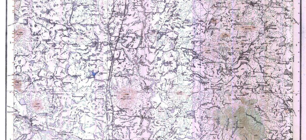

8 TOPOSHHET Project Site
9 3.3 Details of alternate sites considered The mineral is site specific, hence there are no alternative sites considered. Mining activities are carried out based on local geology and availability of the mineral. Geology: The manganese deposit within the ML area is a part of plains that border the Eastern ghat Hill ranges and is occupied by Kondalite group of rocks, viz: garnet-silimanite-graphgite schist/gneiss, granetiferousquartizite, calc gneisses/granulites, Charnokites (quartz hypersthenes-diopside granulites). Magmatites and pergmatites/quartz veins. Reserves: UNCF Classification of reserves and Resources Classification Code Quantity (Tons) Grade (Mn %) Total Mineral Resources (A+B) A. Mineral Reserves 1. Proved Mineral Reserves , % 2. Probable Mineral Reserves 122 1,27, B. Remaining Resources 1. Feasibility Mineral Resources Prefeasibility Mineral Resources 221& Measured Mineral Resources indicated Mineral Resources Inferred Minerals Resources reconnaissance Resource 334 The proposed average annual rate of production is about 30, Tons. The life of mine at the proposed rate of production is calculated to be about 6 years.
10 3.4 Size or magnitude of operation Year Planned Production Ore (Tons) OB (m 3 ) , , , , Total 60, , Project description with process details The mining method adopted in this mine is open cast, mechanized method of working involving use of Atlas Capco drill, tractor mounted air compressor, special gelatin, safety fuse and ordinary detonators for blasting. The mine is being worked by mechanized open cast benching method keeping an height of 6 m each with location variations at few locations. PC 200 L&T make excavator will be used for breaking the OB and Ore. Sorting of ROM material will be manual. This proposed to maintain a bench height of 6 m and width 43 and 65 0 in the future. During the scheme period initially the mine will be developed in the NW side and SE side along with the opening of mine faces. The haul road will 15m width with 1 in 16 slope and the overall UPL slope will be maintained at 45 o. List of Mining Machinery Purpose Type of machinery Capacity & No s Make Drilling Crawler mounted 1 No ICM Excavation P C No L&T Loading Tyre Mounted 1 No L&T Water sprinkling Water tanker 10 KL 1 No Ashok Leyland Hauling Tippers / Trucks 14 ton. 4 No s Barat Benz Dewatering Pumps 20%40 HP. 2 No s Kirloskar
11 3.6 Raw Material Required Along With Estimated Quantity, Likely Source, Marketing Area of Final Product/S, Mode of Transport of Raw Material and Finished Product No raw material will be required in the proposed project. Manganese will be sold to the ferro alloy industries. 3.7 Resource optimization/ recycling and reuse. Minerals are depleting asset once mined, they cannot be replenished like agriculture, vegetation thus a scientific approach will be taken up in exploitation of mineral with systematic method. Mining work will be carried outby mechanized open cast method. 3.8 Availability of water its source, energy/ power requirement and source Water Requirement Around 13.0KLD of water will be required for the project activity. Water requirement will be met through water tankers. Water is required in the mine for spraying on the roads and working faces to suppress the dust. Also a small quantity of drinking water is required S. No Description Fresh water Waste water Disposal 1 Domestic 10 KLD 8 KLD Septic tank 2 Green belt 1.0 KLD -- followed by 3 Dust suppression 2.0 KLD -- soak pit Total 13.0 KLD 8 KLD 3.9 Quantity of wastes to be generated (liquid and solid) and scheme for their management/ disposal Solid Waste Generation& its Disposal About 18, m 3 of total side burden material is estimated to be generated with an average annual waste generation of 9, m 3. During the process development of the pit the quantity of OB and waste material is estimated to be generated.
12 Year 31% waste from over Waste generated Total waste (m 3 ) burden from the side burden , , , , , , Total 9, , , Liquid Effluent 8.0 KLD ofdomestic effluent will be generated at the mine site. Domestic Waste Water generated will be send to septic tank followed by soak pit. Fresh Water Requirement & Wastewater generation S. No Description Fresh water Waste water Disposal 1. Domestic 10 KLD 8 KLD Septic tank followed by soak pit 2. Green belt 1.0 KLD Dust suppression 2.0KLD SITE ANALYSIS 4.1 Connectivity The quarry lease area is connected byb.t roadwith internal earthen road Nearest Railway Station The nearest rail head is Garividi Railway Station is at km from the mine location Nearest Airport The nearest airport facility is available at Visakhapatnam airport which is about km away from mine Nearest Highway Nearest Highway is NH-43 at a distance of kms from the mine site. Nearest State Highway-39at a distance of kms from the mine site.
13 4.2 Land form, land use and land ownership During the ensuing scheme period an area of Ha of land will be mining will be done as per approved mine plan. Measures will be taken for the reclamation only after the end of mining scheme period. 4.3 Topography The manganese deposit within the ML area is a part of plains that border the Eastern ghat Hill ranges and is occupied by Kondalite group of rocks, viz: garnet-silimatite-graphgite schist/gneiss, granetiferous quartizite, calc gneisses/granulites, Charnokites (quartz hypersthenes-diopside granulites). Magmatites and pergmatites/quartz veins. 4.4 Existing land use pattern The lease area bearing the Manganese shall be utilized for mining. There area agricultural lands at a distance of 150M. The subject area is a Govt. Waste Land. S. No Pattern of Utilization Area (Ha) 1 Mining 6,351 2 Dump - 3 Infrastructure Roads Ore stock yard Greenbelt Magazine Sub-grade - 9 Area untouched 1,985 Total Existing infrastructure There is no major construction is seen near to the mining lease area. An office/rest shelter for the labourers shall be made. 4.6 Soil classification No top soil was generated.
14 4.7 Climatic data from secondary sources CLIMATE & RAINFALL The climate is characterized by high humidity. The average maximum and minimum temperature during the year varies from 15 C - 43 C on the basis of past years observations. The area receives an average rainfall of about 1050mm. The wind direction is in SW to NE. 4.8 Social infrastructure available All the social infrastructure facilities like hospitals, schools, colleges etc are available nearby villages, Mandalheadquarters. 5.0 PLANNING BRIEF 5.1 Planning concept(type of industries, facilities, transportation etc) Town and Country Planning/Development authority Classification. It is common in the area to put number of small exploratory pits. 5.2 Population projection The project will employ nearly 203workers from nearby villages. Thus, there will not be any increase in population due to the project. 5.3 Landuse planning: Land use pattern is given in Existing land use pattern. 5.4 Assessment of Infrastructure Demand (Physical and Social) Safety equipments, small rest shelter and first aid facilities will be made available for the workers in the mine lease area. 5.5 Amenities/facilities The following facilities will be extended by the mine management: i. Direct and indirect Employment. ii. Arrangement for safe and healthy working conditions. iii. Provision of drinking water.
15 iv. Conducting medical camps for workers and nearby villagers at regular intervals. 6. PROPOSED INFRASTRUCTURE 6.1 Industrial area (Processing Area) There is no mineral reject, so no need of processing plant. The manganese of this area is not met for captive use. Existing infrastructure facilities proposed in mine lease area. 6.2 Residential area (Non Processing Area) The mine workers will be hired from nearby villages, so residential areas will not be made. 6.3 Green belt Plantation will be made at open places and along the approach road. 6.4 Drinking Water Management Water Requirement for drinking purpose is10 KLDwhich will be supplied by water tankers. 6.5 Sewerage System Domestic waste water generated will be send to septic tank followed by soak pit. 6.6 Industrial Waste Management Not Applicable 6.7 Solid Waste management About 18, m 3 of total side burden material is estimated to be generated with an average annual waste generation of 9, m 3. During the process development of the pit the quantity of OB and waste material is estimated to be generated and waste to the dump yard. 6.8 Power Requirement & Supply/ Source Electrical facility is available from near villages.
16 7.0 REHABILITATION AND RESETTLEMENT (R&R) PLAN 7.1 Policy to be adopted (Central/State) in respect of the project affected persons including home oustees, land oustees and landless laborers (a brief outline to be given) No human settlements are existing in the ML area and no humans will be displaced from the area so the proposed project does not involve any rehabilitation and resettlement. 8. PROJECT SCHEDULE & COST ESTIMATES 8.1 Likely date of start of construction and likely date of completion (Time schedule for the project to be given) The project will commence once Environmental Clearance and other necessary certificates are obtained from the respective departments. 8.2 Estimated project cost along with analysis in terms of economic viability of the project. The envisaged maximum annual production of Quartz in a year is estimated to be 5850T. The cost of the project : Capital : 485Lakhs EMP Cost : 45 Lakhs 9. ANALYSIS OF PROPOSAL (Final recommendations) 9.1 The quarry lease applied area is surrounded by 15 villages within a distance of 5kms.Agriculture and sheep breeding are important profession of the people living in the village besides involving themselves in quarrying activity. There is no adverse Socio Economic Impact on the persons in the villages, due to the quarrying operations there is a positive impact of the quarry operations on the socio economic standards of the villagers. The quarrying activity in this area improved the socio-economic status of the local people by virtue direct and indirect employment.