8, (97 persons/km²)
|
|
|
- Crystal Horton
- 5 years ago
- Views:
Transcription
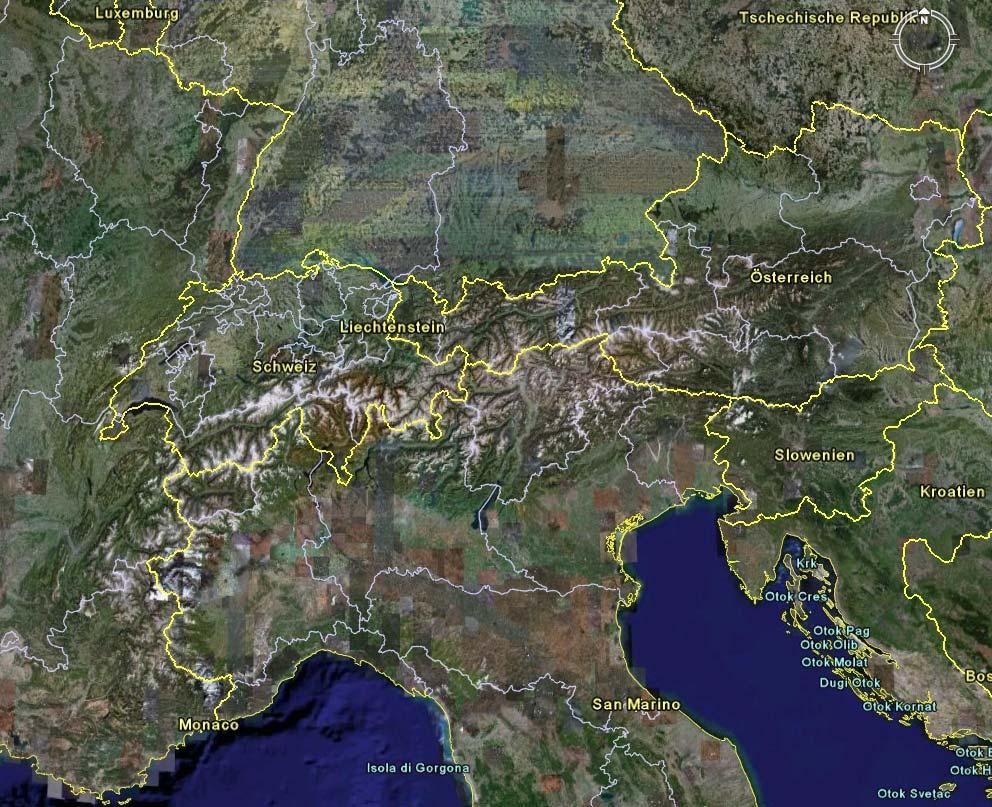
1 Joerg Heumader Director (ret.) of the Federal Service for Torrent and Avalanche Control, Imst, Tyrol Lecturer for Afforestation near the Timberline, University for Natural Resources and Applied Life Sciences, Vienna Austria - Area: Population: Portion of the Alps: Forest cover: General data km² 8, (97 persons/km²) 65 % of Austria 46 % of the total area
2
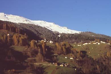
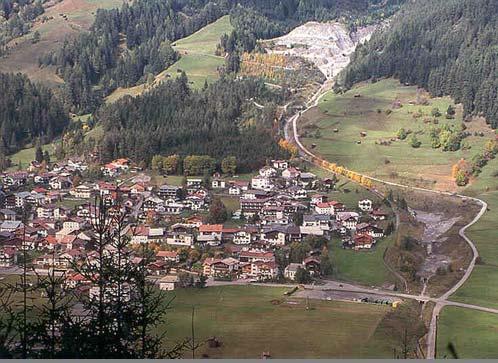
3 Use and development of mountain areas (1) The mountain areas have been used by hunters, shepherds and farmers since thousands of years Cultivated landscape of great beauty and ecological stability
4
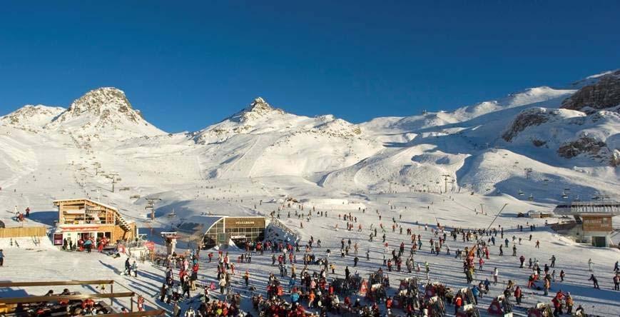
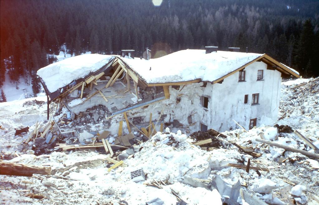
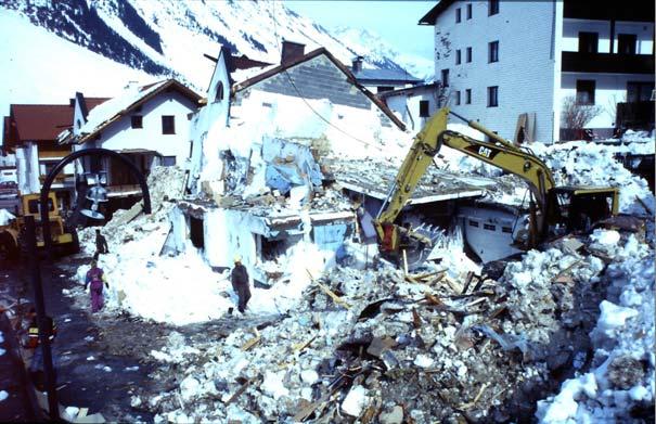
5 Use and development of mountain areas (2) In the last decades the mountain areas are used additionally and heavily by traffic, tourism and free-time sporting activities and the necessary infrastructure facilities Increasing conflicts between different user groups (use or protect, develop or conserve, intervene actively or leave things unchanged) Rapid increase of problems with and damages by natural disasters in the developing mountain villages
6
7
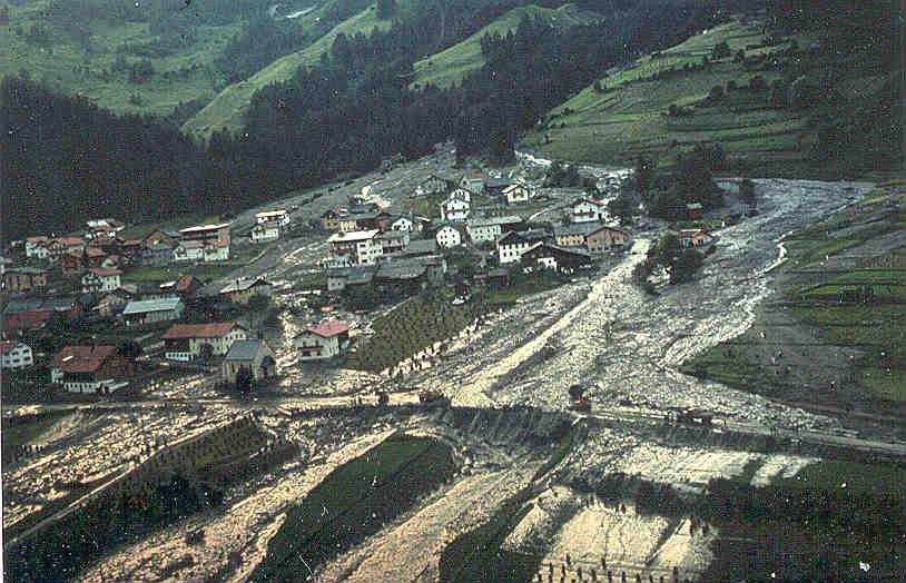
8 Trigger causes for hazard zoning (1) As consequence of rapidly increasing problems by developing areas endangered by mountainous hazards and natural phenomena like floods, debris flows, landslides, rock fall and snow avalanches the efforts of the government on the field of active disaster defence by technical countermeasures and watershed management measures have been intensified, but taking future aspects into account, forward-looking people soon came to the conclusion, that the increasing problems could not be solved by active countermeasures alone in the long run.
9
10
11 Past control combination Since its establishment 1884 the Austrian Service for Torrent and Avalanche Control tries to prevent or reduce mountainous hazards by a combination of technical defence measures and reforestation and watershed management works.
12 New control combination (1) Starting roughly 40 years ago all sorts of passive prevention measures were enforced; one of these and by far the most important lies in the restriction of development and settling by land-use planning in case these human activities conflict with mountainous hazards. Now control works are a combination of three components: Active technical countermeasures (defence works) Active forest- and watershed management Passive disaster and damage prevention and reduction measures
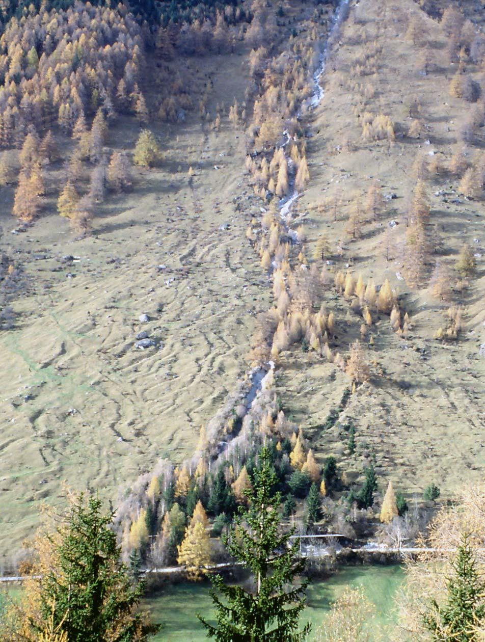
13 Measures against landslides and mass creeping Retending debris flows by: Retention dams with holes, beams or slits in combination with retention basins Retarding debris flows by: Retarding dams and basins Debris-flow breakers Deflecting and keeping-off debris flows by: Deflecting walls and earth dams DISASTER PREVENTION BY HAZARD ZONING IN AUSTRIA New control combination (2) Debris-flow control measuresa active passive Defense works, technical countermeasures Watershed and forest management measures Disaster and damage prevention and mitigation measures Preventing the triggering or forming of debris-flows by: Flood-retention dams and basins Reducing runoff and surficial erosion by: Revegetation of barren sites Reforestation Disaster and damage prevention by: Hazard zoning as base for land-use and settlement restrictions Chains of consolidation dams Regulation of grazing systems and Obligation to cooperate with torrent Bypass rock-channels agricultural use experts in case of plans and projects in torrential watersheds Restoration of protection forests in watersheds Retarding and retending debris flows by: Planting forest shelterbelts and hazardorientated management of debris-cone forests Relocation of endangered buildings, roads and other facilities on safe sites Disaster and damage mitigation by: Construction of debrisflow-proof buildings Warning systems and evacuation plans Disaster preparedness in general Insurance against natural hazards Private and public aid in case of emergencies
14 Start of hazard zoning (1) Hazard zoning was started first in Switzerland for snowavalanche hazards. It was taken up by Tyrolean foresters working in the Federal Service for Torrent and Avalanche Control in Austria, who began about 1970 to work out hazard zone maps which show most of the natural hazards in mountainous regions, especially erosion, torrent, rockfall, landslide and snow-avalanche hazards.
15 Start of hazard zoning (2) The Federal Service for Torrent and Avalanche Control is not responsible for all sorts of running waters, but only for torrents: A torrent is a mountain stream or creek with a catchment area of max. 100 km². A special characteristic is, that disastrous events are not or not only caused by flooding water, but by transport and deposition of large amounts of debris eroded in the upper and middle course of the catchment area, often in form of debris flows. For lowland streams and large rivers the River Control Agency is responsible. This agency has started with hazard zoning only a few years ago.
16 Hazard zoning Legal basis 1975 a new Forest Act, regulating hazard zoning officially, was enacted by the Austrian government. The Forest Law in Austria is a federal law and therefore valid in all provinces. Hazard zoning is done consequently in the same manner all over Austria.
17 Hazard zoning Design event After much discussion the so-called design-event has been fixed in Austria for a recurrence frequency of 150 years. A calculation of the effects of the design-event is possible for torrents and snow avalanches only with a high uncertainty and is almost impossible for landslide and rockfall phenomena.
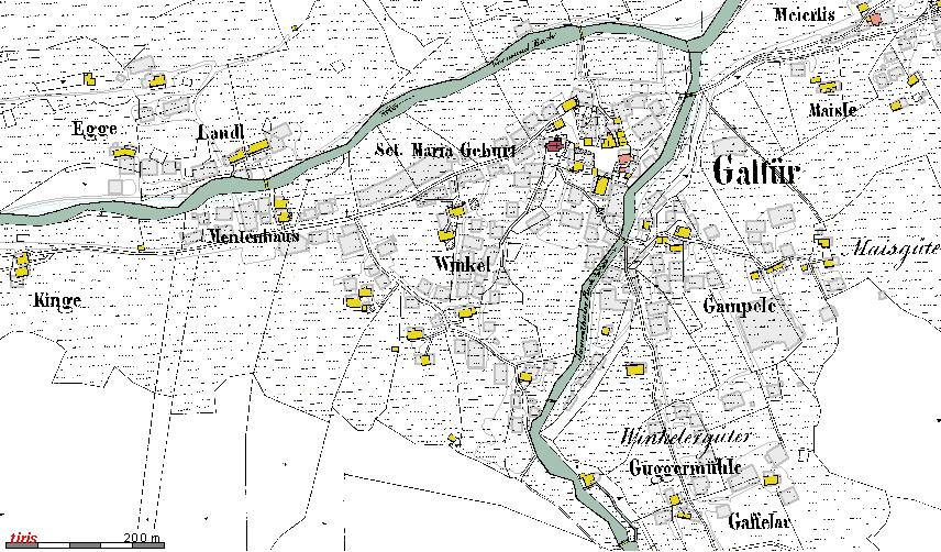
18 Hazard zoning The Hazard Zone Plan in Austria A hazard zone plan normally is worked out for the area of one community. It consists of a written report, a hazard map and a hazard zone map.
19 Hazard zoning The report The report contains the data and investigation results of each torrent, snow avalanche, rock fall or landslide area, which have to be taken into account for the appraisal and delimitation of hazards. Normally these are data of the geological, morphological, meteorological and hydrological conditions, a description of the vegetation cover, of human influences and of reported disasters.
20 Hazard zoning Hazard indicators (1) Very important is also a description of special hints giving evidence of disasters in the past. Such hazard indicators can be found for example considering the pattern of vegetation and land use, the morphology of landscape, the former boundaries of settlements in the last century (mostly built on quite safe places), remnants of debris flows, landslides, rock falls and so on.

21 Hazard zoning Hazard indicators (2)


22 DISASTER PREVENTION BY HAZARD ZONING IN AUSTRIA Hazard zoning Hazard indicators (3)

23 Hazard zoning Hazard indicators (4)


24 Hazard zoning Historical records Not only datable records of past disasters are valuable, but also undated disaster reports of local people.
25 Hazard zoning Control measures The existing control measures are to be described including the construction year, but also if they are estimated to be efficient and sufficient from their design and state to withstand and control the design event.
26 Hazard zoning Data evaluation At last these data and calculation results are to be evaluated by experts with much experience and all the arguments leading to hazard zone delimitation in each special case are written down.
 shows the torrents catchment, debrissource areas, the snowavalanche starting zones and tracks, areas of")
27 Hazard zoning Hazard map The hazard map (scale 1 : to 1 : ) shows the torrents catchment, debrissource areas, the snowavalanche starting zones and tracks, areas of rock fall and landslide activities and so on.
28 Hazard zoning Hazard zone map (1) The hazard zone map (scale 1 : 1000 to 1 : 5000 at least) shows the results of investigated, evaluated and discussed data of each special hazard in form of hazard zones. It is based on the community s land-register map and is the most important basis for all sorts of land-use planning in mountainous areas. The boundaries of hazard zones are the result of overlapping all flood, erosion or deposit areas of several disaster events. Therefore one disaster will never cover the whole hazard zone area.

29 DISASTER PREVENTION BY HAZARD ZONING IN AUSTRIA Hazard zoning Hazard zone map (2)

")
30 Hazard zoning Criteria (1)

")
31 Hazard zoning Criteria (2)

")
32 Hazard zoning Criteria (3)

33 Hazard zoning Criteria (4)
34 Hazard zoning Red Zone (1) The Red Zone includes all areas, which are endangered in case of the design event (that is in Austria one with a recurrence possibility of roughly 150 years) to a high extent and therefore are not suited for permanent settlings and public traffic facilities. The Red Zone includes also less, but frequently endangered areas. The development of new housing or industrial areas is consequently prohibited in Red Zones by the government.
35 Hazard zoning Yellow Zone (1) The Yellow Zone covers the area between the Red Zone and the boundaries, where the harming or damaging effects of the design event with a recurrence possibility of 150 years come to an end. If all suitable safe areas are already settled, development of building sites can be allowed by the local government in Yellow Zones; in that case it should be tried to develop less endangered parts of this zone.
36 Hazard zoning Yellow Zone (2) Buildings and other structures are to be designed in Yellow Zones according to the particular kind of natural hazard. The community respectively its mayor as local building authority has to invite an expert for natural hazards, mostly a member of the Austrian Federal Service for Torrent, Erosion and Avalanche Control, to define the necessary designing and constructing conditions for each building or structure planned in a Yellow Zone.
37 Hazard zoning Yellow Zone (3) The builder is bound by law to observe these conditions. Such conditions are for example: Reinforced concrete walls, deep foundations, no doors and windows on the endangered side, high-levelled entrances, special roof constructions and other sorts of flood and avalanche-proof designs.

")
38 Hazard zoning Yellow Zone (4)

")
39 Hazard zoning Yellow Zone (5)
40 Hazard zoning Brown Zones Landslide and rock fall hazards are mapped as Brown Zones without further differentiation. This is because criteria and especially frequencies are very difficult or impossible to define for such natural hazards. In the future probably this will be possible for rockfall hazards because of the recent progress in rockfall calculation and simulation.
41 Hazard zoning Administration (1) According to the Forest Act of 1975 the draft of each hazard zone plan is to be given to the mayor of the community who has to announce it publicly for four weeks. Everybody is entitled to give his written opinion to the plan.
42 Hazard zoning Administration (2) After this public announcement a commission consisting of a representative of the Minister of Agriculture and Forestry, Environment and Water as chairman, the provincial government, the local community and the Federal Service for Torrent, Erosion and Avalanche Control is formed. This commission has to check the results of hazard zoning, considering especially comments and petitions made by people during the public announcement and to decide on base of voting. In case of parity the vote of presiding chairman prevails.
43 Hazard zoning Administration (3) At last the checked-up Hazard Zone Plan is approved officially by the Minister of Agriculture and Forestry, Environment and Water Management, and copies of it are handed over to the provincial, district and community authorities. The original of the approved plan is kept at the District Office of the Federal Service for Torrent, Erosion and Avalanche Control; everybody is entitled to look it over.
44 Hazard zoning Revision In case of unforeseen disastrous events or as result of active defence works it is of course necessary to revise and alter the hazard zone plan accordingly. The procedure is principally the same as for the first elaboration.
45 Hazard zoning Connections with active control measures (1) The intensive investigations and valuations of data needed for hazard zoning led to a deepened and widened understanding of natural hazard phenomena. Hazard zoning therefore had also very positive effects on planning and performing active defence works against natural disasters in Austria.
46 Hazard zoning Connections with active control measures (2) Since 10 years torrent and avalanche control projects in Austria are financed by the government only in case of an approved Hazard Zone Plan, accepted by the community. The proposed effects of planned control measures are to be delineated on a land-register map and have to be part of each project.
47 Hazard zoning Final remarks Considering more than 35 years of hazard zoning in Austria it can be said, that Hazard Zone Plans proved to be an excellent base for passive disaster prevention measures generally and for land-use and development planning especially.
48 Concluding remarks The most effective protection against natural mountain hazards will result from a combination of all groups of active and passive control measures, that are technical countermeasures, watershed and forest management as well as disaster prevention and reduction measures. Combining will supplement and increase isolated control effects. This combination has a long tradition in Austria, where the public Federal Service for Torrent and Avalanche Control is responsible of all sorts of control measures. This results not only in positive synergistic effects, but also in a very efficient use of personnel and financial resources.
49
50 Remarks for the insurance sector (1) Private insurance is part of the component passive countermeasures against natural hazards. In some Cantons of Switzerland there is a compulsory insurance for such risks, but not in Austria. In Austria the public (state) compensates for damages of private property, but only up to 40 % of the costs at maximum. For this purpose a special Catastrophe Fund has been established after a countrywide series of flood and debris-flow disasters This Fund is supplied by a fixed percentage of the income taxes.
51 Remarks for the insurance sector (2) A compulsory private insurance for buildings in Hazard Zones would make sense and take some financial burden from the public budget. Another positive effect would result from a better control of self-protecting construction specifications, which are prescribed in the building permit in case of an endangered building site. Such prescriptions aim at danger-proof buildings and should be controlled by the community as building authority in Austria, but this is done normally quite carelessly. The control would be done much more effectively and thoroughly by an employee of the insurance company.
52 Future aspects People have to accept, that all control efforts will not bring 100 % safety and that some risk will always remain. These unavoidably remaining risks result from our insufficient knowledge of the complex processes going on especially in debris-flow torrents and from the necessary assumption of an imaginable design event. Even if we could predict our design events correctly, there will be inevitably damaging natural disasters of lower probabilities in the future, with and without global warming and climate change.

53 Thank You for Your attention!