Public Notice. Project No.: SWF Date: January 22, Phone Number:
|
|
|
- Steven Simmons
- 5 years ago
- Views:
Transcription

1 Public Notice Applicant: CBRE Project No.: SWF Date: January 22, 2019 Purpose The purpose of this public notice is to inform you of a proposal for work in which you might be interested. It is also to solicit your comments and information to better enable us to make a reasonable decision on factors affecting the public interest. We hope you will participate in this process. Regulatory Program Since its early history, the U.S. Army Corps of Engineers has played an important role in the development of the nation's water resources. Originally, this involved construction of harbor fortifications and coastal defenses. Later duties included the improvement of waterways to provide avenues of commerce. An important part of our mission today is the protection of the nation's waterways through the administration of the U.S. Army Corps of Engineers Regulatory Program. Section 10 The U.S. Army Corps of Engineers is directed by Congress under Section 10 of the Rivers and Harbors Act of 1899 (33 USC 403) to regulate all work or structures in or affecting the course, condition or capacity of navigable waters of the United States. The intent of this law is to protect the navigable capacity of waters important to interstate commerce. Section 404 The U.S. Army Corps of Engineers is directed by Congress under Section 404 of the Clean Water Act (33 USC 1344) to regulate the discharge of dredged and fill material into all waters of the United States, including wetlands. The intent of the law is to protect the nation's waters from the indiscriminate discharge of material capable of causing pollution and to restore and maintain their chemical, physical and biological integrity. Contact Name: Mr. Eric Dephouse, Project Manager Phone Number:
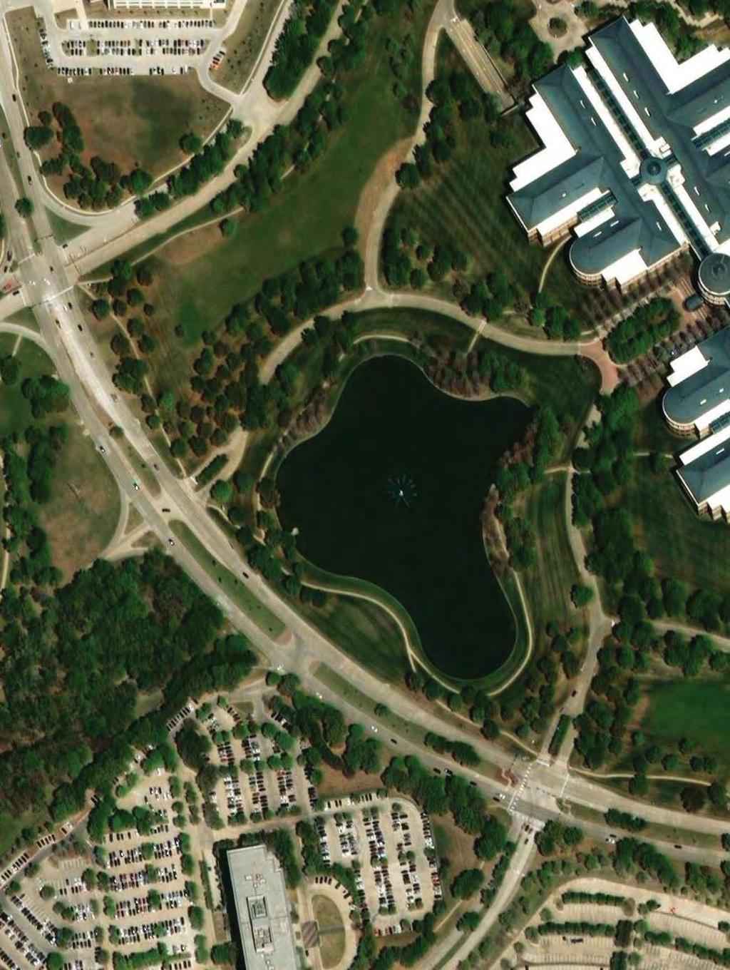
2 JOINT PUBLIC NOTICE U.S. ARMY CORPS OF ENGINEERS, FORT WORTH DISTRICT AND TEXAS COMMISSION ON ENVIRONMENTAL QUALITY SUBJECT: Application for a Department of the Army Permit under Section 404 of the Clean Water Act (CWA) and for water quality certification under Section 401 of the CWA to discharge dredged and fill material into waters of the United States associated with The Campus at Legacy West project which proposes to reconfigure the existing stormwater pond to allow for a for the development of a hotel and office park in Plano, Collin County, Texas. APPLICANT: CBRE c/o Mr. Brian Straley 2100 McKinney Avenue, Suite 700 Dallas, Texas APPLICATION NUMBER: SWF DATE ISSUED: January 22, 2019 LOCATION: The proposed office park and hotel expansion in The Campus at Legacy West would be located on approximately 18.3-acres containing a 6.25-acre on-channel pond in the city of Plano, Collin County, Texas. The proposed project would be located immediately north of Legacy Dr. between Headquarters Dr. and Communications Parkway. The proposed project would be located approximately at latitude and longitude on the Hebron 7.5-minute USGS quadrangle map in the USGS Hydrologic Unit See Figure 1. OTHER AGENCY AUTHORIZATIONS: State Water Quality Certification PROJECT DESCRIPTION: The applicant proposes to discharge approximately 61,991 cubic yards of dredged and fill material into approximately 2.9 acres of waters of the United States, consisting entirely of open water, in conjunction with the construction of the office park and hotel as well as associated attendant features. See Figure 6. Total proposed permanent impacts to waters of the U.S. include 2.9 acres. See Figure 7. The applicant believes there is a local need for accommodations within the rapidly growing area of Plano in the vicinity of the southwest corner of HWY 121 and Legacy Drive. Specifically, the applicant believes the development needs to be located in an area with easy access to Toyota Headquarters and similar other businesses such as Frito Lay, JCP Headquarters, FedEx, JP Morgan, Liberty Mutual, and NTT Data. The proposed development would include construction of a 300,000-1
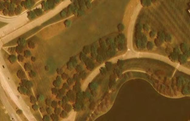
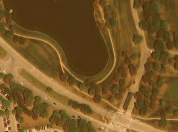
3 square foot, 250-room hotel, associated office park, and retail center, to serve the surrounding commercial properties. This proposed project is modeled after a similar design near the Toyota Headquarters in California. The USGS Topographic map indicates the presence of one blue-line stream within the study area; an unnamed tributary to Indian Creek. See Figure 2. The mapped blue-line stream is not present within the study area. However, a man-made open water pond with concrete, unvegetated vertical edges is present See Figure 5. On the opposite side of Legacy Drive, southwest of the open water, two large culverts outfall into an open channel. The pond collects stormwater from the surrounding uplands and conveys it through an outfall structure and into the culverts under Legacy Drive. The area draining to the pond is approximately 100-acres and is bounded by Headquarters Drive on the north/northwest, Communications Parkway on the east, and Legacy Drive on the southwest/south. Drainage for the 100-acre area is generally collected by storm sewer inlets and/or roof drains and routed via underground pipes and box culverts to the existing pond. The adjacent area surrounding the pond is an urban landscape with mostly manicured lawns consisting of well-maintained grass and some mature planted trees in scattered locations. Paved walkways have been constructed through the lawns. According to the USDA Texas Soil Survey for Collin County, the pond is mapped as open water. See Figure 3. Two soil types are mapped adjacent to the pond and include; Houston Black clay, 1 to 3 percent slopes; and, Stephen silty clay, 1 to 4 percent slopes. None of the mapped soil types are located on the Collin County hydric soils list, suggesting wetlands would not be expected. No wetlands were observed during the site visit. None of the study area is located within the mapped FEMA 100-year floodplain. See Figure 4. ADVERSE IMPACTS OF THE PROPOSED PROJECT: Activities associated with the construction of the proposed hotel and office park would result in permanent impacts to waters of the U.S. including filling 2.9-acres of open water. Additionally, 0.77-acres of uplands would be excavated to maintain the hydrologic function of the stormwater pond. Avoided waters of the U.S. include acres of the existing stormwater pond. ALTERNATIVES TO THE PROPOSED PROJECT: In accordance with the Clean Water Act Section 404(b)(1) guidelines, the Applicant has described alternatives relative to the overall project purpose to demonstrate that the proposed preferred alternative represents the least environmentally damaging practicable alternative. The applicant is interested in this location because the applicant believes there is a demonstrated need for a hotel and office park at this location. A search within the vicinity of the region for other properties was conducted before deciding on this location. Based on the multiple facets of the overall proposed project, the applicant searched for a site that met the following criteria: 1. Located in the Plano area in close proximity to the southwest corner of HWY 121 and Legacy Drive in close vicinity to the facilities the proposed development would serve ; 2. Able to be easily acquired or purchased by coordinating with a small number of landowners; 3. Sized between 18 and 20 acres to allow for the appropriate amount of development to be practicable; 4. Satisfy the minimum separation requirements to other existing developments of similar nature; 5. Located within reasonable walking distance to culturally similar businesses; 6. Located within 2
4 reasonable walking distance (approximately 10 minutes) to DART facilities; and 7. Able to easily connect to existing or proposed utility lines (gas, electric, and water). The applicant has prepared an Alternatives Analysis, including site selection criteria and contraints which is described below. The USACE has not evaluated the applicant s Alternatives Analysis. No-Action Alternative Though the no-action alternative would avoid impacts to waters of the U.S., it would not meet the need and purpose of the proposed project. Therefore, the no-action alternative is not practicable. If the applicant did not develop this property, other developers would likely attempt to develop this site, as there is a high demand for a hotel and office park in this location. Off-site Alternatives Several offsite locations were considered by the applicant and none met the purpose and need for the project Alternative Site 1 and 2 were deemed impracticable because they are located north of HWY 121 and are therefore, not within reasonable or safe walking distance for pedestrians to culturally similar businesses. Additionally, DART does not operate in Frisco preventing patrons from accessing this type of transportation. Alternative Site 3 was ultimately deemed impracticable as it is not large enough for the development and is currently being developed by others. Table 1: Offsite Alternatives Comparison Matrix Criterion Factor Preferred Offsite Alt. 1 Offsite Alt. 2 Offsite Alt. 3 Alternative Location Located Yes No No Yes within reasonable walking distance to Toyota Head Quarters Site is adjacent to Toyota Headquarters and other culturally similar businesses Site is not located within proximity to culturally similar businesses Site is not located within proximity to culturally similar businesses Site is east of Dallas North Tollway near Headquarters Drive in Plano Located within reasonable walking distance to DART Facilities Yes No No Yes Site is located within 0.1- miles of a DART station DART does not operate in Frisco DART does not operate in Frisco Site is located within 0.2-miles of a DART station 3
5 Available to Purchase Reasonably obtainable given number of parcels/ landowners Yes Yes No No Available to Purchase Size of Site Reasonably obtainable given number of parcels/ landowners Between 15 and 18 acres in size One parcel with one property owner One parcel with one property owner Identified as one parcel with one property owner; however, the site is not available for purchase and/or subdivision Identified as multiple parcels with two property owners; site is no longer available as it is being developed by others Size of Site Logistics Between 15 and 18 acres in size Minimum separation requirements to other existing developments of similar nature Yes No No No Site is 18 Site is 44 Site is 19 Site is 5.4 acres acres in size acres in size acres in size in size Yes Yes Yes Yes 4
6 Logistics Minimum separation requirements to other existing developments of similar nature Available Utilities Would be located far enough from other similar developments Would be located far enough from other similar developments Would be located far enough from other similar developments Would be located far enough from other similar developments Yes Yes Yes Yes Available Utilities The site currently has access to utilities. The site currently has access to utilities. The site currently has access to utilities. The site currently has access to utilities. Based on the information presented in Table 1 above, the applicant believes their preferred alternative is the least environmentally damaging practicable alternative, while still meeting the project purpose and need. Onsite Alternatives The applicant undertook an analysis of alternative designs relative to the preferred alternative site to determine the optimal design that would fulfill the project s purpose and need while minimizing adverse impacts to aquatic features to the extent practicable. The critical elements that were used to determine the preferred project design are provided below. Accommodate the space necessary for the required hotel and office park, including adequate parking lots and drives; provide sufficient access to project facilities and amenities, as well as adjacent and nearby commercial and retail developments; provide walkability to culturally similar businesses or DART public transportation; and provide for a sufficient number of hotel rooms to achieve rental prices that render the project financially viable and that are appropriate for the surrounding market and commensurate with the level of amenities provided within the project and in the area immediately surrounding the project. In an effort to achieve the project s purpose and need while minimizing impacts to aquatic sites, the applicant examined the following two on-site design alternatives: 5
7 Full Avoidance Alternative To avoid impacts to jurisdictional features, the proposed hotel would need to be located east of the open water feature. However, the approved City of Plano Concept Plan does not allow for a hotel in this location. The hotel location shown in onsite alternative 1 is not on a legal lot per the City s subdivision ordinance. Additionally, the applicant believes this location is set back too far from Legacy Drive to make the project marketable and economically feasible. The retail portion of the project shown in onsite alternative site 1 is not feasible due to insufficient lot depths; there is not enough room between the existing pond and the onsite driveway for the building, slopes, and required parking. The proposed layout of onsite alternative 1 does not have sufficient supporting retail and office components to make the project economically feasible. Full Impact Alternative Onsite Alternative Site 2 would impact all 6.25-acres of onsite waters of the U.S. This alternative would result in 100% impacts to onsite waters of the U.S. and eliminate stormwater detention areas, which are required for the development of this project. Additionally, there is a deed restriction on the western half of this project that would not allow the two office projects that are proposed in this alternative Based on this alternative impacting all onsite waters of the U.S., eliminating stormwater detention, and building restrictions presented by existing deed restrictions this alternative as described does not meet the purpose and need of the project and is therefore, not practicable or the Least Environmentally Damaging Practicable Alternative. COMPENSATORY MITIGATION: To offset unavoidable adverse impacts to waters of the U.S. the applicant proposes to purchase appropriate mitigation bank credits from Bunker Sands Mitigation Bank in accordance with the methodologies prescribed within the USACE-approved mitigation banking instrument. PUBLIC INTEREST REVIEW FACTORS: This application will be reviewed in accordance with 33 CFR , the Regulatory Program of the U. S. Army Corps of Engineers (USACE), and other pertinent laws, regulations, and executive orders. Our evaluation will also follow the guidelines published by the U. S. Environmental Protection Agency pursuant to Section 404(b)(1) of the CWA. The decision whether to issue a permit will be based on an evaluation of the probable impact, including cumulative impact, of the proposed activity on the public interest. That decision will reflect the national concerns for both protection and utilization of important resources. The benefits which reasonably may be expected to accrue from the proposal must be balanced against its reasonably foreseeable detriments. All factors which may be relevant to the proposal will be considered, including its cumulative effects. Among the factors addressed are conservation, economics, aesthetics, general environmental concerns, wetlands, historic properties, fish and wildlife values, flood hazards, floodplain values, land use, navigation, shore erosion and accretion, recreation, water supply and conservation, water quality, energy needs, safety, food and fiber production, mineral needs, considerations of property ownership, and, in general, the needs and welfare of the people. 6
8 The USACE is soliciting comments from the public; federal, state, and local agencies and officials; Indian Tribes; and other interested parties in order to consider and evaluate the impacts of this proposed activity. Any comments received will be considered by the USACE in determining whether to issue, issue with modifications, or conditions, or deny a permit for this proposal. To make this decision, comments are used to assess impacts on endangered species, historic properties, water quality, general environmental effects, and the other public interest factors listed above. Comments are used in the preparation of an Environmental Assessment and/or an Environmental Impact Statement pursuant to the National Environmental Policy Act. Comments are also used to determine the need for a public hearing and to determine the overall public interest of the proposed activity. STATE WATER QUALITY CERTIFICATION: This project incorporates the requirements necessary to comply with the Texas Commission on Environmental Quality s (TCEQ) Tier I project criteria. Tier I projects are those that result in a direct impact of three acres or less of waters of the State or 1,500 linear feet of streams (or a combination of the two is below the threshold) for which the applicant has incorporated best management practices (BMPs) and other provisions designed to safeguard water quality. The USACE has received a completed checklist and signed statement fulfilling Tier I criteria for the project. Accordingly, a request for 401 certification is not necessary and there will be no additional TCEQ review. ENDANGERED AND THREATENED SPECIES: The USACE has reviewed the U.S. Fish and Wildlife Service's latest published version of endangered and threatened species to determine if any may occur in the project area. The proposed project would be located in Collin County, Texas. Our initial review indicates that the proposed work would have no effect on federally-listed endangered or threatened species. NATIONAL REGISTER OF HISTORIC PLACES: The USACE has reviewed the latest complete published version of the National Register of Historic Places and found no listed properties to be in the project area. However, presently unknown scientific, archaeological, cultural or architectural data may be lost or destroyed by the proposed work under the requested permit. FLOODPLAIN MANAGEMENT: The USACE is sending a copy of this public notice to the local floodplain administrator. In accordance with 44 CFR part 60 (Flood Plain Management Regulations Criteria for Land Management and Use), the floodplain administrators of participating communities are required to review all proposed development to determine if a floodplain development permit is required and maintain records of such review. SOLICITATION OF COMMENTS: The public notice is being distributed to all known interested persons in order to assist in developing fact upon which a decision by the USACE may be based. For accuracy and completeness of the record, all data in support of or in opposition to the proposed work should be submitted in writing setting forth sufficient detail to furnish a clear understanding of the reasons for support or opposition. 7
9 PUBLIC HEARING: Prior to the close of the comment period any person may make a written request for a public hearing setting forth the particular reasons for the request. The District Engineer will determine whether the issues raised are substantial and should be considered in his permit decision. If a public hearing is warranted, all known interested persons will be notified of the time, date, and location. CLOSE OF COMMENT PERIOD: All comments pertaining to this Public Notice must reach this office on or before February 21, 2019, which is the close of the comment period. Extensions of the comment period may be granted for valid reasons provided a written request is received by the limiting date. If no comments are received by that date, it will be considered that there are no objections. Comments and requests for additional information should be submitted to; Regulatory Division, CESWF-DE-R; U. S. Army Corps of Engineers; Post Office Box 17300; Fort Worth, Texas You may visit the Regulatory Division in Room 3A37 of the Federal Building at 819 Taylor Street in Fort Worth between 8:00 A.M. and 3:30 P.M., Monday through Friday. Telephone inquiries should be directed to Mr. Eric Dephouse, Project Manager, (817) Please note that names and addresses of those who submit comments in response to this public notice may be made publicly available. DISTRICT ENGINEER FORT WORTH DISTRICT CORPS OF ENGINEERS 8
10 SWF FIGURE 1 of 7 January 22, 2019 Study Area K:\DAL_Environmental\Project\ CBRE Old JCP HQ\GIS\Legacy West - Vicinity.mxd Legend Jurisdictional Open Water, 6.25-acres ,000 Feet FIGURE DATE: 08/09/ DRAWN: SDG CHECKED: LDC KHA NO.: Vicinity Map Campus at Legacy West (SWF ) Plano, Collin County, Texas I This product is for informational purposes and may not have been prepared for or be suitable for legal, engineering, or surveying purposes. It does not represent an on-the-ground survey and represents only the approximate relative location of property boundaries.
11 SWF FIGURE 2 of 7 January 22, 2019 K:\DAL_Environmental\Project\ CBRE Old JCP HQ\GIS\Legacy West - Topo.mxd Legend Jurisdictional Open Water, 6.25-acres ,000 Feet FIGURE DATE: 08/09/ DRAWN: SDG CHECKED: LDC KHA NO.: USGS Topographic Map Quad Name: Hebron Campus at Legacy West (SWF ) Plano, Collin County, Texas I This product is for informational purposes and may not have been prepared for or be suitable for legal, engineering, or surveying purposes. It does not represent an on-the-ground survey and represents only the approximate relative location of property boundaries.


12 SWF FIGURE 3 of 7 January 22, 2019
13
14
15 K:\DAL_Environmental\Project\ CBRE Old JCP HQ\GIS\Legacy West - FEMA.mxd Legend Existing Open Water A: 100-year Flood Zone (FIRM 48085C) AE: 100-year Flood Zone (FIRM 48121C) ,000 Feet I SWF FIGURE 4 of 7 January 22, 2019 FIGURE DATE: 08/09/ DRAWN: CHECKED: KHA NO.: SDG LDC FEMA Flood Hazard Map Aerial: ESRI Basemap Campus at Legacy West (SWF ) Plano, Collin County, Texas This product is for informational purposes and may not have been prepared for or be suitable for legal, engineering, or surveying purposes. It does not represent an on-the-ground survey and represents only the approximate relative location of property boundaries.
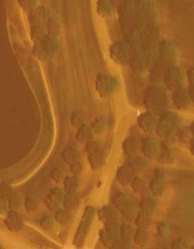
16 K:\DAL_Environmental\Project\ CBRE Old JCP HQ\GIS\Legacy West - Recent Aerial.mxd Legend Jurisdictional Open Water, 6.25-acres Feet I SWF FIGURE 5 of 7 January 22, 2019 FIGURE DATE: 08/09/ DRAWN: CHECKED: KHA NO.: SDG LDC Recent Aerial Nearmap June 2018 Campus at Legacy West (SWF ) Plano, Collin County, Texas This product is for informational purposes and may not have been prepared for or be suitable for legal, engineering, or surveying purposes. It does not represent an on-the-ground survey and represents only the approximate relative location of property boundaries.

17 DWG NAME K:\FRI_CIVIL\ JCP HOME OFFICE\DWG\EXHIBITS\ OF 1 CONCEPT PLAN.V2.DWG LAST SAVED 1/10/2019 3:13 PM LOT 1, BLOCK 1 TO LAY NATIONAL HEADQUARTERS INST. NO O.P.R.C.C.T. LOT 1R, BLOCK 1 O.P.R.C.C.T. COUNTRYWIDE ADDITION INST. NO LEGACY DRIVE (FORMERLY CARPENTER ROAD, CAB. C, PG. 774)(VARIABLE WIDTH R.O.W.) CORPORATE DRIVE (VARIABLE WIDTH R.O.W.) (CAB. C, PG. 774) FIGURE 6 Scale: Designed by: Drawn by: Checked by: Date: AS SHOWN TBB KMB TBB JANUARY 2019 CONCEPT PLAN PLANO, COLLIN COUNTY TEXAS NORTH Project No SWF FIGURE 6 of 7 January 22, 2019

 XF PROPOSED OPEN WATER 4.12-ACRES DISPOSAL SITE 2.")


18 DWG NAME K:\FRI_CIVIL\ JCP HOME OFFICE\DWG\RING ROAD EXTENSION\CAD\EXHIBITS\POND IMPACTS MAP.DWG LAST SAVED 1/10/2019 1:28 PM LEGEND OPEN WATER; 6.25-ACRES EXCAVATION 0.77-ACRES (10,523 CY) XF PROPOSED OPEN WATER 4.12-ACRES DISPOSAL SITE 2.90-ACRES (62,292 CY) 5/8" IRFC "KHA" 5/8" IRFC "KHA" 5/8" IRFC "KHA" 5/8" IRFC "KHA" 5/8" IRFC "KHA" 5/8" IRFC "KHA" "KHA" 5/8" IRFC "KHA" 5/8" IRFC DRAINAGE AND FLOODWAY EASEMENT CAB. H, PG. 698, M.R.C.C.T. BUILDING RUCTURE ' SETBACK TO BUILDING & PARKING STRUCTURE INST. NO O.P.R.C.C.T. 83' SETBACK TO BUILDING & PARKING STRUCTURE INST. NO O.P.R.C.C.T. 50' SETBACK TO BUILDING & PARKING STRUCTURE INST. NO O.P.R.C.C.T. 25' LANDSCAPE SETBACK TO SURFACE PARKING INST. NO O.P.R.C.C.T. LEGACY DRIVE 0 200' 400' GRAPHIC SCALE 200' FIGURE 7 Scale: Designed by: Drawn by: Checked by: Date: AS SHOWN TBB KMB TBB JANUARY 2019 IMPACTS MAP PLANO, COLLIN COUNTY TEXAS NORTH Project No SWF FIGURE 7 of 7 January 22, 2019