Proactive Planning for Resilient Coasts Lessons for North Texas
|
|
|
- Bruce Turner
- 5 years ago
- Views:
Transcription
1 Proactive Planning for Resilient Coasts Lessons for North Texas Kimberly M. Miller, Senior Planner & Operations Manager, Allen Engineering and Science
2 Overview of Today s Program 1. Planning for Coastal Resilience 2. Case Study: Ocean Springs a. Plans to Promote Resilience b. Hazard Mitigation Plan c. Preparing for Risk d. Developing Adaptation 3. Comparing Coastal and Prairie Resilience
3 Disaster and Recovery Get Ready for the Long Haul
4 Know Your Vulnerabilities

5 Assess Your Capacity Coastal Resilience Index, developed by MS-AL Sea Grant Prepare leaders to make decisions that promote resilience Consider adequacy of water and wastewater and other infrastructure systems during emergencies Identify your vulnerable population Plan for businesses to reopen after a disaster

6 Activate Your Team Federal Local State Community Organizations County Businesses

7 Plan to Reduce Risks

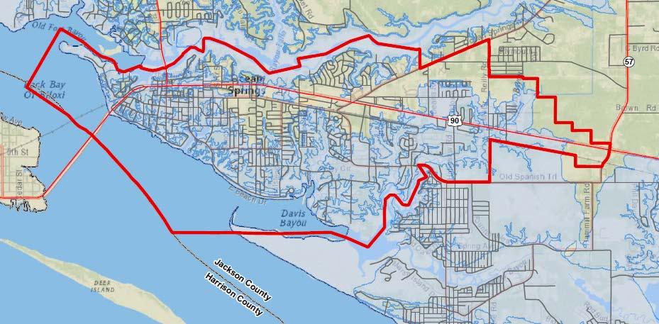
8 Ocean Springs, Mississippi: A Case Study in the Evolution of Resilience Planning
9 Plans to Promote Resilience Comprehensive Plan Hazard Mitigation Plan Floodplain Management Community Rating System Ocean Springs Sea Level Rise Plan

10 Ocean Springs Blueprint: 2010

11 Comprehensive Plan Addresses Resilience by: Setting long range goals for growth and infrastructure Mapping natural resources and land suitability for development Examining community facilities and hazard risk
12 What Risks do Plans Address? High tides and strong storm surges Coastal erosion Loss of wetlands Slow drainage of freshwaters through flooded estuaries Increased salinity in water supply Property loss and damage due to erosion Population being pushed inland
, which makes flood insurance available to the City and private property owners.")
13 FEMA-RELATED EFFORTS Flood Plain Management & Community Rating System Ocean Springs participates in the National Flood Insurance Program's (NFIP), which makes flood insurance available to the City and private property owners.
14 FEMA-RELATED EFFORTS NFIP Community Rating System (CRS) Ocean Springs participates in CRS, an incentive program that encourages floodplain management activities that exceed the minimum NFIP requirements. Residents receive discounted flood insurance premium rates that reflect reduced flood risk from the community actions meeting the three goals of the CRS: Reduce flood damage to insurable property; Strengthen and support insurance aspects of the NFIP Encourage a comprehensive approach to floodplain management.

15 FEMA-RELATED EFFORTS Ocean Springs Hazard Mitigation Plan

16 FEMA-RELATED EFFORTS Hazard Mitigation Plan Priorities Ensure that emergency operations can function and that day-to-day management of the City can be back on track as soon as possible after an emergency. Improve drainage through storm sewer improvements on roads that were not upgraded after the storm. Develop and implement a Capital Improvements Plan for Ocean Springs. Improve N/S roadway access in western Ocean Springs.
17 Hazard Mitigation Priorities Ocean Springs Adopted Mitigation Strategies Description Encourage the underground placement of electric, telephone and cable TV lines by developers working outside of the coastal zone to improve aesthetics, prevent disfigurement of trees and provide protection from high winds and other hazards Include structural design, elevation, and location standards in the Unified Development Code to mitigate effects of natural hazards. Use Planning and Buildings Department review and record-keeping process to ensure compliance with Flood Ordinance, determine appropriate building elevations and minimize development in the floodplain. Update the City's Hazard Mitigation and Emergency Response plan and its Hurricane Response Plan to ensure emergency service and evacuation routes are adequate, well-marked and accessible Develop a Capital Improvements Plan (CIP) for the City of Ocean Springs Strategy Type Infrastructure Planning & Development Management Planning & Development Management Planning & Development Management Infrastructure Priority Ranking High High High High Medium

18 MS-AL SEA GRANT PROJECT Ocean Springs Sea Level Rise Plan
19 Sea Level Rise Risks Beach and wetland loss Higher tides & storm surges Slower stormwater drainage Infrastructure flooded Contaminated drinking water Loss of developable land
20 MS-AL SEA GRANT PROJECT Is Sea Level Rise Occurring in Coastal Mississippi? Station Pascagoula NOAA Lab 5-Year Sea Level Tren Source: NOAA Tides and Currents
21 Infrastructure

22 Critical Facilities: 1 Sea Level Rise


23 Adaptive Solutions Restoring natural habitat to minimize erosion


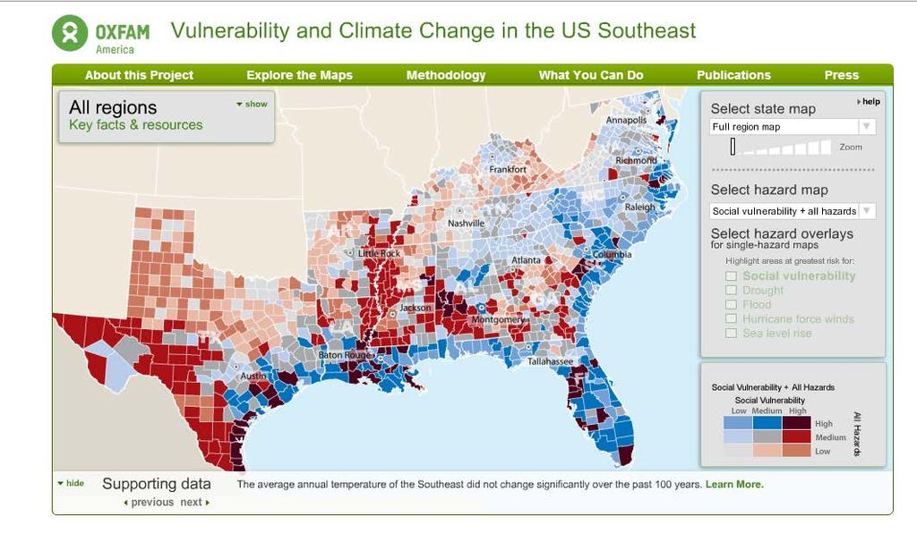
24 Adaptive Solutions Elevating Low Bridges Storm sewer improvements
25 Lessons for North Central Texas Communities Working Together to Promote Resilience
26 FEMA-Defined Risks for our Region Hazards include Sudden Onset events like floods or Chronic Hazards such as drought Tornado Earthquake Erosion Flood Hail Severe winter weather Drought Wildfire


27 Prairies & Coastlines Face Similar Risks Infrastructure damage during major storms Sedimentation of stormwater drainage causes flooding Drinking water supply compromised due to flooding or drought Vulnerable populations located in high risk areas

28 Drought & Sea Level Rise: The Slow Onset Disasters Results Displacement of people Growth constraints Economic shifts Plan for environmental changes in the future!
29 Proactive Planner s Role TRADITIONAL FUNCTIONS: Preparing comprehensive plans Updating land development ordinances Reviewing current development applications and maintain records Administer grants that fund planning and infrastructure departments PROACTIVE PLANNING FUNCTIONS: Identify vulnerable populations Plan for continuity Adapt to new realities 2/26/2015
30 Identify Your Most Vulnerable Populations Know Who They Are, and What They Need

31 What Factors Determine How Vulnerable We Are? Wealth Race/Ethnicity Age Gender Housing Status Special Needs Employment Status Rural or Urban

32 Vulnerability to Hazards in Midwest Texas Moderately High Hazard Risk: Montague, Eastland, Comanche, Mills, Hamilton and Bosque Counties

33 Social Vulnerability in Midwest Texas Moderately High Hazard Risk: Montague, Young, Eastland, Comanche, Mills, Hamilton and Bosque Counties
34 Planning for Continuity Getting Back to Business After a Disaster

35 Disaster and Recovery Get Ready for the Long Haul
36 Preparation How Planning Staff Adds Value Incorporating Hazard Mitigation in comp plans Prioritizing development outside of disaster prone areas Ensuring development applications meet disaster resistant criteria Conducting site inspections & enforcing building code Maintaining development records Seeking grants to fund planning and infrastructure improvements Advising Boards and Commissions

37 Preparation: Protecting Vulnerable Populations Identify populations most likely to suffer from the following needs, and develop a plan to address them: Evacuation Shelter Food Medical Treatment Loss of home and employment

38 Preparation: Protecting Valuable Infrastructure? Make capital investments now to shore up the systems that make the community run, such as: Electrical power Water Supply Wastewater Treatment Garbage Debris removal
39 Response: Who Plans for Emergencies? Fire Department Police Department Public Works Mayor and Council State and Federal Officials and the Planning Department!
40 Adapt to New Realities After the Disaster Strikes

41 Recovery: How will the Community Bounce Back? Strong Data on Needs Improved Land-use and Reconstruction Standards Infrastructure and Transportation Restoration Housing Recovery Economic Redevelopment Environmental Restoration Health and Social Recovery
42 Planners Can Promote Resilience! Get familiar with planning efforts in other departments Contribute to multi-sector emergency preparedness planning Encourage long-range planning that reduces and mitigates risk from hazards Ask applicants questions to determine risk level of development application during fact-finding and deliberation process Encourage developers to use techniques that work with the environment to reduce flooding, erosion, water use and fire hazards
43 Questions? Kimberly Miller, Allen ES