Flood hazard and risk assessment in Yen Bai city: a case study for riverineand flash-floods
|
|
|
- Oscar Nichols
- 5 years ago
- Views:
Transcription


 With support of")
1 Flood hazard and risk assessment in Yen Bai city: a case study for riverineand flash-floods by Nguyen Thi Hai Van 1, Dinand Alkema 2, Victor Jetten 2, Le Thi Chau Ha 3, Le Quoc Hung 1 1 Vietnam Institute of Geosciences and Mineral Resources (VIGMR) 2 Faculty of Geoinformation and Earth Observation, University of Twente (ITC) 3 Water Resources University (WRU) With support of the ADB-funded GITHRA project Da Nang, July 2011

: ~ 94, 000 people in ~ 108 km 2 High density in city centre: ~ 70, 000 people in")
2 Yen Bai city -A low mountainous urbanized area, flood plain of Red river in Northern Vietnam - Political, economic, cultural centre of Yen Bai province -Rapid urbanization Old city (expansion in 2002): ~ 78, 000 people in ~ 56 km 2 New city (expansion in 2008): ~ 94, 000 people in ~ 108 km 2 High density in city centre: ~ 70, 000 people in ~ 20 km 2
 flood from Red River may come")


3 Flood hazard and risk in Yen Bai city: Why & How? Always threatened by floods every rainy season: -riverine (alluvial) flood from Red River may come from other provinces (inside and outside Vietnam) - urban (local) flood due to heavy rain in the city and blocked drainage system Heavy rains? Upstream flows? - flash flood from torrent upstream flow of two upstream catchment City center: most prone to flood hazards High risk to flood 8/ /2003 7/2005 8/ /2007 8/2008 (main causes?) Red river Heavy rains&upstream flows Heavy rains&upstream flows Heavy rains&upstream flows Red river Combination
 flood from Red River - urban")


4 Floods: consequences Always threatened by floods every rainy season: -riverine (alluvial) flood from Red River - urban (local) flood due to heavy rain and blocked drainage system - flash flood from torrent upstream flow City center: most prone to flood hazards High risk to flood Floods on 12/7/2005 (source: VnExpress.net) Floods on 19/8/2006 (source: VnExpress.net)


5 Floods: consequences Market, school, road, farmland, houses... in Yen Bai city after Kummari typhoon on 8-9/8/2008
6 Flood Risk = Hazard x Vulnerability Flood hazard assessment: What cause floods? How, when and where floods happen? Can we predict / monitor flood hazard? prevent a flood? How? Vulnerability assessment: What are consequences if a flood occurs? How much damage& loss can we expect? Can we reduce the risk (damage&loss) of a flood? How? A disaster is a past event. Risk is the probability of a future disaster.
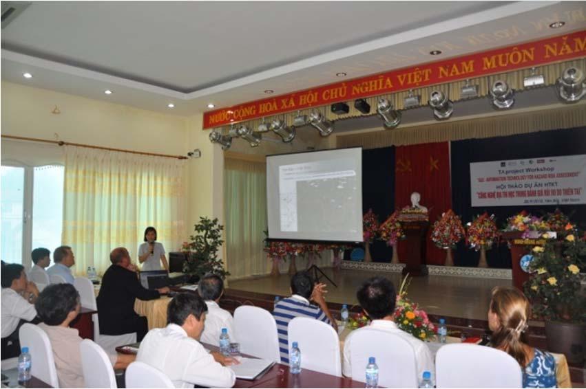
7 Methodology Flood hazard assessment: Flash floods from upstream: hydrological modelling. Red river floods: hydraulic modelling. Vulnerability assessment: Element at risk mapping (buildings) Using local knowledge and past experiences PGIS approach: mainly for 2008 flood reconstruction Household samples to assess the vulnerability of elements at risk (people, properties, infrastructures) perception of risk, coping capacity of individual family Workshops with groups of key people (representatives from flood prone areas, communal and municipal authorities

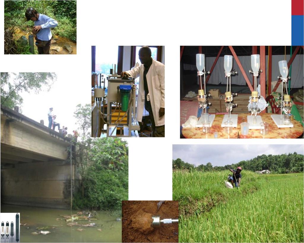
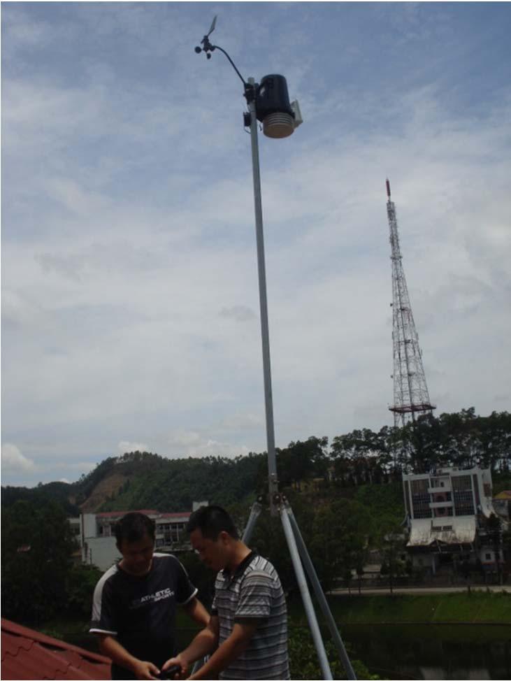
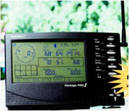
8 Measurements for flood hazard assessment

9 Flashfloods from Cuong No stream Upstream: Flash flood City center: - lowest land - high population - well-infrastructures Flash flood from up- to downstream area high flood hazard and risk Downstream: Red River flood


10 Conceptual of rice field in the model Runoff from slopes to rice fields Sometimes dikes failed Some bottle necks appear along the channel Rice field buffer the runoff for some time, then overflow into one massive water Flow is compressed in narrow valley before it enters the city
 10 10 0 0 0:00 1:00 2:00 3:00 4:00 5:00 6:00 7:00 8:00 9:00 10:00 11:00")
11 Flash flood effect of rice paddies The effect of rice paddy dam-breaks on the flash-floods discharge (m^3/s) rainfall intensity main outlet - non-terraced field main outlet - terraced field without dike break main outlet - terraced field with dike break rainfall intensity (mm/h) :00 1:00 2:00 3:00 4:00 5:00 6:00 7:00 8:00 9:00 10:00 11:00 12:00 13:00 time (h) Flood depth map


12 Downstream: Red river flood Hazard assessment + Vulnerability analysis Hazard Assessment Building inventory Community Participation Participatory mapping Hazard Assessment Vulnerability Assessment Elements at Risk Risk Assessment


13 Red river flood hazard assessment Return period scenarios for rising Red River water level 5 years 10 years 25 years 50 years 100 years Maximum flood depth Maximum flood velocity


14 Vulnerability assessment: inhabitants Household sample Communes conducted PGIS Measurment of water depth of the 2008 flood using water marks on buildings
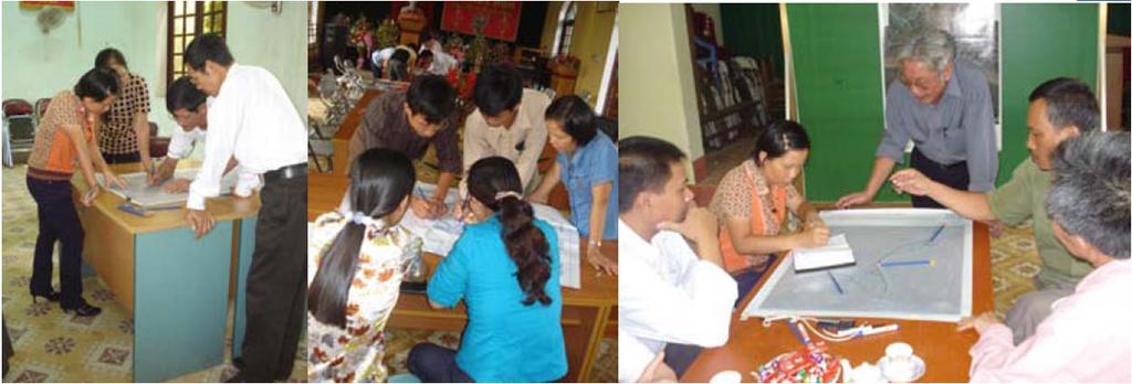
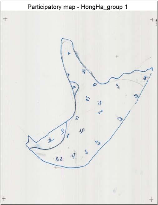
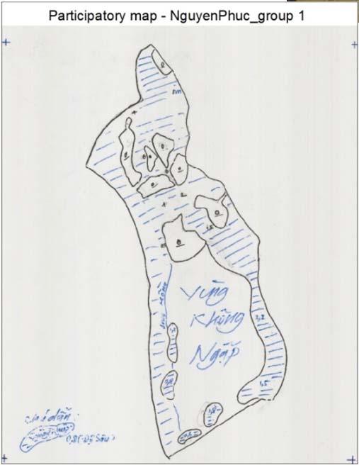
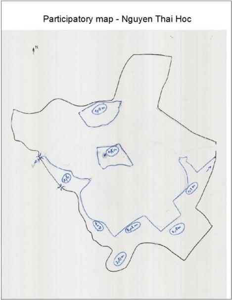
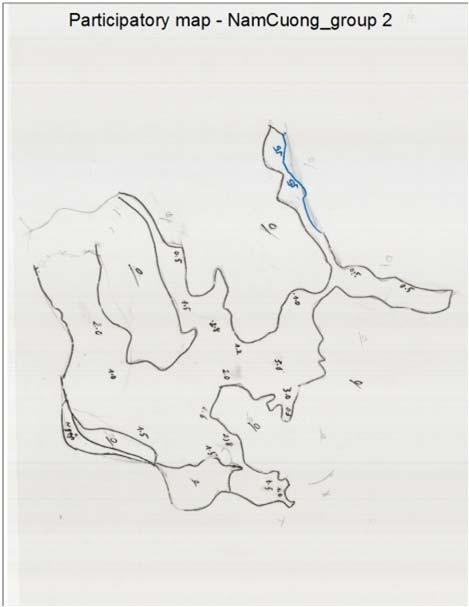
15 Vulnerabillity assessment: Community involvement 2008 flood extent and depth by key people

16 Flood Risk Example of a combined modelling/community based Flood risk map
17 Conclusion (1/2) Flood hazard assessment: focusing on factors that increase abnormal floods nowadays Riverine and local floods: heavy rains need attention in urban planning by aithe\orities, perception of risk by local community Flash-flood: strong influence of terraced fields and local topography need attention in farming practices
18 Conclusion Flood risk assessment for Yen Bai Local knowledge is useful in a data scared environment Drainage is problematic during high-intensity rains; Hazard mitigation is difficult and expensive; to achieve risk reduction, vulnerability must decrease (awareness and preparedness must increase) River flood: lowland along the Red river need to re-locate dwellers to other places, or creat Hazard mitigation (e.g. dike construction) may increase the hazard elsewhere (e.g. downstream).

19 Thank you very much for your attention!