Managing Forests for Snowpack Storage & Water Yield
|
|
|
- Caren McDaniel
- 5 years ago
- Views:
Transcription


1 Managing Forests for Snowpack Storage & Water Yield Roger Bales Professor & Director Sierra Nevada Research Institute UC Merced NASA-MODIS satellite image
2 NASA-MODIS satellite image Outline of talk Mountain hydrology Water security Precipitation & runoff Evapotranspiration & runoff Opportunities for better water information Water management opportunities
3 Much of the water supply for the semi-arid Western U.S. derives from mountain snowpacks Warming by +2 to +6 o C drives significant changes: rain-vs-snow storms * snowpack amounts * snowmelt timing * flood risk streamflow timing * low baseflows growing seasons * recharge? drier soil in summer Precipitation changes? Already observed (*)


4 Fast facts About 2/3 of the precipitation that falls on the Sierra Nevada is evaporated/transpired by vegetation & 1/3 runs out in rivers In an average year, the Sierra Nevada receives 27% of the state s annual precipitation & provides more than 60% of the state s consumptive use of water

5 Basic water balance Precipitation = Evapotranspiration + Runoff = +
6 Mountain hydrology fluxes evapotranspiration snowmelt precipitation infiltration Myth: We can, with a high degree of skill, estimate or predict the magnitude of these fluxes & reservoirs of water sublimation runoff ground & surface water exchange Reservoirs: Snowpack storage Soil-water storage
7 Mountain hydrology fluxes evapotranspiration precipitation snowmelt infiltration My biases: Improved predictions require better process understanding The basis for process understanding is new measurements Processes are coupled & best studied together runoff sublimation ground & surface water exchange Reservoirs: Snowpack storage Soil-water storage
8 NASA-MODIS satellite image Outline of talk Mountain hydrology Water security Precipitation & runoff Evapotranspiration & runoff Opportunities for better water information Water management opportunities
9 Making a water-secure world the three I s INFRASTRUCTURE to store, transport & treat water Stronger & moreadaptable INSTITUTIONS Better & moreaccessible INFORMATION Water security: the reliable availability of an acceptable quantity & quality of water for health, livelihoods & production, coupled w/ an acceptable level of water-related risks
10 Making a water-secure world the three I s INFRASTRUCTURE to store, transport & treat water Ecosystem services Stronger & moreadaptable INSTITUTIONS Better & moreaccessible INFORMATION Water is fundamental to sustainable ecosystem services. Water management therefore translates into managing ecosystem services, and must be a fundamental goal of virtually all such efforts.

11 Water security lies at the heart of adaptation to climate change Includes both: hard options to capture & control water soft tools to manage demand as well as increase supply, e.g. water allocation, conservation, efficiency & land-use planning General feeling in the water community that soft opportunities will be insufficient What California is doing: Planning for infrastructure Collaboration & integration in planning, management More information-intensive decision support Madden, The Beast
12 NASA-MODIS satellite image Outline of talk Mountain hydrology Water security Precipitation & runoff Evapotranspiration Opportunities for better water information Water management opportunities

13 Sierra Nevada precipitation & snow water equivalent (SWE) climatological estimate? in in >80 >

14 Most snowmelt comes from elevations above most measurement of precipitation or snowpack


15 Influence of +3 o C on SNOW vs RAIN More rain, less snow Earlier snowmelt More winter floods Historical, 0 to -3 o C Derived from UW s VIC model daily inputs, Bales et al., 2006
16 NASA-MODIS satellite image Outline of talk Mountain hydrology Water security Precipitation & runoff Evapotranspiration & runoff Opportunities for better water information Water management opportunities

17 Evapotranspiration (ET) across an elevation transect X Water-balance Et ( ) ET flux, mm yr -1 X X Elevation, m Lower elevation is water limited Higher elevation is cold limited Highest current ET in rain to rain-snow-transition region of mixed conifer forest year-round growth
18 Precip, mm inch in Increase in water yield w/ elevation, from rain to snow dominated Kings River basin Decreasing temperature Increasing snow fraction Decreasing vegetation Coarser soils Hunsaker et al., JAWRA 2012
19 3 o C 5 o F 50% more runoff in snow dominated vs. mixed rain-snow catchments Decreasing temperature Increasing snow fraction Decreasing vegetation Coarser soils 0.1 increase per 350 m (1150 ft) Implication for 2 o C warmer climate: Reduce runoff by 10-40% in mixed conifer forest (assuming ecosystems adapt)


20 How forest management is done will influence snow accumulation, snowmelt timing & water yield The knowledge base to inform adaptive management of Sierra Nevada forests is insufficient, given its value & cost
21 NASA-MODIS satellite image Outline of talk Mountain hydrology Water security Precipitation & runoff Evapotranspiration & runoff Opportunities for better water information Water management opportunities
22 Observations as a foundation for water security


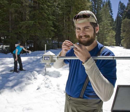
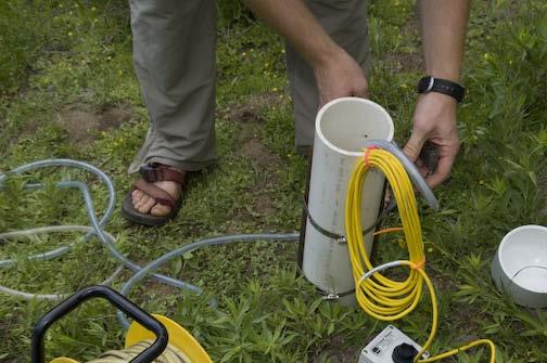
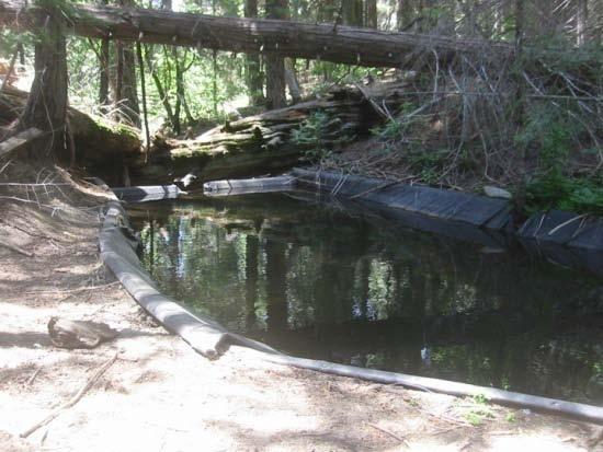
23 A new generation of integrated measurements eddy correlation embedded sensor networks lidar isotopes & ions satellite snowcover low-cost sensors sap flow sediment


24 Research infrastructure Southern Sierra CZO MODIS image Elev., m E-W transect of flux towers San Joaquin Experimental Range 400 m Soaproot Saddle 1100 m Shorthair CZO Creek P m 2000 m Main CZO site N-S transect of research catchments CZO

25 Basin-wide deployment of hydrologic instrument clusters American R. basin Network & integrate these sensors into a single spatial instrument for water-balance measurements. For both research & operations Strategically place low-cost sensors to get spatial estimates of snowcover, soil moisture & other water-balance components


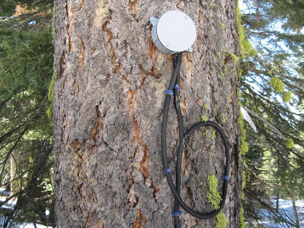
26 Wireless embedded sensor network nodes Sensor node Hopper node

27 Meteorological stations In cooperation w/ CA- DWR Data available on CDEC

28 Snow depth sensors


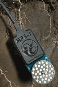
29 Wireless motes Soil moisture


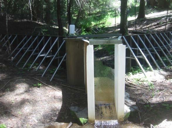
30 Stream stage & discharge R. Bales, UC Merced


31 Meadow piezometers & wells Chemical composition Levels and pressure

32 Sap flow Flux towers

33 Sierra Nevada fractional snow covered area (SCA) from MODIS satellite SCA is binned into 4 classes for ease of viewing Pixel size: 500 m Data available for 2000-present Jan 6, 2007
34 Jan 9 Merced basin SCA & snowmelt volume 2007
35 Jan 16 Merced basin SCA & snowmelt volume 2007
36 Feb 3 Merced basin SCA & snowmelt volume 2007

37 Mar 16 Merced basin SCA & snowmelt volume 2007
38 Apr 3 Merced basin SCA & snowmelt volume 2007
39 Apr 10 Merced basin SCA & snowmelt volume 2007
40 May 7 Merced basin SCA & snowmelt volume 2007
41 May 14 Merced basin SCA & snowmelt volume 2007
42 May 22 Merced basin SCA & snowmelt volume 2007
43 May 28 Merced basin SCA & snowmelt volume 2007
44 Jun 9 Merced basin SCA & snowmelt volume 2007
45 Jun 16 Merced basin SCA & snowmelt volume 2007
46 Jul 3 Merced basin SCA & snowmelt volume 2007
47 NASA-MODIS satellite image Outline of talk Mountain hydrology Water security Precipitation & runoff Evapotranspiration & runoff Opportunities for better water information Water management opportunities

48 Some implications of steep elevation gradients in ET & runoff for water resources Timing & amount of runoff are sensitive to small changes in temperature Forest management is important for water yield & the timing of snowmelt runoff Downstream beneficiaries have a stake in upstream watershed management Better measurement & process understanding are critical to realizing benefits of management actions
49 Envisioning a more water-secure future for California through better water information