OKLAHOMA CORPORATION COMMISSION OIL & GAS CONSERVATION DIVISION P.O. BOX OKLAHOMA CITY, OK (Rule 165:10-3-1) PERMIT TO DRILL
|
|
|
- Silvester Thomas
- 5 years ago
- Views:
Transcription
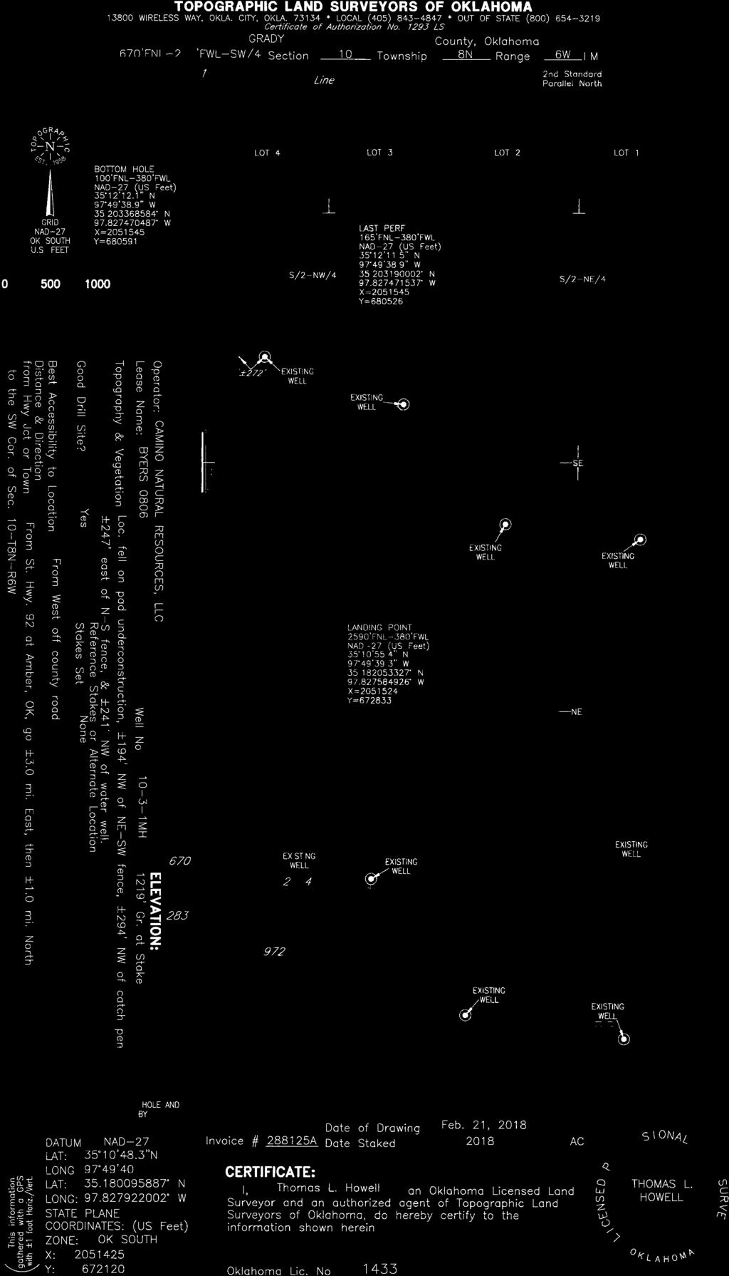
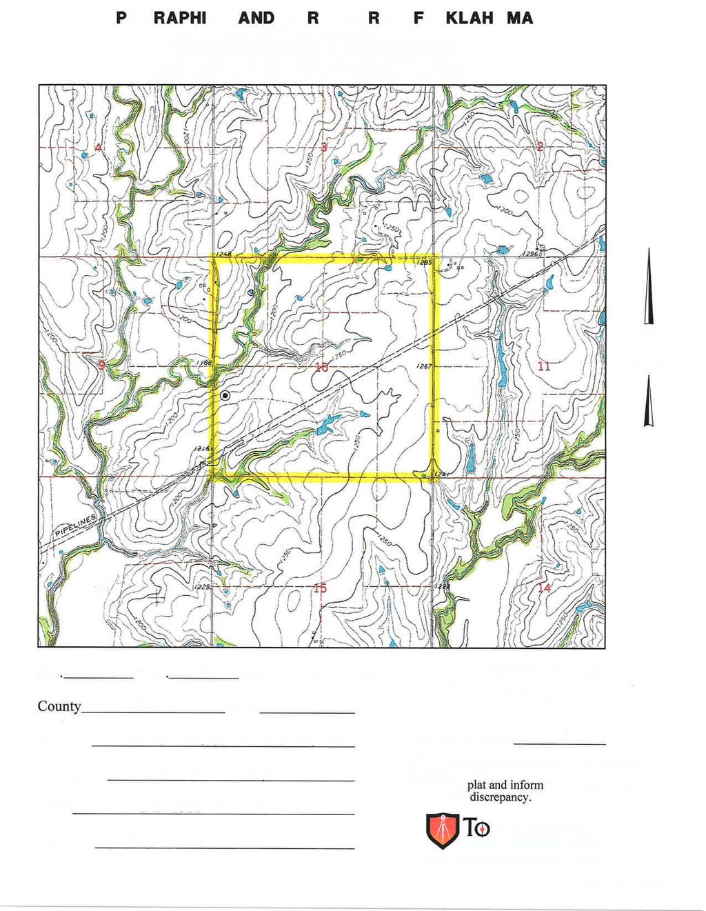
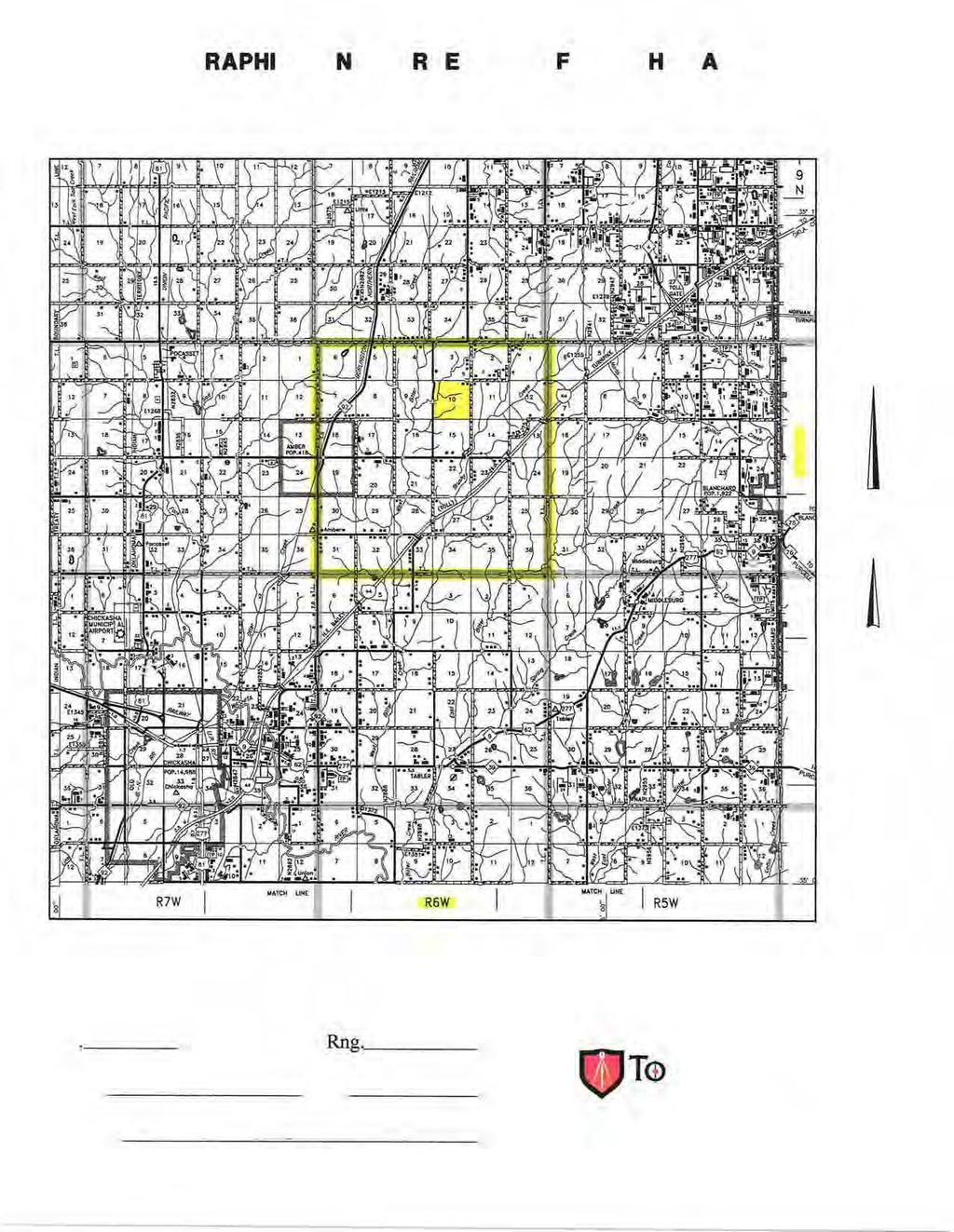
1 API NUMBER: 051 Horizontal Hole Oil & Gas OKLAHOMA CORPORATION COMMISSION OIL & GAS CONSERVATION DIVISION P.O. BOX OKLAHOMA CITY, OK (Rule 165:10-3-1) Approval Date: 03/29/2018 Expiration Date: 09/29/2018 PERMIT TO DRILL WELL LOCATION: Sec: 10 Twp: 8N Rge: 6W County: GRADY FEET FROM QUARTER: SPOT LOCATION: NW SW NW SW FROM SOUTH FROM WEST SECTION LINES: Lease Name: BYERS 0806 Well No: MH Well will be 283 feet from nearest unit or lease boundary. Operator Name: CAMINO NATURAL RESOURCES LLC Telephone: OTC/OCC Number: CAMINO NATURAL RESOURCES LLC TH ST STE 1000 DENVER, CO JESSE A. CAMPBELL & ASHLEY R. CAMPBELL 820 STATE HIGHWAY 92 TUTTLE OK Formation(s) (Permit Valid for Listed Formations Only): Name Depth Name Depth 1 MISSISSIPPIAN Spacing Orders: Location Exception Orders: Increased Density Orders: Pending CD Numbers: Special Orders: Total Depth: Ground Elevation: 1219 Surface Casing: 1500 Depth to base of Treatable Water-Bearing FM: 430 Under Federal Jurisdiction: PIT 1 INFORMATION No Fresh Water Supply Well Drilled: No Surface Water used to Drill: No Approved Method for disposal of Drilling Fluids: Type of Pit System: Type of Mud System: CLOSED Closed System Means Steel Pits WATER BASED Chlorides Max: 5000 Average: 3000 Is depth to top of ground water greater than 10ft below base of pit? Within 1 mile of municipal water well? N Wellhead Protection Area? N Pit is located in a Hydrologically Sensitive Area. Category of Pit: C Liner not required for Category: C Pit Location is BED AQUIFER Pit Location Formation: DUNCAN Y D. One time land application -- (REQUIRES PERMIT) PERMIT NO: H. SEE MEMO This permit does not address the right of entry or settlement of surface damages. The duration of this permit is SIX MONTHS, except as otherwise provided by Rule 165: Rule 165: (c) (7) (e) - The Operator shall give 24 Hours notice by telephone to the appropriate District Office of the Conservation Division as to when Surface Casing will be run. Page 1 of 3
2 PIT 2 INFORMATION Type of Pit System: CLOSED Closed System Means Steel Pits Type of Mud System: OIL BASED Chlorides Max: Average: Is depth to top of ground water greater than 10ft below base of pit? Within 1 mile of municipal water well? N Wellhead Protection Area? N Pit is located in a Hydrologically Sensitive Area. Category of Pit: C Liner not required for Category: C Pit Location is BED AQUIFER Pit Location Formation: DUNCAN Y HORIZONTAL HOLE 1 Sec 03 Twp 8N Rge 6W County GRADY Spot Location of End Point: NE NW NW NW Feet From: Feet From: Depth of Deviation: Radius of Turn: 477 Direction: 3 Total Length: 7758 Measured Total Depth: True Vertical Depth: NORTH 1/4 Section Line: 100 WEST 1/4 Section Line: End Point Location from Lease, Unit, or Property Line: 165 Notes: Category DEEP SURFACE CASING Description 3/22/ G71 - APPROVED; NOTIFY OCC FIELD INSPECTOR IMMEDIATELY OF ANY LOSS OF CIRCULATION OR FAILURE TO CIRCULATE CEMENT TO SURFACE ON ANY CONDUCTOR OR SURFACE CASING HYDRAULIC FRACTURING 3/22/ G71 - OCC 165: REQUIRES: 1) PRIOR TO COMMENCEMENT OF HYDRAULIC FRACTURING OPERATIONS FOR HORIZONTAL WELLS, NOTICE GIVEN FIVE BUSINESS DAYS IN ADVANCE TO OFFSET OPERATORS WITH WELLS COMPLETED IN THE SAME COMMON SOURCE OF SUPPLY WITHIN 1/2 MILE; 2) WITH NOTICE ALSO GIVEN 48 HOURS IN ADVANCE OF HYDRAULIC FRACTURING ALL WELLS TO BOTH THE OCC CENTRAL OFFICE AND LOCAL DISTRICT OFFICES, USING THE "FRAC NOTICE FORM" FOUND AT THE FOLLOWING LINK: OCCEWEB.COM/OG/OGFORMS.HTML; AND, 3) THE CHEMICAL DISCLOSURE OF HYDRAULIC FRACTURING INGREDIENTS FOR ALL WELLS TO BE REPORTED TO FRACFOCUS WITHIN 60 DAYS AFTER THE CONCLUSION THE HYDRAULIC FRACTURING OPERATIONS, USING THE FOLLOWING LINK: FRACFOCUS.ORG MEMO 3/22/ G71 - PITS 1 & 2 - CLOSED SYSTEM=STEEL PITS PER OPERATOR REQUEST, PIT 2 - OBM RETURNED TO VENDOR, CUTTINGS PERMITTED PER DISTRICT PENDING CD /28/ G58 - (640)(HOR) 3-8N-6W VAC MISS EXT MSSP COMPL. INT. NLT 660' FB REC 3/16/2018 (DUNN) This permit does not address the right of entry or settlement of surface damages. The duration of this permit is SIX MONTHS, except as otherwise provided by Rule 165: Rule 165: (c) (7) (e) - The Operator shall give 24 Hours notice by telephone to the appropriate District Office of the Conservation Division as to when Surface Casing will be run BYERS MH Page 2 of 3
3 Category PENDING CD PENDING CD PENDING CD SPACING Description 3/29/ G58 - (E.O.) 10 & 3-8N-6W EST MULTIUNIT HORIZONTAL WELL X MSSP, OTHER (10-8N-6W) X MSSP, OTHER (3-8N-6W) 66% 3-8N-6W 34% 10-8N-6W NO OP. NAMED REC 3/16/2018 (DUNN) 3/29/ G58 - (E.O.) 10 & 3-8N-6W X MSSP, OTHER (10-8N-6W) X MSSP, OTHER (3-8N-6W) COMPL. INT. (10-8N-6W) NCT 0' FNL, NCT 2640' FSL, NCT 330' FWL COMPL. INT. (3-8N-6W) NCT 0' FSL, NCT 165' FNL, NCT 330' FWL NO OP. NAMED REC 3/16/2018 (DUNN) 3/29/ G N-6W X MSSP 1 WELL NO OP. NAMED REC 3/16/2018 (DUNN) 3/29/ G58 - (E.O.)(640)(HOR) 10-8N-6W EXT OTHER EST MSSP COMPL. INT. NLT 660' FB This permit does not address the right of entry or settlement of surface damages. The duration of this permit is SIX MONTHS, except as otherwise provided by Rule 165: Rule 165: (c) (7) (e) - The Operator shall give 24 Hours notice by telephone to the appropriate District Office of the Conservation Division as to when Surface Casing will be run. Page 3 of 3

4


5
6

7

8