2018 Annual Inspection Report
|
|
|
- Maurice Shelton
- 5 years ago
- Views:
Transcription
1 2018 Annual Inspection Report for Compliance with the Coal Combustion Residuals Rule (40 CFR Part 257) Valmont Station 1800 North 63 rd Street Boulder, Colorado January 18, 2019
2 Table of Contents Certification... ii 1 Introduction Site Inspection Review of Available Information Visual Inspection Changes in Geometry Approximate CCR Volume Appearance of Structural Weakness Changes Affecting Stability or Operation... 4 Appendices Appendix A: Landfill Site Maps Valmont Station Page i

3
4 1 Introduction On April 17, 2015 the U.S. Environmental Protection Agency (EPA) published regulations under Subtitle D of the Resources Conservation and Control Act (RCRA) meant to control the safe disposal of coal combustion residuals (CCR) generated by coal fired electric utilities. The rule defines a set of requirements for the disposal and handling of CCR within CCR units (defined as either landfills or surface impoundments). As specified in 40 CFR (b), Existing and new CCR landfills and any lateral expansion of a CCR landfill must be inspected on a periodic basis by a qualified professional engineer to ensure that the design, construction, operation, and maintenance of the CCR unit is consistent with recognized and generally accepted good engineering standards. Valmont Station has one (1) CCR landfill subject to the inspection requirements. This is the fourth annual inspection report for the existing Valmont CCR landfill. This report must be completed and placed into the facility operating record no later than January 18, The requirements of the annual inspection include: A review of available information regarding the status and condition of the CCR unit (B)(1)(i), A visual inspection of the CCR unit to identify signs of distress or malfunction (B)(1)(ii), An inspection report that includes the following: o Changes in geometry since the last inspection (B)(2)(i) o Approximate volume of CCR in unit at time of inspection (B)(2)(ii) o Appearance of actual or potential structural weakness of the CCR unit (B)(2)(iii) o Any other changes which may have affected the stability or operation of the CCR unit since the last inspection (B)(2)(iv) 2 Site Inspection In accordance with (b)(ii), a site inspection of the Valmont CCR Landfill was conducted by an independent Professional Engineer on November 27, The inspection was conducted by Brian Brown of HDR Engineering Inc. (HDR) and Jennifer McCarter, Rebecca Sturgeon, Luke Wolfe, and Marie Vagher of PSCo. This site inspection was performed well in advance of the CCR submittal deadline to ensure that the inspection was completed prior to snow covering the ground. The weather during the site visit was sunny with temperatures around 60 degrees Fahrenheit. The site was free of snow cover. Valmont Station Page 1
5 3 Review of Available Information Numerous documents pertaining to the site operation and structural integrity were reviewed including: 1. Engineering Design and Operation Plan (EDOP), Revision January, 2009 by PSCo. PSCo reported no change in document and still operating under this document. Document not reviewed again since the document is unchanged. 2. Cell D and E Design Modification and Closure Plan, March 2018, by HDR Engineering Inc. 3. Available Weekly CCR Landfill Inspection Forms (per Section (a)). 4. Topographic Map of site post 2018 fill activity at CCR landfill, flown date , by Great Lakes Environmental & Infrastructure. Figure date Review of the above documents did not contain any indications of continuing operational, safety, or structural concerns regarding the CCR landfill. 4 Visual Inspection The site inspection included walking or driving the entire perimeter of the landfill, the interior access road, and select intermediate elevations along the exterior fill embankment. The site inspection included an evaluation of the following landfill features: 1. landfill side slope toe of slope; 2. Landfill side slope benches; 3. Riprapped stormwater drainage conveyance channels on southwest side (Areas Q-1 and A-3) of landfill and east end (Area B-1) of landfill; and 4. Most recent CCR fill areas (Area D-1, C-1, and E-1). The following are the findings of the site inspection: The landfill side slopes showed no signs of operational or functional concerns. Areas of erosion are noted below: The landfill side slopes along the southwest and west side of Area Q-1 have minimal vegetation cover. Despite the presence of regular benches to slow the stormwater flow, these areas show signs of rill and some gulley erosion. These areas require continued monitoring and may require additional topsoil cover and revegetation to minimize future rill erosion. Valmont Station Page 2
6 The western side slopes of the landfill also had numerous prairie dog burrows. These burrows should continue to be monitored as they can impact local slope stability and become conduits for stormwater flow. PSCo reported that it has implemented measures to minimize prairie dog burrow impacts in the soil cover, with limited success. PSCo has indicated that ongoing maintenance will be implemented to will continue to address this issue. The southern slopes of Area Q-1 had some apparently inactive rill erosion near the top of the slope that should be monitored. The inactive southeastern and eastern side slopes have a continuous grade that generally ranges from approximately 2 horizontal to 1 vertical (2H:1V) to 3H:1V with some steeper sections, no benches, and a dense stand of vegetation. o There is a riprap run down on the east slope (Area B-1) with no visible erosion or stability concerns. o The south slope is an area where sloughing and localized instability is visible about one quarter down from the top plateau (against a degraded line of straw bales). This area is heavily vegetated but should be monitored for future sloughing or movement. The consensus of the HDR engineers was to continue monitoring the area. No additional movement, including surface tension cracks, or sloughing was observed since the prior annual inspection. The interior access road leading to the active landfill fill area has steep soil embankments. Minimal erosion was observed during the inspection indicating that the access road embankments do not receive enough surface water run-on flow to create excessive rill or gulley erosion. The roadway embankments should be monitored for localized or general sloughing, though none was observed. The north facing landfill embankment of areas D1, E1 and B1 are graded to a uniform slope. This slope does not have benches but does have a dense cover of vegetation. No erosion or sloughing was noted. Area D-1 areas impacted by construction were observed to be soil covered but no vegetation was established by the time of inspection. Areas within D-1, particularly to the east end of the cell, that were not disturbed by construction were soil and vegetation covered. No ash disposal or compaction was observed during the site visit. There was no standing water observed in the ash cells. 5 Changes in Geometry The Federal CCR Rules require that site geometry changes be identified since the last inspection. The site footprint remains the same since the prior site visit. The material placed in the landfill, comprised of CCR, coal, or a mix of CCR/coal/soil, filled the former borrow excavation in cell D-1, a depth of roughly 32 feet, and placed material over the majority of cell D-1 to a depth of up to 10 feet above the 2017 D-1 cell surface elevations. The cell D-1 surface slopes were predominately modified to positively drain north and east across D-1 discharging via overland flow onto E-1 then B-1 and leaving the landfill area via the designed stormwater Valmont Station Page 3
7 rundown on the east end of the landfill. The far southern edge of cell D-1 continued to surface flow south via overland flow. There was a minor amount of CCR/coal placed in the Emergency Ash Holding Area in cell C-1 in This area was historically used to temporarily stockpile CCR when access to the active pit landfill area was inaccessible due to road conditions. Approximately up to 4 feet of CCR/coal fill was placed in the holding area and then covered with a minimum of 2 feet of soil cover and graded to create positive surface drainage to the east. No structural or safety concerns were observed from the continued site filling. The Landfill is expected to be idle in 2019, and receive additional waste in The landfill was temporarily closed at end of 2018, and is fully covered with permanent and intermediate soil cover. 6 Approximate CCR Volume The CCR within the disposal area as of November 2015 was estimated by PSCo based on volume estimates that utilized topographic surveys, disposal records, ash generation volumes, and extrapolation of generation volumes. The total combined volume of CCR deposited within the landfill through November 2017 is estimated to be 1,415,710 cubic yards. The additional CCR deposited from December 2017 through November 2018 is estimated to be 94,248 CY, assuming one cubic yard of CCR/coal material equates to one ton. The total CCR volume in the landfill through November 2018 is estimated to be 1,509,960 CY. Disposal in 2018 included material from the removal of CCR in and around the CCR impoundments (Ash Ponds 3A and 3B). This cleanup was completed in The landfill is expected to be idle during 2019 and receive additional approved non-ccr waste from a scheduled on-site project in Appearance of Structural Weakness Based on the site inspection, no apparent or potential structural weaknesses were observed. Per Section 4 above, continued monitoring and minor repairs should be implemented as needed to address rill erosion, prairie dog burrows, and apparent localized sloughing, and prevent development of areas of structural weakness. 8 Changes Affecting Stability or Operation The Federal CCR Rule requires that changes that affect site stability or operation be identified since the last inspection. Since the last annual inspection, there were no observed nor reported operational changes or site conditions that indicate issues of stability or safety. Valmont Station Page 4
8 Appendix A Landfill Site Maps Attachments: CCR Jan 2019 Annual Report Fig 1 CCR Jan 2019 Annual Report Fig 2 CCR Jan 2019 Annual Report Fig 3 Valmont Station Page A

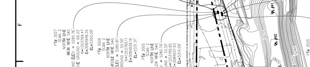
9 OH ELECTRICAL NORTH PROPERTY BOUNDRY MONUMENT CONTROL, TYP~N2v41DISTRIBUTION UNE-~~ MW-7 I MW-6 i,/ / MONUMENT CONTROL SCHEDULE MODIRED NAD83 MODIFIED NAD83 CONTROL POINT NUMBER(1992) NORTHING (1992) EASTINO ELEVATION VICINITY PLAN SCALE: NIS LEGEND A-1 A-2 A-3 B 1 C-1 D-1 ~V E-1 Q-1 Q-2 MONUMENT TRANSMISSION UNE GW ~ONffORWE~ AREA TABLE AREA (AC) A-1 A-2 A-3 B-1 C-1 D-1 E-1 Q-1 Q ESTIMATED STORAGE CAPACI W VOLUME UFE (CY) o 0 o 0 85, , , , o CLOSURE DATE 7/09 7/09 7/09 12/08 7/1# 7/13 7/13 12/11 12/11 7/14. Red text box added by HDR for Jan 2019 CCR annual Report. CCR Jan 2019 Annual Report Figure 1 GRAPHIC SCALE (IN FEET) FIG O-1 DATE:

10


11 CCR fill area cell D1. Fill depths range from 32' in former soil borrow excavation shown in earlier topographic figures with up to 10' of fill in remaining area. Landfill soil cover placed over short-term CCR storage area. Limited CCR/coal placed prior to cover, up to 4' in depth. Red boxed text added by HDR as part of Site CCR Landfill Annual Inspection, reporting date January 2019 CCR Annual Report Figure 3. DRAWN BY: 6025 S. Quebec Street, Suite 300 Centennial, CO Telephone: Fax: H. WHEELER SCALE: 1" = 150' DATE: 11/15/18 NORTH SHEET NUMBER XCEL ENERGY - VALMONT ASH IMPOUNDMENT CLOSURE ASH DISPOSAL FACILITY FINAL GRADE 1 BOULDER, CO OF 1