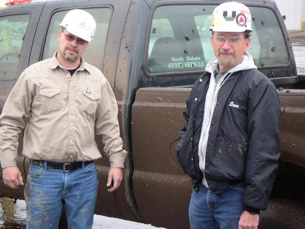
Lignite Mining and Reclamation Process. Kayla Torgerson The Coteau Properties Co.
|
|
|
- Marsha Robertson
- 5 years ago
- Views:
Transcription

1 Lignite Mining and Reclamation Process Kayla Torgerson The Coteau Properties Co. 1

2 Presentation Overview History of Regulation The Process of Mining and Reclamation Harmony Lake 2
3 Which of the following are not currently active lignite coal mines in North Dakota? 1) The Center Mine 12.5% 12.5% 12.5% 12.5% 12.5% 12.5% 12.5% 12.5% 2) The Gascoyne Mine 3) The Freedom Mine 4) Indian Head Mine 5) The Falkirk Mine 6) Both 1 and 5 7) Both 2 and 4 8) Both 1 and 4 3
4 Which of the following are not currently active lignite coal mines in North Dakota? 1) The Center Mine 2) The Gascoyne Mine 3) The Freedom Mine 4) Indian Head Mine 5) The Falkirk Mine 6) Both 1 and 5 7) Both 2 and 4 8) Both 1 and 4 4


5 History of Regulation Increased surface mining in the early 1900s led to passage of the first reclamation laws in the 1930s in the East. 5


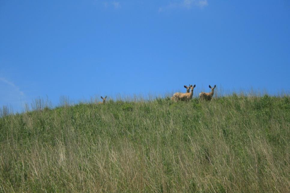
6 Some 14,000 acres of abandoned mined lands, or orphan spoils, still exist in North Dakota. Much of this land is managed by the Game & Fish Department for wildlife habitat and hunting. 6

7 Regulatory Developments North Dakota Strip Mined Lands Act Grade spoils to accommodate farm machinery Save and replace topsoil Mined lands must be returned to 100% of pre-mine productivity 7

8 Early reclamation: rolling landscape, seeded grasses Orphan spoils Look closely and you can read the history of North Dakota reclamation in the landscape. 8
9 1977 Passage of the Federal Surface Mining Control and Reclamation Act (SMCRA) US DEPARTMENT OF INTERIOR other bureaus, offices (if PSC fails) Office of Surface Mining oversight NORTH DAKOTA PUBLIC SERVICE COMMISSION Reclamation Division other divisions REGULATES NORTH DAKOTA SURFACE COAL MINING 9


10 10 HOW DO YOU DETERMINE WHERE TO ESTABLISH A COAL MINE?
11 11
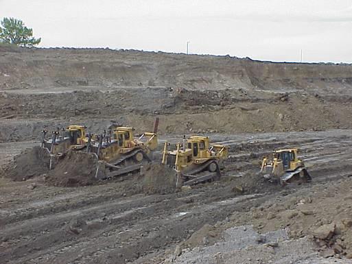
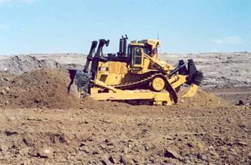
12 12
13 13

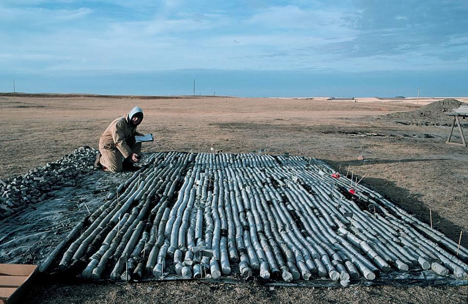
14 Coal Exploration Drill Holes In North Dakota 14
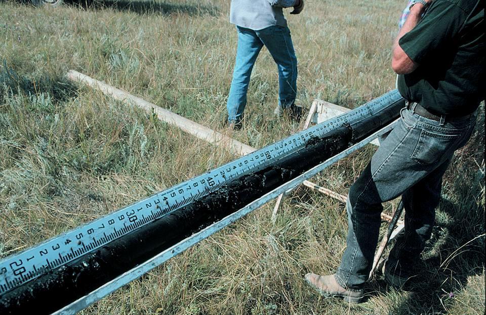
15 Criteria For Economically Recoverable Coal Minimum 10 feet cumulative thickness in not more than two beds (no bed less than 2.5 feet thick) More than 25 feet beneath the surface Not more than 175 feet beneath the surface Stripping ratio of not more than 10:1 (i.e., not more than 10 feet of overburden per every foot of coal) 15
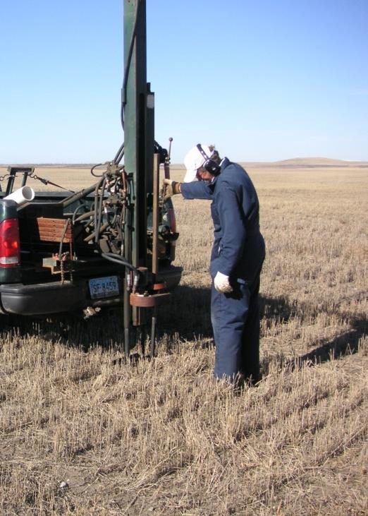
16 Coal Seams and Overburden Overburden A-1 Seam A-2 Seam Interburden B Seam Parting 10 feet thick 4 feet thick 30 feet thick 16
17 Economic to Mine 150 feet thick Overburden A-1 Seam 100 feet thick 10 feet thick 4 feet thick A-2 Seam Interburden Parting B Seam 18 feet thick 17
18 Not Economic to Mine 200 feet thick Overburden A-1 Seam 150 feet thick 10 feet thick 4 feet thick A-2 Seam Interburden Parting B Seam 18 feet thick 18

19 Mining methods 19
20 The Process of Mining and Reclamation 1. Obtain mining rights and regulatory approvals 2. Establish water management 3. Remove topsoil and subsoil 4. Move overburden and remove coal 5. Grade spoils to approximate original contour 6. Spread subsoil and topsoil and seed with grasses or crops 7. Obtain bond release 20

21 Step 1. Obtain Mining Rights and Regulatory Approvals 21


22 Secure Leases or Ownership... 22


23 ...And Collect Baseline Data... Geological drilling is done to characterize the extent and quality of coal and the type and amount of overburden that must be moved. 23 An exploration permit must be obtained. Drill hole sites are reclaimed immediately after completion.

24 Pre-mine soils, vegetation, land use and wildlife surveys are conducted. 24


25 Surface and ground water quantity and quality are assessed. This includes stockponds, wetlands, springs and water wells. 25


26 Cultural resource surveys identify sites that must be studied further, mitigated, or avoided completely. 26


27 All this information, plus proposed mining and reclamation plans, is compiled into a mining permit application... and submitted to the Public Service Commission for their review and approval. 27

28 Required warning signs are placed on the permit area perimeter immediately after permit approval. 28


29 Step 2. Establish Water Management The first earthwork activity is to build sediment ponds downstream from areas to be mined. 29


30 Water running into sediment ponds is allowed to settle until it meets EPA effluent standards, consisting of total suspended solids, ph and iron. 30

31 Once water meets these standards, it can be discharged off the mine and down its normal drainage. 31


32 The size and shape of a sediment pond depends on the size of its contributing watershed and the topography of the pond site. 32


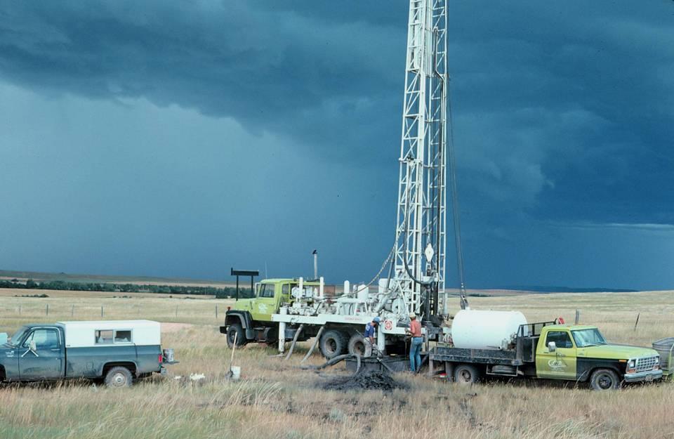
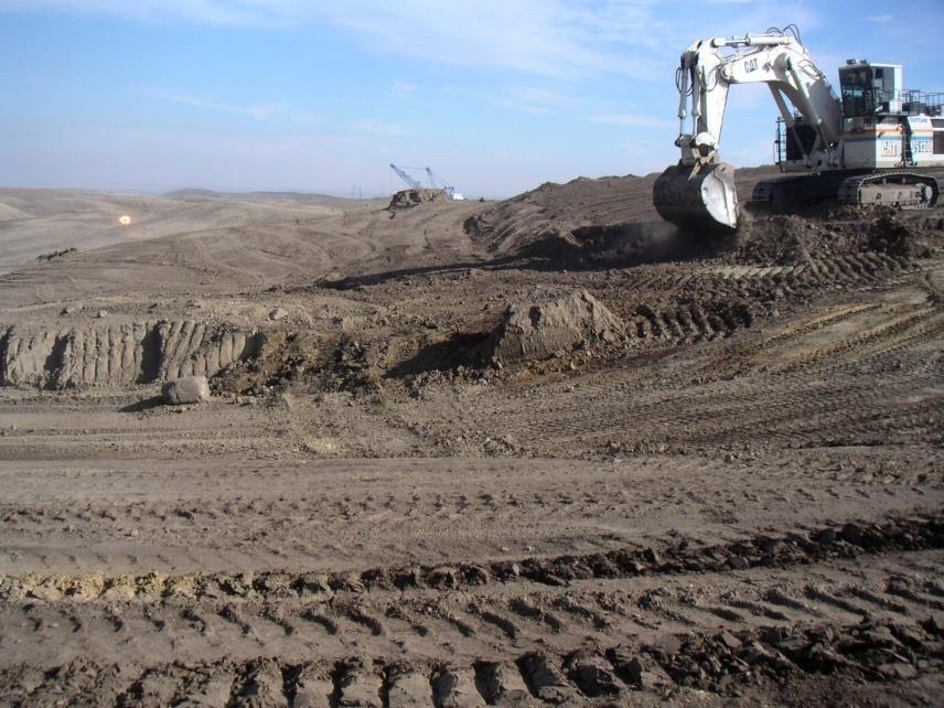
33 Some ponds have a valve for discharging and some must be pumped... regardless of the discharge method, all water leaving the mine is sampled for compliance. 33

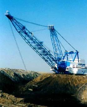
34 Sediment ponds must be cleaned out occasionally. 34


35 Step 3. Remove Topsoil and Subsoil 35

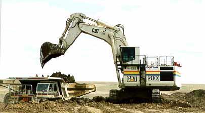
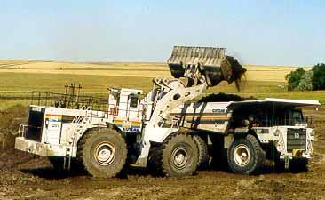
36 Soil is hauled with tractor-scrapers, shovels, backhoes or loaders into haul trucks. 36

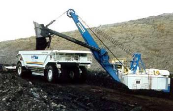
37 37 Soil monuments are staked islands of topsoil and subsoil left after stripping, to tell how much soil has been removed.


38 Soil is either directly spread on reclaimed land or stockpiled for later respread. All soil stockpiles are numbered and identified by owner. 38
39 39 All operations are inspected regularly by the Public Service Commission.

40 Step 4. Move Overburden and Remove Coal 40

41 All mines in North Dakota use electric powered draglines as their primary overburden removal machine. 41


42 Supplemental earthmoving machinery includes large electric loading shovels, hydraulic excavators and front end loaders, combined with large haul trucks. These have advantages in flexibility. Spoil can be placed exactly where desired, reducing final reclamation grading costs. 42


43 After the coal is exposed it is cleaned and ripped or blasted to prepare it for loading. 43


44 Coal is then loaded out of the pit using electric loading shovels or front end loaders 44


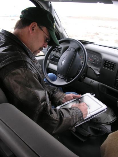
45 Coal is hauled to the truck dump where it is crushed and delivered to the customer. 45
46 How many years after coal removal does the law require land to be graded and seeded? 1) 1 2) 3 3) % 33.3% 33.3%

47 How many years after coal removal does the law require land to be graded and seeded? 1) 1 2) 3 3) 5 47

48 Step 5. Grade Spoils 48

49 Active pit Direction of mining Recently cast spoil Previously graded spoils Finished and ready for soil spreading Spoils are normally graded toward the active pit. 49

50 Spoils must be graded to the approximate original contour of the land prior to mining. Graded spoils must be approved by the PSC before soil can be spread over them. 50

51 Step 6. Spread Subsoil and Topsoil and Seed With Grasses and Crops 51

52 52 Soil may be hauled by tractor-scrapers or trucks. Soil dumped by trucks is spread with bulldozers. Soil depth stakes are set or a GPS system is used to control soil depths.


53 Topsoil is tilled and a seedbed is prepared. Rocks are picked off reclaimed land prior to seeding. 53


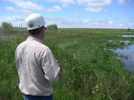
54 Native grasses are seeded on areas reclaimed to prairie. 54


55 Local farmers plant and harvest crops on reclaimed cropland. In North Dakota mining companies do not farm reclaimed croplands. 55


56 56 Some reclaimed lands are seeded to a hay crop of alfalfa and grasses.

57 Overburden removal Soil stockpiles Soil removal Spoils grading Sediment pond Spread soil and plant seed Coal removal 57
58 How many acres have North Dakota coal mines released from bond? 1) Over 5,000 2) Over 12,000 3) Over 20, % 33.3% 33.3%
59 How many acres have North Dakota coal mines released from bond? 1) Over 5,000 2) Over 12,000 3) Over 20,000 21,877 59

60 Once the land is reclaimed, it is managed to achieve bond release. According to law, the land must be monitored for at least ten years after it has been seeded before bond release can be obtained. Step 7. Achieve Bond Release 60


61 Surface water and ground water are monitored closely. Wildlife is also monitored closely. Wildlife habitat removed during mining must be replaced, and the number of wildlife on reclaimed land must compare to adjacent, undisturbed areas. 61


62 Local farmers seed crops on reclaimed land with the goal to meet or exceed premine production. Native grassland is managed to obtain production, cover, and diversity necessary to restore North Dakota prairie. 62


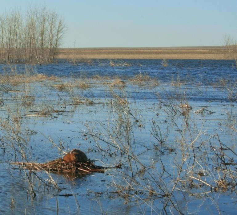
63 The ultimate goal is to make the land just as or more productive than it was pre-mining. Final bond release can then be granted by the Public Service Commission, and the land can be removed from the permit and sold or traded. 63

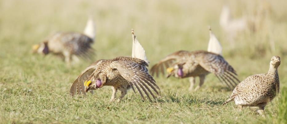
64 Harmony Lake A unique reclamation opportunity is presented at the Freedom Mine 64

65 Freedom Mine The project was developed at The Coteau Properties Company Freedom Mine near Beulah, North Dakota 65
66 Pre-Mining Conditions in 1991 direction of Coteau s mining direction of historic mining abandoned final highwall & pit coal to be mined orphan spoils 66
67 Double Final Pit Created newly cast spoils final pit from Coteau s mining final pit from historic mining orphan spoils 67
68 Standard Reclamation as Required by Regulations topography graded to approximate original contour coal has been removed; spoil hauled back in to tie to abandoned orphan spoils 68
69 Alternative Reclamation: Development of Harmony Lake spoil not hauled in to fill double final pit; lake and surrounding landscape shaped to a wildlife management area, under a recreation land use 69

70 Submerged and exposed rock islands, a winding shoreline with steep banks, and earthen fishing piers enhance the lake fishery 70


71 The Game and Fish Department stocks the lake with largemouth bass, bluegills, minnows, and trout. 71


72 On August 28, 2003, the Public Service Commission approved final bond release for the Harmony Lake Wildlife Management Area. 72


73 Harmony Lake from dragline to fishing line! 73