BASIC ASSESSMENT FOR THE PROPOSED ELECTRICITY EXPANSION PROJECT AND SEKGAME SWITCHING STATION AT THE SISHEN MINE, NORTHERN CAPE PROVINCE
|
|
|
- Juliet Ada Evans
- 5 years ago
- Views:
Transcription
")
1 BASIC ASSESSMENT FOR THE PROPOSED ELECTRICITY EXPANSION PROJECT AND SEKGAME SWITCHING STATION AT THE SISHEN MINE, NORTHERN CAPE PROVINCE Prepared for: Department of Environmental Affairs Prepared by: Exigo Sustainability (Pty) Ltd 0
2 TABLE OF CONTENTS SECTION A: ACTIVITY INFORMATION 4 1. PROJECT DESCRIPTION 4 2. FEASIBLE AND REASONABLE ALTERNATIVES 5 a. Site alternatives 6 b. Lay-out alternatives 7 c. Technology alternatives 7 d. Other alternatives (e.g. scheduling, demand, input, scale and design alternatives) 7 e. No-go alternative 7 3. PHYSICAL SIZE OF THE ACTIVITY 8 a. Indicate the physical size of the preferred activity/technology as well as alternative activities/technologies (footprints): 8 b. Indicate the size of the alternative sites or servitudes (within which the above footprints will occur): 8 4. SITE ACCESS 8 5. LOCALITY MAP 8 6. LAYOUT / ROUTE PLAN 9 7. SENSITIVITY MAP 9 8. SITE PHOTOGRAPHS 9 9. FACILITY ILLUSTRATION ACTIVITY MOTIVATION APPLICABLE LEGISLATION, POLICIES AND/OR GUIDELINES WASTE, EFFLUENT, EMISSION AND NOISE MANAGEMENT WATER USE ENERGY EFFICIENCY 19 SECTION B: SITE/AREA/PROPERTY DESCRIPTION GRADIENT OF THE SITE LOCATION IN LANDSCAPE GROUNDWATER, SOIL AND GEOLOGICAL STABILITY OF THE SITE GROUNDCOVER SURFACE WATER LAND USE CHARACTER OF SURROUNDING AREA CULTURAL/HISTORICAL FEATURES SOCIO-ECONOMIC CHARACTER BIODIVERSITY 26 SECTION C: PUBLIC PARTICIPATION ADVERTISEMENT AND NOTICE DETERMINATION OF APPROPRIATE MEASURES ISSUES RAISED BY INTERESTED AND AFFECTED PARTIES COMMENTS AND RESPONSE REPORT AUTHORITY PARTICIPATION CONSULTATION WITH OTHER STAKEHOLDERS 34 SECTION D: IMPACT ASSESSMENT IMPACTS THAT MAY RESULT FROM THE PLANNING AND DESIGN, CONSTRUCTION, OPERATIONAL, DECOMMISSIONING AND CLOSURE PHASES AS WELL AS PROPOSED MANAGEMENT OF IDENTIFIED IMPACTS AND PROPOSED MITIGATION MEASURES ENVIRONMENTAL IMPACT STATEMENT 37 Section E. Recommendation of practitioner 39 Section F: Appendixes 40 Appendix A: Maps 41 Appendix B: Photographs 48 1
3 Appendix C: Facility illustration(s) 49 Appendix D: Specialist reports (including terms of reference) 51 Appendix E: Public Participation 52 Appendix F: Impact Assessment 53 Appendix G: Environmental Management Programme (EMPr) 65 Appendix H: Details of EAP and expertise 66 Appendix I: Specialist s declaration of interest 67 Appendix J: Additional Information 68 LIST OF FIGURES Figure 1: Vegetation Map 30 Figure 2: Locality of the Sishen Mine 42 Figure 3: Locality Map - Preferred Alternative 43 Figure 4: Locality Map showing Alternatives 44 Figure 5: Layout / Route Plan: Preferred 45 Figure 6: Layout / Route Plan for Alternatives 46 Figure 7: Sensitivity Map 47 Figure 8: Sekgame Project Layout 49 Figure 9: Switching Yard Facility Illustration 50 2
, as amended. Kindly note that: 1.")
4 File Reference Number: Application Number: Date Received: (For official use only) Basic assessment report in terms of the Environmental Impact Assessment Regulations, 2014, promulgated in terms of the National Environmental Management Act, 1998 (Act No. 107 of 1998), as amended. Kindly note that: 1. This basic assessment report is a standard report that may be required by a competent authority in terms of the EIA Regulations, 2014 and is meant to streamline applications. Please make sure that it is the report used by the particular competent authority for the activity that is being applied for. 2. This report format is current as of 08 December It is the responsibility of the applicant to ascertain whether subsequent versions of the form have been published or produced by the competent authority 3. The report must be typed within the spaces provided in the form. The size of the spaces provided is not necessarily indicative of the amount of information to be provided. The report is in the form of a table that can extend itself as each space is filled with typing. 4. Where applicable tick the boxes that are applicable in the report. 5. An incomplete report may be returned to the applicant for revision. 6. The use of not applicable in the report must be done with circumspection because if it is used in respect of material information that is required by the competent authority for assessing the application, it may result in the rejection of the application as provided for in the regulations. 7. This report must be handed in at offices of the relevant competent authority as determined by each authority. 8. No faxed or ed reports will be accepted. 9. The signature of the EAP on the report must be an original signature. 10. The report must be compiled by an independent environmental assessment practitioner. 11. Unless protected by law, all information in the report will become public information on receipt by the competent authority. Any interested and affected party should be provided with the information contained in this report on request, during any stage of the application process. 12. A competent authority may require that for specified types of activities in defined situations only parts of this report need to be completed. 13. Should a specialist report or report on a specialised process be submitted at any stage for any part of this application, the terms of reference for such report must also be submitted. 14. Two (2) colour hard copies and one (1) electronic copy of the report must be submitted to the competent authority. 15. Shape files (.shp) for maps must be included in the electronic copy of the report submitted to the competent authority. 3
5 SECTION A: ACTIVITY INFORMATION Has a specialist been consulted to assist with the completion of this section? YES NO If YES, please complete the form entitled Details of specialist and declaration of interest for the specialist appointed and attach in Appendix I. 1. PROJECT DESCRIPTION a) Describe the project associated with the listed activities applied for Kumba Iron Ore, Sishen Iron Ore Pty Ltd plans to develop additional electricity distribution infrastructure at their Sishen Iron Ore Mine in the Northern Cape Province. The proposed electricity distribution infrastructure will tie in with existing electricity distribution infrastructure at Sishen Mine and involve the following: 80 meter wide servitude from Ferrum Substation along the N14 road to the proposed new Sekgame Switching Station South of the Shooting Range Servitude Distribution lines (132kV overhead lines) Switching yard (Sekgame) The switching yard will be approximately 110 meters from the N14 Road, 250 meters long and 100 meters wide. Eskom will be responsible for the construction, operation and maintenance of the infrastructure. b) Provide a detailed description of the listed activities associated with the project as applied for Listed activity as described in GN 734, 735 and 736 Example: GN 734 Item xx xx): The construction of a bridge where such construction occurs within a watercourse or within 32 metres of a watercourse, measured from the edge of a watercourse, excluding where such construction will occur behind the development setback line. GNR 983 of 2014 Activity No 11 The development of facilities or infrastructure for the transmission and distribution of electricity- (i) outside urban areas or industrial complexes with a capacity of more than 33 but less than 275 kilovolts; GNR 983 of 2014 Activity No 27 The clearance of an area of 1 hectares or more, but less than 20 hectares of indigenous vegetation, except where such clearance of indigenous vegetation is required for- (i) the undertaking of a linear activity; or (ii) maintenance purposes undertaken in accordance with a maintenance management Plan GNR 983 of 2014 Activity No 47 The expansion of facilities or infrastructure for the transmission and distribution of electricity where Description of project activity A bridge measuring 5 m in height and 10m in length, no wider than 8 meters will be built over the Orange river The Project involves the development of electricity distribution lines (132kV overhead lines) The clearance of indigenous vegetation would be required for the development of the Sekgame Switching Yard In this project, the development footprint of the electricity distribution infrastructure at Sishen Mine 4
6 the expanded capacity will exceed 275 kilovolts and the development footprint will increase. GNR 985 of 2014 Activity No 12 The clearance of an area of 300 square metres or more of indigenous vegetation except where such clearance of indigenous vegetation is required for maintenance purposes undertaken in accordance with a maintenance management plan. (d) In Northern Cape: i. Within any critically endangered or endangered ecosystem listed in terms of section 52 of the NEMBA 'or prior to the publication of such a list, within an area that has been identified as critically endangered in the National Spatial Biodiversity Assessment 2004; ii. Within critical biodiversity areas identified in bioregional plans; iii. Within the littoral active zone or 100 metres inland from high water mark of the sea or an estuary, whichever distance is the greater, excluding where such removal will occur behind the development setback line on erven in urban areas; or iv. On land, where, at the time of the coming into effect of this Notice or thereafter such land was zoned open space, conservation or had an equivalent zoning. will increase. Clearance of Vegetation will be required for the construction of the Distribution lines and the switching yard. 2. FEASIBLE AND REASONABLE ALTERNATIVES alternatives, in relation to a proposed activity, means different means of meeting the general purpose and requirements of the activity, which may include alternatives to (a) (b) (c) (d) (e) (f) the property on which or location where it is proposed to undertake the activity; the type of activity to be undertaken; the design or layout of the activity; the technology to be used in the activity; the operational aspects of the activity; and the option of not implementing the activity. Describe alternatives that are considered in this application as required by Appendix 1 (3)(h), Regulation Alternatives should include a consideration of all possible means by which the purpose and need of the proposed activity (NOT PROJECT) could be accomplished in the specific instance taking account of the interest of the applicant in the activity. The no-go alternative must in all cases be included in the assessment phase as the baseline against which the impacts of the other alternatives are assessed. The determination of whether site or activity (including different processes, etc.) or both is appropriate needs to be informed by the specific circumstances of the activity and its environment. After receipt of this report the, competent authority may also request the applicant to assess additional alternatives that could possibly accomplish the purpose and need of the proposed activity if it is clear that realistic alternatives have not been considered to a reasonable extent. 5
7 The identification of alternatives should be in line with the Integrated Environmental Assessment Guideline Series 11, published by the DEA in Should the alternatives include different locations and lay-outs, the co-ordinates of the different alternatives must be provided. The co-ordinates should be in degrees, minutes and seconds. The projection that must be used in all cases is the WGS84 spheroid in a national or local projection. a. Site alternatives Alternative 1 (preferred alternative) Description Lat (DDMMSS) Long (DDMMSS) The preferred alternative is illustrated in Figure 3 and Figure 5 in Appendix A. The route is from the existing Ferrum Substation to the N14, South along the N14 (between the highway and existing Shooting Range Servitude) to the proposed Sekgame Switching Station position south of the Shooting Range servitude. The approximate centre of the Switching Yard position is given: 27 46'33.14"S 23 3'55.96"E Alternative 2 Description Lat (DDMMSS) Long (DDMMSS) Alternative 2 (Figure 4 and Figure 6 Appendix A): it was considered to move the position of the preferred Sekgame Switching station as indicated. This however interferes with possible future plans on the existing Shooting Range Servitude. Alternative coordinates for the switching station (approximate centre) is given '41.41"S 23 3'58.68"E Alternative 3 Description Lat (DDMMSS) Long (DDMMSS) Alternative 3 (Figure 4 and Figure 6 Appendix A) involved an extension of the infrastructure to the south, to just north of the Gamagara River. It was subsequently identified that this option holds no economic merit for the developer at this stage. The swithching yard position in the case of this alternative would be the same as for the preferred alternative In the case of linear activities: 27 46'33.14"S Alternative: Latitude (S): Longitude (E): Alternative S1 (preferred) Starting point of the activity "S "E Middle/Additional point of the activity 27 46'21.27"S 23 4'2.53"E End point of the activity 27 46'31.38"S 23 3'51.84"E Alternative S2 (if any) Starting point of the activity "S "E Middle/Additional point of the activity 27 44'18.68"S 23 4'10.79"E End point of the activity 27 46'46.07"S 23 4'0.68"E Alternative S3 (if any) Starting point of the activity "S "E Middle/Additional point of the activity 27 46'31.38"S 23 3'51.84"E End point of the activity 27 49'6.64"S 23 2'9.19"E 23 3'55.96"E 6
8 For route alternatives that are longer than 500m, please provide an addendum with co-ordinates taken every 250 meters along the route for each alternative alignment. Please refer to Appendix J In the case of an area being under application, please provide the co-ordinates of the corners of the site as indicated on the lay-out map provided in Appendix A of this form. b. Lay-out alternatives Alternative 1 (preferred alternative) Description Lat (DDMMSS) Long (DDMMSS) As described above Alternative 2 Description Lat (DDMMSS) Long (DDMMSS) As described above Alternative 3 Description Lat (DDMMSS) Long (DDMMSS) As described above c. Technology alternatives Alternative 1 (preferred alternative) Best Available Technology will be used as per the Eskom Guidelines Alternative 2 Alternative 3 d. Other alternatives (e.g. scheduling, demand, input, scale and design alternatives) Alternative 1 (preferred alternative) Alternative 2 Alternative 3 e. No-go alternative The implementation of the No-Go alternative (or the no-development option) would mean that the site will be left in its current state. The status quo of the site would thus be maintained, and none of the identified potential impacts would be realized. However, none of the project benefits would be realized either and the Sishen Mine and other Mine s in the area are likely to experience shortages in electricity rendering them unable to continue with mining and mining expansion projects that require electricity. Thus the direct impacts of implementing the no-development option lies primarily in the employment opportunities associated with the construction and maintenance of the infrastructure that would not be realized. Cumulatively, not implementing the proposed project could have significant negative effects on surrounding industries (including Sishen Mine) and all of the Socio-economic benefits associated with those projects requiring electricity. Paragraphs 3 13 below should be completed for each alternative. 7
9 3. PHYSICAL SIZE OF THE ACTIVITY a. Indicate the physical size of the preferred activity/technology as well as alternative activities/technologies (footprints): Alternative: Size of the activity: Alternative A1 1 (preferred activity alternative) m 2 Alternative A2 (if any) m 2 Alternative A3 (if any) m 2 or, for linear activities: Alternative: Alternative A1 (preferred activity alternative) Alternative A2 (if any) Alternative A3 (if any) Length of the activity: Approximately 5800 m Approximately 4000 m Approximately m b. Indicate the size of the alternative sites or servitudes (within which the above footprints will occur): Alternative: Size of the site/servitude: Alternative A1 (preferred activity alternative) Approximately m² Alternative A2 (if any) Approximately m² Alternative A3 (if any) Approximately m² 4. SITE ACCESS Does ready access to the site exist? YES NO If NO, what is the distance over which a new access road will be built m Describe the type of access road planned: The site (servitude) is adjacent to the N14 Highway. The switching yard will be approximately 110 m away from the N14 Highway. The site can be accessed from the Highway to the east of the site, or from Sishen mine areas to the west of the site. Include the position of the access road on the site plan and required map, as well as an indication of the road in relation to the site. 5. LOCALITY MAP An A3 locality map must be attached to the back of this document, as Appendix A. The scale of the locality map must be relevant to the size of the development (at least 1: For linear activities of more than 25 kilometres, a smaller scale e.g. 1: can be used. The scale must be indicated on the map.). The map must indicate the following: an accurate indication of the project site position as well as the positions of the alternative sites, if any; indication of all the alternatives identified; 1 Alternative A. refer to activity, process, technology or other alternatives. 8
10 closest town(s;) road access from all major roads in the area; road names or numbers of all major roads as well as the roads that provide access to the site(s); all roads within a 1km radius of the site or alternative sites; and a north arrow; a legend; and locality GPS co-ordinates (Indicate the position of the activity using the latitude and longitude of the centre point of the site for each alternative site. The co-ordinates should be in degrees and decimal minutes. The minutes should have at least three decimals to ensure adequate accuracy. The projection that must be used in all cases is the WGS84 spheroid in a national or local projection). 6. LAYOUT / ROUTE PLAN A detailed site or route plan(s) must be prepared for each alternative site or alternative activity. It must be attached as Appendix A to this document. The site or route plans must indicate the following: the property boundaries and numbers of all the properties within 50 metres of the site; the current land use as well as the land use zoning of the site; the current land use as well as the land use zoning each of the properties adjoining the site or sites; the exact position of each listed activity applied for (including alternatives); servitude(s) indicating the purpose of the servitude; a legend; and a north arrow. 7. SENSITIVITY MAP The layout/route plan as indicated above must be overlain with a sensitivity map that indicates all the sensitive areas associated with the site, including, but not limited to: watercourses; the 1:100 year flood line (where available or where it is required by DWS); ridges; cultural and historical features; areas with indigenous vegetation (even if it is degraded or infested with alien species); and critical biodiversity areas. The sensitivity map must also cover areas within 100m of the site and must be attached in Appendix A. 8. SITE PHOTOGRAPHS Colour photographs from the centre of the site must be taken in at least the eight major compass directions with a description of each photograph. Photographs must be attached under Appendix B to this report. It must be supplemented with additional photographs of relevant features on the site, if applicable. 9
11 9. FACILITY ILLUSTRATION A detailed illustration of the activity must be provided at a scale of at least 1:200 as Appendix C for activities that include structures. The illustrations must be to scale and must represent a realistic image of the planned activity. The illustration must give a representative view of the activity. 10. ACTIVITY MOTIVATION Motivate and explain the need and desirability of the activity (including demand for the activity): 1. Is the activity permitted in terms of the property s existing land use rights? YES NO Please explain There is existing electricity distribution infrastructure along portions of the road and it is thus assumed that expansion is permitted. Eskom will verify the servitude land use rights prior to construction commencing. 2. Will the activity be in line with the following? (a) Provincial Spatial Development Framework (PSDF) YES NO Please explain The PSDF mentions plans to expand electricity infrastructure from Ferrum to Groblershoop, and emphasizes the importance of mining in the Province. Therefore though the project is more specifically focussed on addressing the needs of the Sishen Mine, it is definitely not in contrast with Provincial Planning. (b) Urban edge / Edge of Built environment for the area YES NO Please explain The project will be an extension / expansion of existing facilities in the immediate surroundings and due to its close proximity to Sishen Mine will not be in contrast to existing development types. (c) Integrated Development Plan (IDP) and Spatial Development Framework (SDF) of the Local Municipality (e.g. would the approval of this application compromise the integrity of the existing approved and credible municipal IDP and SDF?). YES NO Please explain The Gamagara Local Municipality IDP and SDF also recognize the importance of mining in the area, and specifically the Sishen Mine (d) Approved Structure Plan of the Municipality YES NO Please explain The Gamagara Local Municipality IDP and SDF also recognize the importance of mining in the area, and specifically the Sishen Mine (e) An Environmental Management Framework (EMF) adopted by the Department (e.g. Would the approval of this application compromise the integrity of the existing environmental management priorities for the area and if YES NO Please explain so, can it be justified in terms of sustainability considerations?) The project is located within the existing Mining Right Area of the Sishen Mine, and immediately adjacent to the existing N14 Highway, and can therefore not be said to be in contrast with development and environmental priorities of the area. (f) Any other Plans (e.g. Guide Plan) YES NO Please explain 10
12 3. Is the land use (associated with the activity being applied for) considered within the timeframe intended by the existing approved SDF agreed to by the relevant environmental authority (i.e. is the proposed development in line with the projects and programmes identified as priorities within the credible IDP)? YES NO Please explain The project time-frames align with planning authorities intention to develop electricity infrastructure. Planning authorities recognize the value of the Sishen Mine in terms of its economic and socio-economic contribution to the area. 4. Does the community/area need the activity and the associated land use concerned (is it a societal priority)? (This refers to the strategic as well as local level (e.g. development is a national priority, but within a specific local context it could be inappropriate.) YES NO Please explain The activity will facilitate continuation of mining and beneficiation projects at Sishen Mine where a great number of members from surrounding communities work. Though the project is perhaps not truly a national priority (because of its intention to supply electricity to areas within Sishen Mine), it can certainly be said that the project is a priority for Sishen. 5. Are the necessary services with adequate capacity currently available (at the time of application), or must additional capacity be created to cater for the development? (Confirmation by the relevant Municipality in this regard must be attached to the final Basic Assessment Report as Appendix I.) YES NO Please explain Sufficient and appropriate electricity distribution infrastructure is not currently available at Sishen Mine, which is why this project was initiated. 6. Is this development provided for in the infrastructure planning of the municipality, and if not what will the implication be on the infrastructure planning of the municipality (priority and placement of services and opportunity costs)? (Comment by the relevant Municipality in this regard must be attached to the final Basic Assessment Report as Appendix I.) YES NO Please explain The project is not specifically provided for in the infrastructure planning of the Municipality, and is aimed at addressing the needs of the Sishen Mine Primarily. As the project will be constructed, operated and maintained by Eskom, there will be no implication for the Municipality. 7. Is this project part of a national programme to address an issue of national concern or importance? YES NO Please explain The project is mainly aimed at addressing the needs of the Sishen Mine in terms of electricity distribution 8. Do location factors favour this land use (associated with the activity applied for) at this place? (This relates to the contextualisation of the proposed land use on this site within its broader context.) The proposed project is compatible with its immediate surroundings YES NO Please explain 11
13 9. Is the development the best practicable environmental option for this land/site? YES NO Please explain The design, proposed construction and operation / maintenance of this infrastructure will be according to Eskom s Best Practice Guidelines and best practicable environmental options on the proposed site which is compatible with the proposed project. 10. Will the benefits of the proposed land use/development outweigh the negative impacts of it? YES NO Please explain In the Impact Assessment section of this report we see that the environmental impacts associated with this project are manageable and acceptable. Implementation of this project will enable additional projects at Sishen Mine and all of the socio-economic benefits associated with the Mine operations. 11. Will the proposed land use/development set a precedent for similar activities in the area (local municipality)? YES NO Please explain The project is aimed at addressing the increased electricity distribution needs for projects within the Sishen Mine boundary and is unlikely to set a precedent where similar needs do not exist. 12. Will any person s rights be negatively affected by the proposed activity/ies? YES NO Please explain The project and associated activities will not affect anyone s rights as the project is located within the existing Sishen Mining Rights area, in existing servitudes designated for this purpose (relating to the distribution lines) and immediately adjacent to the Road (making alternative land uses on this particular property undesirable). 13. Will the proposed activity/ies compromise the urban edge as defined by the local municipality? YES NO Please explain The proposed activity involves the development of electricity distribution infrastructure for the Sishen Mine and is immediately adjacent to the Sishen Mine. 14. Will the proposed activity/ies contribute to any of the 17 Strategic Integrated Projects (SIPS)? YES NO Please explain SIP 5 refers to the Saldanha-Northern Cape development corridor and includes (among others) Expansion of iron ore mining production and beneficiation. This project is not related to expansion of mining or beneficiation at the Sishen Iron Ore Mine but is supporting infrastructure to facilitate such further developments in future. 15. What will the benefits be to society in general and to the local communities? Please explain Construction personnel will be sourced from the nearest communities where possible, contributing to some job creation (even though temporary there is an opportunity for skills development). Additionally, the indirect benefits arising from this project lies in the continuation and expansion of activities at Sishen Mine, which is associated with significant socio-economic benefit for the communities in the vicinity (as an employer) and the country (as a producer of iron ore). 16. Any other need and desirability considerations related to the proposed activity? Explained above Please explain 17. How does the project fit into the National Development Plan for 2030? Please explain The project does not address the priorities of the National Development Plan directly but does have the aim of facilitating the expansion of projects within the existing Sishen Mine. 12
14 18. Please describe how the general objectives of Integrated Environmental Management as set out in section 23 of NEMA have been taken into account. The general objective of integrated environmental management, and the way in which the project takes these into account are set out below: (a) promote the integration of the principles of environmental management set out in section 2 into the making of all decisions which may have a significant effect on the environment; The principles of IEM are discussed below (b) identify, predict and evaluate the actual and potential impact on the environment, socioeconomic conditions and cultural heritage, the risks and consequences and alternatives and options for mitigation of activities, with a view to minimising negative impacts, maximising benefits, and promoting compliance with the principles of environmental management set out in section 2; Refer to the Impact Assessment presented in Section D of this Report (c) ensure that the effects of activities on the environment receive adequate consideration before actions are taken in connection with them; This process of applying for environmental authorization through conducting an environmental impact assessment and public consultation process (d) ensure adequate and appropriate opportunity for public participation in decisions that may affect the environment; For details of the public participation process, refer to Section C of this Report (e) ensure the consideration of environmental attributes in management and decision-making which may have a significant effect on the environment; and This process of applying for environmental authorization through conducting an environmental impact assessment along with relevant specialist studies (refer to Appendix D) addresses this objective (f) identify and employ the modes of environmental management best suited to ensuring that a particular activity is pursued in accordance with the principles of environmental management set out in section 2. Environmental Management stipulations are given in detail in the Environmental Management Programme Report in Appendix G. 13
15 19. Please describe how the principles of environmental management as set out in section 2 of NEMA have been taken into account. The following Principles apply 2. (1) The principles set out in this section apply throughout the Republic to the actions of all organs of state that may significantly affect the environment The relevant department is the decision-making authority and application is made to them through the relevant and prescribed process for environmental authorization. (2) Environmental management must place people and their needs at the forefront of its concern, and serve their physical, psychological, developmental, cultural and social interests equitably. The proposed project will not negatively impact on any person s interests (3) Development must be socially, environmentally and economically sustainable. The proposed development will ensure the sustained development of the Sishen Mine, along with the socio-economic benefits associated therewith (4) (a) Sustainable development requires the consideration of all relevant factors including the following: (i) That the disturbance of ecosystems and loss of biological diversity are avoided, or, where they cannot be altogether avoided, are minimised and remedied; Refer to the measures stipulated in the EMPR and the specialist ecological report (ii) that pollution and degradation of the environment are avoided, or, where they cannot be altogether avoided, are minimised and remedied; Refer to the measures stipulated in the EMPR (iii) that the disturbance of landscapes and sites that constitute the nation s cultural heritage is avoided, or where it cannot be altogether avoided, is minimised and remedied; Refer to the measures stipulated in the EMPR and the specialist archaeological report (iv) that waste is avoided, or where it cannot be altogether avoided, minimised and re-used or recycled where possible and otherwise disposed of in a responsible manner; Refer to the measures stipulated in the EMPR (v) that the use and exploitation of non-renewable natural resources is responsible and equitable, and takes into account the consequences of the depletion of the resource; (vi) that the development, use and exploitation of renewable resources and the ecosystems of which they are part do not exceed the level beyond which their integrity is jeopardised; Not relevant to the proposed development as no non-renewable resources will be depleted and only very limited natural resources such as water for workers during the construction phase are associated with the proposed development (vii) that a risk-averse and cautious approach is applied, which takes into account the limits of current knowledge about the consequences of decisions and actions; and (viii) that negative impacts on the environment and on people s environmental rights be anticipated and prevented, and where they cannot be altogether prevented, are minimised and remedied. This environmental impact assessment process addresses the above 2 points, especially considering that the precautionary principle is adapted throughout the impact assessment. (b) Environmental management must be integrated, acknowledging that all elements of the environment are linked and interrelated, and it must take into account the effects of decisions on all aspects of the environment and all people in the environment by pursuing the selection of the best practicable environmental option. To this end, this environmental impact assessment has considered all available alternatives to arrive at the preferred alternative and apply for environmental authorization for the development proposal. 14
16 (c) Environmental justice must be pursued so that adverse environmental impacts shall not be distributed in such a manner as to unfairly discriminate against any person, particularly vulnerable and disadvantaged persons. (d) Equitable access to environmental resources, benefits and services to meet basic human needs and ensure human well-being must be pursued and special measures may be taken to ensure access thereto by categories of persons disadvantaged by unfair discrimination. Environmental impacts associated with the proposed development are shown to be limited and manageable and extremely unlikely to lead to any discrimination, or to have any effect on another s access to environmental resources or benefits. (e) Responsibility for the environmental health and safety consequences of a policy, programme, project, product, process, service or activity exists throughout its life cycle. Eskom s standard Health and Safety requirements will apply (f) The participation of all interested and affected parties in environmental governance must be promoted, and all people must have the opportunity to develop the understanding, skills and capacity necessary for achieving equitable and effective participation, and participation by vulnerable and disadvantaged persons must be ensured. Please refer to Section C of this report for details on the public participation process followed and which is still ongoing. (g) Decisions must take into account the interests, needs and values of all interested and affected parties, and this includes recognising all forms of knowledge, including traditional and ordinary knowledge. The Competent Authority will make decisions regarding this project (h) Community wellbeing and empowerment must be promoted through environmental education, the raising of environmental awareness, the sharing of knowledge and experience and other appropriate means. Environmental awareness training is stipulated in the EMPR (i) The social, economic and environmental impacts of activities, including disadvantages and benefits, must be considered, assessed and evaluated, and decisions must be appropriate in the light of such consideration and assessment. Please refer to the Impact Assessment, Section D (j) The right of workers to refuse work that is harmful to human health or the environment and to be informed of dangers must be respected and protected. It is not anticipated that the work associated with the development proposal will be harmful as the EIA Process is completed in terms of the NEMA and Eskom s Health and Safety Policies will also apply. (k) Decisions must be taken in an open and transparent manner, and access to information must be provided in accordance with the law. All relevant stakeholders will be granted access to this report and appendices thereto (l) There must be intergovernmental co-ordination and harmonisation of policies, legislation and actions relating to the environment. A copy of this report has also been forwarded to other Government Departments, refer to Section C point 5. (m) Actual or potential conflicts of interest between organs of state should be resolved through conflict resolution procedures. No conflicts have been identified as yet. (n) Global and international responsibilities relating to the environment must be discharged in the national interest. (o) The environment is held in public trust for the people, the beneficial use of environmental 15
17 resources must serve the public interest and the environment must be protected as the people s common heritage. (p) The costs of remedying pollution, environmental degradation and consequent adverse health effects and of preventing, controlling or minimising further pollution, environmental damage or adverse health effects must be paid for by those responsible for harming the environment. It is not anticipated that the proposed development will cause significant harm to the environment. (q) The vital role of women and youth in environmental management and development must be recognised and their full participation therein must be promoted. The public participation process includes notification of all potentially interested and affected parties including women and youth. (r) Sensitive, vulnerable, highly dynamic or stressed ecosystems, such as coastal shores, estuaries, wetlands, and similar systems require specific attention in management and planning procedures, especially where they are subject to significant human resource usage and development pressure. The proposed development site is not particularly sensitive or vulnerable please refer to the Ecological Report in Appendix D. 11. APPLICABLE LEGISLATION, POLICIES AND/OR GUIDELINES List all legislation, policies and/or guidelines of any sphere of government that are applicable to the application as contemplated in the EIA regulations, if applicable: Title of legislation, policy or guideline The National Environmental Management Act (107 of 1998) (as amended) Environmental Impact Assessment Regulations Listing Notice 1 Government Notice No. R 544 Listing Notice 3 Government Notice No. R 546 National Forests Act (Act 84 of 1998) (NFA) The National Heritage Resources Act (Act 25 of 1999) (NHRA) Integrated Management: Environmental Conservation of Agricultural Resources Act (Act No. 43 of 1983 Applicability to the project Requires environmental authorization for Listed Activities Requires environmental authorization for Listed Activities Requires environmental authorization for Listed Activities Requires environmental authorization for Listed Activities Potential for protected trees on site to be retained or application made to DAFF is removal of these trees is unavoidable. Heritage resources present on site layout to be adjusted to avoid these resources, or Phase 2 assessment to be completed To ensure sustainable development and responsible environmental management takes place refer to previous section for detailed discussion Potential for alien invasive species to be present on site to be removed in accordance with Administering authority Date Department of 1998 Environmental Affairs (DEA). & Northern Cape Department of Environment & Nature Conservation (DENC) DEA & DENC 2014 DEA & DENC 2010 DEA & DENC 2010 Department Agriculture, and Forestry of Fisheries 1998 The South African 1999 Heritage Resources Agency (SAHRA) and their provincial offices DEA 1992 Department Agriculture of
18 Integrated Development Plan (IDP) Gamagara Local Municipality John Taolo Gaetsewe District Municipality IDP John Taolo Gaetsewe District Municipality Spatial Development Framework (SDF) CARA and DWA Guidelines The project should not be in contradiction with local development policies and plans. Gamagara Municipality Local John Taolo Gaetsewe District Municipality John Taolo Gaetsewe District Municipality 2013/ WASTE, EFFLUENT, EMISSION AND NOISE MANAGEMENT a) Solid waste management Will the activity produce solid construction waste during the construction/initiation YES NO phase? If YES, what estimated quantity will be produced per month? Insignificant m 3 How will the construction solid waste be disposed of (describe)? To be disposed of by Eskom who will be responsible for the construction of the infrastructure. Where will the construction solid waste be disposed of (describe)? Likely taken off-site by road truck and disposed of at registered landfill by specialist contractor or disposed of at Sishen Mine s Landfill. Will the activity produce solid waste during its operational phase? YES NO If YES, what estimated quantity will be produced per month? m 3 How will the solid waste be disposed of (describe)? If the solid waste will be disposed of into a municipal waste stream, indicate which registered landfill site will be used. Where will the solid waste be disposed of if it does not feed into a municipal waste stream (describe)? If the solid waste (construction or operational phases) will not be disposed of in a registered landfill site or be taken up in a municipal waste stream, then the applicant should consult with the competent authority to determine whether it is necessary to change to an application for scoping and EIA. Can any part of the solid waste be classified as hazardous in terms of the NEM:WA? YES NO If YES, inform the competent authority and request a change to an application for scoping and EIA. An application for a waste permit in terms of the NEM:WA must also be submitted with this application. Is the activity that is being applied for a solid waste handling or treatment facility? YES NO If YES, then the applicant should consult with the competent authority to determine whether it is necessary to change to an application for scoping and EIA. An application for a waste permit in terms of the NEM:WA must also be submitted with this application. 17
19 b) Liquid effluent Will the activity produce effluent, other than normal sewage, that will be disposed of in a municipal sewage system? YES NO If YES, what estimated quantity will be produced per month? m 3 Will the activity produce any effluent that will be treated and/or disposed of on site? YES NO If YES, the applicant should consult with the competent authority to determine whether it is necessary to change to an application for scoping and EIA. Will the activity produce effluent that will be treated and/or disposed of at another facility? If YES, provide the particulars of the facility: Facility name: Contact person: Postal address: Postal code: Telephone: Cell: Fax: YES NO Describe the measures that will be taken to ensure the optimal reuse or recycling of waste water, if any: Very little water will be present on site: Potable water for construction workers will be provided. Some water may be required for mixing of concrete and general construction activities. This will be sourced either from the Mine or from the Local Municipality. c) Emissions into the atmosphere Will the activity release emissions into the atmosphere other that exhaust emissions YES NO and dust associated with construction phase activities? If YES, is it controlled by any legislation of any sphere of government? YES NO If YES, the applicant must consult with the competent authority to determine whether it is necessary to change to an application for scoping and EIA. If NO, describe the emissions in terms of type and concentration: Some dust may be generated by construction activities. Dust suppression via watering truck will be implemented on site if necessary. d) Waste permit Will any aspect of the activity produce waste that will require a waste permit in terms of the NEM:WA? YES NO If YES, please submit evidence that an application for a waste permit has been submitted to the competent authority e) Generation of noise Will the activity generate noise? YES NO If YES, is it controlled by any legislation of any sphere of government? YES NO 18
20 Describe the noise in terms of type and level: Generally construction activities have the potential to generate noise. Construction will be limited to normal working hours to minimize the disturbance that construction-related noise could cause. The proposed development is adjacent to an existing operating mine and National Highway and the environment is not considered extremely noise sensitive. No significant Noise will be generated during the operational phase of the development. 13. WATER USE Please indicate the source(s) of water that will be used for the activity by ticking the appropriate box(es): Municipal Water board Groundwater River, stream, dam or lake Other The activity will not use water If water is to be extracted from groundwater, river, stream, dam, lake or any other natural feature, please indicate the volume that will be extracted per month: litres Does the activity require a water use authorisation (general authorisation or water use license) from the Department of Water Affairs? YES NO If YES, please provide proof that the application has been submitted to the Department of Water Affairs. Very little water will be present on site: Potable water for construction workers will be provided. Some water may be required for mixing of concrete and general construction activities. This will be sourced either from the Mine or from the Local Municipality. 14. ENERGY EFFICIENCY Describe the design measures, if any, which have been taken to ensure that the activity is energy efficient: None Describe how alternative energy sources have been taken into account or been built into the design of the activity, if any: None 19
21 SECTION B: SITE/AREA/PROPERTY DESCRIPTION Important notes: 1. For linear activities (pipelines, etc) as well as activities that cover very large sites, it may be necessary to complete this section for each part of the site that has a significantly different environment. In such cases please complete copies of Section B and indicate the area, which is covered by each copy No. on the Site Plan. Section B Copy No. (e.g. A): 1 2. Paragraphs 1-6 below must be completed for each alternative. 3. Has a specialist been consulted to assist with the completion of this section? YES NO If YES, please complete the form entitled Details of specialist and declaration of interest for each specialist thus appointed and attach it in Appendix I. All specialist reports must be contained in Appendix D. Property description/physi cal address: Current land-use zoning as per local municipality IDP/records: Province Northern Cape District John Taolo Gaetsewe District Municipality Municipality Local Municipality Gamagara Local Municipality Ward Number(s) 6 Farm name and Kathu number Portion number Sekgame 461 SG Code Re Where a large number of properties are involved (e.g. linear activities), please attach a full list to this application including the same information as indicated above. The site is located next to the N14 Highway in the servitude. The property falls within the Sishen Mine s Mining Right Area. In instances where there is more than one current land-use zoning, please attach a list of current land use zonings that also indicate which portions each use pertains to, to this application. Is a change of land-use or a consent use application required? YES NO 20
22 1. GRADIENT OF THE SITE Indicate the general gradient of the site. Alternative S1: Flat 1:50 1:20 1:20 1:15 1:15 1:10 1:10 1:7,5 1:7,5 1:5 Steeper than 1:5 Alternative S2 (if any): Flat 1:50 1:20 1:20 1:15 1:15 1:10 1:10 1:7,5 1:7,5 1:5 Steeper than 1:5 Alternative S3 (if any): Flat 1:50 1:20 1:20 1:15 1:15 1:10 1:10 1:7,5 1:7,5 1:5 Steeper than 1:5 2. LOCATION IN LANDSCAPE Indicate the landform(s) that best describes the site: 2.1 Ridgeline 2.4 Closed valley 2.7 Undulating plain / low hills 2.2 Plateau 2.5 Open valley 2.8 Dune 2.3 Side slope of hill/mountain 2.6 Plain 2.9 Seafront 2.10 At sea 3. GROUNDWATER, SOIL AND GEOLOGICAL STABILITY OF THE SITE Is the site(s) located on any of the following? Alternative S1: Alternative S2 (if any): Alternative S3 (if any): Shallow water table (less than 1.5m deep) YES NO YES NO YES NO Dolomite, sinkhole or doline areas YES NO YES NO YES NO Seasonally wet soils (often close to water bodies) YES NO YES NO YES NO Unstable rocky slopes or steep slopes with loose soil YES NO YES NO YES NO Dispersive soils (soils that dissolve in water) YES NO YES NO YES NO Soils with high clay content (clay fraction more than 40%) YES NO YES NO YES NO Any other unstable soil or geological feature YES NO YES NO YES NO An area sensitive to erosion YES NO YES NO YES NO If you are unsure about any of the above or if you are concerned that any of the above aspects may be an issue of concern in the application, an appropriate specialist should be appointed to assist in the completion of this section. Information in respect of the above will often be available as part of the project information or at the planning sections of local authorities. Where it exists, the 1: scale Regional Geotechnical Maps prepared by the Council for Geo Science may also be consulted. 21
23 4. GROUNDCOVER Indicate the types of groundcover present on the site. The location of all identified rare or endangered species or other elements should be accurately indicated on the site plan(s). Natural veld - good condition E Natural veld with scattered aliens E Natural veld with heavy alien infestation E Sport field Cultivated land Paved surface Veld dominated by alien species E Building or other structure Gardens Bare soil If any of the boxes marked with an E is ticked, please consult an appropriate specialist to assist in the completion of this section if the environmental assessment practitioner doesn t have the necessary expertise. 5. SURFACE WATER Indicate the surface water present on and or adjacent to the site and alternative sites? Perennial River YES NO UNSURE Non-Perennial River YES NO UNSURE Permanent Wetland YES NO UNSURE Seasonal Wetland YES NO UNSURE Artificial Wetland YES NO UNSURE Estuarine / Lagoonal wetland YES NO UNSURE If any of the boxes marked YES or UNSURE is ticked, please provide a description of the relevant watercourse. Alternative three supposes the Switching yard construction further south that the preferred alternative, closer to the Gamagara River, which is the closest water body to the site. 6. LAND USE CHARACTER OF SURROUNDING AREA Indicate land uses and/or prominent features that currently occur within a 500m radius of the site and give description of how this influences the application or may be impacted upon by the application: Natural area Dam or reservoir Polo fields Low density residential Hospital/medical centre Filling station H Medium density residential School Landfill or waste treatment site High density residential Tertiary education facility Plantation Informal residential A Church Agriculture Retail commercial & warehousing Old age home River, stream or wetland Light industrial Sewage treatment plant A Nature conservation area Medium industrial AN Train station or shunting yard N Mountain, koppie or ridge Heavy industrial AN Railway line N Museum Power station Major road (4 lanes or more) N Historical building Office/consulting room Airport N Protected Area 22
24 Military or police base/station/compound Harbour Graveyard Spoil heap or slimes dam A Sport facilities Archaeological site Quarry, sand or borrow pit Golf course Other land uses (describe) The existing Ferrum Switching Station is located at the northern most end of the proposed project. The Shooting Range Servitude is located to the west of the project. If any of the boxes marked with an N are ticked, how will this impact / be impacted upon by the proposed activity? Specify and explain: This section of the N14 caters for only one lane of traffic in each direction. It is however still considered a major road as it is the most significant road in the area. The activity will have no impact on the N14 Highway as the development site is adjacent to the highway in the servitude. If any of the boxes marked with an " An " are ticked, how will this impact / be impacted upon by the proposed activity? Specify and explain: The proposed project is located within the boundary of the existing Sishen Mining Right Area. The proposed project infrastructure is however almost 2 km from the nearest mining activities. The existing Sishen Slimes Dam is located approximately 1.5 km South West of the existing Ferrum Substation, and approximately 1.6 km to the west of the proposed electricity infrastructure at the closest point. These existing mining related activities will therefore not be affected by the proposed project due to distance. The proposed project will however facilitate the ongoing activities at Sishen Mine requiring electricity. If any of the boxes marked with an " H " are ticked, how will this impact / be impacted upon by the proposed activity? Specify and explain: N/A Does the proposed site (including any alternative sites) fall within any of the following: Critical Biodiversity Area (as per provincial conservation plan) YES NO Core area of a protected area? YES NO Buffer area of a protected area? YES NO Planned expansion area of an existing protected area? YES NO Existing offset area associated with a previous Environmental Authorisation? YES NO Buffer area of the SKA? YES NO If the answer to any of these questions was YES, a map indicating the affected area must be included in Appendix A. 7. CULTURAL/HISTORICAL FEATURES Are there any signs of culturally or historically significant elements, as defined in section 2 of the National Heritage Resources Act, 1999, (Act No. 25 of 1999), including Archaeological or paleontological sites, on or close (within 20m) to the site? If YES, explain: YES NO Uncertain 23
25 A survey of the site was carried out during September 2014 by Mr N Kruger. The Phase 1 Heritage Impact Assessment identified the following: Site EXIGO-SG461-SA01: S E (Low density MSA lithic scatter) A low density Middle Stone Age (MSA) scatter was identified along the proposed electricity distribution line in association with a shallow quarry, directly adjacent to the N14 road. The area has been significantly altered as a result of digging at the quarry The occurrence is of limited scientific value within its local site context due to the general loss of context and site integrity for the artefacts at the quarry, and the low density of diagnostic formal tools. However, the site is situated within (and possibly part of) the significant larger Kathu Stone Age Complex and on a regional scale it might be of importance. Site EXIGO-SG461-SA02: S E (Low density MSA lithic scatter) Site EXIGO-SG461-SA03: S E (Low density MSA lithic scatter) A larger scatter of MSA material was documented towards the southern offset of the proposed electricity distribution line, as well as in the eastern sector of the proposed Sekgame switching yard site. Similar to related Stone Age occurrences in the area, these MSA scatters occur mainly as a single horizon within a shallow, decomposed calcrete formation, where precipitation and groundwater have exposed the stone tools. The Stone Age representations at the site are of interest due to the presence of formal stone tools, as well as its position within the larger Kathu Complex. A specialist analysis of lithics from the sites will provide an understanding of the development and spread of the early MSA in the Northern Cape and Karoo areas. If uncertain, conduct a specialist investigation by a recognised specialist in the field (archaeology or palaeontology) to establish whether there is such a feature(s) present on or close to the site. Briefly explain the findings of the specialist: See above and also refer to the Specialist Report contained in Appendix D. A Phase 2 HIA will have to be conducted on the MSA Site, if the layout cannot be at all shifted to avoid this site entirely. Will any building or structure older than 60 years be affected in any way? YES NO Is it necessary to apply for a permit in terms of the National Heritage Resources Act, 1999 (Act 25 of 1999)? YES NO If YES, please provide proof that this permit application has been submitted to SAHRA or the relevant provincial authority. A Phase 2 HIA will have to be conducted on the MSA Site, if the layout cannot be at all shifted to avoid this site entirely. 8. SOCIO-ECONOMIC CHARACTER a) Local Municipality Please provide details on the socio-economic character of the local municipality in which the proposed site(s) are situated. Level of unemployment: The current unemployment rate in the Gamagara Municipality is 17.7% according to Stats SA. Youth unemployment rate is higher at 22.4% 24
26 Economic profile of local municipality: The single largest factor that has guided the development of the Gamagara area is the iron ore mine at Sishen. Not only does the mine provide jobs to thousands of people, but it was also the reason for the establishment of the town of Kathu. ( Of the households in the municipality, 87,6% have access to flush toilets, 97% have access to piped water and 87,9% Use electricity for lighting. Average Household income is presented in the following Table: Income Percentage None income 10,1% R1 - R4,800 1,9% R4,801 - R9,600 3,9% R9,601 - R19,600 11,2% R19,601 - R38,200 16,8% R38,201 - R76, ,6% R76,401 - R153,800 15,1% R153,801 - R307,600 12,5% R307,601 - R614,400 8,3% R614,001 - R1,228,800 2,7% R1,228,801 - R2,457,600 0,6% R2,457,601+ 0,3% (from Statistics South Africa at Level of education: Group Percentage No Schooling 4,2% Some Primary 40,9% Completed Primary 6,3% Some Secondary 30,9% Completed Secondary 13,5% Higher Education 1,5% Not Applicable 2,6% (from Statistics South Africa at b) Socio-economic value of the activity What is the expected capital value of the activity on completion? R 21 mil What is the expected yearly income that will be generated by or as a result of the R 0 activity? Will the activity contribute to service infrastructure? YES NO Is the activity a public amenity? YES NO How many new employment opportunities will be created in the development and 28 construction phase of the activity/ies? What is the expected value of the employment opportunities during the R 9 mil. pa development and construction phase? What percentage of this will accrue to previously disadvantaged individuals? 33 % How many permanent new employment opportunities will be created during the 3 operational phase of the activity? What is the expected current value of the employment opportunities during the R 10 mil first 10 years? What percentage of this will accrue to previously disadvantaged individuals? 33 % 25
27 9. BIODIVERSITY Please note: The Department may request specialist input/studies depending on the nature of the biodiversity occurring on the site and potential impact(s) of the proposed activity/ies. To assist with the identification of the biodiversity occurring on site and the ecosystem status consult or Information is also available on compact disc (cd) from the Biodiversity-GIS Unit, Ph (021) This information may be updated from time to time and it is the applicant/ EAP s responsibility to ensure that the latest version is used. A map of the relevant biodiversity information (including an indication of the habitat conditions as per (b) below) and must be provided as an overlay map to the property/site plan as Appendix D to this report. a) Indicate the applicable biodiversity planning categories of all areas on site and indicate the reason(s) provided in the biodiversity plan for the selection of the specific area as part of the specific category) Systematic Biodiversity Planning Category Critical Biodiversity Area (CBA) Ecological Support Area (ESA) Other Natural Area (ONA) No Natural Area Remaining (NNR) If CBA or ESA, indicate the reason(s) for its selection in biodiversity plan b) Indicate and describe the habitat condition on site Habitat Condition Percentage of habitat condition class (adding up to 100%) Natural 90% Near Natural (includes areas with low to moderate level of alien invasive plants) Degraded (includes areas heavily invaded by alien plants) Transformed (includes cultivation, dams, urban, plantation, roads, etc) 10% % % Description and additional Comments and Observations (including additional insight into condition, e.g. poor land management practises, presence of quarries, grazing, harvesting regimes etc). Please refer to the Specialist Report Ecology, included in Appendix D, and to the Vegetation Summary and Map Provided hereunder. 26

 Threatened YES NO UNSURE YES NO YES NO d) Please provide a description of the vegetation type and/or aquatic ecosystem present on site, including any important biodiversity")
28 c) Complete the table to indicate: (i) the type of vegetation, including its ecosystem status, present on the site; and (ii) whether an aquatic ecosystem is present on site. Terrestrial Ecosystems Ecosystem threat status as per the National Environmental Management: Biodiversity Act (Act No. 10 of 2004) Aquatic Ecosystems Critical Wetland (including rivers, Endangered depressions, channelled and unchanneled wetlands, flats, Estuary Coastline Vulnerable seeps pans, and artificial Least wetlands) Threatened YES NO UNSURE YES NO YES NO d) Please provide a description of the vegetation type and/or aquatic ecosystem present on site, including any important biodiversity features/information identified on site (e.g. threatened species and special habitats) Tarchonanthus camphoratus shrubveld: State of the vegetation: Conservation priority Open variation Natural state Medium Mixed Tarchonanthus Ziziphus variation Natural state Medium Characteristics Density of woody layer Density of herbaceous layer Sensitivity Protected / Red data species Protected tree species Very open shrubveld dominated by camphor bush (vaalbos) on deep Kalahari sands. Trees: <1% (avg. height: 3-6m) Shrubs: 10-15% (avg. height: 1-2m) Grasses: 60-70% (avg. height: m) Forbs: 2-5 (avg. height: 0.8m) Medium indigenous woodland with a widespread status None observed None observed Medium dense to open shrubveld dominated by camphor bush, buffalo thorn and Searsia ciliata on medium depth Kalahari sands. Calcrete exposed in the surface in some instances (pans). Trees: <1% (avg. height: 3-6m) Shrubs: 15-20% (avg. height: 1-2m) Grasses: 40-50% (avg. height: m) Forbs: 2-5 (avg. height: 0.8m) Medium indigenous woodland with a widespread status None observed Acacia erioloba Open Tarchonanthus shrubveld Mixed Tarchonanthus Ziziphus variation Acacia mellifera Tarchonanthus camphoratus calcrete ridges; Natural variation Degraded variation (quarry) 27

 Shrubs: 15-30% (avg. height: 1-2m) Grasses: 40-50% (avg. height: 0.8-1.")
29 State of the vegetation: Conservation priority Characteristics Density of woody layer Density of herbaceous layer Sensitivity Protected / Red data species Protected tree species Natural woodland Medium This vegetation unit is characterized by a woody layer mostly dominated by low shrubs that form an open to medium dense structure. The woody species is dominated by black thorn and camphor bush shrubs throughout its distribution in the local context. Substrate is deep, sandy-loam soils typical of the Kathu Bushveld vegetation type. Trees: 5-10% (avg. height: 3-6m) Shrubs: 15-30% (avg. height: 1-2m) Grasses: 40-50% (avg. height: m) Forbs: 2-5 (avg. height: 0.8m) Medium indigenous woodland with a widespread status None observed Acacia erioloba Degraded bushveld with alien species and exotic weeds Low This degraded quarry has been completely degraded and represents bare ground with exotic aliens, pioneer grasses and a few scattered woody species. Trees: <1% (avg. height: 3-6m) Shrubs: 10% (avg. height: 1-2m) Grasses: 20-30% (avg. height: m) Forbs: 2-5 (avg. height: 0.8m) Low - degraded land in a modified state None observed Acacia erioloba Natural variation of the Acacia mellifera Tarchonanthus camphoratus calcrete ridges State of the vegetation: Conservation priority Characteristics Open Acacia erioloba Grewia flava woodland; Degraded quarry that was mined for gravel to build the N14 road Natural veld Medium This vegetation unit is characterized by young camel thorn trees and velvet raisin bush, while the grass layer is dominated by Stipagrostis uniplumis Density of woody layer Density of herbaceous layer Sensitivity Red data species Protected tree species Trees: 5-10% (avg. height: 3-6m) Shrubs:1-2% (avg. height: 1-2m) Grasses: 40-50% (avg. height: m) Forbs: 2-5 (avg. height: 0.8m) Medium indigenous woodland with a widespread status None observed. Acacia erioloba 28

 Grasses: 70-80% (avg. height: 0.8-1.2m) Forbs: <1% (avg. height: 0.8m) Medium-low grassland in a slightly degraded state None observed.")
30 State of the vegetation: Conservation priority Characteristics Density of woody layer Density of herbaceous layer Sensitivity Red data species Protected tree species Acacia erioloba Grewia flava woodland on the site of the proposed Sekgame switching yard Open Tarchonanthus Eragrostis pallens grassland; Slightly degraded veld Medium-low This vegetation unit is characterized by tall grassland with scattered camphor bush shrubs. Wood harvesting occurred in the area many years ago. Trees: <1% (avg. height: 3-6m) Shrubs:1-2% (avg. height: 1-2m) Grasses: 70-80% (avg. height: m) Forbs: <1% (avg. height: 0.8m) Medium-low grassland in a slightly degraded state None observed. None observed. Open Tarchonanthus Eragrostis pallens grassland 29
31 Figure 1: Vegetation Map 30
32 SECTION C: PUBLIC PARTICIPATION 1. ADVERTISEMENT AND NOTICE Publication name Kathu Gazette Date published 27 February 2015 Site notice position Latitude Longitude 27 45'29.65"S 23 4'5.46"E Date placed 27 February 2015 Include proof of the placement of the relevant advertisements and notices in Appendix E1. 2. DETERMINATION OF APPROPRIATE MEASURES Provide details of the measures taken to include all potential I&APs as required by Regulation 41(2)(e) and 41(6) of GN 733. Key stakeholders (other than organs of state) identified in terms of Regulation 41(2)(b) of GN 733 Title, Name and Affiliation/ key stakeholder Contact details (tel number or e- Surname status mail address) Alex Mostert Assmang Ltd Tania Anderson WESSA: NC Conservation Badie Badenhorst Agri Northern Cape Judi Bolwez Kathu Gazette Johan Botha Boegoeberg Water User Association Willie Bruwer Orange Vaal Water User Association Stephanie Cornelissen Wright 538, ptn 0 wright@polka.co.za Andre de Villiers Reverend of NG Kerk, Kathu andre@ngkathu.co.za De Villiers Water Users Association & erika@octagonal.co.za; Octagonal Development CC. Denise Eiliers Gamagara High School gamagarahs@gmail.com Suzanne Erasmus WESSA Northern Cape c/o McGregor Museum wessanc@yahoo.com ; wessanc.conservation@yahoo.com Collin Fortune McGregor Museum cfortune@museumsnc.co.za Hennie / Hester Magrieta / Bishopswood ptn 2 hennie@electri-city.co.za Dawid Hermanus Fourie Nico Fourie ngc@mtnloaded.co.za Gerhard Leibbrandt Chief Administrative Official Transnet Gerhard.Leibbrandt@transnet.net Freight Rail (Infrastructure) Louis Hauman Agri Kuruman louis@soetvlakte.co.za Jaap Hoffman Parsons 564, ptn 4 jaap.hoffman@angloamerican.com Shawn Johnston Process Specialist, Sustainable swjohnston@mweb.co.za Futures ZA Mr D Maleke Sedibeng Water: Communication Officer dmaleke@sedibengwater.co.za Abrie Maritz Curtis Boerdery CC maritzsiviel@vodamail.co.za Alfred Markram Moria Boerdery cc amarkram@tramirloc.co.za / amarkram@gmail.com Clive Moses National Development Agency clivem@nda.org.za Mr Livhuwani Wilson Ndou Transnet Freight Rail Risk Livhuwani.Ndou@transnet.net 31
33 Department: Environmental Specialist Kallie Page NG Kerk Annette Smit Sanyati Guest House André Swart DALR & RD Andrea van Gensen Eskom Environmental Officer Albertus Viljoen Tshiping Water user Association Include proof that the key stakeholder received written notification of the proposed activities as Appendix E2. This proof may include any of the following: delivery reports; registered mail receipts; courier waybills; signed acknowledgements of receipt; and/or or any other proof as agreed upon by the competent authority. 3. ISSUES RAISED BY INTERESTED AND AFFECTED PARTIES Summary of main issues raised by I&APs Summary of response from EAP This is the Draft Basic Assessment Report which is made available to relevant stakeholders and Interested and Affected Parties (I&APs) for comment. The comment period is 40 days. Once comments have been received, this Draft BAR will be duly updated and the Final Basic Assessment Report, which will include summaries of and copies of all comments received, will be submitted to the I&APs for another review period (30 days) and to the DENC for consideration. 4. COMMENTS AND RESPONSE REPORT The practitioner must record all comments received from I&APs and respond to each comment before the Draft BAR is submitted. The comments and responses must be captured in a comments and response report as prescribed in the EIA regulations and be attached to the Final BAR as Appendix E3. 5. AUTHORITY PARTICIPATION Authorities and organs of state identified as key stakeholders: Authority/Organ of State Department of Water Affairs Gamagara Municipality - town planning officer Contact person (Title, Name and Surname) Abe Abrahams Johan Burger Tel No Fax No Postal address AbrahamsA@dwa.gov.za johannb@gamagara.co.za South African Mariagrazia mgalimberti@sahra.org.za P Bag X 313 Pretoria
34 Heritage Resource Association Gamagara Local Municipality, Municipal Manager Northern Cape Department of Environmental Affairs and Nature Conservation Department of Mineral Resources Kuruman District Municipality Health Officer Department of Forestry Economic Development Specialist and Advisor to National Government - Pretoria. Development Planning, Provincial Support. Department of Agriculture, Land Reform and Rural Development Moshaweng Local Municipality Gamagara Local Municipality (Mayor) South African Heritage Resource Association Department of Agriculture, Land Reform and Rural Development Khara Hais Municipality Galimberti Cornelius Joachim Sylvia Lucas Ncedisa Mahala Mrs V Manong Jacoline Mans Dr FM Lucky Mathebuila corneliusj@gamagara.co.za slucas@ncpg.gov.za Ncedisa.Mahala@dmr.gov.za vmanong@kur.ncape.gov.za JacolineMa@daff.gov.za mathebula@yebo.co.za PO Box 1001, Kathu, 8446 Private Bag X6010, Kimberly, 8300 Private Bag X910, Kuruman, 8460 Private Bax X5912 Upington 8800 Ms J Meyer jmeyer@ncpg.gov.za Office of the Premier, Templar Building, 6th Floor, Kimberley, 8530 Vijoen Mothibi Mr O Phiri Molodi Rakoi Andrew Timothy Felicity van Heerden Manager cfortune@agri.ncape.gov.za 6001 tmtlhoaele@yahoo.com mayorg@gamagara.co.za atimothy@sahra.org.za FvanHeerden@ncpg.gov.za manager@kharahais.co.za PO Box 1001, Kathu, 8446 PO Box 1930, Kimberly, 8300 Include proof that the Authorities and Organs of State received written notification of the proposed activities as appendix E4. In the case of renewable energy projects, Eskom and the SKA Project Office must be included in the list of Organs of State. 33
35 6. CONSULTATION WITH OTHER STAKEHOLDERS Note that, for any activities (linear or other) where deviation from the public participation requirements may be appropriate, the person conducting the public participation process may deviate from the requirements of that sub-regulation to the extent and in the manner as may be agreed to by the competent authority. Proof of any such agreement must be provided, where applicable. Application for any deviation from the regulations relating to the public participation process must be submitted prior to the commencement of the public participation process. A list of registered I&APs must be included as appendix E5. Copies of any correspondence and minutes of any meetings held must be included in Appendix E6. 34
36 SECTION D: IMPACT ASSESSMENT The assessment of impacts must adhere to the minimum requirements in the EIA Regulations, 2014 and should take applicable official guidelines into account. The issues raised by interested and affected parties should also be addressed in the assessment of impacts. 1. IMPACTS THAT MAY RESULT FROM THE PLANNING AND DESIGN, CONSTRUCTION, OPERATIONAL, DECOMMISSIONING AND CLOSURE PHASES AS WELL AS PROPOSED MANAGEMENT OF IDENTIFIED IMPACTS AND PROPOSED MITIGATION MEASURES Provide a summary and anticipated significance of the potential direct, indirect and cumulative impacts that are likely to occur as a result of the planning and design phase, construction phase, operational phase, decommissioning and closure phase, including impacts relating to the choice of site/activity/technology alternatives as well as the mitigation measures that may eliminate or reduce the potential impacts listed. This impact assessment must be applied to all the identified alternatives to the activities identified in Section A(2) of this report. Activity Impact summary Significance Proposed mitigation Alternative 1 (preferred alternative) (Same for Alternative 2 and 3) Presence of Direct impacts: the Switching Visual Intrusion Low None required visual landscape Yard and electricity has already been significantly distribution altered and the infrastructure is lines in keeping with the surroundings Erosion due to exposed soils Low Exposed soils will be covered where possible and amount of Dust due to exposed soils (Air quality deterioration) Potential pollution from spillages from vehicles and materials on site Habitat destruction due to vegetation clearance disturbance to be minimized Low Stringent erosion and dust control practices will be implemented. A speed limit (max 40km/h) will be enforced on all dirt roads Low Low Appropriate waste management practices will be implemented; Storage of materials will be so as to prevent spillages; training will be provided in management of accidental spillages (use of spill kits); Regular vehicle maintenance will ensure vehicle spillages are avoided; drip trays to be implemented where relevant. Vegetation clearance to be kept to a minimum clear demarcation of development footprint and no-go-areas. Permits will be obtained where removal of protected species cannot be avoided. Rehabilitation will be prioritized and will occur concurrently with construction. An ECO will be appointed for the duration of the construction 35
37 Activity Impact summary Significance Proposed mitigation No-go option Habitat fragmentation due to clearance of vegetation Spread of alien invasive species due to movement of personnel and vehicles Avifauna electrocutions or collisions due to the presence of the power-line Impact on Heritage Resources Moderate - Low Negative effects on flora and fauna due to presence of humans on site for construction Direct impacts: Shortage of available electricity distribution infrastructure at Mines in the area, especially at Sishen Mine. No additional Employment opportunities created during the construction phase Indirect impacts: Limitations on expansion projects at Sishen resulting in loss of socioeconomic opportunities from expansion projects phase. Low Existing facilities will be used as far as possible to limit amount of new disturbance. Protective buffers implemented around sensitive features. No-Go Areas to be clearly demarcated Low Strict control over materials brought to site. Alien invasive monitoring and management programme to be implemented. Disturbed areas will be rehabilitated immediately. Low - Avian safe facilities will be Negligible provided. Lines will also be marked with anti-collision devices as per the Eskom Guidelines. Low High Moderate High Heritage sites should be avoided where possible. If site SG461- SA02 and SG461-SA03 cannot be avoided then a Phase 2 HIA will be done and a destruction permit obtained prior to any disturbance to these sites taking place. No staff will be accommodated on site. Local labour to be used as far as possible. Proper firebreaks will be maintained. No fires will be allowed on site. No-Go Areas will be strictly implemented. Proper waste management practices will be implemented and environmental education / training provided. Cumulative impacts: The implementation of the No-Go alternative (or the no-development option) would mean that the site will be left in its current state. The status quo of the site would thus be maintained, and none of the identified potential negative impacts would be realized. However, none of the project benefits would be realized either and the Sishen Mine and other Mine s in the area are likely to experience shortages in electricity rendering them unable to continue with mining and mining expansion projects that require electricity. Thus the direct impacts of implementing the no-development option lies primarily in the employment opportunities associated with the construction and maintenance of the infrastructure that would not be realized. Cumulatively, not implementing the proposed 36
38 Activity Impact summary Significance Proposed mitigation project could have significant negative effects on surrounding industries (including Sishen Mine) and all of the Socio-economic benefits associated with those projects requiring electricity. A complete impact assessment in terms of Regulation 19(3) of GN 733 must be included as Appendix F. 2. ENVIRONMENTAL IMPACT STATEMENT Taking the assessment of potential impacts into account, please provide an environmental impact statement that summarises the impact that the proposed activity and its alternatives may have on the environment after the management and mitigation of impacts have been taken into account, with specific reference to types of impact, duration of impacts, likelihood of potential impacts actually occurring and the significance of impacts. Alternative A (preferred alternative) The preferred alternative involves the development of the electricity distribution lines from the existing Ferrum Substation in the North of the study area, southwards between the existing Shooting Range servitude and the N14 highway, up to the proposed Sekgame Switching Station which is to comprise a footprint area of 250 meters long and 100 meters wide, approximately 110 meters west from the N14. The proposed development of this infrastructure will inevitably result in some direct habitat destruction and habitat fragmentation. The development footprint is however comparatively small and it is anticipated that any protected trees occurring on the site can be effectively retained. The specialist report (See AppendixD) found that the impacts, after the implementation of mitigation measures, will have a low significance. The electricity distribution lines and Switching Yard Sites contain Heritage Resources in the form of Stone Age artefacts. It is proposed that the infrastructure be re-aligned to avoid these sites and a 20 meter buffer around them. If this is not possible, a Phase 2 Heritage Impact Assessment will have to be conducted to document the sites, and a destruction permit from SAHRA will have to be obtained prior to construction commencing. With the implementation of these mitigation measures, the anticipated impacts from the project on these resources will be negligible. Construction projects always carry a risk of pollution occurring due to spillages of material associated with construction, due to increased erosion potential and risk of spread of alien invasive species from disturbed sites, and due to increased potential for dust pollution. These impacts will mostly be limited to the construction phase of the project although some risk remains during the operational phase associated with maintenance activities. With the implementation of appropriate mitigation measures, these impacts can be effectively managed to low-negligible levels. The presence of the proposed electricity distribution infrastructure could pose a risk to avifauna (birds) in terms of potential for electrocution, and collisions. With the implementation of mitigation measures (aimed at preventing electrocution and collisions from occurring due to appropriate, avifauna-safe designs of the infrastructure) these impacts are considered low negligible. Alternative B This alternative considers the position of the Sekgame Switching Station on the existing Shooting Range servitude. This Alternative will result in comparable impacts as the preferred alternative, however implementation of this alternative is not feasible due to potential for interference with the Shooting Range servitude. Alternative C This alternative considered extending the proposed electricity distribution infrastructure to the South. The impacts associated with this alternative would be the same as for the preferred alternative, and possible more significant (the ecology and archaeology investigations did not include this extended footprint and 37
39 thus the precautionary principle would dictate that insufficient information is available to adequately assess the impacts on the extended footprint area and that the impacts must therefore be considered significant). No-go alternative (compulsory) The implementation of the No-Go alternative (or the no-development option) would mean that the site will be left in its current state. The status quo of the site would thus be maintained, and none of the identified potential impacts would be realized. However, none of the project benefits would be realized either and the Sishen Mine and other Mine s in the area are likely to experience shortages in electricity rendering them unable to continue with mining and mining expansion projects that require electricity. Thus the direct impacts of implementing the no-development option lies primarily in the employment opportunities associated with the construction and maintenance of the infrastructure that would not be realized. Cumulatively, not implementing the proposed project could have significant negative effects on surrounding industries (including Sishen Mine) and all of the Socio-economic benefits associated with those projects requiring electricity. 38
40 Section E. Recommendation of practitioner Is the information contained in this report and the documentation attached hereto sufficient to make a decision in respect of the activity applied for (in the view of the environmental assessment practitioner)? YES NO If NO, indicate the aspects that should be assessed further as part of a Scoping and EIA process before a decision can be made (list the aspects that require further assessment). Please note that this is the Draft Basic Assessment Report and that no decision should be made in respect of the application until the results of the Public Participation Process have been incorporated, including the relevant stakeholders, Interested and Affected Parties, and commenting Authorities comment on this project. If YES, please list any recommended conditions, including mitigation measures that should be considered for inclusion in any authorisation that may be granted by the competent authority in respect of the application. The following measures are included in the EMPr and will be essential in ensuring that the project is associated with minimal environmental impacts: A Phase 2 AIA should be conducted prior to construction commencing and a destruction permit obtained for the medium density MSA scatters (Site EXIGO-SG461-SA02, Site EXIGO-SG461-SA31). Alternatively, the infrastructure should be re-aligned so as not to impact on these resources including a conservation buffer of at least 20 meters. Prior to construction commencing, all protected tree species present on the site should be clearly demarcated by an ecologist or suitably qualified person., and if any of these are to be affected by the development, permits should be obtained from the Department of Forestry beforehand. The development footprint should be demarcated and kept as small as possible. The demarcated footprint is to avoid areas identified as sensitive in terms of ecological and archaeological aspects. Adherence to the provisions of the EMP (Appendix G) should be strictly enforced. Is an EMPr attached? YES NO The EMPr must be attached as Appendix G. The details of the EAP who compiled the BAR and the expertise of the EAP to perform the Basic Assessment process must be included as Appendix H. If any specialist reports were used during the compilation of this BAR, please attach the declaration of interest for each specialist in Appendix I. Any other information relevant to this application and not previously included must be attached in Appendix J. NAME OF EAP SIGNATURE OF EAP DATE 39
41 Section F: Appendixes The following appendixes must be attached: Appendix A: Maps Appendix B: Photographs Appendix C: Facility illustration(s) Appendix D: Specialist reports (including terms of reference) Appendix E: Public Participation Appendix F: Impact Assessment Appendix G: Environmental Management Programme (EMPr) Appendix H: Details of EAP and expertise Appendix I: Specialist s declaration of interest Appendix J: Additional Information 40
42 Appendix A: Maps 41

43 Figure 2: Locality of the Sishen Mine 42

44 Figure 3: Locality Map - Preferred Alternative 43

45 Figure 4: Locality Map showing Alternatives 44
46 Figure 5: Layout / Route Plan: Preferred 45

47 Figure 6: Layout / Route Plan for Alternatives 46

48 Figure 7: Sensitivity Map 47

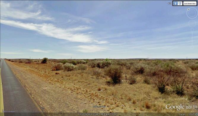
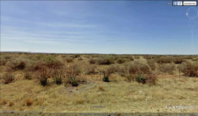
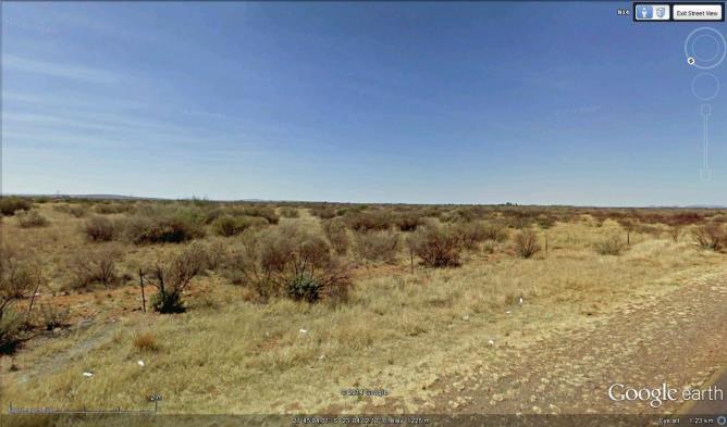
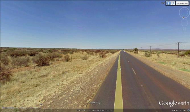

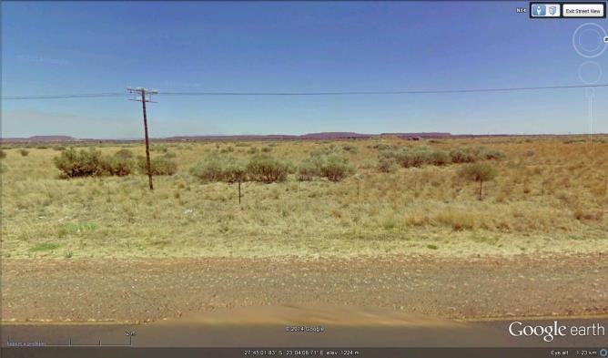
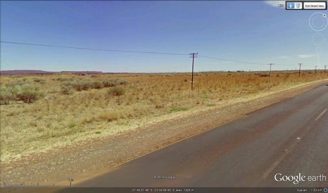
49 Appendix B: Photographs View to North View to North East View to East View to South East View to South View to South West View to West View to North West 48
50 Appendix C: Facility illustration(s) Figure 8: Sekgame Project Layout 49
51 Figure 9: Switching Yard Facility Illustration 50
52 Appendix D: Specialist reports (including terms of reference) 51
53 Appendix E: Public Participation 52
54 Appendix F: Impact Assessment 53
55 No Activity/Aspect Impact Phase General Matters WM/ WOM Probability Duration Scale Magnitude Significance (WOM) Mitigation Frequency / responsibility Significance (WM) WOM 4 Highly Probable 4 Long Term 3 Regional 8 High The Resident Engineer (RE) will keep a copy of the EMPr and the Environmental Authorisation (EA) at the site during the construction phase The EMPr must be updated with the conditions contained in the EA. It will be ensured that all parties employed at the project site are aware of the provisions Understanding and of the EMPr and that implementation of these are legally binding. the EMPr is essential Employees must be to ensure taken through the EMPr compliance to and again if there are relevant legislation amendments or when and conditions of the new employees join. authorization (if The Environmental It is recommended awarded) as well as Pre- Management that signage explaining to ensure Development Programme (EMPr) the nature of the environmental best proposed development, practice, responsible timeframes involved, environmental and contact details of a management and the liaison official must be prevention of placed at key public pollution and areas around the site. environmental The layout is captured degradation. on the Site Development Plan. Deviations from the Site Development Plan (if approved by the competent authority) should be approved by the Site Manager and the Project Manager (PM). Significant 1 WM 1 Improbable 4 Long Term 3 Regional 2 Low 60 Moderate deviations have to be reported to DEA with motivational information and relevant approval sought. Environmental Manager and Project Manager Prior to construction 9 Negligible 2 Contractors The provisions of the Pre- WOM 4 Highly Probable 3 Medium 3 Regional 8 High 56 Moderate The contractor must Contractor(s) 8 Negligible 54
56 3 Clear Site Demarcations EMPr should be included in contract documentation to ensure that provision is made for the implementation thereof and the meeting of the environmental management objectives If the site is not properly demarcated the risk of impacts occurring beyond the approved footprints is increased Development Term Medium sign that he has read and understands the EMP The contractor should provide a programme for site establishment to the construction manager and ECO prior to commencement. The contractor must ensure compliance with conditions described in the Environment Authorisation. The contractor s hard park and storage yard should be located at the designated area as specified by the construction manager and ECO All contractors must be made aware of the audit and monitoring requirements in the EMP Any changes made to the EMP must be approved by the Environmental Manager / ECO As far as possible labourers should be drawn from the local Pre- Development WM 1 Improbable 3 WOM 4 Highly Probable 3 WM 1 Improbable 3 Term 3 Regional 2 Low Medium Term 3 Regional 6 Medium Medium Term 2 Site 2 Low 48 Moderate market. Before construction begins, all areas to be developed must be clearly demarcated with danger tape. No-Go areas should be clearly marked. No Machinery; personnel, material, or equipment should enter the No-Go areas and No disturbance should be visible outside the demarcated area. Vegetation that is not to be removed must be and environmental manager prior to construction Contractor(s) environmental manager and ECO Prior to construction 7 Negligible 55
57 4 5 Environmental Incidents Training Regardless of precautionary measures implemented, accidents can still occur at the site and response to accidental pollution or degradation incidents should then limit the impact of the accident Personnel on site will not be allowed the "but I didn't know" excuse in the event of environmental degradation or pollution occurring as a result of their activities Pre- Development Pre- Development WOM 2 Probable 3 WM 1 Improbable 3 WOM 2 Probable 3 WM 1 Improbable 3 Medium Term 3 Regional 8 High Medium Term 2 Site 2 Low Medium Term 3 Regional 8 High Medium Term 2 Site 2 Low 28 Low 28 Low clearly demarcated Records of all environmental incidents must be maintained and a copy of these records be made available to DEA on request throughout the project execution. Emergency response plans should be available on site including spill kits and employees should be trained how to respond to spillages of different types of materials. Confirm suitable sites for the construction camp (equipment and batching etc) and storage areas for materials, as well as site offices. No equipment / materials will be stored in areas not specifically designated for that purpose and approved by the ECO. Environmental awareness training for construction staff, concerning the prevention of accidental spillage of hazardous chemicals and oil; pollution of water resources (both surface and groundwater), air pollution and litter control and identification of archaeological artefacts will occur prior to construction commencing. Ensure that the training and capabilities of the Contractor s site staff are adequate to carry out the designated Contractor and ECO prior to construction and throughout construction phase 7 Negligible Contractor, PM, EM and ECO prior to construction with follow-up as necessary 7 Negligible 56
58 Topography and Visual Intrusion Presence of the Switching Yard and electricity distribution lines Alteration of the Visual Landscape 1 Soils (Degradation, erosion, sedimentation) 2 Exposure of soils to rainfall and wind 3 Surface and Ground Water 4 Exposure of soils to rainfall and wind Movement of vehicles and storage of materials on site Erosion Dust contamination Pollution potential from Spillages Construction & Operational Construction Construction Construction WOM 5 Definite 5 Permanent 2 Site 2 Low WM 5 Definite 4 Long Term 2 Site 2 Low WOM 4 Highly Probable 4 Long Term 2 Site 6 Medium Medium WM 4 Highly Probable 3 Term 2 Site 2 Low WOM 5 Definite 4 Long Term 2 Site 6 Medium WM 4 Highly Probable 3 Medium Term 2 Site 2 Low WOM 4 Highly Probable 4 Long Term 2 Site 6 Medium WM 4 Highly Probable 3 Medium Term 1 Local 2 Low 45 Moderate tasks. Staff operating equipment (such as excavators, loaders, etc.) shall be adequately trained and sensitised to any potential hazards associated with their tasks, as well as environmental sensitive areas on and around the site. The infrastructure is relatively in keeping with existing developments in the surroundings and the visual landscape has already been significantly altered by similar infrastructure. 40 Low Moderate Moderate Cover disturbed soils as completely as possible. Minimize the amount of land disturbance and develop and implement stringent erosion and dust control practices. Protect sloping areas and drainage channel banks; Repair all erosion damage as soon as possible; Gravel roads must be well drained; Low Low 48 Moderate Any excess or waste material or chemicals should be removed from the site and discarded in an environmental friendly way. The ECO should enforce this rule rigorously; Hazardous chemicals to be stored on an impervious surface protected from rainfall 24 Low 57
59 Biodiversity 6 Clearing of vegetation for construction Habitat Destruction Construction WOM 5 Definite 4 Long Term 1 Local 6 Medium WM 5 Definite 3 Medium Term 1 Local 2 Low 55 Moderate and storm water Ensure that refuelling stations on site are constructed so as to prevent spillage and ensure any accidental spillages can be contained and cleaned up promptly; Spill kits should be onhand to deal with spills immediately; 0All vehicles should be inspected for oil and fuel leaks on a regular basis. Vehicle maintenance yards on site should make provision for drip trays that will be used to capture any spills. Drip trays should be emptied into a holding tank and returned to the supplier. The entire development footprint should be clearly demarcated prior to initial site clearance and prevent construction personnel from leaving the demarcated area. Restrict clearing and damage of plant growth to demarcated areas. Where protected flora will need to be cleared permits should be obtained. The rehabilitation of the site after construction should be prioritized. Avoid sensitive habitats. Only necessary damage must be caused and, for example, unnecessary driving around in the veld or bulldozing natural habitat must not take place. All development 30 Low 58
60 7 Clearing of vegetation for construction Habitat Fragmentation Construction & Operational WOM 5 Definite 5 Permanent 1 Local 6 Medium WM 5 Definite 4 Long Term 1 Local 2 Low 60 Moderate activities should be restricted to specific areas approved by the ECO. Storage of materials should be limited to demarcated areas. Regular environmental training should be provided to construction workers. Where holes for poles pose a risk to animal safety, they should be adequately cordoned off and constant excavating and backfilling during planting of the poles should occur. The use of poisons for the control of rats, mice or other vermin should preferably be avoided and only be used after approval from an ecologist. Limit pesticide use to non-persistent, immobile pesticides and apply in accordance with label and application permit directions. Monitoring (ECO) should be implemented during the construction phase of the development to ensure that minimal impact is caused to the fauna and flora of the area. Use existing facilities (e.g., access roads) where possible to minimize the amount of new disturbance. Ensure protection of important resources by establishing protective buffers to exclude unintentional disturbance. During construction, 35 Low 59
61 8 Movement of personnel and vehicles on and off site Spread of Alien invasive species Construction & Operational WOM 4 Highly Probable 4 Long Term 2 Site 6 Medium WM 4 Highly Probable 3 Medium Term 1 Local 2 Low 48 Moderate sensitive habitats must be avoided by construction vehicles and equipment. Only necessary damage must be caused and, for example, unnecessary driving around in the veld or bulldozing natural habitat must not take place. Construction activities must remain within defined construction areas and the powerline servitudes. No construction / disturbance will occur outside these areas. Institute strict control over materials brought onto site. Inspect for potential invasive species and eradicate these before transport to the site. Routinely fumigate or spray all materials with appropriate insecticides prior to transport. Alien invasive tree species such as black wattle and blue gum should be eradicated. Control involves killing the plants present, killing the seedlings which emerge, and establishing and managing an alternative plant cover to limit regrowth and re-invasion. Refer to the Working for Water Guidelines. Rehabilitate disturbed areas as quickly as possible. Institute a monitoring programme to detect alien invasive species early, before they 24 Low 60
62 9 Presence of humans on site for construction Negative effects on flora Construction WOM 4 Highly Probable 3 WM 4 Highly Probable 3 Medium Term 2 Site 6 Medium Medium Term 2 Site 2 Low 44 Moderate become established and, in the case of weeds, before the release of seeds. Institute an eradication/control programme for early intervention if invasive species are detected, so that their spread to surrounding natural ecosystems can be prevented. Require the use of certified weed-free mulching. Prohibit the use of fill materials from areas with known invasive vegetation problems. The spread of invasive nonnative plants should be avoided by keeping vehicles and equipment clean and reseeding disturbed areas with native plants. No staff should be accommodated on the site. The construction workers should stay in one of the nearby villages and transported daily to the site. Maintain proper firebreaks around entire development footprint. Construction activities must remain within defined construction areas and the road servitudes. No construction / disturbance will occur outside these areas. Educate workers regarding the occurrence of important resources in the area and the importance of protection (for example 28 Low 61
63 10 Presence of the power lines and switching station Avifauna (Bird) electrocutions Operation WOM 4 Highly Probable 5 Permanent 1 Local 6 Medium WM 1 Improbable 5 Permanent 1 Local 2 Low 48 Moderate the protected trees). Instruct employees, contractors, and site visitors to avoid disturbance of wildlife. No fires should be permitted on the construction site for cooking of food etc. Provide avian-safe facilities: An aviansafe power pole is a configuration designed to minimise bird electrocution risk by providing sufficient separation between energised phase conductors (also-called phases ) and between phases and grounded hardware to accommodate at least the wrist-to-wrist or head-to-foot distance of a bird. Cross-arms, insulators and other parts of the power lines can be constructed so that there is no space for birds to perch where they can be proximate to energised wires. Ensure adequate separation between conductors (1.4 to 1.8 meters). Insulation: cover energised parts and/or covering grounded parts with materials appropriate for providing incidental contact protection to birds. Apply perch managing techniques such as conspicuous objects and support roosting sites along the power line that would permit large 8 Negligible 62
64 11 Presence of the power lines and switching station Avifauna (bird) Collissions Operation WOM 5 Definite 5 Permanent 1 Local 8 High WM 4 Highly Probable 4 Long Term 1 Local 2 Low 70 High raptors and bustards to safely roost. There has been considerable success achieved by providing artificial bird safe perches and nesting platforms, which are placed at a safe distance from the energised parts. The line should be marked with suitable anti-collision marking devices on the earth wire as per the Eskom guidelines. The design and technical aspects of using devices on the power line should consider: Line markers should be as large as possible, and increase the visible thickness of the line by at least 20 cm, for a length of at least 10-20cm; Spacing of devices should be not more than 5-10 m apart; Line markers should incorporate as much contrast with relevant backgrounds as possible; Colour is probably less important than contrast; Movement of the device is likely to be important; Markers that protrude vertically both above and under the cable are likely important; Devices that are nocturnally visible (through illumination, ultraviolet radiation and other means) would be advantageous. Although bearing in mind what is 28 Low 63
65 Air Quality Exposure of soils to rainfall and wind 12 Impacts on Heritage Resources Construction Activities (excavation, stockpiling etc.) Construction Activities (excavation, stockpiling etc.) Dust contamination Displacement / destruction of heritage resources at SG461-SA01 Displacement / destruction of heritage resources at SG461-SA02 and SG461-SA03 Construction Construction Construction WOM 5 Definite 4 Long Term 2 Site 6 Medium WM 4 Highly Probable 3 Medium Term 2 Site 2 Low WOM 4 Highly Probable 5 Permanent 1 Local 2 Low WM 1 Improbable 5 Permanent 1 Local 2 Low WOM 4 Highly Probable 5 Permanent 1 Local 8 High WM 1 Improbable 5 Permanent 1 Local 6 Medium 60 Moderate 32 Low 56 Moderate known about birds being attracted to illuminated objects. Line design: The nearer power line cables are to the ground, the better for preventing bird collision. Less vertical separation of cables is preferred as it poses less of an obstacle for birds to collide with. Horizontal separation of conductors is therefore preferred. A speed limit should be enforced on dirt roads (preferably 40km/h). Dust suppression via watering truck on construction areas may be required, according to prevailing site specific conditions. Protect stockpiles from erosion. 28 Low Site Monitoring: Regular examination of excavations & trenches for subsurface stone age resources by qualified heritage specialist. Realign the infrastructure to avoid the resource and a 20m conservation buffer around it. 8 Negligible Conduct a Phase 2 Investigation: Document the sites by means of site mapping, surface artefact collection etc. subject to permitting from SAHRA and otain a destruction permit for the sites. Alternatively the infrastructure would have to be re-aligned t avoid the resources and a 20m buffer around the sites. 12 Negligible 64
66 Appendix G: Environmental Management Programme (EMPr) 65
67 Appendix H: Details of EAP and expertise 66
68 Appendix I: Specialist s declaration of interest 67

69 Appendix J: Additional Information Table 1: Route Coordinates (refer to the Figure below Point No Latitude Longitude Start Ferrum 27 43'55.01"S 23 3'43.62"E Point A - Service Road Crossing 27 44'1.15"S 23 3'50.60"E Point B 27 44'10.36"S 23 4'0.89"E Point C - Bend 27 44'17.78"S 23 4'10.54"E Point D 27 44'35.39"S 23 4'9.18"E Point E 27 44'51.71"S 23 4'8.41"E Point F 27 45'8.65"S 23 4'7.10"E Point G 27 45'30.20"S 23 4'6.31"E Point H 27 45'57.40"S 23 4'4.64"E Point I Sekgame Start 27 46'21.87"S 23 4'2.35"E Point J Sekgame End 27 46'45.92"S 23 4'0.62"E 68