Tri-Municipal Industrial Partnership
|
|
|
- Edgar Barrett
- 5 years ago
- Views:
Transcription

1 Tri-Municipal Industrial Partnership Industrial Area Structure Plan Public Open House October 24 & 25, 2018
2 Outline 1. Introduction 2. Review Project Aims & Objectives 3. Planning Context 4. Constraints & Opportunities 5. Precedent Research 6. Industrial Ecology 7. Summary & Next Steps
3 Introduction
4 Project Aims & Objectives Chart a course for the development of a world class heavy eco-industrial district Showcase the region s untapped potential by paving the way for services and infrastructure where heavy industry is interested in investing Support the creation of long-term employment growth and opportunities for residents, communities and First Nations Create an ordered pattern of development that integrates industry, nature, and people

5 Where is the Project? The proposed industrial district will be located in Greenview, south of Grande Prairie Located on the Montney Gas Deposit a long term resource that is one of the largest conventional gas formations in North America Will provide the only industrial processing centre on the feedstock, resulting in more efficient and sustainable industrial activity

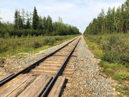
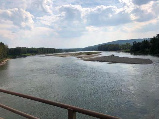
6 Where is the Project? The location is already served by CN rail, Highway 40 and pipeline infrastructure Adjacent to the Smoky River The study area boundary amounts to 188 km 2


7 Site Attributes
8 What is an ASP? An Area Structure Plan (ASP) establishes the following guidelines for the development and subdivision of an area of land: o The Sequence of Development o Land Uses o Employment Density o Location of Major Transportation Routes o Location of Major Public Utilities
9 What is an ASP? An ASP is a high-level plan rather than a detailed development concept Prior to industrial development in the area, additional approvals will be required: Municipal approvals (e.g. land use, subdivision & development permit) Provincial approvals (e.g. environmental & historical)
10 Project Timeline
11 Planning Context

12 Policy Greenview MDP Bylaw No MDP Land Use Concept Designation: Crown Land Policy Area Smoky River Accommodate major economic activities including: Oil and Gas Forestry Sand and gravel extraction Agriculture Agriculture Policy Area Crown Land Policy Area Study Area Boundary
13 Policy Greenview Land Use Bylaw No Land Use Bylaw Potential Land Use: Crown Land (CL) Permitted Uses: Agriculture Processing Accessory Building Compressor Station Natural Resource Extraction Natural Resource Processing Oil and Gas Facility Utilities, Major Study Area Boundary Work Camp
14 Policy Greenview Land Use Bylaw No Land Use Bylaw Potential Land Use: Industrial General (M-2) Permitted Uses: Agriculture Processing Accessory Building Compressor Station Natural Resource Processing Manufacturing Plant, Small Scale Study Area Boundary
15 Policy Greenview Land Use Bylaw No Land Use Bylaw Potential Land Use: Industrial General (M-2) Discretionary Uses: Manufacturing Plant, Large Scale Oil and Gas Facility Utilities, Major Work Camp Study Area Boundary
16 Constraints & Opportunities
17 Constraints & Opportunities

18 Constraints & Opportunities Slope Constraints Rail requires areas with 2% grade or less, of which there are limited options in the study area Opportunities Much of the 0-2% land is located adjacent to existing rail, facilitating additional rail access into proposed development areas *AltaLIS 2018 data was used to calculate percentage slope gradient throughout the study area and classify according to potential impact on development

19 Constraints & Opportunities Slope Constraints The majority of the study area is between 2% and 8% grade, areas closer to 8% will require grading and leveling to accommodate development Opportunities Given the level of investment anticipated for the area, grading and leveling will not be a barrier to development *AltaLIS 2018 data was used to calculate percentage slope gradient throughout the study area and classify according to potential impact on development

20 Constraints & Opportunities Slope Constraints Slopes between 8% and 10% are primarily located in the east and the south of the study area, limiting development potential in these areas Opportunities The majority of land in the study area is below 8%, leaving considerable opportunity for industrial development *AltaLIS 2018 data was used to calculate percentage slope gradient throughout the study area and classify according to potential impact on development
21 Constraints & Opportunities Slope Constraints Steep slopes (>10%) restrict development potential towards the east of the study area Opportunities The study area avoids the majority of slopes >10%, leaving the bulk of the area poised for development *AltaLIS 2018 data was used to calculate percentage slope gradient throughout the study area and classify according to potential impact on development
22 Constraints & Opportunities Topography Constraints The hill in the south of the study area offers limited development potential Opportunities The remainder of the study area has favourable topography for industrial development
 to determine")
23 Constraints & Opportunities Potentially Wet Areas Constraints Potential wetlands exist throughout the study area, particularly in the north Opportunities Wet areas do not preclude development, they will simply require further assessment prior to approval *3 data sources obtained from AEP (Ground Cover Classification 2016, Merged Wetland Inventory 2016 and Wet Areas Mapping 2017) to determine the location of potentially wet areas

24 Constraints & Opportunities Watercourses Constraints Watercourses throughout the study area have been buffered to 100m Opportunities These do not overly restrict development potential in the area
25 Developable Areas After avoiding steep slopes and watercourses, 16 preliminary developable areas remain These amount to 4,530.6 ha of development potential
26 Precedent Research
27 Precedent Research Types of Heavy Industrial Uses 1. Urea/Ammonia Fertilizer Plants 2. Methanol Plants 3. Gas Processing Plants 4. Gas Fired Power Plants 5. Upgraders 6. Waste Water Treatment Facilities

28 Urea/Ammonia Fertilizer Plants Nutrien Complex Redwater AB Located on 360 ha Largest fertilizer complex in North America Licensed to divert up to 15,640,000 m 3 of water / year from the North Saskatchewan River 22km of rail track capable of storing 600 railcars Up to 400 trucks are loaded each day

29 Methanol Plants Methanex Medicine Hat AB Located on 65 ha Largest methanol producer and supplier in the world Uses steam to reform natural gas and then converts and distills it to create pure methanol Products are shipped to and from the facility by road, rail and pipeline

30 Gas Processing Plants Keyera Corp Buck Lake AB Located on 12 ha Includes gas sweetening, Sulphur recovery and power generation Product is shipped to and from via network of pipelines

31 Gas Fired Power Plants Cogeneration Plant Joffre AB Located on 260 ha Co-owned by ATCO, Capital Power and NOVA Supplies steam to NOVA Chemicals Supplies power to the Alberta power grid

32 Upgraders Shell Scotford Upgrader Scotford AB Located on 429 ha Includes Upgrader, Refinery and Chemical Plant Scotford Cogeneration Plant also located on site Licensed to divert up to 8,146,800 m 3 of water / year from the North Saskatchewan River Access via rail, road and pipeline


33 Footprint Analysis Nutrien Redwater AB 360 ha CF Industries Medicine Hat AB 63 ha Nutrien Joffre AB 7 ha Methanex Medicine Hat AB 60 ha Methanex Motunui NZ 75 ha Metanol de Oriente Venezuela 186 ha Fertilizer Plants Methanol Plants


34 Footprint Analysis Keyera Fort Saskatchewan AB 117 ha Keyera Minnehik AB 12 ha Plains Midstream Fort Saskatchewan AB 164 ha Bellshill Power Centre Edmonton AB 8 ha Muskeg River Cogeneration Station Fort Mackay AB 93 ha Joffre Cogeneration Plant Joffre AB 320 ha Gas Processing Power Plants


35 Footprint Analysis Bonnybrook Wastewater Calgary AB 45 ha Pinecreek Wastewater Calgary AB 23 ha Scotford Upgrader Fort Saskatchewan AB 486 ha Upgrader 1 & 2 Fort McMurray AB 215 ha Horizon Upgrader Fort McMurray AB 584 ha Waste Water Treatment Upgraders
36 Planning & Engineering Assumptions Land Area Requirements Heavy Industrial facilities vary in size from ~ 1 ha to more than 500 ha Gas processing facilities require the least land among precedents Upgraders require the most land The average heavy industrial facility requires a full ¼ section of land Land with no rail access is best suited to smaller facilities and supportive uses Access Requirements Access to the study area is via hwy 40 Rail bisects the site from the north to the southeast Land that provides rail access is best suited to the largest facilities Processing plants (e.g. Upgraders) rely less on rail Manufacturing plants (e.g. Fertilizer) rely more on rail
37 Planning & Engineering Assumptions Water Requirements Water demand for the potential uses varies significantly Similar uses in the Heartland area have annual demands from 125,000 m 3 to 15,600,000 m 3 Further information on the Smoky River is required to determine the need for raw water storage Utility Requirements A transmission line runs through the study area Demand for various uses could vary widely ATCO is looking at possible servicing scenarios
38 Potential Developable Areas The largest potentially developable cell, #11, is approximately 935 ha with proximity to existing rail Cell #12 features approximately 512 ha with proximity to rail and to the river Cell #3 is approximately 513 ha with proximity to both rail and the highway
39 Conceptual Road & Rail Network Potentially developable cells #2,3,6, 7,11 and 12 can accommodate rail development The proposed road network provides access via major and minor roads to those areas that cannot be serviced by rail Rail land amounts to approximately 1,277 ha
40 Demonstration of Land Supply With proximity to rail and the river, cells #11 and 12 provide a rational starting point for development

41 Demonstration of Land Supply With proximity to rail and the river, cells #11 and 12 provide a rational starting point for development Cells #2,3 and 6 have rail potential and proximity to the highway but are further from water, making them a logical secondary phase
42 Demonstration of Land Supply With proximity to rail and the river, cells #11 and 12 provide a rational starting point for development Cells #2,3 and 6 have rail potential and proximity to the highway but are further from water, making them a logical secondary phase Remaining areas can accommodate a variety of industrial uses that rely less on proximity to rail and water
43 Demonstration of Land Supply With proximity to rail and the river, cells #11 and 12 provide a rational starting point for development Cells #2,3 and 6 have rail potential and proximity to the highway but are further from water, making them a logical secondary phase Remaining areas can accommodate a variety of industrial uses that rely less on proximity to rail and water
44 Industrial Ecology
45 Eco-Industrial Parks Achieve sustainable development by cooperating with other businesses and the local community to reduce waste and share resources Increase overall economic gains while improving environmental quality Planned, designed and built in such a way that it makes it easier for businesses to co-operate, and can result in a more financially sound, environmentally friendly project
46 Eco-Industrial Parks Kalundborg, Denmark First full realization of industrial symbiosis Businesses exchange material wastes, energy, water, and information Industrial Uses include: Power Station Insulin Producer Statoil Refinery Plaster Board Manufacturing Soil Remediation Farming Recycling Facilities Fish Factories

47 Eco-Industrial Parks Kalundborg, Denmark The power company gives its steam residuals to the Statoil Refinery, meeting 40% of requirements in exchange for waste gas Power plant uses the waste gas to create electricity and steam Surplus heat is used to heat 3500 local homes Achieved through private incentives rather than government planning


48 Eco-Industrial Parks Energy and Technology Park, Edmonton Development Concept Petrochemical Precinct Medium Industrial Precinct Research & Development Precinct
49 Project Timeline
50 Questions?