Overview of NOS Work with Linkages to Coastal Resilience and Natural and Nature-based Solutions. Jeff Payne NOAA Office for Coastal Management
|
|
|
- Julianna Bradley
- 5 years ago
- Views:
Transcription
1 Overview of NOS Work with Linkages to Coastal Resilience and Natural and Nature-based Solutions Jeff Payne NOAA Office for Coastal Management

2 Healthy Coasts - Critical for Nation s Vitality The coast has 23 of the 25 most densely populated counties 19 out of 20 major cities 45% of our GDP 51 million jobs 9 of 10 most costly storms


3 A Very Real Need

4 NOAA National Ocean Service Meeting the nation s coastal management needs Coastal Resilience: preparing, responding, recovering Coastal Intelligence: informing Place-based Conservation: preserving

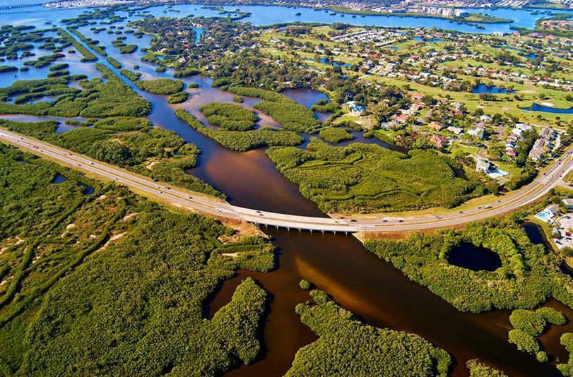
5 Natural and Nature-based Solutions Valuable approaches for reducing flood hazards Increase resilience Reduce risk


6 Multiple Approaches, Multiple Services Landscape Conservation Low Impact Development Source: EPA Dune or Oyster Reef Restoration

7

8 Partnerships are Critical

9 Diverse Needs

10 SAGE - Community of Practice

11 Conserving and Greening the Coast CZMA talk about the coastal program


12 Conserving and Greening the Coast

13 Digital Coast What Makes it Work Focus on coastal management community Full suite of helpful data, tools, training, and resources DIGITAL COAST PARTNERSHIP

14 Data The U.S. Ocean and Great Lakes Economy is large

15 Data 1,535 square miles 23,274 square miles 5,726 square miles 65,000 square miles
 Detailed wetlands and change mapping Higher resolution in Pacific")
16 Coastal Land Cover and Land Change Data National inventory of land cover and change Added focus on coastal detail and change NOAA maps 25% of contiguous U.S. Coastal area accounts for - 66% of all wetlands - 41% of all development - 44% of all change ( ) Detailed wetlands and change mapping Higher resolution in Pacific and Caribbean


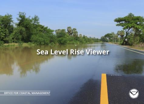
17 Coastal Land Cover and Land Change Data Coastal Land Cover Applications Interagency Coastal Wetlands Workgroup Land Cover Atlas coast.noaa.gov/digitalcoast/tools/lca Sea Level Rise Viewer coast.noaa.gov/digitalcoast/tools/slr

18 Tools


19 Training Methodologies

20 NOAA Coastal Resilience Grants Program hot off the presses - grants, new projects. Nature based solutions Geospatial data and tool development Economic research

21 NOAA Coastal Resilience Grants Program
22


23 NOAA s National Ocean Service Applying NOAA NOS Coastal Intelligence to inform planning and implementation of NNBF Richard Edwing, Director Center For Operational Oceanographic Products and Services

24 NOS Coastal Intelligence Advancing resilience and natural infrastructure


 System-Wide")
 National Water")
25 NOS Coastal Intelligence Advancing resilience and natural infrastructure National Spatial Reference Frame (NRSF) System-Wide Monitoring Program (SWMP) National Water Level Observation Network (NWLON) Remote Sensing


26 Applying Coastal Intelligence to NNBF Advancing resilience and natural infrastructure NOAA Sentinel Sites Sentinel Station Cross Section


27 Applying Coastal Intelligence to NNBF Advancing resilience and natural infrastructure Establishing water and land based datums to support Nature Based Infrastructure


28 Applying Coastal Intelligence to NNBF Advancing resilience and natural infrastructure Marsh Analysis and Planning Tool Incorporating Tides and Elevations (MAPTITE)

29 Applying Coastal Intelligence to NNBF Advancing resilience and natural infrastructure Provide current and future trends to ensure long term project viability
.")

30 Examples of NOS-USACE Collaboration Advancing resilience and natural infrastructure ( Technical_Report_NOS_COOPS_076.pdf). Supporting USACE with adoption of national tidal and geodetic datums through engineering regulations and circulars and applying them to national infrastructure investments Poplar Island Water Level Variation Study Leveraging work to advance airborne lidar and coastal mapping and charting technology and applications and maintaining the National Shoreline


31 Examples of NOS-USACE Collaboration Advancing resilience and natural infrastructure Supporting the development of the sea level and extreme water level technical letters. Providing input and extreme water level statistical analysis to support the development of the USACE Sea Level Change Curve Calculator


32 Coastal Intelligence Partnerships Advancing resilience and natural infrastructure A growing need for common standards, particularly around water level information for use primarily for SLR and extreme events NOS has been fostering partnership with Federal Agencies, move forwards on outlining data standards and looking at monitoring through tiered data perspective USACE and NOAA have already made progress with sharing common standards.

33 Mary Erickson Director, National Centers for Coastal Ocean Science USACE/NOAA-NOS Collaboration Workshop on Natural and Nature-Based Features March 1-3, 2016

34 NOS Science Approach Core NNBF Science Capabilities Emerging Opportunities


35 Science to inform coastal preparedness for coastal storms, hazards, and the effects of climate change Internal and External science capacity Competitive science programs National Estuarine Research Reserve System Science Collaborative
36 What are the impacts of shoreline hardening? Reflected Waves Bulkhead Bulkhead Scour Tidal Marsh Shallow Refuge Breakwater or Sill SAV Smithsonian Environmental Research Center


37 Where are marshes most resilient to erosion? Estuary Shoreline Erosion Rate Wave Energy Marsh Mapped from small boat Aerial photo. 56, 89, 04 RWE from Wave Energy Model
 900 800 Marsh at high")

38 Solutions to mitigate marsh vulnerability? Vulnerability and risk (Hydro-MEM model) Marsh at high (30m) elevation SLR and marsh elevation scenarios (MEM model) Mean Biomass g dw m


39 What if Hurricane Katrina struck in 2050? Dynamic Storm Surge (NGOM3) 2005 vs sea state/lulc 2005 vs LULC 12 in. SLR Over wash and breaching of Dauphin Island

40 How much wave energy can living shorelines sustain? Rachel Carson National Estuarine Research Reserve demonstration Average Marsh Width m NC NERRS Fringing marsh distribution versus wave energy Average RWE jm -1

41 Guidance for installing a living shoreline? Management & Policy Engagement & Education Science
 of damages avoided by having natural habitats Value saved from reduced flood")
42 What is the value of marshes for flood protection? Value ($$) of damages avoided by having natural habitats Value saved from reduced flood insurance costs Economic stimulus to the community


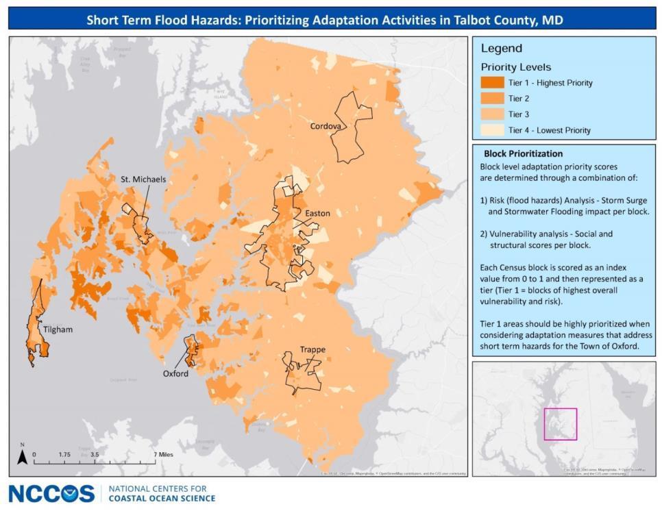
43 How can our science inform adaptation?
44 Enhanced emphasis on NNBF in new projects Tools and models for scenario evaluations (Gulf and CA) Valuing ecosystem services (OR) Thin layer disposal of dredge spoil at Camp Lejeune (NC) NERRS Science Collaborative Living shorelines and erosion (FL) Performance of sustainable shorelines
45 NOS capabilities to advance resilience and natural and naturebased features Coastal Management Coastal Intelligence Coastal Science Strengthen application and facilitate implementation of NNBF Goal this week: Partnering to create a joint framework