Implementation Guide
|
|
|
- Ernest Cummings
- 5 years ago
- Views:
Transcription


1 Humber River Watershed Plan Implementation Guide Prepared by: Toronto and Region Conservation Authority Page Break


2 We look forward to working with these and many other partners in implementation
3 Page Break Table of Contents page Executive Summary. i Introduction... viii 1. Policy Regeneration Land Securement Stewardship and Education Operations and Maintenance Enforcement Monitoring List of Ta bles Table 1.1 Top 10 New Policy Recommendations for the Humber Watershed Table 1.2 Policy Initiatives and Special Studies Table 2.1 Regeneration Project Priorities Table 3.1 Land Securement Projects Table 4.1 Stewardship and Education Projects Table 5.1 Operations and Maintenance Projects Table 6.1 Enforcement Actions Table 7.1 Evaluation of Innovative Technologies Table 7.2 Ambient Watershed Conditions and Long-term Trends Table 7.3 Adaptive Management
4 Page Break List of Figures Figure 1-1 Target Terrestrial Natural Heritage System Figure 1-2 Groundwater Recharge Figure 1-3 Potentially Significant Recharge Areas Figure 1-4 Areas of Shallow Depth to Water Table Figure 1-5 Nature-based Recreation Areas and Experiences Figure 1-6 Inter-regional Trails Plan Figure 1-7 Cultural Heritage Highlight Areas Figure 1-8 Flood Vulnerable Areas and Roads Figure 1-9 Special Land Use Policy Areas Figure 1-10 Fish Management Zones and Target Species Figure 1-11 Compliance Checklist for Major Development on ORM in Humber Watershed Figure 2-1 Humber River Watershed Strategic Regeneration Themes Figure 2-2 Main Humber Subwatershed Regeneration Plan Figure 2-3 East Humber Subwatershed Regeneration Plan Figure 2-4 West Humber Subwatershed Regeneration Plan Figure 2-5 Black Creek Subwatershed Regeneration Plan Figure 2-6 Lower Humber Subwatershed Regeneration Plan List of Appendices Appendix A: Legislative and Policy Context for Watershed Plans Appendix B: Oak Ridges Moraine Conservation Plan Watershed Plan Requirements Conformity Assessment Report Appendix C: List of Supporting Documents Appendix D: List of Acronyms Section Break (Next Page)
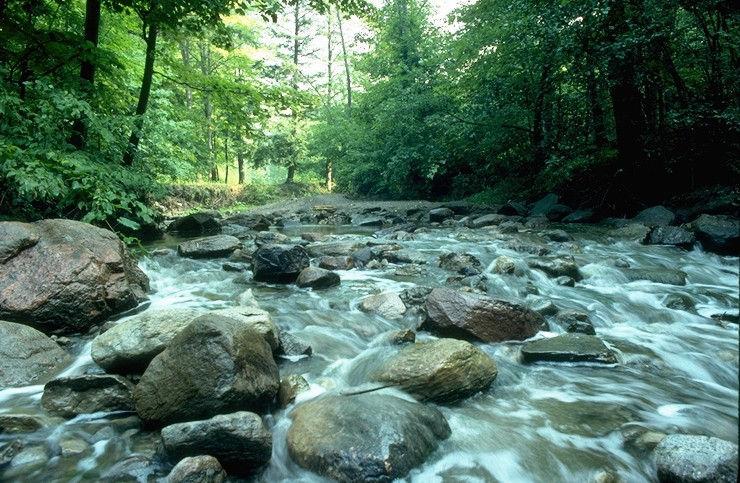
5 Executive Summary I n t r o d u c t i o n The Humber River Watershed Plan Pathways to a Healthy Humber (2008), was prepared by the Toronto and Region Conservation Authority (TRCA), in partnership with municipal, provincial and federal government representatives and other stakeholders including the Humber Watershed Alliance. The Watershed Plan provides guidance to local, regional and provincial governments and TRCA as they update their policies and programs for environmental protection, conservation, and restoration within the contexts of land and water use, and the planning of future development. It also provides direction to local non-governmental organizations and private landowners with regard to best management practices and opportunities for environmental stewardship. The Watershed Plan is based on a strong understanding of current conditions developed through analysis of environmental monitoring information, combined with leading edge approaches to predicting potential future conditions that involved modelling and expert input. A series of management summit workshops were also held to develop recommendations that address key watershed management issues. The Watershed Plan shows that a business-as-usual approach to future development will result in continued losses of environmental quality, biodiversity and cultural heritage, along with considerable costs to address the health, social and economic consequences of degraded environmental conditions and damaged infrastructure and property. A healthy, more resilient Humber watershed that supports a high quality of life for our communities is within reach only if opportunities to protect and restore healthy natural systems, build more sustainable communities, and enhance the regional open space system are acted upon. P u r p o s e o f t h e I m p l e m e n t a t i o n G u i d e The purpose of this guide is to facilitate implementation of the recommendations contained in the Humber River Watershed Plan by planners, consultants, managers, businesses, community groups, residents and other watershed stakeholders. The Guide organizes the Watershed Plan recommendations according to relevant implementation tools (Policy; Regeneration; Land Securement; Stewardship and Education; Operation and Maintenance; Enforcement; and Monitoring) and assembles additional information to inform initial action. The Guide outlines a 10 year work plan of implementation projects, within the context of existing programs and likely implementing partners. Like the Watershed Plan, the Implementation Guide is intended to guide on-going implementation and updating or development of programs and policies. The proposed projects contained in this Guide are meant to serve as a basis for discussion among implementing partners and as a source of ideas for further development of individual partners own long term work plan and budget preparations. S t r a t e g i c W a t e r s h e d M a n a g e m e n t D i r e c t i o n The Humber River Watershed Plan concludes that the watershed is at a critical crossroads in that it continues to support many unique natural and cultural heritage values, and yet a number of present and anticipated stresses will challenge the ability to sustain present conditions. The Watershed Plan identifies three strategic management directions for the protection and enhancement of the watershed:
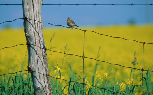
6 1. Protect and expand terrestrial natural cover. Protect, restore and enhance natural cover in a target terrestrial natural heritage system. This action is especially important in areas upstream of existing and future urban growth, from a water management and erosion control imperative, and for parts of the target system vulnerable to loss or impact from urban growth, from a habitat biodiversity standpoint. It will also contribute to serving the growing demand for nature-based recreation and provide greater resilience to climate change. Land use policy, regeneration and land securement projects are the primary implementation mechanisms to achieve this set of recommendations. 2. Build more sustainable new communities and retrofit older ones to improve their sustainability by improving water management and promoting more sustainable practices overall. a) Improve Water Management Manage for pre-development water balance (i.e. runoff volume control and maintenance of infiltration) by protecting natural heritage systems, naturalizing urban landscaping, using innovative lot level and conveyance stormwater management technologies, and rain harvesting. This set of actions is critical to water management and the associated health of the aquatic system. b) Promote Sustainable Practices Overall Facilitate the use of these innovative water management approaches by promoting improved urban form, green buildings and sustainable behaviour, and at the same time address a broad range of other objectives for the sustainable community. Of particular interest is the need to accelerate the shift to the adoption of more sustainable practices through education/ awareness, testing, and demonstrating new technologies. A co-ordinated combination of new policies, retrofit type regeneration projects, improved operations and maintenance programs, stewardship, education, and monitoring initiatives will be necessary. 3. Recognize the Humber s distinctive heritage through an enhanced regional open space system. Further develop the regional open space system to support healthy communities and a growing population by securing additional lands for greenspace, expanding the trail network, and creating new opportunities for interpretation and celebration of natural and cultural heritage. Promote the distinctive experiences of the hills of the headwaters, kettle lakes and Humber valley wilderness as part of marketing campaigns for local businesses and attractions. Cultural heritage features and landscapes are increasingly playing a role in recreation (e.g. rural heritage settings, adaptive re-use of heritage buildings) and opportunities to integrate them with the regional open space system should be considered. Active and participatory education programs were identified as a strategic means of engaging the public and raising awareness of these issues and several regeneration capital works initiatives have been identified to address this set of recommendations. T o p P r i o r i t y I m p l e m e n t a t i o n P r o j e c t s This Implementation Guide outlines a 10 year work plan of implementation projects addressing all recommendations of the Watershed Plan, and is organized according to primary implementation mechanisms: Policy; Regeneration; Land Securement; Stewardship and Education; Operations and Maintenance;
7 Enforcement; and Monitoring. The following list of top priority implementation projects and actions has been selected with consideration for their collective ability to address the three strategic management directions noted above, in an expeditious and mutually supportive way. They are not listed in any particular order. The reference numbers in brackets (i.e. 1-8) are the respective project numbers, as listed in the implementation work plan tables within the Guide, where additional information is provided. Policy and Related Special Studies 1. Municipalities and TRCA should work together to investigate ways to incorporate the following new policy directions into their planning documents (see Table 1.1 for details and Table project 1-1): a) Identify a target terrestrial natural heritage system (TNHS) based on the system recommended in the Humber River Watershed Plan and adopt policies to protect and restore natural cover. b) Manage for pre-development water balance (i.e. reduce excess runoff volume, maintain or restore natural levels of infiltration and evaporation) with particular emphasis on areas confirmed as significant recharge areas. c) Develop strategies and policies to promote sustainable urban form, including sustainable infrastructure, transportation and resource use. d) Conduct Master Environmental Servicing Plans (MESPs) in a subwatershed context to establish the environmental features, functions and linkages as part of the growth planning process rather than limiting them to political or land ownership boundaries. e) Recognize, maintain and enhance a linked regional open space system that provides the basis for recreational experiences of the distinctive natural and cultural heritage of the watershed. f) Conduct comprehensive flood risk assessment plans where intensification is proposed in a flood vulnerable area or Special Policy Area. g) Support stormwater retrofits in existing developments and redevelopment projects (including road reconstruction). h) Adopt policy to implement the Greater Golden Horseshoe Area Conservation Authorities Erosion and Sediment Control Guideline for Urban Construction and update municipal Erosion and Sediment Control by-laws and Fill by-laws as necessary. i) Adopt policy to recognize and implement the Humber River Fisheries Management Plan. j) Support updated and expanded monitoring programs, including ambient monitoring, requirements for pre-development baseline monitoring, and the promotion and testing of new technologies and their cumulative effects. 2. ORM Municipalities recognize the Humber River Watershed Plan in their official plans, as required by the Oak Ridges Moraine Conservation Plan (ORMCP) (1-7).
8 3. ORM municipalities and TRCA should prepare a major development proposal review checklist that specifies the information to be included in a development application and criteria to determine ORMCP conformity (1-8). 4. MPIR, MMAH, MOE, municipalities, TRCA, AMO, CO, BILD - Establish development standards for sustainable community design for application to new development proposals or urban expansions (1-3). 5. TRCA, municipalities and other approval agencies - Develop a strategy/procedure for streamlining approvals for innovative designs (1-4). 6. TRCA, BILD, municipality - Promote a sustainable greenfield neighbourhood demonstration project (1-5). 7. TRCA Undertake a continuous simulation and event-based hydrologic modelling study to determine the most conservative approach to sizing SWM ponds for flood control in future growth areas (1-11). 8. TRCA, municipalities Undertake a scoped economic assessment of the implications of implementing the Watershed Plan integral recommendations, including valuation of ecosystem services, preparation of a methodology for applying the net gain approach, and development of recommendations for applying fairness and equity in implementation (1-18). Regeneration 1. All partners Increase natural cover: 1) in Oak Ridges Corridor Park, Nashville Resource Management Tract, Bolton Resource Management Tract and Claireville Conservation Area - implement existing restoration plans (2-1); 2) in Whitebelt - prepare restoration implementation plans for the natural heritage system identified in municipal plans and co-ordinate with developers (2-2); and 3) in Headwaters - prepare restoration implementation plans for targeted lands in priority areas and implement prior to urban development (2-3). 2. TRCA, municipalities Develop sustainable neighbourhood retrofit action plans (2-8) 3. Toronto and Vaughan Undertake projects identified in stormwater retrofit plans in Black Creek, Rainbow Creek, Lower Humber and West Humber subwatersheds. Projects in combined sewer areas should be undertaken first (2-9) 4. TRCA, NGOs - Continue restoration work in the Humber Marshes and Humber Estuary to increase wetland cover and improve aquatic habitat (2-11). 5. MNR, TRCA, Ontario Streams - Further modify the eight (8) in-stream barriers along the main channel between Bloor St. and Highway 401, to improve passage for jumping and non-jumping species, including repairing and improving the Raymore Park Fishway, upon completion of structural and fish passage assessments (2-12, 7-23). 6. Ministry of Culture and partners Establish a facility for archaeological artifact storage and document collections that is accessible to researchers; secure funding for capital and operations (2-22). 7. TRCA, Ministry of Culture, Aboriginal groups - Increase awareness of the Carrying Place Trail heritage by creating educational resources (e.g. book, video, webpage) and interpretive signs on contemporary trails (2-23).
9 Land Securement 1. TRCA Update priority list for land securement within the Humber watershed based on the Humber River Watershed Plan s recommended priorities within the TNHS and for further development of the system of inter-regional trails and public greenspace (3-1, 3-4). 2. TRCA and municipalities - Work with MPIR to investigate mechanisms, as may be necessary beyond planning measures, to secure the target TNHS lands in potential urban growth areas (i.e. whitebelt ) that do not have any legislated protection from urban development (estimated to be 446 hectares) (3-2). 3. TRCA, municipalities, NGOs Secure lands to establish the missing link in the Humber Trail between Steeles Ave. and Hwy. 7 along the main branch (3-5). 4. TRCA, municipalities, NGOs Undertake a land securement strategy for the proposed East Humber Trail (3-6). 5. TRCA, Municipalities, NGOs Undertake a study to: confirm the location of the historic Carrying Place trail; identify a conceptual route for the proposed contemporary Carrying Place Trail that connects the proposed East Humber Trail to a proposed northern gateway to the Humber greenspace system near Hackett Lake; and develop a strategy for the associated land securement and trail implementation (3.7). Stewardship and Education 1. TRCA and municipalities Deliver technology transfer workshops, seminars and materials for sustainable technologies, innovative stormwater management, erosion and sediment control, and sustainable urban form (4-1, 4-2, 4-8, 4-9). 2. TRCA, municipalities and others Develop a co-ordinated program to accelerate implementation of lot level retrofits (rain gardens, permeable paving, rain barrels/cisterns and native plant landscaping) in priority areas by the business and residential and institutional sectors including resources for promoting rain gardens (2-8, 4-12, 4-14, 4-21). 3. TRCA, MNR, municipalities, community groups Co-ordinate the development of educational materials on invasive species removal techniques and engage volunteer groups to help in monitoring and removal (4-18) 4. Municipalities, utilities, TRCA Develop an outreach program based on the results from the Renewable Energy Road Map to promote the uptake of renewable energy technologies (4-35). 5. Ministry of Education, Boards of Education, School boards, TRCA Encourage all Boards of Education in the Humber watershed to participate in the Ontario Ecoschools Program and schools to achieve certification (4-54). 6. TRCA, NGOs, municipalities - Organize annual community festivals or events and provide opportunities to learn about and celebrate the natural and cultural heritage of the Humber River watershed (4-38). 7. TRCA and others Develop a pilot project for Ontario history and archaeology seminars for adults, featuring Humber sites. Special attention to reaching out to new Canadians and descendents of the watershed as target audience (4-42).
10 8. TRCA and others - Develop a communications plan in partnership with Aboriginal groups to identify key groups and contacts, protocols for consultation and opportunities for cultural heritage interpretation, education and awareness programs, storing and viewing of artifacts, and special events (4-51). 9. Municipalities, federal and provincial agencies, institutions and businesses - Adopt a local food procurement policy (4-59). Operations and Maintenance 1. Municipalities, TRCA Prepare or update comprehensive stormwater management master plans for enhanced controls and low impact development in existing urban areas and new developments (5-1). 2. Municipalities, TRCA Develop guidelines for designing and establishing municipal SWM facility maintenance programs, including monitoring, rehabilitation and financing mechanisms (5-2, 5-3, 5-4). 3. Municipalities Conduct assessments of sediment accumulation in SWM ponds and develop a prioritized list of clean out projects (5-4). 4. Toronto, Vaughan Undertake urban storm sewer outfall studies to identify high priority sources of bacteria and phosphorus. Focus on Lower Humber and West Humber subwatersheds (5-5). 5. Municipalities Undertake retrofits of conveyance and end-of-pipe stormwater measures as part of road reconstruction projects to provide improved water quantity and quality control (5-6). 6. TRCA Update the Claireville Dam operations manual (5-22). 7. TRCA, municipalities Undertake an annual proactive program of EA projects to implement high priority flood risk remediation projects identified through the TRCA Flood Protection and Remedial Capital Works Prioritization Project (5-23). 8. TRCA, municipalities Prepare flood emergency response plan for Special Policy Areas and flood vulnerable areas, including an inventory of hazards, prioritization, and emergency response protocol (5-24). 9. TRCA Track advances in the prediction of regional and local climate change and reassess local flood risks and water management programs (5-25). Enforcement 1. Various agencies, municipalities - Develop interjurisdictional compliance protocols for poaching (wildlife), erosion and sediment control, tree cutting, topsoil and land disturbance, dumping, trespassing, and encroachment). Identify gaps in regulatory capability and capacity. Identify options for addressing gaps. Develop resources and implementation plan (6-2). Monitoring 1. TRCA and partners - Identify technologies that show promise and monitor their performance using Sustainable Technologies Evaluation Program (STEP) i.e. Rainwater collection and re-use, permeable pavement, groundwater and soil contamination risk with infiltration technologies, etc. and long term performance and maintenance costs of any green technology (7-1, 7-2).
11 2. TRCA and partners - Launch a cumulative effects (i.e. effectiveness) monitoring program to assess the effectiveness of innovative development design in mitigating predicted impacts (7-6). 3. TRCA, municipalities- Review recommendations for additional monitoring in the Humber watershed as part of the 5 year review and update of the Regional Watershed Monitoring Program (RWMP) (7-7, 7-11, 7-12, 7-14, 7-17, 7-19). 4. York, Peel, Durham and Toronto Conduct new gravity survey of Laurentian bedrock channel between Weston Rd. and Jane St. in Vaughan through YPDT Groundwater Management Project (7-13). 5. MNR, volunteers, TRCA - Develop a volunteer based detection and response program for aquatic invasive species (i.e. round goby, rusty crayfish) (7-21). 6. MNR, TRCA Evaluate the effectiveness of in-stream barrier mitigation and aquatic species partition barrier projects (7-22). 7. Municipalities Develop and implement a program to monitor trail use and participation rates in other related recreational activities (7-25). T r a c k i n g P r o g r e s s TRCA is proposing to convene an annual multi-stakeholder forum to report on progress at implementing the Watershed Plan and confirm priorities for the following year. Particular attention will be given to the status of top priority implementation projects recommended in this Implementation Guide. Other unanticipated opportunities will be considered as well, based on criteria such as partner contributions, expected outcomes and future benefits. Changes and trends in watershed conditions will be monitored through programs such as the Terrestrial Natural Heritage Program and Regional Watershed Monitoring Program. Results will be periodically reported by TRCA with the assistance of the Humber Watershed Alliance through the publication of progress reports, report cards and other appropriate media.